ORTELIUS, AbrahamBiblio.com
28 034 résultats
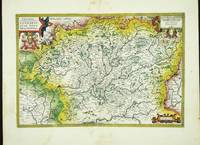
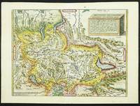
réf. 4916Antwerp: 1570-80. No binding. Very Good. 345 x 460 mm. lovely recent wash colour. First published in the first edition of 1570 of Ortelius' ""Theatrum Orbis Terrarum"" the first modern atlas. This example is from the German edition of 1580. The map is drawn from the work of Aegidius Tscudi who was born in Glarus Switzerland in 1505. From 1524 he travelled extensively in the Alps and wrote a manuscript book with map of his travels. He intended to publish them but became involved in local politics instead. The map was printed separately in 1538 and no example survives. It is only known by a later re-print from the same block in 1560 which in itself survives in just one known example. Blumer pp. 47-9; Van den Broecke M. 115; Karrow 78/1; Weisz p. 82. 1570-[80] unknown
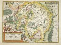
réf. 5620Antwerp: 1590-1608. No binding. Very Good. 340 x 500 mm. in fine recent wash colour good condition This map of the wealthy region of Lorraine is drawn from two maps by Gerard Mercator which were published in 1585. The Ortelius was first published in the 'Theatrum' in 1590 this example with Italian text to the verso was issued in 1608. Meurer p. 37; Van den Broecke M. #50.1. 1590-[1608] unknown
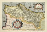
réf. 4183Antwerp: 1587-92. No binding. Very Good. 340 x 510 mm. in fine modern wash colour in excellent condition. The map is derived from a two-sheet map by Fernando Alvarez Secco which was published by Michele Tramezzino in 1561. This is an early issue of the second of two plates by Ortelius of Portugal. There are only subtle differences in engraving between them. Van den Broecke M. #27 state 1; 'Cartografia Impressa dos Seculos XVI e XVII Imagens de Portugal .' Exhibition Catalogue no. 22; Koeman Ort no. 8 not realising the two plates existed; 'Olhar o Mundo ler o Territorio' Exhibition Catalogue p. 144. 1587-[92] unknown
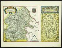
réf. 5580Antwerp: 1570-1602. No binding. Very Good. 310 x 480 mm. early wash colour in good condition. The majority of the map displays the region of central France to the west of Nevers centred on the town of Bourges. An inset to the right details the region immediately to the north of Lyon. It is derived from the work of Gabriel Symeoni 1509-70 in 1561 and was published in Abraham Ortelius' 'Theatrum Orbis Terrarum' the first modern atlas from 1573. This example with Spanish text to the verso was published in 1602. Karrow p. 114-15; Van der Broecke 39. 1570-[1602] unknown
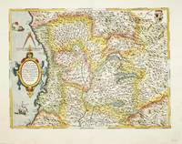
réf. 5106Antwerp: 1570-c.79. No binding. Very Good. 360 x 480 mm. in modern wash colour. Small centrefold split lower margin repaired not affecting the image otherwise in good condition. This fine map of the majority of Northern Italy centred on the Republic of Milan was published in the first edition of Abraham Ortelius' 'Theatrum Orbis Terrarum' in 1570 the first modern atlas. It is derived from the work of Giovan Giorgio Settala a native of Milan. His only surviving map is of the Duchy of Milan and only two examples survive; the Biblioteca Istituto Geograficao Militare Italiano Florence and the British Library. This example was issued in the Latin text edition most probably of 1579 with the pagination 61 to the verso although van den Broecke does not record it. It is derived from a map by Johannes Septala. Karrow p. 478-9; Meurer p. 237; Van den Broecke M. #125 this pagination of '61' not listed. 1570-[c.79] unknown
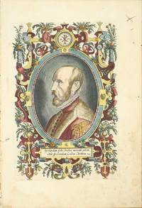
réf. 8818Antwerp: 1579. No binding. Good. 325 x 220 mm. later wash colour with some marginal light water stain and minor crease neither affecting the image otherwise in good condition. This is one of the most famous portraits of a cartographer. Engraved by Philip Galle it is of Abraham Ortelius 1527-98 at the age of about 50. It was first published in his atlas the 'Theatrum Orbis Terrarum' in 1579. A fine ornate portrait likely taken from the painting by Paul Rubens currently displayed in the Plantin-Moretus Museum. Hind I p. 157. pl. 91; Van den Broecke 1996 pp. 14-15. 1579 unknown
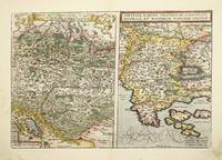
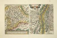
réf. 8630Amsterdam: 1573-88. No binding. Good. 340 x 500 mm. in recent full wash colour early manuscript in left margin finger marks in lower corners otherwise in good condition. The left side of this map bears a beautifully engraved map of Rhaetiae and the Tirol. The right side one of the Istrian peninsula. It is published by Abraham Ortelius in his 'Theatrum Orbis Terrarum' the first uniform world atlas to be published. This map first appeared in the edition of 1573 this example with Spanish text to the verso appeared in the 1588 edition. The cartography is derived from Wolfgang Lazius in 1561. Karrow 49/21; Van der Broecke 116. 1573-[88] unknown
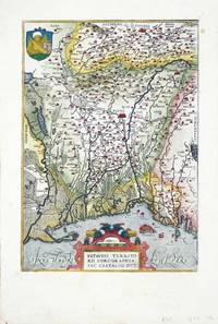
réf. 8303Antwerp: 1573-88. No binding. Very Good. 310 x 220 mm. in fine recent wash colour. This map covers the region of Veneto the area around Venice. This is the first of two plates on the region to accompany Abraham Ortelius' 'Theatrum Orbis Terrarum' the world's first uniform atlas. This issue bears Spanish text to the verso. Van den Broecke 1996 121. 1573-[88] unknown
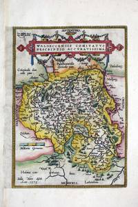
réf. 8324Antwerp: c.1580. No binding. Good. 315 x 225 mm. in recent wash colour good condition. This map was first published in the Latin edition of Abraham Ortelius' 'Theatrum Orbis Terrarum' in 1579 the first modern atlas of the world. This is the right half of a folio sheet map which depicts the region of Waldeck derived from Justus Meurs' six-sheet map of the region published in 1572. Van den Broecke 98b; Meurer p. 202. c.1580 unknown
réf. 8328Antwerp: 1579-80. No binding. Very Good. 370 x 500 mm. in fine wash colour good condition. This is the only map of Luxembourg in the famous Abraham Ortelius ""Theatrum Orbis Terrarum"". It first appeared in the 1579 edition and this example comes from the German edition published the following year. The map was originally drawn by Jacques Surhon for which he received 500 Livres in payment from Charles V in 1551. It was however never published. Van den Broecke M. 60.1; Van der Vekene 102A. 1579-[80] unknown
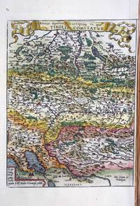
réf. 8305Antwerp: 1573-98. No binding. Good. 345 x 260 mm. fine modern wash colour in good condition. A beautifully engraved map of Rhaetiae and the Tirol published by Abraham Ortelius in his 'Theatrum Orbis Terrarum' the first uniform world atlas to be published. This map first appeared in the edition of 1573 this example with French text to the verso appeared in the 1598 edition. The cartography is derived from Wolfgang Lazius in 1561. Karrow 49/21; Van der Broecke 116. 1573-[98] unknown
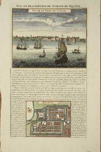
réf. 8616Amsterdam: c.1715. No binding. Good. 375 x 220 mm. with recent wash colour in good condition. With a fine view of the harbour and town of Surate on the northwest coast of India along with a plan of Batavia Jakarta the present-day capital of Indonesia. Surate was an English trading post in India the first. Batavia became the capital of the Dutch East India Company. At this point in time the Dutch dominated the trade in the Spice Islands of the East Indies. c.1715 unknown
réf. 5788Venice: 1598-1655. No binding. Very Good. 80 x 100 mm. in good condition. This edition of the 'miniature' Ortelius atlas entitled 'Il Theatro del Mondo' was first published in Brescia in 1598. The map is derived directly from that in the 1577 miniature Ortelius atlas itself a reduced version of the folio by Ortelius in 1570. Shirley 2004 T.Bot 1a. 1598-[1655] unknown
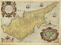
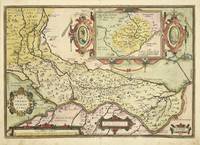
réf. 7027Antwerp: 1573-80. No binding. Very Good. 355 x 500 mm. in full early wash colour one or two light foxmarks otherwise in very good condition. A good example of the FIRST STATE of a classic map of the island of Cyprus in the eastern Mediterranean Sea. It was published by Abraham Ortelius in the 'Theatrum Orbis Terrarum' for the first time in 1573. It is drawn directly from the written account of the French naturalist Pierre Belon of 1553 and cartographically from Jacomo Franco's map published in Venice c.1570 just prior to this map. Franco's map improved the general outline of the island and provided more place names than any other before it. It is unfortunately very rare surviving in only three known examples. This Ortelius map is the earliest derivative of it and is engraved by Jan van Deutecum on a larger scale. It is augmented with three sailing ships a fine sea monster and three ornate cartouches. One of these encloses an inset map of the island of Lemnos. Ortelius' map had a great influence on the future cartography of Cyprus being copied on numerous occasions by later map mapkers. Broecke 1996 149; Maps of Cyprus 25.1; Stylianou 1980 no. 66; Zacharakis 1992 no. 1451. 1573-[80] unknown
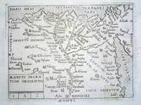
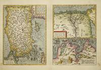
réf. 8320Antwerp: 1570-74. No binding. Very Good. 325 x 495 mm. in fine modern wash colour in good condition. This map was published in the first edition of Abraham Ortelius' 'Theatrum Orbis Terrarum' in 1570 the first modern atlas of the world. This example was issued in the Latin text edition of 1574 with the pagination 67 to the verso. The left side of the map sheet features a well engraved map of Turkey which is oriented with the north to the left. It is derived from the extremely rare map of Giacomo Gastaldi as published by Paolo Forlani in Venice 1564. It depicts the whole of Asia Minor or present day Turkey in excellent detail and includes the important islands of Cyprus Rhodes and Crete. The two smaller maps at the right feature the Lower Nile region of Egypt and the region of ancient Carthage. Van den Broecke 174; refer Woodward 'The Maps and Prints of Paolo Forlani' 26.01; Zacharakis C. 1613. 1570-[74] unknown
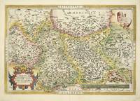
réf. 8327Antwerp: 1570-89. No binding. Very Good. 350 x 510 mm. in recent wash colour in good condition. An attractive bordered map depicting the region of Saxony Germany with the city of Leipzig near the centre. This map was published in the first edition of Abraham Ortelius' 'Theatrum Orbis Terrarum' in 1570 the first modern atlas of the world. This example with German text on the verso is from the 1589 edition. It is derived from a map by Johann Criginger 1521-71. Van den Broecke M. 93; Karrow 22/1; Meurer pp. 132-3. 1570-[89] unknown
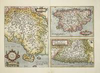
réf. 8612London: 1573-1602. No binding. Very Good. 330 x 490 mm. with recent wash colour in good condition. One half of this map depicts the region of Siena in Italy. The other half is split between a map of Corsica and one of Ancona. This map was first published in the Latin edition of Abraham Ortelius' 'Theatrum Orbis Terrarum' in 1573 the first modern atlas of the world. That of Siena is derived from the map of Cesare Orlandi in 1573 which in itself if probably drawn from Claudio Duchetti's undated earlier map. This example bears Spanish text to the verso and appeared in the 1602 edition. Van den Broecke M. 137; Meurer pp. 210-11. 1573-[1602] unknown
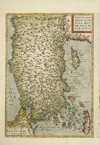
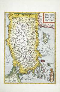
réf. 8306Antwerp: 1570-80. No binding. Very Good. 325 x 230 mm. in fine modern wash colour in good condition. This is the left side only from a double page map sheet that contained two smaller maps at the right. This half features a well engraved map of Turkey which is oriented with the north to the left. The map is derived from the extremely rare map of Giacomo Gastaldi as published by Paolo Forlani in Venice 1564. It depicts the whole of Asia Minor or present day Turkey in excellent detail and includes the important islands of Cyprus Rhodes and Crete. It was published in the first edition of Abraham Ortelius' 'Theatrum Orbis Terrarum' in 1570 the first modern atlas. This example was issued in the German text edition of 1580 with the pagination 88 to the verso. Van den Broecke 174a; refer Woodward 'The Maps and Prints of Paolo Forlani' 26.01; Zacharakis C. 1613. 1570-[80] unknown
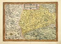
réf. 7028Antwerp: 1575-80. No binding. Very Good. 310 x 430 mm. in fine early wash colour in very good condition. This map of Transilvania is derived from that of Sambucus 1566 itself drawn from Honter in 1532. This example with Latin text to the verso is from the first 1580 edition. Within five years of first publication Ortelius had to replace the plate with this one. This is a fine example of the first state of four. The map extends to cover parts of Poland Slovakia Romania & Hungary. Karrow 1993 65/1 pp. 459-60; Meurer 2004 p. 226; Tibor 1987 73; Van den Broecke 1996 153.1. 1575-[80] unknown
réf. 6997Antwerp: 1570-79. No binding. Very Good. 325 x 230 mm. in good modern wash colour in good condition. This is the left side only from a double page map sheet that contained two smaller maps at the right. This half features a well engraved map of Turkey which is oriented with the north to the left. The map is derived from the extremely rare map of Giacomo Gastaldi as published by Paolo Forlani in Venice 1564. It depicts the whole of Asia Minor or present day Turkey in excellent detail and includes the important islands of Cyprus Rhodes and Crete. It was published in the first edition of Abraham Ortelius' 'Theatrum Orbis Terrarum' in 1570 the first modern atlas. This example was issued in the Latin text edition of 1579 with the pagination 88 to the verso. Van den Broecke 1996 174a; refer Woodward 1990 'The Maps and Prints of Paolo Forlani' 26.01; Zacharakis 1992 1613. 1570-[79] unknown
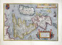
réf. 6982Antwerp: 1570-87. No binding. Good. 345 x 500 mm. in fine modern wash colour a small wormhole by the cartouche lower right repaired otherwise in good condition. This is one of the most recognisable of all the early maps of the British Isles. It was published by Abraham Ortelius in his 'Theatrum Orbis Terrarum' first published in 1570 the first modern atlas. This example was issued in the French text edition of 1587 with the pagination 9 to the verso. The map is derived from Gerard Mercator's eight sheet wall map of 1564. It is a beautifully designed plate with a nice balance between accurate cartographic information and ornate decoration. The map is orientated with north to the right and the Royal Coat of Arms are depicted upper left. Shirley speculates that the engraver was Frans Hogenberg. Van Den Broecke 1996 16; Shirley 1991 British Isles no. 86. 1570-[87] unknown
réf. 8614Antwerp: 1584-98. No binding. Very Good. 305 x 490 mm. recent full wash colour in good condition. The second of two single page maps of Bavaria Germany published by Abraham Ortelius in the 'Theatrum Orbis Terrarum'. This one is distinguished by the title being at the bottom of the map. It is derived from the map by Erhart Reich published in woodcut in 4 sheets in 1540. Regensberg is easily identified near the centre with 'Nurnberg' to the left of the map. Paired with it is a map of the region surrounding Strasbourg. It is derived from Daniel Specklin's three-sheet map of the Alsace issued in 1576. This French text issue was published in 1598. Van den Broecke 112; Karrow 63. 1584-[98] unknown
réf. 7030Antwerp: 1579-80. No binding. Very Good. 360 x 510 mm. early wash colour in very good condition. This is Abraham Ortelius' fine map of the region of Cremona from the 'Theatrum Orbis Terrarum'. It was first published in 1579 this example with German text to the verso is from an edition issued the following year. Cartographically it is derived from a manuscript map of the area by Antonio Campi which was not finally published until 1583. The map extends from Mantua in the east to Cremona Piacenza and Crema in the west. The inset map of Crema is after a printed map by Paolo Forlani issued in 1570. Van den Broecke 1996 no. 127. 1579-[80] unknown
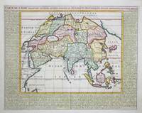
réf. 9410Amsterdam: c.1719. No binding. Very Good. 380 x 485 mm. in recent full wash colour good condition. This map of Asia with surrounding descriptive text was published in the encyclopaedic seven volume 'Atlas Historique' by Henri Abraham Chatelain 1684-1743. Koeman II p. 33; Shirley 'Atlases in the BL' T.Chat-1a; Van Waning 'Chatelain's Atlas Historique' in IMCoS Journal 120 pp. 7-15. c.1719 unknown
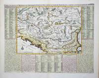
réf. 9347Amsterdam: c.1715. No binding. Very Good. 360 x 460 mm. in recent wash colour and good condition. An attractive map of the Balkans region of south east Europe centred on the River Danube. It is surrounded by descriptive text in French. It was published in the second volume of the encyclopaedic atlas by Henri Abraham Chatelain 1684-1743 entitled 'Atlas Historique ou Nouvelle Introduction a l'Histoire a la Chronologie & a la Geographie'. It was issued from 1705 to 1720 in 7 volumes. Koeman II p. 33; Phillips 579; Shirley 'Atlases in the BL' T.Chat-1a; Van Waning 'Chatelain's Atlas Historique' in IMCoS Journal 120 pp. 7-15. c.1715 unknown