ORTELIUS, AbrahamBiblio.com
28 034 résultats
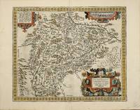
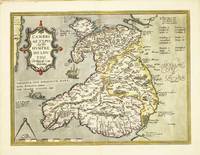
réf. 10630Amsterdam: 1573-87. No binding. Very Good. 370 x 495 mm. fine recent full wash colour with French text to the verso in good condition. 'The first separate map of the whole of Wales in its second state it was compiled in 1568 by Humphrey Llwyd 1527-68 or Lhuyd a Welshman from Denbigh' Roberts. It was first published in the 'Theatrum Orbis Terrarum' by Abraham Ortelius in 1573 but according to Karrow was engraved by 1572. A letter from October 1572 written by the diplomat and historian Daniel Rogers and asks Ortelius to send him two copies so that he may augment them 'with the ancient castles neglected by Fludd Lluyd but noticed by a friend of mine' Karrow. It illustrates the three main regions of Venedotia Gwynedd Povisia Powys and Dehenbartia Deheubarth. Placenames are provided in Welsh English and Latin. Provenance: acquired from Doreen Green 1990; private collection. Booth 1977 no. 2; Evans 1964 pp. 4-5; Karrow 1993 50/1.1; Parker 2017 p. 87; Roberts 1994 1; Van Den Broecke 1996 no. 21. 1573-[87] unknown
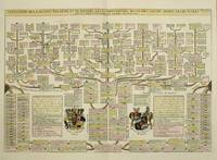
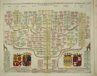
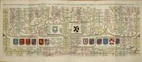
réf. 10383Amsterdam: 1708. No binding. Very Good. 360 x 525 mm. recent wash colour in good condition. A display of the family tree of the House of Bavaria including coats of arms. It was published in the second volume of the encyclopaedic atlas by Henri Abraham Chatelain 1684-1743 entitled 'Atlas Historique ou Nouvelle Introduction a l'Histoire a la Chronologie & a la Geographie'. It was issued from 1705 to 1720 in 7 volumes. Koeman II p. 33; Phillips 579; Shirley 'Atlases in the BL' T.Chat-1a; Van Waning 'Chatelain's Atlas Historique' in IMCoS Journal 120 pp. 7-15. 1708 unknown
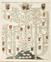
réf. 10702Amsterdam: 1708. No binding. Very Good. 625 x 515 mm. folding as issued full wash colour in good condition. A magnificent display of the family tree of the House of Austria including 20 coats of arms. It includes the nobility of Spain Portugal France Italy Germany and Austria. Several tables identify the Arms which are keyed using letters running all the way around the outside of the image. It was published in the second volume of the encyclopaedic atlas by Henri Abraham Chatelain 1684-1743 entitled 'Atlas Historique ou Nouvelle Introduction a l'Histoire a la Chronologie & a la Geographie'. It was issued from 1705 to 1720 in 7 volumes. Koeman II p. 33; Phillips 579; Shirley 'Atlases in the BL' T.Chat-1a; Van Waning 'Chatelain's Atlas Historique' in IMCoS Journal 120 pp. 7-15. 1708 unknown
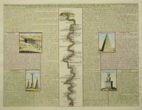
réf. 9350Amsterdam: c.1715. No binding. Very Good. 375 x 490 mm. in recent wash colour and good condition. This plate contains a central map of the River Nile flanked either side by illustrations of the antiquities found in its valley. The illustrations are fully described in French. It was published in the sixth volume of the encyclopaedic atlas by Henri Abraham Chatelain 1684-1743 entitled 'Atlas Historique ou Nouvelle Introduction a l'Histoire a la Chronologie & a la Geographie'. It was issued from 1705 to 1720 in 7 volumes. Koeman II p. 33; Phillips 579; Shirley 'Atlases in the BL' T.Chat-1a; Van Waning 'Chatelain's Atlas Historique' in IMCoS Journal 120 pp. 7-15. c.1715 unknown
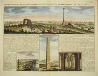
réf. 9716Amsterdam: c.1719. No binding. Very Good. 375 x 485 mm. in recent full wash colour good condition. This interesting plate describes the city of Alexandria in Egypt. The view above is taken from the old town marked by the central column looking towards the current town. Below are three vignettes featuring the Obelisk the ruins of the Palace of Cleopatra and an interior. These are flanked with historical notes and links to the images. It was published in the sixth volume of the encyclopaedic atlas by Henri Abraham Chatelain 1684-1743 entitled 'Atlas Historique ou Nouvelle Introduction a l'Histoire a la Chronologie & a la Geographie'. It was issued from 1705 to 1720 in 7 volumes. Koeman II p. 33; Phillips 579; Shirley 'Atlases in the BL' T.Chat-1a; Van Waning 'Chatelain's Atlas Historique' in IMCoS Journal 120 pp. 7-15. c.1719 unknown
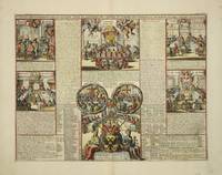
réf. 8978Amsterdam: 1708. No binding. Very Good. 345 x 450 mm. full wash colour in good condition. This plate illustrates the ecclesiastical civil and military structure of Knights of Malta the Teutonic Order structures with ancient lineage. It was published in the second volume of the encyclopaedic atlas by Henri Abraham Chatelain 1684-1743 entitled 'Atlas Historique ou Nouvelle Introduction a l'Histoire a la Chronologie & a la Geographie'. It was issued from 1705 to 1720 in 7 volumes. Koeman II p. 33; Phillips 579; Shirley 'Atlases in the BL' T.Chat-1a; Van Waning 'Chatelain's Atlas Historique' in IMCoS Journal 120 pp. 7-15. 1708 unknown
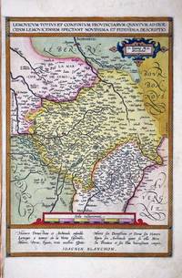
réf. 8846Antwerp: 1570-89. No binding. Very Good. 340 x 235 mm. in full early wash colour in good condition. An attractive map depicting the region of Limousin in south western France with the city of Lymoges Limoges near the centre of the map. This map was drawn from that by Jean Fayen 1530-1616 published in the 'Theatre Francois' by Maurice Bougereau in 1594. It was first published in the 1598 French edition of Abraham Ortelius' 'Theatrum Orbis Terrarum' the first modern atlas of the world. This example is removed from its accompanying map of Blois and lacks any text to the verso. As such it is difficult to determine the edition but from the paper size we may deduce it was an earlier one. Van den Broecke 1996 43; Meurer pp. 132-3. 1570-[89] unknown
réf. 9344Antwerp: 1579-80. No binding. Good. 350 x 505 mm. in recent wash colour otherwise in good condition. FIRST GERMAN EDITION. An attractive bordered map depicting the region of Westphalia Germany extending from Cologne in the right to Bremen and Emden in the left or north. This map was first published in Abraham Ortelius' 'Theatrum Orbis Terrarum' in 1579 the first modern atlas of the world. This example with German text is from the first edition in that language published in 1580. It is derived from a manuscript map by Christian Sgroten from 1565. Van den Broecke M. 91; Meurer pp. 132-3. 1579-[80] unknown
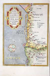
réf. 9346Antwerp: 1570-1580. No binding. Very Good. 300 x 220 mm. in recent wash colour in good condition. A nice example of Ortelius' map of southern France with north to the right. It extends from Oranges in the north to Narbonne in the west and Marseille in the east. This map was introduced to the Ortelius atlas in the first edition of 1570. This example is from the 1580 German text issue. According to Van den Broecke Charles de l'Ecluse 1510-63 was asked by Ortelius to produce a map of the region which turned out to be not particularly accurate. in 1595 'Adam la Planche wrote Ortelius Hessels letter 279 that he had obtained from Pierre Pithou a manuscript map of Ile de France attributed to Francois de la Guillotiere'. Meurer p. 128; Van den Broecke M. 48a. 1570-[1580} unknown
réf. 10375Antwerp: 1570-98. No binding. Very Good. 350 x 510 mm. in recent wash colour otherwise in good condition. An attractive bordered map depicting the region of Saxony Germany with the city of Leipzig near the centre. This map was published in the first edition of Abraham Ortelius' 'Theatrum Orbis Terrarum' in 1570 the first modern atlas of the world. This example with French text on the verso is from the 1598 edition. It is derived from a map by Johann Criginger 1521-71. Van den Broecke M. 93; Karrow 22/1; Meurer pp. 132-3. 1570-[98] unknown
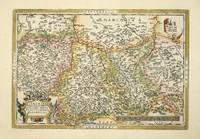
réf. 10671Antwerp: 1592-1598. No binding. Very Good. 385 x 460 mm. with recent full wash colour in good condition. This map of Salzburg in Austria in Abraham Ortelius' 'Theatrum Orbis Terrarum' is from the only French edition to include this plate issued in 1598. It is the second of two maps of the region produced by Ortelius and first introduced in 1592. Ortelius credits Marcus Secznagel with being the cartographer. Born in Salzburg circa 1520 he produced a woodcut map of the region printed by Hans Baumann in 1551 no example survives. Karrow 1993 68.1; Van den Broecke 1996 108. 1592-[1598] unknown
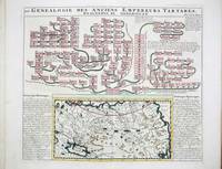
réf. 9679Amsterdam: c.1719. No binding. Very Good. 370 x 430 mm. in recent full wash colour good condition. This map of Tartary or northern Asia is accompanied by a large genealogy of Genghis Khan 1162-1227. The Mongol Empire which he founded became one of the largest in human history. The mapis flanked with historical notes. It was published in the fifth volume of the encyclopaedic atlas by Henri Abraham Chatelain 1684-1743 entitled 'Atlas Historique ou Nouvelle Introduction a l'Histoire a la Chronologie & a la Geographie'. It was issued from 1705 to 1720 in 7 volumes. Koeman II p. 33; Phillips 579; Shirley 'Atlases in the BL' T.Chat-1a; Van Waning 'Chatelain's Atlas Historique' in IMCoS Journal 120 pp. 7-15. c.1719 unknown
réf. 9719Amsterdam: c.1719. No binding. Very Good. 380 x 465 mm. in recent full wash colour good condition. This chart displays the family tree of the House of Stuart whose English reign begins with James I and extends through Charles I and II and James II. It was published in the second volume of the encyclopaedic atlas by Henri Abraham Chatelain 1684-1743 entitled 'Atlas Historique ou Nouvelle Introduction a l'Histoire a la Chronologie & a la Geographie'. It was issued from 1705 to 1720 in 7 volumes. Koeman II p. 33; Phillips 579; Shirley 'Atlases in the BL' T.Chat-1a; Van Waning 'Chatelain's Atlas Historique' in IMCoS Journal 120 pp. 7-15. c.1719 unknown
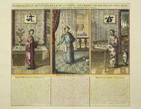
réf. 9353Amsterdam: 1719. No binding. Very Good. 380 x 435 mm. full wash colour in good condition. This plate describes the elaborate clothing of the Emperor of China and his entourage. The elaborate interior furnishings of the palace are also beautifully displayed. These are described below. It was published in the fifth volume of the encyclopaedic atlas by Henri Abraham Chatelain 1684-1743 entitled 'Atlas Historique ou Nouvelle Introduction a l'Histoire a la Chronologie & a la Geographie'. It was issued from 1705 to 1720 in 7 volumes. Koeman II p. 33; Phillips 579; Shirley 'Atlases in the BL' T.Chat-1a; Van Waning 'Chatelain's Atlas Historique' in IMCoS Journal 120 pp. 7-15. 1719 unknown
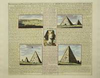
réf. 9349Amsterdam: c.1715. No binding. Very Good. 370 x 430 mm. in recent wash colour and good condition. This plate illustrates and describes the pyramids of Egypt. The illustrations are fully described in French. It was published in the sixth volume of the encyclopaedic atlas by Henri Abraham Chatelain 1684-1743 entitled 'Atlas Historique ou Nouvelle Introduction a l'Histoire a la Chronologie & a la Geographie'. It was issued from 1705 to 1720 in 7 volumes. Koeman II p. 33; Phillips 579; Shirley 'Atlases in the BL' T.Chat-1a; Van Waning 'Chatelain's Atlas Historique' in IMCoS Journal 120 pp. 7-15. c.1715 unknown
réf. 10379Antwerp: 1590-98. No binding. Good. 330 x 425 mm. recent wash colour in good condition. The map is derived from that of Natale Bonifacio 1538-92 which was published in Rome in 1587. Three years later Abraham Ortelius used the map for his 'Theatrum'. This example with Spanish text to the verso comes from the 1612 edition. Van den Broecke no. 138; Meurer p. 118. 1590-[98] unknown
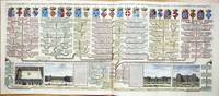
réf. 9713Amsterdam: c.1719. No binding. Very Good. 405 x 965 mm. two sheets joined as one in recent full wash colour good condition. This fine large two sheet decorative plate features the House of Valois. The large family tree bears four vignette views below of the Place Royale Tuilleries and Palais du Luxembourg in Paris. It was published in the final seventh volume of the encyclopaedic atlas by Henri Abraham Chatelain 1684-1743 entitled 'Atlas Historique ou Nouvelle Introduction a l'Histoire a la Chronologie & a la Geographie'. It was issued from 1705 to 1720 in 7 volumes. Koeman II p. 33; Phillips 579; Shirley 'Atlases in the BL' T.Chat-1a; Van Waning 'Chatelain's Atlas Historique' in IMCoS Journal 120 pp. 7-15. c.1719 unknown
réf. 10437Amsterdam: 1708. No binding. Very Good. 385 x 950 mm. two sheets joined as one as issued in full wash colour and good condition. A magnificent display of the genealogical family tree of the mediaeval period of English history. The Royal families of Plantagenet's and the Dukes of Normandy leading to the House of York on the left side and the House of Lancaster on the right side both illustrating the Wars of the Roses. The coats of arms of Edward the Confessor and 13 others adorn the plate. It was published in the second volume of the encyclopaedic atlas by Henri Abraham Chatelain 1684-1743 entitled 'Atlas Historique ou Nouvelle Introduction a l'Histoire a la Chronologie & a la Geographie'. It was issued from 1705 to 1720 in 7 volumes. Koeman II p. 33; Phillips 579; Shirley 'Atlases in the BL' T.Chat-1a; Van Waning 'Chatelain's Atlas Historique' in IMCoS Journal 120 pp. 7-15. 1708 unknown
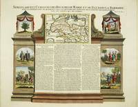
réf. 9715Amsterdam: c.1719. No binding. Very Good. 375 x 470 mm. in recent full wash colour good condition. This ornate plate details Morocco and the Barbary coast. The central map is flanked with historical notes and six decorative vignettes. It was published in the sixth volume of the encyclopaedic atlas by Henri Abraham Chatelain 1684-1743 entitled 'Atlas Historique ou Nouvelle Introduction a l'Histoire a la Chronologie & a la Geographie'. It was issued from 1705 to 1720 in 7 volumes. Koeman II p. 33; Phillips 579; Shirley 'Atlases in the BL' T.Chat-1a; Van Waning 'Chatelain's Atlas Historique' in IMCoS Journal 120 pp. 7-15. c.1719 unknown
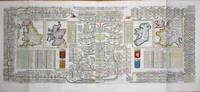
réf. 8986Amsterdam: 1708. No binding. Very Good. 380 x 940 mm. two sheets joined as one as issued in full wash colour in good condition. A magnificent display of the Royal family tree of the British Isles. It features four maps of England Scotland Ireland and France whose cartography is derived from Guillaume de L'Isle. Each are accompanied by their respective coats of arms. The English throne begins at Egbert in 837 upper left the Scottish with Fergus I in the year 3671. Keys list the remarkable battles in England and against France. It was published in the second volume of the encyclopaedic atlas by Henri Abraham Chatelain 1684-1743 entitled 'Atlas Historique ou Nouvelle Introduction a l'Histoire a la Chronologie & a la Geographie'. It was issued from 1705 to 1720 in 7 volumes. Koeman II p. 33; Phillips 579; Shirley 'Atlases in the BL' T.Chat-1a; not in Shirley British Isles; Van Waning 'Chatelain's Atlas Historique' in IMCoS Journal 120 pp. 7-15. 1708 unknown
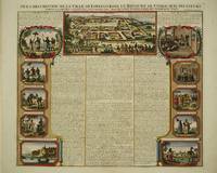
réf. 9718Amsterdam: c.1719. No binding. Very Good. 380 x 440 mm. in recent full wash colour good condition. This decorative plate features the fabled city of Lovango in the Congo West Africa. The central vignette birds-eye view of the town above bears descriptive notes below. Each side bears 5 further vignettes each of the natives and customs of the region. It was published in the sixth volume of the encyclopaedic atlas by Henri Abraham Chatelain 1684-1743 entitled 'Atlas Historique ou Nouvelle Introduction a l'Histoire a la Chronologie & a la Geographie'. It was issued from 1705 to 1720 in 7 volumes. Koeman II p. 33; Phillips 579; Shirley 'Atlases in the BL' T.Chat-1a; Van Waning 'Chatelain's Atlas Historique' in IMCoS Journal 120 pp. 7-15. c.1719 unknown
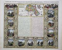
réf. 9348Amsterdam: c.1715. No binding. Very Good. 380 x 435 mm. in recent wash colour and good condition. A very attractive map of Madagascar with very ornate panels surrounding illustrating the people and their customs. In the centre is descriptive text in French. It was published in the sixth volume of the encyclopaedic atlas by Henri Abraham Chatelain 1684-1743 entitled 'Atlas Historique ou Nouvelle Introduction a l'Histoire a la Chronologie & a la Geographie'. It was issued from 1705 to 1720 in 7 volumes. Koeman II p. 33; Phillips 579; Shirley 'Atlases in the BL' T.Chat-1a; Van Waning 'Chatelain's Atlas Historique' in IMCoS Journal 120 pp. 7-15. c.1715 unknown
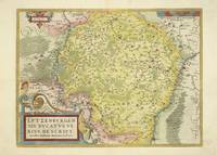
réf. 10381Antwerp: 1579-88. No binding. Good. 370 x 500 mm. in fine wash colour small worm hole at lower margin edge otherwise in good condition. An early large-scale map of Luxembourg the only map of it in the famous Abraham Ortelius 'Theatrum Orbis Terrarum'. It first appeared in the 1579 edition and this example comes from the Spanish edition published in 1588. It is here in the second state with the addition of new place names such as 'Long Linster' to the north of the city of Luxembourg. The map was originally drawn by Jacques Surhon for which he received 500 Livres in payment from Charles V in 1551. It was however never published. Van den Broecke M. 60.2; Van der Vekene 102A. 1579-[88] unknown
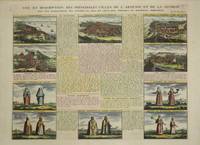
réf. 9205Amsterdam: c.1715. No binding. Very Good. 375 x 495 mm. recent full wash colour in good condition. This plate focuses on Armenia and illustrates five key towns including Tiblsi and five further vignettes of costumes. It was published in the fifth volume of the encyclopaedic atlas by Henri Abraham Chatelain 1684-1743 entitled 'Atlas Historique ou Nouvelle Introduction a l'Histoire a la Chronologie & a la Geographie'. It was issued from 1705 to 1720 in 7 volumes. Koeman II p. 33; Phillips 579; Shirley 'Atlases in the BL' T.Chat-1a; Van Waning 'Chatelain's Atlas Historique' in IMCoS Journal 120 pp. 7-15. c.1715 unknown
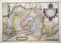
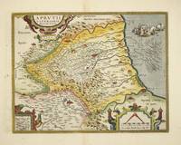
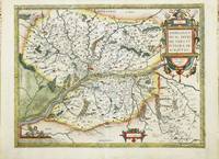
réf. 10972Antwerp: 1579-80. No binding. Good. 360 x 480 mm. in recent wash colour good condition. A detailed attractive map of the Anjou region on the Loire River in France published by Abraham Ortelius in the 'Theatrum Orbis Terrarum'. First published in 1579 this example is from the German edition issued the following year. This is in the first state of three. The map was derived from a lost map published in Paris by Lezin Guyet in 1573. Abraham Ortelius 1527-98 developed an interest in cartography geography and history at an early age. He began as a 'kaarten afzetter' or illuminator of maps and would purchase single maps from booksellers and colour them for re-sale mounted on linen suitable for wall-hanging. At twenty he was entered in the Guild of St Luke at Antwerp. Ortelius travelled extensively in Europe and maintained regular correspondence with mapmakers historians and scientists acquiring information which was to form his greatest opus the 'Theatrum Orbis Terrarum'. What made the atlas stand out as the first modern atlas was its uniformity. They were produced in a similar style and none of the ancient Ptolemaic maps were included. The atlas was accompanied a catalogue of the authors whose source Ortelius had drawn upon in compiling the work. Without this list many cartographers of the day would remain unknown to us today. From its first appearance in 1570 the 'Theatrum' was far more comprehensive in scope than any contemporary work. In all over forty different editions were published with text in Latin Dutch German French Spanish English or Italian with the maps being frequently revised or replaced. By 1612 when the final edition was published the atlas contained no less than 128 maps. Van den Broecke 1996 40. 1579-[80] unknown