Grandes ViajesABAA
38.508 risultati
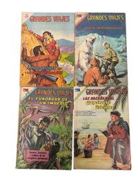
1964rif. 232881964. Grandes Viajes Editorial Novaro's historical travel comic devoted to exploration navigation and imperial expansion ranging from Charles Marie de La Condamine in South America to Adolf Erik Nordenskiöld in the Arctic and from Portuguese voyages to the adventures of Captain Dieppe. Four issues of no. 21 66 69 and 77 these comics turn named explorers and maritime campaigns into short-format instructional narratives for Spanish-language readers pairing dramatic painted covers with exploratory historical stories. Grandes Viajes. Mexico: Editorial Novaro 1964-1969. Archive of 4 issues staple-bound in original pictorial wrappers text in Spanish. The issues retain their cover illustrations and rear advertising wrappers with publisher and date lines to the lower margins and promotional matter for other Novaro series and allied mass-market print on the versos. 1 Grandes Viajes. Año II No. 21. La Condamine en la América del Sur. Mexico: Editorial Novaro 1 de octubre de 1964. 2 Grandes Viajes. Año V No. 66. La expedición de Nordenskiöld. Mexico: Editorial Novaro 1 de septiembre de 1967. 3 Grandes Viajes. Año VI No. 69. El Fundador de un Imperio. Mexico: Editorial Novaro 1 de octubre de 1968. 4 Grandes Viajes. Año VII No. 77. Las Hazañas del Capitán Dieppe. Mexico: Editorial Novaro 1 de junio de 1969. Novaro's history and adventure comics circulated historical knowledge through accessible illustrated magazines sold to Spanish speaking readers of all ages. Within that world Grandes Viajes translated scientific travel imperial founding narratives and polar expeditions into concise episodes. Toning edge wear creasing and rubbing throughout; scattered staining to wrappers with small chips and corner losses most pronounced to no. 66 and no. 69. Overall good condition. Four issues from Novaro's travel-history comic line preserving the intersection of exploration narrative imperial history and Mexican educational entertainment in the 1960-70s. unknown books
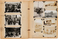
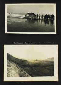
1938rif. 55556Various locations in Latin America. 1938. Rude Americans Tour South America in the Years of the Good Neighbor Policy An illuminating and entertaining illustrated scrapbook documenting the travels of six friends on a trip to Mexico Panama and various points in South America including Colombia Peru Chile Argentina and Brazil in 1938. One of the opening leaves has four photographs of the travellers comprised of two elderly couples and two single women captioned "Rogues to the Pampas!" Throughout the album there are numerous photographs both vernacular and professional a great many capturing locals in native dress as well as images of scenery and the city streets. The photographs are accompanied by detailed descriptive annotations which are colorful and entertaining but also display the compilers' uncharitable to openly offensive views towards some of the foreign peoples and cultures they visit. The voyage began January 20 1938 aboard the Japanese NYK Liner S.S. Bokuyo Maru. There are numerous menus and other ephemera from the ship as well as a photograph of the Japanese crew signed by the ship's officers. The first photographs depict Manzanillo Mexico a week later with captions such as "Worst city we ever saw says the man from Capetown South Africa who has been around the world" and "Sid Thompson says 'I bet if these Mexicans had a good hot bath they'd find a suit of underwear they didn't know they had!" They picture a "peddler of hats and drink" and a "man carrying load on his head" in the streets of Manzanillo. They then take a train to Colima Mexico on which a passenger is noted to say "Jesus Christ you'd think they never saw an American before" and where they eat papaya for the first time. In Panama on February 3 they see "a native with an iguana in each hand - we also saw our first sloth and a land crab" and they witnessed "a negro funeral." On February 5 the travellers stop at Buenaventura Colombia where they experienced an earthquake and their first sight of the Andes along with a "strong acrid wet odor that pervades atmosphere everywhere." There are several photographs of the city and the locals including one of "natives" fishing accompanied by significant commentary on the locals: "The natives have plenty of fish which they catch in nets thrown by hand - plenty of bananas and fruits and cocoanuts and will not work enough to buy anything but a little clothing rice and coffee. There are no public schools in Colombia - a few religious schools inland. All education for boys and girls of better class is in U.S. or Europe.U.S. buys 85% of Colombia's coffee. Population 80% negroes on coast. Government is unstable foreign capital will not make very much of an investment here but Standard Oil Co. has a $52000000 pipeline in Colombia. Malaria is the greatest plague here though typhoid is also guarded against in fruits and vegetables. Buenaventura is wholly tropical." The group then proceeds to Lime Peru where they arrive "in a dense fog - worst in 10 years." They take numerous snapshots of various cultural sights around the city images of "guano birds" along the shoreline and a "Typical Peruvian Indian of the High Andean Plateaus." They stayed three nights at the Hotel Bolivar before proceeding to Cuzco Tacua and Mollendo which they describe as "a dirty town." Still they took several photographs here including "Descendants of the Incas at Cuzco" an "Indian woman riding Burro - typical scene" in Tacua and other street scenes. Chile was next for the group. They were in Santiago by February 23 and shot several images at a street market such as a soap dealer the flower market a corn stand and other scenes. Shortly thereafter they traveled to Valparaiso Puerto Varas Puerto Montt and other Chilean locations. They captured the port of Valparaiso the Three Brothers at Chilean Lakes scenes in the Chilean mountains Lake Llanquihue and include in the album a professional real photo postcard captioned "Typical Araucanian Indian Hut" among other images. The travellers then moved on to Argentina. They describe Buenos Aires as "the most beautiful city in South America so far as the city itself is concerned." Their time in the city is illustrated exclusively with postcards but they include a plethora of descriptive text for numerous monuments landmarks harbor scenes gardens and other sites. During their time in Brazil the travellers document coffee production cattle and other agricultural settings as well as cities and architectural features. These include numerous images of Rio de Janeiro which "no picture however beautiful can portray with any accuracy the beauty of Rio." On March 30 the group heads "from Buenos Aires down the muddy Rio de la Plata" towards the Amazon River. Here they include real photo postcards of "Typical Indians of the Amazon" an "Amazon Indian Hut" and "More Indians - These are some of the most primitive people living." Among the images taken on the streets of Brazil is one showing a black woman walking with a bundle on her head which is captioned "N asterisks ours mammy in pink dress and head load - and was she furious when I took her picture! If looks could kill I'd be buried in Brazil." The group rejoined their cruise in Brazil boarding the Rio de Janeiro Maru and finished their journey at the end of April. A detailed revealing and lengthy travel account extensively illustrated and annotated by a group of somewhat judgmental American tourists. Thick folio. Contemporary brown paper-covered cloth string-tied. Boards lightly scuffed and worn. Some leaves loose moderate edge wear and chipping. Photographs clean and nice annotations highly legible. Good plus. hardcover books
1982rif. 88490Clayton MO: International Institute for Advanced Studies 1982. First Edition. Quarto. Staple-bound pictorial card wrappers softcover; 18pp; maps. Trivial cover soil else Fine. Scarce pre-Perestroika era guide to the cities along the route of the Trans-Siberian Railroad marking points of interest and historical features. Includes several maps in text. OCLC notes two copies only. International Institute for Advanced Studies unknown books
1911rif. 87395New York: Eaton & Mains 1911. First Edition. First printing. Inscribed on front endpaper to James 1st Viscount Bryce at this time British ambassador to the United States: "To the Rt. Hon. James Bryce P.C. etc etc etc with the compliments of the Author" dated July 1911. 12mo 17.5cm. Publisher's green pictorial cloth titled in gilt; 260pp; color photographic frontispiece twenty unnumbered leaves of photographic plates halftones. A bright complete and crisp copy mildly darkened on spine with just a touch of rubbing at spine ends and board corners - Very Good to Near Fine and unusual thus. Taft 1850-1936 a distant cousin of the U.S. President served for more than thirty years from 1880 to around 1913 as a Chinese missionary for the Methodist Episcopal Church. This uncommon little travelogue well-illustrated from photographs by the author appears to have been his only commercially published work. Eaton & Mains unknown books
1911rif. 83593New York: Eaton & Mains 1911. First Edition. First printing. 12mo 17.5cm. Publisher's green pictorial cloth titled in gilt; 260pp; color photographic frontispiece twenty unnumbered leaves of photographic plates halftones. A bright complete and crisp copy mildly darkened on spine with just a touch of rubbing at spine ends and board corners - Very Good to Near Fine and unusual thus. Taft 1850-1936 a distant cousin of the U.S. President served for more than thirty years from 1880 to around 1913 as a Chinese missionary for the Methodist Episcopal Church. This uncommon little travelogue well-illustrated from photographs by the author appears to have been his only commercially published work. Eaton & Mains unknown books
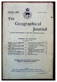
1895rif. 144791895. Bent Theodore. Exploration of the Frankincense Country Southern Arabia published in 1895 provides a firsthand account of Theodore and Mabel Bent's expedition across the Dhofar plain and into the Gara Mountains of southern Arabia. The report records travel beyond the region's coastal settlements into landscapes associated since antiquity with the production and trade of frankincense documenting routes topography vegetation habitation and local communities encountered during the journey. Issued when much of inland Dhofar remained poorly represented in British geographical literature the article supports research into Arabian Peninsula exploration historical geography indigenous settlement botanical resources and the relationship between nineteenth-century field observation and imperial geographical knowledge. The published journal index attributes the article to J. Theodore Bent and identifies it as accompanied by a map and illustrations. Bent Theodore. Exploration of the Frankincense Country Southern Arabia. London: Royal Geographical Society 1895. First edition. The Geographical Journal Vol. VI No. 2. 8vo. Pages 109-134 comprising twenty-six pages with a full-page sketch map several in-text illustrations and a folding color map measuring approximately 7 × 14 inches. In original blue printed wrappers as issued. Bent describes the expedition's movement through the coastal plain of Dhofar and the Gara range including the physical conditions of the frankincense-producing country and the cave dwellings used by Gara families and their livestock. The maps translate the expedition's route and geographical observations into a form intended for the Royal Geographical Society's readership while the illustrations provide supporting visual evidence of terrain settlement and travel conditions. The article predates and supplied material for Southern Arabia published in 1900 by Smith Elder & Co. under the names of Theodore and Mabel Bent; that later volume assembled accounts of their travels in Muscat Hadhramaut Dhofar the Gara Mountains Socotra and neighboring regions. Mabel Bent's role was substantial both in the expeditions and in preparing the posthumous book but the present report was written and published by Theodore during his lifetime. Light foxing affects the front wrapper; the issue is otherwise complete with the folding map present and no further defects noted. Good. The report preserves an early illustrated and cartographic record of Dhofar's frankincense landscape before the Bents' Arabian observations were consolidated in book form. unknown books
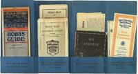
1938rif. 41443Pittsburgh PA: Pittsburgh Motor Club 1938. Near fine. A seemingly complete 1938 membership packet of the Pittsburgh Motor Club containing maps of the environs surrounding Pittsburgh membership materials and pamphlets with fantastic examples of period design. A scarce surviving group from the dawn of the American highway. Folding printed card folder measuring approximately 10.5" x 5"; unfolds to approximately 20" wide. Contains 15 various publications maps and ephemera all loosely laid-in. Contents housed in original mailing envelope mild age toning in areas otherwise near fine throughout. Pittsburgh Motor Club unknown books
1757rif. 317340Dublin: Printed for J. Smith on the Blind-Quay 1757. Same year as the London edition. Folding frontispieces in each volume and other plates. 269; 287; 287pp. 3 vols. 12mo. Bound in modern three quarter brown calf and marbled boards. Text with some stains. Binding fine. Same year as the London edition. Folding frontispieces in each volume and other plates. 269; 287; 287pp. 3 vols. 12mo. Volume I A Journey from Aleppo to Jerusalem By Mr. Henry Maundrel The Travels of Thomas Shaw An Account of a Journey to Palmyra otherwise Tedmor in the Desart Volume II: The Travels of Richard Pococke Thre Travels opf Henry Drummond A Description of Aleppo. By Alexander Russel M.D THE TRAVELS OF MR. HANWAY Through Russia Persia and several other parts for settling a trade upon the Caspian Sea Volume III contains: continuation of.THE TRAVELS OF MR. HANWAY Through Russia Persia and several other parts for settling a trade upon the Caspian Sea With: THE NATURAL HISTORY OF NORWAY by Erich Pontoppidan;. ESTC T164169 Printed for J. Smith, on the Blind-Quay unknown books
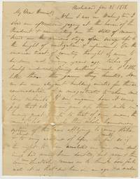
rif. BK0207Richmond Virginia January 31 181. Autograph letter signed three pages with integral address leaf directed to Miss Harriet Cary care of Messrs. Josiah Bradlee & Co. Boston. Blue Richmond circular datestamp and manuscript "25" postal rate. 7 ¾ x 10 inches. Fair condition with staining wear and separations along folds and substantial losses to the final page affecting portions of the text. Detached fragments preserved in a protective sleeve fair. An interesting letter written from Richmond following a visit to Washington containing an extended reflection on the President's House and its significance as a symbol of American government and of supremacy over America's Indigenous people. The writer had seen the building only a few months after James Monroe moved into the reconstructed residence which had been burned by British troops in 1814 and reopened in 1817. The letter begins: "When I was in Washington I stood one afternoon gazing at the house of the President & ruminating on the state of mankind in the various stages from savage life to the height of civilization & refinement. On this immense tract of country thought I were to be seen not many years ago tribes of lawless indians living without rule & little better than the game they hunted. Now we see an elegant building erected for the accommodation of a magistrate to whom millions submit. If we enquire how it comes to pass that all men give up their wills in many great points to that of our man the mind is led through the whole harmonious system of the laws applying to every station almost to every accident of life. We usually feel as if the right to live unmolested in our own dwellings had never been doubted; but now then some new spectacle causes us to think how fortunate it is that we live in an age a nation" He breaks off there commenting "De breakfast bell has rung Master - -" and promising his recipient that "you shall have my opinion on the state of the nation particularly of slavery at some other time." The letter then turns to his travels through Virginia including a dangerous passage near the Occoquan River. Describing a narrow road cut into the side of a steep hill he writes: "Above us the hill almost overhangs it & below at a distance of 50 feet nearly perpendicular. If the horses had started one yard we should have been thrown all together into the river. It is the first time in my life that I ever passed one of these terrible places." He also describes the falls of the James River near Richmond where the water rushes over a rocky bed before concluding with personal news and inquiries after mutual acquaintances. The author appears to be William Ferdinand Cary 1795-1881 a Boston native and younger brother of the recipient Harriet Cary who established himself in business in New York in 1815 and later became a successful tea merchant. The identification is based on the apparent initials "W. F. Cary" and the family connection though the signature has not been conclusively verified. . unknown books
rif. 126029N.d. Single leaf matted and framed. § Copperplate engraving of the crew of HMS Resolution hunting walrus which first appeared in the first folio edition of Cook's Third Voyage. The scene was recorded by John Webber RA 1751-1793 one of the expedition's artists and from his painting this engraving was made by Edward Scott. "From 11 August to 3 September 1778 Cook's ships had a harrowing time sailing through the Arctics ice covered seas and were in need of supplies. On the 19th August Cook sent two boats to hunt the large colony of walruses that had been seen from the ship. By seven that evening seven were brought on board the Resolution. "The sea horse also known as the morse is now called the walrus. Ledyard described them as between a quadrupede and a fish their heads are somewhat like those of a dog without ears except two large white tusks that project downward from the upper jaw. they have a thick skin like that of a horse. Gilbert considered the name sea horse. Why they are so called I cant imagine for they bear not the smallest resemblance to that animal." Cook Journals III i 419. unknown books
1991rif. 3551San Francisco: Alex Wofsy Fine Arts 1991. Later edition. Reprint authorized by the trustees of J.R. Abbey and Dawsons. Four folio volumes measuring 310 x 232 mm. Faux leather with gilt to spines all in Fine jackets. Collating xx 399; xxi 428; xiii 299; xiv 301-675: complete including 633 illustrations. A pleasing set in all. Drawing from his own collection Major J. R. Abbey producied the following representation of landscape and architecture of the 18th and 19th centuries. "I have for over a quarter of a century been collecting books on the Scenery of Great Britain and Ireland illustrated with aquatints or lithographs published between the years 1775 and 1860. In this Bibliographical Catalogue the word 'Scenery' is not strictly confined to landscape but includes architecture and urban and social scenes. I have found it a fascinating subject and a field in which there seem to have been few serious collectors. Many of the illustrations are of real beauty and the fact that a large number are from books of the greatest rarity and therefore known to few in their original form gives added significance to those which are reproduced in this catalogue. It is perhaps true to say that the thirty-five plates are a microcosm of the English scene as well as showing something of the social life of the period. Alex Wofsy Fine Arts unknown books
1875rif. 3184qsLondon: Hurst and Blackett Publishers 1875. First Edition. Octavo leather backed marbled boards hardcover gilt letters xiv 319 pp. Good with heaving scuffing to spine light edgewear. Hurst and Blackett, Publishers, 1875. First Edition. hardcover books
1913rif. 70850New York: Old Dominion Steamship Co 1913. Small 4to folded to narrow 8vo. 22 pp. printed double-column. Illustrated from photographs timetables for steamship sailings and itineraries and connecting railroad schedules ads for Virginia businesses double-page map for the steamship routes and the railways of the eastern half of the United States. Combination promotional describing "points of interest in Virginia" extensive timetable and general interest periodical for travelers. Cover title: Old Dominion Pilot: New York Old Point Comfort Norfolk Newport News Richmond Virginia. Periodical apparently not recorded on OCLC Smithsonian holds and issue several issues have sold on internet sites. Original illustrated wrappers stapled. Very good. Old Dominion Steamship Co unknown books
rif. 68472Verso in manuscript and unsigned reads: "This is to certify that Mr. W. S. Benjamin of Newbern N. C. / is a Loyal Citizen and is visiting New York / on business. The Provost Marshals of New York & Fortress / Monroe will please furnish him with proper permits to /return." Benjamin was the author of The Great Epidemic in New Berne published in New Berne in 1865 and a rare book OCLC locates 11 copies. Old fold lines but very good. unknown books
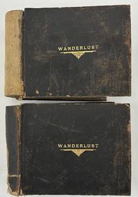
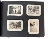
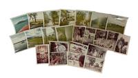
1923rif. 5280Various locations in the American Southwest and West 1923. About very good. Two oblong folio photograph albums bound in brown pebbled leather each titled in gilt on front cover "WANDERLUST" containing a total of 266 full-page vernacular and professional photographs. First albums: 146 leaves illustrated with 128 full-page landscape photographs each around 6 x 8 inches or slightly larger and occasional manuscript or hand-fashioned sectional title pages and maps. Second volume: 148 leaves illustrated with 138 photographs and occasional manuscript or hand-fashioned sectional title pages. All contents mounted one per page to recto of each leaf. Spines perished but holding strong boards worn scuffed and soiled. Contents noticeably curled with minor to moderate dust-soiling throughout. A studio photograph of a young man is laid-in to the first album likely the compiler of the albums but sadly unidentified. An elaborately-produced pair of vernacular photograph albums documenting an epic cross-country train excursion in 1923 by a well-to-do but anonymous traveler from New York comprised of over 260 full-page photographs. The photographs are a mixture of silver gelatin images printing out paper prints handcolored photographs and a handful of cyanotypes. Most of the images appear to be taken by the traveler en route but some images may have been bought along the way. The images largely picture the landscape or architecture seen along the way with a healthy number of images showing the railroad and the railcars themselves with many images taken at train depots. The occasional manuscript sectional title pages denote the regions of travel as the compiler moved west to California and then eventually back east towards home. The first album begins with a manuscript title leaf quoting the text of Gerald Gould's poem "Wanderlust" supplemented by two small drawings and two thumbnail photographs. A map on the second leaf traces the voyage from New York down through the American South and Southwest to California and back to New York through Arizona Colorado and the Midwest. Thereafter the album is comprised mostly of full-page photographs grouped together by location with anywhere from a few to several images per section. The first section in the first album shows the first major stop on the trip -- Washington D.C. and Mount Vernon; this section contains photographs of the Capitol the Lincoln Monument other D.C. buildings and several on the grounds of George Washington's home at Mount Vernon. The album then includes sections featuring New Orleans six photographs; the route between New Orleans and El Paso five images including the train depot at Langtry Texas; El Paso five shots featuring the city and street views; Juarez Mexico eight shots mostly either street scenes or a bullfight; "Thru New Mexico and Arizona" four images; The Apache Trail in Arizona nineteen shots mostly desert landscapes but with some buildings along the trail; and onward through the Carriso Gorge seven photos to California beginning at Coronado Beach eight photographs. The remainder of the first album features California locations namely San Diego sixteen images mostly missions; Pasadena ten photos mostly featuring gardens; Catalina Island eight shots of the island scenery or the bay; Los Angeles eight views in Santa Monica Venice and Ocean Park; and ending with fourteen images featuring missions and other notable structures in Santa Barbara. The second volume picks up the excursion in Del Monte California featuring fifteen scenes in Carmel by the Sea and Monterey. The photographic journey of California then continues to Santa Cruz and the Big Trees five shots; San Francisco eleven views around the city and in the Japanese gardens; Mt. Tamalpais a dozen shots of elevated vistas big trees and forests; Yosemite National Park twenty park views; Mariposa Big Trees seven shots; and ends with the Glenwood Mission Inn in Riverside twenty-two images of the hotel grounds and other local scenery and missions around Riverside. The remainder of the album features photographs from the Grand Canyon in Arizona twenty-six images mostly landscapes but with a few featuring Native American ceremonies and Colorado Springs twenty landscapes and other views of the city surrounding desert Pikes Peak and so forth. Concerned mostly with scenery of the American South Southwest and West Coast the compiler did not see fit to record photographs of the remainder of his trip back home to New York. In addition to the information contained in the photographs here the elaborate materiality custom matching albums with matching gilt titles to the front board handcrafted sectional title pages the hand-drawn and traced map and the nature of the organization of the albums arranged in the order of travel from east to west and back east again speaks volumes about the importance the compiler placed on the trip. Substantially documented western travel albums are growing rare in the market and the present example is one of the most carefully-assembled examples we have ever seen. unknown books
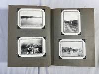
1958rif. 237661958. Mexico travel photo album containing more than 150 photographs 1958 to 1961 documenting an American journey through cities coastal settlements fishing communities archaeological and historic sites markets and rural landscapes during the rapid expansion of postwar tourism to Mexico. The photographer traveled well beyond a single resort itinerary recording Guadalajara Guaymas San Blas Tequila Acapulco Cozumel and other locations while repeatedly turning the camera toward local residents vernacular buildings working waterfronts boats vegetation and roadside landscapes. Printed processing dates of "Dec. 58" and "Jan. 61" establish at least two photographic episodes while handwritten captions trace portions of the route and identify places and people encountered along it. Travel photo album of more than 150 color and black and white snapshots most approximately 3.5 x 3.5 inches Mexico and one page at an unidentified Southeast Asian location 1958 to 1961. The Mexico photographs range from city streets and groups of travelers to fishing boats harbors lagoons markets mountains tropical vegetation stone buildings construction archaeological or historic architecture and portraits of local residents. Handwritten captions identify "San Blas" "Guadalajara" "Guaymas" "Travel thru Mexico" "Tequila" "Cuernavaca" "Lerma Cozumel" and "Acapulco Cozumel '61" while another photograph of three women wearing traditional dress is captioned "Mayan women." A photograph identified "Tequila" records an open landscape and roadside setting while the Guaymas sequence includes fishing vessels and a man standing among their masts and rigging. Other images follow waterways by small boat showing passengers settlements along the banks dense tropical growth and working boats. The photographer also recorded companions and acquaintances including a man identified in a caption apparently reading "Ralph Glad hill" as well as paired portraits captioned "Lerma Cozumel" and "Bathing 30 '61." A group of black and white photographs records stone structures in varying states of construction or repair including one view captioned "My house as purchased." The final approximately ten photographs depart abruptly from the Mexican itinerary and depict an unidentified Southeast Asian village or settlement. The album belongs to a period when Mexico had become one of the principal foreign destinations for American travelers following decades of government investment in highways hotels archaeological tourism resort development and international promotion. By the late 1950s and early 1960s improved road and air connections allowed foreign visitors to construct itineraries extending from major cities into Pacific ports smaller towns archaeological sites and newly developing coastal destinations. The photographs register that mobility directly: named tourist centers sit beside fishing communities working harbors rural roads vernacular houses market activity and portraits of residents encountered during travel. Moderate handling wear to the album and mounts; photographs with occasional fading color shift surface wear and minor edge wear with several color prints showing pronounced red or magenta shift. Overall in good condition. A substantial photographic record of postwar American travel through Mexico preserving the movement between established tourist destinations and local communities before mass international tourism transformed many of the coastal places represented here. unknown books
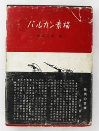
1956rif. 6271Osaka 1956. Very good. 42701pp. plus plates. Black cloth stamped in blind and white; original dust jacket. Jacket with some chipping and wear a few tears reinforced with tape on verso. Authorial presentation inscription on front flyleaf. Internally clean. A rare Japanese travelogue to Yugoslavia in 1954 written and illustrated by the renowned painter Saburo Kurata. This copy features a manuscript dedication by the author to Tsuneko Kondo Kawase a Ljubljana-based Japanese female collector art promotor and intellectual. Kawase who was also known by her Christian name Marija Skušek was recognized as a pioneering ambassador of Japanese culture in Yugoslavia. Following World War II Yugoslavia became the first communist country to formalize diplomatic relations with Japan. The two countries reestablished their bilateral relations in 1952 and Japan opened its representation in Belgrade that same year. This partnership was elevated to the level of embassies from both sides in 1957. In 1954 a renowned Japanese artist Saburo Kurata 1902-1992 was invited by the Yugoslav government to visit the country and give lectures on Japanese art. During his stay which lasted over a hundred days Kurata traveled throughout Yugoslavia resulting in the present work. This richly illustrated book is not a typical travelogue; rather it offers an experience seen through the eyes of a Japanese artist experiencing post-war Balkan Communist culture and the role of art. Saburo Kurata created dozens if not hundreds of sketches during his travels in Yugoslavia many of which were included in the book. He was pleasantly surprised by the strong appreciation for art in Yugoslavia where the government invested significant funds in exhibitions and the founding of museums and libraries. Kurata was particularly excited by the promotion of children's art which was nearly unknown in Japan at the time. He also described the perceptions of Japanese art and traditional artwork in Yugoslavia. In December 1954 he traveled to Ljubljana and was thrilled to discover that Japanese culture was well known there largely due to a Japanese woman named Tsuneko Kondo Kawase who had married a Slovenian officer Ivan Skušek. Kurata was delighted to meet a fellow countrywoman as she assisted him in arranging his exhibition introduced him to high society art circles invited him to a Christmas party and made him miso soup. Shortly after publishing his travelogue in early June 1956 Saburo Kurata sent Tsuneko a copy of the book with a personal dedication on the first page in appreciation of their friendship and her help. An extraordinary association copy of this rare work. We locate two copies in OCLC both held in Japanese institutions. unknown books
1940rif. 229521940. Photographic album of an American family's travels in 1940 and 1941 documents cross regional movement through Mexico Nova Scotia and the United States with a sustained visual record of Mexican landscapes labor and public life at the beginning of the 1940s. The album titled in manuscript "MEXICO 1941" includes detailed captions identifying locations agricultural practices and infrastructure situating the images within a period of expanding road networks and tourism in North America. The photographs support research into travel history visual documentation of rural and urban environments and cross cultural observation during the early twentieth century. Oblong photograph album containing approximately 180 original black and white silver gelatin photographs each measuring about 3 x 4 inches mounted on grey cardstock pages within a black pebbled faux leather album measuring approximately 9 x 7 inches. Over 80 photographs document travel in Mexico in 1941 with images of central Mexican landscapes including agave fields identified as sources of pulque and mezcal rural roads near Montemorelos the Tampoan River near Valles village scenes and market activity with vendors and goods displayed in open air settings. Urban views show streets with carts wagons and commercial signage. A recurring identified figure "Mary Kay" appears throughout including a photograph with a Spanish interpreter and references to a guide named Miquel "Mike" Soto. Additional photographs depict local residents including agricultural workers and market vendors. The remaining images include approximately 90 photographs from a 1940 trip to Nova Scotia and other North American locations including waterfront and forest scenes Washington D.C. civic architecture and monuments Texas small town environments and Gettysburg battlefield landscapes. The album was produced during a period when automobile travel and tourism expanded access to regional and international destinations allowing American travelers to document landscapes and communities through personal photography. The juxtaposition of Mexican rural and urban scenes with locations in Canada and the United States reflects differing regional environments while also demonstrating the continuity of travel practices and visual documentation. The inclusion of detailed captions indicates an effort to record geographic and cultural information alongside personal experience. Photographs remain clean and well preserved with secure corner mounts and a tight binding; overall very good condition. This album provides an extensive visual record of early 1940s travel across North America with particular emphasis on Mexico and Canada. unknown books
1969rif. 225621969. Mexico Travels throughout Mexico in 1969 by Western tourists two older women identified as "Joan" and "Eve". Archive of 23 original color photographs documenting various rural and city locations within Mexico. These images capture a cross-section of urban cultural and historic sites at the cusp of Mexico's late 1960s modernization and tourism boom. The photographs are annotated in period handwriting with dates and locations situating the journey across Mexico City Guadalajara Pátzcuaro Toluca San Miguel de Allende and Teotihuacan. Measurements range from 2.5" x 3.5" to 3.5" x 3.5". The imagery ranges widely: Alameda Park in Mexico City a leafy civic space where tourists strolled among fountains and colonial arcades; the cathedral and central plazas of Guadalajara; and the Hotel Posada de Don Vasco at Pátzcuaro a resort-style colonial inn that catered to international travelers in Michoacán. Several views record the pyramids of Teotihuacan including the Pyramid of the Sun rising over the plateau. Particularly notable is a series from Toluca depicting a traditional Aztec sun dance performed by local costumed dancers in feathered headdresses and decorated attire-images that reflect mid-20th century staged folkloric revivals of pre-Hispanic ritual for both community expression and tourist consumption. Other photographs show the streets of San Miguel de Allende a town that by the late 1960s had become a magnet for expatriate artists and serene scenes of fishermen in dugout canoes on Lake Pátzcuaro. Photographs retain strong color saturation with some natural tonal fading common to late 1960s prints. Light handling wear and minor curling at edges but overall surfaces remain clean with legible handwritten captions. Overall very good condition. A vibrant and personal travel archive these photographs provide a valuable record of how Mexico's cultural heritage urban life and indigenous traditions were framed through the lens of travelers in the late 1960s intersecting with themes of tourism identity and heritage preservation. unknown books
1919rif. 5848Various locations in the United States 1919. Very good. 50 leaves illustrated with 198 tipped-in sepia-toned photographs almost all around 5 x 3 inches a handful somewhat smaller all with white ink manuscript captions in English. Oblong quarto. Contemporary black cloth photograph album with "Places and Faces" in gilt on front cover string tied. Moderate wear soiling and minor scuffing to boards. Occasional creasing and minor wear to images. A unique and informative photographic record of an extensive cross-country journey by a young Japanese man from San Francisco to New York in 1918 and 1919. The trip took place between December 1918 and September 1919 beginning in Yokohama. Though the traveler is unnamed he was most likely Fujisawa Tomonosuke the son of the founder of Fujisawa Yakuhin once one of the major pharmaceutical companies in Japan. The company is now called Astellas Pharma Inc. According to a company history Fujisawa Tomonosuke travelled to the United States in 1919 as the company opened a branch in New York. The last page of the present album shows a Buddhist-style memorial with an explanatory caption on the verso which states that Fujisawa Tomokichi Tomonosuke's father built it in 1918 to console thousands of deaths during World War I. The monument still sits in Domyoji Temple near Osaka. Another clue that the album was compiled by Tomonosuke is the practice by the compiler to identify all the subjects in the album by a prefix and their last name except for one who is constantly referred to as "Tom." Tomonosuke's journey begins in Yokohama where he boarded the Tenyo Maru which delivered him via Honolulu to San Francisco on December 26 1918. He stayed in San Francisco for about six months and visited numerous locations around the Bay Area including Stanford University the University of California at Berkeley Ocean Beach Seal Rock Golden Gate Park Oakland Lincoln Park and more. In late-May he makes his way to Los Angeles and Pasadena where he visits vast oil fields where one image is captioned "Hundreds of oil wells in Los Angeles" a Southern Pacific Railroad station the zoo Bush Garden and other sites. After a few days in southern California Tom sets off across the continent to his presumed ultimate destination of New York briefly visiting Salt Lake City Denver and Chicago before arriving at Niagara Falls by June 3. He includes numerous shots of the falls before arriving in New York City. His stay in New York was extensive and included many sightseeing tours to locations in New York but also New Jersey and Pennsylvania. He includes shots of Bronx Park the Poughkeepsie Bridge the Victory Arch the Statue of Liberty and other sights around Manhattan along with scenes in Montclair Atlantic Highland and Culver's Lake New Jersey and a few locations in Pennsylvania such as Sawkill Falls on the Delaware River. He also witnessed the commemoration parades for both the American Army's 2nd Division and General Pershing's "Grand Parade Day" in New York City each of which he preserved in a handful of photographs. In addition to the variety of the settings the photographs reveal real skill and technique by the photographer. The images are mostly well composed and informative in nature. Despite the fact that the compiler was Japanese all of the captions are written in confident English lending further credence to the notion that the compiler was highly educated and confident as would be the son of the founder of one of Japan's most successful companies. An exceptional annotated vernacular photograph album preserving the adventures of a precocious Japanese business traveler in the United States just after the First World War. unknown books
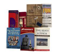
1994rif. 210521994. Laermer Richard; Collins Andrew; Link Matthew; Damron Guides; Fodor's Editors; Guaracino Jeff. Gay and lesbian travel guide collection 1994-2007 documenting the development of LGBTQ travel culture and the identification of queer social spaces in the late twentieth and early twenty-first centuries. These guides situate travel as a structured means of accessing community particularly in the aftermath of the AIDS crisis when information about safe spaces health resources and social networks was critical. The collection provides evidence of how printed directories functioned as both navigational tools and cultural records of LGBTQ presence across cities regions and international destinations. Collection comprises 7 travel guides ranging in size from approximately 4" x 7" to 5" x 8.5". 1 Richard Laermer's Gay and Lesbian Handbook to New York City 1994. This book contains 244 pages of hundreds of listings in New York City broken up by subjects including gay neighborhoods entertainment the arts politics spirituality and most importantly health services and support groups for those suffering from AIDS in the midst of the crisis. 2 Betty & Pansy's Severe Queer Review of San Francisco 1995. A queer travel guide of San Francisco that contains many illustrations and sketches representing the underground of queer culture. 130 pages that includes listings of bars performance spaces night clubs hotels restaurants and more. This copy also includes an original postcard which features a picture of both authors and has an inscription signed by Betty. 3 Fodor's Gay Guide to San Francisco and the Bay Area by Andrew Collins. First Edition 1997. Includes 166 pages on Gay Life Culture Establishments and more in the bay area. 4 Matthew Link's Rainbow Handbook: Hawaii the Island's Ultimate Travel Guide 1999. Contains 225 pages dedicated to gay travel in Hawai'i written by gay travel writer Matthew Link. Includes a breakdown of locations on each individual island. 5 Fodor's Gay Guide to the USA Second Edition 1998. 600 Pages. Measures 5" x 9". Includes a city by city breakdown with 67 road maps. 6 Damron Men's Travel Guide 1999. 900 pages. Measures 3.5" x 6.5". Includes USA Mexico Canada Caribbean and European Cities along with a 1999 party calendar. About 800 pages on USA locations 7 Guaracino Jeff. Gay and Lesbian Tourism: the Essential Guide to Marketing. 183 pages. This is a 2007 book focusing on marketing towards the LGBT community. The author focuses on various aspects of LGBT tourism such as the case for its economic value finding the right stakeholders and the best practices in marketing towards that audience. Produced during a period of expanding LGBTQ visibility and mobility these guides illustrate how travel infrastructure supported the formation and maintenance of queer social networks. The inclusion of health resources nightlife and community organizations reflects the practical needs of travelers as well as the broader cultural landscape of LGBTQ life. Many listed establishments no longer operate making these guides a record of spaces that have since disappeared. Light wear consistent with use; bindings intact and pages clean; overall very good condition. This collection offers a substantial printed record of LGBTQ spatial and cultural networks at the turn of the twenty-first century. unknown books
1990rif. 210491990. Ferrari Marianne; Link Matthew; Damron Guides; Fodor's Editors; Rough Guides Editors. Gay and lesbian travel guide collection 1990-2010 documenting the development of LGBTQ travel culture and the mapping of queer social spaces across the United States and internationally. These guides situate travel as a key component of late twentieth-century queer life providing structured access to community networks commercial establishments and safe gathering spaces during a period when visibility remained uneven across regions. The collection offers insight into how printed directories functioned as practical tools for mobility while also recording the geographic distribution of LGBTQ venues and institutions. Collection comprises 7 travel guides ranging in size from approximately 3.5" x 6.5" to 5.5" x 8.5". 1 Gay Travel Atlas by Marianne Ferrari 1990 includes hundreds of pages of listings for LGBTQ-friendly destinations with extensive coverage of all 50 U.S. states alongside international entries. 2 Inn Places: Gay & Lesbian Accommodations Worldwide 11th edition 1998 presents detailed descriptions of hotels inns and resorts across multiple continents with substantial U.S. coverage and narrative descriptions of clientele and amenities. 3 Rainbow Handbook: Hawai'i by Matthew Link 1999 focuses on island-specific travel organizing listings by location while incorporating interviews cultural commentary and photographs. 4 Fodor's Gay Guide to the USA 1996 arranges listings by city including bars hotels and community venues across major destinations. 5 The Rough Guide to Gay & Lesbian Australia 2001 organizes content by region detailing clubs beaches accommodations and social spaces. 6 Damron City Guide 2nd edition 2005 compiles over 6000 listings across 75 international cities with a strong emphasis on urban centers in the United States. 7 Damron Men's Travel Guide 2010 expands to over 13000 listings across North America Central America and the Caribbean. Across all volumes entries typically include addresses phone numbers descriptive keys maps and advertisements for LGBTQ-oriented businesses documenting both major urban centers and smaller regional locations. Produced during a period of expanding LGBTQ visibility following the late twentieth-century gay rights movement and the AIDS crisis these guides illustrate how travel infrastructure supported community formation and access to safe environments. Many listed establishments no longer exist making these volumes a record of commercial and social networks that have since disappeared or transformed. Light wear consistent with use; bindings intact and pages clean; overall very good condition. This collection provides a substantial printed record of LGBTQ spatial networks at the turn of the twenty-first century. unknown books
1910rif. 209951910. Photo album documenting the travels of a young woman and her companions through California Colorado and Texas during the 1910s and 1920s preserving visual evidence of female leisure travel outdoor recreation and tourism in the early twentieth-century American West. The album captures a period when increasing mobility expanding rail and automobile tourism and changing social expectations allowed middle-class women greater participation in recreational travel and outdoor activity. Particularly notable are photographs depicting women in trousers and climbing attire during excursions in Colorado including two images of the album's owner dressed in men's clothing reflecting evolving attitudes toward women's physical independence and informal dress within recreational settings. The photographs provide primary-source documentation of tourism culture women's social life regional landscapes and everyday travel experiences across the American West during the interwar period. Album containing 72 mounted black-and-white and sepia-toned silver gelatin photographs affixed to black album leaves. Photographs range in size from approximately 1 x 4.5 inches to 3.5 x 5.5 inches with most measuring about 2.5 x 4.5 inches. Early photographs depict the album owner and companions at Exposition Park in Los Angeles and along California beaches including scenes of young adults posing casually outdoors and a young man in a sailor's uniform among the group. Subsequent photographs document travel through Colorado featuring views of Garden of the Gods Pike's Peak mountain landscapes rock formations and hiking excursions. Several images show women climbing among rocky terrain while wearing trousers jackets and practical outdoor clothing associated with recreational mountaineering and travel. The Texas portion of the album includes photographs of Mission Espada in San Antonio and additional Spanish colonial architecture in southern Texas alongside informal portraits of travelers posed before mission buildings and landscaped grounds. Throughout the album the travelers appear in fashionable clothing characteristic of the 1920s including dresses hats coats and leisurewear. The final leaves contain images of puppies livestock and a contemporary automobile possibly documenting the owner's return home after her travels. Handwritten notes tucked into the rear of the album list rooms and furnishings associated with a house interior. The album documents the expansion of tourism culture and personal mobility in the American West during the early twentieth century when scenic travel destinations in California and Colorado became increasingly accessible to middle-class travelers through improved transportation infrastructure and growing interest in outdoor recreation. The inclusion of women participating in hiking and climbing activities while wearing unconventional attire for the period provides additional insight into changing gender norms associated with travel and leisure. String-bound in black cloth boards stamped "Photographs" in gilt on the front cover. Two photographs detached from leaves but present. Otherwise very good condition overall. Well-preserved photographic record of women's travel and recreation in the American West during the early twentieth century. unknown books
1987rif. 209821987. Damron Bob Lindsy Van Gelder Pamela Robin Brandt Hanns Ebensten and others archive of seven travel publications and related materials dating from 1987 to 2003 documents the development of queer travel infrastructure and the circulation of information necessary for LGBTQ individuals to navigate public space safely in the late twentieth century. Produced during and after the AIDS crisis these guides provided listings of bars hotels medical resources and social organizations at a time when visibility and safety varied widely by region. The publications extend a tradition of minority travel guides comparable in function to The Negro Motorist Green Book offering practical tools for identifying supportive environments and avoiding hostile ones. Early editions of the Damron guides compiled through firsthand travel by Bob Damron established a model for cataloging queer friendly spaces across North America and beyond while later publications expanded coverage to Europe and incorporated broader cultural and political resources. Archive of seven items comprising five travel guides one fold out map and one volume of travel writing published between 1987 and 2003. Items include: 1 Damron Bob. Damron Address Book. San Francisco 1987. Approximately 3 x 6 inches. Contains over 6000 listings across the United States Canada and Mexico with extensive coverage of U.S. locations. 2 Van Gelder Lindsy and Pamela Robin Brandt. Are You Two.Together A Gay and Lesbian Travel Guide to Europe. 1991. Approximately 345 pages. Covers accommodations dining and travel sites across multiple European countries. Signed by both authors. 3 The Gay and Lesbian Handbook to New York City. 1994. Approximately 277 pages. Includes listings for cultural venues social organizations and medical resources including AIDS related services. 4 Columbia Fun Maps: Mapping the Gay and Lesbian World. San Francisco 1995. Fold out map with directory of businesses and resources in San Francisco. 5 Damron Bob. Damron Address Book. 1998. Expanded edition with hundreds of pages of listings across North America the Caribbean and Europe. 6 Ebensten Hanns. The Seals on the Icepack and More Gay Travel Adventures. 1999. Signed and inscribed. Travel narratives documenting experiences in multiple global locations. 7 Frommer's Gay and Lesbian Europe. 2003. Comprehensive guide to travel across the United Kingdom and continental Europe. These materials document how LGBTQ travelers relied on print networks to construct routes of movement community and safety prior to the widespread availability of digital resources. The guides reveal the geographic distribution of queer spaces the integration of medical and social support listings during the AIDS crisis and the expansion of international travel opportunities in the late twentieth century. Ebensten's travel writing provides a narrative counterpart to directory based guides offering firsthand accounts that complement the logistical frameworks of the other publications. Together the archive provides evidence of how queer communities mapped social belonging across cities and nations contributing to the study of LGBTQ history tourism and spatial politics. Light handling wear across volumes with typical age toning; overall clean and stable. Overall very good condition. unknown books
1801rif. 23544London: Printed at the Oriental Press by Wilson & Co. for Edward Harding 1801. First Edition. Hardcover. Very good. Quarto pp 205 217 with two folding hand-colored maps and 47 engraved plates in a contemporary full calf binding with gilt rules spine in six compartments with red and black spine labels and gilt embellisment. Some rubbing to boards especially at joints and head of spine a little worming to boards. Binding sound scattered foxing but generally clean. The maps which are in very nice condition show Pennant's route from London to Dover and then from Dover to the Isle of Wight. "Thomas Pennant was a Welsh antiquarian and naturalist whose works were very popular in the eighteenth century. His reputation was built on his important natural history survey British Zoology first printed in 1766 and his accounts of two tours of Scotland undertaken in 1769 and 1772. Pennant made further tours in Wales and in England between 1773 and 1787 and his popularity among amateur naturalists and antiquarians resulted in the development of a comprehensive network of correspondents many of whom supplied him with additional information that he added to subsequent editions of his works. Aside from his 1783 book describing the antiquities on the road between Chester and London and his immensely popular account of the antiquities of London none of Pennant’s English tours were published during his lifetime. This account of his 1787 tour to the Isle of Wight was edited by his son David and published in 1801. Rather than heading directly to the island Pennant’s tour took in much of the south-east coast of England travelling first from London to Dover before traversing the coasts of Kent and Sussex" Royal Collection Trust. Printed at the Oriental Press by Wilson & Co. for Edward Harding hardcover books