Travels in Circassia Krim-Tartary C
rif. 028256604X.Gpaperback. Good. Access codes and supplements are not guaranteed with used items. May be an ex-library book. paperback

Bonita · Stati Uniti71,69 USD≈ 64,05 €
21 risultati
rif. DADAX0800756770New unknown
rif. 028256604X.Gpaperback. Good. Access codes and supplements are not guaranteed with used items. May be an ex-library book. paperback
2000rif. A61247Porto Alegre: Fumproarte 2000. First Edition. Wraps. Very Good. First Edition. Wraps. Large 4to. Colour illustrated wraps/ paperback. pp 144. Copiously illustrated in colour and black and white throughout. Text in Portuguese. Art. Fine. Fumproarte, paperback
2016rif. 1-3330742194Novas Edições Acadêmicas 2016. Paperback. New. 124 pages. Portuguese language. 8.66x5.91x0.28 inches. Novas Edições Acadêmicas paperback
rif. DADAX1436997402New unknown
rif. SONG186046467XUsed: Good unknown
rif. 620981560X.Gpaperback. Good. Access codes and supplements are not guaranteed with used items. May be an ex-library book. paperback
rif. 6209823289.Gpaperback. Good. Access codes and supplements are not guaranteed with used items. May be an ex-library book. paperback
rif. DADAX0521036151New unknown
rif. SONG190767764XUsed: Good unknown
rif. 6209813046.Gpaperback. Good. Access codes and supplements are not guaranteed with used items. May be an ex-library book. paperback
rif. 6209820727.Gpaperback. Good. Access codes and supplements are not guaranteed with used items. May be an ex-library book. paperback
rif. 6209825842.Gpaperback. Good. Access codes and supplements are not guaranteed with used items. May be an ex-library book. paperback
rif. 63-8178Paris: Hotel Du Danube 1887. 11 x 35 cm. Folded Page. Hand-written Signed Receipt on Hotel Du Danube letterhead. Very Good. En Francais. Paris: Hotel Du Danube, 1887. unknown
rif. DADAX0792343824New unknown
rif. DADAX0486231917New unknown
rif. Andersen, Hans ChristianIn Pristine Condition. unknown
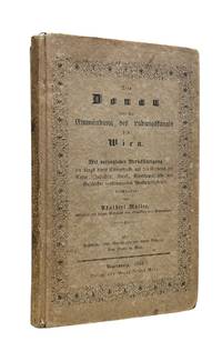
1844rif. 10175Regensburgh: Georg Joseph Manz 1844. First edition. 8vo xiv 205 1pp. Frontispiece with two engraved views and a large folding 6-section map at back. Original printed boards rubbed and soiled. Some foxing to the frontis and title scattered throughout and the map. Very good. Very attractive copy of this travel guide devoted to the stretch of the Danube from the Ludwig Canal to Vienna. This is a follow up to Müller's first work on the Danube issued in two volumes from 1839-1841 and covering the entire length of the river. Adalbert Müller 1802-1879 was a popular history and travel writer from Bavaria who wrote several works on the scenery and monuments in southern Germany during the steam travel age. Scarce. Georg Joseph Manz unknown
rif. DADAX0415227801New unknown
rif. SONG3662477386Used: Good unknown
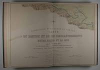
1874rif. 47511Leipzig: F. A. Brockhaus 1874. First edition. Hardcover. vg- to vg. Elephant Folio. 6 leaves 60 Nos. I-LIX plus XXXIb plates two of them folding the others doubled-paged. Original three-quarter red morocco over green pebbled cloth tightened with twelve original metal pegs with gilt lettering and decor embossed medallion of cover gilt lettering and raised bands on spine. Marbled endpapers. Maps of the Danube delta and comparative plans of the mouth and of some river sections of the Soulina arm showing the last works which were carried out there by the European Commission according to the projects of Sir Chr. A. Hartley its leading engineer following the collection of comparative plans published by the commission in 1867. The commission of the Danube River Commission Européenne was authorized by the Treaty of Paris 1856 following the end of the Crimean War and is considered the most successful international commission to control the Danube Delta commerce. It was the precursor of the League of Nations the U.N. and the EU. This extensive atlas with detailed maps charts and technical plans was compiled by the Commission to present the regulations put in place at the Danube Delta between 1857 and 1867 the first decade of neutrality of the region. It contains a detailed folding map of the Danube delta 30 x 50" / 1:100000 rendered in color lithography as all plates showing ports Danube canals and their depth compared to Russian measurements of 1829. The second folding map also showing the Danube Delta and additional maps showing various parts of the delta and its distributaries in detail followed by charts and technical plans. All plates printed to double pages. Text in French. Binding with some wear bump at lower right corner closed tear at tail of spine with very light scuffing rubbed and very light soiling. Large map reinforced with brown tape on verso bleeding through and small 3 x 2/12/" taping on front with two and a half inch closed tear here. Light foxing of endpapers and first few pages. Brown spots on plates XXI through XVII barely affecting lithographs mostly at margins of five plates. Binding in overall good interior in very good- to very good condition. F. A. Brockhaus hardcover