[Burchinshaw, Dorothy, comp]Biblio.com
22 135 résultats
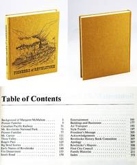
1986réf. 765j1516Revelstoke British Columbia: Revelstoke Senior Citizen Association. Fine. 1986. First Edition. Hardcover. 088925401X . Presents the local history of Revelstoke British Columbia. "Dedicated to our pioneers who opened up this country. To those that settled at Second Crossing as Revelstoke was first called. To the men that came with the building of the Canadian Pacific Railway bringing their wives from many countries to men and women who cleared the land south of here with stumping powder and a horse and often oxen." - page ii. Includes over 140 pages of family histories. Generously illustrated with black and white reproductions of archival photos. Map endpapers. 354 pages. Index. Clean bright tight and unmarked with negligible wear. An excellent example. Gift quality. Hale & Barman 142.; 4to . Revelstoke Senior Citizen Association hardcover
1987réf. 099259Cadillac Saskatchewan: Cadillac And District History Book Association 1987. Hardcover. pp. x 707. 4to. Bound in brown buckram with gilt lettering and decoration to spine and front board. Map and pictorial endpapers. Black and white photographs maps illustrations chart and tables etc. Minor shelfwear front board slightly bowed; very good. Cadillac And District History Book Association hardcover
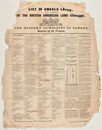
1842réf. 39134Montreal: Printed by John C. Becket 1842. Canadian Land for Sale A Canadian broadside advertising lands available in the Eastern Townships printed at the beginning of the region's transformation into a French-speaking area. In the early 1800s the Eastern Townships were an almost exclusively Anglophone region of Quebec. The American Revolution precipitated the flight of over 40000 Loyalists to Canada in the 1780s including a small handful to the largely unsettled region of Quebec between the St. Lawrence River and the U.S. border known as the Eastern Townships. The Loyalists cleared much of the rich land for farming which attracted a large number of immigrants from New England in the first decades of the 19th century. In the 1840s a rapid shift occurred in the region as French-speaking Quebecois from poorer areas began pouring in and the English speakers began emigrating to the U.S. and other parts of Canada. Francophones became a majority in the 1870s and today constitute over 85% of the population. The present broadside printed in English lists hundreds of lots for sale by the British American Land Company and includes over a column's worth of detailed descriptions of lands open for purchase. The following towns and areas are represented: Ascot Auckland Brompton Compton Clifton Clinton Ditton Dudswell Eaton Hereford Melbourne Newport Orford Shipton Stoke Weedon Westbury and Windsor in the County of Sherbrooke; Barford Barnston Bolton Hatley Potton and Stanstead in the County of Stanstead; Brome Ely Farnham Granby Milton Roxton Shefford and Stukeley in the County of Shefford; Acton Aston Chester Durhan Grantham Ham Kingsley Simpson Tingwock Warwick Wendover and Wickham in the County of Drummond; Sutton in the County of Missisquoi; Hemmingford in the County of Beauharnois; and improved farms in the district of St. Francis Territory Port St. Francis and the town of Sherbrooke. OCLC locates copies at the following institutions: McGill University Library and Archives Canada and the University of Vermont. Very rare. Small tears and creasing at all margins affecting a few words of text; significant loss at upper corners not affecting text. Fair. OCLC 61623796 30991751. unknown
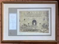
1912réf. 115761912. Original Print. Matted framed photograph. Very Good. Original back & white platinum photo print mounted on a period mat board stamped "Larrigan / Victoria" and framed within an additional mat board all within a 17 x 12.5 inch wood frame. Small dampstain the size of a US dime at lower margin. Prince Arthur Duke of Connaught 1850-1942 Queen Victoria's third and reportedly favorite son served as Governor-General of Canada 1911-1912. In 1887 he married Princess Louise Margaret of Prussia 1860-1917. The photo reveals the preposterous panoply of personalities who turned out for the Governor's visit many presumably being representatives of religious flocks including grey-bearded eastern-orthodox elders fraternal organizations including two exalted potentates with black-eyes who are connected at the neck by a drooping chain musicians a marching band is present political figures in formal attire et al. unknown
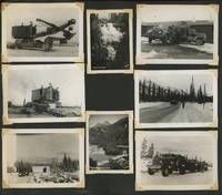
1943réf. Cat317Canada and the United States 1943. Photo album measuring 11 x 14 inches containing approximately 400 original photos with an additional 24 commercially produced photos. Photos attached with corner mounts. Original photos mainly measure 3 ½ x 4 ½ inches and smaller. Album pages delicate with wear especially to edges; photos generally excellent with some wear to corners. Overall very good to excellent. Between March and October of 1942 the Alaska-Canadian or ALCAN Highway was built by the US Army Corps of Engineers running from Dawson Creek British Columbia through Whitehorse Yukon to Delta Junction Alaska. The US had long seen a need for such a highway for defense purposes and Canada finally agreed to its construction in February of 1942 shortly after the Pearl Harbor attack on the conditions that the US would both pay for it and turn the Canadian portion over to Canada after the conflict. Over 10000 men worked to construct it including about 3000 African Americans in segregated regiments. Though officially completed in October 1942 work on the highway continued and it did not open to the public until 1948 due to issues with grading surfacing and other safety measures. Offered here is an album of photographs by an unknown photographer involved in the highway's construction. Signage in the photos places them around Whitehorse Yukon a bit more than halfway from Dawson Creek to Delta Junction. Besides the imposing Yukon landscape shots show men and their vehicles: military trucks earthmovers tractors trains ships seaplanes and tanks. Vehicles like tractors and construction plows are often fitted with tank treads; they pull wagons down steep hills and over creeks and are often pictured driving via rivers-perhaps this was easier than going overland on the soft delicate tundra. A man who is pictured in one of the photographs appears to be African American possibly part of one of the segregated regiments; the insignia on his jacket matches that on others' so he is likely part of the construction efforts. In many shots the materials and vehicles look more abandoned than in use and some appear to show junkyards. During its construction the ALCAN came to be known as the "oil can highway" for the quantity of discarded oil cans that the construction left behind; oil cans are omnipresent in these photos but they also suggest that more than just oil cans were left as debris. Two shots show an unidentified structure fire and what appears to be a head-on collision of two trucks one carrying numerous oil cans. Several show massive areas of erosion including one that has taken out a large portion of a paved road. One shows a bear standing by the rubble and trash left on the side of the road captioned on the verso "This Bear Weighs about 1400 lb. he is a dandy". These photos record the environmental impact of the highway's construction. Some shots document the men's recreation: fishing lunching in a field posing with what looks to be a wolf that was killed feeding a squirrel and even playing with bear cubs. Several are of puppies and dogsled teams. Others show wildlife in more natural habitats: bears from afar bighorn sheep in a rocky field and a moose splashing in a river. Small towns tent cities and quonset huts-including the TITA This Is The Army movie theater-dot the formidable landscape of pines and snowy peaks. Of interest to historians of highway infrastructure especially in harsh circumpolar climates and its environmental impacts.
1943réf. Cat317Canada and the United States 1943. Photo album measuring 11 x 14 inches containing approximately 400 original photos with an additional 24 commercially produced photos. Photos attached with corner mounts. Original photos mainly measure 3 ½ x 4 ½ inches and smaller. Album pages delicate with wear especially to edges; photos generally excellent with some wear to corners. Overall very good to excellent. Between March and October of 1942 the Alaska-Canadian or ALCAN Highway was built by the US Army Corps of Engineers running from Dawson Creek British Columbia through Whitehorse Yukon to Delta Junction Alaska. The US had long seen a need for such a highway for defense purposes and Canada finally agreed to its construction in February of 1942 shortly after the Pearl Harbor attack on the conditions that the US would both pay for it and turn the Canadian portion over to Canada after the conflict. Over 10000 men worked to construct it including about 3000 African Americans in segregated regiments. Though officially completed in October 1942 work on the highway continued and it did not open to the public until 1948 due to issues with grading surfacing and other safety measures. Offered here is an album of photographs by an unknown photographer involved in the highway's construction. Signage in the photos places them around Whitehorse Yukon a bit more than halfway from Dawson Creek to Delta Junction. Besides the imposing Yukon landscape shots show men and their vehicles: military trucks earthmovers tractors trains ships seaplanes and tanks. Vehicles like tractors and construction plows are often fitted with tank treads; they pull wagons down steep hills and over creeks and are often pictured driving via rivers-perhaps this was easier than going overland on the soft delicate tundra. A man who is pictured in one of the photographs appears to be African American possibly part of one of the segregated regiments; the insignia on his jacket matches that on others' so he is likely part of the construction efforts. In many shots the materials and vehicles look more abandoned than in use and some appear to show junkyards. During its construction the ALCAN came to be known as the "oil can highway" for the quantity of discarded oil cans that the construction left behind; oil cans are omnipresent in these photos but they also suggest that more than just oil cans were left as debris. Two shots show an unidentified structure fire and what appears to be a head-on collision of two trucks one carrying numerous oil cans. Several show massive areas of erosion including one that has taken out a large portion of a paved road. One shows a bear standing by the rubble and trash left on the side of the road captioned on the verso "This Bear Weighs about 1400 lb. he is a dandy". These photos record the environmental impact of the highway's construction. Some shots document the men's recreation: fishing lunching in a field posing with what looks to be a wolf that was killed feeding a squirrel and even playing with bear cubs. Several are of puppies and dogsled teams. Others show wildlife in more natural habitats: bears from afar bighorn sheep in a rocky field and a moose splashing in a river. Small towns tent cities and quonset huts-including the TITA This Is The Army movie theater-dot the formidable landscape of pines and snowy peaks. Of interest to historians of highway infrastructure especially in harsh circumpolar climates and its environmental impacts. books
1931réf. 111275Toronto, Canada, Specification Data , Limited 1931 In-4 29 x 23,5 cm. Cartonnage éditeur souple percaline verte, dos lisse, titre doré sur le premier plat, XXXVI-305-74 pp., abondamment illustré. Exemplaire en bon état.
1842réf. 39134Montreal: Printed by John C. Becket 1842. Canadian Land for Sale A Canadian broadside advertising lands available in the Eastern Townships printed at the beginning of the region's transformation into a French-speaking area. In the early 1800s the Eastern Townships were an almost exclusively Anglophone region of Quebec. The American Revolution precipitated the flight of over 40000 Loyalists to Canada in the 1780s including a small handful to the largely unsettled region of Quebec between the St. Lawrence River and the U.S. border known as the Eastern Townships. The Loyalists cleared much of the rich land for farming which attracted a large number of immigrants from New England in the first decades of the 19th century. In the 1840s a rapid shift occurred in the region as French-speaking Quebecois from poorer areas began pouring in and the English speakers began emigrating to the U.S. and other parts of Canada. Francophones became a majority in the 1870s and today constitute over 85% of the population. The present broadside printed in English lists hundreds of lots for sale by the British American Land Company and includes over a column's worth of detailed descriptions of lands open for purchase. The following towns and areas are represented: Ascot Auckland Brompton Compton Clifton Clinton Ditton Dudswell Eaton Hereford Melbourne Newport Orford Shipton Stoke Weedon Westbury and Windsor in the County of Sherbrooke; Barford Barnston Bolton Hatley Potton and Stanstead in the County of Stanstead; Brome Ely Farnham Granby Milton Roxton Shefford and Stukeley in the County of Shefford; Acton Aston Chester Durhan Grantham Ham Kingsley Simpson Tingwock Warwick Wendover and Wickham in the County of Drummond; Sutton in the County of Missisquoi; Hemmingford in the County of Beauharnois; and improved farms in the district of St. Francis Territory Port St. Francis and the town of Sherbrooke. OCLC locates copies at the following institutions: McGill University Library and Archives Canada and the University of Vermont. Very rare. Small tears and creasing at all margins affecting a few words of text; significant loss at upper corners not affecting text. Fair. OCLC 61623796 30991751. unknown books
réf. 36090P., Editions du Carrefour, sans date (vers 1950), in 8° carré, broché, VIII-270 pages ; cachets ; dos grossièrement recollé ; couverture fanée.
1928réf. 50929Victoria BC: The Fred Cox Service Ltd. label pasted over British Columbia Advertisers Engineering & Architectural Design Dept. ca. 1928. One oblong atlas folio map. 42 x 28.5 in. when unfolded 5 x 10.75 in. when folded. Printed in red white & blue w/ roads indicated in red. Preserved in original advertising map folder tan covers printed in red on front & back advertising Gutta Percha Tires and the Auto Service Club of British Columbia minor chipping to corners of covers toning; map w/ couple very small closed tears at creases very slight wear still VG- copy w/ ink annotations on back cover of folder. First edition of this scarce automobile travel map through the Pacific Northwest and British Columbia during the Roaring 20s with detailed mileage indicated between destinations. There is inset detail map of the Peace River District and Peace River Block West to Hudson Hope showing roads and trails. Worldcat locates 1 copy Univ. of Wash. The Fred Cox Service, Ltd., label pasted over British Columbia Advertisers, Engineering & Architectural Design Dept., unknown
1928réf. 54283Quebec Canada: Canadian Pacific Jan. 1928. Folio. 9.25 x 12.25 in. 8 pp unpaginated. Illust. title in blue & black 3 floor plans blue printed borders printed in blue & black. Textured blue embossed illustrated softcovers cover art of Chateau Frontenac on front cover blue & gilt lettering sewn w/ green silk braid at spine minor edgewear rubbing minor dampsoiling to verso of front cover faint rust mark at gutter margin from staple still VG- copy. First edition of this scarce souvenir brochure issued for hotel guests in this splendid Canada’s grand railway hotel after the upgrading and remodeling of the luxurious hotel in 1924 by William Sutherland Maxwell. Worldcat locates 2 copies Archives du Quebec Canadian Centre for Architecture. Canadian Pacific, paperback
réf. 62117Edmonton Alberta Canada: The Douglas Printing co. Ltd. 1959. Tall 8vo. 236 2 pp. Numerous photo plates plates 1 large folding map. Blue publisher’s cloth gilt lettering on spine minor bumping to a couple corners minor soiling to fore-edges w/ d.j. cover art photo of the Canadian Pacific Railway survey in 1872 minor toning to fore-edges some scuffing still VG/VG copy signed by the author on rear endpapers. First edition signed of this informative and well-illustrated follow-up history of Fort Edmonton and Edmonton drawing from Frank Oliver’s writings the Hardisty family records and Sir Donald A. Smith. The Douglas Printing co., Ltd., hardcover
réf. 62116Edmonton Alberta Canada: The Douglas Printing co. Ltd. 1954. Tall 8vo. 255 1 pp. Numerous photo plates plates 1 large folding map. Blue publisher’s cloth gilt lettering on spine minor bumping to a couple corners still VG copy. First edition of this informative and well-illustrated historyof Fort Edmonton and Edmonton including the Hudson’s Bay Co. The Northwesters and more. Detailed are the efforts of Samuel Hearne Alexander MacKenzie the formation and influence of Fort Saskatchewan Fort Edmonton Fort Vancouver John McLoughlin and more. The Douglas Printing co., Ltd., hardcover
1885réf. 58338Port Hawkesbury Inverness Nova Scotia: n.p. ca. 1885. Four mounted albumen photos including three cabinet card sized photos w/ images sized 3.75 x 6.2 in. mounted on 4.25 x 6.5 in. brown boards gilt lettering stamped at lower fore-edges 1 small 3.25 x 3.25 in. photo on 5 x 5 in. gray studio mount card stock all w/ annotations on versos indicating locations and w/ manuscript greetings some soiling dustsoiling and minor spotting to the Cabinet photos the smaller image a tad over-exposed still all three with fairly good contrast and well-defined images. These scarce images depict the town and harbour of Port Hawkesbury situated along the Strait of Canso and the only really viable port along the strait which faced Point Tupper. Originally named Ship Harbour the town supplied men materials and repairs to the Gulf of St. Lawrence fishing fleet and two of these images show vessels either anchored or under sail. These cabinet photos appear to have been sent to “Angus” as “Pictures of ‘home dear home’” with manuscript notes indicating “Port Hawkesbury looking towards Pt. Tupper. . . from Pt. Tupper. . . across the harbour.” The final photo shows the small Langley family home built by John Langley 1849-1926 who had married Maria Ballieul Langley 1848-1925 in 1872. He was initially a barrel cooper and later ship’s carpenter boat builder and later a railway foreman. n.p., hardcover
1925réf. 59066Vancouver B.C.: Board of Park Commissioners Park Board Offices 1925. 8vo. 70 pp. Colour frontisp. numerous photo plates 1 large folding colour map. Tan colour-illustrated softcovers Arts & Crafts cover art of swans swimming in park lake yapp fore-edge minor creasing & edgewear creasing to a few corners minor fold creases at fore-edge of folding map still a VG copy. First edition of this work illustrating and outlining many of the improvements and changes brought to Stanley Park during the first decade of Rawlings 1882-1937 as Park Superintendent. These changes included the construction of the Lost Lagoon Lake saltwater pipes were shut off turning it into a freshwater lake with many other changes. This work also details several other newly acquired parks during the Progressive Era as well as improvements initiated for beach access bathing facilities and upgrades for automobile tours. See: Christina Cameron Jim Barlow & Susan Mundick Stanley Park National Historic Site of Canada Commemorative Integrity Statement 2004. Board of Park Commissioners, Park Board Offices, paperback
1934réf. 59558Boston: Meador Publishing Co. 1934. 8vo. 271 1 pp. Red-ribbed publisher’s cloth black lettering front cover & spine w/ d.j. wraparound cover art of bucking bronco slight shelfwear toning still NF/NF copy. First American edition of this thrilling Western set in Saskatchewan against the backdrop of prairie fires stampedes wolves cattle-rustlers and gun-play. With parts in Western dialect the author recounts the homesteading days of Northwest Canada. See: Peel’s Bibliography of the Canadian Prairies to 1953 5800. Meador Publishing Co., hardcover
1899réf. 52956Victoria BC: Victoria Sealing Co. Dec. 27 1899. One albumen photo sized 3.75 x 4.75 in. mounted on thick board sized 4.25 x 5.25 in. sepia-tinted image minor scuffing edgewear very minor dustsoiling back still VG image. Scarce original albumen photograph of the sealing Schooner Penelope which began sealing voyages on the Pacific Coast in 1885 and continued till foundering off Clallam Bay WA in the Straits of Juan de Fuca in 1904. The image shows the Victoria Sealing Company schooner under full sail leaving Kyuquot Sound on the west coast of Vancouver Island with buildings in the background. The sealing industry in British Columbia was under great pressure from the U.S. Government as it wished to protect its’ sealing monopolies in Alaska. See: Stephen Lunsford Agreement and Account of Crew for Schooner Penelope Univ. of British Columbia Library; Wright Lewis & Dryden’s Marine History of the Pacific Northwest pp. 210 450-51. Victoria Sealing Co., unknown
1887réf. 55678Victoria New Westminster & Vancouver B.C.: The British Columbia Stationery & Printing Co. ca. 1887. 8vo. 5.75 x 7.6 in. 16 leaves unpaginated. sepia-tinted lithographed images bound leporello accordion style w/ 68 different images all w/ white & red borders. Embossed pebbled red publisher’s cloth gilt lettering front cover blind embossed raised borders very minor shelfwear 1 leaf w/ lifting from facing litho 1 very minor closed tear still a VG bright copy. First edition of this beautifully printed and illustrated souvenir book issued by the noted British Columbia printing firm which operated from 1885 to 1888 in Victoria and Vancouver BC. The views include the Victoria harbour the Fraser River Lighthouse birds-eye views of New Westminster Vancouver Coal Mining Co.’s Shaft No. 1 in Nanaimo the dockyards at Esquimalt Native American carvings totem poles and tribes people along with views of Sitka Alaska. Ferguson partnered with Pearson Robson & Hart in May 1886 to form the British Columbia Printing Co. who intended to establish themselves as the leading stationer printers in the province but due to the destruction of the company’s Vancouver branch by fire June 13 1886 and then on Sept. 1 1886 in Victoria but even though the company reconstituted and continued with their contract to print the West Shore Magazine locally as well as Canadian Pacific Railway literature the firm only survived until November 1888 when Ferguson returned to Winnipeg to open a book and stationery store. Worldcat locates 2 copies UBC WSU; See: Lana Okerlund British Columbia Stationery and Printing Company A Most Agreeable Place History of Booksellers and Stationers in British Columbia Oct. 3 2017; The West Shore Vol. 1 Vol. 13 1887 p. 496. The British Columbia Stationery & Printing Co., hardcover
1875réf. 51587Montreal Toronto & London: George N. Tackabury Printed by the Burland-Desbarats Lithographic Co. 1875. Folio. 14.25 x 17.75 in. 251 1 pp. Colour lithograph illustrated title page showing the Parliament Building in Ottawa Canada from photograph by W. Notman 53 colour lithograph maps many double-page many tables. Publisher’s plum-coloured embossed cloth gilt decorative lettering on front cover marbled endpapers nicely rebacked in simulated black calf corners renewed some wear & rubbing to corners 1 leaf w/ repairs to creases minor tidemark to upper right corner not affecting maps still G copy. First edition of this fine atlas of Victorian-era Canada including maps of climatology possessions provinces prior to Alberta Saskatchewan & Newfoundland becoming provinces plat maps of counties Railways as well as maps of the United States and Europe. Of particular interest are the city maps of Quebec Ottawa London Hamilton Kingston Toronto and Montreal. This excellent reference work also provides a comprehensive list of railways in Canada steamships in use lists post offices railway stations cities and populations as well as business cards located by city and town. George N. Tackabury, [Printed by the Burland-Desbarats Lithographic Co.], hardcover
1905réf. 33586Ottawa: Government Printing Bureau 1905. Thick 8vo. xviii 459 1 pp. Numerous photos maps illusts. Brown cloth gilt lettrng mnr bmpng & wear to crnrs hd & ft of spine VG copy w/ bkplate on frnt pstdn and from library of former Oregon State Geologist Paul Lawson. First edition of vol. I of this work on hunting exploration mountaineering and exploration in the Selkirk Range in British Columbia. In addition there is an extensive section on the Canadian Pacific Railway. Government Printing Bureau, hardcover
1958réf. 59583Calgary ALB & Geraldton ONT Canada: Trans-Canada Corporation Fisher’s Studio Box 370 1958. Oblong 4to. 11.25 x 7.25 in. 78 pp unpaginated. on thick black paper stock. With 69 tipped-in silver gelatin photographs 57 sized 5 x 7 in. & 12 sized 3.5 x 5 in. all tipped-in w/ silver corners first third of the album featuring white ink manuscript annotations in drafting hand occasional offsetting at upper fore-edges from old tape. Contemporary red boards post-binder gilt lettering stamped on front cover punch-sewn at gutter margin w/ black silk braid small label for Fisher’s Studio Geraldton ONT on front pastedown slight scuffing shelfwear still VG bright exemplar. This exceptional souvenir construction album illustrates the efforts of the Majestic Construction Co. building the Trans-Canada pipeline originally conceived following World War II by the Trans-Canada Pipe Lines Ltd. subsidiary of Texas oil magnate Clint Murchison’s Canadian Dehli. Majestic Construction specialized in building pipelines as well as power generation and transmission projects across Canada the United States India Malaysia and the Middle East. This album opens with photos of the Trans-Canada inspection crew engineering department and Majestic personnel followed by photos of caterpillar excavators digging ditches building right-of-ways drilling through rock and blasting. Also included are photographs of back hoes digging the pipeline ditch road boring machines giant bending machines and pipe gangs welding and x-raying the finished pipes. Also depcited are spooling machines for laying cables cranes laying pipe into position as well as pouring and placing the concrete sleeves and more. The Sturgeon River Crossing construction is also shown in the album which runs through the Sturgeon Lake Cree Nation Reserve Land. Smaller photos show some of the labor crews which managed to complete the pipeline by Oct. 1958. Fisher’s Studio often produced commercial souvenir albums including a similar album depicting the construction of King’s Highway 11 for the Ontario Ministry of Transportation and also issued souvenir Real Photo Postcards. We could find no similar albums in Worldcat or private holdings; See: Deborah Sawyer & Nathan Baker TC Energy formerly TransCanada Canadian Encyclopedia 2021. Trans-Canada Corporation], Fisher’s Studio, Box 370, hardcover
1866réf. 56658Montreal: Eusebe Senecal Imprimeur-Editeur Rue St.-Vincent 1866. 8vo. xiii 1 245 1 pp. Printed softcovers covered in thick 19th-century ribbed paper chipping & wear to spine hinges partially split shaken ex-lib markings on endpapers still G reference copy from the library of Marylhurst College which was disbanded in 2018 and the original recipient of much of the Father Blanchet library at the end of the 19th century. First edition of this work filled with annual reports by the noted Catholic missionary sent along with Bishop Provencher to organize Oblate Missions traveling by Hudson’s Bay Company canoe helping haul his portages and finally reaching the Red River Colony in 1846. For the next decade he divided his time between the Lac Ile a la Crosse a Cree station in Athabasca and also the St. Raphael Mission over the divide with the Chipewyan tribe. He corresponded and directed the efforts of Father Pierre-Henri Grollier the concentration of the Metis establishing parishes at Pointe-de-Chenes and also supported increased education efforts. Blanchet De Smet and La Fleche are all woven into his letters detailing the Oblates’ missionary work. This would be followed up by his second effort in 1869 which detailed geographical demographic and political conditions in the territory prior to annexation by Canada. Eusebe Senecal, Imprimeur-Editeur, Rue St.-Vincent, paperback
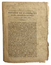
1837réf. 43482Np: Np 1837. Rare. 12mo 17x 13cm uncut 8p. an original document self wraps foxed Gagnon I 1085. T.P.L. 2054. Ducharme Catalogue No. 1 of the Victor Morin collection no. 895 issued April 1950 calls it très rare and prices it at $7.00. - The pamphlet is a defense of Bishop Lartigue's pastoral letter of October 24 1837 denouncing the actions of the Patriote leaders. Np unknown
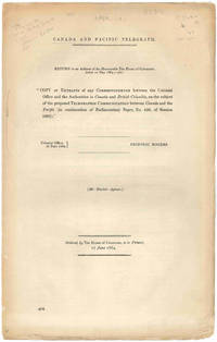
1864réf. 47423London. 1864. Founding the Canadian Pacific Telegraph: The Streeter Copy The Thomas W. Streeter copy with his pencil notes on the titlepage. This House of Commons working paper is a continuation of their return dated July 10 1863 on the subject of constructing a telegraph line to British Columbia and the Pacific. The Hudson's Bay Company unsurprisingly was intimately involved in the machinations for the building of the line. They had made an agreement with the Canadian government to build the telegraph line from the Red River to the Pacific themselves but when they failed to do so a group of English bankers proposed to step in and do the job. The papers included herein provide much information on the qualities of the land between Lake Superior and British Columbia and the need for swift communication throughout and across the vast region. Also included is a memorial from the people of the Red River Settlement discussing their urgent need for the telegraph. The Streeter copy sold to Nebenzahl for $30 in 1969 and was still in his stock when the Reese Company bought the last of it in 2013; here it is. Folio. String-tied as issued. A bit tanned some small chips at the edges. Very good. STREETER SALE 3436 this copy. SOLIDAY I:1207. LOWTHER 228. unknown
1864réf. 47423London. 1864. Founding the Canadian Pacific Telegraph: The Streeter Copy The Thomas W. Streeter copy with his pencil notes on the titlepage. This House of Commons working paper is a continuation of their return dated July 10 1863 on the subject of constructing a telegraph line to British Columbia and the Pacific. The Hudson's Bay Company unsurprisingly was intimately involved in the machinations for the building of the line. They had made an agreement with the Canadian government to build the telegraph line from the Red River to the Pacific themselves but when they failed to do so a group of English bankers proposed to step in and do the job. The papers included herein provide much information on the qualities of the land between Lake Superior and British Columbia and the need for swift communication throughout and across the vast region. Also included is a memorial from the people of the Red River Settlement discussing their urgent need for the telegraph. The Streeter copy sold to Nebenzahl for $30 in 1969 and was still in his stock when the Reese Company bought the last of it in 2013; here it is. Folio. String-tied as issued. A bit tanned some small chips at the edges. Very good. STREETER SALE 3436 this copy. SOLIDAY I:1207. LOWTHER 228. unknown books