11 077 résultats
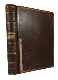
réf. 69768Hardcover. Good. Holograph. Includes Charles River Branch Railroad Company pages 1-116 covering June 20 1849-Oct. 24 1853; Charles River Railroad Company pages 119-133 covering Dec. 8 1852-Oct. 12 1853; and United Charles River Railroad Company pages 139-209 covering Nov. 9 1853-Aug. 30 1855. Ruled ledger. Leather. 26cm. Covers sound but scuffed and rather worn. hardcover books
1973réf. 72430New York: Union Pacific Railroad Company 1973. Paperback. Very Good. xii 86p. Wrapper. Plastic comb binding. 28cm. Text printed on one side. Countries surveyed: United States Canada Great britain France West Germany Italy the Netherlands and Japan. Union Pacific Railroad Company paperback books
1955réf. 73008n.p.: Printed by the Cuneo Press 1955. Paperback. Very Good. Pennsylvania Railroad Company. Announcing the New Organization of the Pennsylvania Railroad. cover title. n.p.: Printed by the Cuneo Press n.d. probably 1955. organizational charts double-page map 27p. Wrapper. 31cm. Printed by the Cuneo Press paperback books
réf. 19198African American Two Trains Running play by August Wilson the sixth in his ten-part series The Pittsburgh Cycle. The play takes place in Civil Rights era 1968 in the Hill District an African-American neighborhood in Pittsburgh Pen. August Wilson depict a black urban class struggle in America and the play's dialog spotlights 1960 Black American Culture. Vintage original poster Los Angeles. Poster size 22 x 14″ The poster artwork was by Jeffrey Smith. The poster features artwork depicting Browne Fishburne and Chisholme.The main charachters are shown on the poster : Wolf Anthony Chisholm the numbers runner; Sterling Larry Fishburne a Young Turk fresh out of prison; Hambone Sullivan Walker the mentally troubled and Holloway Roscoe Lee Browne the cafe's philosopher.There were a few regional performances of the play including one at the Ahmanson at the Doolittle in Los Angeles. It ran only January 16 through March 291992 and was directed by Lloyd Richards who also directed the plays Broadway debut. Laurence Fishburne won a Tony Award for "Outstanding Actor in a Play" for his portrayal of Sterling and can be seen in the for front row of the poster. Very good condition and matted and Framed. unknown books
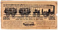
1875réf. 48055Chicago: Chicago Rock Island & Pacific Railroad Co 1875. Good. Chicago: Chicago Rock Island & Pacific Railroad Co. ca. 1875. Small pictorial broadside flyer. 16.5x33cm printed in black. Stock worn toned and chipped with a few instances of soiling extensive splitting along old folds with tape repair to verso. Good only. Promotional broadside for the Chicago Rock Island & Pacific Railroad that operated from roughly 1850-1970 largely in the Midwest. Features a paper-cut illustration that was created on the occasion of the first trip made by steam-powered passenger cars in New York in 1831 before the company's incorporation. This broadside however was not issued until several decades later. The extensive railway inspired the tune "Rock Island Line" covered by country crooners Johnny Cash and Lead Belly. No separately cataloged copies in OCLC as of May 2026. Chicago, Rock Island & Pacific Railroad Co unknown books
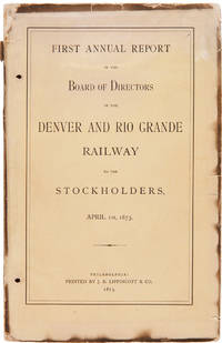
1873réf. 57738Philadelphia: J.B. Lippincott & Co. 1873. Rare Early Report of a Major Western Railroad A rare and detailed report from the infancy of what would become one of the West's largest railway companies. The Denver and Rio Grande Railway D&RG headed by former Union General William Jackson Palmer was founded in 1870 and the first tracks were laid the following year. The goal of the railroad was to find an efficient path through Colorado and across the Rockies and then southwest to a terminus at Los Angeles. The company expanded with considerable aggression and speed and before long was the largest narrow-gauge railway network on the continent. This report touts the results in the year since the railroad reached Colorado Springs the rapid growth in population in towns along the line progress of their work natural resources including coal stone lime and lumber various connecting lines and the goal of taking the railroad into Mexico which greatly wanted for railroads at the time the venture into Mexico would prove to be a disastrous waste of money and manpower. The appendix discusses the virtues of narrow gauge railroads and there are also tonnage reports a list of buildings owned by the railroad in various towns brief descriptions of spur lines and more. From 1877 to 1880 the Denver and Rio Grande was engaged in a railroad war with the Atchison Topeka and Santa Fe Railway led by William Strong in which both companies used political maneuvers physical force and sometimes violent sabotage to get the upper hand. The D&RG continued operations in a variety of shapes all the way until 1996 when it merged with the Union Pacific. The folding map titled "Map showing the Property of the Central Colorado Improvement Company" depicts the assets of that company one of three D&RG subsidiaries that later merged to form the Colorado Fuel & Iron Company. It shows the boundaries of part of the Nolan and St. Vrain grants; some township range and section boundaries; locations of major natural resources; railroads constructed and proposed; and other details. Other railroads shown include the Kansas Pacific future nemesis the Atchison Topeka & Santa Fe and the Arkansas Valley Extension R.R. The lengthy folding profile shows the route of the D&RG from Denver to Pueblo noting elevations as well as a profile of the Arkansas Valley Branch line. This copy is lacking the map titled "Denver and Rio Grande Railway and Connections" which was also published separately in larger format the same year. A rare and important early document from one of the west's largest and longest-running railroads. OCLC records only five copies at the Denver Public Library California Historical Society the Autry Museum Colorado College and the American Antiquarian Society. Original printed wrappers. Wrappers somewhat chipped and stained two small holes punched in gutter throughout. Ex-Denver Public Library with bookplate on inner front wrapper and deaccession stamps on titlepage verso. Soot-stains to edges and outer margins of many pages but on the whole quite clean internally. Good plus lacking one map. OCLC 71998109 1109396713. unknown books
1869réf. 38155Mexico: Tipografia Mexicana 1869. A rare pamphlet promoting a major Mexican railroad company with plans to build a line across Mexico to the Pacific Ocean. The by-laws are statutes of the railroad are given its capitalization is discussed and the officers listed. Mariano Riva Palacio was the President of the railroad company and Edmundo Stephenson whose name appears at the end of this report is listed as the Vice President. Mariano Riva Palacio was a prominent Mexican statesman with a distinguished record of political and economic reform. He served as governor of the State of Mexico several times and though an ardent republican defended the Emperor Maximilian at Queretero. OCLC locates only two copies - at Tulane University and New Mexico State. Rare. 12mo. Dbd. Ink stamp in upper outer corner of titlepage. Upper outer corner of final blank leaf chipped. Old faint dampstain in upper edge. Withal still about very good. OCLC 16830002. unknown books
1867réf. 36119Saint Paul. 1867. The map which was printed by Baker of Chicago and then married with the text prior to issue at St. Paul delineates the extent of the rail lines in Minnesota with the trunk projected to beyond the Canadian border and branches to Sioux City Superior etc. Included are estimates of profits to be accrued from tonnage as well as the eventual sale of the granted lands. Original printed wrappers. Lacking rear wrapper. Ex-lib. with institutional inkstamp and blindstamp on front wrapper. Small numerical ink inscriptions on front wrapper. Small tear along folds of map without loss. Overall a very good copy of this fragile and crudely printed item. BRE p.263. unknown books
1848réf. 41664Manchester & Concord N.H.: 1848 1857 1863 1868 1872-1885 1887. The Manchester & Lawrence Railroad was chartered in 1847 to build a railroad from Manchester New Hampshire to the Massachusetts border. The reports here detail its operations for nearly forty years. All stitched in original printed wrappers except first and twentieth which are stitched as issued. Minor scattered soil. Very good. unknown books
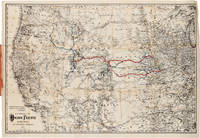
1884réf. 23845New York. 1884. Annual stockholder's report for the famous western railway. With detailed financial statement and other statistics relative to western lands etc. Total surplus earnings for 1883 topped $12700000. The handsome and quite large folding map of the United States west of the Mississippi shows the Union Pacific Route and its connections. Original printed wrappers. Wrappers a bit soiled and worn front wrapper wrinkled with small closed tears titlepage soiled. Still very good. unknown books
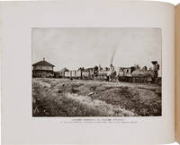
1912réf. 65871Boston: The Tudor Press n.d. but ca. 1912. Elaborate Wyoming and Colorado Railroad Promotion Printed in an unspecified number for private distribution by the company this is an elaborately printed and illustrated promotional book issued by the Laramie Hahns Peak & Pacific Railway Company. The line ran southwest from Laramie through Colorado passing through North Park Walden Hebron and Coalmont with projected extensions through Hayden Craig Meeker Grand Junction and into Utah. A prefatory note asserts that "no one connected with the work has any ambition to become a railroad king or to build up a through line with its complications and responsibilities. The builders recognize the most wonderful future in store for this particular country an are opening it up and will serve it with a local system which will assist in its acute development." The text and fine photographic views describe the agricultural and mineral potential of Wyoming northwestern Colorado and northeastern Utah with descriptions of a number of towns. Included are scenes of railroad construction mining operations logging strawberry and alfalfa fields apple and peach orchards cattle and sheep dam construction and numerous town views. The partially colored folding map is drawn on a scale of approximately fourteen miles to the inch and shows an area from just west of the Great Salt Lake to just east of Denver highlighting the route of the railroad from Laramie to Coalmont and identifying deposits of oil coal iron and gold and copper; forests; and agricultural lands. Laid into this copy are two typed letters signed from bookseller Fred Rosenstock of Denver offering this copy to his customer Walter Steenstra in 1961 and attesting to the volume's scarcity. This is only the second copy we have handled. Oblong quarto. Original purple cloth gilt title on front cover. Light wear at spine ends and corners spine lightly sunned light wear and scuffing to boards. 1½-inch closed tear in upper edge of folding map. Very clean internally. Near fine. WYNAR 6652. hardcover books
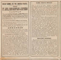
1880réf. 57333Chicago: Rand McNally & Co. ca. 1880. Folding Rand McNally Map and Promotional for Eastern Texas Missouri and Arkansas A scarce promotional for Missouri and Arkansas published by the St. Louis Iron Mountain and Southern Railway featuring a folding map by Rand McNally & Co. The map shows cities rivers railways and geographical features from eastern Texas through Louisiana Arkansas Missouri Mississippi and parts of Illinois Indiana and Alabama. The Iron Mountain Railway owned a large land grant in the central United States but it was not allowed to sell until the railway was completed; now that time had come and they were advertising it heavily. Some of the attractions promoted in the text include wild game hunting including squirrels resources such as zinc and coal good soil river and rail transportation telegraph service "cheap homes in Missouri and Arkansas" and low property taxes. They also exhort the nervous migrant: "This is the time to have decision of character or the opportunity will be lost to you and to your family forever. The strong-hearted Europeans who settled America did not know what they would reap from planting in strange soils and climates. Why should you hesitate about a country peopled an hundred years and well known Have manhood and come." The authors do not limit their reach to the United States either as they make sure to note after listing their prices that "One dollar in American is equal to about four shillings in English money." Also included is a panel of text with a table describing the climate of Little Rock and a list of instructions to railroad agents. The St. Louis Iron Mountain and Southern Railway originally established to deliver iron ore from Iron Mountain Missouri to St. Louis eventually stretched from eastern Texas through Missouri and Arkansas. In 1883 it was acquired by Jay Gould and in the 1900s merged into the Missouri Pacific and later Union Pacific Railroads. The folksong "Iron Mountain Baby" tells the true story of a Civil War veteran who walking along the railroad collecting building materials discovered a baby who had been apparently thrown from the train in a valise. When the child grew older the railway paid for his education. The Iron Mountain Baby's story became popular around the United States and has been recorded in numerous forms throughout the years including the 2014 stage musical adaptation Bright Star written by musician and comedian Steve Martin. Though the Iron Mountain Railway put out a number of such promotionals in the late 1870s and early 1880s they remain rather scarce; OCLC records this edition focusing on Arkansas and Missouri only at Harvard and the University of Arkansas at Mullins. Old folds. Minor tanning. Slight splitting along some folds and a few cross-folds. Very good. unknown books
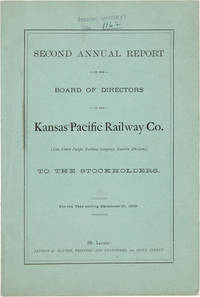
1869réf. 59062St. Louis: Levison & Blythe 1869. Early Report of the Kansas Pacific A report on the Kansas Pacific Railway Company's earnings and expenses for the year 1868. Includes discussions of Texas cattle shipped from Abilene the need for "speedy settlement" of the company's lands "by an active producing population" a projected extension through New Mexico and Arizona the planned completion of the extension to Denver and the eventual connection with the Union Pacific via the Denver Pacific between Denver and Cheyenne. Reproduces the text of three congressional acts including the joint resolution dated March 3 1869 authorizing the company's name change from "the Union Pacific Railway Company Eastern Division" to the "Kansas Pacific Railway Company." William J. Palmer was a member of the Board of Directors of the Kansas Pacific his own much more complicated and torturous efforts to run a railway line through southern Colorado into New Mexico and thence to the Pacific Ocean still in his future. This report was published in St. Louis and is scarcer than another edition of the report with a New York imprint. Original printed blue wrappers. Wrappers soiled and ink stamp and annotation to front wrapper. Very good. RAILWAY ECONOMICS p.314. LITERATURE RELATING TO THE UNION PACIFIC p.229. EBERSTADT 137:301 New York ed. unknown books
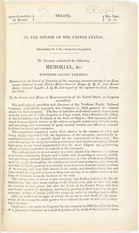
1868réf. 58056Washington: Government Printing Office 1868. With Johnson's Great Map of the Northern Pacific Route This copy is inscribed on the front wrapper: "With Regards of James Tilton C.E." Tilton 1819–78 was then chief engineer of the Washington Division of the Northern Pacific Railroad. Thanks in part to his support for Franklin Pierce's presidential campaign Tilton was appointed the first Surveyor General of Washington Territory and served from 1853-61. Both the Tilton River and Fort Tilton near Fall City Washington are named for him. An important report to Congress by the Northern Pacific Railroad headed by Minnesota railroad magnate James J. Hill for federal aid to support the Railroad's expansion to the West Coast. The petition reviews the railroad's original charter printing with it a memorial from the NPRR's Board of Directors and supporting communications from military figures including Montgomery Meigs and Ulysses S. Grant. Since the early 1850s Edwin Johnson described by Wheat as a "visionary" engineer had been associated with the plan to build a railroad across the northern part of the United States from the Great Lakes to the Pacific Coast. In 1867 he was named chief engineer of the Northern Pacific and this memorial is a work of major importance for the history of the railroad. It includes Johnson's topographical survey of the route to the Pacific a discussion of potential problems that may be encountered and a detailed economic and military survey of the area in justification of construction. The exceptional large folding "Map of the Country from Lake Superior to the Pacific Ocean from the Latest Explorations and Surveys" was produced by the Colton firm in New York. One of the finest maps of the region to date it shows the area from Detroit to the Pacific well into Canada and south to about the 39th parallel. Johnson has drawn the route of the Northern Pacific from Lake Superior to Washington Territory where the line splits with one branch heading toward Fort Vancouver and the other to Puget Sound. Among the details shown on the map are the Pony Express route wagon routes and overland mail routes exploration routes and other proposed railroad routes the locations of Indian tribes mineral deposits military forts and much more. Wheat gives a long description of the map and remarks that "the detail of such a map defies cataloging." Construction on the Northern Pacific Railroad began in 1870 and was completed in 1883. Edwin Johnson did not see its completion dying in 1872. An edition of this report with the supporting documents and map was also privately published in Hartford. A significant early account of railroad expansion in the Northwest. We could find only ten copies listed in OCLC and this is the first copy we have seen in wrappers and with a presentation from an important engineer on the project. Original printed wrappers. Presentation inscription on front wrapper see below. Wrapper edges chipped minor soiling and tanning to wrappers spine partially chipped old vertical fold to pamphlet. Light foxing and tanning and occasional soiling throughout Map with a few small closed tears at cross-folds with no loss. About very good. RAILWAY ECONOMICS pp.242-43. SABIN 55819 Hartford edition. WHEAT TRANSMISSISSIPPI V item 1169 pp.205-09. PHILLIPS MAPS p.916. DECKER 37:266 Hartford ed. MIDLAND NOTES 68:164. OCLC 60578657. unknown books
1882réf. 8157New York. 1882. Further dialogue regarding extension of the time period for the Congressional land grant to the NPRR. 8pp. Printed wrappers front cover detached top right corner chipped a good copy. unknown books
1888réf. 13837Philadelphia. 1888. The Mercantile Trust Company makes claims to security in property of the Railway including holdings in New Orleans. The property is described in detail. Also printed are the articles of the new mortgage and documents of certification of New York and Louisiana. 38pp. Original printed wrappers. Wraps darkened and chipped top margin considerably chipped with no loss of text old fold. A decent copy printed on bad paper. In a folding cloth box leather label. paperback books
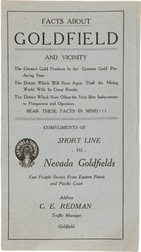
1912réf. 66966Goldfield NV: Goldfield Publicity Bureau ca. 1912. Rare Promotional Pamphlet Attempting to Revitalize Nevada's Largest Boomtown An unrecorded promotional pamphlet encouraging renewed investment in the Nevada boomtown of Goldfield. Gold was discovered at soon-to-be-dubbed Goldfield in 1902 and the town was laid out by the end of the year. The wealth extracted from the aptly named settlement was so great that population exploded to over 20000 by 1906 making Goldfield the largest city in Nevada. Gold production then fell off as quickly as it began and the population fell below 5000 by 1910 and to only a few hundred by the 1930s. The present pamphlet issued compliments OF the Las Vegas & Tonopah Railroad Company dates from the middle of that sharp decline. The Las Vegas & Tonopah Railroad LV&T was owned by Montana Senator and entrepreneur William A. Clark and first began operations at the height of Goldfield's success in 1907 aiming to connect Las Vegas to the northern mining region. The northern line which connected Beatty to Goldfield operated only until 1914. With the outbreak of World War One and with rail traffic in and out of Goldfield already plummeting that part of the railway was scrapped and the LV&T merged with the failing Bullfrog Goldfield Railroad using their tracks to continue service to the region. Clark with his keen eye for profits scuttled the project in 1918 taking advantage of the high price of metal during the war to completely liquidate the company. This pamphlet represents a last-ditch attempt to drum up traffic to Goldfield and make the railroad profitable. Printed on both sides of seven panels it contains a history of Goldfield illustrated by a five-panel panorama of the city taken from above a thoroughly labeled map of the region's mines and a railroad map with table of distances. The text is suitably effusive with praise for the nearly defunct boomtown and declares that it "Will Soon Again Thrill the Mining World With Its Great Results." The rear panel assures readers that "the oasis of Southern Nevada is about to come back into her own and will soon again be the mecca for mining men" and "will rapidly and surely make up for lost time." Clark attempted to revive the mining industry himself at the same time forming the Goldfield Deep Mines Co. with $10000000 in capital stock in late 1911. The company is mentioned by name in the pamphlet which precludes a publication date prior to the latter half of that year. A very rare piece of mining ephemera. Not in Lingenfelter nor recorded on OCLC. Light tanning minor edge wear a few very small marginal tears. Very good. unknown books
1868réf. 33573Washington. 1868. With Johnson's Great Map of the Northern Pacific Route An application to Congress by the Northern Pacific Railroad headed by Minnesota railroad magnate James J. Hill for federal aid to support the Railroad's expansion to the West Coast. The petition reviews the railroad's original charter and includes an impressive color folding map "Map of the Country from Lake Superior to the Pacific Ocean" which illustrates the railroad's route from Duluth to Seattle and Portland. This map was originally produced to accompany Edwin Johnson's report on the feasibility of the railroad. This is one of the finest maps of the region traversed to be issued up to this time and was produced by Colton in New York not by the government. Wheat devotes several pages to discussing it noting that "the detail of such a map defies cataloging." Above the map appears an elevation chart for the same distance. A fine account of railroad expansion in the Northwest. Rare. Not on OCLC. 39pp. plus large color folding map. Modern maroon cloth gilt maroon morocco label. Minor dust soiling in text. Map bright and clean. Overall very good. MIDLAND NOTES 68-164. WHEAT TRANSMISSISSIPPI 1169. hardcover books
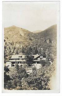
1916réf. 8508Salt Lake City 1916. Real photo postcard 9 cm x 14 cm Divided Noko back. Manuscript noted on the back dated July 12 1916. Image of Emigration Canyon's Pinecrest Inn that was built as a destination by the Emigration Canyon Railroad. The Emigration Canyon Railroad was incorporated in 1907. Within a year the 14-mile line was in operation. Its city terminus and yards were located near the western end of the present University of Utah stadium parking lot. Its route passed by Mount Olivet Cemetery Sunnyside Avenue the Wagner Brewery near the mouth of the canyon and up what is now Highway U-65 to the Killyon's Canyon turnoff with a spur to the quarries. The ECCR operated until 1907. unknown books
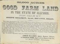
1850réf. List3869Pennsylvania: Hoffman & Morwitz 1850. Single-sided card measuring 4 ¼ x 3 ⅛ inches. Some toning and staining at edges with unrelated manuscript on the verso. Excellent. A card advertising the sale of 20000 acres of land in Illinois appealing to farmers; it boasts easily cultivated soil "of superior fertility" where "all vegetables and fruits of a temperate climate grow luxuriously." It also notes that the land is "crossed and surrounded by a network of Railroads" allowing "ready access" to the markets especially of Chicago. The land agent was Joseph Milliken of Decatur along with Francis Funk of Philadelphia. Funk is listed as "Agent of the Penns. R.R. Co."; that company was involved in operating railroad lines that ran out to Chicago in the midcentury. The PRR would not have been selling the land itself however; the major railroad land grants in Illinois at the time belonged to the Illinois Central railroad. Milliken and Funk were likely hoping to capitalize on the massive wave of immigration to the state from within and outside the US which brought 100000 new residents to the state between the mid-1850s and 1870. The card belongs to the mid-nineteenth century promotion of Illinois prairie land when railroad expansion transformed interior acreage into market-oriented farmland. Decatur was well positioned for such promotion: by the 1850s it had become an important central Illinois railroad point and the Illinois Central and other lines helped turn prairie land into a commodity for eastern buyers immigrant farmers and speculators. The Philadelphia imprint and the presence of Funk as an eastern agent show the interstate machinery behind this kind of western land sale: local Illinois acreage marketed through eastern print railroad connections and promises of quick access to Chicago. Hoffman & Morwitz unknown books
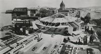
1954réf. List38123San Francisco California: United Press Photo 1954. Photograph measuring 8 ⅗ x 4 ½ inches. With typed caption date stamp manuscript and later sticker verso. Near Fine. An artist's rendering of a proposed monorail terminal in San Francisco. The caption on the verso states that "Plans for the 117-car line $96000000 monorail system have been submitted to City Hall." This was likely the proposal by the Monorail Engineering & Construction Corp. headed by George D. Roberts which submitted a lengthy report on the possibilities of monorail transit to the Mayor Elmer Robinson's office in June 1954.1 At the time what public transit in the Bay Area would look like was an open question; the California legislature created the Bay Area Rapid Transit Commission in 1951 to study the issue. Though BART's designers wanted the brand-new system to take advantage of new developments in rail technology they did not settle on monorail which remained more of a novelty and was never widely adopted in the US. 1 Monorail Engineering & Construction Corp. Report to the City and County of San Francisco on Monorail Rapid Transit June 30 1954. . United Press Photo unknown books
1926réf. 2789London: Great Western Railway 1926. 1/4 Cloth Over Boards. Fair. 4to. 74 photo halftones; 4 brightly silkscreened plates of heraldric crests; folded map of Great Western Railway routes in special pocket. Book is rather slack shaken faded soiled rubbed and bumped but overall sound and entire. Great Western Railway hardcover books
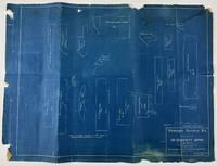
1907réf. 13196San Francisco: Chief Engineer's Office 1907. Three blueprints each about 18 x 24 inches. Old folds noticeable chipping to edges occasionally costing minor content near the margins. Good condition. A trio of blueprints detailing the Western Pacific Railroad's standard 20-x-32-foot Desert Depot structure. This standard building plan was created for the depots between San Francisco and Salt Lake City in the Nevada Desert. The blueprints include side views of the building plain views floor plans details of footings overall foundation construction details of prominent structural support and so forth. The layout of the office reveals that each would have a telegraph office at front and center a conductors room at the right of the building three bedrooms and a kitchen. A wonderful relic of the western railroad. Chief Engineer's Office unknown books
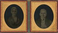
1854réf. List1708Philadelphia 1854. Ninth plate ambrotypes in a union case measuring 2 ½ x 2 ⅛ inches visible in larger case. With the identification of Isaac Rehn with his imprint and "Patented July 4 & 11 1854" imprinted on the case. A fine pair. A striking pair of ambrotypes of Mary and Moses Pennock who were members of the Kennett Square Underground Railroad network as well as active members of the Kennett Square abolitionist and Quaker community. Moses was one of the founders of the Longwood Progressive Meeting. In R.C. Smedley's History of the Underground Railroad in Chester and Neighboring Counties of Pennsylvania Lancaster Office of the Journal 1883 the Pennocks are mentioned on p. 301 as working as part of the network surrounding Isaac and Thamazine Meredity. Their son Samuel who would go on to secure important agricultural patents is also mentioned twice. The images are notable from a photographic history perspective as well as being early examples of the ambrotype process that had been patented in part by fellow Quaker and spiritualist Isaac Rehn. Rehn held a partial patent on ambrotypes along with James Ambrose Cutting of Boston and became unpopular among other photographers for his efforts to extend his patent. He later practiced spiritual photography and was a Professor of Chemistry at Pennsylvania Medical University in Philadelphia. Rehn was also involved in radical politics as a founder and leader of the Philadelphia section of the International Workingmen's Association which was later disenfranchised by Karl Marx along with several other American sections. Examples of Rehn's work are held at the National Gallery of Art the Library Company of Philadelphia and Yale's Sterling Memorial Library. Overall a very fine and significant pair of images. unknown books
1881réf. List1934BCarson 1881. Single sided receipt measuring 7 ¾ x 4 ½ inches. Near fine with a small tear to bottom of page. Near Fine. A receipt issued for passage from Carson to Badie Nevada in 1881 aboard the Virginia and Truckee Railroad issued with a note that reads "Chinamen" in the remarks section. The Virginia and Truckee was originally built to service the Comstock Lode area in Nevada. Chinese who represented ten percent of Virginia City during the period referred to Nevada as "Yin Shan" which translates to "Silver Mountain." Chinese people in Nevada held varied jobs in the state perhaps more so than in other parts of the United States with an 1870 census listing Chinese merchants miners laborers laundrymen cooks gamblers and harlots. Despite the heavy involvement of Chinese in Nevada during the period few ephemeral records surface in the trade likely due to the drops in population caused by the Chinese Exclusion Act and perhaps also due to the overall population drop when miners left the region. unknown books