Joseph-Francois Lafitau (1681-1746)Biblio.com
1 517 résultats
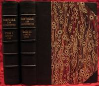
1733réf. E05532 volumes. 8xxiv616471 pages with 4 maps ad view one folding and 3 plates one folding; 2693892 pages with 1 map and 6 plates. Quarto 10 1/4" x 10 1/4" bound in half leather with raised spine bands and gilt lettering to spine over marbled boards. Borba de Moraes page I:453; European Americana 733/146; Sabin 38591 First edition. Joseph-François Lafitau was a French Jesuit missionary ethnologist and naturalist. He is best known for his use of the comparative method in the field of scientific anthropology the discovery of ginseng and his writings on the Iroquois. Lafitau was the first of the Jesuit missionaries in Canada to have a scientific point of view. Lafitau is considered the first of the modern ethnographers and a precursor of scientific ethnology for his work on the Iroquois. He developed a model of studying peoples that involved describing existing cultures on their own terms—not in comparison to European society. He distinguished generic and specific traits transforming the "generic savage" into specific tribal groups. He explained that "only from specific identities can genetic relations be inferred." Furthermore he was the first to declare "contemporary primitive cultures throw light upon the culture of ancient people and vice versa. Lafitau is remembered for applying the comparative method with a greater level of competency than any of his contemporaries. Through original field observations he was able to critique the works of earlier writers on Primitive peoples. By using the Comparative Method Lafitau rejected all theories of social and cultural change and instead used his study to demonstrate the similarities in customs practices and usages of the Native North Americans with diverse peoples from different continents and centuries. He consistently relied on the doctrine of degeneration: all men originally shared one religion with one God but over time as people migrated to separate margins of the earth where they then lost touch with the values and traditions of this one true religion and culture. Therefore Lafitau believed in the "psychic unity of mankind" and the doctrine of primitive monotheism. His major work written in French was first published in 1724 in Paris. It is entitled Customs of the American Indians Compared with the Customs of Primitive Times Moeurs des Sauvages Amériquains Comparées aux Moeurs des Premiers Temps and is 1100 pages in total. In 1974 William Fenton and Elizabeth Moore made the first translation into English available. Lafitau published two other works. One Histoire de Jean de Brienne Roy de Jérusalem et Empereur de Constantinople Paris 1727 was released before he returned to Canada; it is little known and seldom seen. A two-volume Histoire des découvertes et conquestes des Portugais dons le Nouveau Monde . . . 1733 appeared after he came home to France. Frequently found in libraries it is not just a compilation of original sources but an attempt to make available to French readers a story of exploration and adventure otherwise denied to them; in the chronicles he sees a long development of customs hitherto unnoticed such as he had reported in the Mœurs; from them understood only he says in the original languages of the people who practice them he builds his "system" or philosophy of history and once more he is concerned too with the relation between custom and natural history or ecology. Condition: Beautifully rebound in half leather. Faint dampening to second volume; early owner's signatures on title pages inked stamps of St Charles Borromeo Seminary on front paste-downs and first title page lacks frontispiece else a very good to fine set. Chez Saugrain pere, quai des Augustins, au coin de la rue Chez Saugrain pere, quai des Augustins, au coin de la rue Pavee, a la hardcover
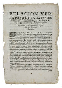
1625réf. ABC_46574Lisbon: Pedro Craesbeeck 1625. Not bound. Folio. With a small woodcut decorated initial opening the text. Rare Spanish propagandistic news publication emphasizing the success of the Spanish fleet against the English and Dutch during the Anglo-Spanish and Eighty Years' War discussing the heavy losses of the Anglo-Dutch fleet on their way to Cádiz in 1625. In 1624 negotiations for the marriage between Charles Prince of Wales son of King James I and the Spanish infanta Maria sister of Philip IV broke down and war broke out because the Spanish court could not accept a marriage as long as Charles refused to convert to Catholicism. In 1625 the English prepared a fleet to sail to Spain more specifically Cádiz an important trading port of the Spanish silver fleet. In October 1625 approximately 100 ships including 15 Dutch warships sailed for Cádiz. Soon the ships were plagued with difficulties especially storms. Many ships were left barely seaworthy and it caused major delays. On 1 November 1625 fleet entered the Bay of Cádiz but in the end the mission failed.The present publication can be seen as Spanish propaganda presented as "news" emphasizing their victories. While sailing to Cádiz the Anglo-Dutch fleet came in heavy weather near Dunkirk. The text describes in great detail how ships went down or how they were captured but also the drowning of many people on board. The present publication in Spanish was printed in Lisbon in 1625 still under the rule of the Spanish monarchs the Crown of Portugal was united with the Crowns of Castile and Aragon from 1580 to 1640. It is an outstanding example of the Spanish annus mirabilis praising the Spanish victories during the wars with England and the Dutch Republic.Edges frayed and slightly browned with a few spots the two leaves nearly separated at the fold some minor foxing and a small jagged tear in the second leaf with minor loss of text. Otherwise in good condition. A rare piece of news and propaganda on the successes of the Spanish fleet against the Dutch and English ships.l Ensayo de bibliografía marítima Española 2467; Palau 257848; Pohler Bibliotheca Historico-Militaris p. 246; USTC 5025988 9 copies; Wilkinson & Lorenzo eds. Iberian Books 55774; WorldCat 1 copy noting no place of publication or publishers name. Pedro Craesbeeck, unknown
1897réf. 21457[1897] 17,5 x 13 cm environ conservé dans une boîte moderne de carton noir
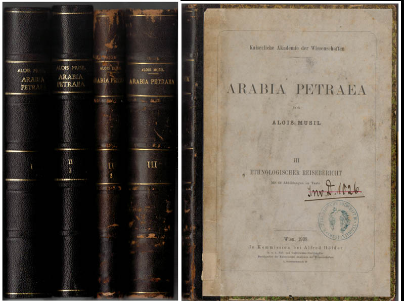
1907réf. 55717BBWien, In Kommission bei Alfred Hölder, 1907-1908. Groß-8°. 24,5 cm. XXIII, 443, XII, 343, X, 299 und XV, 550 Seiten. Schwarze und dunkelbraune Halblederbände mit goldgeprägten Rückentiteln.
1855réf. E05582 volumes. xx383 pages with hand colored frontispiece 3 maps in pockets plates many colored; vii41923 ad pages with color frontispiece and plates some colored. Small quarto 10 1/2" x 6 3/4" bound in original publisher's pictorial brown cloth with blind-stamped cover with gilt pictorial in gilt. Notes on the Natural History by John Richardson. Abbey Travel 645; Arctic Bibliography 1241; Books on Ice 5.8a; Hill 106; Sabin 4389; TPL 3409 First edition. Belcher's five-ship 1852-54 expedition in search of Franklin would be the last official British attempt. On the HMS Assistance Belcher successfully navigated through the Wellington Channel but beset by ice was unable to return to Lancaster Sound and was forced to abandon the ship. This account of the expedition also includes several essays on the natural history of the region by Richardson Owen Bell Salter and Reeve. Condition: Minor wear re-backed with parts of original back-strips laid down; minor foxing short separations at folds to the largest map; inked stamps on title pages Edinger bookplates else a good set internally very good. Lovell Reeve hardcover
1700réf. E0566xxiii43313 table pages with two folding maps of the Marsianes and Guam. Duodecimo 6 1/2 x 3 1/4" bound in contemporary full sheep with red label in gilt spine and five raised spine bands speckled red end pages. Brunet 28230 Cioranescu 41783 First edition. Charles Le Gobien was a French Jesuit writer founder of the Lettres édifiantes et curieuses a collection of reports from Jesuit missionaries in China. It is a major source of information for the history of Catholic missions and life in China in those times. Le Gobien was born at Saint-Malo Brittany. He entered the Society of Jesus on 25 November 1671. As professor of philosophy and especially while procurator of the Franco-Chinese mission he sought in a series of papers to awaken interest in the work of Christianizing Eastern Asia. In 1697 appeared at Paris his Lettres sur les progréz de la religion à la Chine. Apropos of Chinese Rites controversy he published among other things Histoire de l'édit de l'empereur de la Chine en faveur de la religion chrétienne avec un éclaircissement sur les honneurs que les Chinois rendent à Confucius et aux morts Paris 1698; and in the year 1700: Lettre à un Docteur de la Faculté de Paris sur les propositions déférées en Sorbonne par M. Prioux. Under the same date there appeared in Paris the Histoire des Isles Mariannes nouvellement converties à la religion chrétienne. The second part translated into Spanish by J. Delgado is found in the latter's Historia General de Filipinas Manila 1892. In 1702 Père Le Gobien published Lettres de quelques missionnaires de la Compagnie de Jésus écrites de la Chine et des Indes Orientales; this was the beginning of the collection soon to become celebrated under the title of Lettres édifiantes et curieuses écrites des missions étrangéres par quelques missionnaires de la Compagnie de Jésus. The first eight series were by Le Gobien the latter ones by Fathers Du Halde Patouillet Geoffroy and Maréchal. The collection was printed in thirty-six volumes duodecimo Paris 1703–76 and reissued in 1780-81 by Fathers Yves de Querbeux and Brotier in twenty-six volumes duodecimo omitting the prefaces. New editions appeared in 1819 1829–32 and 1838-43. One abridgment in four volumes octavo was entitled Panthéon Littéraire by L. Aimé Martin 1834–43. A partial English translation came out in London in 1714. The publication incited the Austrian Jesuit Stöcklein to undertake his Neuer Welt Bott about 1720 at first considered merely a translation but soon an independent and particularly valuable collection five volumes folio in forty parts substantially completing the Lettres Edifiantes. This is a history of the Christian missions in the Marianas or Ladrones Islands in the north-western Pacific the principal island of which is Guam. Reprinted in the text are several letters from early missionaries Medina Clain Sanvitores &c. The Jesuit mission was established there by Diego Luis de Sanvitores. Father Le Gobien never visited the Mariana islands but based his account chiefly on the relations and letters of missionaries sent to him from Rome Spain the Netherlands etc. Includes a letter by P. Clain about the discovery of the Caroline Islands. Condition: Rebacked with original spine laid down provenance: Jesuit College library with old stamps to front free endpaper half title and title page else about very good. Nicolas Pepie hardcover
1799réf. biblio160First French edition of Bartram's Travels which chronicled his explorations of the southern British colonies in North America from 1773–1777 2 volumes. 457 pages with frontispiece engraved portrait by Bovinet Mico Chlucco Grana King of the Seminoles and one folding plate; 436 pages without title with large folding map by J.B. Poirson engraved by Alexandre Blondeau and folding plate. Octavo 8 1/4" x 5 1/4" bound in half leather with six spine compartments with red and black labels in gilt over original marbled boards. Translated by Pierre Vincent Benoist. Sabin 3871; Palau 251346; Howes B223; Field 94 First French edition. William Bartram was an American naturalist. The son of the naturalist John Bartram. As a boy he accompanied his father on many of his travels to the Catskill Mountains the New Jersey Pine Barrens New England and Florida. In 1773 he embarked upon a four-year journey through eight southern colonies. Bartram made many drawings and took notes on the native flora and fauna and the native American Indians. In 1774 he explored the St. Johns River where he had memorable encounters with aggressive alligators and also visited a principal Seminole village at Cuscowilla where his arrival was celebrated with a great feast. He met Ahaya the Cowkeeper chief of the Alachua band of the Seminole tribe. When Bartram explained to the Cowkeeper that he was interested in studying the local plants and animals the chief was amused and began calling him Puc Puggy the flower hunter. Bartram continued his explorations of the Alachua Savannah or what is today Paynes Prairie. William Bartram wrote of his experiences exploring the Southeast in his book Travels through North & South Carolina East & West Florida the Cherokee Country the Extensive Territories of the Muscogulges or Creek Confederacy and the Country of the Chactaws Containing an Account of the Soil and Natural Productions of Those Regions Together with Observations on the Manners of the Indians published in 1791 and which is today simply known as Bartram's Travels. It was considered at the time one of the foremost books on American natural history. Many of Bartram's accounts of historical sites were the earliest records including the Georgia mound site of Ocmulgee. In addition to its contributions to scientific knowledge Travels is noted for its original descriptions of the American countryside. Bartram's writing influenced many of the Romantic writers of the day. William Wordsworth Samuel Taylor Coleridge and François René de Chateaubriand are known to have read the book and its influence can be seen in many of their works. Ephraim George Squier and Edwin Hamilton Davis in their book Ancient Monuments of the Mississippi Valley name Bartram as "the first naturalist who penetrated the dense tropical forests of Florida." Condition: Some rubbing to original boards page 143 of volume one has small burn mark affecting text half title bound upside down in back old water stain to plate of volume two. Fold-out map has repair to first fold internally pages are clean and free of toning and foxing else a very good copy. Chez Carteret et Brosson and Dogour Duran hardcover
1854réf. 191943Yokohama: c. 1854. A broadside newsletter kawaraban reporting on the return of the famous castaway Nakahama Manjiro and Perry's second visit to Japan. This example was produced in the year the Japanese isolation policy was ended and talk of foreigners especially Commodore Perry and his "black ships" was rife. Kawaraban were woodblock digests of local news events and scandals cheaply printed and distributed throughout the Edo period. On the left of this example is a short report about Nakahama Manjiro the castaway who lived in America for a decade before returning to Japan in 1851. It is accompanied by an illustration of an American sailor called "Itsuhii" carrying a gun and a compass and a sentence about how he supposedly travelled from Kanagawa to Daisha Gawara before returning to his ship. On the right is an illustration of an item sent floating towards Uraga Bay by Perry's ships with the caption "we do not know what it is". The centre of the page is taken up by an English-Japanese "dictionary" titled Amerika kotoba wakai no utsushi "American Words Translated" which purports to give the translations of common words such as "father" "fish" and "hair". However the translations are not correct: "oranhee" "kyonpo" and "romo" respectively. These words may have been misheard by the author or they may have been a satirical attempt to mock the sound of English. The historian of the English language Sogo Masaaki suggested that perhaps there is some relation to words in Malay. Single sheet 210 x 284 mm woodblock on one side only. Illustrations in text; text in Japanese. Mounted framed with Hawaiian koa wood and glazed 340 x 440 mm. Print bright two small holes on right edge light creasing and dust-soiling; small crack in frame in lower right corner: a very good copy unexamined out of frame. unknown
18738vo [26 x 17.5 cm]; xiv, 370, 16 [ads] pp, 38 hand colored plates, including 32 of birds by Keulemans, 6 of plants, 26 heliotype illus on 16 plates, frontis, colored plates of geological sections, other illus, fldg map (tear at stub) part colored, tables. later cloth with gilt title on front cover, cover lightly rubbed, signature on half title page, lightly foxed on few margins, very good sound and tight copy. A picture of this book is available upon request by email. Kaul 690: "A description of the route from Jammu to Ladakh via Banihal". Wood 383: "Report of an important scientific expedition". Zimmer 298: "The ornithological report contains descriptions of several new species". RGS Catalogue 215. The first 150 pages contains Henderson's travel narrative, with the rest of the book on natural history, mostly on birds by Hume. The narrative describes the 2,000 mile trip each way over a period of six months. The entomological report is by H. W. Bates and the botanical one by Henderson and J. D. Hooker, with a meteorological appendix. Notable especially for its fine plates, the hand colored plates of birds are very attractive.
1799réf. biblio160First French edition of Bartram's Travels which chronicled his explorations of the southern British colonies in North America from 1773–1777 2 volumes. 457 pages with frontispiece engraved portrait by Bovinet Mico Chlucco Grana King of the Seminoles and one folding plate; 436 pages without title with large folding map by J.B. Poirson engraved by Alexandre Blondeau and folding plate. Octavo 8 1/4" x 5 1/4" bound in half leather with six spine compartments with red and black labels in gilt over original marbled boards. Translated by Pierre Vincent Benoist. Sabin 3871; Palau 251346; Howes B223; Field 94 First French edition. William Bartram was an American naturalist. The son of the naturalist John Bartram. As a boy he accompanied his father on many of his travels to the Catskill Mountains the New Jersey Pine Barrens New England and Florida. In 1773 he embarked upon a four-year journey through eight southern colonies. Bartram made many drawings and took notes on the native flora and fauna and the native American Indians. In 1774 he explored the St. Johns River where he had memorable encounters with aggressive alligators and also visited a principal Seminole village at Cuscowilla where his arrival was celebrated with a great feast. He met Ahaya the Cowkeeper chief of the Alachua band of the Seminole tribe. When Bartram explained to the Cowkeeper that he was interested in studying the local plants and animals the chief was amused and began calling him Puc Puggy the flower hunter.2 Bartram continued his explorations of the Alachua Savannah or what is today Paynes Prairie. William Bartram wrote of his experiences exploring the Southeast in his book Travels through North & South Carolina East & West Florida the Cherokee Country the Extensive Territories of the Muscogulges or Creek Confederacy and the Country of the Chactaws Containing an Account of the Soil and Natural Productions of Those Regions Together with Observations on the Manners of the Indians published in 1791 and which is today simply known as Bartram's Travels. It was considered at the time one of the foremost books on American natural history. Many of Bartram's accounts of historical sites were the earliest records including the Georgia mound site of Ocmulgee. In addition to its contributions to scientific knowledge Travels is noted for its original descriptions of the American countryside. Bartram's writing influenced many of the Romantic writers of the day. William Wordsworth Samuel Taylor Coleridge and François René de Chateaubriand are known to have read the book and its influence can be seen in many of their works. Ephraim George Squier and Edwin Hamilton Davis in their book Ancient Monuments of the Mississippi Valley name Bartram as "the first naturalist who penetrated the dense tropical forests of Florida." Condition: Some rubbing to original boards page 143 of volume one has small burn mark affecting text half title bound upside down in back old water stain to plate of volume two. Fold-out map has repair to first fold internally pages are clean and free of toning and foxing else a very good copy. Chez Carteret et Brosson and Dogour Duran hardcover books
1711réf. E0013iixxixvii1911blank 223 pages with 1 of 3 large fold out maps and 15 of 19 engraved fold out plates. Octavo 8" x 5" bound three quarter leather with raised spine bands and gilt lettering to spine over marbled boards. Edited by Sir Tancred Robinson. Second edition preferred over the first edition "because it has the chart of the western and southern oceans." Hill In 1699. First published in 1694 which contained only two maps The book is important because it contains one of the earliest English accounts of Abel Janszoon Tasman's famous voyage of 1642 from Batavia during which he discovered Tasmania and New Zealand and visited Tonga and Fiji Hill 1475. Rear Admiral Sir John Narborough RN was an English naval commander of the 17th century who served with distinction during the Anglo-Dutch Wars and against the Barbary Coast pirates. He was descended from an old Norfolk family. He received his commission in 1664 and in 1666 was promoted lieutenant for gallantry in the action with the Dutch fleet off the Downs in June of that year. After the peace he was chosen to conduct a voyage of exploration in the South Seas. He set sail from Deptford on November 26 1669 and entered the Straits of Magellan in October of the following year. In 1670 he visited Port Desire in Argentina and claimed the territory for the Kingdom of Great Britain but returned home in June 1671 without accomplishing his original purpose. A narrative of the expedition was published at London in 1694 under the title An Account of several late Voyages and Discoveries to the South and North. During the Third Anglo-Dutch War Narborough was second captain of the Lord High Admiral's ship the Prince and conducted himself with such conspicuous valor at the battle of Solebay Southwold Bay in May 1672 that he won special approbation and shortly afterwards was made rear-admiral and knighted. In 1675 he was sent to suppress the Tripoline piracies and by the bold expedient of dispatching gun-boats into the harbor of Tripoli at midnight and burning the ships he induced the them to agree to a treaty. Shortly after his return he undertook a similar expedition against the Algerians. In 1680 he was appointed commissioner of the Navy an office he held till his death. He was buried at Knowlton church Kent where a monument has been erected to his memory. The island of Fernadina the youngest and westernmost island of the Galapagos Archipelago was originally named 'Narborough Island' in his honor by the 17th century buccaneer William Ambrosia Cowley. Condition: Marginal foxing soiling and damp staining through out paper fault across second C2 affecting one letter some rubbing hinges and corners else a better than good copy. Printed for D Brown hardcover books
1802réf. E01512 volumes with Atlas. 4xxiv385 pages with xxii-xxiv lists books of voyages available from the publisher; 4418 pages with appendix containing vocabularies of the languages of Yukagir Yakut Tungoose Kamchatka the Aleutian Islands and Kadiak and inex. Atlas with title list of plates 14 engraved plates & large folding engraved map. Text volumes are small octavo 7¾" x 4½" 19th century quarter calf & boards spines tooled in gilt morocco lettering pieces; atlas is quarto 11" x 7½" in period tree calf spine tooled in gilt. Translated by J Castéra. Howes S-117 First French Edition. Martin Sauer was an English civil servant who knew Russian French and German. He became acquainted with Joseph Billings in St Petersburg in the 1780s. He agreed to join Billings expedition as his secretary and interpreter. It was agreed that he would write the official account but there is some controversy about his actives when he returned to St Petersburg in 1794. It has been suggested that he left hurriedly for England with much of the important archival material from the voyage including diaries and secret reports so that he could publish a record of the expedition before Russian authorities and scholars in the Academy of Sciences could review its details. Sauer's An account of the Geographical and Astronomical Expedition to the Northern Parts of Russia was published in London in 1802. It contains an abundance of detail about eastern Siberia and the Aleutian Islands and records the expeditions visits to Kodiak Island Prince William Sound and the coast south as far as Yakutat Bay. The chart was made by Aaron Arrowsmith from Sauer's notes and Billings observations and the whole complements well the other contemporary accounts of the expedition by the cartographer Gavriil Sarychev and the naturalist Carl Heinrich Merck. Aaron Arrowsmith 1750–1823 was an English cartographer engraver and publisher and founding member of the Arrowsmith family of geographers. He moved to Soho Square London from Winston County Durham when about twenty years of age and was employed by John Cary the engraver and William Faden. He became Hydrographer to the Prince of Wales ca. 1810 and subsequently to the King in 1820. In January 1790 he made himself famous by his large chart of the world on Mercator projection. Four years later he published another large map of the world on the globular projection with a companion volume of explanation. Condition: Some rubbing and wear to coves of both atlas and text volumes some chipping to spine ends small gouge at back of atlas and stamp to front end paper else in very good condition. Chez F Buisson hardcover books
1890réf. STLB0014Wien u. Olmütz, Eduard Hölzel 1888 und 1890. 8°. IX(1), 150 S. mit 1 kl. Titelvign., 16 Illustr. im Text, auf Tafelseiten sowie auf 1 doppelblattgr. Tafel v. Hans Fischer u. Franz Zimerman, nach Skizzen des Verfassers sowie 1 mehrf. gef., farb. Karte und VIII, 224 S. mit 18 Illustr. v. Ludwig Hans Fischer u. Franz Zimerman nach Skizzen des Verfassers, sowie nach Photographien, und einer (mehrf. gefalteten) farbigen Originalkarte. Leinenbd. d. Zt. m. goldgepr. Rückentit. u. blindgepr. Deckelrahmen. Unteres Kapital u. Ecken bestoßen u. berieben, Text papierbedingt gebräunt u. z. Tl. fingerfleckig, im hint. Falz aufgeplatzt. Henze I, 200 ff. Die überaus seltene Promotionsarbeit des bedeutenden österreichischen Afrika-Forschers Oscar Baumann (1864-1899). Seine gründlichen Aufnahmen über die Besteigung des Durmitors, während einer Reise durch Montenegro im Jahr 1883, bewegten Oskar Lenz, der 1885 die österreichisch-ungarische Kongo-Expedition vorbereitete, ihn einzuladen, die Expedition als Topograph zu begleiten. B. erkrankte jedoch nahe Stanley Falls, und wurde in einem Lager zurückgelassen, wo er während seines Aufenthaltes die Swahili-Sprache erlernte. Seine Rekonvaleszenz verbrachte er auf der Insel Fernando Póo, von deren Hauptstadt aus er eine zweimonatige Rundreise antrat und mit seinen Beobachtungen wertvolle Beiträge zur Kenntnis der Insel und ihrer Bewohner, der Bube, von deren Sprache er zwei Vokabularien zusammenstellte, lieferte. - 1887 promovierte B. in Leipzig mit dem 'Versuch einer Monographie von Fernando Póo', einer Vorarbeit zu vorliegendem Werk. In dem angebundenen Werk beschreibt B. eine Reise, die ihn als Begleiter des deutschen Forschungsreisenden Hans Meyer 1888 nach Ostafrika führte, um den Kilimandscharo zu bezwingen. Die Expedition durchquerte - von der Ostküste ausgehend - die damals noch völlig unbekannte Gebirgslandschaft zwischen den Flüssen Pangani und Umba. Wegen an der Küste ausgebrochener Araber-Unruhen sahen sie sich am südlichen Pare-Gebirge zur Umkehr gezwungen. Das Ergebnis dieser Expedition war die erste topographische Aufnahme von Usambra. Seine kartografischen und ethnologischen Aufzeichnungen waren für die schnell folgende wirtschaftliche Erschließung des Landes von unschätzbarem Wert. (vgl. dazu: Ausstellungskat. ?Abenteuer Ostafrika?. S.147).
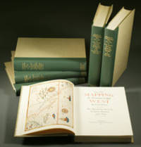
1957réf. E0551From the Spanish discovery to the opening of the Civil War 5 volumes in 6. Volume One: The Spanish Entrada to the Louisiana Purchase 1540-1804 xiv264 pages with color frontispiece map and 275 maps many folding and index; Volume Two: From Lewis and Clark to Fremont 1804-1845 xiii281 pages with colored frontispiece map 143 additional maps some folding and index. Volume Three: From the Mexican War to the Boundary Surveys 1846-1854 xiii349 pages with colored frontispiece map 322 additional maps and index; Volume Four: From the Pacific Railroad Surveys to the Onset of the Civil War 1855-1860 xiii260 pages with color frontispiece map an additional 127 maps some folding and index; Volume Five From the Civil War to the Geological Survey Part One: xviii222 pages with color frontispiece map and an additional 152 maps; Volume Five From the Civil War to the Geological Survey Part Two: 223-487 pages with 124 maps and index. Folio 14 1/2" x 10 1/2" bound in quarter green leather with gilt lettering to spines. volume I printed by the Grabhorn Press; volumes II-V printed by Taylor & Taylor and James Printing based on the designs of Edwin and Robert Grabhorn. First edition limited to 1000 copies. Carl Wheat's Mapping of the Trans-Mississippi West is a comprehensive and readable cartographic history of the American West. The first three volumes of the work are by necessity bulky and out sized to accommodate the many maps contained with their covers. These beautifully printed books present a truly graphic picture of the exploration and peopling of the vast unknown land west of the Mississippi. The author does not merely present a catalog of significant maps of each era but tells the exciting story of many facets of history that resulted in their making-of the hard journeys the hazardous exploits the motivation the mysticism the misunderstandings and the strange blend of fact imagination false geographic concept and political necessity which were consummated in the engraver's work. These volumes will provide exciting text for the casual reader and have become eminent source book for the student and scholar. Condition: A near fine set. Due to the size and/or weight of this lot extra shipping and/or handling charges may apply. Institute of Historical Cartography hardcover
1802réf. E01512 volumes with Atlas. 4xxiv385 pages with xxii-xxiv lists books of voyages available from the publisher; 4418 pages with appendix containing vocabularies of the languages of Yukagir Yakut Tungoose Kamchatka the Aleutian Islands and Kadiak and inex. Atlas with title list of plates 14 engraved plates & large folding engraved map. Text volumes are small octavo 7¾" x 4½" 19th century quarter calf & boards spines tooled in gilt morocco lettering pieces; atlas is quarto 11" x 7½" in period tree calf spine tooled in gilt. Translated by J Castéra. Howes S-117 First French Edition. Martin Sauer was an English civil servant who knew Russian French and German. He became acquainted with Joseph Billings in St Petersburg in the 1780s. He agreed to join Billings expedition as his secretary and interpreter. It was agreed that he would write the official account but there is some controversy about his actives when he returned to St Petersburg in 1794. It has been suggested that he left hurriedly for England with much of the important archival material from the voyage including diaries and secret reports so that he could publish a record of the expedition before Russian authorities and scholars in the Academy of Sciences could review its details. Sauer's An account of the Geographical and Astronomical Expedition to the Northern Parts of Russia was published in London in 1802. It contains an abundance of detail about eastern Siberia and the Aleutian Islands and records the expeditions visits to Kodiak Island Prince William Sound and the coast south as far as Yakutat Bay. The chart was made by Aaron Arrowsmith from Sauer's notes and Billings observations and the whole complements well the other contemporary accounts of the expedition by the cartographer Gavriil Sarychev and the naturalist Carl Heinrich Merck. Aaron Arrowsmith 1750–1823 was an English cartographer engraver and publisher and founding member of the Arrowsmith family of geographers. He moved to Soho Square London from Winston County Durham when about twenty years of age and was employed by John Cary the engraver and William Faden. He became Hydrographer to the Prince of Wales ca. 1810 and subsequently to the King in 1820. In January 1790 he made himself famous by his large chart of the world on Mercator projection. Four years later he published another large map of the world on the globular projection with a companion volume of explanation. Condition: Some rubbing and wear to coves of both atlas and text volumes some chipping to spine ends small gouge at back of atlas and stamp to front end paper else in very good condition. Chez F Buisson hardcover
réf. 238169Paris et Milan, 1800 - 1801 7 pièces en deux vol. in-8, demi-veau fauve, dos lisses ornés de dent-de-rat et filets dorés, pièces de titre crème, coins en vélin (reliure un peu postérieure). Des mouillures claires au premier volume.
1893réf. 2712376Adelaide: C.E. Bristow 1893. Wrappers torn at edges but well repaired as are the boards of the map section. Octavo complete with maps; original wrappers and boards preserved in a brown morocco bookform box. First edition: one of 500 copies printed of the narrative of one of the last great Australian exploring expeditions written by the leader of the expedition and complete with its maps. Lindsay led this extensive expedition - it ran to eight men forty-four camels and five Afghan camel drivers - organised by the South Australian Branch of the Royal Geographical Society and equipped by Sir Thomas Elder to explore the unknown interior between South Australia and the west coast and to look for Leichhardt. Lindsay's exhaustive report includes the surveyor L.A. Wells's journal of the expedition. Also included is an extensive Aboriginal vocabulary collected by Wells from the Pidong tribe at the head of the Murchison River the Minninng tribe at Fraser Range from the Everard Ranges at Mount Illbillee and from the "Wallawe" tribe at Yarragabie Station Western Australia. He states "Appended is a list of native names which I have collected from four tribes met with during the expedition.". The separate large folding maps are original lithographs coloured to illustrate geological changes. Compiled and drawn by both Lindsay and Wells these maps show in great detail the earlier discoveries of Giles Gosse Forrest and Hunt as well as the route taken by the Elder explorers. . C.E. Bristow unknown
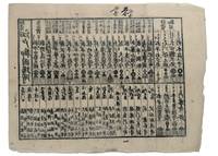
1853réf. 347481853. Three woodblock-printed sheets on mulberry paper. Mild edge wear old folds. A detailed revealing group of late Tokugawa samurai reference sheets recording the names ranks stipends heraldry standards and service obligations through which the shogunate and Edo public understood military readiness at the moment of Perry's arrival. Commodore Matthew C. Perry anchored off Uraga at the entrance to Edo Bay in July 1853. His arrival made visible the vulnerability of the Tokugawa capital and produced an immediate demand for information about coastal defence domain strength and the lords responsible for guarding the approaches to Edo. Kawaraban and related broadsides answered that demand in compressed visual form combining names crests military symbols income figures and geographical or administrative data. The first printed sheet appears to be an earlier roster of Edo office-holders or guard personnel. Its tabular format with names offices crests and standards records the recognitional system already in place within Tokugawa administration before the Perry crisis sharpened the public appetite for such information. The manuscript sheet is ruled into a large grid with headings formed from the twelve zodiac signs and the four seasons including Rat Ox Tiger Hare and the seasonal headings. The entries appear to record named houses Lords or retainers against recurring seasonal and cyclical categories probably for service attendance or ceremonial obligation. The third sheet is headed "Rekko yushinroku" here translated as "Register of Valiant Retainers of the Lords." It lists major daimyo houses and their principal retainers with domain or house headings names titles stipend figures in koku family crests standards and related insignia. Visible regional or house designations include "Kaga" "Owari" "Kii" "Satsuma" "Higo" and "Tosa." The sheet gives a graphic register of the daimyo world mobilised or imagined as mobilised around the defence of Edo Bay. Together the sheets preserve the administrative and visual language of Tokugawa defence at a moment of acute pressure. They are not formal shogunal orders and the first sheet may predate Perrys arrival but they show how late Edo Japan translated rank obligation military identity and coastal defence into portable tabular form. Their compression the names of Lords and retainers the scale of domains the crests and standards by which armed households could be recognised and the bureaucratic habits of a regime suddenly forced to account for its capacity to defend the country reveals these documents' immediacy and importance. unknown
1733réf. E05532 volumes. 8xxiv616471 pages with 4 maps ad view one folding and 3 plates one folding; 2693892 pages with 1 map and 6 plates. Quarto 10 1/4" x 10 1/4" bound in half leather with raised spine bands and gilt lettering to spine over marbled boards. Borba de Moraes page I:453; European Americana 733/146; Sabin 38591 First edition. Joseph-François Lafitau was a French Jesuit missionary ethnologist and naturalist. He is best known for his use of the comparative method in the field of scientific anthropology the discovery of ginseng and his writings on the Iroquois. Lafitau was the first of the Jesuit missionaries in Canada to have a scientific point of view. Lafitau is considered the first of the modern ethnographers and a precursor of scientific ethnology for his work on the Iroquois. He developed a model of studying peoples that involved describing existing cultures on their own terms—not in comparison to European society. He distinguished generic and specific traits transforming the "generic savage" into specific tribal groups. He explained that "only from specific identities can genetic relations be inferred."5 Furthermore he was the first to declare "contemporary primitive cultures throw light upon the culture of ancient people and vice versa. Lafitau is remembered for applying the comparative method with a greater level of competency than any of his contemporaries. Through original field observations he was able to critique the works of earlier writers on Primitive peoples. By using the Comparative Method Lafitau rejected all theories of social and cultural change and instead used his study to demonstrate the similarities in customs practices and usages of the Native North Americans with diverse peoples from different continents and centuries. He consistently relied on the doctrine of degeneration: all men originally shared one religion with one God but over time as people migrated to separate margins of the earth where they then lost touch with the values and traditions of this one true religion and culture. Therefore Lafitau believed in the "psychic unity of mankind" and the doctrine of primitive monotheism. His major work written in French was first published in 1724 in Paris. It is entitled Customs of the American Indians Compared with the Customs of Primitive Times Moeurs des Sauvages Amériquains Comparées aux Moeurs des Premiers Temps and is 1100 pages in total. In 1974 William Fenton and Elizabeth Moore made the first translation into English available. Lafitau published two other works. One Histoire de Jean de Brienne Roy de Jérusalem et Empereur de Constantinople Paris 1727 was released before he returned to Canada; it is little known and seldom seen. A two-volume Histoire des découvertes et conquestes des Portugais dons le Nouveau Monde . . . 1733 appeared after he came home to France. Frequently found in libraries it is not just a compilation of original sources but an attempt to make available to French readers a story of exploration and adventure otherwise denied to them; in the chronicles he sees a long development of customs hitherto unnoticed such as he had reported in the Mœurs; from them understood only he says in the original languages of the people who practice them he builds his "system" or philosophy of history and once more he is concerned too with the relation between custom and natural history or ecology. Condition: Beautifully rebound in half leather. Faint dampening to second volume; early owner's signatures on title pages inked stamps of St Charles Borromeo Seminary on front paste-downs and first title page lacks frontispiece else a very good to fine set. Chez Saugrain pere, quai des Augustins, au coin de la rue Chez Saugrain pere, quai des Augustins, au coin de la rue Pavee, a la hardcover books
1855réf. 46629Gotha, Julius Perthes, 1855-1874. 4to. Bound in 18 contemp. hcalf, some wear to the first 10 vols., some a bit rubbed. Some scattered brownspots to the first volumes. Gilt spines. Wear to top of spines. With a huge amount of original maps, plates, profiles etc., lithographed and engraved, large and folded and mainly in colour. This set does not include the ""Ergänzungsbände"".
1855réf. 46629Gotha Julius Perthes 1855-1874. 4to. Bound in 18 contemp. hcalf some wear to the first 10 vols. some a bit rubbed. Some scattered brownspots to the first volumes. Gilt spines. Wear to top of spines. With a huge amount of original maps plates profiles etc. lithographed and engraved large and folded and mainly in colour. This set does not include the "Ergänzungsbände". The first 19 lacking vol. 14 volumes of this importent periodical from its "Golden Period". "Petermann's Mittheilungen" became the leading geographic publication of the world and remained so until World War I. All the new geographical discoveries all the reports from the latest exploratory expeditions were published and flowed into Petermann's Geographische Anstalt and he took care to see that it was translated into cartographic form as quickly as possible. The maps soon came to have a reputation for containing the latest and the most accurate information available. Not only German but international readers as well came to see the 'Mitteilungen' as an indispensable organ for the world of geographical research. unknown
réf. H4141874. Albumin Prints ca. 145 x 129 cm 15 x 106 cm und 145 x 113 cm auf Kartontafeln montiert. Mit Beschriftung in deutscher Sprache. Eine Aufnahme ist etwas gebleicht die anderen sind in gutem Zustand und von guter Qualität. Die Photos wurden während des Aufenthalts der Korvette Gazelle 1874 in Monrovia gemacht. Sie zeigen Mitglieder der Expedition. Kommandant von Schleinitz führte die Korvette Gazelle 1874 bis 1876 auf einer Weltreise mit wissenschaftlichem Auftrag. Auf den Kerguelen-Inseln verbrachte die Expedition längere Zeit um den Venustransit zu beobachten. Mitte 1875 ging es weiter nach Neu Guinea. Viele Wissenschaftler forschten in den Bereichen Zoologie Botanik Geologie Meteorologie und Meeresforschung während Schleinitz selbst ethnologisches Material sammelte. Er benannte die Halbinsel nach seinem Schiff der Gazelle. Melanesien wurde erfirscht während auf der Rückfahrt Fiji Tonga und Samoa besucht wurden. Die Ergebnisse der Expedition wurden in einem fünfbändigen Werk publiziert. unknown
1618réf. 2417Paris, Gobert (texte) & Tauernier (cartes), 1618. Petit in-8 – 11,5 x 17 cm. Reliure de l’époque en vélin, dos lisse muet. Dans une chemise-étui moderne. 7 ff., 232 pp., 4 pl. Première édition française du récit populaire de Schouten sur son voyage avec Jacob Le Maire à la recherche d’un passage alternatif au détroit de Magellan, qui a été traduit en français, allemand, latin et anglais moins d’un an après la première édition néerlandaise. Le voyage historique de Schouten n’était que le troisième tour du monde, « au cours duquel le Cap Horn fut découvert et contourné pour la première fois » (Hill). Exemplaire orné de 4 planches dépliantes (sur les 8 usuelles) : mappemonde ornée des portraits de Magellan et Schouten, carte du Cap Horn, gravure de l’Ile Horn, carte de la côte de Nouvelle Guinée. Lors d’un voyage, un ancien propriétaire a fait tamponner le dos de l’étui (XXe) au moment de son passage au Cap Horn.
17514to [25 x 20 cm]; [ii], xxxvi, 280, xv (index) pp, 7 engraved maps, plans and plates including 6 folding, one being fldg table, engraved vignette head-pieces and tail-pieces. contemporary full leather, gilt spine title & design, raised bands, light cover wear, few tiny holes on front joint,marbled endpapers, endpaper labels of Le Chev du Blaisel & B. Mendel, few leaves with light marginal browning, else clean crisp, near fine. This is the first edition of the account of the great French Scientific Expedition to South America to measure an arc of the meridian at the equator to determine the dimension and shape of the earth. After the scientific measurements done north of the city of Quito in Ecuador, La Condamine then journeyed down the Amazon, being the first to explore that region. His measurements stood the test of time until the advent of GPS showed that the actual equator was somewhat further south, although the original monument and museums north of Quito still advertise themselves as the actual equator. The work includes a detailed plan of the city of Quito and a large map of what is now Ecuador. Hill 169: 'the greatest geographical event of the eighteenth century as regards South America. . . to measure one exact degree of meridian to determine the dimensions and shape of the earth. . . the work occupied eight years'. Sabin 38479. Norman 1250.
1790réf. E00534 of 6 volumes. Volume 1: i-ix-372 pages with 23 plates including frontispiece plate of Cook and 4 folding maps; Volume II lacking; Volume 3: 793-1184 pages with 11 plates including frontispiece of Possession Bay and 5 fold out maps; Volume IV: 1185-1546 pages with 26 plates including frontispiece of Woman Child and Man of Van Diemen's Land and 6 folding maps; Volume V: 1547-1938 pages with 30 plates including frontispiece of A View of Huaheine and 8 folding maps; Volume VI lacking. Octavo 8 1/2" x 5 1/2" bound in original full leather with red labels to spine with gilt lettering. Abridged by George William Anderson. An earlier Large folio edition by Anderson was published earlier. This edition originally issued in 80 weekly parts and also called the Large octavo edition. M K Beddie: 39 First edition of the bound edition. Captain James Cook RN was a British explorer navigator and cartographer ultimately rising to the rank of Captain in the Royal Navy. Cook made detailed maps of Newfoundland prior to making three voyages to the Pacific Ocean during which he achieved the first European contact with the eastern coastline of Australia and the Hawaiian Islands as well as the first recorded circumnavigation of New Zealand. Cook joined the British merchant navy as a teenager and joined the Royal Navy in 1755. He saw action in the Seven Years' War and subsequently surveyed and mapped much of the entrance to the Saint Lawrence River during the siege of Quebec. This helped bring Cook to the attention of the Admiralty and Royal Society. This notice came at a crucial moment both in his personal career and in the direction of British overseas exploration and led to his commission in 1766 as commander of HM Bark Endeavour for the first of three Pacific voyages. Cook charted many areas and recorded several islands and coastlines on European maps for the first time. His achievements can be attributed to a combination of seamanship superior surveying and cartographic skills courage in exploring dangerous locations to confirm the facts for example dipping into the Antarctic Circle repeatedly and exploring around the Great Barrier Reef an ability to lead men in adverse conditions and boldness both with regard to the extent of his explorations and his willingness to exceed the instructions given to him by the Admiralty. Cook was killed in Hawaii in a fight with Hawaiians during his third exploratory voyage in the Pacific in 1779. Condition: Lacks volume II and VI. First signature of volume one loose inner hinges cracked some interior soiling spine ends and corners of leather rubbed some scuffing to leather else a good set. Printed for A Millar, W Law, and R Cater hardcover books