1.519 Ergebnisse
1923Boards with light rubbing to extremities. Light chipping to top spine. Former owner's initials on front free endpapers ; 8vo 8" - 9" tall; 309, 297 pages
192023 pages. Plus many photographic illustrations and a large fold-out color map, measuring approximately 8x 19.25 inches (20 x 49cm). Original condition with blue wrappers, titles to front, and containing all the ads. This is a complete issue, seldom found in such good and original condition. This is an exceptional report Arabia expedition report which includes a fold out colour map and a profusion of plates illustrating the author's journey from the Persian Gulf to the red Sea. Philby was a British explorer, official and author, joined the British Foreign Service in 1917 and was the first European to visit the southern desert of Arabia. Philby was the first European to enter Abha, the capital of Najran, the frontier district between the Wahhabis and the Yemenites, and the second to visit Shabwa, although he was the first to explore the ruins where he discovered the great temple of Astarte. During Philby's explorations of Arabia, he came into contact with Ibn Saud, and was greatly influenced by the Wahabi ideology and culture, converting to Islam and renouncing his faith in Christianity.
193326 pages. Plus black and white photographic plates and large fold-out color map, measuring approximately 15 x 15 inches (38 x 38cm). Original condition with blue wrappers, titles to front, and containing all the ads. This is a complete issue, seldom found in such good and original condition. Accompanied by a spectacular descriptive colour map, this is Philby's first-hand expedition report on early explorations into unknown regions of Arabia, under the auspices and patronage of His Majesty `Abdul `Aziz ibn Sa`ud, King of the Hejaz and Nejd and its Dependencies. Philby continues where Bertram Thomas left off - "ninety days of wanderings across Arabia by way of the Rub'al Khali" in this riveting narrative. Key to Philby's compelling story telling is his attention to detail: we learn of the breed of camels employed for the gruelling expedition - Umaniya - best of all strains; of the characters of the eighteen strong party - their fear and reluctance to navigate the Empty Quarter and the presence of evil omen; descriptions of adherence to the fast of Ramadhan, condemning the party to thirty hungry days with nothing to eat or drink between daybreak and sunset. Philby's central objective lay in as complete an observation as possible of the Jafura desert, an extensive northward continuation of the sands of the Great South Desert reaching from the line Jaub-Jabrin to within a few miles of the Hasa oasis and skirted on the east by the esturay-like depressions known as Jiban. Features Anbak, settlement of antiquity and small oasis; Qasr ibn Dahbash, Jabrin District; Dharbun ridge; arrival at Wabar; the sand slopes of Naifa; Hadhat al Hawaya and many more locations. Includes fascinating discussion of the Murra tribes people; the search for Maqainama or Magan; the wells of Bir Fadhil; the discovery of an unexpected volcano and craters at Wabar, mythical site of an ancient civilization and much more.
190718 pages, including photographic illustrations and a large fold-out map, measuring approximately 9 x 17 inches (23 x 43cm). Contained within 2 complete issues of the Royal Geographical Society. Original condition with blue wrappers, titles to front, and containing all the ads. Two complete issues, small chip to cover of one issue, otherwise seldom found in such good and original condition. The region explored by Sykes in northern Mesopotamia was then little-known and only partially explored, making this a highly important expedition, as some of the earliest cultures in the world and indeed the cradle of civilization itself was thought to have sprung from the depths of these historic lands. Featuring primarily Kurdish custom, he reveals the contemporary Wetsern perceptions of Arabs being 'savage' and Kurds as 'ruthless'. While chronicling his journey he also describes astounding and legendary sites such as Ain el Arus, concluding with the important objective of a proposed railway route from Ras-el-ain, following the Khabur south to Shedadeh, to Tell Afar, then along the Tigris.
194717 pages. Plus photographic plates and an extra large fold-out colour map, measuring approximately 17 x 25 inches (43 x 64cm). Original condition with blue wrappers, titles to front, and containing all the ads. This is a complete issue, seldom found in such good and original condition. Wilfred Thesiger has an immense ability to describe very vividly the life and ways of the people of the desert, the Bedu, and his work shines with his clear attachment to them. After leaving Arabia he travelled extensively in the Karakoram and the Hindu Kush (the setting of his meeting with Eric Newby immortalised in Newby's A Short Walk in the Hindu Kush), the mountains of Kurdistan and the marshlands of Iraq. But he says that none of these places moved him as did the deserts of Arabia. He spent five years in the region travelling on camels and on foot across some ten thousand miles of a vast empty land. What he found, as in his time with the people of the Iraq marshes which he described in his book "The Marsh Arabs", was a way on life on the threshold of destruction. The 20th century was very fortunate in being able to have a record of some of the glory it lost as seen through the eyes and camera of this very remarkable explorer.
1949Two accounts in one issue, altogether 35 pages (27 on Thesiger's account). Plus photographic plates and a fold-out colour maps, measuring approximately 11 x 11 inches (28 x 28cm) and a fold-out sketch map, measuring approximately 13 x 7.5 inches (33 xx 19cm). Original condition with blue wrappers, titles to front, and containing all the ads. This is a complete issue, seldom found in such good and original condition. Thesiger has an immense ability to describe very vividly the life and ways of the people of the desert, and his writings shine with his clear attachment to them. Accompanied by a spectacular detailed fold-out color map, illustrating Thesiger's journey through western and northern Rub al Khali. This is Thesiger's first-hand account and pre-dates his book, "Arabian Sands", published in 1959 by Longmans. His account of the Arabian Sands and its people, its tribal warfare and ancient history, its daily life and landscape, is of such range and value, so supremely well written, that the book can confidently claim to be a classic of Arabian travel literature. Also included in this issue is an 8 page account by Philby, entitled "Two Notes from Central Arabia", accompanied by a fold-out sketch map of the Jabal Tuwaiq region of Arabia. Phibly provides an illuminating description of the pools of Aflaj and the Qariya ruin field, from his excursion in 1948 and his journey in 1918. Also included is a brief description of Phibly's map.
193134 pages. Plus photographic plates and a large fold-out colour map, measuring approximately 16 x 21 inches (40 x 53cm). Original condition with blue wrappers, titles to front, and containing all the ads. This is a complete issue, seldom found in such good and original condition. This is a fascinating expedition report on the author's explorations in Arabia, which Predate his All-Important Book - Arabia Felix; Across the Empty Quarter of Arabia, published in 1931. Accompanied by a vivid and descriptive map, this narrative is an outstanding early report into the harsh savage regions of Arabia. Thomas undertook the exploration of the magnificent Rub' Al Khali in three journeys. The first camel journey of 600 miles through the south-eastern borderlands was made in the winter of 1927-1928, the second, travelling nortwards 200 miles from the central south to the edge of the sands, were undertaken under his own initiative, a part of his plan to explore the unkown south and also as a preliminary reconnaissance for a final desert crossing. The realization of that journey is the subject of this report. In order to make the journeys, Thomas grew a beard, donned Arab clothing, and lived as one of the Badus themselves. On completion of his second journey he entered into a secret arrangement, sealed with only 20 Pounds Sterling, with a member of his party, an influential member of the Rashid tribe, to bring him in the following winter, by caravan to a point in the desert where occasionally Murra tribesmen would come from the north, and that from there he would make his way by being passed from tribe to tribe! The author's captivating story of his third and successful pioneering exploration, includes notes on the tribes, geography, and extensive appendices on the natural history collections. The writer of this book was one of the most talented of the younger political officers in Mesopotamia during and after the War, and served in a similar capacity in Trans-Jordan, before being selected to fill the responsible post of Financial Advisor and Wazir to His Highness the Sultan of Muscat and Oman. He showed courage and resource in circumstances of much difficulty and great danger during and after the war in Mesopotamia. He performed two remarkable journeys over territory hitherto completely unknown. The first was along the Southeastern Borderlands of the Rub 'al Khali from near Ras al Had to Dhufar, the second from Dhufar for a distance of some two hundred miles inland. The two journeys, taken together, constitute the most important and most extensive piece of geographical exploration undertaken in any part of the world since the War.
192924 pages. Plus photographic plates and a large fold-out colour map, measuring approximately 14 x 13 inches (36 x 33cm) Original condition with blue wrappers, titles to front, and containing all the ads. This is a complete issue, seldom found in such good and original condition. An outstanding early narrative on Arabia accompanied by a profusion of plates and a large fold out colour map. This report pre-dates Thomas' all-important books, including; ARABIA FELIX: Across The Empty Quarter of Arabia,first published in 1932 & THE ARABS, first published in 1937. The last of the great single-handed explorations of Arabia, begun more than a century earlier. And despite the relatively modern date, not an unworthy successor to Burckhardt and Richard Burton. Bertram Thomas represented the end of an epoch - the insightful traveler who made his exploration on foot, using his own resources. The author enjoys the distinction of being the only white man to have served as Prime Minister of an independent Arab state and the first white man to have crossed the great South Arabian Desert. On reporting on his famous book, The Arabs, T.E. Lawrence writes; "Thomas was Political Officer in Mesopotamia, Assistant British Representative in Transjordania, and the only white man ever to cross the great South Arabian Desert, a feat which T.E. Lawrence described as being finest thing in Arabian exploration. The author begins in the morn of history, when Arabia formed a barbarian wedge between Egypt and Sumer. He tells of the life and teachings of the Prophet Mohammed. He traces the wars of expansion, and the gradual disintegration of a great empire under the impact of Crusaders from Europe and Mongols from Asia. And not only does he give the story of their battles and victories, but of their social life, of the arts and sciences which came to flower under their stimulation, and which made the Arab civilization pre-eminent in its day. He takes us from the earliest stirrings of racial consciousness of a people down to the days of the Great War..." References T.E. Lawrence.
Best.-Nr. 123830London: Jonathan Cape 1935 1st Trade Edition. 4to 672pp. Very good no dust jacket. Frontispiece 4 folding maps all called for portraits appendices. Covers are a little battle-weary and the front inner hinge is starting to crack. Also known as Lawrence of Arabia. Also known as 352087 A / C Ross. Time Period World War 1. Locale: Arabia. World War 1 Arab Revolt History--Middle East. Jonathan Cape Hardcover
1902Outside dimensions 7.5" x 10.5". Circa 1902. Centerfold. Light wear. Please see our photo for details. Book
1961Best.-Nr. 54825Lausanne La Guilde du Livre 1961 In-4, bradel papier glac illustr (cartonnage de l'diteur).Voici le premier album qui ait t consacr l'Arabie Soudite. Sans doute a-t-on dj reproduit tel ou tel aspect particulier de ce pays. Mais jamais encore on a publi un ouvrage qui le dpeigne dans son entier (extrait du texte de prsentation). Edition originale de cet album runissant 109 photographies (7 en couleurs et 102 en noir et blanc) rapportes par Hatami, Aramco, Maurice Jarnoux, Bernard Rouget, Ren Vital, Frdrique Duran... Elles ont t regroupes selon cinq parties: Ce pays faonn par la lumire et le vent - Au c?ur blanc de l'Islam la pierre noire de Dieu - L'Energie des mnaires dormant au fond des sables - Un dfi lanc au dsert: Riyad - La Royaut dans son dcor. Tirage non prcis. Etat neuf.
1912Best.-Nr. 198021912. Paris Librairie Plon 1912 e.o. Broché 12 cm x 19 cm 289 pages+ catalogue de l'éditeur 1 carte du Hedjaz dépliante hors-texte. Texte de Albert Le Boulicaut. Non coupé papier jaunissant sinon très bon état
1787Raffigurazione dell'Arabia, del Mar Rosso e del Golfo Persico.Rigobert Bonne (1727-1795) fu uno dei più importanti cartografi del tardo XVIII secolo. Nel 1773 succedette a Jacques Bellin come cartografo reale in Francia.
Best.-Nr. ORD-3118Avec une carte de l'Arabie et note sur cette carte par M. Jomard. Paris. Firmin Didot. 1847. In-8 (128 x 205mm) dos lisse, toile chagrinée bleu nuit, 2ff.n.ch. 522 pages, 1f.n.ch. Bien complet des 44 planches hors texte, carte rempliée en photocopie. Des rousseurs mais bon exemplaire dans une reliure ancienne.
Best.-Nr. ORD-17100Paris. Firmin Didot. 1847. In-8 (140 x 213mm) dos lisse, basane noire, triples filets et titres dorés, plats mouchetés de bleu, 2ff.n.ch. 522 pages, 1f.n.ch. Bien complet des 44 planches hors texte (classement imparfait d'origine), carte rempliée. Des rousseurs mais bon exemplaire, bien relié.
1906In-8 gr., mz. pergam. con ang., tit. ms. al dorso, pp. (6),XXXVIII,449,(9), con un ritratto fotografico in b.n. all’antiporta e alc. figg. nel testo. “La création, Les forces cosmiques, Dieu et le diable, La science de la Vie, La Philosophie des Religions, Médecine, Magisme, L’art de connaitre le passé et l’avenir, etc.”. Firma e timbri d’appartenenza, ex-libris; alc. sottolineature a biro nera, pagine leggermente ingiallite per la qualità della carta, ma complessivamente esempl ben conservato.
1650Best.-Nr. 27260Paris Mathieu Guillemot 1650 Une gravure sur cuivre au burin en noir sur papier vergé, ligné, gravée d'après les originaux de l'édition de NICOLAY de 1568, Format à la cuvette : 27,3 centimètres de haut par 17,3 centimètres de large. Format total : 32,8 centimètres de haut par 21,3 centimètres de large, tirée de "L'histoire de la décadence de l'empire grec et établissement de celuy des Turcs" de Laonikos Chalcocondyle, par Thomas Artus d'Embry, d'après Nicolas de Nicolay, trés légère mouillure claire (vraiment trés légère) en haut de la gravure en marge, mais n'atteignant à aucun moment la gravure, 1650 Paris, Mathieu Guillemot Editeur,
2010Best.-Nr. 100144345Gorgias Press 2010 132 pages 15 748x1 524x23 114cm. 2010. Cartonné. 132 pages.
Best.-Nr. 75762Paris, éd. Librairie Hachette et Cie, 1893, EDITION ORIGINALE, in-4, cartonnage plein chagrin rouge avec très beau décor doré en doré et noir sur le premier plat et sur le dos lisse éditeur, 3 tranches dorées, 378 pp., papier fort, ill. de 61 gravureshors et in-texte, bandeaux et culs-de-lampe, table des matières, ENVOI de l'auteur à Georges Clairise, légères rousseurs éparses sur l'ensemble des pages, Belle histoire d'un voyage à travers l'Est du monde par un voyageur breton à la fin du 19e siècle. Très belle reliure de l'éditeur dans un très bel état (RARE !). Des dessins en noir d'après Alfred Paris. Un envoi de l'auteur. Très bon état de la reliure; papier en très bon état mais rousseures claires éparses sur l'ensemble du volume
1913Best.-Nr. G56437Wien, Alfred Hölder 1913 iv + 216pp.+ 5 folding maps, in the series "Sammlung Eduard Glaser" volume I, text printed in 2 columns, bound in green cloth, 30cm., VG
1913iv + 216pp.+ 5 folding maps, in the series "Sammlung Eduard Glaser" volume I, text printed in 2 columns, bound in green cloth, 30cm., VG
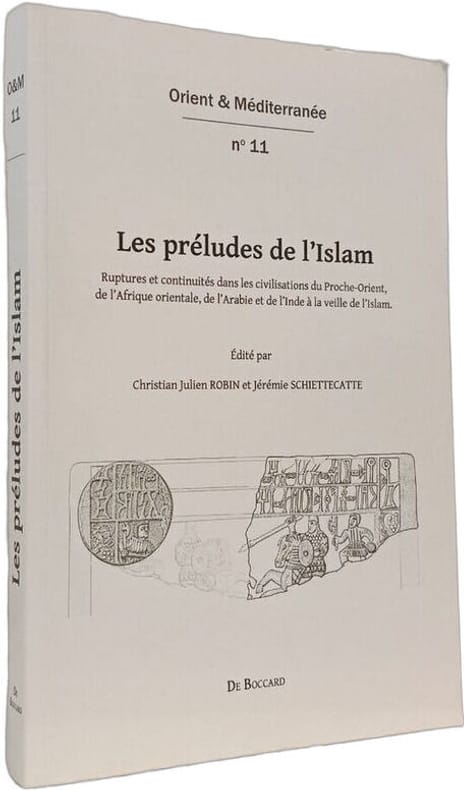
2012Best.-Nr. 100151086Editions De Boccard 2012 in8. 2012. Broché. Cet ouvrage collectif édité par Christian Julien Robin et Jérémie Schiettecatte examine les civilisations du Proche-Orient de l'Afrique orientale de l'Arabie et de l'Inde à la veille de l'Islam en analysant les ruptures et continuités qui ont précédé l'émergence de cette nouvelle civilisation. Il s'appuie sur des recherches archéologiques et historiques notamment sur l'Arabie préislamique
1771Best.-Nr. 89801771 carte ancienne colorée d'époque en vert , rouge et jaune, cartouche non coloré, gravée par Arrivet. Format total : 50 centimètres de haut par 39 centimètres de large, 1771 Paris Lattré Editeur,
2026Best.-Nr. x-1032864559Taylor & Francis Ltd 2026. Paperback. New. 400 pages. 7.00x0.84x10.00 inches. Taylor & Francis Ltd paperback
Best.-Nr. SONG0814782701Used: Good unknown