Guzzo, SiriaBiblio.com

1 628 résultats
2014réf. 1-1443866741Cambridge Scholars Pub 2014. Hardcover. New. 145 pages. 8.10x5.80x0.80 inches. Cambridge Scholars Pub hardcover
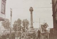
réf. PF40Oblong Quarto album ca. 19x262 cm. 12 card stock leaves. With 84 mounted original gelatin silver photographs ca. 57x8 cm 2 ¼ x 3 in. No captions. Period brown cardboard album fastened with a string. Binding worn at the edges tear of the spine photos age-toned one photo with minor stains but otherwise a very good album with strong interesting photos. Historically interesting collection of original gelatin silver photographs likely taken by French soldiers stationed in Lebanon and Syria during the French mandate in the 1920s. At the time both nations were under a French administration established shortly after the collapse of the Ottoman Empire in 1922. The mandate period saw major political upheavals including local uprisings the drawing of new borders and the emergence of Beirut and Damascus as cultural and administrative centers under French influence. The album features eighty-four rare amateur photographs of the western Arab World with most images showing early twentieth-century Lebanon. About twenty photos of Baalbek portray local landmarks Temple of Jupiter Hajar al-Hibla Roman Ruins Roman Temple of Bacchus etc. ethnographic views with a clearly visible Lebanese flag waving atop a local dwelling and lively shots of the compiler and his military comrades posing at ancient sites. Especially interesting is a candid urban scene showing locals in European costume and traditional attire standing on the platform or walking along the tracks at Baalbek Railway Station with French police maintaining order. The Lebanon series concludes with a photograph of the iconic Pine Residence in Beirut and well-executed views of the city’s waterfront. Identified photos from Syria mostly show the Grand Café Moderne the entrance to the at-Taynabiyya mausoleum mosque the Umayyad Mosque Bab Tauma and a busy Al Marjeh Square with clearly visible telegraph column trams and horse carts in Damascus. One lively vernacular photograph taken at the historic Midhat Pasha Souh shows dozens of locals busily navigating a dense corridor of marketplace stalls. The other images primarily depict sweeping aerial views of the city residential architecture street reconstruction works and diverse urban scenes. Overall historically interesting collection of original gelatin silver photographs likely taken by French soldiers stationed in Lebanon and Syria during the French mandate in the 1920s. unknown
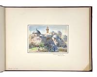
réf. MA83Thirty original watercolours on paper from ca. 85x175 cm 3 ¼ x 7 in to ca. 85x125 cm 3 ¼ x 4 ¾ in mounted within ink-drawn frames on the original white greyish and greenish album leaves ca. 21x275 cm 8 ¼ x 11 in. All but one captioned and dated in period ink on the mounts. Period style brown half morocco album with gilt tooled spine and pebbled cloth boards Several leaves with minor stains on the lower right blank corners of the mounts not affecting the watercolours otherwise a very good album of bright attractive watercolours. Attractive album of bright watercolour views drawn by a British traveller to the Holy Land in the spring of 1893. Dated between March 4th – April 27th 1893 the watercolours include two views of Jaffa city waterfront and the house of Simon the Tanner where St. Peter stayed during his missionary voyages a street in Lydda Lod a distant view of the Mizpah of Benjamin often identified with the modern-day Tell en-Nasbeh 8 miles north of Jerusalem Jerusalem Gate in Ramleh Ramla four views of Jerusalem Jaffa Gate Tomb of David Garden of Gethsemane and hospital of the Knights of S. John two views of Bethlehem Church of the Nativity Rachel’s Tomb Mountain of the Temptation near Jericho usually identified with Mount Quarantania near Jericho West Bank Jordan River Dead Sea St. George Greek Orthodox Monastery near Wadi Qelt mosque at Mizpeh the site of the Biblical Bethel Mount Gerizim near Nablus West Bank ruins of ancient Samaria and Jezreel views of Mary’s Well in Nazareth the bay of Acre a well in the Cana of Galilee two views of the Sea of Galilee and two views of Mount Hermon on Lebanese-Syrian border. Two last watercolours drawn in May 1893 depict a Syrian village of Surghaya in the Anti-Lebanon Mountains and a Greek Acropolis in Smyrna Izmir Turkey. Overall a beautiful collection giving a picturesque overview of some of the iconic sites of the Holy Land through the eyes of a 19th-century English traveller. Captions: Jaffa. The Holy Land. March 4th 1893; House of Simon the Tanner. Jaffa. March 4th 1893; Lydda. March 7th 1893; Mizpeh of Benjamin. March 8th 1893; Jerusalem Gate. Ramleh. March 8th 1893; Jaffa Gate. Jerusalem March 15th 1893; Church of the Nativity. Bethlehem. March 16th 1893; Rachel’s Tomb. Bethlehem. March 16th 1893; Tomb of David. Jerusalem. March 17th 1893; Mountain of the Temptation near Jericho. March 20th 1893; Fords of the Jordan. March 21st 1893; The Dead Sea. March 21st 1893; Greek Monastery. Brook Cherith. March 22nd 1893; Garden of Gethsemane. Jerusalem. April 4th 1893; Mosque at Mizpeh. April 7th 1893; Hospital of the Knights of S. John Jerusalem. April 11th 1893; Bethel. April 12th 1893; Mount Gerizim. April 14th 1893; Samaria. April 16th 1893; Jezreel. April 18th 1893; The Virgin’s Well. Nazareth. April 19th 1893; Bay of Acre. April 20th 1893; Well at Cana of Galilee. April 22nd 1893; Sea of Galilee. April 23rd 1893 2 different views with the same title; Mount Hermon. April 24th 1893; Mount Hermon. From road to Damascus. April 27th 1893; Village of Surghaya. Anti-Lebanon. May 2nd 1893; The Acropolis. Smyrna. May 10th 1893; Untitled view. hardcover
1910réf. PALESTIN024601Macmillan London. 1910. Fifth edition revised throughout. Issued in the Macmillan Guides series. Small octavo. pp xxxii 164 8 adverts. 13 colour maps six of them folding 6 plans. Fine in the scarce dustwrapper which is very good darkened at the spine nicked and chipped. Macmillan, London. unknown
1597réf. 14746Leiden 1597. 8vo. Franciscus Raphelengius Late 18th-century gold-tooled red morocco with the title lettered in gold on the spine gold-tooled board edges and turn-ins gilt edges purple front endpapers red silk reading ribbon. With Raphelengius' Plantin's printer's device on the title-page decorated woodcut initials and the text is partially set in Greek script. 2 parts in 1 volume. 1 1 blank 86 376 32; 8 344 164 3 1 blank pp. A beautiful edition printed in Leiden nominally published by Franciscus Raphelengius the elder but in fact printed by his son Franciscus the younger and published by Christophe Raphelengius 1566-1600 grandsons of Christoffel Plantin featuring parallel Latin and Greek texts with commentary and translation by Konrad Rittershausen a German publisher jurist and philologist. This work contains the Greek poems of Oppian of Anazarbus on fishing and those devoted to hunting by Oppian of Syria. The two poets were long confused.With the ex libris book plate of Reinhold Dezeimer on the front pastedown and a manuscript inscription in brown ink on the verso of the second free flyleaf "Chardon de la Rochette". The binding shows very slight signs of wear foxed and browned throughout. Otherwise in good condition.l Adams O-207; Brunet IV 195; Leiden imprints p. 78; Machiels O-69; STCN 840293046 12 copies incl. 1 incomplete; Thiébaud 696-7; Typ. Bat. 3873; USTC 423710. ABE CAT Falconry & Hunting BOOK HISTORY & PRINTING EARLY PRINTING & MANUSCRIPTS HISTORY HORSES HUNTING SPORTS & GAMES LITERATURE & LINGUISTICS Classical Antiquity Early Printing - 16th century Falconry Fishing & Hunting Greek & Non-Western Types Greek & Roman Classics unknown
2011réf. DADAX3846578452Eae Editorial Academia Espanola 2011-12-16. paperback. New. 5.91x0.16x8.66. Buy with confidence. Excellent Customer Service & Return policy. Eae Editorial Academia Espanola paperback
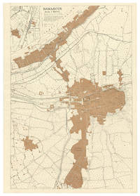
1918réf. M2BH82CWPN7GDamascus: Field Survey Company. R.E. E.E.F. 1918. Map of Damascus 73.5 x 51 cm printed in black and tan on a scale of 1:10000. Extremely rare British map of Damascus with a more detailed inset map of the area around Kadem Station to the west of the city centre the northern terminus of the Hejaz railway between Damascus and Medina especially rare in its present first state published by the British forces only a week after the fall of Damascus. Drafted by the Royal Engineers from a captured enemy map dated June 1918 with additional detail of Kadem Station from aeroplane photographs taken by the R.A.F. and printed under the surveyors supervision in the field probably in Damascus on a portable press carried by the Field Survey Company.The ancient city of Damascus one of the final prizes taken by the British and allied forces in World War I was long a great cultural centre the head of the Syrian Hajj Road and more recently the northern terminus of the Hejaz Railway and the headquarters of the Ottoman-German forces in the Middle East. In the last months of the war British forces met stiff resistance in Palestine and it was only weeks before the end of the conflict that they managed to break into Syria. British forces and their allies captured the Damascus on 1 October 1918. Lawrence of Arabia who was part of the conquering force was disappointed not to have been amongst the first allied troops to enter the city especially as he envisaged Damascus as the future capital of an independent and unified Arab state and Prince Feisals army supported the British and allied forces with that understanding unaware that the British and French in 1916 had made a secret agreement to divide the Ottoman territories outside the Arabian peninsula among themselves. Although Feisals troops did raise their flag in Damascus on 1 October and declare an independent Syrian state it was in fact to be ruled as a French protectorate until 1945.All maps printed by British and allied forces in the field in the Middle East during WWI are extreme rarities. The present map would have been issued in only a very small print run for the use of senior British officers and printed on fragile paper in a large format its survival rate would have been very low. We can trace only a single other example of the map in its present first state held by the British Library. The British forces printed the map in a second state with some revisions for the Survey of Egypt in 1919 but it is also extremely rare in that second state.In very good condition clean and bright with just some minor creasing from having been rolled for many years.l British Library Cartographic Items: Maps 48855.11; WorldCat 557017180 same copy; cf. 557017192: 1 copy of 1919 revision. Field Survey Co[mpan]y. R.E., E.E.F., unknown
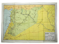
1965réf. ABC_47061Syria: Ba'ath Arab Socialist Party 1965. Original publisher's printed wrappers stapled. 24 x 17 cm. With 28 photos on 16 plates and some tables in the text. With: MAP - SYRIAN ARAB REPUBLIC MINISTRY OF ECONOMY DIRECTORATE OF TOURISM. Syria.Damascus Tourist Office ca. 1965. Folded. 70 x 49.5 cm.A brightly coloured folding map of Syria with some information about the country and its principal cities with a table of distances on the back all text in the map and on the back is in English and Arabic. Propaganda from the Arab Socialist Ba'ath Party in Syria presenting the successes of the new socialist government two years after the 8 March Revolution or 1963 Syrian coup d'état. The propagandistic nature of the text already takes shape in the introduction. For example in the part of the text informing the reader of the contents of the present work: "The following chapters ignore plots and intrigues and limit themselves to the task of giving an accout ! =account of the Revolution's achievements in the fields of socialism democracy industrialisation agriculture and agrarian reform trade unionism and other organisation of the people's activity social cultural and health welfare and related fields of public service".The Arab Socialist Ba'ath Party was founded in 1947. This political party follows the Arab nationalist ideology called Ba'atism which promotes the creation and development of a unified Arab state the enlightenment of the Arab people and a general renaissance of their culture values and society.The wrappers are slightly stained mainly to the back wrapper and the spine shows slight signs of wear and has been restored at the foot. The title page has some small tears around the staples otherwise internally fine and clean. The edges of the map are very slightly frayed otherwise in very good condition. Overall the work and additional map are in good condition.l WorldCat 7653999 11 copies. Ba'ath Arab Socialist Party], unknown
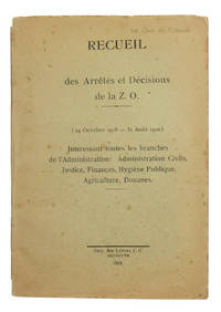
1918réf. ABC_45213Beirut 1918. 8vo. Impimerie des Lettres J. G. Original printed wrappers. 188 pp. 2 final blank leaves. First edition of ac ollection of laws and regulations for Lebanon Zone Ouest passed by the French under their mandate for Syria and the Lebanon from October 1918 until the end of August 1920 two days prior to the declaration of independence of Greater Lebanon. A compact primary source on French administration in the Middle East this rare manual contains decrees for administrative issues such as the division of Lebanon into three zones sanitary measures against the plague but also detailed regulations concerning everything from travel permits and the organisation and surveillance of prisons to the application of the metric system the trade in carrier pigeons the prices for ice 2 piastres for 400 grams wholesale 3 piastres retail alcoholic drinks 16 piastres for a litre of table wine and tramway fares and the circulation of vehicles. A few marginal flaws to the wrappers occasional minor edge flaws. A good clean copy with provenance stamp "Le Chef de Cabinet" on the upper cover. ABE CAT Agriculture ASIA ECONOMY TRADE & NUMISMATICS EUROPE LAW PHILOSOPHY & POLITICS MIDDLE EAST & ISLAMIC WORLD NATURAL HISTORY / Botany Agriculture Economic History & Trade France Law & Politics West Asia Wine / Viticulture unknown
1900réf. 144451900. Keystone View Company. Six stereoviews of Middle Eastern cities settlements workers and local inhabitants circa 1900-1910 document landscapes and daily life across the late Ottoman domains during the formative years of mass-market educational photography. The photographs encompass river agriculture in Mesopotamia urban panoramas of Beirut and Damascus an Arab sheikh accompanied by an armed bodyguard and skilled labor in Tarsus. Together they provide visual evidence for the study of Ottoman urban geography rural settlement transportation dress animal labor and American representations of the Middle East before the territorial divisions imposed after the First World War. Keystone founded in Meadville Pennsylvania in 1892 distributed stereographs for domestic and classroom use and established an Educational Department in 1905 placing geographically distant communities within an interpretive framework designed for American viewers. Six original photographic stereoviews published by the Keystone View Company circa 1900-1910 each with an extended printed caption on the verso. 1 "Land of Euphrates" shows two boys looking from flat rooftops toward the riverine Mesopotamian landscape contrasting cultivated ground near the Euphrates with the arid plain beyond; its caption identifies the region through the biblical tradition of the Garden of Eden. 2 An Arab sheikh stands with his horse and an accompanying bodyguard carrying a rifle preserving details of dress equestrian culture and armed personal attendance. 3 A panoramic view of Beirut records a dense concentration of buildings and several vessels offshore documenting the Mediterranean port's built environment and maritime setting. 4 An Arab village beside the Euphrates shows settlement within the Mesopotamian river valley. 5 A Damascus cityscape places a minaret above clustered rooftops emphasizing the vertical relationship between religious architecture and surrounding domestic buildings. 6 A blacksmith shoes a buffalo within the streets of Tarsus recording animal-powered transportation and an urban metalworking trade. Although the printed caption reportedly associates Tarsus with Syria the city was in Ottoman Cilicia and is now in southern Turkey. Produced before the postwar mandates divided much of the former Ottoman Middle East between British and French administration the views should not be described as records of modern European colonization; rather they document places still governed within the Ottoman imperial framework while revealing the biblical ethnographic and educational language through which Keystone presented the region abroad. The caption texts are themselves significant secondary evidence particularly where "Land of Euphrates" interprets Mesopotamian geography through Christian scripture and where broad ethnic labels mediate the identification of pictured subjects. The stereoviews show only minor evidence of age and handling and remain in very good condition. This coherent group combines detailed visual records of six locations and activities with the publisher's original explanatory texts enabling comparative study of both Ottoman-era environments and their circulation within American visual education. unknown
réf. 166450060X.GaudioCD. Good. Access codes and supplements are not guaranteed with used items. May be an ex-library book. unknown
1883réf. 320989London: Richard Bentley 1883. First edition. x 2 436 6 adspp. 8vo. Bound in three quarters modern brown morocco and marbled boards. Fine. First edition. x 2 436 6 adspp. 8vo. Richard Bentley unknown
1872réf. 308355London: Tinsley Brothers 1872. First edition. Lithographic frontispiece to each vol. folding map 25 other lithographic plates 11 of which are folding. 2 vols. 8vo. Contemporary half brown morocco and cloth sides t.e.g. Front joint of vol. I tender headcap and joints of vol. II rubbed; short tape repair to verso of one fold of map still a very good set. First edition. Lithographic frontispiece to each vol. folding map 25 other lithographic plates 11 of which are folding. 2 vols. 8vo. Account of the lands and tribes of Syria written by Burton and Drake while Burton was British consul in Damascus. Drake had walked from the Sinai through desert Palestine with Edward Palmer on the first surveying expedition of the Palestine Exploration Fund. Burton was dismissed from his post because of opposition to him from the Ottoman governor of Syria and high level intrigue in the British consular service. Penzer pp. 85-88; Blackmer 247; Casada 68 Tinsley Brothers unknown
1948réf. 053602Beirut : Tiba'ât Alî al-Vefeyyât fî Al-Matbaat al-Katolikiyya i.e. The Catholicos Printing House 1948. Soft cover. Very Good. Original chromo-lithograph map in brown tones. On a special paper with an ongoing blindstamped "Regestre Robur" during the borders. Folded. 70x100 cm. In Arabic. Scale: 1 /1.000.000. Chipped on margins split on folded traces. Slight discoloration and one stain on lower margin. Otherwise a good copy. An attractive and detailed map of Syria shows the capital as Aleppo n that map other cities like Damascus Raqqa Homs Latakia Ayn al-Arab Idlib Hama Deir Ez-Zor Jarabulus et alli. And it shows Turkey on the north as Turkey containing Hatay and Alexandrette The Mediterranean shores of the land as well as Lebanon and Palestine and Jerusalem on the west Sharq al-Urdun Jordan and Iraq on the south and east. It's very detailed on showing the roads spread throughout the land like railways and ancient roads from the Roman period. Additionally this roads can be followed to the other Arabic countries and regions on the map. This map was calligraphed by Kamel Al-Baba 1905-1991 who was a Lebanese contemporary / modern calligrapher. He is the son of famous calligrapher Mokhtar Al-Baba. Cannot be found in WorldCat.; Not in Library of Congress Map Collection. Very scarce. Tiba'ât Alî al-Vefeyyât fî Al-Matbaat al-Katolikiyya [i.e. The Catholicos Printing House] paperback
réf. BN374908Brill Fink. Byzanz und die Kreuzfahrerstaaten: Studien zur Politik des byzantinischen Reiches gegenüber den Staaten der Kreuzfahrer in Syrien und Palästina bis zum vierten Kreuzzug 1096-1204 Lilie Ralph J Byzanz und die Kreuzfahrerstaaten: Studien zur Politik des byzantinischen Reiches gegenüber den Staaten der Kreuzfahrer in Syrien und Palästina bis zum vierten Kreuzzug 1096-1204 Lilie Ralph J Byzanz und die Kreuzfahrerstaaten: Studien zur Politik des byzantinischen Reiches gegenüber den Staaten der Kreuzfahrer in Syrien und Palästina bis zum vierten Kreuzzug 1096-1204 Lilie Ralph J Brill | Fink unknown
réf. 49869423like new. unknown
réf. 45016512-nnew. unknown
réf. 0061720194.Gpaperback. Good. Access codes and supplements are not guaranteed with used items. May be an ex-library book. paperback
1988réf. G0872431738I4N00Templegate Publishers 1988. Paperback. Very Good. May have limited writing in cover pages. Pages are unmarked. ~ ThriftBooks: Read More Spend Less.Dust jacket quality is not guaranteed. Templegate Publishers paperback
réf. 63835886University of Wisconsin Press . Hardback. New. pp. 252 1st edition University of Wisconsin Press hardcover
1919réf. 5488Barlatier. Good. Softcover. Wraps are browned. Former owner's name on titlepage. Chipping to wraps. Tear along top of spine 3".; Congrès Français De La Syrie 3 4 et 5 Janvier 1919.; Chambre De Commerce De Marseille; 252 pages . 1919. Barlatier paperback
réf. B9781020023712Hardback. New. hardcover
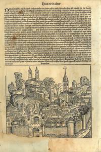
1493réf. 78413Nürnberg 1493. Originalt tresnitt. Folio. Arkets størrelse : 276 X 406 cm.Folio. Original woodcut.Size of sheet : 276 X 406 cm. Tysk. Utbedret skade ved nedre marg med noe tap av motivet.Damage at lower margin repaired with some loss of motive.Fra Hartmann Schedel : Liber Chronicarum. Utgitt av Anton Koberger i Nürnberg i 1493.“It is one of the best-documented early printed books—an incunabulum —and one of the first to successfully integrate illustrations and text.” Wikipedia.The publisher and printer was Anton Koberger the godfather of Albrecht Dürer who in the year of Dürer's birth in 1471 ceased goldsmithing to become a printer and publisher. He quickly became the most successful publisher in Germany eventually owning 24 printing presses and having many offices in Germany and abroad from Lyon to Budapest. Wikipedia.The large workshop of Michael Wolgemut then Nuremberg's leading artist in various media provided the unprecedented 1809 woodcut illustrations. Wikipedia.Utbedret rift ved nedre marg.Tear repaired at lower margin. unknown
réf. 1481217682.Gpaperback. Good. Access codes and supplements are not guaranteed with used items. May be an ex-library book. paperback
réf. 0061979341.Gpaperback. Good. Access codes and supplements are not guaranteed with used items. May be an ex-library book. paperback