LEVASSEUR (Victor).Livre Rare Book
5 790 résultats
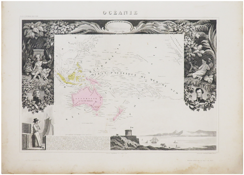
1861réf. LBW-6953Paris, [1861]. 315 x 422 mm.
1841Carta geografica tratta dall’ Atlante geografico. Corredato di notizie relative alla geografia fisica politica, ed in generale alla statistica delle varie regioni del Globo. Compilato ed eseguito in litografia per cura e sotto la direzione di Benedetto Marzolla edito a Napoli nel 1858. Marzolla, autore di importanti atlanti sulle provincie del Regno di Napoli, è anche autore di diverse carte sulle Circoscrizioni Ecclesiastiche nel Regno delle Due Sicilie, pubblicate postume, nello stesso anno della morte (1858) a Napoli nello Stabilimento Geografico diretto da Luigi Manzella. Benedetto Marzolla fu disegnatore topografo e litografo; geografo e cartografo; membro della Commissione di statistica presso il Ministero dell'Interno. Personaggio di grandissimo rilievo nella cartografia napoletana ed italiana del XIX secolo, Marzolla ottenne in vita pubblici riconoscimenti ed attestati per la produzione cartografica di altissima qualità. La sua notorietà si è lentamente dissolta dopo la morte; va tuttavia osservato che solo la mancanza di uno spiccato coinvolgimento politico in senso risorgimentale e di una valenza letteraria nella sua opera non lo hanno reso famoso come i contemporanei Francesco Costantino Marmocchi (1805-1858) e Attilio Zuccagni-Orlandini (1783-1872), con i quali può certamente confrontarsi. I progetti culturali didattici e editoriali di Marzolla furono e rimangono di straordinaria modernità; egli inventò, è il caso di dire, un nuovo modo di intendere e di disegnare la carta geografica, fornendo una visione assolutamente originale della comunicazione dei dati geografici attraverso la combinazione di testo e immagine. Con tale operazione, egli riuscì a fondere in un'unica opera, storia, geografia, economia, statistica e cartografia, raggiungendo un equilibrio grafico di rara efficacia (cfr. V. Valerio, Benedetto Marzolla Brindisino, Geografo e Cartografo dell'800 Europeo, Brindisi 2008). Bell’esemplare con coloritura coeva dei contorni, in ottimo stato di conservazione. Bibliografia V. Valerio, Benedetto Marzolla Brindisino, Geografo e Cartografo dell’800 Europeo (2008), n. 60. Map taken from the Atlante geografico. Corredato di notizie relative alla geografia fisica politica, ed in generale alla statistica delle varie regioni del Globo. Compilato ed eseguito in litografia per cura e sotto la direzione di Benedetto Marzolla published in Naples in 1858. Marzolla, author of important atlases on the provinces of the Kingdom of Naples, is also the author of several maps on the Ecclesiastical Circumscriptions in the Kingdom of the Two Sicilies, published posthumously in the same year of his death (1858) in Naples in the Stabilimento Geografico directed by Luigi Manzella. Benedetto Marzolla was draftsman topographer and lithographer, geographer and cartographer. Character of great importance in the Neapolitan and Italian cartography of the nineteenth century, Marzolla obtained during his life public recognition and certificates for the production of high quality cartography. His notoriety slowly faded after his death; it should be noted, however, that only the lack of a strong political involvement in the sense of the Risorgimento and of a literary value in his work did not make him as famous as his contemporaries Francesco Costantino Marmocchi (1805-1858) and Attilio Zuccagni-Orlandini (1783-1872), with whom he can certainly compare himself. Marzolla's cultural, didactic and editorial projects were, and remain, extraordinarily modern; he invented a new way of understanding and drawing maps, providing an absolutely original vision of the communication of geographical data through the combination of text and image. With this operation, he was able to merge in a single work, history, geography, economics, statistics and cartography, achieving a graphic balance of rare effectiveness. Benedetto Marzolla is famous for being among the most important cartographers of the XIX century, for being the one to print geographic maps using high quality lithographies. His Atlante Geografico, made of 58 maps, presents finely sketched works. Six maps depict North America, among them famous map of gold diggers in California, deriving from Hippolite Ferry. Extremely relevant are also the maps of Antarctic, South Africa with the plan of Cape Town and those about Australia. Though the maps are dated between 1843 and 1856, this 1858 edition, printed in Naples at the Stabilimento Geografico Strada San Carlo (founded by Marzolla himself), represents the final version of his atlas, the last one before his death. A posthumous edition will be published in 1865. The atlas is pretty rare, is not actually listed in Phillips, British Library e OCLC. Beautiful specimen with contemporary coloring of the contours, in excellent condition. Bibliografia V. Valerio, Benedetto Marzolla Brindisino, Geografo e Cartografo dell’800 Europeo (2008), n. 60.
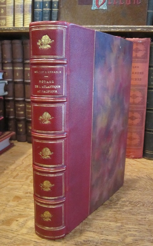
1866réf. 003178Hachette et Cie (Imprimerie Générale de Ch. Lahure), 1866
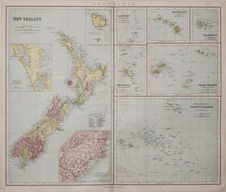
1865réf. LBW-3197London & Liverpool, Philip & Son, [circa 1865]. 520 x 610 mm.
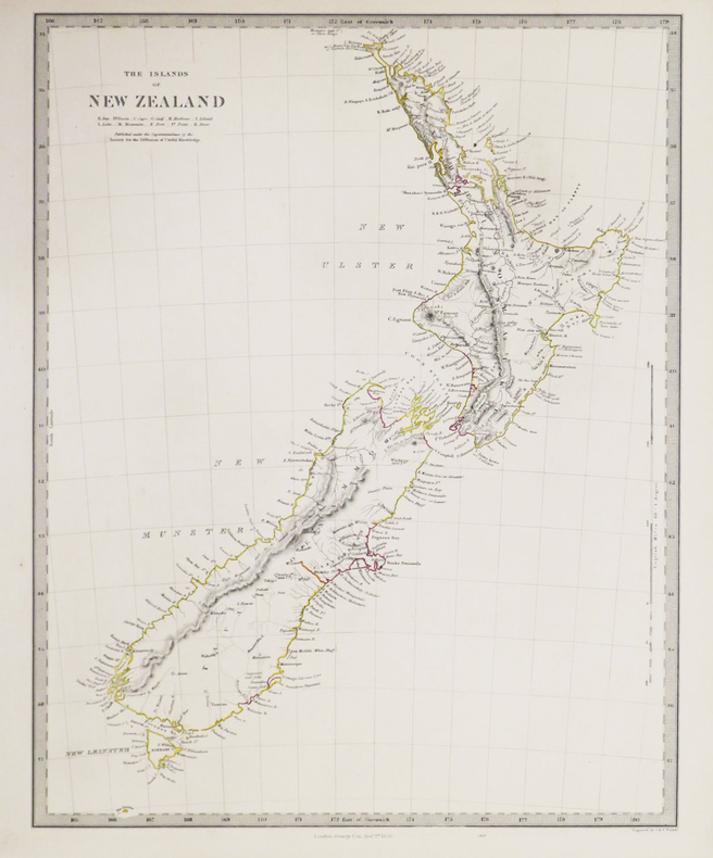
1853réf. LBW-3418London, George Cox, 1853. 400 x 310 mm.
1838Carta geografica edita dalla "Society for the Diffusion of Useful Knowledge". Incisione in rame, coloritura coeva, in ottime condizioni. Map of the islands of New Zealand.Shows towns, mountains, rivers, lakes, and details concerning the uninhabited regions. The Society for the Diffusion of Useful Knowledge was active from the 1830s through the 1860s and published some of the best regional maps of the era.Published by Society for the Diffusion of Useful Knowledge. Steel engraving with original colour. Perfect condition.
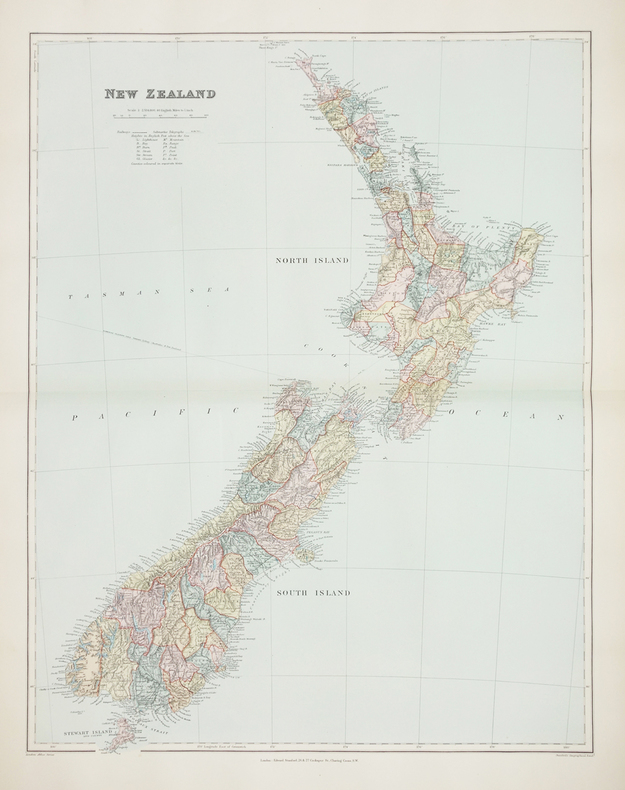
1896réf. LBW-2760London, Edward Stanford, [1896]. 606 x 470 mm.
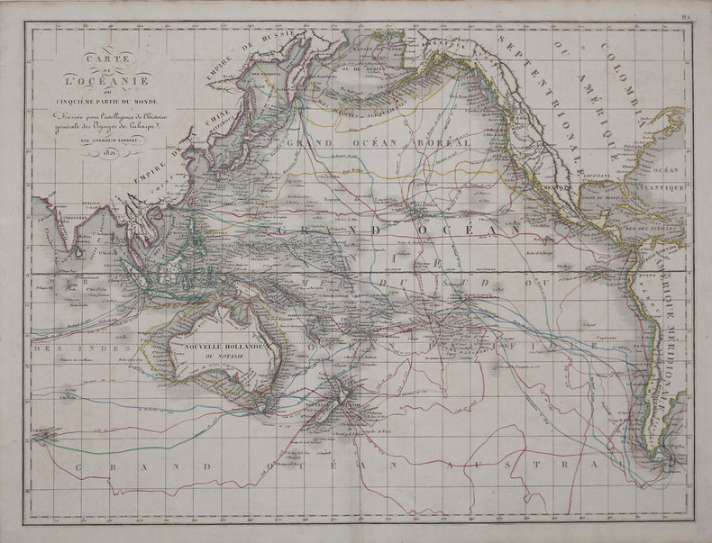
1825réf. LBW-31631821 [1825]. 408 x 544 mm.
1827Carta apparsa nella sesta parte, "Océanique", dell'Atlas universel de géographie physique, politique, statistique et minéralogique di Vandermaelen. L'atlante fu prodotto in un'unica edizione nel 1827; furono venduti solo 810 esemplari completi. Questa grande opera, che comprende circa 378 mappe uniche e che fu compilata nell'arco di tre anni, fu il primo atlante litografico e il primo a rappresentare il mondo con la stessa proiezione e in una scala uniforme. Philippe Marie Guillaume Vandermaelen è stato un cartografo fiammingo attivo a Bruxelles nella prima parte del XIX secolo. A Vandermaelen si deve uno dei più notevoli sviluppi dell'impresa privata nella cartografia, ovvero il suo straordinario Atlas Universel de Geographie in sei volumi. Vandermaelen, nato a Bruxelles il 23 dicembre 1795, viene considerato come il più grande cartografo belga dopo Mercatore e Ortelius. Figlio di un medico che era diventato un ricco produttore di sapone, muovendosi in un ambiente commerciale e da autodidatta, divenne un commerciante di prodotti chimici e farmaceutici. Fanatico di geografia, la sua carriera subisce una svolta definitiva quando, nel 1825, inizia a pubblicare un rivoluzionario Atlas universel che lo consacra come cartografo. Primo atlante al mondo a rappresentare la Terra su una scala unica ed eccezionalmente grande, l'Atlas universel offriva la rappresentazione più ampia, completa e precisa mai realizzata. I suoi contemporanei lo capirono, come la Chiesa cattolica romana, che era in una fase di espansione. Negli anni Trenta del XIX secolo, Roma sosteneva che questo atlante era assolutamente il miglior atlante disponibile, prezioso strumento della sua politica missionaria nell'Oceano Pacifico e nelle isole meridionali. Bibliografia Marguerite Silvestre, Philippe Vandermaelen, Mercator de la jeune Belgique, 2016. Map appeared in the sixth part, 'Océanique,' of Vandermaelen's Atlas universel de géographie physique, politique, statistique et minéralogique. The atlas was produced in one edition in 1827; only 810 complete sets were sold. This great work, featuring some 378 unique maps and compiled over three years, was the first lithograph atlas, and the first to render the world on the same projection and at a uniform scale. Philippe Marie Guillaume Vandermaelen (December 23, 1795 - May 29, 1869) was a Flemish cartographer active in Brussels during the first part of the 19th century. Vandermaelen is created with "one of the most remarkable developments of private enterprise in cartography," namely his remarkable six volume Atlas Universel de Geographie. No one could have foreseen that Philippe Vandermaelen, born in Brussels on 23 December 1795, would become the greatest Belgian cartographer since Mercator and Ortelius. Son of a doctor who had become a wealthy soap maker, moving in a business environment and self-taught, he became a dealer of chemical and pharmaceutical products. As a geography fanatic, there was a definitive shift in his career when, in 1825, he began to publish a revolutionary Atlas universel which established him as a cartographer. As the first atlas in the world to represent the Earth on a single and exceptionally large scale, the Atlas universel offered the widest, most complete and most precise representation ever achieved. His contemporaries understood this, such as the Roman Catholic Church, which was in a phase of expansion. In the 1830s, Rome claimed that this atlas was “the best atlas available” and was the instrument of its missionary policy in the Pacific Ocean and the southern islands. Litograph, with original outline colour, very good condition. Bibliografia Marguerite Silvestre, Philippe Vandermaelen, Mercator de la jeune Belgique, 2016.
1827Carta apparsa nella sesta parte, "Océanique", dell'Atlas universel de géographie physique, politique, statistique et minéralogique di Vandermaelen. L'atlante fu prodotto in un'unica edizione nel 1827; furono venduti solo 810 esemplari completi. Questa grande opera, che comprende circa 378 mappe uniche e che fu compilata nell'arco di tre anni, fu il primo atlante litografico e il primo a rappresentare il mondo con la stessa proiezione e in una scala uniforme. Philippe Marie Guillaume Vandermaelen è stato un cartografo fiammingo attivo a Bruxelles nella prima parte del XIX secolo. A Vandermaelen si deve uno dei più notevoli sviluppi dell'impresa privata nella cartografia, ovvero il suo straordinario Atlas Universel de Geographie in sei volumi. Vandermaelen, nato a Bruxelles il 23 dicembre 1795, viene considerato come il più grande cartografo belga dopo Mercatore e Ortelius. Figlio di un medico che era diventato un ricco produttore di sapone, muovendosi in un ambiente commerciale e da autodidatta, divenne un commerciante di prodotti chimici e farmaceutici. Fanatico di geografia, la sua carriera subisce una svolta definitiva quando, nel 1825, inizia a pubblicare un rivoluzionario Atlas universel che lo consacra come cartografo. Primo atlante al mondo a rappresentare la Terra su una scala unica ed eccezionalmente grande, l'Atlas universel offriva la rappresentazione più ampia, completa e precisa mai realizzata. I suoi contemporanei lo capirono, come la Chiesa cattolica romana, che era in una fase di espansione. Negli anni Trenta del XIX secolo, Roma sosteneva che questo atlante era assolutamente il miglior atlante disponibile, prezioso strumento della sua politica missionaria nell'Oceano Pacifico e nelle isole meridionali. Bibliografia Marguerite Silvestre, Philippe Vandermaelen, Mercator de la jeune Belgique, 2016. Map appeared in the sixth part, 'Océanique,' of Vandermaelen's Atlas universel de géographie physique, politique, statistique et minéralogique. The atlas was produced in one edition in 1827; only 810 complete sets were sold. This great work, featuring some 378 unique maps and compiled over three years, was the first lithograph atlas, and the first to render the world on the same projection and at a uniform scale. Philippe Marie Guillaume Vandermaelen (December 23, 1795 - May 29, 1869) was a Flemish cartographer active in Brussels during the first part of the 19th century. Vandermaelen is created with "one of the most remarkable developments of private enterprise in cartography," namely his remarkable six volume Atlas Universel de Geographie. No one could have foreseen that Philippe Vandermaelen, born in Brussels on 23 December 1795, would become the greatest Belgian cartographer since Mercator and Ortelius. Son of a doctor who had become a wealthy soap maker, moving in a business environment and self-taught, he became a dealer of chemical and pharmaceutical products. As a geography fanatic, there was a definitive shift in his career when, in 1825, he began to publish a revolutionary Atlas universel which established him as a cartographer. As the first atlas in the world to represent the Earth on a single and exceptionally large scale, the Atlas universel offered the widest, most complete and most precise representation ever achieved. His contemporaries understood this, such as the Roman Catholic Church, which was in a phase of expansion. In the 1830s, Rome claimed that this atlas was “the best atlas available” and was the instrument of its missionary policy in the Pacific Ocean and the southern islands. Litograph, with original outline colour, very good condition. Bibliografia Marguerite Silvestre, Philippe Vandermaelen, Mercator de la jeune Belgique, 2016.
1940réf. 725unknown: Pacific Telephone & Telegraph Company 1940. 18 x 16 inches. Good condition with map nicely mounted on mildly acidic board. This is a comprehensive compilation of long distance phone lines in the Pacific Northwest. The map goes from Crescent City California in the South to Nelson BC in the north. It goes from Buffalo Hump Idaho in the east to Zumwalt Oregon in the west. It is a fine print masterpiece getting a plethora of switching stations in the map. ðŸ—ºï¸ It is printed on paper mounted on board. The overall map is tanned from the mounting on a board with an acidic base. The browning is light and not aggressive and will respond well to deacif=dification. Pacific Telephone & Telegraph Company unknown
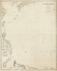
1884réf. 143681London: James Imray and Son 1884. Very Good. London James Imray and Son 1884. A very large engraved chart printed on two sheets combined printed surface 1268 × 1015 mm overall total size 1280 × 1048 mm mounted on the original blue backing paper with the publisher's title-label on the verso. Chips and short tears to the margins in a few places clear of the printed surface; a few small light stains and other minor signs of age and handling; in very good condition with faint pencil annotations tracking a voyage to Hangzhou in September 1888. A very large and detailed blueback chart of the western rim of the Pacific Ocean including the East China Sea Philippine Sea and parts of the coastlines of Japan Korea China Taiwan the Philippines and New Guinea. It features eight inset charts: Guajan Island; Borodino Island; Umata Bay; Farralon de Medinilla; Rota; Alamagan; Guguan; and Rosario Island. Both sheets incorporate corrections to June 1884. The title-label on the verso reads 'Chart No 193. Western Pacific in Seven Charts. Chart No. 4. Price 8s.'. James Imray and Son unknown
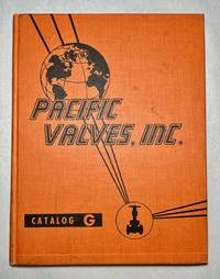
1959réf. 1394Pacific Valves Inc. Catalog G – Cast & Forged Steel Asbestos Parts 1959 Vintage Hardcover Reference Research Copyright 1959 published by Pacific Valves Inc. Long Beach CA. 240 pages. There is an extra insert Bulletin BV-2 that is included. Catalog G features steel valves by Pacific some of which utilized gaskets with Asbestos material. Catalog is divided into separate sections: cast steel valves small steel valves stainless steel corrosion-resistant valves and "Y" globe valves. Orange hardcover shows wear to include spine lean black smudges scuffs soiling nicks scratches bumped corners and edges bumped spine head and tail and nicks to the edges. Hard creases throughout with a wavy textblock. The textblock and pages are tanning with spots. Previous owner's stamps on the pastedowns and index page. There are small markings smudges and scuffs throughout the text but nothing significant. Overall this book is in Very Good minus VG- condition. Pacific Valves, Inc. hardcover
1928réf. 18880n.p.: Southern Pacific Lines 1928. First edition. Rubbed and retouched area at center of rear board else fine. Original reptile-skin patterned boards oblong quarto 8.75 x 15 inches 20 leaves printed on rectos only. 9 large group photographs several portrait photos of SP executives. Laid in loose are 1 5.5 x 9.5-inch cyanotype photo print of a locomotive works and 1 vintage 6 x 8.5-inch silver print photograph of a coal-fired locomotive and crew. Also laid in is a typed letter dated San Francisco July 3 1929 signed J. N. Clark to Mr. O. B. Schoenky presenting this album. Dated ink stamp recording receipt of Southern Pacific Co. Los Angeles Cal. July 5 1929 at top of sheet. Both sender and recipient are pictured in the management portraits portion of the album. Founded in 1865 1929 was Southern Pacific's heyday with 13848 miles of their own track. A fine piece of railroading history. Southern Pacific Lines hardcover
1940réf. 64697San Francisco CA: San Francisco Bay Exposition Co. Published by Pacific House Lithographed by H.S. Crocker Co. Inc. & Schwabacher-Frey Inc. 1940. One oblong atlas folio map 25.5 x 19 in. colour lithographed on beautiful thick paper stock minor age toning slight dustsoiling on right portion still a VG bright original pictorial map. First edition of this separate issue souvenir map issued by the Golden Gate International Exposition GGIE World’s Fair which first opened in 1939 and carried over to 1940 celebrating the stunning series of giant murals painted in 1939 by Covarrubias for the Pacific House presenting the Pacific Ocean as an idyllic yet with remote and exotic areas prior to World War II. This splendid and vibrant pictorial map vividly presents the ranges of building methods and Indigenous Peoples dwellings from Yurts in Mongolia to peaked longhouses of the Maori in New Zealand not dissimilar to the cedar Longhouses of the Northwest Coast tribes along with thatched huts teepees and the pueblos of the Mesoamerican peoples of the Southwest. The six original murals ranged in size from 9 x 13 feet ”Native Dwellings” and “Transportation” while the other four such as “Flora & Fauna” measured 16 x 24 feet. Originally the set of six was exhibited until 1953 at the American Museum of Natural History shipped back to San Francisco in 1949 when the original “Art Forms of the Pacific” mysteriously went missing and exhibited at the Ferry Building until 2001. Covarrubias 1904-1957 was a noted Mexican muralist illustrator caricaturist painter and ethnologist who not only produced artwork and caricatures for the Mexican Ministries of Education and Communication but also later became noted artist and caricaturist for Vanity Fair and the New Yorker set designer and commissioned later by the GGIE to produce the murals series. San Francisco Bay Exposition Co., Published by Pacific House, Lithographed by H.S. Crocker Co. Inc. & Schwabacher-Frey, Inc., unknown
1940réf. 64698San Francisco CA: San Francisco Bay Exposition Co. Published by Pacific House Lithographed by H.S. Crocker Co. Inc. & Schwabacher-Frey Inc. 1940. One oblong atlas folio map 25.5 x 19 in. colour lithographed on beautiful thick paper stock minor age toning slight dustsoiling on right portion still a VG bright original pictorial map. First edition of this separate issue souvenir map issued by the Golden Gate International Exposition GGIE World’s Fair which first opened in 1939 and carried over to 1940 celebrating the stunning series of giant murals painted in 1939 by Covarrubias for the Pacific House presenting the Pacific Ocean as an idyllic yet with remote and exotic areas prior to World War II. This splendid and vibrant pictorial map focuses the inventive ways in which Indigenous Peoples across the Pacific Rim traveled to new places from elephant back in India to catamarans in Tonga and Samoa reindeer sledge in Siberia to dogsled and dugout canoe in Alaska and Northwest Coast Peoples. The GGIE is represented by an illustration of a Sikorsky S-42 flying boat for Pan Am as the Treasure Island site following the World’s Fair was originally intended to be converted into an airport prior to World War II. The six original murals ranged in size from 9 x 13 feet ”Native Dwellings” and “Transportation” while the other four such as “Flora & Fauna” measured 16 x 24 feet. Originally the set of six was exhibited until 1953 at the American Museum of Natural History shipped back to San Francisco in 1949 when the original “Art Forms of the Pacific” mysteriously went missing and exhibited at the Ferry Building until 2001. Covarrubias 1904-1957 was a noted Mexican muralist illustrator caricaturist painter and ethnologist who not only produced artwork and caricatures for the Mexican Ministries of Education and Communication but also later became noted artist and caricaturist for Vanity Fair and the New Yorker set designer and commissioned later by the GGIE to produce the murals series. San Francisco Bay Exposition Co., Published by Pacific House, Lithographed by H.S. Crocker Co. Inc. & Schwabacher-Frey, Inc., unknown
1909réf. 53081Seattle & Berkeley CA: Ellis A. Davis 1909. Folio. 190 pp. Illust. & decorated title 100s of photo illusts. over 100 colour maps many double page 1 very large folding colour map tipped-in on rear pastedown a couple minor closed tears at creases. Red cloth silver lettering & decoration embossed on front cover minor bumping to corners bumping & minor fraying head & foot of spine very faint tidemark to fore-edges still a VG- copy very clean and bright textblock. First edition of this well-illustrated commercial atlas intended to promote the Pacific Northwest during the Alaska-Yukon Exposition carefully listing most of the major and minor cities their counties industries local products and 100s of photos of buildings logging railroads shipping and more. The atlas includes detailed economic statistical maps of Oregon Washington and Idaho; street maps of Spokane WA Portland OR Seattle WA Boise ID and more. The large folding colour map at rear is of Oregon State -- these atlases were also issued with Idaho Washington and Oregon & Washington colour maps separately. Ellis A. Davis, hardcover
1902réf. 63438The Dalles OR: Benj. A. Gifford 1902. Oblong 8vo. 9.5 x 6.5 in. 37 leaves unnumbered. including 18 boudoir-sized collotype photographs printed on matte-finish paper stock w/ Benj. Gifford copyright notice lower fore-edge of image captions & negative number indicated all printed with excellent contrast w/in the negative also included 18 printed caption tissue guards. Dark gray ribbed softcovers yapp fore-edges w/ folding clasp flap at fore-edge of front cover decorative white lettering front cover punch-sewn w/ colour silk braid at gutter margin minor chipping to foot of spine into lower left front cover minor shelfwear creasing to yapp fore-edges still a VG- copy w/ ownership markings on title for Lillie D. Stewart a railroad company stenographer living in Denver CO at the beginning of the 20th Century and she paid $ 1.50 for the booklet. First edition of this very scarce and nicely printed collotype photographic views of the Columbia River Gorge sold from Gifford’s studio in The Dalles OR. Gifford 1859-1936 is considered perhaps Oregon’s most famous photographer and his beautiful images included here depict Rooster Rock sternwheeler at the Dalles Latourelle Falls Cape Horn the Pillars of Hercules Multnomah Falls shot 12 years prior to the historic Benson Footbridge at Multnomah Falls constructed by Robert Lee Ringer in 1914. Other images include the Sternwheeler Regulator Warren’s Salmon Cannery Sternwheeler Bailey Gatzert approaching the Cascade Locks Fish Wheel on the Columbia the Oregon Railway & Navigation Chicago-Portland Special leaving Tunnel 2 and the Native American burial ground of Memaloose Island. Gifford first worked in Portland until 1895 then opened a studio in The Dalles and later returned to Portland in 1910 where he continued to operate both studios until about 1920. Later his son Ralph I Gifford took over operation of the studio and continued to operate the business. Worldcat locates 1 copy OSU. Benj. A. Gifford, paperback
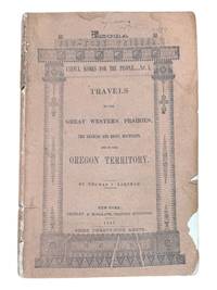
1843réf. 9124New York: Greeley & McElrath 1843. Third edition. 23.5x15.5cm 112pp. Printed in two columns with tables ads on inner wrappers. Stitched in original printed brown wraps. Damp staining to upper corner of first 35 or so pages more pronounced at title and near the front. Spine cocked and with ends chipped chipping along edges of wraps. Pencil annotation to front cover. A very good copy. Third edition following the 1841 and 1843 Poughkeepsie printings of this popular text issued as an "Extra" of the New York Tribune. The book is essentially an account of the first overland to Oregon migration of emigrants bound for the territory led by Farnham and known as the "Peoria Party." They left Independence Missouri on May 20th 1839 and as a substantially smaller group arrived in Oregon on September 23 1839 with Marcus Whitman. Scarce in the original wrappers. Howes F50. Wagner-Camp 85:3. Washington 89 20. Greeley & McElrath unknown
réf. 2299San Francisco: H. S. Crocker & Co. 1883. . Large 8vo printed color-lithographed wrappers; lacking one inch at the head of the spine and one half inch at the foot. Institutionally common. Scarce in trade. San Francisco: H. S. Crocker & Co., 1883. unknown
réf. 2299San Francisco: H. S. Crocker & Co. 1883. . Large 8vo printed color-lithographed wrappers; lacking one inch at the head of the spine and one half inch at the foot. Institutionally common. Scarce in trade. San Francisco: H. S. Crocker & Co., 1883. unknown books
réf. PC71Thirteen unmounted gelatin silver prints ca. 155x205 cm 6x8 in. All with pencil titles in English on versos. This interesting collection of photos of New South Wales includes views of the Sydney Harbour taken from the deck of HMS “Powerful” Circular Quay taken from RMS “Orontes” two images of Bondi Beach and three rare views of the Parramatta River taken on a day of the famous scull boat race between George Towns and Jim Stanbury one of two races between them either in 1905 or in 1906. The photos show the Parramatta river full of canoes paddle boats and “steamers going up to the starting point” as well as “the Parramatta River after the finish of the Stanbury-Towns boat race the boats hurrying back to town.” The other images show the Hacking River taken from the Moombara district Port Hacking southern Sydney Jamberoo village on the Illawarra South Coast of New South Wales; Nowra Bridge over the Shoalhaven River built in 1881 and the Bomaderry Creek near Nowra South Coast. The last view shows the harbour of Hobart with HMS “Challenger” on the right taken from the deck of RMS “Orontes.” “George Towns was the Australian Single Sculls World Champion from 1901 to 1905 and 1906 to 1907. He was the last of the seven Australian World Sculling Champion who between them held the title almost uninterrupted from 1876 to 1909” Wikipedia. His two races with another famous Australian sculler James Stanbury 1868-1945 took place on 22 July 1905 and 28 July 1906. “Stanbury was a tough proposition as he had been World Champion from 1891 to 1896 and had held off several challenges before losing to Gaudaur. The race was agreed to be run on 22 July 1905 on the Parramatta with a stake of £500 a side. The water was smooth and the weather was fine with just a light breeze. Again large crowds were on hand to witness what was expected to one of the great sculling contests. At the start Stanbury at once went to the front and by Uhr’s Point was a length and a half ahead. Towns then spurted but could make no impression on the leader. For every effort Towns made Stanbury responded and he crossed the line by two lengths in a time of 19m.47s. Often when one sculler was beaten by another he was offered a return match to have the chance to get even – or go two down. Stanbury offered Towns and they had another Championship race on the same course almost a year later on 28 July 1906. After the start Towns took an early lead but was soon overhauled by Stanbury who then continued to widen the gap until he was two lengths ahead but at Cabarita he started to show signs of distress. It was evident that his right shoulder was troubling him and about which rumours had been circulating. He had to slow down considerably and Towns then managed to catch up. Stanbury’s shoulder finally gave out and from there on the race was a procession. Towns won by about twenty lengths in a time of 19m.53s. This was Stanbury’s final Championship race; he had raced in seven and won five” Wikipedia. unknown
réf. 56-0260Stockton Calif.: Southern Pacific Company 1922 revised 1935. Map. Blueprint 24" x 36." From Bear River to Creegan. With Key to Industry with 52 listings including Union Oil Co Merced Growers' Packing Assoc. Scale 1" = 400'. Stockton, Calif.: Southern Pacific Company, 1922, revised 1935. unknown
réf. 56-0287San Francisco Calif.: Southern Pacific Company 1938 revised 1944. Map. Blueline print 24" x 56" From WP crossing to Luther. Includes Monarch Match Co Levin Machinery and Salvage Co California Concrete Products Co. Scale 1" = 100'. San Francisco, Calif.: Southern Pacific Company, 1938, revised 1944. unknown
réf. 56-0437San Francisco Calif.: Southern Pacific Company 1920 rev. 1949. Blueline print 24" x 56". From Belmost Avenue to Cedar Street and E Street to Tulare Avenue. Includes PG&E Co Grant Pacific Rock Co Producers & Growers Market of Central California West Compress Co Sun Maid Raisin Growers Association. Scale approx 1" = 400'. San Francisco, Calif.: Southern Pacific Company, 1920, rev. 1949. unknown