6 276 résultats
1942réf. 79-6841942. 1942. 6 pages including annexes. In original printed file binder. Task Force Eleven under Vice Admiral brown to Conduct Offensive Patrol in the Central Pacific. Fine Copy. Hardcover. Fine. Book. 1942. Hardcover
1991564 pages. Geographical and subject indeces. "Provides detailed descriptions of the different life phases through which each of the seven species passes... Some of the topics covered are geographic distribution, transplants, freshwater life, ocean life, development, growth, feeding, diet, migration, and spawning behaviour. The text is richly supplemented by numerous maps, illustrations, colour plates and tables." - from dust jacket. Clean, bright and unmarked with negligible wear. Dust jacket now preserved in archival-grade Brodart. An excellent copy. Book
2002157 pages including index. Haida carvers on Canada's Pacific Coast have carved figures from black rock for about 150 years. The genesis of this book was when two dedicated collectors donated their works to the British Columbia Provincial Museum, thus assembling the largest and best collection of these carvings known to the Museum. The benefactors, Francis and Kathleen Reif, suggested that the Museum produce a well illustrated book as a definitive scholarly work on the black, Haida carvings. This volume is the result. Contains dozens of excellent black and white photographs plus extensive text and descriptions. Clean, bright and unmarked with zero wear. Book
1984280 pages. Index. Bibliography. Archival black and white photos abound, plus several in colour. Includes maps, timetables and scale drawings. "This is the dramatic story of the CPR's British Columbia sternwheelers and steam tugs through the races, boiling rapids, moonlit cruises, and gold rushes to their passing." - from dust jacket. Light wear to clean and unmarked book. Average wear and closed tears to back panel of dust jacket which is now preserved in glossy new archival-grade Brodart cover. Sound copy of this wonderful piece of B.C. history. Book
1920388 pages. Index. Tissue-protected frontis of subject. Illustrated with photos. Describes the life of the railroad executive best-known for overseeing the construction of the first Canadian transcontinental railway. Blue buckram hardcover library binding remains sound. Usual library markings. Average wear. A solid copy. Book
1943Pages 105-155 plus nine pages of nice vintage ads. Features: Northwest Passage By Air - many super photos; Canadian Handicraft Old and New; Canada's Million and More Needlecraft Workers; and more. Some of the best ads include: Canadian Pacific Airline (two-color ad inside front cover), Northern Electric (Red Cross Features); Westinghouse Electronics "Where a speck of dust could hide a Nazi airdrome". Moderate wear. Binding intact. A sound vintage copy. Magazine
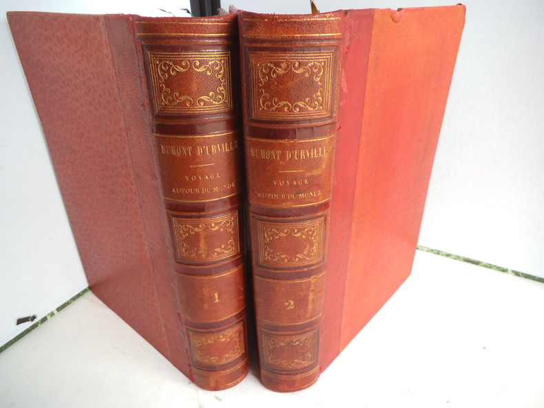
réf. 9721Publié sous la direction du Contre Amiral DUMONT D’ URVILLE. Nouvelle édition revue, corrigée. Deux tomes en deux volumes in 4 demi-cuir rouge. Titre et caissons dorés. Larges filets à froid sur les plats. Tome1 : faux-titre, frontispice gravé, sous serpente, titre XI, 550 pages, 1 page de table des chapitres, tranches mouchetées. 21 gravures sur acier, hors-texte, sous serpente, y compris le frontispice, Une grande carte dépliante Tour du Monde. Furne & Cie 1848. Rousseurs, importantes, fortes à certaines pages ainsi qu’au verso de certaines gravures. Une mouillure à l’ange supérieur droit. Tome 2 : faux-titre, frontispice gravé sous serpente« mort du Capitaine COOK », 542 pages, 20 gravures sur acier, hors-texte , sous serpente, y compris le frontispice. Grande carte dépliante des Iles TAHITI pour les voyages autour du monde ; 1 page de table des chapitres. Rousseurs, fortes et concentrées à certaines pages, ainsi qu’au verso de certaines gravures. Furne et Cie 1848
2026réf. x-1009689045Cambridge University Press 2026. Hardcover. New. 228 pages. 6.00x0.56x9.00 inches. Cambridge University Press hardcover
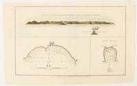
1784réf. 174896London.: Alexander Hogg at the King's Arms. circa1784. Engraved map in triptych on laid paper 20.1 x 32.7 cm three insets: cross section of the north side of Queen Charlotte's Islands Solomon Islands with detail of a volcano "6 leagues North"; Swallow's Bay Harbour; and Byron's Harbour early hand colour trimmed to the plate mark at the top edge neat sealed tear affecting the publisher's caption slight edge wear and paper toning but a most attractive map in very good condition. Attractive engraving of the Queen Charlotte's Islands Solomon Islands. The Islands were named for the consort of King George III by Philip Carteret the British naval officer and explorer who participated in two of the Royal Navy's circumnavigation expeditions in 1764–66 and 1766–69. His ship the Swallow gave her name to the Bay and Carteret's commanding officer on the first of his voyages John Byron to the Harbour depicted in this most attractive early chart. . Alexander Hogg at the King's Arms. unknown
réf. 125039Peking Secretariat of the Peace Conference of the Asian and Pacific Regions 1952. 176pp. folio. Original green cloth with gilt title and decoration a little faded on backstrip. B/w illustrations. Hinges a little loose. A very good copy. . Signed by various national representatives. Peking, Secretariat of the Peace Conference of the Asian and Pacific Regions 1952. hardcover
19048vo [22 x 16 cm]; xiv, 567 pp, frontis, numerous illustrations and plates, large color folding map of Philippine Islands (short tear in margin), folding table of language comparison, plan, folding table of crimes at p. 544 not listed, index. original cloth, gilt lettering, top edge gilted, very light wear at corners, spine slightly faded but lettering clearly visible, edges rubbed, very good, clean throughout, sound tight copy. A picture of this book is available upon request by email. Travels to Manila, Philippines, Lubang Islands, Poetic Islands, Cuyonos, Suto Island, Agutaya, Calamia, Linapakan, Kaisian Island, Malampaya, Araceli, Palawan, Balabac Island, Cagayanes, Cagayan de Sulu, Samales, Maibun, Sulu Island, Tapul, Laminusa, Bajaos, Siminor, Celebes, Sanga-Sanga, Basilan Island, Zamboanga, Malanaos, Tirurays, Datto Piang, Pawa, Mindanao, Bagobos, Davao, Sebu Island, Panay, Luzon, Gaddanes among other famous places, with much on the native peoples encountered and wildlife. The Philippine Islands #52392. Not in Hill.
18618vo [23.5 x 16.5 cm]; xii, 548, 16 [publisher's ads] pp, plates and illus, color frontis of Samoan Orator in color photocopy, map, extra illustrations not in list of illus, folding table at end (often lacking). new cloth preserving the original cloth of covers and gilt lettering of spine, stains on title page, few marginal pencil notes on few leaves, spine label removed, solid and tight copy. A picture of this book is available upon request by email. Hill p. 295. Mostly on Samoa and New Hebrides, the author describes the peoples, their customs, society, wars, mythology, language, canoes, clothing, food, amusements, as well as his activities there. The very large folding table compares the dialects for 24 islands for about 120 words. An appendix gives the meteorological data averaged over seven years for each month of the year.
1898réf. 37912Chicago: Poole Bros. 1898. 1898. COLORADO. 8 1/2" x 6 1/2" in color pictorial wrappers. 44 pp. illustrations. Information on Manitou Colorado Springs Pikes Peak the Manitou and Pike's Peak Railway side trip to the Grand Canon of the Arkansas various parks the Rocky Mountain Limited etc. Double-page drawing of "The Rocky Mountain Limited" above the floor plan of the train above a line map of the route from Chicago to Denver. Numerous illustrations of scenes along the Great Rock Island Route. Wear and rubbing to corners and spine. A nicely produced booklet. Poole Bros., 1898. unknown
1904réf. 654536Pacific Net & Twine Company 1904. First Edition. Hardcover. Very Good. A scarce surviving copy of the first catalog issued by this important Seattle supplier of maritime equipment. A very good copy in the original gray cloth some soiling and wear. Includes the first 3 supplements: No 1: Marine Plumbing Specialties; No. 2: Michigan Speed Wheels; No. 3: Shipmate Stoves and Parts. 596 16 plus supplements. Profusely illustrated in b/w. Founded in 1897 Pacific Net & Twine survived in some form through the 1980s. It was located on Pier 6 the address for this catalog from 1904 through 1913 when it moved to Pier 8. This copy has at least two ink stamps of the Walstad Machine Company of Tacoma. Pacific Net & Twine Company hardcover
1990réf. 08M001Warner Books 1990. 1st printing. Hardbound. VERY GOOD. Tight bright clean slight tilt. Small corner bump has dogeared about a dozen pages. Pocket size 5-5/8x3-1/2" shopping and sightseeing guide keyed to full-page indexed street maps. Yellow leather-finish cover. ISBN: 0446387797. Warner Books hardcover
1924réf. 349G2506Canada: Canadian Pacific 1924. Book. Good. Paperback. First Edition. 8vo - over 7¾" - 9¾" tall. 12 pages. Illustration of the "Empress of Scotland" on front cover. A very detailed fare guide which describes various classes of sailings from Montreal and Quebec to Southampton Cherbourg Hamburg Liverpool Belfast-Glasgow and Antwerp. Average external wear and fading soiling. A quality copy of this wonderful vintage item. Canadian Pacific Paperback
1972réf. 323a0906British Columbia: Pacific Hovercraft Limited 1972. Book. Very Good. Paperback. First Edition. 8vo - over 7¾" - 9¾" tall. Rare memento of this early high-speed endeavour to connect passengers travelling between Vancouver and Vancouver Island by sea. Claimed to connect downtown Nanaimo with downtown Vancouver in just over 45 minutes; downtown Vancouver to downtown Victoria in under one and a half hours. Light wear. Few pencil notes. Undated. Circa 1972. Pacific Hovercraft Limited Paperback
1944réf. Alibris.0038228Allied Geographical Section South West Pacific Area. 1944. Trade paperback. Good. ex-library label & stamps on front cover back cover has spotting chips to cover edges & top of spine stamps on title page stamp on p. 1 margin stamps & label on last blank page stamps inside back cover. 82 p. Includes: illustrations maps. . Philippine Series. Allied Geographical Section, South West Pacific Area paperback
1937réf. Alibris.0030290Japan Pacific Association. 1937. Trade paperback. Good. ex-library stamp on front cover owner's name on front cover cover detached from pages back cover & some pages have a crease front & back cover are separating from each other pages unmarked. 48 p. Includes illustrations. Japan Pacific Association paperback
1938réf. Alibris.0030343Japan Pacific Association. 1938. Trade paperback. Very good. some cover wear includes errata slip. 74 p. Includes illustrations. Japan Pacific Association paperback
réf. OCT19.TUCSONDIVISION.10.8Southern Pacific Lines. Hardcover. B004XWPBXC Book is in like new condition. Customer service is our #1 priority. We sell great books at great prices with super fast shipping and free tracking. . Fine. Southern Pacific Lines hardcover
1955réf. 60170Elma WA: Fulco Publications Press of The Elma Chronicle 1955. 8vo. 8 229 1 pp. Illustrated title photographic illustrations. Red cloth gilt lettering on spine slight shelfwear minor rubbing w/ d.j. cover art logging scene chipping head & foot of spine closed tears at joints old scotch tape repairs to spine & some offset ghosting still a NF/Fair copy inscribed by the author on the ffep. from library of Pete Hurd w/ bookplate on ffep. First edition signed. This scarce Northwest title was written by the former secretary to Washington State Governor Louis F. Hart and founder with Frank Satterlee of the Olympia News in 1924 and finally a consulting criminologist. This work includes the crimes adventures mass murderers and manhunts for John Tornow Billy Gohl Harry Tracy Frank Romandorff Henry Plummer Boone Helm Doc Howard Chris Lowry Peter Miller and many others. Very scarce in original dustjacket. Fulco Publications, Press of The Elma Chronicle, hardcover
1931réf. 60944Syracuse NY: Empire New England Company Inc. 1931. One large 6-panel dissected colour linen-backed map featuring one hemisphere map of Pacific Ocean 34 inches in diameter within larger 40 x 52 in. colour-printed wall map with scale at Equator of 1:23300000 folding down to 19.5 x 17.25 brass grommets mounted for hanging at upper fore-edge minor edgewear rubbing at crease folds minor age toning light fraying to the linen still VG copy. Second printing of this scarce linen-backed dissected wall map reflecting the extent of Imperialist Colonial spheres of influence in the Pacific just 10 years before the outbreak of World War II. These educational maps served as key instructional tools for detailing Japanese British Dutch French Portuguese and U.S. colonies dependencies and mandated territories demarcated here in respective colours spanning from Asia to the Americas and include British holdings in Antarctica. Worldcat locates 1 copy Boston Public. Empire New England Company, Inc., unknown
1895réf. 56659Mount Angel OR: Typis Monasterii S. Benedicti 1895. 8vo. 73 3 pp. Black embossed cloth embossed blind-stamped lettering on front cover minor edgewear rubbing slightly shaken still VG- copy from the library of Edwin Vincent O’Hara 1881-1956 Roman Catholic Priest educator social reformer and author of the Pioneer Catholic History of Oregon. whose manuscript note indicates this copy was acquired after he became the bishop of Great Falls MT in 1923. First edition of this scarce Oregon imprint and one of the earliest publications issued by the Mount Angel Seminary Press. This work publishes in Latin the orders and decrees describing and outlining the work and efforts of the Catholic missionaries and churches in the Oregon Territory and later state. It includes orders decrees and letters concerning missions and churches in Walla Walla Vancouver Island Portland Willamette Valley from and to the Archbishops and Bishops in Oregon Idaho Washington and Vancouver Island. Of particular interest the second Provincial Council was vehemently opposed to Public Schools and that due to the “swearing cursing and Profane expressions . . . of public school children” all good Catholics were “enjoined to preserve the little ones from the poisoned atmosphere of these godless institutions.” The Third Provincial Council was overseen by Archbishop William Gross who was also responsible for urging the Benedictine Monks to establish the Mount Angel Seminary to train Pacific Northwest priests. Typis Monasterii S. Benedicti, hardcover
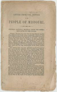
1853réf. BK0172Washington D.C. 1853. 24 pp. measuring 6 ½ x 10 inches. Stitched and untrimmed. Good with considerable wear and chipping at the edges some soiling and early pencil notations. Thomas Hart Benton's argument for a central transcontinental route issued as Congress was moving toward the government surveys that would dominate the Pacific railroad question during the next several years. Benton had been promoting a government-backed "central national highway" since 1849 running west from Missouri toward California. Writing to his former Missouri constituents on March 4 1853 Benton argues that the accumulated western explorations had already demonstrated the practicality of a central route. He gives particular attention to the country approaching the Rocky Mountains and to the search for a usable pass near the headwaters of the Arkansas and Rio Grande drawing heavily on the western travels of his son-in-law John C. Frémont. The final eight pages form an appendix bringing together evidence for the route. They include Frémont's 1850 letter to the Philadelphia Railroad Convention and more notably a statement made to Benton by the veteran trader and guide Antoine Leroux. Leroux recounts his early years in the West his association with the fur-trading expeditions of Ashley and Henry and his long residence at Taos. Graff describes this as the probable first printing of Leroux's statement. A useful piece of western railroad literature with substantial Frémont and New Mexico content published on the eve of the federal Pacific railroad surveys. Howes B368; Graff 270; Wagner-Camp 221; Sabin 4186. . unknown