6 358 résultats
2026réf. x-1837420300Emerald Publishing Limited 2026. Hardcover. New. 376 pages. 5.98x0.87x9.02 inches. Emerald Publishing Limited hardcover
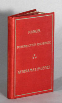
1913réf. 47868Ristigouche P. Q.: Freres mineurs capucins Ste. Anne de Ristigouche 1913. 12mo pp. 306 2; bound with: Gtapegiemgeoel. Cantiques. pp. 32; 112 zinc-block illustrations throughout; red buckram with gilt title on upper cover; red stained edges; small bump to upper cover else near fine. Text in Mi'kmaq translated by Pacifique after the 1759 edition by Abbe Maillard. Pacifique de Valigny née Henri-Joseph-Louis Buisson was a Capucin French missionary who wrote and published a number of religious materials for the benefit of the Mi'kmaq and Gaspe people. Freres mineurs capucins Ste. Anne de Ristigouche unknown
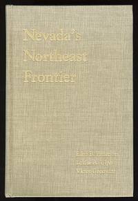
réf. 010927Reno Nevada: University of Nevada Press 1991. . Hardcover. Very Good. Reprint. Cloth with gilt lettering. xvii 713 pages. Illustrated. Bibliography. Index. No dust jacket. A clean copy with little wear. "There are chapters on the relationship between the Indians and whites early exploration and emigrant parties the role of the military transportation the sheep and livestock industries . histories of various valleys towns and mining districts." - Paher University of Nevada Press (1991). hardcover
195124 pages. Features: The Perfect System Myth - an argument against Russia's alleged peaceful intentions; Old Inn by the Roadside - The Clinton Hotel - article with photos; Camp Cookery - Game Recipes; Small Business League; The Rooster's Eye; Pioneer Ashcroft Author is Custodian of Archives - The Journal Museum and Archives; Sam Slade's Dream (poem); Finning ad on back cover with sawmill illustration; Dozens of nostalgic ads for local businesses. Average wear. A sound copy. Magazine
2006réf. BN662695VS Verlag für Sozialwissenschaften 2006. 2006. Softcover. Die Persönlichkeit in der Handschrift Die Persönlichkeit in der Handschrift Pacifico Cristofanelli VS Verlag für Sozialwissenschaften paperback
réf. BN328929Blurb. Softcover. Une guerrière pacifique à Tokyo: et ses environs Une guerrière pacifique à Tokyo: et ses environs Julie Guerrière Pacifique Blurb paperback
1774Carta geografica tratta dall'atlante della relazione di James Hawkesworth "Cartes et figures des voyages entrepris par ordre de sa Majesté Britannique pou fair des découvertes dans l'hémisphère méridional; exécutes par Byron, Carteret, Wallis & Cook dans les vaisseaux le Dauphin, Le Swallow & l'Endeavour" pubblicata in più edizioni di lingua francese, inglese, olandese ed italiano. Incisione in rame, in ottimo stato di conservazione. Map of the atlas is the report by James Hawkesworth "Cartes et figures des voyages entreprise par ordre de sa Majesté Britannique pou fair des découvertes dans l'Hémisphère southern exécutes par Byron, Carteret, Wallis and Cook dans les vaisseaux le Dauphin, Le Swallow & Endeavour "published in multiple editions of the English, French, Dutch and Italian.Interesting and highly detailed charting of a portion of the Coastline of New South Wales, from Cape Tribulation to Endeavour Straits and Cape York.
1774Carta geografica tratta dall'atlante della relazione di James Hawkesworth "Cartes et figures des voyages entrepris par ordre de sa Majesté Britannique pou fair des découvertes dans l'hémisphère méridional; exécutes par Byron, Carteret, Wallis & Cook dans les vaisseaux le Dauphin, Le Swallow & l'Endeavour" pubblicata in più edizioni di lingua francese, inglese, olandese ed italiano. Incisione in rame, in ottimo stato di conservazione. Map taken from the atlas by James Hawkesworth "Cartes et figures des voyages entrepris par ordre de sa Majesté Britannique pou fair des découvertes dans l'hémisphère méridional; exécutes par Byron, Carteret, Wallis & Cook dans les vaisseaux le Dauphin, Le Swallow & l'Endeavour" published in more edition in french, english, duth and italian. Fine map shows the explorations of Captain Cook, Captain Byron, Captain Wallis and Captain Carteret in the vicinity of Tahiti and the Society Islands from 1765 to 1769. Extends from Is. Scilly [i.e. the Scilly Islands] in the west and to I. Whitsunday de la Pentecote [i.e. the Whitsunday Island] in the east, from Is. du Disappointment [i.e. Disappointment Island] in the north to Ohetiroa in the south. Features the routes taken by these important explorers as the zig-zagged in and around the Society Islands. Depicts the island of Tahiti (Otaheite) as well as Bora Bora (Bolabola), Otaha, Marma, Ulietea, and others. Title in decorative script in the upper right quadrant. Copper engraving, in excellent condition.
1907réf. 627272Hamburg, A. Janssen, (1907). 4to. 5 Bl., 119 S. Mit zahlreichen (20 ganzseitigen) Illustrationen des Verfassers. Originalhalbleinen mit Vorderdeckelillustration (etwas lichtrandig, Ecken bestoßen, Rücken u. Vorsätze erneuert). [2 Warenabbildungen]
1983réf. yam00442 forts volumes reliures éditeur sous jaquettes illustrées tranches jaunies sinon très bon état 380 et 390 pages + illustrations hors texte édités par les éditions du Pacifique
1719réf. 228651719 A Paris chez I. Chiquet A Paris 1719. - 25':.- Altkolorierter Kupferstich aus Le nouveau et curieux Atlas Geographique . b. Jacques Chiquet in Paris, dat. 1719, 17 x 22,5cm Tooley's Dic. of Mapm. Rev. Ed. A - D, S. 264 (Jacques Chiquet, c. 1673-1721; french cartographer, engraver and 'marchand d' estampes, rue St Jacques' in Paris). - Zeigt Asien zwischen Arabien und Japan. - Fine condition, good margins.bonnes marges
réf. 9256description-organisation-histoire. In 8 pleine toile rouge, chagrinée, de l’éditeur. Titre doré. Filets à froid en encadrement. Faux-titre, titre, 283 pages. Complet de la grande carte, en couleurs, dépliantes de B. ROBLET, en fin de volume. Tranches dorées. Paris Librairie Charles Delagrave 1895. Edition originale. Une petite déchirure, sans gravité page
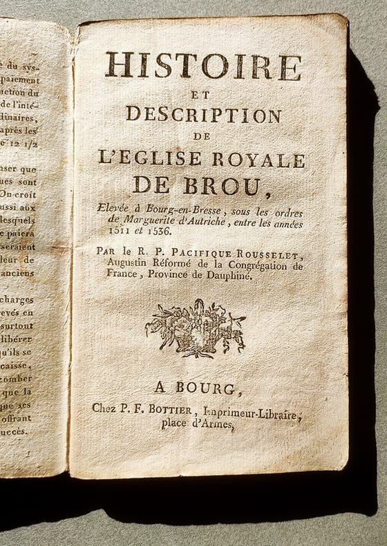
réf. 16895"Chez P.F. Bottier, imprimeur libraire ; place d'armes" "A Bourg, sd (1767 ?), in-12 broché, 143pp., couverture d'attente muette de papier chamois. Bois gravé au titre (corbeille de fruits) et en bandeau du chapitre premier (vue d'architectures). Cerne d'eau en bordure et angle inférieur des quarante dernières page. Une édition a été donnée en 1767 (avec date), chez Desaint à Paris et Chez Comte à Bourg-en-Bresse, une ""seconde"" édition a été donnée en 1806 (avec date au titre) chez Bottier, à Bourg. Notre édition, sans date, est souvent donnée comme l'édition originale de l'ouvrage. Bien que l'éditeur et le fleuron du titre soient identiques à l'édition de 1806, la comparaison des exemplaires montre des différences notables dans la composition du texte, la numérotation des pages, les caractères typographiques (y compris à la page de titre) ou les ornements typographiques. Il paraît donc difficile de dire s'il s'agit ici véritablement de la première édition ou d'une édition intermédiaire entre celle de 1767 chez Comte et celle de 1806 chez Bottier. Elle est néanmoins fort rare dans sa simplicité d'édition provinciale. Quérard, La France Littéraire, VIII-240 indique que ce ""petit ouvrage est plein de recherches curieuses"" mais donne la date de 1724 par erreur. (l'approbation est datée de 1767). "
1851Decorativa carta geografica pubblicata in The Illustrated Atlas, And Modern History Of The World Geographical, Political, Commercial & Statistical… edito da John Tallis. Le mappe del The Illustrated Atlas non solo fornivano conoscenze geografiche aggiornate, ma utilizzavano anche viste a vignetta all'interno del disegno per mostrare i popoli nativi e le loro occupazioni, le città e i punti di interesse. Le mappe si rifanno alla tradizione cartografica dei cartografi olandesi del XVII secolo, con bordi decorativi finemente incisi. Le tavole sono state disegnate e incise da John Rapkin con vedute realizzate da una serie di artisti di spicco. Le mappe furono pubblicate in volume completo dal 1851 fino al 1865 circa. Alcune delle mappe furono pubblicate anche in altri libri di storia pubblicati da Tallis, tra cui quello sulle British Colonies e, senza le vignette, in dizionari geografici ed enciclopedie fino al 1880 circa. John Tallis (1817-1876) era un editore di mappe britannico. Nato nelle Midlands, Tallis arrivò a Londra negli anni '40 del XIX secolo. Tallis iniziò la sua carriera londinese con una serie di notevoli vedute stradali di Londra. Iniziò una collaborazione con un certo Frederick Tallis, forse suo fratello, ma la loro collaborazione terminò nel 1849. In occasione della Grande Esposizione del 1851, Tallis pubblicò il The Illustrated Atlas. Le mappe furono successivamente ristampate dalla London Printing & Publishing Company, che lasciò intatta l'imprint di Tallis, assicurandogli così una fama duratura. Incisione su acciaio, coloritura dei confini all'acquarello, in ottime condizioni. Decorative map taken from The Illustrated Atlas, And Modern History Of The World Geographical, Political, Commercial & Statistical by John Tallis The maps from The Illustrated Atlas were first published in serial form to a target audience that led insular lives due to the expense and hardship of travel. All that changed as the progress of the nineteenth century brought swift and dramatic changes in public awareness of far away places. Tallis' maps no doubt played an important role in this dramatic awakening. These maps not only provided up-to-date geographical knowledge, but also used vignette views within the map's design to show the native people and their occupations, cities and points of interest. The maps hark back to a cartographic tradition from the Dutch mapmakers of the seventeenth century with finely engraved decorative borders. The maps were drawn and engraved by John Rapkin with views drawn and engraved by a number of prominent artists. The maps were issued as a complete volume from 1851 until about 1865. Some of the maps were also published in other history books published by Tallis including British Colonies and, without the vignettes, in geographical dictionaries and encyclopedias until about 1880. John Tallis (1817-1876) was a British map publisher. Born in the Midlands, Tallis came to London in the 1840s. Tallis began his London career with a series of remarkable London street views. He began a partnership with a Frederick Tallis, possibly his brother, but their collaboration ended in 1849. For the Great Exhibition of 1851, Tallis published the Illustrated World Atlas, one of the last series of decorative world maps ever produced. The maps were later reissued by the London Printing & Publishing Company, who left the Tallis imprint intact, thus ensuring his enduring fame. In 1858, he began publication of the popular Illustrated News of the World and National Portrait Gallery of Eminent Personages, selling it in 1861 (it ceased publication in 1863).
réf. ria9781461353720_inpPaperback. New. New Book; Fast Shipping from UK; Not signed; Not First Edition; Implantable defibrillators as originally conceived by Michel Mirowski were limited to the detection and automatic termination of ventricular fibrillation. In the original "AID" device the detection algoritlun sought to distinguish sinu paperback
réf. ria9781402071430_inpHardcover. New. New Book; Fast Shipping from UK; Not signed; Not First Edition; Implantable defibrillators as originally conceived by Michel Mirowski were limited to the detection and automatic termination of ventricular fibrillation. In the original "AID" device the detection algoritlun sought to distinguish sinu hardcover
191212mo [19 x 13 cm]; xvi, 172 pp, frontis with tissue guard, complete with numerous illustrations on plates from photos and drwgs, 2 folding maps including one with tribes. original cloth, gilt title lettering on spine and cover, name on endpaper, very good overall and interior is clean and near fine. A picture of this book is available upon request by email. There is a preface by the bishop of Labuan and Sarawak and foreword by Bishop Hose. A very informative work, excellent illustrations including of weaving and looms, making poison dart, handicrafts and charms, views, activities, portraits, etc.
185512mo [19 x 12 cm]; 2 volumes, xviii, 441; xiv, 426, [vi], 8 [ads dated July 1855] pp. original blind-stamped cloth, rubbed, spine ends chipped and frayed, joint split and repaired, interior with few light stains in margins, good. A picture of this book is available upon request by email. A description of the Australian colonies including Melbourne, the people, immigrants, productions, conditions, nature, crime, society, digging for gold, convicts, climate, travelling through area, Sydney, smaller towns, etc.
2013réf. 2-1447116909Springer London 2013. Paperback. New. 1989 edition. 390 pages. 10.63x7.60x0.95 inches. Springer London paperback
1982réf. 190107049xbvkBeijing, Cartographic Publishing House / Xinhua Bookstore, 1982. 6 folded sheets (26,5 x 38,5; unfolded: 53 x 77; in total, 3 vertical x 2 horizontal: 159 x 154, incl. ca. 2 cm blank frames on each sheet). - Together in publisher's illustrated and printed vertical paper-sleeve; Folio (ca. 39 x 27 cm).
1767réf. 81061767 broché.(non rogné, quelques coins em.). in-12, VIII-132pp. (2ff.), Paris Desaint, Bourg-en-Bresse Comte 1767,
1952réf. 2090502124400090Not Available 1952. Soft Cover. Fine. The book is in fine condition. Not Available paperback
1830réf. 1226830Leipzig, Fleischer, 1830. 9 (v. 11), 364 S., 2 gefaltete Kupfertafeln, 1 gestochene Faltkarte. OBroschur (Rücken geklebt u. mit Fehlstellen, vorn gestempelt, Bindung leicht gelockert, innen etwas braunfleckig, ohne den Einzeltitel).