Canadian Pacific Railway (CPR) C P RBiblio.com
6 276 résultats
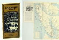
1925réf. 652j0955Canada: Canadian Pacific Railway C.P.R. Good. 1925. First Edition Thus. Pamphlet. Substantial text is graciously illustrated with black and white photos on alternating pages. Contents include: Victoria; Motoring & Golfing; East Coast; Hunting & Fishing; West Coast; Resources/Industries; Travel Routes. Two-colour 16.5" x 12" fold-out map of Vancouver Island affixed to back cover lists hotels and boarding houses on verso. 16 glossy pages folded vertically in half. Contents securely stapled. Black and white photo-illustrated covers loose but present with opening to upper portion of fold. Inside the covers are lists of Canadian Pacific Hotels and Canadian Pacific Agencies throughout the world. A remarkable and informative memento of Vancouver Island's early tourism industry.; Sm 4to . Canadian Pacific Railway (C.P.R.) unknown
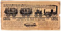
1875réf. 48055Chicago: Chicago Rock Island & Pacific Railroad Co 1875. Good. Chicago: Chicago Rock Island & Pacific Railroad Co. ca. 1875. Small pictorial broadside flyer. 16.5x33cm printed in black. Stock worn toned and chipped with a few instances of soiling extensive splitting along old folds with tape repair to verso. Good only. Promotional broadside for the Chicago Rock Island & Pacific Railroad that operated from roughly 1850-1970 largely in the Midwest. Features a paper-cut illustration that was created on the occasion of the first trip made by steam-powered passenger cars in New York in 1831 before the company's incorporation. This broadside however was not issued until several decades later. The extensive railway inspired the tune "Rock Island Line" covered by country crooners Johnny Cash and Lead Belly. No separately cataloged copies in OCLC as of May 2026. Chicago, Rock Island & Pacific Railroad Co unknown
1875réf. 48055Chicago: Chicago Rock Island & Pacific Railroad Co 1875. Good. Chicago: Chicago Rock Island & Pacific Railroad Co. ca. 1875. Small pictorial broadside flyer. 16.5x33cm printed in black. Stock worn toned and chipped with a few instances of soiling extensive splitting along old folds with tape repair to verso. Good only. Promotional broadside for the Chicago Rock Island & Pacific Railroad that operated from roughly 1850-1970 largely in the Midwest. Features a paper-cut illustration that was created on the occasion of the first trip made by steam-powered passenger cars in New York in 1831 before the company's incorporation. This broadside however was not issued until several decades later. The extensive railway inspired the tune "Rock Island Line" covered by country crooners Johnny Cash and Lead Belly. No separately cataloged copies in OCLC as of May 2026. Chicago, Rock Island & Pacific Railroad Co unknown books
1911réf. 652j1196Canada: Mail. Good. 1911. First Edition. Pamphlet. A lavishly produced promotional brochure in brown card covers illustrated with an elegant colour illustration of the Château Frontenac hotel and gilt lettering. Several high-resolution black and white photos. Includes content about fishing and camping on Ontario's French River Calgary - The Pearl of the Prairies Customs and Baggage Commercial Travellers C.P.R. Train Service The Columbia Valley and more. Marconigram on page 6 suggests a 1911 printing date. 12 glossy pages. Single staple binding has disintegrated but covers and all contents present. Clean and unmarked with light wear. A quality example of this early piece of Canadian transportation ephemera. 23 cm x 15.5 cm. ; 8vo . Mail unknown
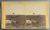
1880réf. 68192Fargo D.T. Dakota Territory: F. Jay Haynes Official Photographer Northern Pacific Railway 1880. Photograph. Very Good. Stereoview photograph on a yellow Northern Pacific Railway mount 10 cm x 18 cm. Northern Pacific Views backstamp with decorative diamond border lines. Title is negative-etched in white along along the bottom edge of the right image. Both the card and the image is a little bit rubbed and dirty. Image is still clear and sharp. View of the burial ground with several structures visible. Taken at ground level centered and from a middle distance. Frank Jay Haynes 1853-1921 was the official photographer for the Northern Pacific Railway and later for Yellowstone National Park. Haynes took many noteworthy photographs at various locations along the Northern Pacific Yellowstone Park Line. Haynes travelled to Yellowstone in 1882 and captured many images of the emerging park. He opened his Log Cabin Studio the following year at Mammoth Hot Springs and continued to photograph the park for many years to come. Haynes' photography is inextricably linked to the public image of the famous national park. F. Jay Haynes, Official Photographer, Northern Pacific Railway unknown
1880réf. 68192Fargo D.T. Dakota Territory: F. Jay Haynes Official Photographer Northern Pacific Railway 1880. Photograph. Very Good. Stereoview photograph on a yellow Northern Pacific Railway mount 10 cm x 18 cm. Northern Pacific Views backstamp with decorative diamond border lines. Title is negative-etched in white along along the bottom edge of the right image. Both the card and the image is a little bit rubbed and dirty. Image is still clear and sharp. View of the burial ground with several structures visible. Taken at ground level centered and from a middle distance. Frank Jay Haynes 1853-1921 was the official photographer for the Northern Pacific Railway and later for Yellowstone National Park. Haynes took many noteworthy photographs at various locations along the Northern Pacific Yellowstone Park Line. Haynes travelled to Yellowstone in 1882 and captured many images of the emerging park. He opened his Log Cabin Studio the following year at Mammoth Hot Springs and continued to photograph the park for many years to come. Haynes' photography is inextricably linked to the public image of the famous national park. F. Jay Haynes, Official Photographer, Northern Pacific Railway unknown books
1888réf. 31649np 1888. 79 1 pp plus folding map couple of expertly repaired short fold splits one chip. Disbound Good. This promotional went through a number of editions of which this appears to be the first. It provides the information promised by the title. 110 Eberstadt 15. unknown
1888réf. 31649np 1888. 79 1 pp plus folding map couple of expertly repaired short fold splits one chip. Disbound Good. This promotional went through a number of editions of which this appears to be the first. It provides the information promised by the title. 110 Eberstadt 15. unknown books
1892réf. 74364W. C. Riley. VG. 1892. Hardcover. Hardback in Very Good condition without dust jacket. 16mo 6" - 7" tall. 439 pages. Includes map. Profusely illustrated edition. Clean interior. Binding tight. Fading to spine. Corners bumped. Some rubbing and wear to boards. Quick shipping excellent customer service. All books carefully packaged in boxes and ship with tracking information. . W. C. Riley hardcover
réf. 16-2981Oakland: Circa 1950s. . 21.5 x 7.5 inches. Period frame by Saake of Oakland. Memorabilia for a travel agent or world traveler. Oakland: Circa 1950s. unknown
réf. 51-1101San Francisco and Oakland: 1866. Stock Certificate for one share July 20 1866 to Frank Buck. One of 74 shares at $300 each. Signed in ink by the officers. With 25 cent Washington revenue stamp. 5 x 8.5 inches in quadruple mats. San Francisco and Oakland: 1866 unknown
réf. 56-0295San Francisco Calif.: Southern Pacific Company 1947 revised 1963. Map. Blackline print 15.5" x 39" printed mirror-image reverse. From Milpitas to Oak Grove and Alamitos. Includes Wayne College Park Shell Oil Co Municipal Airport Agnew State Hospital. With Index to Industries with approx. 700 entries. Scale 1" = 2000'. San Francisco, Calif.: Southern Pacific Company, 1947, revised 1963. unknown
réf. 56-0288San Francisco Calif.: Southern Pacific Company 1947 revised 1963. Map. Blueline print 15.5" x 39". From Milpitas to Oak Grove and Alamitos. Includes Wayne College Park Shell Oil Co Municipal Airport Agnew State Hospital. With Index to Industries with approx. 700 entries. Scale 1" = 2000'. San Francisco, Calif.: Southern Pacific Company, 1947, revised 1963. unknown
réf. 56-0324San Francisco Calif.: Southern Pacific Company 1926 revised 1930. Map. Blueline print 24" x 36". From French Camp to Calveras River and Pacific Ave to Sinclair Ave. With Stockton Channel State Hospital Grounds College of Pacific. Includes Index to Industry with 122 listings. Scale approx. 1" = 1200'. San Francisco, Calif.: Southern Pacific Company, 1926, revised 1930. unknown
réf. 56-0465San Francisco Calif.: Southern Pacific Company 1929 rev. 1960. Blueline print 33" x 19" lines for five carriers indicated by red yellow green mauve and brown highlighting. From Burbank Junction to Lynwood. Includes Burbank Glendale Los Angeles Firestone Park South Gate. Interchanges and switching limits for each carrier indicated in detail. Scale approx 1" = 3500'. San Francisco, Calif.: Southern Pacific Company, 1929, rev. 1960. unknown
réf. 56-0434San Francisco Calif.: Southern Pacific Company 1937. Blueprint 13" x 46". From Nevada Avenue to Tyler Avenue along Maple Avenue. Includes Yard Limit Board Fresno Building Corp Imperial Building Company station point. Scale 1" = 100'. San Francisco, Calif.: Southern Pacific Company, 1937. unknown
réf. 56-0468Los Angeles Calif.: Security First National Bank Southern Pacific notations approved 1961. Blackline print 29" x 36" with Southern Pacific zones 1-9 indicated in colored pencil. From Northridge to Manhattan Beach and San Gabriel Mountains to Norwalk. Includes Los Angeles Santa Monica Inglewood Alhambra Glendale Burbank. Extremely detailed every street in area is named with index to all streets on back. Scale 1 inch = 1 mile. Los Angeles, Calif.: Security First National Bank, Southern Pacific notations approved 1961. unknown
réf. 56-0262Sacramento Calif.: Southern Pacific Company 1952. Map. Blueline print 24" x 34" with red highlighting. From Durham Ferry Rd to Austin Rd and County Road 01-159 to 0.7 mile south of City Limit. Including Western Pacific and Southern Pacific Railroad Lines and Highway Route 99. Not drawn to scale. Sacramento, Calif.: Southern Pacific Company, 1952. unknown
réf. 01-0069Southern Pacific Railroad July 9 1956. Map. Blueprint. 24 x 68 inches. Scale: 1 inch = 2000 feet. Southern Pacific Railroad, July 9, 1956. unknown
réf. 56-0357San Francisco Calif.: Southern Pacific Company 1954. Map. Blueline print 24" x 34" with red and green highlighting. Small area in center of maps details all streets within city limits. Includes Yreka Hawkinsville all railroad lines with circle of two mile radius denoting proposed extension of present limits. Not drawn to scale. San Francisco, Calif.: Southern Pacific Company, 1954. unknown
réf. 56-0356San Francisco Calif.: Southern Pacific Company 1923 revised 1930. Map. Blueprint 12" x 56". From South Fork Mill Creek to beyond Tulare Avenue. Includes Shell Co of California General Petroleum Co Southern California Edison Co Mineral King Road. Scale 1" = 100'. San Francisco, Calif.: Southern Pacific Company, 1923, revised 1930. unknown
réf. 56-0205San Francisco Calif.: Southern Pacific Company 1955. Map. Blueline print. 24 x 35 inches. Includes Port Chicago site of famous 1944 Port Chicago Naval Disaster Hastings Slough Bridge C.A. Smith Lumber Co. With Schedule of Property Acquisition Date Original Grantor/Grantee Instrument of Transfer and Remarks of Sale for approximately 35 transfers 1873-1955. Scale: 1 inch = 400 feet. Photo of detail. San Francisco, Calif.: Southern Pacific Company, 1955. unknown
réf. 56-0267Oakland Calif.: Southern Pacific Company 1949 revised 1960. Map. Blueline print 24" x 53". Includes Western Union and Signal lines. Some buildings indicated in northeast corner body of map is made up of measurements and signs along tracks. Scale 1" = 100'. Oakland, Calif.: Southern Pacific Company, 1949, revised 1960. unknown
réf. 56-0354San Francisco Calif.: Southern Pacific Company 1925 revised 1929. Map. Blueprint 12" x 55". From beyond western City Limits to Flora Street. Includes California Packing Corp California Fruit Cannery Association Associated Oil Co. Scale 1" = 100'. San Francisco, Calif.: Southern Pacific Company, 1925, revised 1929. unknown
réf. 56-0433San Francisco Calif.: Southern Pacific Company n.d. Blackline print 15" x 41". Portion of previous map indicating only area of railroad yard. No legend. From Biola Junction and Muscatel to Barton Calwa Tower. Detailed listing of structures and signals inside railroad yard. No scale indicated. San Francisco, Calif.: Southern Pacific Company, [n.d.] unknown