6 355 résultats
réf. 56-0280San Francisco Calif.: Southern Pacific Company 1928. Map. Blueline print 24" x 36" with red and black pencil markings indicating railroad track routes limits of railroad yard. Industrial map of Madera with Key to Industries including 24 entries indexed to location by letter. Scale 1" = 450' San Francisco, Calif.: Southern Pacific Company, 1928. unknown
réf. 56-0369San Francisco Calif.: Southern Pacific Company 1950 revised 1952. Map. Blueline print 17.5" x 45.5". Detail of area between yard limits from State Highway to Dibble Creek including city of Red Bluff station points Red Bluff and Glade. Partial Schedule of Property included approx 35 entries majority missing information. Scale 1" = 400'. With inset showing parcel at Breckinridge St and Washington St scale 1" = 100'. San Francisco, Calif.: Southern Pacific Company, 1950, revised 1952. unknown
réf. 58-0482Ogden Utah: Southern Pacific Company. Blueprint 19 inches x 29 inches. From Park Street and Fourth Street to Seventh Street. Note on sketch reads "With exception industries marked B-C-L-N Western Pacific have placed or spotted competitive loads on which southern pacific enjoyed line haul. Tracks serving these industries should be classified." Not drawn to scale. Ogden, Utah: Southern Pacific Company. unknown
réf. 56-0281San Francisco Calif.: Southern Pacific Company 1949 revised 1954. Map. Blueline print 24" x 36" with pencil notation. Includes State Highway 4 & 24 Standard Oil Co Camp Stoneman U.S. Government building. Scale 1" = 100' San Francisco, Calif.: Southern Pacific Company, 1949, revised 1954. unknown
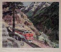
réf. 04-1224ca. 1950s. Color print. 15 x 17 inches. Stains in left margin. Framed and glazed. ca. 1950s. unknown
1894réf. R320056427CHALLAMEL A. / CHAILLEY LEON. 1894. In-8. Broché. Etat d'usage, Plats abîmés, Dos abîmé, Intérieur acceptable. 124 pages + 1 carte depliante en noir et blanc + environ 15 pages publicitaires -. . . . Classification Dewey : 996-Autres régions du pacifique
1987réf. BN173868Kluwer Academic Publishers Group 1987. 1987. Hardcover. Issues in Diagnostic Research Issues in Diagnostic Research Pacific University Forest Grove OR USA Michel Hersen School of Professional Psychology Kluwer Academic Publishers Group hardcover
1945Contents: color Parker pen ad inside front cover; interesting ad for the Curtiss Commando aircraft; Great International Harvester Truck/War Bonds ad; Pullman railcar ad with returning vets bearing swastika emblazoned souvenirs; Colour Cadillac ad; nice color ad for White Trucks - military theme; Does Truman lean left or right? - clues appear in the first 40 days; Are Japs Wanted? - article with interesting poster demanding fair play for America's Japanese; Congressional committee tours Concentration camps; Miami dogs killed after they kill Doretta Zinke; Blockade and bombs hit Japan as prelude to gathering storm - attrition is Allied policy while knockout forces transfer in strength to the Pacific; Great photo of the first Yank post V-E day ship bringing servicemen home; Great map indicating the 'Bomb Strategy Against Japan'; color Seiberling Tire ad; How to Starve out Japan - bomb the rice paddy dikes; Philippines - sobering losses; China - the Japs back up; Dramatic photo of the American Essex-class carrier Franklin (Big Ben) with its crew huddled on the flight deck after it was attacked by a single Japanese bomber with two 500lb bombs; Okinawa - sacrifice - 156 American marines and doughboys died there each day last week; photo of German prisoners with shovels in the massive American Henri Chappelle Cemetery in Belgium; Russia casts its shadow over Asia; Yugoslavs' willful grab at Trieste poses danger for Charter makers; Prince Faisal and other Arabs agree Palestine is an Arab state, despite a half-dozen vociferous Jewish organizations on the conference sidelines; Color Goodyear belt centerfold; Photo of Allied officers in front of Reichstag ruins; Pattern emerges for occupation - Allies command, Germans obey; "Life has no meaning" for Dr. Ley, once leader of the German labor front - article and photo; Nazi U-boat (with 'the Schnorkel') surrenders and is escorted to a Newfoundland port - photo; NBC airs dramatization of F.A. Hayek's The Road to Serfdom; Max Schmeling released; Rosenberg's den of Royal Theives holds key to looted art of Europe; interesting ad for a Sperry gunsight "The gunsight that 'things' faster than humans... or Japs!"; Great color Chesterfield cigarette ad on back cover. Average wear. Unmarked. Address label on front cover. A sound copy. Book
2005282 pages. Index. References. Dozens of black and white reproductions of archival photos in text. "During WWII the RCAF developed five flying boat stations between Victoria and Prince Rupert for the defense of the Pacific Coast. It would be well into 1943 before airfields were built on the west coast in both Alaska and British Columbia suitable for serving the needs of military aircraft. It would be these airfields, developed in a time of intense need, that would evolve into the future airfields that exist along the entire Pacific Coast today. This, then, is the story of both these airfields and the air harbours that preceded them." - from Preface. This copy was presented by a daughter to her father and contains her lengthy and heartfelt gift greetings to him inside the front cover. Few other markings to contents. Average wear. A sound copy. Book
900Ancient and original map of Malekula (Mallicolo) Island Southern part - The East Coast surveyed by Lieut. & Comm. G.C. Frederick, assisted by Lieut.ts H.J. Gedge, E.A. Day & H.B.T. Somerville, H.M. Surveying Ship "Dart" 1891. The South and Ambrym I surveyed by Lieut. & Comm. H.E. Purey-Cust, assisted by Lieut. s W. Pudsey-Dawson, F.C.C. Pasco & A.E.H. Marescaux H.M.Surveying Ship "Dart" 1893. The West Coast North of South West Bay from a Sketch Survey by Lieut. K. Dixon, assisted by M.r G.J. Pacey, Gunner, H.M.S. "Arker", 1903. Additions to Ambrym I. from a Survey by Lieut. Comm. R.L. Hancock and the Officers of H.M. Surveying Ship "Sealark" 1914. In the left side insert of Pangkumu Bay From a French Government Plan 1906. London Published at the Admiralty, 26th June 1893, under the Superintendence of Captain W.J.L. Wharton, Hydrographer. Small corrections: 1931. Folded editorially. Autore: Admiralty Charts. Luogo: Pacific Ocean South - Malekula Island. Anno: '900. Tecnica: incisione. Dimensioni: 650x985 mm
1907Sketches of Anchorages in the Tuamotu or Low Archipelago chiefly taken from the French Government charts to 1907. In the left side of the chart insert of Lagoon Entrance, Manihi Entrance, Avatoru Entrance, Tiputa Entrance, North passage to Rotoava , Passes into Amanu Atoll From the United States Goverment Chart, 1902, Pakaka Pass From the United States Government Chart, 1902. In the right side of the chart Lagoon Entrance, Amyot Bay, Mururoa Island, Fangahina I. From the United States Government Chart, 1902, Pakaka to Seignelay P.t.London Published at the Admiralty 9th July 1907, under the Superintendence of Rear Admiral A. Mostyn Field, Hydrographer. Small corrections: 1931. Autore: Admiralty Charts. Luogo: Tuamotu Islands - Polynesia - Pacific Ocean. Anno: 1907 [1931]. Tecnica: incisione. Dimensioni: 595x480 mm
900Tonga Islands From British surveys between 1888 and 1898. Washington D.C., published Jan. 1903, at the Hydrographic Office, under the authority of the Secretary of the Navy. Small corrections: Printed Oct. 1930. Folded editorially. Autore: Admiralty Charts. Luogo: Tonga Islands - Pacific ocean. Anno: '900. Tecnica: incisione. Dimensioni: 988x657 mm
1792réf. 14588Paris Janet Doreur 1792 cartonnage souple polychrome, tr. dor. (le Ier calendrier a 1 petit mq. de papier) in-32, front., 24pp. gravées, 24pp. imprimées, 12 gravures, 2 planches dépl. des mois de l'année. P. Janet doreur 1792
Madrid, 1852. Un mapa de 80 x 107 cm., plegado a 17 x 11 cm., coloreado, con planos particulares de Islas Marianas : Mapas de todas las Islas en la escala de 1:1.000.000 para la comparación de sus magnitudes, con las de otras posesiones españolas, Palaos y Carolinas Centrales, Carolinas Orientales, Archipielago de Gilbert ó Grupo Kingsmill, Isla de Rota, Guajan, Puerto de Umata, Farallon de Medinilla, Bahia y Ciudad de Agaña, Rada de la Isla de Tinian, Isla de Guguan, Puerto de Tarofofo, Farallon de Torres, y Puerto de San Luis de Apra. Encuadernación original en cartoné y media tela.
1945106 pages. Oblong 7" x 10". Undated but appears to be circa 1945. Profusely illustrated with wonderful vintage black and white photos. "This is the story of Pacific Mills Limited and the most northerly located paper mill on the North American continent at Ocean Falls, B.C." - page 3. Name stamped atop title page otherwise unmarked with moderate external wear and soiling. A sound vintage copy of this important history. HALE 1230, EDWARDS & LORT 2700. Book
réf. 43165Paris A. Franck, Libraire 1848 grand in 8 (27,5x19,5) 1 volume reliure demi chagrin vert à coins de l'époque, dos lisse orné d'un riche décor doré (fer au singe et à l'oiseau), tranches dorées, II et 3266 pages, avec de nombreuses illustrations, dont 17 hors texte, un plan dépliant de la baie de Papaete (folding map of the Bay of Papaete), et une grande carte gravée dépliante in fine (large folding map of the world). Ex-dono manuscrit signé par le père de l'auteur sur la page de faux-titre. Eugène Delessert, 1819-1877. Edition originale (First edition). Bel exemplaire ( Photographies sur demande / We can send pictures of this book on simple request )
1860Rara carta dell'Oceania tratta da "Atlas Universel " edita a Parigi e pubblicata del Dufour. Bella coloritura coeva. Scarce map of Oceana and the Pacific Ocean, from Dufour's Atlas Universel. Centered on Hawaii. Includes ocean currents and other details. Inset maps of New Caledonia, Tahiti, and the Marquesas.This is an impressive 1860 elephant folio map of Australia, New Zealand, Polynesia and the Pacific Ocean by A. H. Dufour. It covers from Burma (Myanmar) east as far as Chile and from Japan south to New Zealand. Although the interiors of the continents remain blank, the coastal regions are highly detailed. Numerous islands of Polynesia, Melanesia and Micronesia are noted. Five insets are features along the bottom border of the map. These include an inset of New South Wales, Australia, showing gold locations, New Caledonia, Martinique Island, Tahiti and the Gambier Archipelago.The map shows extraordinary detail throughout noting European possessions in Australia and southeast Asia, cities, islands, rivers, lakes, mountains, oceans and ocean currents, sea routes of explorers and a host of other geographical, topographical and physical features. Rumsey 5020.044.
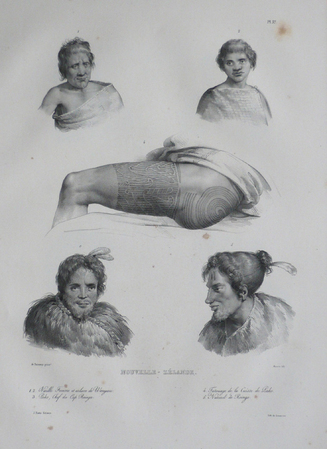
1833réf. LBW061aaParis, [1833]. 352 x 262 mm.
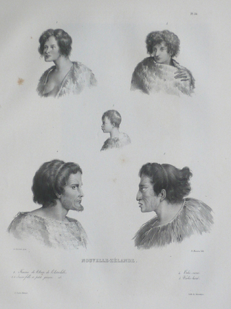
1833réf. LBW061abParis, [1833]. 332 x 275 mm.
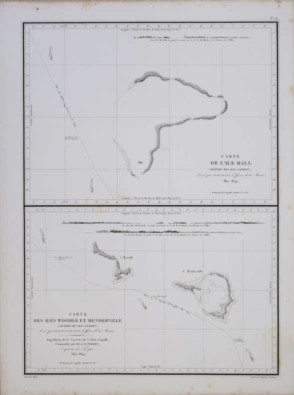
1827réf. LBW-4443[1827]. 504 x 361 mm.
194890 pages. Articles: How to Beat the Communists - by UAW (United Auto Workers') chief Walter Reuther; Walter Winchell - Aan American Phenomenon - a study of the fastest talker on the airwaves; Our Lights are Going Out - electrical power shortage; John N. Garner's Story (part 2) - the former Vice-President tells of his most serious disagreement with Mr. Roosevelt; Hot-Sun Hockey - The Pacific Coast goes for hockey in a big way - article with color photos including the Fresno Falcons playing the Los Angeles Monarchs; Boys at Work - this school reforms tough kids. Fiction: Jason Hazard's Swim; The Female Circumstance; Cupid Up the Bayou!; The Farmer's Face; The Mysterious Way; Interruptions, Interruptions. Nostalgic ads include: Old Thompson Whiskey; Packard cars; GMC trucks (nice!); Nash cars; Oldsmobile two-page color ad; Dodge Trucks; Lord Calver liquor ad featuring one-page color photo portrait of Richard C. Kettles, Jr. and his boxer Worlord; Chrysler color centerfold features cowboy scene; Chevrolet trucks; Botany 500; Samson card tables; Kleenex (featuring Little Lulu); Wow! - two-page color ad for Roma Wines features large image of Jane Russell; Camel cigarette ad on back cover features rodeo star Jerry Ambler, fisher Dorothy Allan Newstead, polo star Cecil Smith and table-tennis star Mary Reilly. Average wear. Unmarked. A sound vintage copy. Book
1789réf. 15818Tourneisen Bâle 1789 1 vol. In-8 de XVI 381 pp., pleine basane fauve de l'époque, dos lisse fileté, pièce de titre, tranches rouges.
réf. 5265in 4 reliure éditeur plein maroquin bleu nuit à nerfs, bords à biseaux,titre doré au dos mappemonde dorée sur le premier plat avec frise décorative et filet à froid.En encadrement.Faux-titre,Titre avec vignette photo.IV,602 pages sur beau papier,tranches dorées,17 grandes planches en couleurs d’après les aquarelle de Henry DARIEN et environ 300 illustrations en noir dans le texte et hors-texte d’après les documents les lus récents et les plus originaux.Charles Tallandier éditeur sans date.Vers 1900. Quelques petits ressauts de pages,sinon Très bon état.Premier plat de couverture en couleurs,conservé. Charnière intérieure toilée
1848Carta geografica tratta dall’ Atlante geografico. Corredato di notizie relative alla geografia fisica politica, ed in generale alla statistica delle varie regioni del Globo. Compilato ed eseguito in litografia per cura e sotto la direzione di Benedetto Marzolla edito a Napoli nel 1858. Marzolla, autore di importanti atlanti sulle provincie del Regno di Napoli, è anche autore di diverse carte sulle Circoscrizioni Ecclesiastiche nel Regno delle Due Sicilie, pubblicate postume, nello stesso anno della morte (1858) a Napoli nello Stabilimento Geografico diretto da Luigi Manzella. Benedetto Marzolla fu disegnatore topografo e litografo; geografo e cartografo; membro della Commissione di statistica presso il Ministero dell'Interno. Personaggio di grandissimo rilievo nella cartografia napoletana ed italiana del XIX secolo, Marzolla ottenne in vita pubblici riconoscimenti ed attestati per la produzione cartografica di altissima qualità. La sua notorietà si è lentamente dissolta dopo la morte; va tuttavia osservato che solo la mancanza di uno spiccato coinvolgimento politico in senso risorgimentale e di una valenza letteraria nella sua opera non lo hanno reso famoso come i contemporanei Francesco Costantino Marmocchi (1805-1858) e Attilio Zuccagni-Orlandini (1783-1872), con i quali può certamente confrontarsi. I progetti culturali didattici e editoriali di Marzolla furono e rimangono di straordinaria modernità; egli inventò, è il caso di dire, un nuovo modo di intendere e di disegnare la carta geografica, fornendo una visione assolutamente originale della comunicazione dei dati geografici attraverso la combinazione di testo e immagine. Con tale operazione, egli riuscì a fondere in un'unica opera, storia, geografia, economia, statistica e cartografia, raggiungendo un equilibrio grafico di rara efficacia (cfr. V. Valerio, Benedetto Marzolla Brindisino, Geografo e Cartografo dell'800 Europeo, Brindisi 2008). Bell’esemplare con coloritura coeva dei contorni, in ottimo stato di conservazione. Bibliografia V. Valerio, Benedetto Marzolla Brindisino, Geografo e Cartografo dell’800 Europeo (2008), pag. 62, 94. Two maps on one sheet, showing Western Australia and Tasmania, taken from the Atlante geografico. Corredato di notizie relative alla geografia fisica politica, ed in generale alla statistica delle varie regioni del Globo. Compilato ed eseguito in litografia per cura e sotto la direzione di Benedetto Marzolla published in Naples in 1858. Marzolla, author of important atlases on the provinces of the Kingdom of Naples, is also the author of several maps on the Ecclesiastical Circumscriptions in the Kingdom of the Two Sicilies, published posthumously in the same year of his death (1858) in Naples in the Stabilimento Geografico directed by Luigi Manzella. Benedetto Marzolla was draftsman topographer and lithographer, geographer and cartographer. Character of great importance in the Neapolitan and Italian cartography of the nineteenth century, Marzolla obtained during his life public recognition and certificates for the production of high quality cartography. His notoriety slowly faded after his death; it should be noted, however, that only the lack of a strong political involvement in the sense of the Risorgimento and of a literary value in his work did not make him as famous as his contemporaries Francesco Costantino Marmocchi (1805-1858) and Attilio Zuccagni-Orlandini (1783-1872), with whom he can certainly compare himself. Marzolla's cultural, didactic and editorial projects were, and remain, extraordinarily modern; he invented a new way of understanding and drawing maps, providing an absolutely original vision of the communication of geographical data through the combination of text and image. With this operation, he was able to merge in a single work, history, geography, economics, statistics and cartography, achieving a graphic balance of rare effectiveness. Beautiful specimen with contemporary coloring of the contours, in excellent condition. Bibliografia V. Valerio, Benedetto Marzolla Brindisino, Geografo e Cartografo dell’800 Europeo (2008), p. 62, n. 94. Tooley, Maps of Australia, 895.
1836Carta geografica dell'Oceania tratta dal "L'Univers. Atlas Classique Et Universel De Geographie Ancienne Et Moderne". Dresse Par M. Monin, Membre de la Societe de geographie, et M. Fremin, Geographe du Depot de la guerre … Paris. Armand Aubree, Edteur, Rue De Vaugirard, 17. 1837. Uncolored engraved map. Relief shown by hachures. Rivers shown. Insets for southeastern Australia and southwestern Australia. Inset table showing the nomenclature for the principal islands in the South Pacific. Taken from 'Univers. Atlas Classique Et Universel De Geographie Ancienne Et Moderne. Dresse Par M. Monin, Membre de la Societe de geographie, et M. Fremin, Geographe du Depot de la guerre ... Paris. Armand Aubree, Edteur, Rue De Vaugirard, 17. 1837.