STANFORD (Edward).Livre Rare Book
6 355 résultats
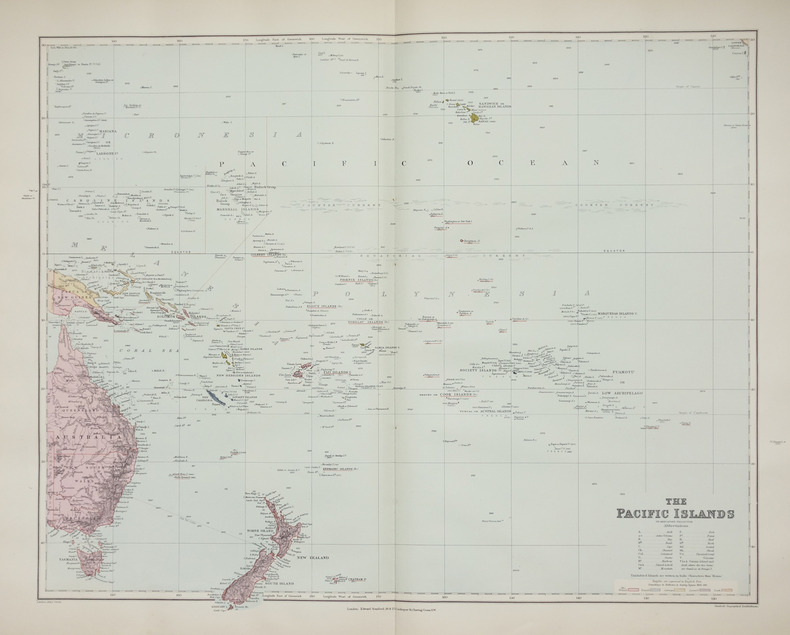
1896réf. LBW-2658London, Edward Stanford, [1896]. 480 x 603 mm.
1827Carta apparsa nella sesta parte, "Océanique", dell'Atlas universel de géographie physique, politique, statistique et minéralogique di Vandermaelen. L'atlante fu prodotto in un'unica edizione nel 1827; furono venduti solo 810 esemplari completi. Questa grande opera, che comprende circa 378 mappe uniche e che fu compilata nell'arco di tre anni, fu il primo atlante litografico e il primo a rappresentare il mondo con la stessa proiezione e in una scala uniforme. Philippe Marie Guillaume Vandermaelen è stato un cartografo fiammingo attivo a Bruxelles nella prima parte del XIX secolo. A Vandermaelen si deve uno dei più notevoli sviluppi dell'impresa privata nella cartografia, ovvero il suo straordinario Atlas Universel de Geographie in sei volumi. Vandermaelen, nato a Bruxelles il 23 dicembre 1795, viene considerato come il più grande cartografo belga dopo Mercatore e Ortelius. Figlio di un medico che era diventato un ricco produttore di sapone, muovendosi in un ambiente commerciale e da autodidatta, divenne un commerciante di prodotti chimici e farmaceutici. Fanatico di geografia, la sua carriera subisce una svolta definitiva quando, nel 1825, inizia a pubblicare un rivoluzionario Atlas universel che lo consacra come cartografo. Primo atlante al mondo a rappresentare la Terra su una scala unica ed eccezionalmente grande, l'Atlas universel offriva la rappresentazione più ampia, completa e precisa mai realizzata. I suoi contemporanei lo capirono, come la Chiesa cattolica romana, che era in una fase di espansione. Negli anni Trenta del XIX secolo, Roma sosteneva che questo atlante era assolutamente il miglior atlante disponibile, prezioso strumento della sua politica missionaria nell'Oceano Pacifico e nelle isole meridionali. Bibliografia Marguerite Silvestre, Philippe Vandermaelen, Mercator de la jeune Belgique, 2016. Map appeared in the sixth part, 'Océanique,' of Vandermaelen's Atlas universel de géographie physique, politique, statistique et minéralogique. The atlas was produced in one edition in 1827; only 810 complete sets were sold. This great work, featuring some 378 unique maps and compiled over three years, was the first lithograph atlas, and the first to render the world on the same projection and at a uniform scale. Philippe Marie Guillaume Vandermaelen (December 23, 1795 - May 29, 1869) was a Flemish cartographer active in Brussels during the first part of the 19th century. Vandermaelen is created with "one of the most remarkable developments of private enterprise in cartography," namely his remarkable six volume Atlas Universel de Geographie. No one could have foreseen that Philippe Vandermaelen, born in Brussels on 23 December 1795, would become the greatest Belgian cartographer since Mercator and Ortelius. Son of a doctor who had become a wealthy soap maker, moving in a business environment and self-taught, he became a dealer of chemical and pharmaceutical products. As a geography fanatic, there was a definitive shift in his career when, in 1825, he began to publish a revolutionary Atlas universel which established him as a cartographer. As the first atlas in the world to represent the Earth on a single and exceptionally large scale, the Atlas universel offered the widest, most complete and most precise representation ever achieved. His contemporaries understood this, such as the Roman Catholic Church, which was in a phase of expansion. In the 1830s, Rome claimed that this atlas was “the best atlas available” and was the instrument of its missionary policy in the Pacific Ocean and the southern islands. Litograph, with original outline colour, very good condition. Bibliografia Marguerite Silvestre, Philippe Vandermaelen, Mercator de la jeune Belgique, 2016.
1827Carta apparsa nella sesta parte, "Océanique", dell'Atlas universel de géographie physique, politique, statistique et minéralogique di Vandermaelen. L'atlante fu prodotto in un'unica edizione nel 1827; furono venduti solo 810 esemplari completi. Questa grande opera, che comprende circa 378 mappe uniche e che fu compilata nell'arco di tre anni, fu il primo atlante litografico e il primo a rappresentare il mondo con la stessa proiezione e in una scala uniforme. Philippe Marie Guillaume Vandermaelen è stato un cartografo fiammingo attivo a Bruxelles nella prima parte del XIX secolo. A Vandermaelen si deve uno dei più notevoli sviluppi dell'impresa privata nella cartografia, ovvero il suo straordinario Atlas Universel de Geographie in sei volumi. Vandermaelen, nato a Bruxelles il 23 dicembre 1795, viene considerato come il più grande cartografo belga dopo Mercatore e Ortelius. Figlio di un medico che era diventato un ricco produttore di sapone, muovendosi in un ambiente commerciale e da autodidatta, divenne un commerciante di prodotti chimici e farmaceutici. Fanatico di geografia, la sua carriera subisce una svolta definitiva quando, nel 1825, inizia a pubblicare un rivoluzionario Atlas universel che lo consacra come cartografo. Primo atlante al mondo a rappresentare la Terra su una scala unica ed eccezionalmente grande, l'Atlas universel offriva la rappresentazione più ampia, completa e precisa mai realizzata. I suoi contemporanei lo capirono, come la Chiesa cattolica romana, che era in una fase di espansione. Negli anni Trenta del XIX secolo, Roma sosteneva che questo atlante era assolutamente il miglior atlante disponibile, prezioso strumento della sua politica missionaria nell'Oceano Pacifico e nelle isole meridionali. Bibliografia Marguerite Silvestre, Philippe Vandermaelen, Mercator de la jeune Belgique, 2016. Map appeared in the sixth part, 'Océanique,' of Vandermaelen's Atlas universel de géographie physique, politique, statistique et minéralogique. The atlas was produced in one edition in 1827; only 810 complete sets were sold. This great work, featuring some 378 unique maps and compiled over three years, was the first lithograph atlas, and the first to render the world on the same projection and at a uniform scale. Philippe Marie Guillaume Vandermaelen (December 23, 1795 - May 29, 1869) was a Flemish cartographer active in Brussels during the first part of the 19th century. Vandermaelen is created with "one of the most remarkable developments of private enterprise in cartography," namely his remarkable six volume Atlas Universel de Geographie. No one could have foreseen that Philippe Vandermaelen, born in Brussels on 23 December 1795, would become the greatest Belgian cartographer since Mercator and Ortelius. Son of a doctor who had become a wealthy soap maker, moving in a business environment and self-taught, he became a dealer of chemical and pharmaceutical products. As a geography fanatic, there was a definitive shift in his career when, in 1825, he began to publish a revolutionary Atlas universel which established him as a cartographer. As the first atlas in the world to represent the Earth on a single and exceptionally large scale, the Atlas universel offered the widest, most complete and most precise representation ever achieved. His contemporaries understood this, such as the Roman Catholic Church, which was in a phase of expansion. In the 1830s, Rome claimed that this atlas was “the best atlas available” and was the instrument of its missionary policy in the Pacific Ocean and the southern islands. Litograph, with original outline colour, very good condition. Bibliografia Marguerite Silvestre, Philippe Vandermaelen, Mercator de la jeune Belgique, 2016.
1827Carta apparsa nella sesta parte, "Océanique", dell'Atlas universel de géographie physique, politique, statistique et minéralogique di Vandermaelen. L'atlante fu prodotto in un'unica edizione nel 1827; furono venduti solo 810 esemplari completi. Questa grande opera, che comprende circa 378 mappe uniche e che fu compilata nell'arco di tre anni, fu il primo atlante litografico e il primo a rappresentare il mondo con la stessa proiezione e in una scala uniforme. Philippe Marie Guillaume Vandermaelen è stato un cartografo fiammingo attivo a Bruxelles nella prima parte del XIX secolo. A Vandermaelen si deve uno dei più notevoli sviluppi dell'impresa privata nella cartografia, ovvero il suo straordinario Atlas Universel de Geographie in sei volumi. Vandermaelen, nato a Bruxelles il 23 dicembre 1795, viene considerato come il più grande cartografo belga dopo Mercatore e Ortelius. Figlio di un medico che era diventato un ricco produttore di sapone, muovendosi in un ambiente commerciale e da autodidatta, divenne un commerciante di prodotti chimici e farmaceutici. Fanatico di geografia, la sua carriera subisce una svolta definitiva quando, nel 1825, inizia a pubblicare un rivoluzionario Atlas universel che lo consacra come cartografo. Primo atlante al mondo a rappresentare la Terra su una scala unica ed eccezionalmente grande, l'Atlas universel offriva la rappresentazione più ampia, completa e precisa mai realizzata. I suoi contemporanei lo capirono, come la Chiesa cattolica romana, che era in una fase di espansione. Negli anni Trenta del XIX secolo, Roma sosteneva che questo atlante era assolutamente il miglior atlante disponibile, prezioso strumento della sua politica missionaria nell'Oceano Pacifico e nelle isole meridionali. Bibliografia Marguerite Silvestre, Philippe Vandermaelen, Mercator de la jeune Belgique, 2016. Map appeared in the sixth part, 'Océanique,' of Vandermaelen's Atlas universel de géographie physique, politique, statistique et minéralogique. The atlas was produced in one edition in 1827; only 810 complete sets were sold. This great work, featuring some 378 unique maps and compiled over three years, was the first lithograph atlas, and the first to render the world on the same projection and at a uniform scale. Philippe Marie Guillaume Vandermaelen (December 23, 1795 - May 29, 1869) was a Flemish cartographer active in Brussels during the first part of the 19th century. Vandermaelen is created with "one of the most remarkable developments of private enterprise in cartography," namely his remarkable six volume Atlas Universel de Geographie. No one could have foreseen that Philippe Vandermaelen, born in Brussels on 23 December 1795, would become the greatest Belgian cartographer since Mercator and Ortelius. Son of a doctor who had become a wealthy soap maker, moving in a business environment and self-taught, he became a dealer of chemical and pharmaceutical products. As a geography fanatic, there was a definitive shift in his career when, in 1825, he began to publish a revolutionary Atlas universel which established him as a cartographer. As the first atlas in the world to represent the Earth on a single and exceptionally large scale, the Atlas universel offered the widest, most complete and most precise representation ever achieved. His contemporaries understood this, such as the Roman Catholic Church, which was in a phase of expansion. In the 1830s, Rome claimed that this atlas was “the best atlas available” and was the instrument of its missionary policy in the Pacific Ocean and the southern islands. Litograph, with original outline colour, very good condition. Bibliografia Marguerite Silvestre, Philippe Vandermaelen, Mercator de la jeune Belgique, 2016.
1827Carta apparsa nella sesta parte, "Océanique", dell'Atlas universel de géographie physique, politique, statistique et minéralogique di Vandermaelen. L'atlante fu prodotto in un'unica edizione nel 1827; furono venduti solo 810 esemplari completi. Questa grande opera, che comprende circa 378 mappe uniche e che fu compilata nell'arco di tre anni, fu il primo atlante litografico e il primo a rappresentare il mondo con la stessa proiezione e in una scala uniforme. Philippe Marie Guillaume Vandermaelen è stato un cartografo fiammingo attivo a Bruxelles nella prima parte del XIX secolo. A Vandermaelen si deve uno dei più notevoli sviluppi dell'impresa privata nella cartografia, ovvero il suo straordinario Atlas Universel de Geographie in sei volumi. Vandermaelen, nato a Bruxelles il 23 dicembre 1795, viene considerato come il più grande cartografo belga dopo Mercatore e Ortelius. Figlio di un medico che era diventato un ricco produttore di sapone, muovendosi in un ambiente commerciale e da autodidatta, divenne un commerciante di prodotti chimici e farmaceutici. Fanatico di geografia, la sua carriera subisce una svolta definitiva quando, nel 1825, inizia a pubblicare un rivoluzionario Atlas universel che lo consacra come cartografo. Primo atlante al mondo a rappresentare la Terra su una scala unica ed eccezionalmente grande, l'Atlas universel offriva la rappresentazione più ampia, completa e precisa mai realizzata. I suoi contemporanei lo capirono, come la Chiesa cattolica romana, che era in una fase di espansione. Negli anni Trenta del XIX secolo, Roma sosteneva che questo atlante era assolutamente il miglior atlante disponibile, prezioso strumento della sua politica missionaria nell'Oceano Pacifico e nelle isole meridionali. Bibliografia Marguerite Silvestre, Philippe Vandermaelen, Mercator de la jeune Belgique, 2016. Map appeared in the sixth part, 'Océanique,' of Vandermaelen's Atlas universel de géographie physique, politique, statistique et minéralogique. The atlas was produced in one edition in 1827; only 810 complete sets were sold. This great work, featuring some 378 unique maps and compiled over three years, was the first lithograph atlas, and the first to render the world on the same projection and at a uniform scale. Philippe Marie Guillaume Vandermaelen (December 23, 1795 - May 29, 1869) was a Flemish cartographer active in Brussels during the first part of the 19th century. Vandermaelen is created with "one of the most remarkable developments of private enterprise in cartography," namely his remarkable six volume Atlas Universel de Geographie. No one could have foreseen that Philippe Vandermaelen, born in Brussels on 23 December 1795, would become the greatest Belgian cartographer since Mercator and Ortelius. Son of a doctor who had become a wealthy soap maker, moving in a business environment and self-taught, he became a dealer of chemical and pharmaceutical products. As a geography fanatic, there was a definitive shift in his career when, in 1825, he began to publish a revolutionary Atlas universel which established him as a cartographer. As the first atlas in the world to represent the Earth on a single and exceptionally large scale, the Atlas universel offered the widest, most complete and most precise representation ever achieved. His contemporaries understood this, such as the Roman Catholic Church, which was in a phase of expansion. In the 1830s, Rome claimed that this atlas was “the best atlas available” and was the instrument of its missionary policy in the Pacific Ocean and the southern islands. Litograph, with original outline colour, very good condition. Bibliografia Marguerite Silvestre, Philippe Vandermaelen, Mercator de la jeune Belgique, 2016.
1827Carta apparsa nella sesta parte, "Océanique", dell'Atlas universel de géographie physique, politique, statistique et minéralogique di Vandermaelen. L'atlante fu prodotto in un'unica edizione nel 1827; furono venduti solo 810 esemplari completi. Questa grande opera, che comprende circa 378 mappe uniche e che fu compilata nell'arco di tre anni, fu il primo atlante litografico e il primo a rappresentare il mondo con la stessa proiezione e in una scala uniforme. Philippe Marie Guillaume Vandermaelen è stato un cartografo fiammingo attivo a Bruxelles nella prima parte del XIX secolo. A Vandermaelen si deve uno dei più notevoli sviluppi dell'impresa privata nella cartografia, ovvero il suo straordinario Atlas Universel de Geographie in sei volumi. Vandermaelen, nato a Bruxelles il 23 dicembre 1795, viene considerato come il più grande cartografo belga dopo Mercatore e Ortelius. Figlio di un medico che era diventato un ricco produttore di sapone, muovendosi in un ambiente commerciale e da autodidatta, divenne un commerciante di prodotti chimici e farmaceutici. Fanatico di geografia, la sua carriera subisce una svolta definitiva quando, nel 1825, inizia a pubblicare un rivoluzionario Atlas universel che lo consacra come cartografo. Primo atlante al mondo a rappresentare la Terra su una scala unica ed eccezionalmente grande, l'Atlas universel offriva la rappresentazione più ampia, completa e precisa mai realizzata. I suoi contemporanei lo capirono, come la Chiesa cattolica romana, che era in una fase di espansione. Negli anni Trenta del XIX secolo, Roma sosteneva che questo atlante era assolutamente il miglior atlante disponibile, prezioso strumento della sua politica missionaria nell'Oceano Pacifico e nelle isole meridionali. Bibliografia Marguerite Silvestre, Philippe Vandermaelen, Mercator de la jeune Belgique, 2016. Map appeared in the sixth part, 'Océanique,' of Vandermaelen's Atlas universel de géographie physique, politique, statistique et minéralogique. The atlas was produced in one edition in 1827; only 810 complete sets were sold. This great work, featuring some 378 unique maps and compiled over three years, was the first lithograph atlas, and the first to render the world on the same projection and at a uniform scale. Philippe Marie Guillaume Vandermaelen (December 23, 1795 - May 29, 1869) was a Flemish cartographer active in Brussels during the first part of the 19th century. Vandermaelen is created with "one of the most remarkable developments of private enterprise in cartography," namely his remarkable six volume Atlas Universel de Geographie. No one could have foreseen that Philippe Vandermaelen, born in Brussels on 23 December 1795, would become the greatest Belgian cartographer since Mercator and Ortelius. Son of a doctor who had become a wealthy soap maker, moving in a business environment and self-taught, he became a dealer of chemical and pharmaceutical products. As a geography fanatic, there was a definitive shift in his career when, in 1825, he began to publish a revolutionary Atlas universel which established him as a cartographer. As the first atlas in the world to represent the Earth on a single and exceptionally large scale, the Atlas universel offered the widest, most complete and most precise representation ever achieved. His contemporaries understood this, such as the Roman Catholic Church, which was in a phase of expansion. In the 1830s, Rome claimed that this atlas was “the best atlas available” and was the instrument of its missionary policy in the Pacific Ocean and the southern islands. Litograph, with original outline colour, very good condition. Bibliografia Marguerite Silvestre, Philippe Vandermaelen, Mercator de la jeune Belgique, 2016.
1827Carta apparsa nella sesta parte, "Océanique", dell'Atlas universel de géographie physique, politique, statistique et minéralogique di Vandermaelen. L'atlante fu prodotto in un'unica edizione nel 1827; furono venduti solo 810 esemplari completi. Questa grande opera, che comprende circa 378 mappe uniche e che fu compilata nell'arco di tre anni, fu il primo atlante litografico e il primo a rappresentare il mondo con la stessa proiezione e in una scala uniforme. Philippe Marie Guillaume Vandermaelen è stato un cartografo fiammingo attivo a Bruxelles nella prima parte del XIX secolo. A Vandermaelen si deve uno dei più notevoli sviluppi dell'impresa privata nella cartografia, ovvero il suo straordinario Atlas Universel de Geographie in sei volumi. Vandermaelen, nato a Bruxelles il 23 dicembre 1795, viene considerato come il più grande cartografo belga dopo Mercatore e Ortelius. Figlio di un medico che era diventato un ricco produttore di sapone, muovendosi in un ambiente commerciale e da autodidatta, divenne un commerciante di prodotti chimici e farmaceutici. Fanatico di geografia, la sua carriera subisce una svolta definitiva quando, nel 1825, inizia a pubblicare un rivoluzionario Atlas universel che lo consacra come cartografo. Primo atlante al mondo a rappresentare la Terra su una scala unica ed eccezionalmente grande, l'Atlas universel offriva la rappresentazione più ampia, completa e precisa mai realizzata. I suoi contemporanei lo capirono, come la Chiesa cattolica romana, che era in una fase di espansione. Negli anni Trenta del XIX secolo, Roma sosteneva che questo atlante era assolutamente il miglior atlante disponibile, prezioso strumento della sua politica missionaria nell'Oceano Pacifico e nelle isole meridionali. Bibliografia Marguerite Silvestre, Philippe Vandermaelen, Mercator de la jeune Belgique, 2016. Map appeared in the sixth part, 'Océanique,' of Vandermaelen's Atlas universel de géographie physique, politique, statistique et minéralogique. The atlas was produced in one edition in 1827; only 810 complete sets were sold. This great work, featuring some 378 unique maps and compiled over three years, was the first lithograph atlas, and the first to render the world on the same projection and at a uniform scale. Philippe Marie Guillaume Vandermaelen (December 23, 1795 - May 29, 1869) was a Flemish cartographer active in Brussels during the first part of the 19th century. Vandermaelen is created with "one of the most remarkable developments of private enterprise in cartography," namely his remarkable six volume Atlas Universel de Geographie. No one could have foreseen that Philippe Vandermaelen, born in Brussels on 23 December 1795, would become the greatest Belgian cartographer since Mercator and Ortelius. Son of a doctor who had become a wealthy soap maker, moving in a business environment and self-taught, he became a dealer of chemical and pharmaceutical products. As a geography fanatic, there was a definitive shift in his career when, in 1825, he began to publish a revolutionary Atlas universel which established him as a cartographer. As the first atlas in the world to represent the Earth on a single and exceptionally large scale, the Atlas universel offered the widest, most complete and most precise representation ever achieved. His contemporaries understood this, such as the Roman Catholic Church, which was in a phase of expansion. In the 1830s, Rome claimed that this atlas was “the best atlas available” and was the instrument of its missionary policy in the Pacific Ocean and the southern islands. Litograph, with original outline colour, very good condition. Bibliografia Marguerite Silvestre, Philippe Vandermaelen, Mercator de la jeune Belgique, 2016.
1827Carta apparsa nella sesta parte, "Océanique", dell'Atlas universel de géographie physique, politique, statistique et minéralogique di Vandermaelen. L'atlante fu prodotto in un'unica edizione nel 1827; furono venduti solo 810 esemplari completi. Questa grande opera, che comprende circa 378 mappe uniche e che fu compilata nell'arco di tre anni, fu il primo atlante litografico e il primo a rappresentare il mondo con la stessa proiezione e in una scala uniforme. Philippe Marie Guillaume Vandermaelen è stato un cartografo fiammingo attivo a Bruxelles nella prima parte del XIX secolo. A Vandermaelen si deve uno dei più notevoli sviluppi dell'impresa privata nella cartografia, ovvero il suo straordinario Atlas Universel de Geographie in sei volumi. Vandermaelen, nato a Bruxelles il 23 dicembre 1795, viene considerato come il più grande cartografo belga dopo Mercatore e Ortelius. Figlio di un medico che era diventato un ricco produttore di sapone, muovendosi in un ambiente commerciale e da autodidatta, divenne un commerciante di prodotti chimici e farmaceutici. Fanatico di geografia, la sua carriera subisce una svolta definitiva quando, nel 1825, inizia a pubblicare un rivoluzionario Atlas universel che lo consacra come cartografo. Primo atlante al mondo a rappresentare la Terra su una scala unica ed eccezionalmente grande, l'Atlas universel offriva la rappresentazione più ampia, completa e precisa mai realizzata. I suoi contemporanei lo capirono, come la Chiesa cattolica romana, che era in una fase di espansione. Negli anni Trenta del XIX secolo, Roma sosteneva che questo atlante era assolutamente il miglior atlante disponibile, prezioso strumento della sua politica missionaria nell'Oceano Pacifico e nelle isole meridionali. Bibliografia Marguerite Silvestre, Philippe Vandermaelen, Mercator de la jeune Belgique, 2016. Map appeared in the sixth part, 'Océanique,' of Vandermaelen's Atlas universel de géographie physique, politique, statistique et minéralogique. The atlas was produced in one edition in 1827; only 810 complete sets were sold. This great work, featuring some 378 unique maps and compiled over three years, was the first lithograph atlas, and the first to render the world on the same projection and at a uniform scale. Philippe Marie Guillaume Vandermaelen (December 23, 1795 - May 29, 1869) was a Flemish cartographer active in Brussels during the first part of the 19th century. Vandermaelen is created with "one of the most remarkable developments of private enterprise in cartography," namely his remarkable six volume Atlas Universel de Geographie. No one could have foreseen that Philippe Vandermaelen, born in Brussels on 23 December 1795, would become the greatest Belgian cartographer since Mercator and Ortelius. Son of a doctor who had become a wealthy soap maker, moving in a business environment and self-taught, he became a dealer of chemical and pharmaceutical products. As a geography fanatic, there was a definitive shift in his career when, in 1825, he began to publish a revolutionary Atlas universel which established him as a cartographer. As the first atlas in the world to represent the Earth on a single and exceptionally large scale, the Atlas universel offered the widest, most complete and most precise representation ever achieved. His contemporaries understood this, such as the Roman Catholic Church, which was in a phase of expansion. In the 1830s, Rome claimed that this atlas was “the best atlas available” and was the instrument of its missionary policy in the Pacific Ocean and the southern islands. Litograph, with original outline colour, very good condition. Bibliografia Marguerite Silvestre, Philippe Vandermaelen, Mercator de la jeune Belgique, 2016.
1827Carta apparsa nella sesta parte, "Océanique", dell'Atlas universel de géographie physique, politique, statistique et minéralogique di Vandermaelen. L'atlante fu prodotto in un'unica edizione nel 1827; furono venduti solo 810 esemplari completi. Questa grande opera, che comprende circa 378 mappe uniche e che fu compilata nell'arco di tre anni, fu il primo atlante litografico e il primo a rappresentare il mondo con la stessa proiezione e in una scala uniforme. Philippe Marie Guillaume Vandermaelen è stato un cartografo fiammingo attivo a Bruxelles nella prima parte del XIX secolo. A Vandermaelen si deve uno dei più notevoli sviluppi dell'impresa privata nella cartografia, ovvero il suo straordinario Atlas Universel de Geographie in sei volumi. Vandermaelen, nato a Bruxelles il 23 dicembre 1795, viene considerato come il più grande cartografo belga dopo Mercatore e Ortelius. Figlio di un medico che era diventato un ricco produttore di sapone, muovendosi in un ambiente commerciale e da autodidatta, divenne un commerciante di prodotti chimici e farmaceutici. Fanatico di geografia, la sua carriera subisce una svolta definitiva quando, nel 1825, inizia a pubblicare un rivoluzionario Atlas universel che lo consacra come cartografo. Primo atlante al mondo a rappresentare la Terra su una scala unica ed eccezionalmente grande, l'Atlas universel offriva la rappresentazione più ampia, completa e precisa mai realizzata. I suoi contemporanei lo capirono, come la Chiesa cattolica romana, che era in una fase di espansione. Negli anni Trenta del XIX secolo, Roma sosteneva che questo atlante era assolutamente il miglior atlante disponibile, prezioso strumento della sua politica missionaria nell'Oceano Pacifico e nelle isole meridionali. Bibliografia Marguerite Silvestre, Philippe Vandermaelen, Mercator de la jeune Belgique, 2016. Map appeared in the sixth part, 'Océanique,' of Vandermaelen's Atlas universel de géographie physique, politique, statistique et minéralogique. The atlas was produced in one edition in 1827; only 810 complete sets were sold. This great work, featuring some 378 unique maps and compiled over three years, was the first lithograph atlas, and the first to render the world on the same projection and at a uniform scale. Philippe Marie Guillaume Vandermaelen (December 23, 1795 - May 29, 1869) was a Flemish cartographer active in Brussels during the first part of the 19th century. Vandermaelen is created with "one of the most remarkable developments of private enterprise in cartography," namely his remarkable six volume Atlas Universel de Geographie. No one could have foreseen that Philippe Vandermaelen, born in Brussels on 23 December 1795, would become the greatest Belgian cartographer since Mercator and Ortelius. Son of a doctor who had become a wealthy soap maker, moving in a business environment and self-taught, he became a dealer of chemical and pharmaceutical products. As a geography fanatic, there was a definitive shift in his career when, in 1825, he began to publish a revolutionary Atlas universel which established him as a cartographer. As the first atlas in the world to represent the Earth on a single and exceptionally large scale, the Atlas universel offered the widest, most complete and most precise representation ever achieved. His contemporaries understood this, such as the Roman Catholic Church, which was in a phase of expansion. In the 1830s, Rome claimed that this atlas was “the best atlas available” and was the instrument of its missionary policy in the Pacific Ocean and the southern islands. Litograph, with original outline colour, very good condition. Bibliografia Marguerite Silvestre, Philippe Vandermaelen, Mercator de la jeune Belgique, 2016.
1827Carta apparsa nella sesta parte, "Océanique", dell'Atlas universel de géographie physique, politique, statistique et minéralogique di Vandermaelen. L'atlante fu prodotto in un'unica edizione nel 1827; furono venduti solo 810 esemplari completi. Questa grande opera, che comprende circa 378 mappe uniche e che fu compilata nell'arco di tre anni, fu il primo atlante litografico e il primo a rappresentare il mondo con la stessa proiezione e in una scala uniforme. Philippe Marie Guillaume Vandermaelen è stato un cartografo fiammingo attivo a Bruxelles nella prima parte del XIX secolo. A Vandermaelen si deve uno dei più notevoli sviluppi dell'impresa privata nella cartografia, ovvero il suo straordinario Atlas Universel de Geographie in sei volumi. Vandermaelen, nato a Bruxelles il 23 dicembre 1795, viene considerato come il più grande cartografo belga dopo Mercatore e Ortelius. Figlio di un medico che era diventato un ricco produttore di sapone, muovendosi in un ambiente commerciale e da autodidatta, divenne un commerciante di prodotti chimici e farmaceutici. Fanatico di geografia, la sua carriera subisce una svolta definitiva quando, nel 1825, inizia a pubblicare un rivoluzionario Atlas universel che lo consacra come cartografo. Primo atlante al mondo a rappresentare la Terra su una scala unica ed eccezionalmente grande, l'Atlas universel offriva la rappresentazione più ampia, completa e precisa mai realizzata. I suoi contemporanei lo capirono, come la Chiesa cattolica romana, che era in una fase di espansione. Negli anni Trenta del XIX secolo, Roma sosteneva che questo atlante era assolutamente il miglior atlante disponibile, prezioso strumento della sua politica missionaria nell'Oceano Pacifico e nelle isole meridionali. Bibliografia Marguerite Silvestre, Philippe Vandermaelen, Mercator de la jeune Belgique, 2016. Map appeared in the sixth part, 'Océanique,' of Vandermaelen's Atlas universel de géographie physique, politique, statistique et minéralogique. The atlas was produced in one edition in 1827; only 810 complete sets were sold. This great work, featuring some 378 unique maps and compiled over three years, was the first lithograph atlas, and the first to render the world on the same projection and at a uniform scale. Philippe Marie Guillaume Vandermaelen (December 23, 1795 - May 29, 1869) was a Flemish cartographer active in Brussels during the first part of the 19th century. Vandermaelen is created with "one of the most remarkable developments of private enterprise in cartography," namely his remarkable six volume Atlas Universel de Geographie. No one could have foreseen that Philippe Vandermaelen, born in Brussels on 23 December 1795, would become the greatest Belgian cartographer since Mercator and Ortelius. Son of a doctor who had become a wealthy soap maker, moving in a business environment and self-taught, he became a dealer of chemical and pharmaceutical products. As a geography fanatic, there was a definitive shift in his career when, in 1825, he began to publish a revolutionary Atlas universel which established him as a cartographer. As the first atlas in the world to represent the Earth on a single and exceptionally large scale, the Atlas universel offered the widest, most complete and most precise representation ever achieved. His contemporaries understood this, such as the Roman Catholic Church, which was in a phase of expansion. In the 1830s, Rome claimed that this atlas was “the best atlas available” and was the instrument of its missionary policy in the Pacific Ocean and the southern islands. Litograph, with original outline colour, very good condition. Bibliografia Marguerite Silvestre, Philippe Vandermaelen, Mercator de la jeune Belgique, 2016.
1827Carta apparsa nella sesta parte, "Océanique", dell'Atlas universel de géographie physique, politique, statistique et minéralogique di Vandermaelen. L'atlante fu prodotto in un'unica edizione nel 1827; furono venduti solo 810 esemplari completi. Questa grande opera, che comprende circa 378 mappe uniche e che fu compilata nell'arco di tre anni, fu il primo atlante litografico e il primo a rappresentare il mondo con la stessa proiezione e in una scala uniforme. Philippe Marie Guillaume Vandermaelen è stato un cartografo fiammingo attivo a Bruxelles nella prima parte del XIX secolo. A Vandermaelen si deve uno dei più notevoli sviluppi dell'impresa privata nella cartografia, ovvero il suo straordinario Atlas Universel de Geographie in sei volumi. Vandermaelen, nato a Bruxelles il 23 dicembre 1795, viene considerato come il più grande cartografo belga dopo Mercatore e Ortelius. Figlio di un medico che era diventato un ricco produttore di sapone, muovendosi in un ambiente commerciale e da autodidatta, divenne un commerciante di prodotti chimici e farmaceutici. Fanatico di geografia, la sua carriera subisce una svolta definitiva quando, nel 1825, inizia a pubblicare un rivoluzionario Atlas universel che lo consacra come cartografo. Primo atlante al mondo a rappresentare la Terra su una scala unica ed eccezionalmente grande, l'Atlas universel offriva la rappresentazione più ampia, completa e precisa mai realizzata. I suoi contemporanei lo capirono, come la Chiesa cattolica romana, che era in una fase di espansione. Negli anni Trenta del XIX secolo, Roma sosteneva che questo atlante era assolutamente il miglior atlante disponibile, prezioso strumento della sua politica missionaria nell'Oceano Pacifico e nelle isole meridionali. Bibliografia Marguerite Silvestre, Philippe Vandermaelen, Mercator de la jeune Belgique, 2016. Map appeared in the sixth part, 'Océanique,' of Vandermaelen's Atlas universel de géographie physique, politique, statistique et minéralogique. The atlas was produced in one edition in 1827; only 810 complete sets were sold. This great work, featuring some 378 unique maps and compiled over three years, was the first lithograph atlas, and the first to render the world on the same projection and at a uniform scale. Philippe Marie Guillaume Vandermaelen (December 23, 1795 - May 29, 1869) was a Flemish cartographer active in Brussels during the first part of the 19th century. Vandermaelen is created with "one of the most remarkable developments of private enterprise in cartography," namely his remarkable six volume Atlas Universel de Geographie. No one could have foreseen that Philippe Vandermaelen, born in Brussels on 23 December 1795, would become the greatest Belgian cartographer since Mercator and Ortelius. Son of a doctor who had become a wealthy soap maker, moving in a business environment and self-taught, he became a dealer of chemical and pharmaceutical products. As a geography fanatic, there was a definitive shift in his career when, in 1825, he began to publish a revolutionary Atlas universel which established him as a cartographer. As the first atlas in the world to represent the Earth on a single and exceptionally large scale, the Atlas universel offered the widest, most complete and most precise representation ever achieved. His contemporaries understood this, such as the Roman Catholic Church, which was in a phase of expansion. In the 1830s, Rome claimed that this atlas was “the best atlas available” and was the instrument of its missionary policy in the Pacific Ocean and the southern islands. Litograph, with original outline colour, very good condition. Bibliografia Marguerite Silvestre, Philippe Vandermaelen, Mercator de la jeune Belgique, 2016.
1827Carta apparsa nella sesta parte, "Océanique", dell'Atlas universel de géographie physique, politique, statistique et minéralogique di Vandermaelen. L'atlante fu prodotto in un'unica edizione nel 1827; furono venduti solo 810 esemplari completi. Questa grande opera, che comprende circa 378 mappe uniche e che fu compilata nell'arco di tre anni, fu il primo atlante litografico e il primo a rappresentare il mondo con la stessa proiezione e in una scala uniforme. Philippe Marie Guillaume Vandermaelen è stato un cartografo fiammingo attivo a Bruxelles nella prima parte del XIX secolo. A Vandermaelen si deve uno dei più notevoli sviluppi dell'impresa privata nella cartografia, ovvero il suo straordinario Atlas Universel de Geographie in sei volumi. Vandermaelen, nato a Bruxelles il 23 dicembre 1795, viene considerato come il più grande cartografo belga dopo Mercatore e Ortelius. Figlio di un medico che era diventato un ricco produttore di sapone, muovendosi in un ambiente commerciale e da autodidatta, divenne un commerciante di prodotti chimici e farmaceutici. Fanatico di geografia, la sua carriera subisce una svolta definitiva quando, nel 1825, inizia a pubblicare un rivoluzionario Atlas universel che lo consacra come cartografo. Primo atlante al mondo a rappresentare la Terra su una scala unica ed eccezionalmente grande, l'Atlas universel offriva la rappresentazione più ampia, completa e precisa mai realizzata. I suoi contemporanei lo capirono, come la Chiesa cattolica romana, che era in una fase di espansione. Negli anni Trenta del XIX secolo, Roma sosteneva che questo atlante era assolutamente il miglior atlante disponibile, prezioso strumento della sua politica missionaria nell'Oceano Pacifico e nelle isole meridionali. Bibliografia Marguerite Silvestre, Philippe Vandermaelen, Mercator de la jeune Belgique, 2016. Map appeared in the sixth part, 'Océanique,' of Vandermaelen's Atlas universel de géographie physique, politique, statistique et minéralogique. The atlas was produced in one edition in 1827; only 810 complete sets were sold. This great work, featuring some 378 unique maps and compiled over three years, was the first lithograph atlas, and the first to render the world on the same projection and at a uniform scale. Philippe Marie Guillaume Vandermaelen (December 23, 1795 - May 29, 1869) was a Flemish cartographer active in Brussels during the first part of the 19th century. Vandermaelen is created with "one of the most remarkable developments of private enterprise in cartography," namely his remarkable six volume Atlas Universel de Geographie. No one could have foreseen that Philippe Vandermaelen, born in Brussels on 23 December 1795, would become the greatest Belgian cartographer since Mercator and Ortelius. Son of a doctor who had become a wealthy soap maker, moving in a business environment and self-taught, he became a dealer of chemical and pharmaceutical products. As a geography fanatic, there was a definitive shift in his career when, in 1825, he began to publish a revolutionary Atlas universel which established him as a cartographer. As the first atlas in the world to represent the Earth on a single and exceptionally large scale, the Atlas universel offered the widest, most complete and most precise representation ever achieved. His contemporaries understood this, such as the Roman Catholic Church, which was in a phase of expansion. In the 1830s, Rome claimed that this atlas was “the best atlas available” and was the instrument of its missionary policy in the Pacific Ocean and the southern islands. Litograph, with original outline colour, very good condition. Bibliografia Marguerite Silvestre, Philippe Vandermaelen, Mercator de la jeune Belgique, 2016.
1827Carta apparsa nella sesta parte, "Océanique", dell'Atlas universel de géographie physique, politique, statistique et minéralogique di Vandermaelen. L'atlante fu prodotto in un'unica edizione nel 1827; furono venduti solo 810 esemplari completi. Questa grande opera, che comprende circa 378 mappe uniche e che fu compilata nell'arco di tre anni, fu il primo atlante litografico e il primo a rappresentare il mondo con la stessa proiezione e in una scala uniforme. Philippe Marie Guillaume Vandermaelen è stato un cartografo fiammingo attivo a Bruxelles nella prima parte del XIX secolo. A Vandermaelen si deve uno dei più notevoli sviluppi dell'impresa privata nella cartografia, ovvero il suo straordinario Atlas Universel de Geographie in sei volumi. Vandermaelen, nato a Bruxelles il 23 dicembre 1795, viene considerato come il più grande cartografo belga dopo Mercatore e Ortelius. Figlio di un medico che era diventato un ricco produttore di sapone, muovendosi in un ambiente commerciale e da autodidatta, divenne un commerciante di prodotti chimici e farmaceutici. Fanatico di geografia, la sua carriera subisce una svolta definitiva quando, nel 1825, inizia a pubblicare un rivoluzionario Atlas universel che lo consacra come cartografo. Primo atlante al mondo a rappresentare la Terra su una scala unica ed eccezionalmente grande, l'Atlas universel offriva la rappresentazione più ampia, completa e precisa mai realizzata. I suoi contemporanei lo capirono, come la Chiesa cattolica romana, che era in una fase di espansione. Negli anni Trenta del XIX secolo, Roma sosteneva che questo atlante era assolutamente il miglior atlante disponibile, prezioso strumento della sua politica missionaria nell'Oceano Pacifico e nelle isole meridionali. Bibliografia Marguerite Silvestre, Philippe Vandermaelen, Mercator de la jeune Belgique, 2016. Map appeared in the sixth part, 'Océanique,' of Vandermaelen's Atlas universel de géographie physique, politique, statistique et minéralogique. The atlas was produced in one edition in 1827; only 810 complete sets were sold. This great work, featuring some 378 unique maps and compiled over three years, was the first lithograph atlas, and the first to render the world on the same projection and at a uniform scale. Philippe Marie Guillaume Vandermaelen (December 23, 1795 - May 29, 1869) was a Flemish cartographer active in Brussels during the first part of the 19th century. Vandermaelen is created with "one of the most remarkable developments of private enterprise in cartography," namely his remarkable six volume Atlas Universel de Geographie. No one could have foreseen that Philippe Vandermaelen, born in Brussels on 23 December 1795, would become the greatest Belgian cartographer since Mercator and Ortelius. Son of a doctor who had become a wealthy soap maker, moving in a business environment and self-taught, he became a dealer of chemical and pharmaceutical products. As a geography fanatic, there was a definitive shift in his career when, in 1825, he began to publish a revolutionary Atlas universel which established him as a cartographer. As the first atlas in the world to represent the Earth on a single and exceptionally large scale, the Atlas universel offered the widest, most complete and most precise representation ever achieved. His contemporaries understood this, such as the Roman Catholic Church, which was in a phase of expansion. In the 1830s, Rome claimed that this atlas was “the best atlas available” and was the instrument of its missionary policy in the Pacific Ocean and the southern islands. Litograph, with original outline colour, very good condition. Bibliografia Marguerite Silvestre, Philippe Vandermaelen, Mercator de la jeune Belgique, 2016.
1827Carta apparsa nella sesta parte, "Océanique", dell'Atlas universel de géographie physique, politique, statistique et minéralogique di Vandermaelen. L'atlante fu prodotto in un'unica edizione nel 1827; furono venduti solo 810 esemplari completi. Questa grande opera, che comprende circa 378 mappe uniche e che fu compilata nell'arco di tre anni, fu il primo atlante litografico e il primo a rappresentare il mondo con la stessa proiezione e in una scala uniforme. Philippe Marie Guillaume Vandermaelen è stato un cartografo fiammingo attivo a Bruxelles nella prima parte del XIX secolo. A Vandermaelen si deve uno dei più notevoli sviluppi dell'impresa privata nella cartografia, ovvero il suo straordinario Atlas Universel de Geographie in sei volumi. Vandermaelen, nato a Bruxelles il 23 dicembre 1795, viene considerato come il più grande cartografo belga dopo Mercatore e Ortelius. Figlio di un medico che era diventato un ricco produttore di sapone, muovendosi in un ambiente commerciale e da autodidatta, divenne un commerciante di prodotti chimici e farmaceutici. Fanatico di geografia, la sua carriera subisce una svolta definitiva quando, nel 1825, inizia a pubblicare un rivoluzionario Atlas universel che lo consacra come cartografo. Primo atlante al mondo a rappresentare la Terra su una scala unica ed eccezionalmente grande, l'Atlas universel offriva la rappresentazione più ampia, completa e precisa mai realizzata. I suoi contemporanei lo capirono, come la Chiesa cattolica romana, che era in una fase di espansione. Negli anni Trenta del XIX secolo, Roma sosteneva che questo atlante era assolutamente il miglior atlante disponibile, prezioso strumento della sua politica missionaria nell'Oceano Pacifico e nelle isole meridionali. Bibliografia Marguerite Silvestre, Philippe Vandermaelen, Mercator de la jeune Belgique, 2016. Map appeared in the sixth part, 'Océanique,' of Vandermaelen's Atlas universel de géographie physique, politique, statistique et minéralogique. The atlas was produced in one edition in 1827; only 810 complete sets were sold. This great work, featuring some 378 unique maps and compiled over three years, was the first lithograph atlas, and the first to render the world on the same projection and at a uniform scale. Philippe Marie Guillaume Vandermaelen (December 23, 1795 - May 29, 1869) was a Flemish cartographer active in Brussels during the first part of the 19th century. Vandermaelen is created with "one of the most remarkable developments of private enterprise in cartography," namely his remarkable six volume Atlas Universel de Geographie. No one could have foreseen that Philippe Vandermaelen, born in Brussels on 23 December 1795, would become the greatest Belgian cartographer since Mercator and Ortelius. Son of a doctor who had become a wealthy soap maker, moving in a business environment and self-taught, he became a dealer of chemical and pharmaceutical products. As a geography fanatic, there was a definitive shift in his career when, in 1825, he began to publish a revolutionary Atlas universel which established him as a cartographer. As the first atlas in the world to represent the Earth on a single and exceptionally large scale, the Atlas universel offered the widest, most complete and most precise representation ever achieved. His contemporaries understood this, such as the Roman Catholic Church, which was in a phase of expansion. In the 1830s, Rome claimed that this atlas was “the best atlas available” and was the instrument of its missionary policy in the Pacific Ocean and the southern islands. Litograph, with original outline colour, very good condition. Bibliografia Marguerite Silvestre, Philippe Vandermaelen, Mercator de la jeune Belgique, 2016.
1940réf. 30946ABOxford, Clarendon Pewaa, 1940. XXIV, 464 Seiten, 62 Blatt. zahlreiche Illustrationen, graphische Darstellungen und Karten. Leinenband mit geprägter Rückenbeschriftung. Mit Schutzumschlag. + Wichtig: Für unsere Kunden in der EU erfolgt der Versand alle 14 Tage verzollt ab Deutschland / Postbank-Konto in Deutschland vorhanden +, A|B
1913Roy. 8vo., First Edition, with numerous illustrations; original dark green cloth, gilt back, gilt top, bevelled boards, covers very lightly age-marked, corners lightly bruised, some mild cockling (mainly at margins) else a good, clean copy. EXTREMELY SCARCE
1927réf. 132974Canadian Pacific Railway 1927. Softcover. very good. 8pp. Quarto. Green card stock with original painting and manuscript lettering on front wrapper. 5 more tempera and india ink paintings and border decorations. Wear to spine and slight wear to corners. Slight paint transfer from images to opposite pages and first painting has some smudging in top corner. very good A dummy brochure consisting of 6 paintings: one train one CPR logo and 4 decorative borders that would later include text or photo illustrations. Possibly intended to contain information on Western Canada due to the pine tree and mountain imagery. Front cover illustration is signed by Glidden Second image signed WC27. The only original manuscript template for a CPR brochure we have ever encountered. The front illustration is beautifully done and with internal illustrations having an art deco feel. We are unsure if the finished product was ever published. 1927 Canadian Pacific Railway paperback
1997réf. __3110147920De Gruyter 1997. Hardcover. New. reprint 2011 ed. edition. 431 pages. 9.75x7.25x1.00 inches. De Gruyter hardcover
19478vo., Second Australian Edition, with a frontispiece, 16 plates on 11 and a double map in red on blue stock; handsomely bound in red full morocco, backs gilt with five raised bands, second and fourth compartments lettered and ruled in gilt, all other compartments tooled and ruled in gilt, a most attractive copy ideal as a gift or for presentation. With small blind stamp on title. Daisy Bates's classic work was first published by Murray in 1938; with a first Australian edition following in 1944.
1897Manuscript Signed Letter, dated 21 January 1897, discussing matters pertaining to the settlement era of Perth, Western Australia. 8vo. Two double-leafs, 5 pages. Very good condition. Fascinating content such as a poverty, drought, general health issues in Perth from the conditions, problems of the homeless, and in contrast the increase in land values, and prospects for youngsters, The writer also talks of the Music Society and of singing the Messiah at Christmas. Written by M. Barigh of Havelock Street, her home located on a hill above the central town, who may have been a relative of Richard Henry Barigh, an immigrant to Australia, possibly originally as a convict. Excerpts from the letter: "Lately we have had a water famine and all day long the water is cut off but we fill a tank and so it does not cause us much inconvenience... We do not like W.A. half so much as N.Z. it is too hot and dry and this town is not healthy." "The place must have grown half since we came and building is going on all the time and the values of property increasing - our land cost about four pounds a foot and a lady has just bought this piece adjoining ours and given over eleven pounds for it and thinks she has got it cheap." "There are scores of people here with nothing who a little while since in Melbourne were living in luxury." End Excerpts. Perth had only been established since 1829. In 1850, Western Australia was opened to convicts at the request of farming and business people looking for cheap labour. Queen Victoria announced the city status of Perth in 1856.
1886Boards with light rubbing to extremities. A very handsome, tight and clean copy. ; A systematic description of many (if not all) islands, in the South Pacific, Caribbean, Indian Ocean and beyond. Many of which, especially the smaller ones, have very few mentionings in other literature. 93 b&w illustrations, including many full page illustrations. Bold decorative boards in green with gilt spine lettering. Pictorial design and lettering in gilt and black. ; 8vo 8" - 9" tall; 698 pages
1946réf. 69-890BGPO 1946. 1946. 2 vols. 286p. 286p. Folding maps. Light blue cloth. Oversize. Ex.lib. No external markings. Not worn. Spine lettering faint. Near Fine copy. Hardcover. Near Fine. Book. GPO, 1946. Hardcover
19458vo [22 x 15 cm]; 4 volumes, xv, 599; xvi, 739; xvii, 741; xvi, 526 pp, 550 illustrations and plates from photos, 677 other illustrations from drwgs, maps including 2 large folding maps in pockets, diagrams, tables, index in each volume. original blue cloth with gilt title lettering on spines & front covers, spines faded but lettering clean, stain on endpapers, a little paper rippling but a very good clean copy with excellent maps in pockets, printer has excised some blank pages at end. A Bookplate of Philip Snow on endpapers. Day p. 160. A massive and comprehensive compilation covering all parts of the Pacific and its islands in great detail, very well-illustrated with photos and drawings, including geography, topography, peoples, natural history, resources, administration, climate, etc. Volume I has a hundred page history of the Pacific and a bibliography up to World War II. A superb reference with a high reputation for accuracy and impartiality. The versos of each title has the cancel, 'this volume was produced and printed for official purposes during the war 1939/45'.
1906réf. MISS021Echo OR: UMATILLA RIVER WATER USERS' ASSOCIATION 1906. First Edition. Soft cover. Near Fine. Original printing. Stapled printed wraps. Very very scarce booklet describing the Hermiston Water Rights Association. Tall light green wrappers. 59pp. Contains a few ads. For some context beginning of page 44 reads Hermiston is the central point of the Umatilla Irrigation Project by the United States Government." Printed inside the front cover is list of seven U. S. Reclamation engineers. On verso of front leaf is list of officers of the association. Facing page list of "What Irrigation Does." After several pages of the description of the area are the by-laws of the association and articles of incorporation pps 17-35 and following that various promotional material of local communities. Near fine condition. Front cover slightly pulled from spine of text block. Rare with only 2 copies appearing on World Cat. UMATILLA RIVER WATER USERS' ASSOCIATION unknown
1862réf. 97509London, Longman, Green, Longman, and Roberts 1862 In-8 20 x 12,5 cm. Cartonnage éditeur pleine percaline verte, fer doré sur le premier plat, plats encadrés de grecques noires, XXIII-423 pp., une carte repliée de l’archipel des Hawaii, 5 gravures hors-texte, table des matières. Exemplaire de travail d’un ouvrage peu courant. En l’état.