DUPERREY (Louis-Isidore).Livre Rare Book
5 789 résultats
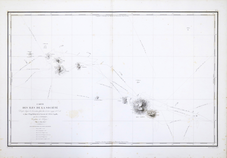
1827réf. LBW-4426[1827]. 500 x 361 mm.
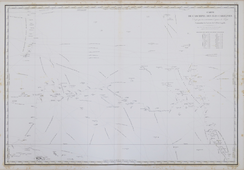
1827réf. LBW-4422[1827]. 470 x 739 mm.
1827réf. LBW-4425[1827]. 537 x 767 mm.
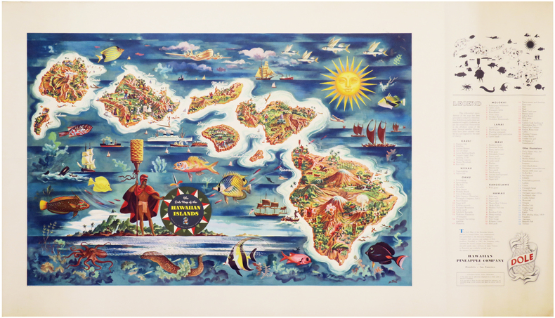
1950réf. LBW-7046Honolulu & San Francisco, Hawaiian Pineapple Company Limited, 1950. Lithographie en couleurs de 475 x 960 mm.
1825réf. 2452Paris, Anselin et Pochard, 1825. In-8 de VIII-63 pp., 1 tableau replié, demi-chagrin bleu, couverture imprimée et dos conservés (reliure moderne).
1858Carta geografica raffigurante le legazioni ecclesiastiche della regione, tratta dall’Orbe Cattolico di Girolamo Petri. L'Orbe Cattolico ossia Atlante Geografico Storico Ecclesiastico fu pubblicato a Roma in 3 volumi nel 1858-1859. Le mappe di grande formato sono finemente incise e ben colorate. È senza dubbio una delle opere più finemente incise ed eleganti della metà del XIX secolo. Ogni mappa mostra le varie diocesi, ognuna delle quali è contraddistinta da colori vivaci che ne segnano la sede, e altre città importanti. Sebbene le caratteristiche geografiche siano chiaramente espresse, le mappe sono volutamente piuttosto scarne di dettagli, in modo da non sminuire visivamente il loro scopo, che è quello di mostrare le divisioni ecclesiastiche. Nel creare l'atlante, Petri ha sottolineato di aver attinto solo alle "fonti più attendibili", comprese le mappe degli archivi vaticani e delle diocesi d'oltremare L'atlante fu pubblicato in un numero molto limitato di esemplari ad uso esclusivo dei cardinali e degli amministratori di alto rango, il che ne spiega la grande rarità odierna. Girolamo Petri (1806 - 1871) fu una figura importante nell'amministrazione della Chiesa cattolica romana durante il regno di Pio IX. Nacque a Onano (Viterbo, Lazio), figlio di un funzionario vaticano che in seguito divenne governatore di Frascati. Il lavoro di Petri fu svolto in un periodo in cui la Chiesa era sotto assedio in Europa, ma, al contrario, aveva grandi ambizioni di espansione all'estero, in particolare in Asia e in Africa. La metà del XIX secolo fu un periodo di grandi cambiamenti a Roma. L'atlante faceva senza dubbio parte degli ultimi sforzi del Vaticano per comprendere e controllare la sua vasta influenza in tutto il mondo, resuscitando il concetto popolare di province ecclesiastiche diffuso nelle opere di Nicolas Sanson e altri cartografi del XVII secolo. La Calcografia Nazionale (Istituto per la Grafica) conserva ancora 135 rami di questo rarissimo atlante. Incisione in rame, coloritura coeva, in ottimo stato di conservazione. Bibliografia Walter Goffart, Historical Atlases: The First Three Hundred Years, 1570-1870 (Chicago, 2003), p. 427-8; J.A.B. Jongeneel, Philosophy, Science, and Theology of Mission in the 19th and 20th Centuries: A Missiological Encyclopedia (1995), p. 264. A very rare map showing the dioceses of Catholic organization, taken from L'Orbe Cattolico by Girolamo Petri. L’Orbe Cattolico ossia Atlante Geografico Storico Ecclesiastico’ was published in Rome in 3 volumes in 1858-1859. The large-format maps are finely engraved and beautifully colored. The atlas is a testament to the artistry of the engravers and the relative indifference of the publisher to the commercial success of the work. It is without question one of the most finely engraved and elegant works of the mid-19th Century. Each map shows the various dioceses, which are each distinguished by their own bright colors, marking their seats, as well as other major towns. While key geographical features are expressed throughout, the maps are otherwise intentionally rather sparing of detail, so as not to visually detract from their purpose, which is the show the ecclesiastical divisions. In creating the atlas, Petri noted that he drew only upon the “most trusted sources”, including maps from the Vatican archives and overseas dioceses. The atlas was by far and away the finest ecclesiastical atlas created during the 19th Century, featuring exceptionally beautiful examples of thematic cartography. The uncommonly beautiful atlas was published in only a very small number of examples for the exclusive use of Cardinals and high-ranking administrators, accounting for the great rarity today. Petri who was commissioned by Pope Pius XI thus created during a time when the Church was under siege within Europe, but, conversely, while it had major ambitions for expansion overseas, particularly in Asia and Africa. The mid-19th Century was a period of dramatic change in Rome. The atlas was no doubt part of the Vatican's last-ditch efforts to understand and control its vast influence around the world, resurrecting the popular concept of ecclesiastical provinces popularized in works by Nicholas Sanson and others during the 17th Century. The Calcografia Nazionale still preserves 135 copperplates of this extremely rare atlas. Bibliografia Walter Goffart, Historical Atlases: The First Three Hundred Years, 1570-1870 (Chicago, 2003), p. 427-8; J.A.B. Jongeneel, Philosophy, Science, and Theology of Mission in the 19th and 20th Centuries: A Missiological Encyclopedia (1995), p. 264.
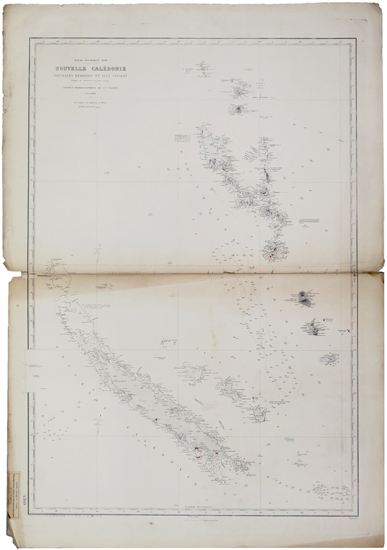
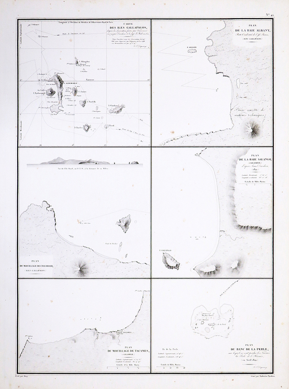
1888réf. LBW-6011Paris, Service Hydrographique de la Marine, 1888-1909. 943 x 654 mm.
18478vo [20.5 x 13 cm]; 2 volumes, xxiv, 288, 32 [publisher's ads dated April 1847]; xii, 278, [ii, ads] pp. original cloth with blind-stamped design on covers and spines, gilt lettering on spine, rear joint of volume I with crack but holding firm, light wear at spine ends and corners, covers a little faded, but a clean very good set. A picture of this book is a Sabin 17143. Howes C802. Cowan 145. Hill I, 70: 'The early materials on California and Melanesia are of importance'. A detailed and interesting account, with much on Pacific island life, the native peoples, the first chapter describes a whale chase. This copy has both the half title pages and the ads in each volume, often lacking.
18378vo [22.5 x 14.5 cm]; xii, 461 pp, 4 maps including foldout frontis map, music notation in text, tables. later red cloth, which is a little faded and stained, interior is clean and near fine with only light offsetting from maps, and a few corners bent, overall quite good. A picture of this book is available upon request by email. There is considerable detail on Singapore including the economy with tables of imports and exports and number of ships over three years, as well as details on government, politics, people. The author, noted for his linguistic abilities, describes the Dayak (Dyak) people, their customs, head-hunting, and the geography of the area. There are appendices on the commercial resources of the Indian Archipelago and observations on the unexplored parts of north and north-western Australia. Hill 411. National Maritime Museum 458 (their copy has only 3 maps).
1847small 8vo [17.5 x 12 cm]; xiii, 321 pp, map frontispiece, text illus. contemporary half calf, raised bands, decorated in gilt and blind, red title labels with gilt lettering, marbled boards, rubbed at edges, a very good copy, clean throughout. A picture of this book is available upon request by email. BAL 13655, with the 'P' at p. 209, as signature mark, showing top half only, no priority of states. The London edition preceeded the US edition by several weeks. Hill 196: "This work deals with Melville and his part in the mutiny aboard the Julia, called in this book, Lucy Ann. Melville then spent about three months wandering in various parts of Tahiti and Imeeo (Moorea) as a beachcomber and was able to make extensive observations on the social conditions of the natives. This work is also a true story." The author has been described as "the most important of all the great American writers" and later wrote Moby Dick. This is the author's second book.
1851Sm. 8vo., Second Edition, with lithographed portrait frontispiece (original tissue guard present), lithographed portrait of John Adams, lithographed plate of the landing beach and full-page illustration in the text, some minimal spotting on title; attractively bound in contemporary half calf, maroon pebble-grain cloth sides, expertly rebacked with old backstrip gilt laid down, backstrip with gilt ruled, second compartment with green leather label lettered in gilt, red sprinkled edges, terracotta endpapers, a remarkably bright, crisp, clean copy. With the record of shipping and list of of subscribers. This famous and invaluable account of the Bounty mutineers was published three times in the first year. The author, en route from New Zealand to the gold fields of California, was stranded at Pitcairn when his vessel was blown offshore. During his enforced stay he compiled an extensive account of the later events of the Bounty Mutiny, with a detailed list of Bounty descendants and a valuable record of vessels calling at the island. EXTREMELY SCARCE IN THIS CONDITION.
1875réf. 44494Washington D.C.: From the Press of The Henry E. Wilkens Printing Co. n. d. ca 1875. 1875. First edition. 3 3/8" x 6" pictorial wrappers 50 pp. including covers illustrated from photographs map. A train trip on the Washington Line of the Southern Pacific Company is described from Washington D. C. to California. Beginning in Washington D.C through North Carolina Alabama Louisiana Texas Arizona New Mexico southern California northern California and ending in Portland Oregon. Many interesting photographic views are shown including the Congressional Library the White House a cotton market in Alabama the French Market in New Orleans the Alamo New Mexican Indians protesting against their picture being taken views of Riverside California Los Angeles and much more. The centerfold is an interior diagram and vignettes of a tourist bedroom and sleeping car. Stamp of Alex S. Thweatt Eastern Passenger Agent Southern Railway 1185 Broadway New York on the inside front cover light wear to the spine else a near fine bright copy of one of the nicest booklets we have handled. From the Press of The Henry E. Wilkens Printing Co., n. d. (ca 1875). unknown
19578vo., First Edition thus, with 49 plates on 16, several maps and charts in the text and endpaper maps; handsomely bound in full dark green crushed morocco, sides with gilt frame border, back with raised bands, second and fourth compartments lettered and ruled in gilt, all other compartments tooled in gilt, gilt top, hand-made endpapers, ribbon marker, an elegant copy ideal as a gift or for presentation. The standard account from the Japanese perspective and a classic of WWII. One of the foremost figures in the IJNAF, Mitsuo Fuchida was strike force commander at Pearl Harbor. Unable to take part in operations at Midway due to a recent appendix operation he watched the action from the deck of the flagship, taking notes as events unfolded. Subsequently, he was one of the few Japanese naval officers permitted to study the reports of the battle and is therefore uniquely qualified to deliver this account. For the first US edition (published for USNI) the Japanese original was translated into English by Commander Chihaya and edited by Kawakami and Pineau; their text is repeated here. Importantly, the Japanese photographs (although of poorer quality) are retained, and supplemented by a small number of well-chosen USN pictures. SCARCE IN THIS CONDITION. Albion, p.297; Enser, p. 515.
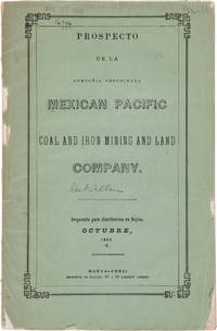
1856réf. 27974Nueva-York: Imprenta de Hallet 1856. Coal Mining in Mexico A Spanish-language prospectus for an American mining and land company on the Pacific coast of Mexico. Original printed wrappers. Rear wrapper detached spine mostly perished library blindstamp on front wrapper and withdrawal stamp on wrapper interior. Foxed. Good overall. SABIN 48572 note. unknown
1856réf. 27974Nueva-York: Imprenta de Hallet 1856. Coal Mining in Mexico A Spanish-language prospectus for an American mining and land company on the Pacific coast of Mexico. Original printed wrappers. Rear wrapper detached spine mostly perished library blindstamp on front wrapper and withdrawal stamp on wrapper interior. Foxed. Good overall. SABIN 48572 note. unknown books
1871réf. 66Boston; Nov. 1 1871. 1871 9 pp. folio. This indenture was made the first day of November 1871 between the Atlantic and Pacific Railroad Company and Oliver Ames and Charles F. Choate. The Atlantic and Pacific was to be built from Missouri and Arkansas to the Pacific Coast. From the very beginning the Atlantic and Pacific was plagued with problems even though they had the same rights as other transcontinental railroads regarding bonds land grants etc. Ames and Choate noted bankers of railroads and other various schemes were to loan to the railroad in gold coin. The amount is left blank in this document and the document is not signed by the parties. They were to be repaid in gold coin with an annual interest rate of 6%. In addition to the indenture listed above another indenture was made with George Bigeldow and James Dixwell. 2 pp. with manuscript corrections and additions. Including a provision to enable the Atlantic and Pacific to mortgage the road. This document was written earlier and does not have nearly as many provisions as in the Ames and Choate indenture. Four years later the Atlantic and Pacific would lapse into receivership. Oliver Ames then the largest stockholder purchased 96697 acres of the road's Missouri lands. After reorganization the A & P had some life until the panic of 1893 and the spoils were then divided between the Santa Fe and Frisco. These two documents are important in understanding the financial development of this railroad. Atlantic and Pacific material is quite scarce. Oliver Ames was the brother of Oakes. This railroad was to have been a very important development for Arkansas and Missouri. These documents are housed in a very attractive folding box 9 x 7 3/4 inches with green cloth-covered boards and a green morocco spine label with gilt lettering. 3214013 OG2080. 1st Edition. Hardcover. Very Good. Boston; Nov. 1, 1871. hardcover
réf. 56-0238San Francisco Calif.: Southern Pacific Company 1958. Map. Blueline print 31" x 142". Map from Bay Bridge to Hayward including Berkeley Emeryville Oakland San Leandro and Hayward. Index of Industries with approx. 1500 entries listed alphabetically. Scale 1" = 1000'. San Francisco, Calif.: Southern Pacific Company, 1958. unknown
réf. 58-0506San Francisco Calif.: Southern Pacific Company 1956 rev. 1958. Blueline print 30 inches x 112 inches. Pencilled note indicates "Richmond Switching Zones & Limits have been zoned as of Oct. 13 1960 on another industry map within file." From First Street and Linden Street to Giant and Sobrante station points. With Index to Industry listing approx 700 industries indexed alphabetically and by number to map location. Scale 1 inch = 1000 feet. San Francisco, Calif.: Southern Pacific Company, 1956, rev. 1958. unknown
réf. 56-0227San Francisco Calif.: Southern Pacific Company 1962. Map. Blueline print. 31 x 139 inches. Map from Bay Bridge to Hayward including Berkeley Emeryville Oakland San Leandro and Hayward. Index of Industries with approximately 1500 entries listed alphabetically. Scale: 1 inch = 1000 feet. San Francisco, Calif.: Southern Pacific Company, 1962. unknown
réf. 58-0505San Francisco Calif.: Southern Pacific Company 1956 rev. 1958. Blueline print 30 inches x 112 inches. From First Street and Linden Street to Giant and Sobrante station points. Colored pencilling indicates zones and districts. With Index to Industry listing approx 700 industries indexed alphabetically and by number to map location. Scale 1 inch = 1000 feet. San Francisco, Calif.: Southern Pacific Company, 1956, rev. 1958. unknown
réf. 56-0214Tucson Ariz.: Southern Pacific Company 1945 revised 1950. Map. Blueline print. 24 x 156 inches. Very detailed map of railroad yard and every lot in Phoenix along rail lines. Scale: 1 inch = 100 feet. Tucson, Ariz.: Southern Pacific Company, 1945, revised 1950. unknown
réf. 56-0219Tucson Ariz.: Southern Pacific Company 1947 revised 1950. Map. Blackline print. 24 x 164 inches. Very detailed map of West Phoenix from Ninth Avenue to Thirty-Fifth Avenue including names of plot owners and businesses. Scale: 1 inch = 100 feet. Tucson, Ariz.: Southern Pacific Company, 1947, revised 1950. unknown
réf. 56-0268San Francisco Calif.: Southern Pacific Company 1946. Map. Blueline print 24" x 220". Detailed map of Fresno along railroad lines from Roeding Park to Atchison Topeka and Santa Fe building at California Ave and Belgravia Ave. Scale 1" = 100'. San Francisco, Calif.: Southern Pacific Company, 1946. unknown
réf. 58-0479San Francisco Calif.: Southern Pacific Company 1959. Blueline print 24 inches x 9 feet. Three maps joined irregularly with red pencil indicating switching limits. From beyond Sacramento and Clear Creek to beyond City of Redding. With City of Redding station point Girvan. With Schedule of Property listing approx 50 transfers 1872 - 1959. Scale 1 inch = 400 feet. San Francisco, Calif.: Southern Pacific Company, 1959. unknown
réf. 4249Lettres adressées à son cousin le Marquis de Gravisi, de 1777 à 1779. "Ouvrage très curieux pour l'histoire pré-colombienne de l'Amérique" (Chadenat). Pour servir de suite aux mémoires de D. Ulloa. A Boston et Paris en 1788. 2 vol. in-8. Reliure d'époque en veau marbré. Dos orné avec pièces de titre et de tomaison. Carte dépliante dans le tome 1. Tranches rouges. Etat satisfaisant.