ROSS (John)Livre Rare Book

6.901 Ergebnisse
1835Best.-Nr. PHO-2498Paris, Baudry, 1835. In-8, (4)-VI-(2)-475 pp., frontispice gravé, une vue hors texte sous serpente et une grande carte dépliante in fine. Demi-basane glacée fauve de l'époque, pièce de titre au dos. Cois usés, plats détachés, réparations au dos, rousseurs. Illustré d'un frontispice, d'une vue et d'une grande carte repliée retraçant l'itinéraire de l'expédition.
Madrid, 1964. Ocho folletos en 4to. Facsímiles. Cubiertas originales.
1896Best.-Nr. LBW-2744London, Edward Stanford, [1896]. 539 x 308 mm.
1827Carta apparsa nella sesta parte, "Océanique", dell'Atlas universel de géographie physique, politique, statistique et minéralogique di Vandermaelen. L'atlante fu prodotto in un'unica edizione nel 1827; furono venduti solo 810 esemplari completi. Questa grande opera, che comprende circa 378 mappe uniche e che fu compilata nell'arco di tre anni, fu il primo atlante litografico e il primo a rappresentare il mondo con la stessa proiezione e in una scala uniforme. Philippe Marie Guillaume Vandermaelen è stato un cartografo fiammingo attivo a Bruxelles nella prima parte del XIX secolo. A Vandermaelen si deve uno dei più notevoli sviluppi dell'impresa privata nella cartografia, ovvero il suo straordinario Atlas Universel de Geographie in sei volumi. Vandermaelen, nato a Bruxelles il 23 dicembre 1795, viene considerato come il più grande cartografo belga dopo Mercatore e Ortelius. Figlio di un medico che era diventato un ricco produttore di sapone, muovendosi in un ambiente commerciale e da autodidatta, divenne un commerciante di prodotti chimici e farmaceutici. Fanatico di geografia, la sua carriera subisce una svolta definitiva quando, nel 1825, inizia a pubblicare un rivoluzionario Atlas universel che lo consacra come cartografo. Primo atlante al mondo a rappresentare la Terra su una scala unica ed eccezionalmente grande, l'Atlas universel offriva la rappresentazione più ampia, completa e precisa mai realizzata. I suoi contemporanei lo capirono, come la Chiesa cattolica romana, che era in una fase di espansione. Negli anni Trenta del XIX secolo, Roma sosteneva che questo atlante era assolutamente il miglior atlante disponibile, prezioso strumento della sua politica missionaria nell'Oceano Pacifico e nelle isole meridionali. Bibliografia Marguerite Silvestre, Philippe Vandermaelen, Mercator de la jeune Belgique, 2016. Map appeared in the sixth part, 'Océanique,' of Vandermaelen's Atlas universel de géographie physique, politique, statistique et minéralogique. The atlas was produced in one edition in 1827; only 810 complete sets were sold. This great work, featuring some 378 unique maps and compiled over three years, was the first lithograph atlas, and the first to render the world on the same projection and at a uniform scale. Philippe Marie Guillaume Vandermaelen (December 23, 1795 - May 29, 1869) was a Flemish cartographer active in Brussels during the first part of the 19th century. Vandermaelen is created with "one of the most remarkable developments of private enterprise in cartography," namely his remarkable six volume Atlas Universel de Geographie. No one could have foreseen that Philippe Vandermaelen, born in Brussels on 23 December 1795, would become the greatest Belgian cartographer since Mercator and Ortelius. Son of a doctor who had become a wealthy soap maker, moving in a business environment and self-taught, he became a dealer of chemical and pharmaceutical products. As a geography fanatic, there was a definitive shift in his career when, in 1825, he began to publish a revolutionary Atlas universel which established him as a cartographer. As the first atlas in the world to represent the Earth on a single and exceptionally large scale, the Atlas universel offered the widest, most complete and most precise representation ever achieved. His contemporaries understood this, such as the Roman Catholic Church, which was in a phase of expansion. In the 1830s, Rome claimed that this atlas was “the best atlas available” and was the instrument of its missionary policy in the Pacific Ocean and the southern islands. Litograph, with original outline colour, very good condition. Bibliografia Marguerite Silvestre, Philippe Vandermaelen, Mercator de la jeune Belgique, 2016.
1827Carta apparsa nella sesta parte, "Océanique", dell'Atlas universel de géographie physique, politique, statistique et minéralogique di Vandermaelen. L'atlante fu prodotto in un'unica edizione nel 1827; furono venduti solo 810 esemplari completi. Questa grande opera, che comprende circa 378 mappe uniche e che fu compilata nell'arco di tre anni, fu il primo atlante litografico e il primo a rappresentare il mondo con la stessa proiezione e in una scala uniforme. Philippe Marie Guillaume Vandermaelen è stato un cartografo fiammingo attivo a Bruxelles nella prima parte del XIX secolo. A Vandermaelen si deve uno dei più notevoli sviluppi dell'impresa privata nella cartografia, ovvero il suo straordinario Atlas Universel de Geographie in sei volumi. Vandermaelen, nato a Bruxelles il 23 dicembre 1795, viene considerato come il più grande cartografo belga dopo Mercatore e Ortelius. Figlio di un medico che era diventato un ricco produttore di sapone, muovendosi in un ambiente commerciale e da autodidatta, divenne un commerciante di prodotti chimici e farmaceutici. Fanatico di geografia, la sua carriera subisce una svolta definitiva quando, nel 1825, inizia a pubblicare un rivoluzionario Atlas universel che lo consacra come cartografo. Primo atlante al mondo a rappresentare la Terra su una scala unica ed eccezionalmente grande, l'Atlas universel offriva la rappresentazione più ampia, completa e precisa mai realizzata. I suoi contemporanei lo capirono, come la Chiesa cattolica romana, che era in una fase di espansione. Negli anni Trenta del XIX secolo, Roma sosteneva che questo atlante era assolutamente il miglior atlante disponibile, prezioso strumento della sua politica missionaria nell'Oceano Pacifico e nelle isole meridionali. Bibliografia Marguerite Silvestre, Philippe Vandermaelen, Mercator de la jeune Belgique, 2016. Map appeared in the sixth part, 'Océanique,' of Vandermaelen's Atlas universel de géographie physique, politique, statistique et minéralogique. The atlas was produced in one edition in 1827; only 810 complete sets were sold. This great work, featuring some 378 unique maps and compiled over three years, was the first lithograph atlas, and the first to render the world on the same projection and at a uniform scale. Philippe Marie Guillaume Vandermaelen (December 23, 1795 - May 29, 1869) was a Flemish cartographer active in Brussels during the first part of the 19th century. Vandermaelen is created with "one of the most remarkable developments of private enterprise in cartography," namely his remarkable six volume Atlas Universel de Geographie. No one could have foreseen that Philippe Vandermaelen, born in Brussels on 23 December 1795, would become the greatest Belgian cartographer since Mercator and Ortelius. Son of a doctor who had become a wealthy soap maker, moving in a business environment and self-taught, he became a dealer of chemical and pharmaceutical products. As a geography fanatic, there was a definitive shift in his career when, in 1825, he began to publish a revolutionary Atlas universel which established him as a cartographer. As the first atlas in the world to represent the Earth on a single and exceptionally large scale, the Atlas universel offered the widest, most complete and most precise representation ever achieved. His contemporaries understood this, such as the Roman Catholic Church, which was in a phase of expansion. In the 1830s, Rome claimed that this atlas was “the best atlas available” and was the instrument of its missionary policy in the Pacific Ocean and the southern islands. Litograph, with original outline colour, very good condition. Bibliografia Marguerite Silvestre, Philippe Vandermaelen, Mercator de la jeune Belgique, 2016.
1827Carta apparsa nella sesta parte, "Océanique", dell'Atlas universel de géographie physique, politique, statistique et minéralogique di Vandermaelen. L'atlante fu prodotto in un'unica edizione nel 1827; furono venduti solo 810 esemplari completi. Questa grande opera, che comprende circa 378 mappe uniche e che fu compilata nell'arco di tre anni, fu il primo atlante litografico e il primo a rappresentare il mondo con la stessa proiezione e in una scala uniforme. Philippe Marie Guillaume Vandermaelen è stato un cartografo fiammingo attivo a Bruxelles nella prima parte del XIX secolo. A Vandermaelen si deve uno dei più notevoli sviluppi dell'impresa privata nella cartografia, ovvero il suo straordinario Atlas Universel de Geographie in sei volumi. Vandermaelen, nato a Bruxelles il 23 dicembre 1795, viene considerato come il più grande cartografo belga dopo Mercatore e Ortelius. Figlio di un medico che era diventato un ricco produttore di sapone, muovendosi in un ambiente commerciale e da autodidatta, divenne un commerciante di prodotti chimici e farmaceutici. Fanatico di geografia, la sua carriera subisce una svolta definitiva quando, nel 1825, inizia a pubblicare un rivoluzionario Atlas universel che lo consacra come cartografo. Primo atlante al mondo a rappresentare la Terra su una scala unica ed eccezionalmente grande, l'Atlas universel offriva la rappresentazione più ampia, completa e precisa mai realizzata. I suoi contemporanei lo capirono, come la Chiesa cattolica romana, che era in una fase di espansione. Negli anni Trenta del XIX secolo, Roma sosteneva che questo atlante era assolutamente il miglior atlante disponibile, prezioso strumento della sua politica missionaria nell'Oceano Pacifico e nelle isole meridionali. Bibliografia Marguerite Silvestre, Philippe Vandermaelen, Mercator de la jeune Belgique, 2016. Map appeared in the sixth part, 'Océanique,' of Vandermaelen's Atlas universel de géographie physique, politique, statistique et minéralogique. The atlas was produced in one edition in 1827; only 810 complete sets were sold. This great work, featuring some 378 unique maps and compiled over three years, was the first lithograph atlas, and the first to render the world on the same projection and at a uniform scale. Philippe Marie Guillaume Vandermaelen (December 23, 1795 - May 29, 1869) was a Flemish cartographer active in Brussels during the first part of the 19th century. Vandermaelen is created with "one of the most remarkable developments of private enterprise in cartography," namely his remarkable six volume Atlas Universel de Geographie. No one could have foreseen that Philippe Vandermaelen, born in Brussels on 23 December 1795, would become the greatest Belgian cartographer since Mercator and Ortelius. Son of a doctor who had become a wealthy soap maker, moving in a business environment and self-taught, he became a dealer of chemical and pharmaceutical products. As a geography fanatic, there was a definitive shift in his career when, in 1825, he began to publish a revolutionary Atlas universel which established him as a cartographer. As the first atlas in the world to represent the Earth on a single and exceptionally large scale, the Atlas universel offered the widest, most complete and most precise representation ever achieved. His contemporaries understood this, such as the Roman Catholic Church, which was in a phase of expansion. In the 1830s, Rome claimed that this atlas was “the best atlas available” and was the instrument of its missionary policy in the Pacific Ocean and the southern islands. Litograph, with original outline colour, very good condition. Bibliografia Marguerite Silvestre, Philippe Vandermaelen, Mercator de la jeune Belgique, 2016.
1827Carta apparsa nella sesta parte, "Océanique", dell'Atlas universel de géographie physique, politique, statistique et minéralogique di Vandermaelen. L'atlante fu prodotto in un'unica edizione nel 1827; furono venduti solo 810 esemplari completi. Questa grande opera, che comprende circa 378 mappe uniche e che fu compilata nell'arco di tre anni, fu il primo atlante litografico e il primo a rappresentare il mondo con la stessa proiezione e in una scala uniforme. Philippe Marie Guillaume Vandermaelen è stato un cartografo fiammingo attivo a Bruxelles nella prima parte del XIX secolo. A Vandermaelen si deve uno dei più notevoli sviluppi dell'impresa privata nella cartografia, ovvero il suo straordinario Atlas Universel de Geographie in sei volumi. Vandermaelen, nato a Bruxelles il 23 dicembre 1795, viene considerato come il più grande cartografo belga dopo Mercatore e Ortelius. Figlio di un medico che era diventato un ricco produttore di sapone, muovendosi in un ambiente commerciale e da autodidatta, divenne un commerciante di prodotti chimici e farmaceutici. Fanatico di geografia, la sua carriera subisce una svolta definitiva quando, nel 1825, inizia a pubblicare un rivoluzionario Atlas universel che lo consacra come cartografo. Primo atlante al mondo a rappresentare la Terra su una scala unica ed eccezionalmente grande, l'Atlas universel offriva la rappresentazione più ampia, completa e precisa mai realizzata. I suoi contemporanei lo capirono, come la Chiesa cattolica romana, che era in una fase di espansione. Negli anni Trenta del XIX secolo, Roma sosteneva che questo atlante era assolutamente il miglior atlante disponibile, prezioso strumento della sua politica missionaria nell'Oceano Pacifico e nelle isole meridionali. Bibliografia Marguerite Silvestre, Philippe Vandermaelen, Mercator de la jeune Belgique, 2016. Map appeared in the sixth part, 'Océanique,' of Vandermaelen's Atlas universel de géographie physique, politique, statistique et minéralogique. The atlas was produced in one edition in 1827; only 810 complete sets were sold. This great work, featuring some 378 unique maps and compiled over three years, was the first lithograph atlas, and the first to render the world on the same projection and at a uniform scale. Philippe Marie Guillaume Vandermaelen (December 23, 1795 - May 29, 1869) was a Flemish cartographer active in Brussels during the first part of the 19th century. Vandermaelen is created with "one of the most remarkable developments of private enterprise in cartography," namely his remarkable six volume Atlas Universel de Geographie. No one could have foreseen that Philippe Vandermaelen, born in Brussels on 23 December 1795, would become the greatest Belgian cartographer since Mercator and Ortelius. Son of a doctor who had become a wealthy soap maker, moving in a business environment and self-taught, he became a dealer of chemical and pharmaceutical products. As a geography fanatic, there was a definitive shift in his career when, in 1825, he began to publish a revolutionary Atlas universel which established him as a cartographer. As the first atlas in the world to represent the Earth on a single and exceptionally large scale, the Atlas universel offered the widest, most complete and most precise representation ever achieved. His contemporaries understood this, such as the Roman Catholic Church, which was in a phase of expansion. In the 1830s, Rome claimed that this atlas was “the best atlas available” and was the instrument of its missionary policy in the Pacific Ocean and the southern islands. Litograph, with original outline colour, very good condition. Bibliografia Marguerite Silvestre, Philippe Vandermaelen, Mercator de la jeune Belgique, 2016.
1845Best.-Nr. 1309560London, J. Murray, 1845. 10, 482 S., 32 S. Anzeigen, 1 lithograph. Faltkarte (69 x 49 cm) in Kartentasche im Hinterdeckel). OLwd m. goldgeprägtem Rückentitel (Rücken verblichen, Vorderdeckel bleichfleckig, innen gering gebräunt).
1988Best.-Nr. EW433361988-1990 Three volumes (complete). 290, 260, [1], 267 p., 122, 95, 71 figures, 3 maps, paperbound. Library stamps, else very good set of this out of print title.
1948Best.-Nr. 020830Indianapolis IN: USA: The Bobbs-Merrill Company 1948. First Edition so stated. Very minor wear else about fine in dust jacket worn at folds large piece out at rear smaller piece at spine foot chipped along edges not price clipped $2.50 price intact most of the front of jacket is still bright and now in protective mylar cover. Very scarce. The second Beau Smith; Pogy Rogers title Nevada. First Edition. Hardcover. Near Fine/Good-Very Good. Book. The Bobbs-Merrill Company
Best.-Nr. 9211199913.Gpaperback. Good. Access codes and supplements are not guaranteed with used items. May be an ex-library book. paperback
2015Best.-Nr. 2-889912163XCavinato 2015. Paperback. New. Italian language. 8.19x5.91x0.87 inches. Cavinato paperback
1888Best.-Nr. ZB579853Washington: 1888. Price HAS BEEN REDUCED by 10% until Monday Oct. 26 weekend SALE item 88 pp. 3 large folding maps; issued as 50th Congress 1st Session SED 254; concerns indemnity lands in Washington Territory; text browned maps very good slight extraction roughness at left margin self wrappers. - If you are reading this this item is actually physically in our stock and ready for shipment once ordered. We are not bookjackers. Buyer is responsible for any additional duties taxes or fees required by recipient's country. Photos available upon request. Washington: unknown
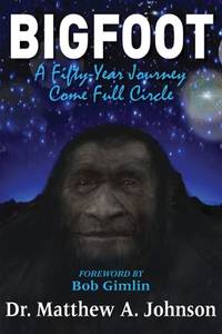
2017Best.-Nr. 5004071Anchorage: Publication Consultants 2017. 1st printing in wrappers. Soft cover. Near Fine. 1st printing. Pictorial glossy trade wraps. 440pp. Foreword by Bob Gimlin. A rather remarkable account of the author's research on sasquatch from his research sites in Oregon. The author is a licensed clinical psychologist. Near fine just a tiny bit of curling to the cover front corners hardly worth of mentioning because there are folks who want absolutely perfect copies of books. We are a real bookseller not a "ghost" seller with cheaper copies that have so many caveats you can't see straight and they won't examine their copies to give you exact details. Publication Consultants unknown
1997Best.-Nr. 294038PN. New. 1997. Soft Cover. Date is original print. This is a reprint edition . PN paperback
1999Best.-Nr. 1315768PN. New. 1999. Soft Cover. Date is original print. This is a reprint edition . PN paperback
1999Best.-Nr. 1315767PN. New. 1999. Soft Cover. Date is original print. This is a reprint edition . PN paperback
2001Best.-Nr. 1331566PN. New. 2001. Soft Cover. Date is original print. This is a reprint edition . PN paperback
1998Best.-Nr. 1307631PN. New. 1998. Soft Cover. Date is original print. This is a reprint edition . PN paperback
1996Best.-Nr. 288038PN. New. 1996. Soft Cover. Date is original print. This is a reprint edition . PN paperback
1998Best.-Nr. 1311564PN. New. 1998. Soft Cover. Date is original print. This is a reprint edition . PN paperback
1998Best.-Nr. 1311562PN. New. 1998. Soft Cover. Date is original print. This is a reprint edition . PN paperback
1998Best.-Nr. 1311563PN. New. 1998. Soft Cover. Date is original print. This is a reprint edition . PN paperback
1946Best.-Nr. 73-521BGPO 1946. 1946. 286p. Folding maps. Light blue cloth. Oversize. Spine lettering faint. Hinges cracked. Very Good copy. Hardback. Very Good. Book. GPO, 1946.
Best.-Nr. DADAX0387952462New unknown