Williams, Francis EdgarAntiquariat.de
6.368 Ergebnisse
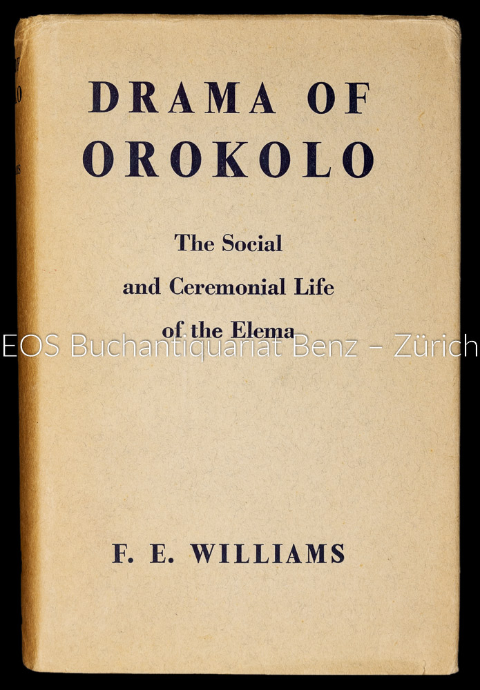
1940Best.-Nr. 30946ABOxford, Clarendon Pewaa, 1940. XXIV, 464 Seiten, 62 Blatt. zahlreiche Illustrationen, graphische Darstellungen und Karten. Leinenband mit geprägter Rückenbeschriftung. Mit Schutzumschlag. + Wichtig: Für unsere Kunden in der EU erfolgt der Versand alle 14 Tage verzollt ab Deutschland / Postbank-Konto in Deutschland vorhanden +, A|B
1913Roy. 8vo., First Edition, with numerous illustrations; original dark green cloth, gilt back, gilt top, bevelled boards, covers very lightly age-marked, corners lightly bruised, some mild cockling (mainly at margins) else a good, clean copy. EXTREMELY SCARCE
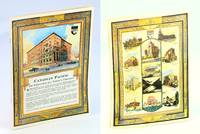
1927Best.-Nr. 132974Canadian Pacific Railway 1927. Softcover. very good. 8pp. Quarto. Green card stock with original painting and manuscript lettering on front wrapper. 5 more tempera and india ink paintings and border decorations. Wear to spine and slight wear to corners. Slight paint transfer from images to opposite pages and first painting has some smudging in top corner. very good A dummy brochure consisting of 6 paintings: one train one CPR logo and 4 decorative borders that would later include text or photo illustrations. Possibly intended to contain information on Western Canada due to the pine tree and mountain imagery. Front cover illustration is signed by Glidden Second image signed WC27. The only original manuscript template for a CPR brochure we have ever encountered. The front illustration is beautifully done and with internal illustrations having an art deco feel. We are unsure if the finished product was ever published. 1927 Canadian Pacific Railway paperback
1997Best.-Nr. __3110147920De Gruyter 1997. Hardcover. New. reprint 2011 ed. edition. 431 pages. 9.75x7.25x1.00 inches. De Gruyter hardcover
19478vo., Second Australian Edition, with a frontispiece, 16 plates on 11 and a double map in red on blue stock; handsomely bound in red full morocco, backs gilt with five raised bands, second and fourth compartments lettered and ruled in gilt, all other compartments tooled and ruled in gilt, a most attractive copy ideal as a gift or for presentation. With small blind stamp on title. Daisy Bates's classic work was first published by Murray in 1938; with a first Australian edition following in 1944.
1897Manuscript Signed Letter, dated 21 January 1897, discussing matters pertaining to the settlement era of Perth, Western Australia. 8vo. Two double-leafs, 5 pages. Very good condition. Fascinating content such as a poverty, drought, general health issues in Perth from the conditions, problems of the homeless, and in contrast the increase in land values, and prospects for youngsters, The writer also talks of the Music Society and of singing the Messiah at Christmas. Written by M. Barigh of Havelock Street, her home located on a hill above the central town, who may have been a relative of Richard Henry Barigh, an immigrant to Australia, possibly originally as a convict. Excerpts from the letter: "Lately we have had a water famine and all day long the water is cut off but we fill a tank and so it does not cause us much inconvenience... We do not like W.A. half so much as N.Z. it is too hot and dry and this town is not healthy." "The place must have grown half since we came and building is going on all the time and the values of property increasing - our land cost about four pounds a foot and a lady has just bought this piece adjoining ours and given over eleven pounds for it and thinks she has got it cheap." "There are scores of people here with nothing who a little while since in Melbourne were living in luxury." End Excerpts. Perth had only been established since 1829. In 1850, Western Australia was opened to convicts at the request of farming and business people looking for cheap labour. Queen Victoria announced the city status of Perth in 1856.
1886Boards with light rubbing to extremities. A very handsome, tight and clean copy. ; A systematic description of many (if not all) islands, in the South Pacific, Caribbean, Indian Ocean and beyond. Many of which, especially the smaller ones, have very few mentionings in other literature. 93 b&w illustrations, including many full page illustrations. Bold decorative boards in green with gilt spine lettering. Pictorial design and lettering in gilt and black. ; 8vo 8" - 9" tall; 698 pages
1946Best.-Nr. 69-890BGPO 1946. 1946. 2 vols. 286p. 286p. Folding maps. Light blue cloth. Oversize. Ex.lib. No external markings. Not worn. Spine lettering faint. Near Fine copy. Hardcover. Near Fine. Book. GPO, 1946. Hardcover
19458vo [22 x 15 cm]; 4 volumes, xv, 599; xvi, 739; xvii, 741; xvi, 526 pp, 550 illustrations and plates from photos, 677 other illustrations from drwgs, maps including 2 large folding maps in pockets, diagrams, tables, index in each volume. original blue cloth with gilt title lettering on spines & front covers, spines faded but lettering clean, stain on endpapers, a little paper rippling but a very good clean copy with excellent maps in pockets, printer has excised some blank pages at end. A Bookplate of Philip Snow on endpapers. Day p. 160. A massive and comprehensive compilation covering all parts of the Pacific and its islands in great detail, very well-illustrated with photos and drawings, including geography, topography, peoples, natural history, resources, administration, climate, etc. Volume I has a hundred page history of the Pacific and a bibliography up to World War II. A superb reference with a high reputation for accuracy and impartiality. The versos of each title has the cancel, 'this volume was produced and printed for official purposes during the war 1939/45'.
1906Best.-Nr. MISS021Echo OR: UMATILLA RIVER WATER USERS' ASSOCIATION 1906. First Edition. Soft cover. Near Fine. Original printing. Stapled printed wraps. Very very scarce booklet describing the Hermiston Water Rights Association. Tall light green wrappers. 59pp. Contains a few ads. For some context beginning of page 44 reads Hermiston is the central point of the Umatilla Irrigation Project by the United States Government." Printed inside the front cover is list of seven U. S. Reclamation engineers. On verso of front leaf is list of officers of the association. Facing page list of "What Irrigation Does." After several pages of the description of the area are the by-laws of the association and articles of incorporation pps 17-35 and following that various promotional material of local communities. Near fine condition. Front cover slightly pulled from spine of text block. Rare with only 2 copies appearing on World Cat. UMATILLA RIVER WATER USERS' ASSOCIATION unknown
1862Best.-Nr. 97509London, Longman, Green, Longman, and Roberts 1862 In-8 20 x 12,5 cm. Cartonnage éditeur pleine percaline verte, fer doré sur le premier plat, plats encadrés de grecques noires, XXIII-423 pp., une carte repliée de l’archipel des Hawaii, 5 gravures hors-texte, table des matières. Exemplaire de travail d’un ouvrage peu courant. En l’état.
2012Best.-Nr. DADAX0759121257AltaMira Press 2012-05-03. hardcover. New. 7.22x1.05x10.42. Buy with confidence. Excellent Customer Service & Return policy. AltaMira Press hardcover
18918vo., First Edition thus, with folding coloured map as frontispiece, 4 coloured plates and 8 woodcut illustrations in the text; original red cloth, upper board blocked in blind, gilt back, expertly rebacked with old backstrip laid down, a very good, bright, clean copy. Published as no. 64 in the series 'Scott Library', with 18pp publisher's catalogue bound in at end. The first of the two editions edited by Williams, following those of Bonney (1889) and Judd (1890). VERY SCARCE, ESPECIALLY IN THIS CONDITION. Freeman 91.
1910Best.-Nr. 302511Pacific Electric Railway ca. 1910. 1910. Original photograph depicting 43 passengers men and women dressed in coats and hats at the Echo Mountain Terminal 3200 feet above sea level with printed descriptive information on the mount with pictorial green borders. 4 11/16" x 7 1/2" image on stiff 6 1/16" x 9" pictorial folder. No Binding. Fine. Pacific Electric Railway [ca. 1910]. unknown
1910Best.-Nr. 302511Pacific Electric Railway ca. 1910. 1910. Original photograph depicting 43 passengers men and women dressed in coats and hats at the Echo Mountain Terminal 3200 feet above sea level with printed descriptive information on the mount with pictorial green borders. 4 11/16" x 7 1/2" image on stiff 6 1/16" x 9" pictorial folder. No Binding. Fine. Pacific Electric Railway [ca. 1910]. unknown books
1930Best.-Nr. 652j1093Canada: Canadian Pacific - Hotel Department. Good. 1930. First Edition. Paperback. A glorious memento of Winnipeg's famed Royal Alexandra Hotel once the social centre of the city. "Designed for the Canadian Pacific Railway by Montreal architects Edward and William Maxwell and built by contractor Alexander A. Woodward in 1906 the 'Royal Alex' was considered one of the finest hotels in western Canada. It closed its doors in 1967 and was torn down in 1971." - Manitoba Historical Society Archives. Undated but cover illustration includes a horse-drawn wagon suggesting a printing date circa 1930 or prior. A half-page black and white aerial photo of the hotel shows it environs at the north-east corner of Higgins Avenue and Main with Canadian Pacific railway station adjoining. Beneath this photo Winnipeg's winter climate is described as having a 'crisp tingling cold that sets eyes asparkle and sends the blood racing.' Includes very detailed information about the hotel's many amenities and capacities plus four pages of floor plans. A one-page map of the city vividly reveals the subsequent growth of the city. Includes black and white photos of the Gold Room Ball Room Vice-Regal Suite Lobby Dining Room and Library. 12 stapled pages including color-illustrated covers. 11" x 8". A fabulouse piece of Winnipeg ephemera.; Sm 4to . Canadian Pacific - Hotel Department paperback
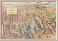
Best.-Nr. 6276Glendale CA: Gerald A. Eddy; Union Pacific Railroad 1958. Folding color process map 22" x 31" 18 panels of illus. and text on verso folded size 7.5" x 5.25". A striking post-WWII panoramic map of the Southwest including portions of Nevada and Arizona as well as California's Death Valley and Utah's Zion Bryce and Cedar Breaks areas depicting the vast region accessible via the Union Pacific Railroad including its mountains cliffs washes plateaus mines Hoover and other dams Nellis Air Force Base the Atomic Energy Commission testing grounds Indian reservations Valley of Fire state park numerous national parks forests and monuments the Colorado River supplying Lake Mead and Boulder City and Las Vegas with street grids showing hotel locations. The map ranges from the Grand Canyon in the East to Death Valley and the Yucca Flats in the West; and from Boulder City in the south to Salt Lake City in the North. The Union Pacific Railroad lines are delineated in red; elevations are indicated for mountains and terrain within state and national parks; and bodies of water show depths and state boundaries. Promotional text and colorful illustrations of Las Vegas appear on the verso. An engineering marvel Hoover Dam and Lake Mead became a tourist attraction during the post-war boom. The project opened up the west for development providing water from the once-wild Colorado River to the arid Southwest leading to the expansion of such major cities as Los Angeles Las Vegas and Phoenix as well as the growth of railroad lines national recreational areas and military installations. CONDITION: Good blue ink routes discreetly traced on Rt. 95 and Rt 89. Glendale, CA: Gerald A. Eddy; Union Pacific Railroad, 1958 unknown
Best.-Nr. 6276Glendale CA: Gerald A. Eddy; Union Pacific Railroad 1958. Folding color process map 22" x 31" 18 panels of illus. and text on verso folded size 7.5" x 5.25". A striking post-WWII panoramic map of the Southwest including portions of Nevada and Arizona as well as California's Death Valley and Utah's Zion Bryce and Cedar Breaks areas depicting the vast region accessible via the Union Pacific Railroad including its mountains cliffs washes plateaus mines Hoover and other dams Nellis Air Force Base the Atomic Energy Commission testing grounds Indian reservations Valley of Fire state park numerous national parks forests and monuments the Colorado River supplying Lake Mead and Boulder City and Las Vegas with street grids showing hotel locations. The map ranges from the Grand Canyon in the East to Death Valley and the Yucca Flats in the West; and from Boulder City in the south to Salt Lake City in the North. The Union Pacific Railroad lines are delineated in red; elevations are indicated for mountains and terrain within state and national parks; and bodies of water show depths and state boundaries. Promotional text and colorful illustrations of Las Vegas appear on the verso. An engineering marvel Hoover Dam and Lake Mead became a tourist attraction during the post-war boom. The project opened up the west for development providing water from the once-wild Colorado River to the arid Southwest leading to the expansion of such major cities as Los Angeles Las Vegas and Phoenix as well as the growth of railroad lines national recreational areas and military installations. CONDITION: Good blue ink routes discreetly traced on Rt. 95 and Rt 89. Glendale, CA: Gerald A. Eddy; Union Pacific Railroad, 1958 unknown books
1889Best.-Nr. 33137St. Louis: Press of Woodward & Tiernan Printing Co. 1889. 1889. MISSOURI. First edition. 12mo. 7 1/2" x 5 1/4" printed wrappers 110 2 pp. engraved illustrations folding map advertisements. A detailed report of Missouri done county by county and discussing such subjects as location physical features and soil agriculture wheat corn grasses and pasturage stock raising and dairying wool growing mines and minerals coal iron lead zinc copper granite and other minerals fruit raising available lands for sale exemption and taxation laws timber lands manufacturing adaptability education and schools hunting and fishing labor wages and taxation etc. A discussion of each county is provided along with vital statistics pertaining to cattle hogs sheep et al county by county. The folding map of Missouri is in fine condition. Inked number "1889" on front cover else a very good clean tight copy. Press of Woodward & Tiernan Printing Co., 1889]. unknown
1856Best.-Nr. DEMO015982IWashington: Beverly Tucker 1856-7. First & Quarto edition. Hardcover. Fair. chromolithographs. 4to original sheep lacks t-pg. Ex libris U.S. House of Representatives. Comprised of 5 reports by John Grubb Parke Albert Henry Campbell Thomas Antisell John Torrey Andrew Atkinson Humphreys. "This widely known work requires no comment - Cowan CALIFORNIA p.512." Illustrated with chromolithographs. Beverly Tucker hardcover
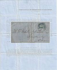
1857Best.-Nr. 010681New York 1857. Envelope or Cover. Very good. This printed circular is titled “Transfer Office of the Southern Pacific Rail-Road Company / No. 54 Wall-Street / New York May 30 1857.” It is addressed to W. P. Mehville Wilne Esq. of Sandusky Ohio and franked with an imperforate Franklin stamp Scott #9 canceled by a black circular New York postmark. In nice shape with a tiny bit of soiling to the edges. The notice reads in part: “An installment of fifty cents a share will become due and payable on the three percent. Stock held by you in the Company on the first Monday of July next. . . Stock on which said instalment shall not be paid will be sold at auction in conformity with . . . the Charter. . . “About sixteen miles of our ‘Road’ are now graded and nearly furnished with cross-ties – twenty-four hundred and seventy-eight tons of rail-road iron have been bought and paid for and sent up Red River – sufficient to finish twenty-five miles of road.” . The Southern Pacific Rail-Road referenced in this document is not the much more famous transcontinental route. This railroad was founded on 16 February 1852 officially as the Vicksburg and El Paso Railroad although throughout the document it was referred to as the Texas Western Railroad. It was later bought by the Atlantic and Pacific Railroad for $600000. It was later acquired by Texas interests and its named officially changed to the Southern Pacific Railroad the predecessor of the Texas and Pacific Railway. It was never associated with the later and more famous transcontinental Southern Pacific. During 1857 the railroad laid 23 miles of track between Marshall and Swanson’s Landing on Caddo Creek. During the Civil War the line was connected to Shreveport Louisiana. In 1872 it was sold to the Texas Pacific Railroad Company which in 1976 merged with the Missouri Pacific Railroad. For more information see Werner’s “History of the Texas Western Railroad Companies” and “History of the Texas and Pacific Railway Company” both at the Texas State Historical Association website. Scarce. At the time of listing no other documents from this Southern Pacific Railroad are for sale in the trade. Although no other 1857 circulars documenting the construction of the first 16 miles of its track have been sold at auction other materials related to it have. OCLC shows no materials related to this Southern Pacific Railroad are held by institutions however it is possible there may some within the Texas & Pacific Railway Collection at the University of North Texas. . unknown
Best.-Nr. 56-0298Alameda County Calif.: County Surveyor 193 unfinished date. Map. Blueline print 37.5" x 39" with switching limits in red pencil. From Mento St and Dorchester Ave to Kent/Laurel Ave and Lake Chabot. Includes Rancho San Leandro Eden City lower portion of Brooklyn Township. Scale 1" = 500'. Alameda County, Calif.: County Surveyor 193? (unfinished date). unknown
Best.-Nr. 56-0435Fresno Calif.: Progressive Map Service n.d. Blueline print 38" x 26" with red and black pencilling indicating track lines switching limits. From Marks Avenue to Willow Avenue and Annadale Avenue to Barstow Avenue. Includes City Directory street index approx 400 listings. Scale approx 1" = 1700'. Fresno, Calif.: Progressive Map Service, [n.d.] unknown
Best.-Nr. 56-0436Fresno Calif.: Progressive Map Service Southern Pacific notations approved 1942. Blueline print 38" x 26" with red and blue pencil on map attached typewritten and handwritten memorandum indicating proposed extension. Marks Avenue to Willow Avenue and Annadale Avenue to Barstow Avenue. Includes City Directory street index approx 400 listings. Scale approx 1" = 1700'. Fresno, Calif.: Progressive Map Service, Southern Pacific notations approved 1942. unknown
Best.-Nr. 56-0348San Francisco Calif.: Southern Pacific Company 1922 revised 1931. Map. Blueprint 24" x 36". From West Avenue to Oak Street and D Street to beyond Standard Oil Co. Inclues Index to Industries with approx 60 listings. Scale 1" = 400'. San Francisco, Calif.: Southern Pacific Company, 1922, revised 1931. unknown