PACIFICBiblio.com
6355 risultati
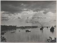
rif. PC71Thirteen unmounted gelatin silver prints ca. 155x205 cm 6x8 in. All with pencil titles in English on versos. This interesting collection of photos of New South Wales includes views of the Sydney Harbour taken from the deck of HMS “Powerful” Circular Quay taken from RMS “Orontes” two images of Bondi Beach and three rare views of the Parramatta River taken on a day of the famous scull boat race between George Towns and Jim Stanbury one of two races between them either in 1905 or in 1906. The photos show the Parramatta river full of canoes paddle boats and “steamers going up to the starting point” as well as “the Parramatta River after the finish of the Stanbury-Towns boat race the boats hurrying back to town.” The other images show the Hacking River taken from the Moombara district Port Hacking southern Sydney Jamberoo village on the Illawarra South Coast of New South Wales; Nowra Bridge over the Shoalhaven River built in 1881 and the Bomaderry Creek near Nowra South Coast. The last view shows the harbour of Hobart with HMS “Challenger” on the right taken from the deck of RMS “Orontes.” “George Towns was the Australian Single Sculls World Champion from 1901 to 1905 and 1906 to 1907. He was the last of the seven Australian World Sculling Champion who between them held the title almost uninterrupted from 1876 to 1909” Wikipedia. His two races with another famous Australian sculler James Stanbury 1868-1945 took place on 22 July 1905 and 28 July 1906. “Stanbury was a tough proposition as he had been World Champion from 1891 to 1896 and had held off several challenges before losing to Gaudaur. The race was agreed to be run on 22 July 1905 on the Parramatta with a stake of £500 a side. The water was smooth and the weather was fine with just a light breeze. Again large crowds were on hand to witness what was expected to one of the great sculling contests. At the start Stanbury at once went to the front and by Uhr’s Point was a length and a half ahead. Towns then spurted but could make no impression on the leader. For every effort Towns made Stanbury responded and he crossed the line by two lengths in a time of 19m.47s. Often when one sculler was beaten by another he was offered a return match to have the chance to get even – or go two down. Stanbury offered Towns and they had another Championship race on the same course almost a year later on 28 July 1906. After the start Towns took an early lead but was soon overhauled by Stanbury who then continued to widen the gap until he was two lengths ahead but at Cabarita he started to show signs of distress. It was evident that his right shoulder was troubling him and about which rumours had been circulating. He had to slow down considerably and Towns then managed to catch up. Stanbury’s shoulder finally gave out and from there on the race was a procession. Towns won by about twenty lengths in a time of 19m.53s. This was Stanbury’s final Championship race; he had raced in seven and won five” Wikipedia. unknown
rif. 56-0260Stockton Calif.: Southern Pacific Company 1922 revised 1935. Map. Blueprint 24" x 36." From Bear River to Creegan. With Key to Industry with 52 listings including Union Oil Co Merced Growers' Packing Assoc. Scale 1" = 400'. Stockton, Calif.: Southern Pacific Company, 1922, revised 1935. unknown
rif. 56-0287San Francisco Calif.: Southern Pacific Company 1938 revised 1944. Map. Blueline print 24" x 56" From WP crossing to Luther. Includes Monarch Match Co Levin Machinery and Salvage Co California Concrete Products Co. Scale 1" = 100'. San Francisco, Calif.: Southern Pacific Company, 1938, revised 1944. unknown
rif. 56-0437San Francisco Calif.: Southern Pacific Company 1920 rev. 1949. Blueline print 24" x 56". From Belmost Avenue to Cedar Street and E Street to Tulare Avenue. Includes PG&E Co Grant Pacific Rock Co Producers & Growers Market of Central California West Compress Co Sun Maid Raisin Growers Association. Scale approx 1" = 400'. San Francisco, Calif.: Southern Pacific Company, 1920, rev. 1949. unknown
rif. 56-0259Stockton Calif.: Southern Pacific Company 1922 revised 1945. Map. Blueline print 24" x 36." From Bear River to Creegan. Includes Key to Industry approx. 80 listings. Scale 1" = 400'. Stockton, Calif.: Southern Pacific Company, 1922, revised 1945. unknown
rif. 56-0296San Francisco Calif.: Southern Pacific Company 1920 revised 1924. Map. Blueline print 24" x 55". From Morris St to McLellan Ave and Valbrick. Includes Southern Pacific Yard Guadalupe Creek Washington Square Shell Oil Co. With Index to Industries with approx. 65 entries. Scale 1" = 400'. San Francisco, Calif.: Southern Pacific Company, 1920, revised 1924. unknown
rif. 56-0254San Francisco Calif.: Southern Pacific Company 1947. Map. Blueline print 23" x 35" with red pencilling. Includes index of approx. 120 industries. Includes Barium Products Co E.D.J. Lying Warehouse Pacific Fruit Express Tri-Valley Packing U.S. Army. Scale 1" = 600'. San Francisco, Calif.: Southern Pacific Company, 1947. unknown
rif. 56-0461San Francisco Calif.: Southern Pacific Company 1929 rev. 1937. Blueline print 24" x 36". From Kettleman Lane to Mokelumne River and Cherokee Lane to Grant Avenue. With Index to Industries listing 59 entries referenced to map by number. Includes American Fruit Growers United Packing Compnay Main Street. Scale 1" = 400'. San Francisco, Calif.: Southern Pacific Company, 1929, rev. 1937. unknown
rif. 56-0334San Francisco Calif.: Southern Pacific Company 1926 revised 1930. Map. Blueline print 23" x 36" with extensive multicolor pencilling indicating zones and yard limits. Two 12" tears and two smaller no missing material. "See Revised Map" written in large letters across side. From French Camp to Calaveras River and Sinclair Ave to Pacific. Includes Index to Industries wiith 122 listings. Scale approx. 1" = 1200'. With 8.5" x 11" switching charges sheet attached. San Francisco, Calif.: Southern Pacific Company, 1926, revised 1930. unknown
rif. 56-0429San Francisco Calif.: Southern Pacific Company 1925 rev. 1949. Blueline print 24" x 56". From meeting of Franklin canal and Rio Grande to approx 1 1/2 miles east of city limits and from Juarez border to Arizona Street Tularosa Street. WIth Index to Industries approx 175 entries indexed to map by number. Scale 1" = 600'. San Francisco, Calif.: Southern Pacific Company, 1925, rev. 1949. unknown
rif. 58-0504San Francisco Calif.: Southern Pacific Company 1927 rev. 1943. Blueline print 24 inches x 55 inches. Colored pencilling indicates zones. From San Pablo Bay to Page Street Ferry Point to 52nd Street. With San Pablo Richmond Stege Bates Proposed Richmond Inner Harbor. With Index to Industries approx 135 entries. Scale 1 inch = 1000 feet. Typewritten listing of switching zones and zone milage affixed. San Francisco, Calif.: Southern Pacific Company, 1927, rev. 1943. unknown
rif. 56-0218Tucson Ariz.: Southern Pacific Company 1950. Map. Blueline print. 24 x 56 inches. With list and map of approximately 300 Phoenix industries. Scale: 1 inch = 500 feet. Tucson, Ariz.: Southern Pacific Company, 1950. unknown
rif. 56-0323San Francisco Calif.: Southern Pacific Company 1926 revised. 1937. Map. Blueline print 24" x 36" with 3" tear no missing material. From French Camp to Calveras River and Pacific Ave to Sinclair Ave. With Stockton Channel State Hospital Grounds College of Pacific. Includes Index to Industry with 180 listings. Scale approx. 1" = 1200'. San Francisco, Calif.: Southern Pacific Company, 1926, revised. 1937. unknown
rif. 56-0346San Francisco Calif.: Southern Pacific Company 1954. Map. Blueline print 22" x 77". From Casa Grande Road to Davis - Monthan Air Force Base. Includes city of Tucson station points Petrie Tucson P.F.E. Yard Wilmot. Scale 1" = 1000'. San Francisco, Calif.: Southern Pacific Company, 1954. unknown
rif. 56-0333San Francisco Calif.: Southern Pacific Company 1926. Map. Blueline print 23" x 36" with extensive multicolor pencilling indicating zones and yard limits. Two tears ears along entire length joined together with no longer adhering tape no missing material. From French Camp to Calaveras River and Sinclair Ave to Pacific. Includes Index to Industries wiith 107 listings. Scale approx. 1" = 1200'. San Francisco, Calif.: Southern Pacific Company, 1926. unknown
rif. 56-0211Tucson Ariz.: Southern Pacific Company 1925. Map. Blueline print. 24 x 55 inches. Red mauve and yellow highlighting. With extensive list of Phoenix industries. Scale: 1 inch = 500 feet. Tucson, Ariz.: Southern Pacific Company, 1925. unknown
rif. 56-0399San Francisco Calif.: Southern Pacific Company 1932 rev. 1938. Blueline print 18" x 34". From Saco Oil Junction Oil City to beyond Edison and Magunden. Includes Seguro Maltha Oil City Nome Bakersfield Bakersfield Corrals Algoso Magunden Edison SFRD Icing Plant. Scale 1" = 1500'. San Francisco, Calif.: Southern Pacific Company, 1932, rev. 1938. unknown
rif. 56-0350San Francisco Calif.: Southern Pacific Company 1926 revised 1936. Map. Blueline print 24" x 55". From East Avenue to Wright Subdivision and Third Avenue to Race Street. Includes Dania track and Highway Subdivision Union Paving Company Shell Company of California Peerless Milling Company. Scale 1" = 100'. San Francisco, Calif.: Southern Pacific Company, 1926, revised 1936. unknown
rif. 56-0353San Francisco Calif.: Southern Pacific Company 1921 revised 1930. Map. Blueprint 24" x 59". From Flora Street to beyond Mill Creek. Includes Southern California Edison Co Material Yard for County of Tulare original townsite Brown's Addition Drouillard's Addition Spaulding Lumber Co. Scale 1" = 100'. San Francisco, Calif.: Southern Pacific Company, 1921, revised 1930. unknown
rif. 56-0451Sacramento Calif.: Southern Pacific Company 1937 Rev. 1938. Blueline print 24" x 56". From 1000' south on railroad tracks from station point Hilt to 1000' west of Log Pond. Includes lumber shed planing mill warehouses boom house blacksmith and machine shop. Scale 1" = 100'. Sacramento, Calif.: Southern Pacific Company, 1937, Rev. 1938. unknown
rif. 56-0261Sacramento Calif.: Southern Pacific Company 1920. Revised 1930. Map. Blueprint 32" x 96." From Bear River to Creegan. With First St through Eighteenth St with Ranges A B C and D. Train lines and Western Union lines indicated. Scale 1" = 100'. Sacramento, Calif.: Southern Pacific Company, 1920. Revised 1930. unknown
rif. 56-0416San Francisco Calif.: Southern Pacific Company 1924. Blueprint 24" x 56" with yellow and brown pencilling indicating leases. From beyond little Chico Creek and Dayton Avenue to beyond big Chico creek with block numbers of buildings on three blocks each side along railroad tracks Rancho Arroyo Chico. Scale 1" = 100'. San Francisco, Calif.: Southern Pacific Company, 1924. unknown
rif. 56-0415San Francisco Calif.: Southern Pacific Company 1947 rev. 1961. Blueline print 24" x 56" with red ink indicating Interchange track. From Hammond Lumber Co Railroad switch on Western line Simpson land east to railroad intersection with county road. Includes mill. Scale 1" = 400'. San Francisco, Calif.: Southern Pacific Company, 1947, rev. 1961. unknown
rif. 56-0229San Francisco Calif.: Southern Pacific Company 1931 revised 1939. Map. Blueline print. 25 x 48 inches. With red pencilling. Map of Oakland Railroad Yard and Vicinity from Oakland Pier to Estudillo. Includes Air Force Intransit Depot Parr Terminal Wholesale Co. Melrose Station. Scale: 1 inch = 1500 feet. San Francisco, Calif.: Southern Pacific Company, 1931, revised 1939. unknown
rif. 56-0216Tucson Ariz.: Southern Pacific Company 1944. Map. Blueline print. 32 x 48 inches. Includes passenger station railroad yard switches. Scale: 1 inch = 400 feet. Tucson, Ariz.: Southern Pacific Company, 1944. unknown


