5789 risultati
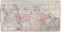
1868rif. 58056Washington: Government Printing Office 1868. With Johnson's Great Map of the Northern Pacific Route This copy is inscribed on the front wrapper: "With Regards of James Tilton C.E." Tilton 1819–78 was then chief engineer of the Washington Division of the Northern Pacific Railroad. Thanks in part to his support for Franklin Pierce's presidential campaign Tilton was appointed the first Surveyor General of Washington Territory and served from 1853-61. Both the Tilton River and Fort Tilton near Fall City Washington are named for him. An important report to Congress by the Northern Pacific Railroad headed by Minnesota railroad magnate James J. Hill for federal aid to support the Railroad's expansion to the West Coast. The petition reviews the railroad's original charter printing with it a memorial from the NPRR's Board of Directors and supporting communications from military figures including Montgomery Meigs and Ulysses S. Grant. Since the early 1850s Edwin Johnson described by Wheat as a "visionary" engineer had been associated with the plan to build a railroad across the northern part of the United States from the Great Lakes to the Pacific Coast. In 1867 he was named chief engineer of the Northern Pacific and this memorial is a work of major importance for the history of the railroad. It includes Johnson's topographical survey of the route to the Pacific a discussion of potential problems that may be encountered and a detailed economic and military survey of the area in justification of construction. The exceptional large folding "Map of the Country from Lake Superior to the Pacific Ocean from the Latest Explorations and Surveys" was produced by the Colton firm in New York. One of the finest maps of the region to date it shows the area from Detroit to the Pacific well into Canada and south to about the 39th parallel. Johnson has drawn the route of the Northern Pacific from Lake Superior to Washington Territory where the line splits with one branch heading toward Fort Vancouver and the other to Puget Sound. Among the details shown on the map are the Pony Express route wagon routes and overland mail routes exploration routes and other proposed railroad routes the locations of Indian tribes mineral deposits military forts and much more. Wheat gives a long description of the map and remarks that "the detail of such a map defies cataloging." Construction on the Northern Pacific Railroad began in 1870 and was completed in 1883. Edwin Johnson did not see its completion dying in 1872. An edition of this report with the supporting documents and map was also privately published in Hartford. A significant early account of railroad expansion in the Northwest. We could find only ten copies listed in OCLC and this is the first copy we have seen in wrappers and with a presentation from an important engineer on the project. Original printed wrappers. Presentation inscription on front wrapper see below. Wrapper edges chipped minor soiling and tanning to wrappers spine partially chipped old vertical fold to pamphlet. Light foxing and tanning and occasional soiling throughout Map with a few small closed tears at cross-folds with no loss. About very good. RAILWAY ECONOMICS pp.242-43. SABIN 55819 Hartford edition. WHEAT TRANSMISSISSIPPI V item 1169 pp.205-09. PHILLIPS MAPS p.916. DECKER 37:266 Hartford ed. MIDLAND NOTES 68:164. OCLC 60578657. unknown
1868rif. 58056Washington: Government Printing Office 1868. With Johnson's Great Map of the Northern Pacific Route This copy is inscribed on the front wrapper: "With Regards of James Tilton C.E." Tilton 1819–78 was then chief engineer of the Washington Division of the Northern Pacific Railroad. Thanks in part to his support for Franklin Pierce's presidential campaign Tilton was appointed the first Surveyor General of Washington Territory and served from 1853-61. Both the Tilton River and Fort Tilton near Fall City Washington are named for him. An important report to Congress by the Northern Pacific Railroad headed by Minnesota railroad magnate James J. Hill for federal aid to support the Railroad's expansion to the West Coast. The petition reviews the railroad's original charter printing with it a memorial from the NPRR's Board of Directors and supporting communications from military figures including Montgomery Meigs and Ulysses S. Grant. Since the early 1850s Edwin Johnson described by Wheat as a "visionary" engineer had been associated with the plan to build a railroad across the northern part of the United States from the Great Lakes to the Pacific Coast. In 1867 he was named chief engineer of the Northern Pacific and this memorial is a work of major importance for the history of the railroad. It includes Johnson's topographical survey of the route to the Pacific a discussion of potential problems that may be encountered and a detailed economic and military survey of the area in justification of construction. The exceptional large folding "Map of the Country from Lake Superior to the Pacific Ocean from the Latest Explorations and Surveys" was produced by the Colton firm in New York. One of the finest maps of the region to date it shows the area from Detroit to the Pacific well into Canada and south to about the 39th parallel. Johnson has drawn the route of the Northern Pacific from Lake Superior to Washington Territory where the line splits with one branch heading toward Fort Vancouver and the other to Puget Sound. Among the details shown on the map are the Pony Express route wagon routes and overland mail routes exploration routes and other proposed railroad routes the locations of Indian tribes mineral deposits military forts and much more. Wheat gives a long description of the map and remarks that "the detail of such a map defies cataloging." Construction on the Northern Pacific Railroad began in 1870 and was completed in 1883. Edwin Johnson did not see its completion dying in 1872. An edition of this report with the supporting documents and map was also privately published in Hartford. A significant early account of railroad expansion in the Northwest. We could find only ten copies listed in OCLC and this is the first copy we have seen in wrappers and with a presentation from an important engineer on the project. Original printed wrappers. Presentation inscription on front wrapper see below. Wrapper edges chipped minor soiling and tanning to wrappers spine partially chipped old vertical fold to pamphlet. Light foxing and tanning and occasional soiling throughout Map with a few small closed tears at cross-folds with no loss. About very good. RAILWAY ECONOMICS pp.242-43. SABIN 55819 Hartford edition. WHEAT TRANSMISSISSIPPI V item 1169 pp.205-09. PHILLIPS MAPS p.916. DECKER 37:266 Hartford ed. MIDLAND NOTES 68:164. OCLC 60578657. unknown books
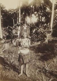
rif. PF4Oblong Folio album ca. 27 x 33 cm or 10 ½ x 13 in. 24 card stock leaves. With 138 original gelatin silver photos mostly ca. 8 x 12 cm 3 x 4 ¾ in. With 17 printed postcards ca. 9x13 cm 3 ½ x 5 in; all mounted in windows. All postcards withprinted captions on the margins. Some of the photos are captioned in German on versos. Period green full cloth album; red gilt-tooled ornamental border and generic title in German on the front board. Binding slightly rubbed on extremities several images previously removed from the album a few photos mildy faded but overall a very good album. A historically interesting extensive collection of original gelatin silver vernacular photos and printed postcards taken and collected by a German traveller to the colonies of German New Guinea and German Samoa in the early 20th century before both were occupied by Australia and New Zealand during WW1. The album opens with twenty-one photos and seven printed postcards dating back to the compiler’s voyage to the South Pacific through the Dutch East Indies modern-day Indonesia showing streets and waterfront of Makassar Sulawesi volcanoes and settlements of Banda Islands Banda Neira Banda Api Banda Papenberg peak the ocean steamer which transported the travelling party anchored in harbours the steamer crew and native Indonesians on board the steamer &c. Over forty photos and five postcards show the views and people of German New Guinea - mostly of the Bismarck Archipelago modern-day Islands Region of Papua New Guinea: native children and families from “Matupi” and “Neu Pommern Bismarck Archipel” views of Ralum and Herbertshöhe Kokopo “Landschaft bei Nusa” harbours with the travellers’ steamship cutter boats and native outrigger canoes villages and palm groves a large communal building in construction portraits of Papuan farmers members of local militia people wearing traditional costumes decorations and headdresses Papuan men listening to a gramophone on board the steamer a native couple captioned “Gruss aus dem Bismarck Archipel” on the mount &c. Very interesting are over sixty original photos and a printed postcard of German Samoa. About seventeen photographs document a public ceremony of hoisting a German Imperial flag at an open space likely in the colonial capital Apia with government officials colonial troops and a crowd of spectators. Two scenes with colonial residents feature Wilhelm Solf the first Governor of German Samoa in office: 1900-1911 wearing a white uniform and peaked cap. Two photos portray an elderly Samoan chief - most likely Mata’afa Josefo ca. 1832-1912 a Paramount Chief of German Samoa posing with a colonial resident in front of a German Imperial flag. There is also a view of the wreck of SMS “Adler” in Apia harbour which was destroyed alongside several German and U.S. warships during the 1889 Apia cyclone. Other photos show Samoan rivers coastal views portraits of Samoans in traditional costumes families children German residents &c. The printed postcard is a view of “Samoa Inseln – Apia nach Süden zu.” The album also contains several printed postcards and original photos of Fiji showing “A peep of Suva” “Fijian canoe” “Village scene – Fiji” “Attacked” “Cannibal feast – Fiji” portraits of native warriors and young women &c. Overall an historically interesting extensive collection of original gelatin silver amateur photos documenting life in German New Guinea and German Samoa in the early 20th century. hardcover
1945rif. 61-1310US Army Dec. 1945 1945. Parts 1-6 in Three massive volumes. Recent black cloth binding with gilt spine lettering. Offset printing. Evidence of Yamashita's war crimes. 382 exhibits. Photos. Illustrations. Maps. Facsimilies of documents. Very heavy set. Near Fine Set. 1st. Hardcover. Near Fine. US Army, Dec. 1945 hardcover
17894to [30.5 x 23.5 cm]; xxix, [ii, errata, directions leaf], 360, 47 pp, 22 plates and maps including 6 folding maps and charts, tables, with the half title page (often lacking). contemporary leather backed marbled boards, gilt spine title lettering, joints rubbed, corners worn round, some light staining to about 5 plates at rear, mostly marginal, generally clean and unmarked, very good, a tall copy with wide margins. A picture of Two ships, the King George commanded by Portlock and the Queen Charlotte, commanded by George Dixon, visited the Falkland Islands, made a long stay at Hawaii, then proceeded to survey the American coast, to more accurately map the coast and to establish a British presence in the region's fur trade. National Maritime Museum 140: 'Dixon discovered Queen Charlotte Island, named after his ship'. Buck 35. Sabin 20364. Howes D365. Wickershaam 6574. Lada-Mocarski 43. Hill 352: 'This expedition set out to establish a trade in furs in North America. Dixon visited Hawaii three times in the course of the voyage. . .discovered Queen Charlotte Islands, Port Mulgrave, Norfolk Bay, Dixon Entrance and Archipelago while continuing down the coast and trading with the Indians.. . . Dixon's contribution to the work also includes the valuable maps. The accounts of this expedition relate to the geography, ethnology, and natural history of the American coast from Nootka Sound northward'. The fine plates including many views, birds, portrait, etc. One of the detailed appendices is on the natural history encountered. Dixon had earlier sailed with Cook on the Resolution
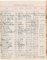
1519rif. 57522Various places mostly Sand Point Id. and Victor Mt. 1915-1938. Preaching in Montana and Idaho During War and Peace Two volumes of an unidentified pastor's register for a variety of locations in Idaho Montana and Washington beginning during the First World War and continuing throughout the entire interwar period. In it the unnamed pastor records his sermons the dates and locations they were given their titles the number of people in the congregation and frequently supplies notes about the service weather or other local events. In addition he has recorded extensive lists of baptisms marriages new church members and funerals throughout the entire period providing valuable demographic and genealogical information. On the rear pastedown of the earlier volume the writer has provided a brief history of his service: he began his ministry in 1893 and spent several years preaching in Alabama before moving to a variety of churches across the country including in Tennessee New York and Texas. The registers begin with a new appointment in Sand Point Idaho in November of 1915. During this period of worldwide tension and struggle the pastor's early entries often allude to the political situation at home or the ongoing war. On November 5 1916 - the day of the 1916 Presidential Election - the topic of his sermon appropriately enough is "Presidents." On December 28th of that year he notes that "Soldiers came home." Since the United States had yet to join in World War I this perhaps refers to new trainees inducted as part of the National Defense Act of 1916 which significantly increased the size of the Army and National Guard. The next year America had joined the war and supplies at home were scarce in the face of international pressures and German submarine patrols. In this environment a sermon was delivered on October 14 1917 titled "Food Conservation." In 1918 he notes a guest lecture by a "Mr. Krikorian" which proved to be "a splendid meeting on the Armenian situation. Collection $409.45." That year saw the beginning of several years of armed conflict between Armenia and Azerbaijan exacerbated by meddling from the Soviets Ottomans and the British. Things didn't improve quickly for Sand Point as September of 1918 saw the first hometown death - a "Memorial service for W.D. Martin - Killed in France. First of Co. A to fall." His loss was dearly felt by his community as evidenced by a turnout of 225: much greater than the average congregation of fifty to eighty for that church. We unfortunately are not privy to the speech our record keeper would have made around Armistice Day November 11 1918; he was unable to preach for six weeks due to catching the Spanish Flu. The pandemic was keenly felt even in Idaho where annotations over the next several months note that the "flu scare is on." His topical lectures for the period end on April 13 1919 with an entry titled "Lecture on the League of Nations." Besides making note of current events in his sermons the preacher at times uses these registers as a journal. Particularly after moving to a new position serving Victor and Stevensville Montana in 1921 he struggles to reckon with the frigid temperatures and seems to have developed an interest in sports often noting local baseball and basketball games. One day in particular his sermon was not well attended because he assumes "many at ball game." Aside from taking notice of "much sickness" during the 1923 measles outbreak current events feature less in the remainder of the register. The Depression doesn't seem to have been strongly felt in his leg of Montana - or at least it is not much reflected in the register except perhaps for slightly decreased congregations in 1930 and 1931 which quickly recovered to record numbers or a 1933 sermon on "Hunger & Thirst." A guest lecturer "Reverend Adams of China" also delivered a speech on that country in 1933 but it is unclear whether or not that was related to the ongoing Uighur uprising or simply a description for a Western audience. The final entry is for a sermon given on Thanksgiving of 1938. An extensive and detailed record of a pastor's work throughout World War I and the entire interwar period augmented by a remarkable wealth of detail on local baptisms funerals and marriages in Idaho and Montana. Quarto. Original three-quarter leather and pebbled black cloth gilt. Leather rubbed both spines perished boards detached and most leaves of first volume loose hinges of second volume cracked but holding. Internally clean and unmarked. The bindings only fair but internally near fine. hardcover
1519rif. 57522Various places mostly Sand Point Id. and Victor Mt. 1915-1938. Preaching in Montana and Idaho During War and Peace Two volumes of an unidentified pastor's register for a variety of locations in Idaho Montana and Washington beginning during the First World War and continuing throughout the entire interwar period. In it the unnamed pastor records his sermons the dates and locations they were given their titles the number of people in the congregation and frequently supplies notes about the service weather or other local events. In addition he has recorded extensive lists of baptisms marriages new church members and funerals throughout the entire period providing valuable demographic and genealogical information. On the rear pastedown of the earlier volume the writer has provided a brief history of his service: he began his ministry in 1893 and spent several years preaching in Alabama before moving to a variety of churches across the country including in Tennessee New York and Texas. The registers begin with a new appointment in Sand Point Idaho in November of 1915. During this period of worldwide tension and struggle the pastor's early entries often allude to the political situation at home or the ongoing war. On November 5 1916 - the day of the 1916 Presidential Election - the topic of his sermon appropriately enough is "Presidents." On December 28th of that year he notes that "Soldiers came home." Since the United States had yet to join in World War I this perhaps refers to new trainees inducted as part of the National Defense Act of 1916 which significantly increased the size of the Army and National Guard. The next year America had joined the war and supplies at home were scarce in the face of international pressures and German submarine patrols. In this environment a sermon was delivered on October 14 1917 titled "Food Conservation." In 1918 he notes a guest lecture by a "Mr. Krikorian" which proved to be "a splendid meeting on the Armenian situation. Collection $409.45." That year saw the beginning of several years of armed conflict between Armenia and Azerbaijan exacerbated by meddling from the Soviets Ottomans and the British. Things didn't improve quickly for Sand Point as September of 1918 saw the first hometown death - a "Memorial service for W.D. Martin - Killed in France. First of Co. A to fall." His loss was dearly felt by his community as evidenced by a turnout of 225: much greater than the average congregation of fifty to eighty for that church. We unfortunately are not privy to the speech our record keeper would have made around Armistice Day November 11 1918; he was unable to preach for six weeks due to catching the Spanish Flu. The pandemic was keenly felt even in Idaho where annotations over the next several months note that the "flu scare is on." His topical lectures for the period end on April 13 1919 with an entry titled "Lecture on the League of Nations." Besides making note of current events in his sermons the preacher at times uses these registers as a journal. Particularly after moving to a new position serving Victor and Stevensville Montana in 1921 he struggles to reckon with the frigid temperatures and seems to have developed an interest in sports often noting local baseball and basketball games. One day in particular his sermon was not well attended because he assumes "many at ball game." Aside from taking notice of "much sickness" during the 1923 measles outbreak current events feature less in the remainder of the register. The Depression doesn't seem to have been strongly felt in his leg of Montana - or at least it is not much reflected in the register except perhaps for slightly decreased congregations in 1930 and 1931 which quickly recovered to record numbers or a 1933 sermon on "Hunger & Thirst." A guest lecturer "Reverend Adams of China" also delivered a speech on that country in 1933 but it is unclear whether or not that was related to the ongoing Uighur uprising or simply a description for a Western audience. The final entry is for a sermon given on Thanksgiving of 1938. An extensive and detailed record of a pastor's work throughout World War I and the entire interwar period augmented by a remarkable wealth of detail on local baptisms funerals and marriages in Idaho and Montana. Quarto. Original three-quarter leather and pebbled black cloth gilt. Leather rubbed both spines perished boards detached and most leaves of first volume loose hinges of second volume cracked but holding. Internally clean and unmarked. The bindings only fair but internally near fine. hardcover books
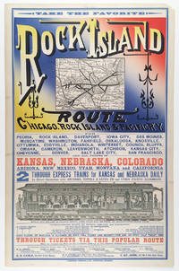
rif. 5510Chicago: Cameron Amberg & Co. Printers ca. 1880. Illustrated chromolithographic broadside with map 21.25” x 13.125” plus margins inset map measuring 4.5” x 5.875” illus. measuring 3.25” x 12.5”. CONDITION: Very good margin chipped at upper right corner a few minor stains. A rare and striking broadside issued by the Chicago Rock Island & Pacific Railway advertising the Rock Island through-express route and promoting the railroad’s numerous destinations connections and amenities. Featuring the eye-catching mix of typefaces and colors that characterized railroad advertising in this era this attractive broadside promotes the numerous midwestern stops and destinations accessible via the Chicago Rock Island & Pacific R’y. At this time two through-express trains for Kansas and Nebraska ran daily in connection with the Atchison Topeka & Santa Fe and Union Pacific railroads. As noted here meals were served in palace dining cars for seventy-five cents each and 150 pounds of baggage were allowed on each full ticket and seventy-five pounds on each half ticket free. The line’s various destinations included Iowa City Council Bluffs Denver Salt Lake City and San Francisco as well as “all points in Kansas Nebraska Colorado Arizona New Mexico Utah Montana and California.” Showing the Rock Island R.R. in bold the inset map spans from Chicago and Lake Michigan in the east to Omaha and Council Bluffs in the west and reaches from St. Paul in the north to St. Louis and Kansas City in the south—with Lake Michigan lying in the upper-right corner. One axis of the line extends from Milwaukee and Racine Wisconsin to Leavenworth Kansas and another stretches from Chicago to Omaha. Various spurs connect to both. The lower section of the broadside features a marvelously detailed illustration of the interior of a palace dining car showing numerous fashionably dressed passengers seated and dining among African American waiters who are shown in the small kitchen and serving food. In the far-right end of the train men are depicted in drawing rooms—reading newspapers and smoking—and various railway operators and ticket-men appear at the ends of the car. Also included is a table of connections with various railroads that could be made in “Union depots.” Through-tickets via this route could be found on sale at all coupon offices in the U.S. and Canada. Those seeking additional information folders maps and times-tables are encouraged to contact any of the ten agents and managers of the Rock Island R.R. listed at the bottom who were based in New York Toronto Philadelphia Chicago etc. Established in 1847 as the Rock Island & LaSalle R.R. the company was reincorporated in 1851 as the Chicago & Rock Island R.R. Co.—its rails during this period reaching to Morris Illinois and later Ottawa. After acquiring the Mississippi & Missouri R.R. in 1866 the company was renamed Chicago Rock Island & Pacific R.R. Co. Expanding between 1873 and 1882 the company built more branch lines that reached into Iowa as well as Kansas City. In 1880 the firm was reorganized under the name Chicago Rock Island and Pacific R’y Co. and by 1883 extended nearly to the southern boundary of Kansas. After Congress granted passage across Indian Territory in 1887 the Rock Island R.R. began developing through Texas to Galveston as well as New Mexico Territory. During the 1920s the railroad enjoyed considerable success. In 1926 the company began constructing a freight line between Amarillo Texas and Liberal Kansas which was finished in 1929 and served to make accessible a country of rich grain. While the railroad industry continued fairly steadily through 1930 between 1931 and 1935 the Depression took a toll on the Rock Island R.R. and went into decline. The company ceased operation in 1980. OCLC records just one copy held at Yale. REFERENCES: “Chicago Rock Island and Pacific Railway Records” at Kansas Historical Society online. Chicago: Cameron, Amberg & Co., Printers, [ca. 1880] unknown
rif. 5510Chicago: Cameron Amberg & Co. Printers ca. 1880. Illustrated chromolithographic broadside with map 21.25” x 13.125” plus margins inset map measuring 4.5” x 5.875” illus. measuring 3.25” x 12.5”. CONDITION: Very good margin chipped at upper right corner a few minor stains. A rare and striking broadside issued by the Chicago Rock Island & Pacific Railway advertising the Rock Island through-express route and promoting the railroad’s numerous destinations connections and amenities. Featuring the eye-catching mix of typefaces and colors that characterized railroad advertising in this era this attractive broadside promotes the numerous midwestern stops and destinations accessible via the Chicago Rock Island & Pacific R’y. At this time two through-express trains for Kansas and Nebraska ran daily in connection with the Atchison Topeka & Santa Fe and Union Pacific railroads. As noted here meals were served in palace dining cars for seventy-five cents each and 150 pounds of baggage were allowed on each full ticket and seventy-five pounds on each half ticket free. The line’s various destinations included Iowa City Council Bluffs Denver Salt Lake City and San Francisco as well as “all points in Kansas Nebraska Colorado Arizona New Mexico Utah Montana and California.” Showing the Rock Island R.R. in bold the inset map spans from Chicago and Lake Michigan in the east to Omaha and Council Bluffs in the west and reaches from St. Paul in the north to St. Louis and Kansas City in the south—with Lake Michigan lying in the upper-right corner. One axis of the line extends from Milwaukee and Racine Wisconsin to Leavenworth Kansas and another stretches from Chicago to Omaha. Various spurs connect to both. The lower section of the broadside features a marvelously detailed illustration of the interior of a palace dining car showing numerous fashionably dressed passengers seated and dining among African American waiters who are shown in the small kitchen and serving food. In the far-right end of the train men are depicted in drawing rooms—reading newspapers and smoking—and various railway operators and ticket-men appear at the ends of the car. Also included is a table of connections with various railroads that could be made in “Union depots.” Through-tickets via this route could be found on sale at all coupon offices in the U.S. and Canada. Those seeking additional information folders maps and times-tables are encouraged to contact any of the ten agents and managers of the Rock Island R.R. listed at the bottom who were based in New York Toronto Philadelphia Chicago etc. Established in 1847 as the Rock Island & LaSalle R.R. the company was reincorporated in 1851 as the Chicago & Rock Island R.R. Co.—its rails during this period reaching to Morris Illinois and later Ottawa. After acquiring the Mississippi & Missouri R.R. in 1866 the company was renamed Chicago Rock Island & Pacific R.R. Co. Expanding between 1873 and 1882 the company built more branch lines that reached into Iowa as well as Kansas City. In 1880 the firm was reorganized under the name Chicago Rock Island and Pacific R’y Co. and by 1883 extended nearly to the southern boundary of Kansas. After Congress granted passage across Indian Territory in 1887 the Rock Island R.R. began developing through Texas to Galveston as well as New Mexico Territory. During the 1920s the railroad enjoyed considerable success. In 1926 the company began constructing a freight line between Amarillo Texas and Liberal Kansas which was finished in 1929 and served to make accessible a country of rich grain. While the railroad industry continued fairly steadily through 1930 between 1931 and 1935 the Depression took a toll on the Rock Island R.R. and went into decline. The company ceased operation in 1980. OCLC records just one copy held at Yale. REFERENCES: “Chicago Rock Island and Pacific Railway Records” at Kansas Historical Society online. Chicago: Cameron, Amberg & Co., Printers, [ca. 1880] unknown books
17794to [29 x 24.5 cm]; [ii], xxiii, [i, errata], 388, 13, [i, directions] pp, engraved frontis portrait, plus 32 engraved plates, maps and charts including 20 folding. orig full tree calf, rebacked with orig gilt decorated spine, gilt title lettering on orig red spine leather label, wear at corners & spine ends, armorial bookplate of Robert Austen, marbled endpapers, interior clean, crisp & fine with only slight foxing. Taylor 401. Cox i, 301. Hill p. 108: 'Forrest sailed from Balembangan, in the 'Tartar', a native prahu of about ten tons burden, with two English officers and eighteen Malays, towards the Moluccas. He pushed further east than any of his company predecessors, eventually reaching Geelvink Bay in New Guinea. The voyage was one of examination and enquiry . . . the tact with which he conducted his intercourse with the natives, and the amount of work done in a small boat, deservedly won him credit as a navigator'. They explored the Gilolo Passage between New Guinea and the Moluccas, then sailed to Mindanao, examining the Sulu Archipelago, Mandiolo, Batchian and Waygiou, and reaching the Malay peninsula A vocabulary of the Magindano tongue is added at the end of the book. There is much on the native people, their customs, manners, activities. The book is famous for its fine engraved plates and maps.
1885rif. 53538Paris: Imprimé pour Isadore Liseux et ses amis 1885. First edition thus. Near fine. First vernacular translation of these suppressed Latin elegies that include the most explicit poetic expressions of homosexual desire of the Italian Renaissance. The HECATELEGIUM was first published in Florence in 1489 by a poet so notorious for his open homosexuality that Machiavelli named him in a 1501 letter as one of those poets who would have been burned at the stake had they not been protected by powerful cardinals "qui nisi haberent refugium in asylum nunc huius nunc illius Cardinalis combusti iam essent". Massimi's fame during his long life was nearly extinguished over the centuries of suppression and silence that followed which saw a heavily bowdlerized edition of the HECATELEGIUM published in Parma in 1691 and this privately printed edition in French and Latin only in 1885 the first uncensored edition since 1523. Though the Latin of this edition is complete certain obscene Latin words are printed in Greek rather than French in the facing translation still deemed too filthy to be read by anyone without a protective classical education. Undertaken by the shadowy publisher Antoine-Isidore Liseux 1835-1894 it was printed in Liseux's elegant typographical style in a "private" edition of 120 copies. Rare and important. 9.75'' x 6.5''. Later three-quarter cherry-red calf over marbled boards signed "Canape Belz" with matching marbled endpapers. Edition of 120 copies this copy no. 80. Text in French and Latin. xvi 354 2 pages. Minor rubbing to extremities. Old shelf label removed from head of spine. Else bright clean and sound. Imprimé pour Isadore Liseux et ses amis unknown
1885rif. 53538Paris: Imprimé pour Isadore Liseux et ses amis 1885. First edition thus. Near fine. First vernacular translation of these suppressed Latin elegies that include the most explicit poetic expressions of homosexual desire of the Italian Renaissance. The HECATELEGIUM was first published in Florence in 1489 by a poet so notorious for his open homosexuality that Machiavelli named him in a 1501 letter as one of those poets who would have been burned at the stake had they not been protected by powerful cardinals "qui nisi haberent refugium in asylum nunc huius nunc illius Cardinalis combusti iam essent". Massimi's fame during his long life was nearly extinguished over the centuries of suppression and silence that followed which saw a heavily bowdlerized edition of the HECATELEGIUM published in Parma in 1691 and this privately printed edition in French and Latin only in 1885 the first uncensored edition since 1523. Though the Latin of this edition is complete certain obscene Latin words are printed in Greek rather than French in the facing translation still deemed too filthy to be read by anyone without a protective classical education. Undertaken by the shadowy publisher Antoine-Isidore Liseux 1835-1894 it was printed in Liseux's elegant typographical style in a "private" edition of 120 copies. Rare and important. 9.75'' x 6.5''. Later three-quarter cherry-red calf over marbled boards signed "Canape Belz" with matching marbled endpapers. Edition of 120 copies this copy no. 80. Text in French and Latin. xvi 354 2 pages. Minor rubbing to extremities. Old shelf label removed from head of spine. Else bright clean and sound. Imprimé pour Isadore Liseux et ses amis unknown books
NUMBER ONE OF ONLY TEN SETS OF THIS OUTSTANDING PORTFOLIO OF EXPRESSIONIST ETCHINGS, WITH MANY OF THE ETCHINGS PRINTED ON OLD JAPANESE PAPER. In 1918 German novelist Hans Bethge wrote "Satuila oder vom Zauber der Suedsee" ("Satuila or the Enchantment of the South Sea"), the story of a young woman in Samoa. It is a sensual, escapist tale: the situation in Germany was quite terrible after the defeat in WWI, and there was great demand for escapism. This novel was a hit, and a deluxe edition, with 6 original etchings by German Expressionist artist Georg Alexander Mathey, was published in Berlin in 1921. The etchings are extremely beautiful, perfectly capturing the lush sensuality of the landscape and the unabashed sexuality of the characters (similar to the depictions of Gypsies by Otto Mueller, from about the same time). This edition of the novel was limited to 250 copies. Aside from the book edition, 10 sets of the etchings were printed, with large margins. In these 10 sets, each of the etchings is signed and numbered by the artist. I OFFER ONE OF THESE 10 SETS: SET NUMBER 1, with each of the etchings numbered 1/10 and signed in pencil by the artist. FOUR OF THE SIX ETCHINGS IN THIS SET ARE PRINTED ON OLD JAPANESE PAPER, AND ARE PERHAPS UNIQUE AS SUCH. Additionally, there is a signed working proof of an early version of one of the etchings, also printed on old Japanese paper. This proof is probably unique, as the etching was never published. The set is as it was issued. Each etching (sheet size 8 1/2 x 7 inches--22 x 18 cm) is individually matted, and the original parchment-backed cloth portfolio case (16 1/2 x 13 inches--42 x 33 cm). There is a little light wear to the portfolio, but the etchings are fine and bright. An important and extremely rare item (and perhaps the only German Expressionist depictions of the South Pacific!)
1900rif. 373823St. Louis 1900. 34 photographs mounted recto and verso on 17 cards with printed album title on each the images captioned in the negative on linen guards. Oblong small folio 10-1/8x12-1/2 inches. Contemporary half calf and cloth covered boards titled in gilt on the upper cover leather perished contents loose. The images generally dark printings in good condition. Provenance: Battery Park Hotel Asheville NC presentation in gilt on the upper cover from H. C. Townsend Gen'l Pass'r and Ticket Agent St. Louis. 34 photographs mounted recto and verso on 17 cards with printed album title on each the images captioned in the negative on linen guards. Oblong small folio 10-1/8x12-1/2 inches. The images by an unindentifed photographer comprise lovely compositions of buildings and scenes along the route in Missouri Kansas Nebraska and Arkansas. OCLC locates only a single example at University of Texas Austin. unknown
1900rif. 373823St. Louis 1900. 34 photographs mounted recto and verso on 17 cards with printed album title on each the images captioned in the negative on linen guards. Oblong small folio 10-1/8x12-1/2 inches. Contemporary half calf and cloth covered boards titled in gilt on the upper cover leather perished contents loose. The images generally dark printings in good condition. Provenance: Battery Park Hotel Asheville NC presentation in gilt on the upper cover from H. C. Townsend Gen'l Pass'r and Ticket Agent St. Louis. 34 photographs mounted recto and verso on 17 cards with printed album title on each the images captioned in the negative on linen guards. Oblong small folio 10-1/8x12-1/2 inches. The images by an unindentifed photographer comprise lovely compositions of buildings and scenes along the route in Missouri Kansas Nebraska and Arkansas. OCLC locates only a single example at University of Texas Austin. unknown books
1913Unread. As new. Number 216 of limited edition of 350 copies. Signed by co-author R.E. Gosnell. "Few publications, if any, of similar size and excellence have been produced in Canada." - From Editor's Foreword. Part I includes 210 pages and eighteen chapters which constitute "a survey of events from the earliest times down to the Union of the Crown Colony of British Columbia with the Dominion of Canada." Part II is "a history, mainly political and economic, of the Province since Confederation up to the present time." Part I is preceded and followed by dozens of tissue-protected black and white portraits of individuals influential in the early history of the province, complete with their brief biographies upon the tissue. Part II comprises eighteen chapters over 226 pages plus 5 pages of addenda followed by dozens of tissue protected portraits of "some of the men conspicuous as present day factors in development." Top edge gilt. Gilt lettering upon backstrip. Marbled endpapers. Exceptionally clean, bright, and unmarked with zero wear. Brown suede exterior appears as fresh as the day it was applied over 100 years ago. This majestic fourteen pound tome measures 13" x 10.5" x 4". A magnificent acquisition for any serious collector of British Columbia history. A better copy will not be found. [Lowther 1607, Hale 2523, Edwards & Lort 3177, Strathern 495] Book
1776rif. 15746Ruault Paris 1776 1 vol. In-4 de XII 2 ff.n.ch. 206 pp. 1 f.n.ch., veau glacé porphyre de l'époque, dos à nerfs orné, pièce de titre de maroquin vert, triple filet doré en encadrement sur les plats, coupes filetées, tranches marbrées.
1798rif. 205561798. Very good condition. Scarce copper engraved proof plate for a very early image of Canada's British Columbia coast depicting First Nations people and their village as encountered by Captain George Vancouver. This is a proof for plate IV Volume I of George Vancouver's Voyage 'A Voyage of Discovery to the North Pacific Ocean and Round the World; in which the Coast of North-west America has been Carefully Examined and Accurately Surveyed .'. Vancouver's voyage was intended to ensure Britain's hold on territory on the Northwest coast of North America and to search for the Northwest Passage. Vancouver who began his career sailing under Capt. Cook explored the mouth of the Columbia River Vancouver Island and Puget Sound. There were no commissioned artists on the voyage; Thomas Heddington 1776-1860 was one of four gifted crewmen who made drawings of the new territory. A midshipman on the ship Chatham Heddington's view shows a tree covered hill with the village at the top with wooden fish drying structures on the slope and with First Nation people in canoe on the water. Bute's Canal is now known as Bute's Inlet about 125 miles from Vancouver on the southwest coast of British Columbia. Vancouver describes the scene depicted here: ". fires of the natives had been observed on entering this canal; which I distinguished by the name of 'Bute's Canal'. Here was found an Indian village situated on the face of a steep rock containing about one hundred and fifty of the natives some few of whom had visited our party on their way up the canal and now many came off in the most civil and friendly manner with a plentiful supply of fresh herrings and other fish which they bartered in a fair and honest way for nails". The drawings were later revised by William Alexander to illustrate Vancouver's Voyage. The original ink and wash sketch for this proof plate sold in Vancouver in 2012 for $55000 Heffel Fine Art Auction House May 17 2012. The proof plate printed on tissue paper laid on to India paper. Image size 13 1/2 x 10 1/2". Full paper size 17 1/4 x 12". Two faint diagonal creases upper left side. with the printed edition of the print titled 'Village of the Friendly Indians at the entrance of Bute's Canal'. "W. Alexander del: from a Sketch taken on the Spot by T. Heddington" and "J. Landseer sculp" printed below the image. London published May 1st 1798 by R. Edwards New Bond Street J. Edwards Pall Mall & G. Robinson Paternoster Row. 11 1/2 x 9 1/4". Both images in very good condition. unknown
1912rif. 65871Boston: The Tudor Press n.d. but ca. 1912. Elaborate Wyoming and Colorado Railroad Promotion Printed in an unspecified number for private distribution by the company this is an elaborately printed and illustrated promotional book issued by the Laramie Hahns Peak & Pacific Railway Company. The line ran southwest from Laramie through Colorado passing through North Park Walden Hebron and Coalmont with projected extensions through Hayden Craig Meeker Grand Junction and into Utah. A prefatory note asserts that "no one connected with the work has any ambition to become a railroad king or to build up a through line with its complications and responsibilities. The builders recognize the most wonderful future in store for this particular country an are opening it up and will serve it with a local system which will assist in its acute development." The text and fine photographic views describe the agricultural and mineral potential of Wyoming northwestern Colorado and northeastern Utah with descriptions of a number of towns. Included are scenes of railroad construction mining operations logging strawberry and alfalfa fields apple and peach orchards cattle and sheep dam construction and numerous town views. The partially colored folding map is drawn on a scale of approximately fourteen miles to the inch and shows an area from just west of the Great Salt Lake to just east of Denver highlighting the route of the railroad from Laramie to Coalmont and identifying deposits of oil coal iron and gold and copper; forests; and agricultural lands. Laid into this copy are two typed letters signed from bookseller Fred Rosenstock of Denver offering this copy to his customer Walter Steenstra in 1961 and attesting to the volume's scarcity. This is only the second copy we have handled. Oblong quarto. Original purple cloth gilt title on front cover. Light wear at spine ends and corners spine lightly sunned light wear and scuffing to boards. 1½-inch closed tear in upper edge of folding map. Very clean internally. Near fine. WYNAR 6652. hardcover
1912rif. 65871Boston: The Tudor Press n.d. but ca. 1912. Elaborate Wyoming and Colorado Railroad Promotion Printed in an unspecified number for private distribution by the company this is an elaborately printed and illustrated promotional book issued by the Laramie Hahns Peak & Pacific Railway Company. The line ran southwest from Laramie through Colorado passing through North Park Walden Hebron and Coalmont with projected extensions through Hayden Craig Meeker Grand Junction and into Utah. A prefatory note asserts that "no one connected with the work has any ambition to become a railroad king or to build up a through line with its complications and responsibilities. The builders recognize the most wonderful future in store for this particular country an are opening it up and will serve it with a local system which will assist in its acute development." The text and fine photographic views describe the agricultural and mineral potential of Wyoming northwestern Colorado and northeastern Utah with descriptions of a number of towns. Included are scenes of railroad construction mining operations logging strawberry and alfalfa fields apple and peach orchards cattle and sheep dam construction and numerous town views. The partially colored folding map is drawn on a scale of approximately fourteen miles to the inch and shows an area from just west of the Great Salt Lake to just east of Denver highlighting the route of the railroad from Laramie to Coalmont and identifying deposits of oil coal iron and gold and copper; forests; and agricultural lands. Laid into this copy are two typed letters signed from bookseller Fred Rosenstock of Denver offering this copy to his customer Walter Steenstra in 1961 and attesting to the volume's scarcity. This is only the second copy we have handled. Oblong quarto. Original purple cloth gilt title on front cover. Light wear at spine ends and corners spine lightly sunned light wear and scuffing to boards. 1½-inch closed tear in upper edge of folding map. Very clean internally. Near fine. WYNAR 6652. hardcover books
1872rif. 29311Various places. ca. 1872. Views in Hawaii New Zealand and on the Central Pacific Railroad An excellent collection of views quite early for Hawaii and New Zealand. The four views of Honolulu include one wide view of the town a view of a side street with a church steeple in the background the Pali mountain pass and the harbor with several large vessels at anchor. In New Zealand the Supreme Court building in Christchurch and the city of Littleton are displayed. The San Francisco images include the Palace Hotel and the famous Cliff House. Of particular interest are the three views of the Central Pacific Railway. The sections of the track include Capestown the Palisade and Summit Station each with fresh evidence of the line's recent completion. Also in the collection is one image of a railroad along the banks of Salt Lake and three wide views of Salt Lake City one with the Mormon tabernacle completed in 1871 prominently featured. An attractive collection of views each quite displayable. Twelve cards each 17 x 13 inches a.e.g. with manuscript captions in lower margins. Images are 9 x 6½ inches except the two oval images of San Francisco. Some minor soiling on cards some images slightly faded. Very good. Archivally matted protected with a mylar sheet. unknown
1872rif. 29311Various places. ca. 1872. Views in Hawaii New Zealand and on the Central Pacific Railroad An excellent collection of views quite early for Hawaii and New Zealand. The four views of Honolulu include one wide view of the town a view of a side street with a church steeple in the background the Pali mountain pass and the harbor with several large vessels at anchor. In New Zealand the Supreme Court building in Christchurch and the city of Littleton are displayed. The San Francisco images include the Palace Hotel and the famous Cliff House. Of particular interest are the three views of the Central Pacific Railway. The sections of the track include Capestown the Palisade and Summit Station each with fresh evidence of the line's recent completion. Also in the collection is one image of a railroad along the banks of Salt Lake and three wide views of Salt Lake City one with the Mormon tabernacle completed in 1871 prominently featured. An attractive collection of views each quite displayable. Twelve cards each 17 x 13 inches a.e.g. with manuscript captions in lower margins. Images are 9 x 6½ inches except the two oval images of San Francisco. Some minor soiling on cards some images slightly faded. Very good. Archivally matted protected with a mylar sheet. unknown books
1801rif. 9122London: Printed for T. Cadell Jun. & W. Davies; Cobbett & Morgan; and W. Creech by R. Noble 1801. First edition. 4to 4 viii 412 2 errata cxxii pp with "General History of the Fur Trade" following the Voyages section and errata leaf. Complete with half title often lacking frontis portrait three large folding engraved maps. Fine 1/2 polished calf tooled in blind and lettered in gilt on spine marbled boards endpapers and page edges. Few stains and foxing to prelims most notably at the inner margin of the frontis and title pages. Otherwise scattered light foxing mainly marginal and more pronounced on the final dozen leaves or so. Maps quite nice with typical offsetting from folds some foxing and toning. A very good copy in attractive binding housed in a custom oatmeal cloth Solander box lined with green felt gilt spine label. A cornerstone work on early Pacific Northwest exploration being the first account of crossing the continent from ocean to ocean by a white man some dozen years before Lewis and Clark. This text also represents the first published account of the fur trade which was attributed to Roderick Mackenzie. A nice copy in attractive binding. Howes M 133. Sabin 43414. Streeter 3653. . Printed for T. Cadell, Jun. & W. Davies; Cobbett & Morgan; and W. Creech, by R. Noble unknown
1756In-4°, due volumi, XIV, 463pp; (2cc), 514pp; prima edizione originale senza le 7 carte pieghevoli della seconda edizione, pubblicata lo stesso anno. Legatura coeva in vitello francese marmorizzato, tagli rossi, con nervi e titolo in oro al dorso. Uno dei rari esemplari comprendenti le 7 carte supplementari nel secondo volume (437*-450*) intitolate Scoperte degli Olandesi nell’Australasia. Si tratta di uno delle più importanti opere consacrate alle prime spedizioni nel Pacifico del Sud. “Il suo studio fa epoca nella conoscenza dell’Oceania(...). De Brosses, raccogliendo tutti i testi conosciuti dai viaggiatori, chiama a raccolta tutti gli studiosi e aiutò a creare un clima favorevole alle esplorazioni scientifiche e alle installazioni coloniali” (O’Reilly 93). Si tratta di una raccolta di narrazioni della maggioranza dei più famosi viaggiatori nei Mari del Sud, cominciando dal secondo viaggio di Vespucci nel 1502 fino ai viaggi di Magellano, Drake, Schouten, Tasman, etc. (Pézennes, France). “Questa è un’opera estremamente importante e completa sui viaggi, e un’opera eccezionale sulla preistoria dell’Australasia (Hill, p.35). Sabin, 8388. In-4°, two volumes, XIV, 463pp; (2cc), 514; first original edition without the 7 folding cards of the second edition, published the same year. Contemporary fine French marbled calf binding, red edges with bands and golden title on the spine. One of the rare copies including the 7 additional leaves in the second volume (437 *-450 *) entitled Discoveries of the Dutch in Australasia. It is one of the most important works devoted to the first expeditions to the South Pacific. "His study made an epoch in the knowledge of Oceania (...). De Brosses, gathering all the texts known by travelers, summons all the scholars and helped to create a climate favourable to scientific explorations and colonial installations "(O'Reilly 93). It is a collection of narratives of the majority of the most famous travelers in the South Seas, starting from the second voyage of Vespucci in 1502 up to the journeys of Magellan, Drake, Schouten, Tasman, etc. (Pézennes, France). "This is an extremely important and complete work on travel, and an exceptional work on the early history of Australasia (Hill, p.35). Sabin, 8388.
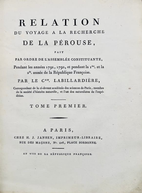
1800rif. 43698Paris, H.-J. Jansen, 1800 (an VIII). 2 vol. in-4 de XVI-442 pp. et 332-113 pp. pour les deux volumes de texte, et 1 atlas in-folio de 1 titre, 43 planches gravées hors texte et 1 grande carte dépliante, demi-basane verte, dos lisses ornés, entièrement non rogné, couvertures muettes conservées, l'atlas est en demi-veau à coins.