6355 risultati
rif. 56-0222San Francisco Calif.: Southern Pacific Company 1938. Map. Blueline print. 24 x 56 inches. With red and orange pencilling. Map of Mayfield from Churchill Avenue to Diss Road. Includes Sunnyside and Evergreen Park. With Schedule of Property Acquisition Date Original Grantor/Grantee Instrument of Transfer and Remarks of Sale for approximately 26 transfers 1864-1938. Scale 1 inch = 200 feet. San Francisco, Calif.: Southern Pacific Company, 1938. unknown
rif. 56-0344San Francisco Calif.: Southern Pacific Company 1957. Map. Blueline print 24" x 55". Includes Normal Junction Tempe Junction. Map is primarily railroad track with measurement markings with some numbered buildings at Tempe Junction. Includes Schedule of Property with 10 transfers 1926-1957. Scale 1" = 400'. San Francisco, Calif.: Southern Pacific Company, 1957. unknown
rif. 58-0543Portland Ore.: Southern Pacific Company n.d. Blueline print 24 inches x 55 inches. From Isaac Hutchins Donation Land Claim at southwest corner of Albany to Exum Powell claim beyond 2nd standard Parallel south. With Williamette River all streets within Albany city limits. Scale 1 inch = 400 feet. Portland, Ore.: Southern Pacific Company, [n.d.] unknown
rif. 56-0304San Francisco Calif.: Southern Pacific Company 1937. Map. Blueline print 24" x 55" with red pencil indicating switching limits. Includes Rancho de la Canada de Rincon discontinued station point Golf Links. From approx 4000' northwest of Golf Links to Coral St to the south-east. With schedule of Property listing appox 10 transfers 1875-1937. Scale 1" = 200'. San Francisco, Calif.: Southern Pacific Company, 1937. unknown
rif. 56-0225San Francisco Calif.: Southern Pacific Company 1920. Map. Blueline print. 24 x 56 inches. Folded with red pencilling. Map from Binney Junction to Oroville with Schedule of Property Acquisition Date Original Grantor/Grantee Instrument of Transfer and Remarks of Sale for 15 transfers 1852-1915. Scale: 1 inch = 400 feet. San Francisco, Calif.: Southern Pacific Company, 1920. unknown
rif. 56-0245San Francisco Calif.: Calif. Southern Pacific Company 1926. Map. Blueprint 24" x 55". Complete map of Pabrico. Includes W.S. Dickey Clay Co. K. & L. Box Co. Scale 1" = 100'. San Francisco, Calif.:, Calif. Southern Pacific Company, 1926. unknown
rif. 56-0326San Francisco Calif.: Southern Pacific Company 1957. Map. Blueline print 24" x 55". Includes San Joaquin River station point Firebaugh with 35 buildings Miller and Lux subdivision plot. With Schedule of Property listing approx. 20 transfers 1888-1957. Scale 1" = 400'. San Francisco, Calif.: Southern Pacific Company, 1957. unknown
rif. 56-0279San Francisco Calif.: Southern Pacific Company 1929. Map. Blueline print 24" x 56". Railroad track map of Luring and vicinity. Includes Shedule of Property of record of 5 transfers 1875-1929. Scale 1" = 400'. Includes small inset detail map of Luning no scale indicated. San Francisco, Calif.: Southern Pacific Company, 1929. unknown
rif. 56-0402San Francisco Calif.: Southern Pacific Company 1927. Blueline print 24" x 65" and 6" x 8" addition with red lines indicating switching points. Detail of additional map affixed to original to indicate switching limits. From Fresno Avenue No. 8 to Las Palmas. With portion of Schedule of Propoerty approx. 50 incomplete listings of transfer 1924-1944. Includes Cincotta Bartonette Roessler and Las Palmas. Scale 1" = 400'. San Francisco, Calif.: Southern Pacific Company, 1927. unknown
rif. 58-0545San Francisco Calif.: Southern Pacific Company 1952. Blueline print 24 inches x 55 inches. From Alturas to California-Oregon State Line along railroad tracks and North Fork of Pitt River. No structures indicated extensive listing of signal and track measurements. With Schedule of Property listing approx 35 transfers 1875-1952. Scale: 1 inch = 1000 feet. San Francisco, Calif.: Southern Pacific Company, 1952. unknown
rif. 56-0450San Francisco Calif.: Southern Pacific Company 1953. Blueline print 24" x 55". Five inch tear no missing material. From Plumas Avenue and Terminal Avenue in Henderson to Alameda County Line. With San Francisco Bay Drawbridge Ravenswood San Francisco Bay Rancho de Las Pulgas University Village. Includes Schedule of Property listing approx 20 transfers 1907-1953. Scale 1" = 400'. Includes insert showing details of structures at Ravenswood water pipes and train lines surrounded Hetch Hetchy. Scale 1" = 100'. San Francisco, Calif.: Southern Pacific Company, 1953. unknown
rif. 56-0361Tucson Ariz.: Southern Pacific Company 1942. Map. Blueline print 24" x 56" with red pencilling indicating present switching limits. From Colorado River and City of Yuma to Fortuna AZ. Includes Yuma East Yard Araby and Fortuna station points. With Schedule of Property listing approx. 60 transfers 1892-1942. Scale 1" = 1000'. Tucson, Ariz.: Southern Pacific Company, 1942. unknown
rif. 58-0525San Francisco Calif.: Southern Pacific Company 1956. Blackline print 24 inches x 56 inches. From Woodman/Castro Avenue to Craner Avenue Magnolia Boulevard to Oxnard Street. Includes North Hollywood Kester Rancho Ex-Mission de San Fernando. With Schedule of Property listing approx 80 transfers 1893-1956. Scale 1 inch = 400 feet. San Francisco, Calif.: Southern Pacific Company, 1956. unknown
rif. 56-0242Tucson Ariz.: Southern Pacific Company 1923. Map. Blueline prints 24" x 56" and 24" x 28". Second map is missing northern half with tear along opposite edge. Map of Nogales railroad yard from north of Nogales to border with Mexico with Schedule of Property Acquisition Date Original Grantor/Grantee Instrument of Transfer and Remarks of Sale for approx. 35 transfers 1875-1946 Scale 1" = 400'. Tucson, Ariz.: Southern Pacific Company, 1923. unknown
rif. 56-0256San Francisco Calif.: Southern Pacific Company 1960. Map. Blueline print 24" x 56" with red highlights. From Elmhurst to Rancho San Leandro border. Includes inset Index Map scale 1 inch = 2miles Elmurst to Santa Clara. With Schedule of Property listing approx. 20 transfers 1906-1946. Includes Scale 1" = 400'. San Francisco, Calif.: Southern Pacific Company, 1960. unknown
rif. 56-0376San Francisco Calif.: Southern Pacific Company 1930. Map. Blueline print. 24 x 56 inches. Includes station point Westwood track markings six blocks by two blocks of unmarked buildings between Cedar Street and Ash Street. With Schedule of Property listing 13 transfers 1899-1930. Scale: 1 inch = 400 feet. San Francisco, Calif.: Southern Pacific Company, 1930. unknown
rif. 58-0529San Francisco Calif.: Southern Pacific Company n.d. Blackline print 24 inches x 55 inches. From Glendale Boulevard and Irving Avenue to Brand Boulevard and Fernando Road. Includes Rancho San Rafael Rancho Los Felis West Glendale Glendale. Scale 1 inch = 400 feet. San Francisco, Calif.: Southern Pacific Company, [n.d.] unknown
rif. 58-0541San Francisco Calif.: Southern Pacific Company 1960. Blueline print 24 inches x 55 inches. From Abbot & Beade tract in Antioch to 4000 feet east of Station Point Neroly. With Frank Peabody's Subdivision Associated Pipe Line Company. Includes Schedule of Property listing approx 25 transfers 1872-1960. Scale: 1 inch = 400 feet. San Francisco, Calif.: Southern Pacific Company, 1960. unknown
rif. 56-0418San Francisco Calif.: Southern Pacific Company 1920. Black ink drawing on vellum 24" x 56". From San Diego Bay and Fourteenth Street in National City to southern limits of Chula Vista. With National City Marlborough Heights San Diego Fruit Co. San Diego Land Co. plots San Diego Oil Products AT&SF Railyard. With Schedule of Property listing 10 transfers 1887-1920. Scale: 1" = 400'. San Francisco, Calif.: Southern Pacific Company, 1920. hardcover
rif. 56-0455Sacramento Calif.: Southern Pacific Company 1939. Blueline print 24" x 56". From California - Oregon State Line to Kirk. Includes Ewauna Park Texum Lot listings 1 1/2 miles south of Texum. Schedule of Property listing approx 15 transfers 1906 - 1939. Scale 1" = 400'. Sacramento, Calif.: Southern Pacific Company, 1939. unknown
rif. 58-0547San Francisco Calif.: Southern Pacific Company 1939. Blueline print 24 inches x 55 inches. From approx 4 miles south to approx 3 miles north of Sugar Hill along Goose Lake and Railroad tracks. No structures indicated extensive listing of signal and track measurements. With Schedule of Property listing approx 20 transfers 1861-1939. Scale 1 inch = 1000 feet. San Francisco, Calif.: Southern Pacific Company, 1939. unknown
rif. 58-0534San Francisco Calif.: Southern Pacific Company 1960. Blackline print 24 inches x 55 inches. From Barstow Tract past Los Gatos Creek and railroad tracks to Pollard Road in Vasona. Includes Vasona Campbell Los Gatos Creek gravel beds. With Schedule of Property listing approx 35 transfers 1877-1960. Scale 1 inch = 200 feet. San Francisco, Calif.: Southern Pacific Company, 1960. unknown
rif. 56-0431San Francisco Calif.: Southern Pacific Company n.d. Blueline print 24" x 56". From west of Oak Home addition and Solomon Zumwalt Donation Land east to Jackson Street. With western portion of City of Eugene F.P. Blair's Donation land claim Cooper's Plat Ross Plat McClaren's Plat. Scale approx 1" = 200'. San Francisco, Calif.: Southern Pacific Company, [n.d.] unknown
rif. 56-0282San Francisco Calif.: Southern Pacific Company 1938. Map. Blueline print 24" x 56" with red pencil notation. Includes Los Medanos Sommerville Road Antioch. With Schedule of Property listing approx 20 transfers 1878-1938. Scale 1" = 400' San Francisco, Calif.: Southern Pacific Company, 1938. unknown
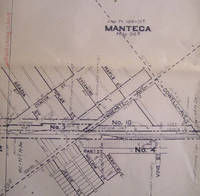
rif. 56-0263San Francisco Calif.: Southern Pacific Company 1934. Map. Blueline print 24" x 56" with red highlighting. Includes Manteca Morrano Calla and vicinity. With L.M. Larson's subdivision Spreckels Sugar Co. Spur. With Schedule of Property listing 17 transfers 1871-1934. Scale 1" = 400'. San Francisco, Calif.: Southern Pacific Company, 1934. unknown