[RONBINSONNADE]:Livre Rare Book
6355 risultati
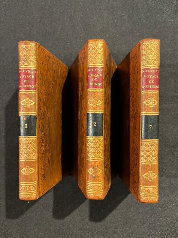
1804rif. 15855Paris, Cordier et Legras, 1804. 3 volumes in-12 de [4]-VIII-182; [4]-176 et [4]187-[1] pages, plein veau raciné, dos lisses ornés de filets et fleurons dorés, pièces de titres et tomaison rouge et noire.
1938rif. SHEL1576Spokane: Matthews & Kerr 1938. First Thus. Soft cover. Near Fine. Original catalogue from what world libraries site determines is 1938. Pictorial orange and black 4to wraps. 160pp. Illus. Index. This company went out of business in the modern era but only one copy of this catalogue shows up in world libraries in the Spokane Library. Page after pages of b/w depictions of supplies for restaurants soda fountains bars. Also Matthews & Kerr were "manufacturers" perhaps more accurately distributors of coffees teas spices extracts baking powders and syrups. I found simply amazing the appliances devices and tools available for all these kinds of businesses some of which like old time soda fountains are sparsely located in our cities and towns. Tipped in is a printed orange slip stating that "No prices are quoted with this catalog" and the reasons why. Along with the images of hundreds if not thousands of items sold by this company are mainly size descriptions of each one. A rare catalogue. Top corner of front cover with small triangular crease else fine. Matthews & Kerr unknown
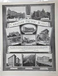
1918rif. P3768Montreal Canada: The Montreal Standard Publishing Co. Limited; Canadian Pacific Railway c. 1918. Very Good. Notes: Advertising poster showing various Canadian Pacific Hotels across Canada. Image Size : 539x425 mm 21.22x16.73 Inches Platemark Size : Paper Size : 595x463 mm 23.43x18.23 Inches Coloring: Black & White Medium: Offset print after Notman's photographs Categories: Advertising The Montreal Standard Publishing Co. Limited; Canadian Pacific Railway unknown
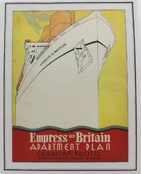
1920rif. P4221Montreal: Canadian Pacific c.1920. Very Good. Laid on acid free paper for long term preservation. Notes: A charming advertisement for the Empress of Britain one of the flagships of the Canadian Pacific Fleet during the early part of the 20th century. Image Size : 305x246 mm 12.01x9.69 Inches Platemark Size : Paper Size : 353x281 mm 13.90x11.06 Inches Coloring: Printed in Color Medium: Lithograph Categories: Advertising; Transportation Ships; Posters; Canadian Pacific unknown
1890rif. 300405Pacific Electric Railway 1890. 1890. Photograph depicting 37 passengers at the Echo Mountain Terminal 3500 feet above sea level with printed descriptive information on the verso of mount with pictorial borders. 4 1/2" x 7 3/4" image on stiff 10" x 7" mount. No Binding. Very Good/No Jacket. Pacific Electric Railway [1890]. unknown
1890rif. 300405Pacific Electric Railway 1890. 1890. Photograph depicting 37 passengers at the Echo Mountain Terminal 3500 feet above sea level with printed descriptive information on the verso of mount with pictorial borders. 4 1/2" x 7 3/4" image on stiff 10" x 7" mount. No Binding. Very Good/No Jacket. Pacific Electric Railway [1890]. unknown books
1940rif. 64224New York NY: Fortune Magazine March 1940. One atlas folio sized map 22.25 x 27.5 in. archivally mounted on linen sized 26 x 31.25 in. in excellent bright condition. First edition of this eye-catching pictorial map celebrating the regions resources and inhabitants of Washington & Oregon chronicling the impact of the New Deal programs including the construction of Bonneville Dam and ongoing massive project of the Grand Coulee. The 1940 Fortune magazine which highlighted the growing economic potential of the Pacific Coast states including Washington Oregon & California details as well through charming caricature pictographs including sheaves of wheat cattle salmon fishermen logging tulip growers apple and peach growers Native American Reservations and more. Petrucelli 1907-1994 launched his career as a textile designer later began illustrating for House Beautiful Fortune Magazine The New Yorker and Collier’s Today who would illustrate charts diagrams cover art caricatures and won several important design awards. During World War II he also illustrated propaganda maps and ALCOA maps detailing the company’s worldwide operations. Worldcat locates 3 copies UCT Buffalo & Erie Pub. Lib. U of O. Fortune Magazine, unknown
1882rif. 63407New York NY & St. Paul MN: The Northern Pacific Railroad Co.; Printed by E. Wells Sackett & Rankin 1882. 8vo. 81 1 pp. With double-page frontisp. birds-eye woodcut view of Portland OR stretching out to Mount Rainier south to Mt. Hood 9 woodcut-engraved plates. Pink-tinted printed softcovers decorated lettering minor creasing egewear slight chipping at corners without the folding map still a good reference copy. First edition of this informative land promotion issued by the Northern Pacific Railroad upon completion of its line to the Pacific Northwest from St. Paul MN in conjunction with Jacob Kamm’s Oregon Railway & Navigation Co. The views include the two-panel birdseye of Portland OR as well as views of Astoria a Puget Sound sawmill Commercial Street in Seattle of the Washington Territory and includes a mention of Chinese-Americans employed to build the railroad and now available to take contracts for “grubbing brush land.” The Northern Pacific Railroad Co.; [Printed by] E. Wells Sackett & Rankin, paperback
1775rif. 21548Paris 1775. Very good condition. Large detailed copper engraved map of Captain Cook's voyage in the Resolution of New Caledonia and the New Hebrides islands in the south Pacific with the tracks and the dates indicated. From Prevost's "L'Histoire Generale des Voyages". Bellin 1703 - 1772 one of the most noted French mapmakers of the 18th century was named the hydrographer chief cartographer to the French Navy and later the Official Hydrographer to the French King. Folding 19 x 15 1/4". Strong impression very clean. unknown
1874rif. M7526Montreal: The Desbarats Litho & Publish Co. c.1874. Very Good;. Notes: The map is based on Capt. Vancouver's survey 100 years earlier and improved with the latest survey by Canadian Pacific Railway. Size : 489x624 mm 19.25x24.57 Inches Coloring: Black & White Category: Maps Canada West British Columbia; The Desbarats Litho & Publish Co., unknown
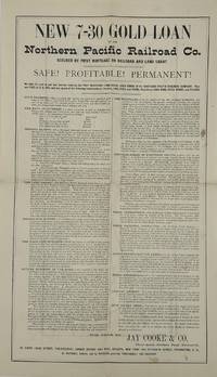
1873rif. 70529Philadelphia PA: Jay Cooke & Co 1873. Broadsheet. 43 x 25 cm. Promotional for a loan at 7% per annum for 30 years principal and interest payable in gold or if desired converted at 1.10 into real estate. Text describes the land granted the railroad the Emigration Scheme to settle and develop the Land work already begun services to be provided by the railroad etc. On verso is a map showing the route of the Northern Pacific Railroad from Duluth Minn. to Bellingham Washington. Old fold lines a few small spots else very good. Jay Cooke & Co. was originally created in 1861 as a partnership engaged in the banking business in Philadelphia. Separate companies were also formed in New York and Washington DC and the three were combined into one in January 1871 with assets exceeding $6 million. "In addition to their large negotiations of government securities they had conducted an extensive business in the negotiation of railroad bonds and paper as well as the ordinary business of discounting and negotiation of other securities." The Panic of 1873 caused many disruptions including destroying "all market for railroad bonds for the time being. reflecting the various antagonistic influences then at work against the railroads of the country culminating during the spring and summer of 1873 in almost total destruction of the credit of the railroad securities." Jay Cooke & Co. suspended operations in September 1873 and its assets including Northern Pacific Railroad stocks and bonds were sold by order of the courts in December of that year. see: an article in the Philadelphia Inquirer July 23 1874 for a lengthy discussion of the company and its finances. Jay Cooke & Co unknown
1873rif. 70529Philadelphia PA: Jay Cooke & Co 1873. Broadsheet. 43 x 25 cm. Promotional for a loan at 7% per annum for 30 years principal and interest payable in gold or if desired converted at 1.10 into real estate. Text describes the land granted the railroad the Emigration Scheme to settle and develop the Land work already begun services to be provided by the railroad etc. On verso is a map showing the route of the Northern Pacific Railroad from Duluth Minn. to Bellingham Washington. Old fold lines a few small spots else very good. Jay Cooke & Co. was originally created in 1861 as a partnership engaged in the banking business in Philadelphia. Separate companies were also formed in New York and Washington DC and the three were combined into one in January 1871 with assets exceeding $6 million. "In addition to their large negotiations of government securities they had conducted an extensive business in the negotiation of railroad bonds and paper as well as the ordinary business of discounting and negotiation of other securities." The Panic of 1873 caused many disruptions including destroying "all market for railroad bonds for the time being. reflecting the various antagonistic influences then at work against the railroads of the country culminating during the spring and summer of 1873 in almost total destruction of the credit of the railroad securities." Jay Cooke & Co. suspended operations in September 1873 and its assets including Northern Pacific Railroad stocks and bonds were sold by order of the courts in December of that year. see: an article in the Philadelphia Inquirer July 23 1874 for a lengthy discussion of the company and its finances. Jay Cooke & Co unknown books
rif. 56-0286San Francisco Calif.: Southern Pacific Company 1944. Map. Blueline print 51" x 52" Multiple maps have been cut and joined with glue red ink indicating railroad lines switching points and switching limits cross map joints. No Index to Industry is included but many industries in center are notated directly. Scale 1" = 500'. San Francisco, Calif.: Southern Pacific Company, 1944. unknown
rif. 01-0063San Francisco Calif.: Southern Pacific Railroad 1946. Map. Blueprint. 3 x 6 feet. Scale 1 inch = 800 feet. August 25 1927 revised to May 10 1946. Florence Ave. to Wilmington Anaheim Blvd. With index to industries showing names and location. Includes Los Angeles Huntington Park Lynwood Compton Long Beach. San Francisco, Calif.: Southern Pacific Railroad, 1946. unknown
rif. 56-0452San Francisco Calif.: Southern Pacific Company 1950 rev. 1952. Blueline print measuring 25" x 55". From Texum southern Yard Limits to Terminal City Bisbee Street to Upper Klamath Lake. Includes index to industries with approx 100 entries indexed by number on map and location by vertices. With Chelsea Lake Ewauna Associated Oil Co. Big Lake Iron & Steel Co. General Petroleum. Scale 1" = 800'. San Francisco, Calif.: Southern Pacific Company, 1950, rev. 1952. unknown
rif. 56-0454San Francisco Calif.: Southern Pacific Company 1950 rev. 1960. Blueline print 25" x 64". With switching zones 1 - 5 indicated in colored pencils. From Texum southern Yard Limits to Terminal City Bisbee Street to Upper Klamath Lake. Includes Index to Industries with approx 120 entries listed both alphabetically and numberically. With Chelsea Lake Ewauna Associated Oil Co Big Lake Iron & Steel Co General Petroleum. Scale 1" = 800'. San Francisco, Calif.: Southern Pacific Company, 1950, rev. 1960. unknown
rif. 56-0453San Francisco Calif.: Southern Pacific Company 1950. Blueline print 24" x 55". From Texum southern Yard Limits to Terminal City Bisbee Street to Upper Klamath Lake. Includes Index to Industries with approx 85 entries indexed by number on map and location by vertices. With Chelsea Lake Ewauna Associated Oil Co Big Lake Iron & Steel Co General Petroleum. Scale 1" = 800'. San Francisco, Calif.: Southern Pacific Company, 1950. unknown
rif. 56-0432San Francisco Calif.: Southern Pacific Company 1932 rev. 1940. Blueline print 25" x 48" with red pencil indicating switching limits. From Biola Junction Muscatel to Mattei Calwa Tower. Includes Fresno Yard Forsey Crayold Fresno station point Cincotta Bartonette Sun Maid Tower State Center Malaga. Tracks and station points indicated no buildings. Scale approx 1" = 1500'. San Francisco, Calif.: Southern Pacific Company, 1932, rev. 1940. unknown
rif. 58-0562San Francisco Calif.: Southern Pacific Company 1959. Blueline print 35 inches x 68 inches yellow highlighting indicates operating area. With Mutual Plywood Plant Fairhaven South Fairhaven connecting tracks Humboldt Bay Pacific Ocean. Scale 1 inch = 200 feet. Includes Mutual Plywood Plant insert map scale 1 inch = 50 feet. San Francisco, Calif.: Southern Pacific Company, 1959. unknown
rif. 56-0235Oakland Calif.: Southern Pacific Company 1930. Map. Blueline print. 24 x 57 inches. Minor tears along edges minor ink smudging. Map of Elmhurst includes Gerber Products Co L.A. Young Spring and Wire Co General Metals. Scale: 1 inch = 100 feet. Oakland, Calif.: Southern Pacific Company, 1930. unknown
rif. 56-0230San Francisco Calif.: Southern Pacific Company 1947 revised 1949. Map. Blueline print. 25 x 48 inches. With lines and zones indicated by red green mauve etc. highlighting. Map of Oakland Emeryville Berkeley Alameda and San Leandro from North Berkeley to San Leandro. Scale: 1 inch = 1000 feet. San Francisco, Calif.: Southern Pacific Company, 1947, revised 1949. unknown
rif. 58-0490Ogden Utah: Southern Pacific Company 1928 rev. 1948. Blueline print 48 inches x 37 inches. With 4 inch tear no missing material. From Moana Lane to Wedekind Road and Mountain View Cemetery to Kietske Lane. With listing of streets all streets listed. 1 inch = 600 feet. Ogden, Utah: Southern Pacific Company, 1928, rev. 1948. unknown
rif. 56-0293San Francisco Calif.: Southern Pacific Company 1929 revised 1940. Map. Blueline print 25" x 68". From Maple St to Hillsdale Ave and Lick. Includes former town of Willow Glen Lewis Canal Washington Square Oakhill Cemetery. Scale 1" = 500'. San Francisco, Calif.: Southern Pacific Company, 1929, revised 1940. unknown
rif. 56-0292San Francisco Calif.: Southern Pacific Company 1933. Map. Blueline print 27" x 68.5" with red black and mauve outline and pencilling . From Maple St to Hillsdale Ave and Lick. Includes former College of the Pacific Southern Pacific Yards Willow Glen Washington Square Oakhill Cemetery. Scale 1" = 500'. San Francisco, Calif.: Southern Pacific Company, 1933? unknown