(COXE William)MareMagnum

6368 risultati
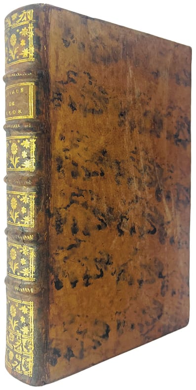
1781In-8 gr. (mm. 256x192), p. vitellino coevo (con aloni, restauro a una cerniera per spacco), dorso a cordoni con decoraz. e tit. oro su tassello, tagli rossi, pp. (4),XXII,314, con 4 carte geografiche, inc. in rame e più volte ripieg. (carte générale de l’Empire Russe - Voyage de Krenitzin et de Levasheff aux Isles des Renards, en 1768 et 1769 - Carte du voyage de Synd vers les Parages de Tschukotikoi: partie Nord Est de la Sibérie - Carte du voyage de Shalaurof: Mer Glaciale) e 1 bellissima grande tavola (più volte ripieg.) con la veduta di “Maimatschin ville frontière chinoise et du ruisseau de Kiachta, prise de l’Ouest”, pure inc. in rame. "Prima edizione della versione francese". Cfr. Brunet,II,399 - The Hill Collection of Pacific Voyages,391 per la prima ediz. inglese del 1780: “The Reverend William Coxe was an English historian who traveled widely in Europe and Russia.. Coxe recounts (from 1745 on) the principal Russian discoveries and explorations made in northwestern America in their attempts to open communications with Alaska and the Aleutia Islands. The voyages and discoveries of Nevodsikoff, Serebranikoff, Trapesnikoff, Drusinin, Korovin, Glottoff, Solovioff, Krenitzin, Levasheff, Synd, Bering, Shalauroff, and several others are included.. Coxe made suggestions which led the Russians to promote expeditions of discovery to the northern parts of Siberia. Notable in the present work are a useful bibliography and pertinent observations on the fur trade between the Russians and the Chinese”. Lievi arross. o aloni al margine esterno bianco, ma buon esemplare.
rif. 8186dans le quel la côte Nord-ouest de l’Amérique a été soigneusement reconnue et relevée ordonnée par le Roi d’Angleterre, principalement dans la vue de constater s’il existe,à travers le continent de l’Amérique,un passage pour les vaisseaux,de l’Océan pacifique du nord à l’Océan atlantique septentrional et exécuté en 1790,1791,1792,1793 par le capitaine George VANCOUVER traduit de l’anglais. Ouvrage enrichi de figures.Trois tomes en trois volumes petit in folio,reliure cartonnée, postérieure,avec étiquette de titre imprimée.Tome premier:faux-titre,titre, XII,491 pages 7 gravures hors-texte sous serpente.I) village indien désert II)4 mâts singuliers fichés en terre III) Mont Rainier IV) village d’une tribu d’indiens V) village de Cheslakées VI) la découverte VII) Anse des amis. Tome second : faux-titre titre 516 pages 5 planches hors-texte sous serpente petites déchirures réparées en marge inférieure de la table des matières. Planche I) La mission Carlos près de Monterey II) cartes des iles d’Hergest, III) Anse des Saumons, dans l’entrée de l’observatoire. IV) New-Eddystone, dans le canal de Behm. V) le Présidio de Monterey Tome troisième : faux-titre, titre 562 pages, une déchirure réparée à la dernière page de la table des matières ainsi qu’à la page de garde. 5 planches hors-texte sous serpente planche I) cratère d’un volcan au sommet du Mont Worroway dans l’ile d’Owhyhée. II) Port Dick pris à l’entrée de Cook avec une flotille de pirogues indiennes III) Le mont saint Elie IV) Montagne remarquable près de la rivière de Monterey VI) le village d’Almandrel dans la baie de Valparaiso.La vue de Valparaiso,annoncée,n’était pas jointe à ce volume.Grandes marges.Sans l'atlas.Edition originale de la traduction française. A Paris de l’Imprimerie de la République An VIII
Pacifico Sidoli fu autore assai versatile, di buon nome non solo come ritrattista ma anche come pittore di paesaggi, realizzati a olio, a pastello o all'acquerello. Trasferitosi giovanissimo da Piacenza, sua città natale, a Parigi, si distinse anche in quella capitale, ove fu ammesso ben presto ai Salons, esponendo in varie altre città d'Europa con buon successo. Come lui, anche i due fratelli minori Nazzareno e Giuseppe si distinsero nel campo artistico-pittorico. 1 e 2. Ritratto di fanciulla sorridente, in due pose diverse. Due pastelli eseguiti su cartoncino bruno, ciascuno di cm. 54 x 35. La graziosa modella inclina vezzosamente il capo, nel primo ritratto con un nastro nero a trattenerle i capelli che nel secondo sono invece sciolti. Euro: 1.500 3. Ritratto di fanciulla bionda. Acquerello su cartoncino giallino. Cm. 58 x 40. Una bella fanciulla dai grandi occhi azzurri e coi lunghi capelli a onde, tiene una mano appoggiata alla scollatura adornata da un nastro rosa. Euro 900 Per P. Sidoli, cfr. Comanducci, II/p. 770; Catalogo Bolaffi della pittura italiana dell'800 (1974), p. 382; Bénézit, XII/p. 777.
rif. 16212Manuscrit du XVIIIe siècle ; in-folio, br. ; 100 pp., (8) pp. complément d'une autre main et sur un autre papier du XIXe siècle. Les ratures indiquent un texte en cours de finition.
1807rif. 14464Dentu Paris 1807 2 vol. 2 vol. in-8 de 3 ff.n.ch. XXXII 243 pp. 1 f.n.ch. (errata) et 2 ff.n.ch. 341 pp., cartonnage papier à la bradel de l'époque, dos lisse fileté, pièces de titre.
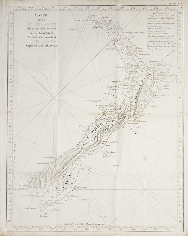
1774rif. LBW-2723[1774]. 482 x 373 mm.
1907243 pages. Tissue-protected frontis photo portrait of author. Attractively decorated maroon cloth-covered front board. All seventeen black and white plates present. "An autobiographical account of the author's first twelve years (from 1862 to September 1873) as a Methodist missionary among the Cowichan and Nanaimo Indians." - Lowther. Average wear. Prior owner's name in light pencil upon front free endpaper. Faint moisture marks to fore-edge of first twenty-five pages. Hinges starting. Issued without dust jacket. LOWTHER 1556, RICKS p.75, AMTMANN 3499, SMITH 2134, WALLACE p.52, MATTHEWS 295, TOD & CORDINGLEY p.85. Book
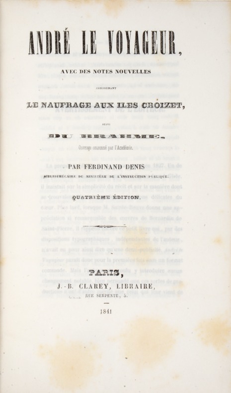
1841rif. 39808Paris, Clarey, 1841. In-8 de (4)-III-259 pp. maroquin vert, dos orné à nerfs, triple filet doré d’encadrement sur les plats, dentelle intérieure dorée, tranches dorées sur marbrure, non rogné (Brany).
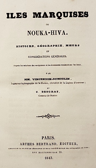
1843rif. 14285Arthus Bertrand Paris 1843 1 vol. In-8 de VIII 362 pp. 1 f.n.ch. 2 ff.n.ch. manuscrits, demi-chagrin moderne, dos à 5 nerfs, titre doré, couverture et dos conservés (Boichot).
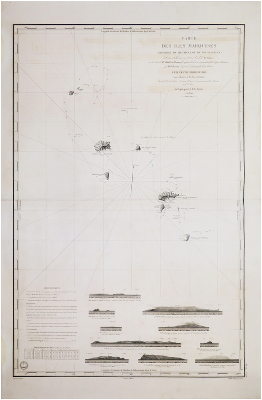
1845rif. LBW-7576[Paris], Dépôt-Général de la Marine, 1842 [1845. 882 x 590 mm.
1833rif. LBW-5457[Paris, 1833]. 581 x 429 mm.
1833rif. LBW-1980Paris, 1833-1839. 275 x 371 mm.
1817rif. 4234Paris, Gide Fils and Nicolle, November 1817. 1817 2 vol. in-8° (250 x 125 mm) de : 398 pp. (dont les xxii pp. du début), [1] ff.; 398 pp. Demi-veau d'époque, dos lisse orné, plats recouverts de papier à la colle bleu, tranches jaspées. (Reliure et corps d'ouvrage très frais).
rif. 104239De l'Imprimerie Didot Jeune, An X (1801-1802), 5 volumes +1atlas in-8 de 220x140 mm environ, viij-341 pages - 384 pp., - 381 pp., - 368 pp.,- 438 pp., dernier volume-atlas contenant 17 vues sous serpentes et 9 cartes dont 8 dépliantes, cartonnage de l'éditeur portant titres et tomaisons dorés sur le dos. Feuillets non rognés. Dos insolés, frottements sur les coins et coiffes, petits défauts de marge sur quelques pages sans atteinte au texte, sinon bon état.
1880rif. 59310Portland OR & Seattle WA: Walter Angus MacKay Julia Rose Eder MacKay Cross & Dimmitt ca. 1880-1958. Two vols. 1st - Thick oblong 4to. 11.5 x 8.75 x 2.25 in. 128 pp unpaginated. on thick black paper. With 461 photographs sized 1.75 x 2.75 in. up to 4.5 x 5.5 in. including 2 CDV’s 1 cyanotype several albumen and range of silver gelatin snapshots on matted and glossy paper stock many w/ annotations either on verso below images or w/in the margins at lower fore-edge or in pencil some w/ white ink alongside the images. Contemporary flexible polished calf post-binder punch-sewn at gutter margin in gold silk braid RPPC of Tillamook Bay OR by Gregg mounted on front cover chipping & wear to front cover wear to corners wear & rubbing to some fore-edges occasional chipping minor closed tears still VG exemplar; 2nd vol. -- Oblong 8vo. 8 x 5.75 in. 78 pp unpaginated. on thick tan paper stock. With 101 silver gelatin photographs mounted sized from 1.75 x 2.75 in. up to 4 x 6 in. some w/ sepia effect either mounted directly on the pages or many affixed with small strips of black paper or old paper corners affixing the images to the leaves a few w/ annotations on verso or below. Contemporary flexible diced calf “Housh” photo album chipping & wear to spine wear & bumping to corners some pages reworked by compilers at some point still a G exemplar both albums’ photos with bright strong contrast. These photo albums faithfully follow the sporting and leisure activities of two gearheads from Chicago -- Walter MacKay and his brother Carrol MacKay who together with their extended families and friends drive and auto-camp across the West. The large first album opens with many photos following a trip to Yosemite National Park as well as scenes along the route and upon the return of Walter & Julia. Their follow-up automobile trip in 1928 takes them to Yellowstone National Park via Spokane Idaho and Montana with photos included of Old Faithful a photo by Haynes of the Grand Geyser as well as auto camping at “Mammoth Hot Springs.” Subsequent photos trace their travels through the Columbia River Gorge the Snake River Mount Rainier National Park Ariel Dam near Ariel WA Hoods Canal WA and Newport OR. Their speed boat launch the Carmen is featured in some photos along with several views of pumps hoisting engines giant diesel and gas engines under repair. Other trips include those to Snoqualmie Falls Trout Lake WA near Mt. Adams working a hoist at logging camp partying with friends in Renton WA and even views of Walter MacKay advertising his Automobile Repair Shop with a cover on his rear tire. Other outings include auto camping and picnicking along the Mt. Hood Loop Grant’s Park on the Clackamas River Mt. Hood the Rogue River Table Mountain and views of Grants Pass. Walter and his gearhead friends were known for their stripped-down roadster racing cars and were also early participants in the Seattle Motorcycle Club and Motorcycle races. A couple photos within the two albums show early motorcycles and even gallivanting on some stripped down chassis without engines or tires. The second album includes a series of photos featuring Walter and his car beneath a towering Cedar Stump with arch cut into the base and him holding gun as well as standing on the fenders of the car. The second also includes automobile camping photos with tent and cots folded out of the rear of the automobile driving into Vancouver B.C. as well as driving to Mount Rainier and more along the Columbia River Highway and Mount Hood. Also featured are hunting shots in Eastern Oregon construction of a summer log cabin and much more. Mackay 1883-1959 was a mechanical engineer machinist gearhead racecar builder who came West working for the railroad as a machinist before working for Paragon Co. in Seattle as parts manager. He owned and operated the MacKay Automotive Repair at 165 E. 39th in Portland OR on the SW corner of 39th Cesar Chavez and Belmont for years before working at Albina Engine & Machine Works at the end of the Great Depression. One of the photos in the 2nd album shows MacKay with his camera shooting a photo and several show Julia MacKay’s 1880-1958 sisters and family. Should be noted we unknowingly catalogued an album on Seattle Auto Racing and Motorcycle Clubs from before World War I without having had access to these unknown albums. See: The Origins and Growth of the Club Scene in Western Washington 1910-1941 Jolly Rogers Motorcycle Club Feb. 7 2009; Seattle Motorcycle Races Pantages Theater Program Early Advertising in the West 1867-1918 Univ. of Washington Spec. Collections. Walter Angus MacKay, Julia Rose Eder MacKay, Cross & Dimmitt, unknown
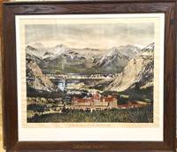
1930rif. P5538Canada: Canadian Pacific c.1930. Very Good. Notes: Framed in an original Canadian Pacific wooden frame. The Fairmont Banff Springs formerly and commonly known as the Banff Springs Hotel is a historic hotel in western Canada located in Banff Alberta. Opened in 1888 by the Canadian Pacific Railway it is one of the earliest of Canada's grand railway hotels. On 24 June 1988 the hotel buildings were designated as a National Historic Site of Canada. Image Size : 507x655 mm 19.96x25.79 Inches Platemark Size : Paper Size : 560x710 mm 22.05x27.95 Inches Coloring: Hand Colored Medium: Offset Lithograph Categories: Advertising; Views Canada Alberta & British Columbia; Canadian Pacific unknown
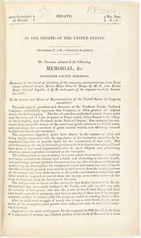
1868rif. 33573Washington. 1868. With Johnson's Great Map of the Northern Pacific Route An application to Congress by the Northern Pacific Railroad headed by Minnesota railroad magnate James J. Hill for federal aid to support the Railroad's expansion to the West Coast. The petition reviews the railroad's original charter and includes an impressive color folding map "Map of the Country from Lake Superior to the Pacific Ocean" which illustrates the railroad's route from Duluth to Seattle and Portland. This map was originally produced to accompany Edwin Johnson's report on the feasibility of the railroad. This is one of the finest maps of the region traversed to be issued up to this time and was produced by Colton in New York not by the government. Wheat devotes several pages to discussing it noting that "the detail of such a map defies cataloging." Above the map appears an elevation chart for the same distance. A fine account of railroad expansion in the Northwest. Rare. Not on OCLC. 39pp. plus large color folding map. Modern maroon cloth gilt maroon morocco label. Minor dust soiling in text. Map bright and clean. Overall very good. MIDLAND NOTES 68-164. WHEAT TRANSMISSISSIPPI 1169. hardcover
1868rif. 33573Washington. 1868. With Johnson's Great Map of the Northern Pacific Route An application to Congress by the Northern Pacific Railroad headed by Minnesota railroad magnate James J. Hill for federal aid to support the Railroad's expansion to the West Coast. The petition reviews the railroad's original charter and includes an impressive color folding map "Map of the Country from Lake Superior to the Pacific Ocean" which illustrates the railroad's route from Duluth to Seattle and Portland. This map was originally produced to accompany Edwin Johnson's report on the feasibility of the railroad. This is one of the finest maps of the region traversed to be issued up to this time and was produced by Colton in New York not by the government. Wheat devotes several pages to discussing it noting that "the detail of such a map defies cataloging." Above the map appears an elevation chart for the same distance. A fine account of railroad expansion in the Northwest. Rare. Not on OCLC. 39pp. plus large color folding map. Modern maroon cloth gilt maroon morocco label. Minor dust soiling in text. Map bright and clean. Overall very good. MIDLAND NOTES 68-164. WHEAT TRANSMISSISSIPPI 1169. hardcover books
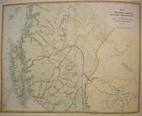
1874rif. M7548Montreal: Canadian Pacific Railway 1874. Very Good; laid down on acid-free tissue paper for long-term preservation. Notes: A very important and early working map of Alberta and British Columbia depicting existing and suggested railways. There is a note written in period ink in the lower margin in reference to a contemporary marking of newly suggested routes in black ink: "Note -- The Surveys made since the publication of the Report & Maps of 1874 shew the routes colored full black line and thus broken black line to be the best lines for railway construction that have been found to this date Oct 1875. Mr. Smith". "Mr. Smith" is believed to be Donald A. Smith a major partner in the yet-to-be incorporated Canadian Pacific Railway Company in 1881. The routes marked out in red as printed depict potential lines crossing the Rockies to the west of Edmonton at Yellowhead Pass. Almost none of the suggested routes depicted on this map were eventually used--CPR dismissed the use of Yellowhead Pass for a pass farther south in order to discourage competition from railway lines south of the border. They chose instead Kicking Horse Pass which is depicted on this map. Size : 608x779 mm 23.94x30.67 Inches Coloring: Hand Colored Category: Maps Railroad; Maps Canada West British Columbia;Maps Canada West Alberta; Canadian Pacific Railway unknown
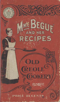
1900rif. 6878San Francisco; Chicago: Southern Pacific Railroad; Printed by Poole Bros 1900. Duodecimo-size booklet 14.75 x 8.5 cm. 80 pages. Blue and brown ink on pink paper. Two photographic portraits Monsieur and Madame Bégué. Illustrations. List of railway agents. Title from cover. In logo at head of title: Southern Pacific Sunset Route. ~ Evident FIRST EDITION. A souvenir anthology of writings including sixty recipes from two landmark New Orleans restaurants offered for sale to customers traveling the Sunset Route San Francisco–New Orleans by the Southern Pacific Railroad Company. A sampling: Mutton Feet à la Créole Liver à la Bégué Jambalaya of Chicken Codish with White Beans Bisque of Crayfish Creamed Cauliflower Onion Salad Eggplant with Rice and Ham Mayonaise of Celery and Shrimps Pineapple with White Wine. ~ The title displayed on the wrappers is misleading: the atmospheric essays and testimonials – arranged by a literary journalist who contributed to Southern Pacific's promotional magazine Sunset Henry Monroe Mayo 1868-1950 – reveal little regarding the eponymous originator of the recipes or the history of the cuisine that brought her fame. Only pages 47-68 contain recipes by Elizabeth née Elisabetha Kettenring Dutreuil Bégué 1831-1906 the proprietary chef of the beloved restaurant in the Vieux Carré – the second oldest such establishment in New Orleans – located on the Rue de la Levée Decatur Street after 1870 downriver from Jackson Square and across from the French Market. An immigrant from southern Germany she had opened a coffee shop with her husband Louis Dutreuil in 1863. After his death in 1875 she married again and with her second husband Hippolyte Bégué 1842-1917 reopened in the same location with the aim of serving one meal per day – a “second breakfast” beginning at 11:00 a.m. – to accommodate laborers in the meat markets and on the docks who started work at dawn. A fuller history by David Shields is available in his The Culinarians Chicago: University or Chicago Press 2017 pages 270-273. By the mid-1880s trade fairs held in the city were bringing tourists as well and Bégué’s became a destination on its own. Madame Bégué died in 1906. The restaurant continued under management of her daughter but was sold in 1914 to relatives of the family Tujague competitors since 1856 on Decatur Street a few doors away. ~ A shorter tribute with recipes pages 69-74 is accorded another restaurateur presumably Victor Béro d. 1904 an immigrant from Belgium who had presided over Victor's Restaurant since 1873. Mayo appears to confuse the "Monsieur Victor" of his time with the founder and namesake of the establishment Victor Martin 1812-1865; cf. Shields page 136 445. ~ The Sunset Route of the Southern Pacific Company was the southernmost of the transport lines to the West Coast originally contemplated by the series of Pacific Railroad Acts between 1862 and 1866. Of the resulting publicly subsidized corporate consortia that would transform western North America – known collectively as the transcontinental railroads – Southern Pacific was already a mammoth system in 1900 including smaller subsidiaries such as the Texas and New Orleans Railroad and extending across territories that would later become New Mexico and Arizona as well as northwards through Nevada Utah and much of California. The in-house Sunset magazine appears to have been printed close to headquarters in San Francisco but like many publications issued by the transportation industry Mme. Bégué and Her Recipes was printed by Poole Brothers of Chicago who advertised as "railway printers" and also produced tickets brochures and mileage tables. ~ A few pages dog-eared. Very good in publisher's red wrappers decorated in black and white with an image of Madame Chef in kitchen apron. Rare. OCLC locates thirteen copies; Uhler 28; New Orleans Culinary History Group page 13; not in Bitting Brown or Cagle. Southern Pacific Railroad]; [Printed by] Poole Bros unknown
1900rif. 6878San Francisco; Chicago: Southern Pacific Railroad; Printed by Poole Bros 1900. Duodecimo-size booklet 14.75 x 8.5 cm. 80 pages. Blue and brown ink on pink paper. Two photographic portraits Monsieur and Madame Bégué. Illustrations. List of railway agents. Title from cover. In logo at head of title: Southern Pacific Sunset Route. ~ Evident FIRST EDITION. A souvenir anthology of writings including sixty recipes from two landmark New Orleans restaurants offered for sale to customers traveling the Sunset Route San Francisco–New Orleans by the Southern Pacific Railroad Company. A sampling: Mutton Feet à la Créole Liver à la Bégué Jambalaya of Chicken Codish with White Beans Bisque of Crayfish Creamed Cauliflower Onion Salad Eggplant with Rice and Ham Mayonaise of Celery and Shrimps Pineapple with White Wine. ~ The title displayed on the wrappers is misleading: the atmospheric essays and testimonials – arranged by a literary journalist who contributed to Southern Pacific's promotional magazine Sunset Henry Monroe Mayo 1868-1950 – reveal little regarding the eponymous originator of the recipes or the history of the cuisine that brought her fame. Only pages 47-68 contain recipes by Elizabeth née Elisabetha Kettenring Dutreuil Bégué 1831-1906 the proprietary chef of the beloved restaurant in the Vieux Carré – the second oldest such establishment in New Orleans – located on the Rue de la Levée Decatur Street after 1870 downriver from Jackson Square and across from the French Market. An immigrant from southern Germany she had opened a coffee shop with her husband Louis Dutreuil in 1863. After his death in 1875 she married again and with her second husband Hippolyte Bégué 1842-1917 reopened in the same location with the aim of serving one meal per day – a “second breakfast” beginning at 11:00 a.m. – to accommodate laborers in the meat markets and on the docks who started work at dawn. A fuller history by David Shields is available in his The Culinarians Chicago: University or Chicago Press 2017 pages 270-273. By the mid-1880s trade fairs held in the city were bringing tourists as well and Bégué’s became a destination on its own. Madame Bégué died in 1906. The restaurant continued under management of her daughter but was sold in 1914 to relatives of the family Tujague competitors since 1856 on Decatur Street a few doors away. ~ A shorter tribute with recipes pages 69-74 is accorded another restaurateur presumably Victor Béro d. 1904 an immigrant from Belgium who had presided over Victor's Restaurant since 1873. Mayo appears to confuse the "Monsieur Victor" of his time with the founder and namesake of the establishment Victor Martin 1812-1865; cf. Shields page 136 445. ~ The Sunset Route of the Southern Pacific Company was the southernmost of the transport lines to the West Coast originally contemplated by the series of Pacific Railroad Acts between 1862 and 1866. Of the resulting publicly subsidized corporate consortia that would transform western North America – known collectively as the transcontinental railroads – Southern Pacific was already a mammoth system in 1900 including smaller subsidiaries such as the Texas and New Orleans Railroad and extending across territories that would later become New Mexico and Arizona as well as northwards through Nevada Utah and much of California. The in-house Sunset magazine appears to have been printed close to headquarters in San Francisco but like many publications issued by the transportation industry Mme. Bégué and Her Recipes was printed by Poole Brothers of Chicago who advertised as "railway printers" and also produced tickets brochures and mileage tables. ~ A few pages dog-eared. Very good in publisher's red wrappers decorated in black and white with an image of Madame Chef in kitchen apron. Rare. OCLC locates thirteen copies; Uhler 28; New Orleans Culinary History Group page 13; not in Bitting Brown or Cagle. Southern Pacific Railroad]; [Printed by] Poole Bros unknown books
1777rif. 44433Amsterdam, et se trouve à Paris, chez Pissot, Nyon, 1777. In-8 de (4)-XIX-(1)-546 pp., veau havane marbré, dos orné à nerfs, pièce de titre en maroquin rouge, tranches rouges (reliure de l'époque).
1846Edges a bit browned; Beautifully rebound in 1/2 leather. Spine with label and gilt, linear design. Absolutely handsome copy; B&W Photographs; 16mo; 285 pages
1896rif. 49745Chicago: Rand McNally & Co. 1896. 1896. RAILROAD MAP. Oblong atlas folio. 37 x 56 in. One large color lithograph map mounted on linen showing the routes of the Union Pacific and subsidiary railroads in red with red yellow & black banner style lettering at upper fore-edge Union Pacific shields with mentions of subsidiary Railways mounted to upper & lower wooden rods as issued some minor lifting & creasing from being rolled over the years minor tide mark at left fore-edge upper fore-edge minor fraying and darkening still nice complete example of this map. First Rand McNally & Co. edition thus of this uncommon First Rand McNally & Co. edition thus of this uncommon Union Pacific Railroad route map intended to be used by travel agents and passenger agents in Union Pacific stations across the West. The map demarcates the Overland Route and connections with the Oregon Short Line RR Co. Oregon RR & Navigation Co. and the Southern Pacific in bold red stretching West from Kansas City Leavenworth St. Joseph Omaha Council Bluffs Sioux City & Fort Worth. A version of this map was initially released in 1892 by Reeves with the Knight Leonard & Co. and a little larger by a couple inches as it included insets for Sandwich Islands and Alaska whereas this version focuses only on the Continental United States. Rand McNally & Co., 1896. unknown
1851In-8 gr. (mm. 255 x 165), 5 volumi, tela editoriale, ricca decoraz. a secco ai piatti e al dorso (2 volumi restaur. per piccole manc. ai bordi), pp. LX,434; XVI,476; XVI,438; XVI,540; XVI,558; molto ben illustrati da numerose figg. inc. su legno nel testo e da 63 (su 64) belle tavole inc. su acciaio fuori testo: sono vedute, ritratti di indigeni, loro abitazioni e cerimonie; unite 13 cartine geografiche piu' volte ripieg. Resoconto di una importante missione scientifica di esplorazione, diretta dall'ufficiale di marina americano Charles Wilkes (1798-1877). Durante il lungo viaggio vennero visitati vari arcipelaghi del Sud Pacifico, toccata l'Australia, scoperte le coste dell'Antartico oggi chiamate "Wilkes Land" e percorse le isole Fidji, Hawaii e la costa nord-ovest degli Stati Uniti; ritornata fino al Borneo via Filippine, la spedizione fece definitivo rientro attraverso la Polinesia e il Capo di Buona Speranza. Esemplare uniformemente arrossato e con fioriture ma complessivamente in buono stato.