6911 risultati
1975rif. 2412050448xbvkHoniara, British Solomon Islands Protectorate, printed by the Government Printer, 1971-1975. Detailed collation: I. Annual titlepage, v pages 'Index', 224 pages (Issue #1-#4 individually paginated [16 p. in total], Issue 5 starts with p. 17, then onwards to p. 224). / II. Annual titlepage, xiii pages 'Index', 245 pages. / III. Annual titlepage, xi pages 'Index', 200 pages. / IV. Annual titlepage, x pages 'Index', 245 pages. / V. Annual titlepage, xi pages 'Index', 196 pages. - 'Publisher's' titled greyblue halfcloth bindings with yellow thick cardboard-panels; 8vo.(ca. 20,5 x 14 x 9 cm; ca. 2,5 kg.).
1946rif. 2409300270xbvkJapan, 1946. 33 (1) pages, with few illustrations; Texts American or Japanese, each which translational-aid for the other language, incl. American-Japanese glossary. - Publisher's photographically illustrated wrapper 8vo.(19 x 12 cm).
1974518 pages. Report of the estuary working group, Department of the Environment, Regional Board Pacific Region. Summarizes existing knowledge pertinent to potential ecological changes rising from estuarine modification. Contents include: Geology; Climatology, Hydrology and Water Quality; Oceanography; Invertebrate Biology; Fish; Bacteria; Flora; Wildlife; Land Use; Waste Disposal and Pollution Problems; Food Chains; and more. Clean and unmarked with light wear. Tight and square. Nice copy. Book
1837rif. PHO-2143Paris, Arthus Bertrand, 1837, 1 volume (3) grand in-4° (30x24,5cm), VIII pp., 742 pp., demi basane époque, dos lisse avec auteur, titre et tomaison, frottements au dos, quelques rousseurs, défaut à la coiffe sup., de la bibliothèque de Cayrol avec son cachet et signature manuscrite.
1767rif. 14642Molini Paris 1767 1 vol. In-12 de 2 ff.n.ch. LXVIII 335 pp., veau fauve de l'époque, dos à nerfs orné, pièce de titre, tranches rouges.
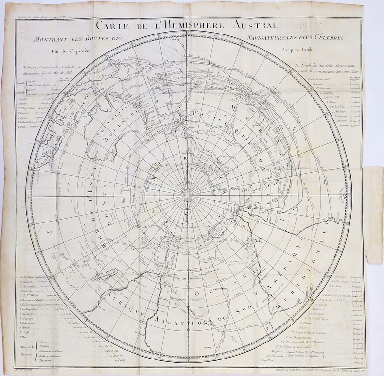
1780rif. LBW-4310[1780]. 535 x 535 mm.
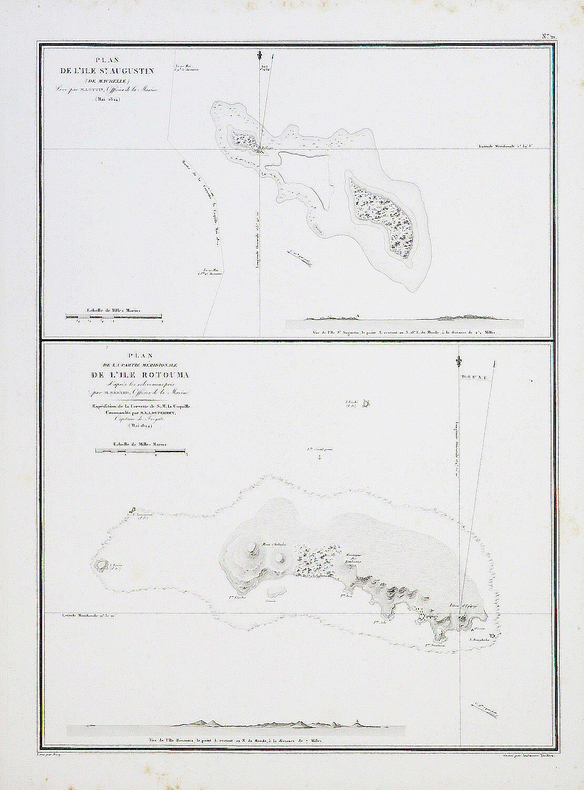
1827rif. LBW-4441[1827]. 495 x 361 mm.
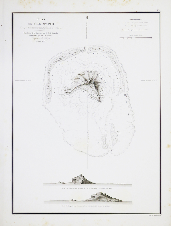
1827rif. LBW-4419[1827]. 489 x 360 mm.
1893rif. 0711262Salem: M P RW Co. St. Louis 1893 Woodward & Tiernan Printing Co. 1893. 2nd Edition. Soft cover. Fair. 2nd edition issued same year as 1st edition. Printed wraps 5 1/4" x 7 1/2". 85pp. Illustrated with several full page & smaller engravings. Ads. Folding map in facsimile. Title page in facsimile & on paper virtually the same as the text. A rare promotional booklet issued by the railroad to prepare homesteaders about to rush into the Cherokee Strip. Contents include: historical background including references to the 1889 land rush; information table of Indian groups occupying the Strip including location of agency acreage square miles population; analysis of the soil; info on favorable crops; "How To Locate Your Land"; etc. This rare booklet has insect damage 2 3/4" diagonally to the upper corner of the last four leaves & the back cover but there is very little loss of text -- only a few words. Quarter coin size insect loss to upper right edge of front cover -- no loss of text or even close to it as cover title & decoration is in center of cover. Stains to upper fore edge of last one-half of book. The large 16 1/4" x 22" 1889 folding facsimile map "A Correct Map of the Oklahoma Country and Cherokee Outlet reached via the Missouri Pacific Railway and Iron Mountain Route" was done from an original copy. There was top edge damage on the original with loss of a few title letters from the phrase "Oklahoma and Cherokee Strip 'THE HOMESEEKERS' Mecca" most of "Mecca" lost. Map includes all of Kansas & parts of adjacent states to Oklahoma. In spite of noted damage a very usable booklet with flexible paper. Professional stabilizing to the binding. Herd 1706 indicates an 1894 issuance but material in the book reasonably points to the earlier 1893 date. Herd 1706. Hargrett Gilcrease Imprints p92 references an 1898 edition but their copy was at the time of bibliography's publication not at hand for editor to double-check against records. M P RW Co., St. Louis, (1893) (Woodward & Tiernan Printing Co.) unknown
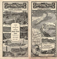
1890rif. 46165San Francisco: Crocker & Co. December 1890. 1890. 7" x 21" sheet on cream-colored stock folded to 12 panels each 7" x 3 1/2." 2 pictorial cover panels. Ticket rates from San Francisco to Monterey Pacific Grove or Santa Cruz along with excursion rates. 2 panels offering "Schedule of Stage Connections Showing Routes Distances Rates of Fare Etc." Black and white illustration showing bird's eye view of Hotel del Monte. Time schedules for the Monterey Line Pacific Grove Extension Santa Cruz Line Almaden Line Tres Pinos Line and Sta. Margarita Line. Light soiling to cover panels else near fine. Crocker & Co., December, 1890. unknown
rif. 650067Very Good. Softcover. Circa 1855. No title page -- appears to be assembled collection of bird plates from various U.S.P.R.R. Exp. & Surveys publications bound into a nice three-quarter leather album. Contains 31 linen-backed color plates. Most plates are not identified by species. All plates are Birds: California Plates II III IV V VII 2 plates with slight variation in background VIII 2 plates with slight variation in background; Cal & Oregon Plate IX; 32nd Parallel West Plates IV VI XIV; 32nd Parallel East Plates XV XXXI; 35th Parallel Plates XIV XX XXVII XXX XXXIII XXXVI; 38th-39th-41st Parallels Plates XII 2 identical plates XIII XVII XXXII XXXV; 47th Parallel Plates XI XVI; 47th-35th Parallels Plate XVIII 2 identical plates; 47th-32nd Parallels Plate XXVIII. Plates are very good. The covers show some rubbing spotting but binding is generally very sound and attractive. ; Trade PB; Oblong Small 4to 9" - 11" tall . paperback
1850rif. DEMO014460IPhiladelphia: Printed by C. Sherman 1850. Popular Edition. Hardcover. Good. 64 excellent steel-plate engravings with 12 of 13 maps Samoa map apparently never inserted many vignettes and woodcuts. Octavos half brown calf blue marbled boards edges and endpapers; vol. 1 rebacked retaining original back and leather labels scuffing and wear to other spines corners worn. Wilkes' expedition was the first American scientific exploring expedition by sea voyage. His six ships sailed south around South America along Antarctica causing Wilkes to decide that Antarctica was indeed a separate continent. Other stops were at the Pacific islands of Tahiti the Samoas Australia and New Zealand. Maps of Tahiti & Australia and New South Wales Along the way they charted the coasts of California Washington and Oregon. Howes W414; Palau 375505; Sabin 103994 note; see Cowan p.683; Taylor PACIFIC BIBLIOGRAPHY p.13. "Wilkes' spectacular Antarctic and South Sea explorations - Goetzmann ARMY EXPLORATION IN THE . WEST p.61" 64 excellent steel-plate engravings many vignettes and woodcuts. Unlike the 1844 edition the following Sherman editions did not have a 6th volume - the Atlas but have 3 Tables and 11 maps Printed by C. Sherman hardcover
19522 vols., 8vo., First Edition, with title-vignettes, several illustrations in the text and 2 maps (one double-page) on green stock; handsomely bound in full dark red crushed morocco, sides framed in gilt, backs gilt with raised bands, second and fourth compartments ruled and lettered in gilt, hand-made endpapers, ribbon markers, white blocking from original upper boards preserved and mounted on new and separate leaves at front, custom-made slip-case, an elegant set ideal as a gift or for presentation. Bright set of Grimble's classic travel-autobiography set in the Gilbert and Ellice Islands of the Central Pacific
1911Features: Steel Bridge Across Chehalis River at Aberdeen Formally Opened - article with photo; The Panama Canal Route for Canadian Northwest Shipping; Photo of Charles M. Hays, president of the Grand Trunk Railway; Address to General Passenger Agents by Howard Elliott, president of the Northern Pacific Railway (four pages); Brief business biography of George W. Hibbard, General Passenger Agent of the C.M. & P.S., with photo; Bernard N. Baker's Steamship Line a Golden Opportunity; Puget Sound Tugboat Co. on the Columbia River; New Boilers for North Vancouver Ferries; Steamer Maunganui Launched; Review of the Charter Market; Casualties to Pacific Coast Shipping; Modern Aids to Navigation Demanded for Alaskan Waters - article including lengthy list of vessels lost; Excellent illustrated centerfold makes the case for lighthouses in Alaskan waters; Review of Marine Insurance and Shipping Law; Address by president of the San Francisco Merchants' Exchange, Robert Dollar, entitled "The American Merchant Marine As It Affects Our Foreign Commerce" - with photo of Dollar; and more. 44 pages including several pages of nostalgic ads, some illustrated in black and white, featuring local marine and rail interests. Printed upon glossy coated stock. Average wear. Binding intact. Few library markings to front cover. A well-preserved copy of this highly-informative memento of Pacific Northwest transportation over a century ago. 12" x 9". Magazine
1912Features: Big Improvements by Northern Pacific During 1912; Through Service Seattle to Texas; O.-W. R. & N. Enter Vancouver; Will Carl Gray Succeed L.W. Hill? - article with photo of Gray; Dangers Attending Hauling Explosives; New H-H-1 Locomotive Design; Seattle's Greatest Opportunity; Bush Terminal Company to Build on Harbor Land - article with photo of Model Loft buildings at the New York Bush Terminal, similar to those to be built on Harbor Island; Portland's Proposed Harbor Front Development and the Commission of Public Docks - major article; South and Central American Trade; Great Prospects for Vancouver, B.C.; The Official Statement of the [Seattle] Port Commission re: improvements and facilities; Economy of the [Seattle] Municipal Plan (part 4) - major article which includes official map of Grand Trunk Pacific Railway showing proposed extension to Vancouver and Seattle, plus map of new thoroughfare donated to Seattle by Great Northern Railway with franchise for Interbay-Ballard Route; Bogue Plans for Tacoma Harbor Are Impressive - major article with map showing City section of harbor plans; Casualties to Pacific Coast Shipping for Year 1911 - Four full pages of fine print document the voluminous incidents of the year including the vessel and damage it sustained; Photo of Strathalbyn's bow after collision; Review of Marine Insurance and Shipping Law; Big Company to use Panama Canal - International Mercantile Marine; and more. 44 pages including several pages of nostalgic ads, some illustrated in black and white, featuring local marine and rail interests. Printed upon glossy coated stock. Average wear. Binding intact. Few library markings to front cover. A well-preserved copy of this highly-informative memento of Pacific Northwest transportation over a century ago. 12" x 9". Magazine
1911Features: Reasons Why the Canadian Pacific is So Prosperous; Spokane Rate Decision Eagerly Awaited; Value of Steel Equipment Demonstrated in Wreck of the Crack Milwaukee Train, Columbian on May 30th east of Ralston, WA; Continued Smuggling of Opium into West Coast Ports Aboard Trans-Pacific Steamships; Professional Biography of Joseph H. Young, President of Alaska Steamship Co. - with photo; Contracts Let for Coaling Plants in Seattle and Tacoma - article with two photos; $1 Million Available for Improvements at Moran Shipyards; Record Run Between Puget Sound and Callao by Schooner Wilbert L. Smith; After 20 Years on the Seattle-Tacoma Run, Steamer Flyer is Sold - Feature article with photo; Review of Marine Insurance and Shipping Law; Photo of Steamer Tampico Submerged in Seattle Harbor; Photo of New Boilers for Steamer Charmer built by Commercial Boiler Works of Seattle; Effects of the Panama Canal on Pacific Coast - Oriental Trade; News of Tacoma; Launching of the Titanic - 1/3 page article including photo of the Titanic in drydock with man standing below her massive 100-ton rudder; Charming one-page illustrated ad for The Shasta Limited, "The Finest Train in the West" which connected Seattle with San Francisco; and more. 44 pages including several pages of nostalgic ads, some illustrated in black and white, featuring local marine and rail interests. Printed upon glossy coated stock. Average wear. Binding intact. Few library markings to front cover. A well-preserved copy of this highly-informative memento of Pacific Northwest transportation over a century ago. 12" x 9". Magazine
1922rif. IG038951922-1964 ca. 5000 p., num. figs & pls, paperbound or disbound (= taken from journal, no covers). Published in Videnskabelige Meddelelser fra Dansk naturhistorisk Forening i Kobenhavn. Contains numerous important contributions like: Ditlevsen, Marine freeliving Nematodes / Broch, Studies on Pacific Cirripeds / Mortensen, Echinoderms from New Zealand and the Auckland-Campbell Islands / Michaelsen, Ascidiae Ptychobranchiae / Dyktiobranchiae / Krikobranchiae von Neuseeland und den Chatham-Inseln / Sérène, Goneplacidae et Pinnotheridae / Stock, Pycnogonida from Indo-West-Pacific, Australian, and New-Zealand Waters / Odhner, New Zealand Mollusca / Carlgren, Actiniaria from New Zealand and its Subantarctic Islands / Bronsted, Sponges from New Zealand / Bock, Planarians / Boschma, Madreporaria. I. Fungiidae / Weber-van Bosse, Algues de l'Expédition danoise aux îles Kei / Augener, Polychaeta von Neuseeland and many other contributions. We added a biography and bibliography of Th. Mortensen.
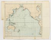
1790rif. 143934Paris: F. Dufart 1790. Very Good. Paris F. Dufart circa 1790. A hand-coloured engraved map printed surface 378× 415 mm sheet size approximately 420 × 540 mm. 'Gravée par Tardieu l'Ainé . Dessiné par Poirson . Ecrit par Beaublé'. Original folds as issued; some minor uneven tanning; in very good condition. An uncommon chart of the Pacific Ocean and Australia showing magnetic variation and dip drawing on observations made in the course of Pacific voyages after 1775 most notably Cook's third voyage. It is most likely from a duodecimo edition of Buffon's 'Histoire naturelle générale et particulière' around the end of the eighteenth century 'PL. III. Tome XVI' and 'Page 58' are printed in the top margin. It is based on a larger chart in four sheets attributed to Jean-Charles de Borda. The engraver Tardieu is one of half a dozen members of the family working as engravers at the period one of whom P.A.F. Tardieu would engrave the charts published in the official account of the Baudin voyage. F. Dufart unknown
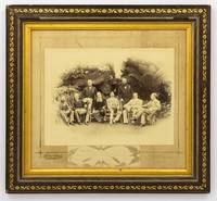
1888rif. 134827Sydney: Kerry & Jones 308 George Street 1888. Sydney Kerry & Jones 308 George Street 1888. A high-gloss gelatin silver photograph 222 × 296 mm laid down within a gilt border on the original cardboard mount with the photographic studio's details in gilt in the bottom margin. Also mounted there is a small gelatin silver photograph 47 × 165 mm of the signatures of the eight participants 'Government House Sydney Jan. 25 1888' is written below the original signatures. The item is in a contemporary frame wood with gilt-decorated plaster a little chipped now lacking the original glass visible image size 315 × 350 mm external dimensions 423 × 458 mm. The contemporary label of Cole's Book Arcade Melbourne is mounted on the verso. The main photograph has a couple of tiny surface chips to the top edge and a few tiny marks to the bottom right-hand corner; the mount is a little marked possibly lightly water-streaked but fortunately the photograph is untouched; these trifling blemishes have little impact on this fine portrait. This informal group portrait features the Governors of each of the Australian colonies along with the Governors of Fiji and New Zealand. It was taken on 25 January 1888 the day before the centenary of the arrival of the First Fleet at Port Jackson the main reason for their presence in Sydney. It features left to right Sir Robert George Crookshank Hamilton 1836-1895 KCB LLD Governor and Commander in Chief of Tasmania and its dependencies; Sir Anthony Musgrave 1828-1888 GCMG Governor of Queensland; Sir Charles Bullen Hugh Mitchell 1836-1899 Governor of Fiji; Henry Brougham Loch 1st Baron Loch 1827-1900 GCP GCMG PC Governor and Commander in Chief of Victoria; Charles Robert Wynn-Carrington 1st Marquess of Lincolnshire 1843-1928 KG GCMG PC JP DL Governor of New South Wales; Sir Frederick Napier Broome 1842-1896 KCMG Governor of Western Australia; Lieutenant General Sir William Francis Drummond Jervois 1821-1897 GCMG CB FRS Governor of New Zealand; and Sir William Cleaver Francis Robinson 1834-1897 GCMG FRGS Governor of South Australia. Extensive research notes come with this item; they were compiled with the assistance of Dr John Fahey author of 'Australia's First Spies' Sydney 2018 and 'Traitors and Spies: Espionage and Corruption in High Places in Australia 1901-1950' Sydney 2018. Among much else the notes have identified a slightly variant photograph taken at the same time as this one held by the Blue Mountains City Library; the identity of the sitters comes from a letter and diagram sent to them from the Mitchell Library in 1929. 'From the various sources available most notably the title given by the State Library of New South Wales this photograph commemorates an unofficial side-meeting of these Governors to discuss Australia's interests in the South Pacific'. Dr Fahey puts it more succinctly when he says it likely offers 'evidence of one of our earliest "secret" off to the side policy conferences'. The notes provide a lot more background information for the purchaser. A few incidentals not mentioned there: Sir Anthony Musgrave was Governor of South Australia from 1873 to 1877 and he died on 9 October 1888; Sir William Jervois was Governor of South Australia from 1877 to 1883; Sir William Robinson was Governor of Western Australia three times between 1875 and 1895 1875-1877 1880-1883 and 1890-1895. Provenance: the Sloane Pastoral Family of the Riverina purchased at the estate clearing sale in April 2021. Kerry & Jones, 308 George Street unknown
1912rif. 64223Portland OR: American Map and Reproducing Company Corner E. Stark & E. 43rd 1912. One double atlas folio colour lithograph map sized 28 x 40.5 professionally mounted on archival linen sized 32 x 45 in. w/ scale of 1:24000 minor edgewear slight age toning at fore-edges and lower corner still a VG bright copy. First edition of this very uncommon Progressive Era map of Portland Oregon in the years between the Lewis & Clark Centennial Exposition and World War I. The map depicts public lands including township range and section grids along with neighborhood and addition place names steam & electric interurban railroads and electric streetcar lines along with parks city limits and radial distances from point in downtown Portland included. Place names included Zion Town the old steel bridge built in 1888 followed by a new Steel bridge which opened later in 1912 the Plank/Old Canyon Road Laurelhurst and others. Of particular interest beyond most maps of Portland during the era this map delineates a significant portion of Vancouver Washington prior to the construction of the Interstate Bridge across Hayden Island as well as inroads into portions of Northwest Portland and Washington County in the Southwest. Fritsche 1877-1928 was an intrepid German-American photo-lithographer architect printer and later photographer who first arrived in New York before coming West to the Pacific Northwest in 1907 where he set up an architecture and engraving firm with his brother Rudolph Fritsche. Wenzel is perhaps best remembered as architect of the historic Henry C. & Wilhemina Bruening House Craftsman bungalow located at 5919 North Williams in Portland’s Humboldt neighborhood erected in 1910. However by 1914 Wenzel had returned to Manhattan with his family including one son and three daughters. Worldcat locates 5 copies U of IL Boston Pub. OHS Reed U of O. American Map and Reproducing Company, [Corner E. Stark & E. 43rd], unknown
1928rif. 64603Albany NY: Louise ca. 1928. Oblong 4to. 62 pp unpaginated. on thick black paper stock. With 110 original silver gelating photographs sized from 2.75 x 4.5 in. up to 5 x 7 in. with most sized 2.75 x 4.5 in. all mounted w/ black corners nearly all neatly identified below in white ink MS. Contemporary brown flexible cloth post-binder brass screw posts at gutter margin gilt lettering stamped on front cover minor shelfwear slight scuffing still a VG exemplar w/ all the photos consistently featuring bright strong contrast. This charming album opens with photos of Louise & “Snookie” their little poodle mix pet dog along with several images depicting their well-appointed Arts & Crafts Albany NY home featuring exterior & interior wicker furnishings Arts & Crafts quarter-sawn oak Stickley furniture Persian rugs lamps and a considerable number of taxidermy trophies on the walls. One small photo identified as “where Louise spent many happy hours” of the Charles Winthrop Crockett 1862-1936 home owned y the noted longtime professor of astronomy & mathematics at Rensselaer Polytechnic Institute in Troy NY. The travel photos begin with the well-to-do couple’s stops in Newcastle and St.-Annes-on-the-Sea England Wrexham Wales near Eli Yale’s tomb Oban Scotland Marseilles France and sailing with Captain Hans Fjelstadt on the S/Y Prinz Olav to Norway. Originally launched as the HMY Alexandra by 1925 the yacht had been renamed the Prinz Olav sailing to Scandinavian ports and photos here depict a Lapp Family visit to Goteborg Stockholm Finland and the Little Mermaid statue in Copenhagen. They also continue to visit the Alhambra in Spain and the Solfatara crater vents in Italy associated with Dante’s Inferno. Many of the photographs reveal their stops in Africa including Bou Saada Algeria Torit Bori Malakal and Khartoum Sudan along with images of their White Nile River ship the Fateh and their sleeping barge. Other Africa sites including Mombasa Kenya Beira Portuguese East Africa Mozambique Durban Natal and Capetown South Africa. Over a third of the remaining photos nearly 50 touch on their stops and visits to Auckland NZ Bali Java Sumagra Agra India Bangkok Thailand Angkor Wat in Cambodia visits to Beijing Suzhou and Nankou China with stops at the Forbidden City the Great Wall and more. Their Japan photos feature stops in Kyoto the Kamakura Buddha temple complex at Nara followed by homeward voyage through the Territory of Hawaii Venezulea Trinidad Argentina Chile & Peru. Possibly inspired by Jules Verne’s Phileas Fogg they travel by rickshaw sedan chair in China train and at least four different steamship/ocean liners including the SS Orduna S/Y Prinz Olav the S/S Nestor and the RMS Niagara the Royal Mail transpacific ocean liner. Louise, hardcover
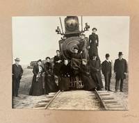
1902rif. 236271902. Early twentieth century American travel photograph album with accompanying handwritten identification notes circa 1900 to 1905 documenting the travels of the family of Texas & Pacific Railway official C. G. Warner through the railroad steamship and hotel networks that connected the American Southwest with Europe during the mature era of international leisure travel. The accompanying manuscript key identifies family members railroad scenes buildings and destinations throughout the album transforming anonymous travel photographs into a documented record of an identifiable railroad family. The notes further preserve family tradition explaining that Warner traveled to Europe in 1902 for medical treatment providing a narrative framework that links the railroad photographs Atlantic crossing and European views as a documented journey. Photo album of silver gelatin photographs various sizes most approximately 3.5 x 3.5 inches the largest approximately 6.25 x 8.25 inches United States Europe and Mexico circa 1900 to 1905 accompanied by four pages of handwritten identifications. The opening sequence depicts repeated group portraits posed around Texas & Pacific locomotive no. 21 including women standing on the pilot smokebox running boards and cab additional views of the locomotive in profile railroad employees passenger cars station scenes and the Railroad Young Men's Christian Association building. The handwritten notes identify C. G. Warner in multiple railroad photographs and suggest he served as a director of the Texas & Pacific identify Elizabeth W. Douglass in an early family portrait distinguish mail or express cars identify Warner's private railroad car and name additional family members including Aunt Libbet Anna Warner Clara K. Green Clara Kooser and H. B. Kooser. The journey continues aboard the American Line steamship SS St. Paul including deck scenes crew members harbor views and a large commercial photograph of the liner under way. European photographs include the Arc de Triomphe the Paris Opéra lakeside towns and grand hotels in Switzerland the Palace of Westminster and Big Ben in London streetscapes waterfronts public gardens and prominent civic buildings. Family members appear throughout in formal portraiture seaside recreation hotel grounds and informal gatherings while additional photographs record Juárez Mexico and substantial American residences photographed before departure. The handwritten notes record that C. G. Warner Aunt Juliett and Aunt Libbet sailed on April 2 1902 returning on June 3 after spending most of their journey in France with a shorter stay in England and state that Warner traveled abroad because of poor health to "take the baths." The notes further preserve family recollection that contemporary newspapers reported Warner "derived much benefit from two months' rest" before spending time in the Gould offices upon his return to New York placing the photographs within a documented episode in the life of a named railroad executive rather than an anonymous vacation. Viewed alongside the photographs the manuscript identifications establish people places transportation infrastructure and chronology substantially strengthening the documentary character of the album. Red stained leather album with black pasted decoration; pages 7 and 9 loose binding heavily worn album leaves toned photographs clear and firmly adhered. Overall in good condition. A documented visual record of one American railroad family's movement through the interconnected rail steamship and hotel systems that carried affluent travelers between Texas New York Mexico and Europe at the beginning of the twentieth century. unknown
1902rif. 236271902. Early twentieth century American travel photograph album with accompanying handwritten identification notes circa 1900 to 1905 documenting the travels of the family of Texas & Pacific Railway official C. G. Warner through the railroad steamship and hotel networks that connected the American Southwest with Europe during the mature era of international leisure travel. The accompanying manuscript key identifies family members railroad scenes buildings and destinations throughout the album transforming anonymous travel photographs into a documented record of an identifiable railroad family. The notes further preserve family tradition explaining that Warner traveled to Europe in 1902 for medical treatment providing a narrative framework that links the railroad photographs Atlantic crossing and European views as a documented journey. Photo album of silver gelatin photographs various sizes most approximately 3.5 x 3.5 inches the largest approximately 6.25 x 8.25 inches United States Europe and Mexico circa 1900 to 1905 accompanied by four pages of handwritten identifications. The opening sequence depicts repeated group portraits posed around Texas & Pacific locomotive no. 21 including women standing on the pilot smokebox running boards and cab additional views of the locomotive in profile railroad employees passenger cars station scenes and the Railroad Young Men's Christian Association building. The handwritten notes identify C. G. Warner in multiple railroad photographs and suggest he served as a director of the Texas & Pacific identify Elizabeth W. Douglass in an early family portrait distinguish mail or express cars identify Warner's private railroad car and name additional family members including Aunt Libbet Anna Warner Clara K. Green Clara Kooser and H. B. Kooser. The journey continues aboard the American Line steamship SS St. Paul including deck scenes crew members harbor views and a large commercial photograph of the liner under way. European photographs include the Arc de Triomphe the Paris Opéra lakeside towns and grand hotels in Switzerland the Palace of Westminster and Big Ben in London streetscapes waterfronts public gardens and prominent civic buildings. Family members appear throughout in formal portraiture seaside recreation hotel grounds and informal gatherings while additional photographs record Juárez Mexico and substantial American residences photographed before departure. The handwritten notes record that C. G. Warner Aunt Juliett and Aunt Libbet sailed on April 2 1902 returning on June 3 after spending most of their journey in France with a shorter stay in England and state that Warner traveled abroad because of poor health to "take the baths." The notes further preserve family recollection that contemporary newspapers reported Warner "derived much benefit from two months' rest" before spending time in the Gould offices upon his return to New York placing the photographs within a documented episode in the life of a named railroad executive rather than an anonymous vacation. Viewed alongside the photographs the manuscript identifications establish people places transportation infrastructure and chronology substantially strengthening the documentary character of the album. Red stained leather album with black pasted decoration; pages 7 and 9 loose binding heavily worn album leaves toned photographs clear and firmly adhered. Overall in good condition. A documented visual record of one American railroad family's movement through the interconnected rail steamship and hotel systems that carried affluent travelers between Texas New York Mexico and Europe at the beginning of the twentieth century. unknown books
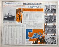
1930rif. P2619Montreal: Canadian Pacific c. 1930. Very Good laid-down on acid-free paper for long-term preservation. Notes: A charming view of Canadian Pacific Montrose and Montclare. Image Size : 470x568 mm 18.50x22.36 Inches Platemark Size : Paper Size : 479x601 mm 18.86x23.66 Inches Coloring: Printed in Color Medium: Offset Lithograph Categories: Advertising; Transportation Ships; Canadian Pacific unknown
1891rif. 32829St. Louis: Woodward & Tiernan Printing Co. n.d. 1891. 1891. First edition. Third edition. 12mo. Original orange wrappers printed in black ink 82 2 pp. illustrated map. advertising. Issued by the general passenger department of the Missouri Pacific Railway. A general description of the state and its place in history is provided. Plus soil rainfall churches schools higher educational opportunities newspapers population and wealth corn wheat oats stock farming wild flowers orchards and vineyards salt lead and zinc stone brick and lime coal gas hunting and fishing cities irrigation etc. Views are offered of farms and ranches parade grounds city parks etc. of various cities. Herd 1204 says "Issued by the Missouri Pacific Railway Company this book appeared in many editions though all are now rare." Prior to this copy the earliest edition of a similar booklet was a 13th edition and that was 15 years ago. Fine clean copy with a fine folding map. An exceptional copy of a rare item. Woodward & Tiernan Printing Co., n.d. (1891)]. unknown