Thomas Bros MapsBiblio.com
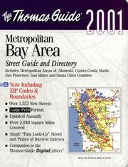
rif. 1581742509.Gspiral_bound. Good. Access codes and supplements are not guaranteed with used items. May be an ex-library book. unknown
rif. 0881305383.Gpaperback. Good. Access codes and supplements are not guaranteed with used items. May be an ex-library book. paperback
rif. 0540082880.Gpaperback. Good. Access codes and supplements are not guaranteed with used items. May be an ex-library book. paperback
rif. 0008445230.Gpaperback. Good. Access codes and supplements are not guaranteed with used items. May be an ex-library book. paperback
rif. 1553413512.Gmap. Good. Access codes and supplements are not guaranteed with used items. May be an ex-library book. unknown
rif. 000749050X.Gmap. Good. Access codes and supplements are not guaranteed with used items. May be an ex-library book. unknown
rif. 1334563543.Gpaperback. Good. Access codes and supplements are not guaranteed with used items. May be an ex-library book. paperback
rif. 187791195X.Gpaperback. Good. Access codes and supplements are not guaranteed with used items. May be an ex-library book. paperback
rif. 0881308528.Gpaperback. Good. Access codes and supplements are not guaranteed with used items. May be an ex-library book. paperback
rif. 0007455208.Gspiral_bound. Good. Access codes and supplements are not guaranteed with used items. May be an ex-library book. unknown
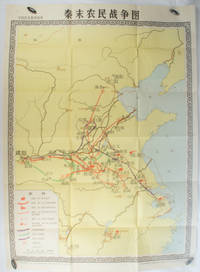
1981rif. 173280Beijing.: 地图出版社. Di tu chu ban she. 1st Edition 2nd Printing. 1981. Large Chinese coloured educational map folded scale 1:2000000. Legend lower left corner shows the routes of military advance led by peasant rebellion leaders' 陈胜Chen Sheng and 吴广Wu Guang in red and other military activities led by 项羽Xiang Yu and 刘邦Liu Bang in various colours. In original worn paper wrapper map in very good condition. Text in Chinese. Map measures 105.5 x 76.6cm. . 地图出版社. [Di tu chu ban she]. unknown
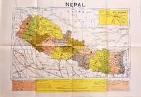
1979rif. 207710Dehli.: Indian Book Depot Map House. 1979. Colour map on blush coloured paper 44.2 x 63.6 cms; 53.6 x 75.9 cms sheet inset map of air service routes folding into pictorial card wrappers 25.5 x 19.3 cms issued into colour pictorial paper folder in very good condition. Map shows Nepal and surrounding borders with India Tibet and China provinces picked out in colour international and state boundaries sealed roads railway lines canals lakes springs rivers towns and villages tourist places temples and the inset map shows air services from Nepal to Thailand and India. The rear wrapper shows a view of Pashupatinath Temple the oldest Hindu temple in Kathmandu. . Indian Book Depot (Map House). unknown
1970rif. 54789circa1970. Collection of 20 black and white photographic plates with their accompanying negatives of maps showing patterns of land use and land forms throughout Pakistan. These photographs are of two sets of maps prepared by the Canadian government covering the whole of Pakistan. A very useful set. From the collection of Professor Basil Johnson Emeritius Professor of Geography at the Australian National University Canberra. From the collection of geographer Professor Basil Johnson who was the author of a number of works on South Asia including "India Resources and Development" and "Geographical Dictionary of India". . unknown
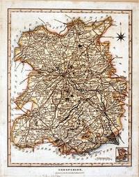
1827rif. 61872London.: J. Wilkes. 1827. Attractive hand coloured map of Shropshire 27.5 x 21.5 cm. very occasional light foxing on reverse but not visible on the image itself. A most attractive map. . [J. Wilkes.] unknown
rif. 1566958601.Gmap. Good. Access codes and supplements are not guaranteed with used items. May be an ex-library book. unknown
1840rif. 661840 plaquette éditeur petit in-octavo, couverture jaune illustrée en noir sur le verso, long papier, illustrations : frontispice, très rares et très légères piqûres, 107 pages, 1840 environ Paris .J. Moronval Imprimeur-Libraire Editeur,
1997rif. 52551997 reliure pleine toile bleue in-quarto, titre frappé or sur le dos, illustrations photographiques en couleurs, 224 pages, 1997 London Apple Press,
1767rif. 34612(København, 1767). Kobberstukket prospekt af Kerteminde. (16x24,5 cm.). Stukket af A. Lode. På skrivepapir.
1764rif. 53305(København, 1764). Kobberstukket prospekt af palæet med omgivende ejendomme. (17x24,5 cm.). Stukket af J. Haas. På skrivepapir. Lidt marginale brunpletter.
1764rif. 34584(København, 1764). Kobberstukket prospekt af kirken med omgivende ejsendomme. (17x24,5 cm.). Stukket af J. Haas.
1764rif. 34591(København, 1764). Kobberstukket prospekt af Palæet set gennem Bredgade, folk og karet i gaden. (16,5x24,5 cm.).
1764rif. 34592(København, 1764). Kobberstukket prospekt af Garnisonskirken. (19x25,5 cm.).
1764rif. 53300(København, 1764). Kobberstukket prospekt af Kalvebod kanal med omgivende ejendomme. (17x24,5 cm.). Stukket af J. Haas. På skrivepapir. Et par brunpletter og en lille fejl i trykket hen over pladen
1764rif. 34606(København, 1764). Kobberstukket prospekt af kirken. (17,5x25 cm.).
1764rif. 53301(København, 1764). Kobberstukket prospekt af kirken. (17x24,5 cm.). Stukket af J. Haas. På skrivepapir. Et par svage brunpletter i marginer og en repareret rift i nederste margin.