12.235 risultati
1774(København, 1774). Kobberstukket prospekt af Løvenborg. (20x31,5 cm.). Tegnet af C.F. Numsen, stukket af J. Haas. Lille skjold i øverste venstre hjørne.
1767(København, 1767). Kobberstukket prospekt af Sakskøbing. (17,8x25,5 cm.). Stukket af J. Haas efter tegning af I. Bang. Frisk eksemplar på skrivepapir.
1767(København, 1767). Kobberstukket prospekt af Stege. (17x25,5 cm.).
1767(København, 1767). Kobberstukket prospekt af Åkirkeby. (18x26,5 cm.).
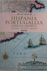
2006rif. 30647Köln: Taschen 2006. Hardcover. Very Good/Very Good. 15.3x10.3x1.2in. small indents on back cover. Dust jacket in clear protector. Reproduces all 64 maps of Spain Portugal Africa and America and the original commentaries from John Blaeu's Atlas Major of 1665 "the greatest and finest atlas ever published." Text in Spanish English and Portuguese. 232pp 4.66lb 15.3x10.3x1.2in Taschen hardcover
1955rif. 28769HOLIDAY HOUSE BOOK 1955. VG 1955 DUSTJACKET ONLY NO BOOK DJ ONLY LITE DJ RUB & Wear A Most Remarkable Nation surviving from Ancient Times Persia is now Iran Emerging from Poverty without having Lost any of Her Love of Art Poetry & Fragrant Gardens. Unbound. Illus. by Rafaello Busoni . HOLIDAY HOUSE BOOK paperback
rif. 7552Houghton Mifflin Printed in Great Britain. HBNoDJ 1923 1st editionGreen Silk Covers lettered in Gold GiltCover some stains & small amount clear tape & some wear Hinge starting slightly interior Nice & TightVG-/G- AS-IS NODJ. Houghton Mifflin, Printed in Great Britain unknown
1819rif. 1405618Paris: Menard et Desenne 1819. Dernière édition. Hardcover. Octavo 684 pages. In Fair minus condition. Spine is tan with gold print on red banner. Boards half bound with green leather to spine and corners and green cloth to boards; corner leather not present spine leather is toned with some rubbing and wear to hinges board cloth has worn edges rubbing shelf wear. Text block has deckle edges; cracked front hinge foxing and toning throughout. Illustrated: “Enrichie de sept Cartes géographiques conformes aux nouvelles divisions et ornée des Pavillons des vingt principales Puissances maritimes”— title page; however illustrations may not be present. Text in French. NOTE: Shelved in Netdesk Column W. 1405618. FP New Rockville Stock. Menard et Desenne hardcover
rif. 0783499000.Gmap. Good. Access codes and supplements are not guaranteed with used items. May be an ex-library book. unknown
rif. 5069824Philips 04/18/2019. Spiral_bound. Used; Good. WE SHIP WITHIN 24 HRS FROM LONDON UK 98% OF OUR ORDERS ARE RECEIVED WITHIN 7-10 DAYS. We believe you will be completely satisfied with our quick and reliable service. All orders are dispatched as swiftly as possible! Buy with confidence! Greener Books. Philips unknown
2023rif. SONG159775336XNational Geographic 2023-01-01. 2023. map. Used: Good. 4.25x0.30x9.25. Buy with confidence. Excellent Customer Service & Return policy. National Geographic unknown
rif. 1802239014.Ghardcover. Good. Access codes and supplements are not guaranteed with used items. May be an ex-library book. hardcover
2012rif. DADAX159775501XNatl Geographic Society Maps 2012-06-29. 2012. map. New. 3.50x3.50x37.15. Buy with confidence. Excellent Customer Service & Return policy. Natl Geographic Society Maps unknown
2010rif. DADAX1597750026Natl Geographic Society Maps 2012-01-01. 2012. map. New. 37.00x3.25x3.25. Buy with confidence. Excellent Customer Service & Return policy. Natl Geographic Society Maps unknown
2012rif. DADAX1597754285Natl Geographic Society Maps 2012-05-31. 2012. map. New. 3.50x3.50x37.15. Buy with confidence. Excellent Customer Service & Return policy. Natl Geographic Society Maps unknown
2021rif. DADAX0792293193Natl Geographic Society Maps 2021-06-01. 2021. map. New. 68.90x47.64x2.36. Buy with confidence. Excellent Customer Service & Return policy. Natl Geographic Society Maps unknown
rif. DADAX0792281136Natl Geographic Society Maps 2017-01-01. 2017. map. New. 2.20x35.98x45.98. Buy with confidence. Excellent Customer Service & Return policy. Natl Geographic Society Maps unknown
rif. DADAX1597754064National Geographic 2019-01-01. 2019. map. New. 4.00x0.40x7.50. Buy with confidence. Excellent Customer Service & Return policy. National Geographic unknown
rif. 0282475524.Gpaperback. Good. Access codes and supplements are not guaranteed with used items. May be an ex-library book. paperback
rif. 1845876067.Gpaperback. Good. Access codes and supplements are not guaranteed with used items. May be an ex-library book. paperback
2017rif. 1-1566957427Natl Geographic Maps 2017. Paperback. New. fol map edition. 6 pages. 9.25x4.25x0.39 inches. Natl Geographic Maps paperback
1830rif. 009582Paris - 21 Quai Voltaire: Rosselin 1830. Map. Fine. Map. A fine map hand-coloured in outline folding into original marbled paper boards with title label to the front board. Boards rubbed conrners worn. The map measures 74 x 55cm and is in very good condition with the paper bright. A very good to fine copy of this rare map. Rosselin hardcover
rif. 609610 October 1891; Paris. On printed receipt. On one side of piece of discoloured paper roughly 13 x 22 cm. Delongueil's circular engraved device 3 cm diameter in top left-hand corner. Charges for striking a medal in bronze and silver of Olivier de Serres. 10 October 1891; Paris. On printed receipt. unknown
1970rif. 145196Couverture rigide. 2 volumes reliés cuir vert. Au total 470 pages.
1921rif. 116839Couverture rigide. Reliure de l'éditeur. 1200 pages. Rousseurs. 21 x 28 cm.