VUILLEMIN (Alexandre Aimé).Livre Rare Book

12.228 Ergebnisse
Best.-Nr. 10702Paris, Fatout, 1855, 65 x 88 cm, entoilée. Parties coloriées. Sous étui. Bon état.
1953Best.-Nr. 634DG1953. Aquarell auf festem Papier. Blattgrösse: 36 x 30 cm. + Wichtig: Für unsere Kunden in der EU erfolgt der Versand alle 14 Tage verzollt ab Deutschland / Postbank-Konto in Deutschland vorhanden +, bild
50 x 59 cm. 50 x 59 cm. *Sauber und sehr gut erhalten. Landkarten de
Best.-Nr. 65322CBo.J. [2 Warenabbildungen]
1935Foilo in maroon stamped and gilted boards; 328 pages : illustrations, maps (some color) ; 37 x 29 cm; indexes Uncommon. // **A large, heavy book. Weighs almost 5 lbs. before packing. Extra shipping charges may apply for international & expedited orders. Please inquire.**
1964Best.-Nr. 20925Paris, Julliard, 1964. In-8 broché de 374-[6]p., couverture à rabats illustrée.
1927Best.-Nr. 20524Paris, Gallimard, 1927-1928. 2 volumes brochés in-12 de 249-[7] et 252-[4]pages.
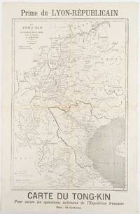
1883Best.-Nr. 180621Lyon.: Lyon-Républicain. circa1883. Engraved map 40.5 x 27.5; 48.9 x 31.8 cm sheet original folds some browning to the fold and margins two small holes at the central fold without significant loss in good condition. Map issued as a supplement to "Le Lyon-Republicain" one of the great radical daily newspapers in Lyon. The map is after documents by French explorer and trader Jean Dupuis 1829-1912 who had explored regions along the Red River in the hopes of establishing trade routes within Vietnam and China and variously published. This supplement was issued on the eve of the Tonkin War in 1883 so that readers could follow the military movements of the French Expeditionary Force. It shows northern Vietnam and into south-western China with provinces marked and river systems in detail. . Lyon-Républicain. unknown
1618Best.-Nr. 60225Rome: Venance Monaldini Librarie Place d’Espagne No. 79 1816-1821. Four works. 1st -- Large dissected copper-engraved map dissected & mounted on linen 35.5 x 22.75 in. slight foxing edgewear closed tears at corner folds a couple folds w/ archival repair tape on verso over linen; 2nd & 3rd - 8vo. 63 1; 15 1 pp. With large folding copper-engraved frontisp. highlighting section of the pantogram. Original marbled wrappers very slight chipping head & foot of spine; 4th -- large 3-sheet “Pantogram” or panoramic view of Rome 63 x 8.75 in. all preserved together in open-backed slipcase wrapped in patterned blue paper printed cover label manuscript pricing information & title in ink some scuffing & edgewear still an overall VG set. Second edition of the large dissected map of Rome and surrounding countryside fourth edition of the two-in-one handbook illustrating the coast along the Tyrrhenian Sea from Lake Bracchiano to Mount Circe and inland to the Central Apennines foothills. Sickler’s 1773-1836 Panoramic elevated view of Rome with text key above identifying churches monuments and historical locations in 19th-Century Rome together with the map and handbooks here were key references for those taking the Grand Tour following the Napoleonic Wars which had devastated much of the Continent. Pietro Ruga 1772-1850 was a noted Italian engraver printmaker furniture designer and architectural draftsman best remembered for his maps and pocket panoramic views of Rome. Venance Monaldini Librarie, Place d’Espagne, No. 79, unknown
1980Best.-Nr. 3562N.p. probably Brownsville Tx 1980. Very good. Blue-line map 42 x 62 inches. Uneven toning minor overall wear. A large-format plat map of the Texas border town of Brownsville likely created in the early 1980s. The date is based on the appearance of the Sunrise Mall which opened its doors in 1979 and the name of the airport which was changed in 1983; as such the present map was printed sometime between those two dates. The present map shows the original city parcel as well as many other notable modern developments including the Airport Industrial Park the Fourteenth Street Commercial Plaza and the Amigoland Theme Park the latter of which was never built. The Rio Grande can be seen winding its way through the bottom portion of the map. We locate no other copies of this map anywhere. It was likely produced for local developers and as such is quite rare. An ideal decorative Texas map. unknown
1980Best.-Nr. 3562N.p. probably Brownsville Tx 1980. Very good. Blue-line map 42 x 62 inches. Uneven toning minor overall wear. A large-format plat map of the Texas border town of Brownsville likely created in the early 1980s. The date is based on the appearance of the Sunrise Mall which opened its doors in 1979 and the name of the airport which was changed in 1983; as such the present map was printed sometime between those two dates. The present map shows the original city parcel as well as many other notable modern developments including the Airport Industrial Park the Fourteenth Street Commercial Plaza and the Amigoland Theme Park the latter of which was never built. The Rio Grande can be seen winding its way through the bottom portion of the map. We locate no other copies of this map anywhere. It was likely produced for local developers and as such is quite rare. An ideal decorative Texas map. unknown books
2008Best.-Nr. 3278London 2008. Slipcased. as New. Bartholomew John G maps. Used - VG: in very good condition with slipcase Hardcover ISBN 13 9780007801503 ISBN 10 0007801505 The Times Book Group. Illustrated hardback laminated board cover. 460mm x 320mm 18" x 13". 67pp 224pp plates. Colour maps. Heavy item - shipping supplement will apply for overseas. . unknown
1945Best.-Nr. 194660New York.: Army Information Branch. Volume III No. 51F. 9 April1945. Folding colour map and six inset maps in a vertical panel 88 x 119 cms sheet and on the recto circular map of Europe smaller inset map of Asia and of the Ryukyu Islands descriptive text original folds in very good bright condition. Scarce Newsmap of "China Southeast Coast" from Shanghai to French Indochina with the islands of Formosa and Hainan. At the right edge are inset maps of the vicinities of Shanghai Wenchow Foochow Swatow Canton and Hong Kong. On the verso is a large map of the European theatre of operations centred on Berlin a map of the Pacific area noting the American occupation of Okinawa with a detailed map of this island. In unusually fine bright condition. . Army Information Branch. unknown
1932Best.-Nr. 176499London.: Royal Geographical Society. 1932. Twenty one loose maps with tissue guards printed on sheets 49.5 x 63.5 cm in the original folio title-wrappers the maps with some edge wear and toning but on the whole in very good condition the wrappers browned and stained torn with minor loss at the foot of the title wrapper small closed edge tears now re-enforced with archival material and sound. Lacking the introductory notes by Edward Heawood. The complete suite of maps: an impressive production. The first map is a general map of England and Ireland by an unknown author 1594; nineteen county maps; and a final sheet of miniature county maps printed as a deck of playing-cards. The county maps proper vary in date from Saxton's “Southamtonia” of 1575 to John Speed's version of Norden's map of Sussex dated 1610. A contemporary reviewer dubbed it " a rich cartographical feast" allowing easy access to rare and valuable maps and comparison of maps by different cartographers for the same county. The county maps reproduced include five by Christopher Saxton three by John Norden Philip Symonson's map of Eastern Kent published in 1596 a series of seven maps dating from the early years of the seventeenth century two maps prepared for Camden and two published by John Speed. . Royal Geographical Society unknown
1879Best.-Nr. 150316Couverture rigide. 4 premiers volumes de cette célèbre géographie. Reliures demi-basane brune, à nerfs et à coins. 1011 + 961 + 983 + 977 pages. 20 x 28 cm. Peu de rousseurs.
1912Best.-Nr. 107028BBBerlin, Otto v. Holten, 1912. 4°. [2] w. Bl., [7] Bl., 199 S., [1] Bl.; [2] w. Bl., [5] Bl., 183 S., [1] Bl. mit Titel in Rot und Schwarz und 113 teils montierten Abbildungen und 1 Holzschnitt, 6 Radierungen, 12 Lithographien und 1 Prägedruck nach Hans Baluschek, Franz v. Bayros, Ludwig Burger, Daniel Chodowiecki, Fidus, Max Klinger, Max Liebermann, Adolph Menzel, Max Slevogt u. a. Orig.-Halbpergamentbände mit goldgepr. Rückentiteln und Rückenvergoldung (Entwurf: E. Doepler). 2 Bände.
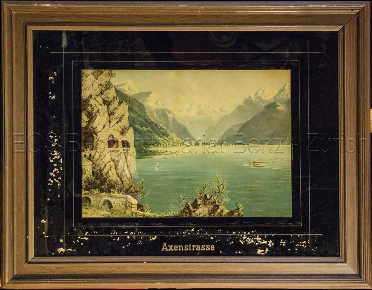
1860Best.-Nr. 823CG(um 1860). Chromolithographie hinter Glas. Bildausschnitt: 24 x 33,5 cm. + Wichtig: Für unsere Kunden in der EU erfolgt der Versand alle 14 Tage verzollt ab Deutschland / Postbank-Konto in Deutschland vorhanden +, Abb.
Best.-Nr. 79037Paris Ch. Delagrave 1881. Two maps printed in black blue and red 25.7 x 25.6 cm; and 16.5 x 17.4 cm on a single folded sheet 46.7 x 30.3 cm. Original printed wrappers. = Two seldom-seen if not downright rare maps showing the Polar region and Africa indicating where the latest explorations were made thus showing the borderline between areas known and those still unknown in the year 1880. Contained in the Bulletin of the Société de Géographie Paris together with descriptive text. Also included is an account of the disastrous Flatters expedition. Paul Flatters 1832-1881 "was a French soldier who spent a long period as a military administrator in Algeria. He is known as leader of the Flatters expedition an ill-fated attempt to explore the route of a proposed Trans-Saharan railway from Algeria to the Sudan. Almost all members of the expedition were massacred by hostile Tuaregs. The survivors resorted to eating grass and to cannibalism on the long retreat through the desert. After a brief outburst of public indignation the fiasco was forgotten." French Wikipedia. The Polar map is in blue the African map in grey. Short tear at map adhesion point; slight fraying to the uncut wrapper's edges; otherwise very good clean and unmarked. unknown
Best.-Nr. 295Six volumes in 8 demi-veau glacé fauve,fers dorés en long,titre doré,tranches marbrées,texte sur 2 colonnes. Contient la statistique et la description complète des 86 départements,orné de 740 vignettes et portraits gravés sur acier.de 86 cartes de départements.Par une société de gens de lettres,de géographes et d'artistes.sans la grande carte de France annoncée.Firmin Didot frères éditeur 1838.quelques charnières restaurées.Bon état d'ensemble.
Best.-Nr. 15894DBo.J. (Friedrich Kühnow, gestorben 1675. Kartograf. oan Blaeu (niederländisch ['jo??n 'bl?u]; deutsch Johannes Blaeu; * 1596 in Alkmaar, Niederlande; ? 28. Dezember 1673 in Amsterdam, Niederlande) war ein niederländischer Kartograf und Kupferstecher. 1654 schuf er den ersten Atlas Schottlands. Sein 1662 erstmals erschienener elfbändiger Atlas Maior gehörte zu den aufwendigsten und teuersten europäischen Atlanten des 17. Jahrhunderts.
49 x 58 cm. Blatt: 52 x 66 cm. Theoretische und pratische Erklärung: in der Unterhalfte zwei Abb. von einer "Quadranten Uhr" und einer "Äquinoctial oder dem Mittel=kreis gleich ebene Universal Uhr" (je 24:24 cm), daruber der umfangreiche gestochene Erläuterungstext (in Latein). Zwischen den Abb. und dem Text in 2 Kolumnen sind Abb. von Instrumenten. - Unterrand knapp beschnitten, sonst breitrandig. Sauber und sehr gut erhalten. Graphiken de
1659Best.-Nr. 78800O. O. (Paris), (Jean Dupuis), ( 1659). Kupferstich. Darstellung ca. 28 x 33 cm, Blattmaß 31 x 42 cm. Feinkartonpassepartout.
1780Best.-Nr. 41637Augsburg, G.B. Probst, ca. 1780. Engraved and hand coloured vue d'optique. 30 x 40 cm. Mirrored titel with small tear not affecting text. Colours slightly faded, margins a little foxed.
1780Augsburg, G.B. Probst, ca. 1780. Engraved and hand coloured vue d'optique. 30 x 40 cm. Mirrored titel with small tear not affecting text. Colours slightly faded, margins a little foxed.
1978Best.-Nr. 2080502106916389Not Available 1978. Soft Cover. Fine. The book is in fine condition. Not Available paperback