1782 resultados
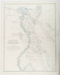
1861ref. 177021Edinburgh & London.: William Blackwood & Sons. 1861. Engraved map with original outline hand-colour 57 x 43.8 cm 61.1 x 49 cm sheet central fold very slight edge toning but the map in very good bright condition. First edition. Fine large folding map: the Nile delta and river with attractive original outline colour railways and canals marked and name references to biblical and classical geography. Published for inclusion as map 39 in "Keith Johnston's royal atlas of modern geography" . William Blackwood & Sons. unknown
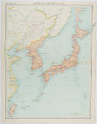
1922ref. 215880Edinburgh.: John Bartholomew & Son Ltd. 1922. Large double page map 54.2 x 43 cms map original fold some edge toning and to the fold but in very good condition. Large map prepared as plate 65 for “The Times Survey Atlas of the World” in 1922 and was prepared at the Edinburgh Geographical Institute under the direction of J G Bartholomew. The map shows Japan's territory inclusive of Korea southern Sakhalin and Taiwan. . John Bartholomew & Son Ltd. unknown
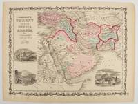
1860ref. 177019New York.: Johnson & Browning. circa1860. Engraved map 30.2 x 40.5 cm 34.5 x 45.5 cm sheet original hand-colour elaborate strapwork border three fine vignettes of Muscat Trebisond small marginal edge tears top corner chipped the map in very good condition. Most attractive decorative map of Arabia the Ottoman Empire Persia Afghanistan Beloochistan and surrounds by one of the most popular and successful 19th Century American atlas publishers. . Johnson & Browning. unknown
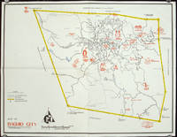
1960ref. 206510circa1960. Printed pictorial map 44.8 x 58 cm 46.7 x 60.3 cms sheet original folds a little wear but in very good condition. Attractive 1960s tourist map of Baguio city when it was the "Summer Capital" of the Philippines. Tourist attractions are shown pictorially in red blue triangles denote wood carving shops the city boundaries outlined in yellow sealed and unsealed roads are also shown. . unknown
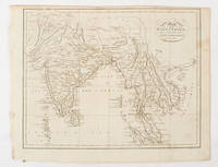
1805ref. 175148London & Glasgow.: W. and D. Brownlie. 1805. Engraved map 18.7 x 23.9 cm original folds age toned and spotted inner margin a trifle ragged paper thinning in a few spots in good condition. Attractive map engraved for "A System of Geography; or A Descriptive Historical and Philosophical View of the Several Quarters of the World" published in 1805. . (W. and D. Brownlie) unknown
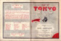
1954ref. 194113Tokyo.: Charles E. Tuttle Company. 1954. Printed four colour map 92 x 71cm; 102.5 x 74.5cm sheet folding into pictorial wrappers 25.6 x 19 cm inset map of the Marounouchi District and on the verso an extensive grid reference in English and Japanese and over four panels a map of the streetcar railway and subway system scant spotting to cover two small fold splits without loss and toning most evident at the folds in very good condition. Comprehensive 1950s map of Tokyo by US publisher Charles E. Tuttle "Here at last is the map that makes order out of chaos.extending as far as Haneda Airport Grant Hights Harbor Area and Nakano Ward" blurb. . Charles E. Tuttle Company. unknown
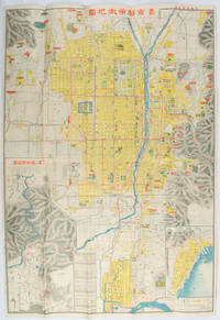
1922ref. 171899京都. Kyoto.: 山中書房. Yamanaka Shobō. 大正 11 1922. Attractive colour folding map of Kyoto with a quite detailed illustrated tourist guide printed in blue and white on the reverse some light browning holes at some folds good copy. 78.5 x 54cm This 1922 colour folding tourist map of Kyoto offers sightseeing information each panel showing a photographic monochrome image of the site discussed. The two inset maps on the Kyoto map show Otsu city on the shore of Lake Biwa and the Arashiyama area north of Kyoto. The main map highlights the major temples and famous sights in red geographic features such as rivers and hills are shown and an inset chart shows distances of sights from the nearby stations. The information on the reverse gives more detail on the famous sights a calendar of events seasonal highlights and details of the Imperial graves around Kyoto. . 山中書房. [Yamanaka Shobō]. unknown
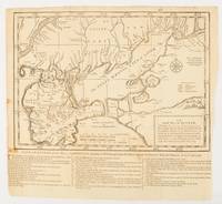
1739ref. 174921London.: The Gentleman's Magazine. circa1739. Engraved map 22.2 x 31.4 31.1 x 33 cm sheet size elaborate explanatory key in three columns at the foot original folds sealed 2 cm tear to the lower part of the inner margin one other small fold tear no loss inner margin of the key trimmed with some loss an original fault paper browned and spotted on the verso but an historic map in good condition. . [The Gentleman's Magazine]. unknown
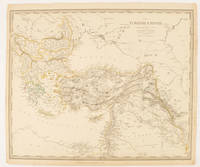
1840ref. 174957London.: Charles Knight & Co. circa1840s. Lithographed map with original outline hand-colour 31.9 x 39.1 cm small marginal tears neatly repaired with archival material but no loss small surface abrasion affecting the border at the foot edgewear and browning inked pagination in an early hand but in very good condition. A handsome map with fine topographical engraving also showing the borders with Hungary Russia and Persia. . Charles Knight & Co. unknown
ref. 092959195X.Gpaperback. Good. Access codes and supplements are not guaranteed with used items. May be an ex-library book. paperback
ref. 366634US: Houghton Mifflin 1952. Houghton Mifflin 1952 First Edition NAP Fine/Very Good DJ Author: De Voto Bernard; Raisz Erwin maps. Light blue cloth with grey text bloacks and brown lettering. USA map end papers. Pages lightly tanned with many smaller maps in text. xxii647 pages with index. Bright glossy clipped dust jacket with small mended tears protected in clear dust jacket cover. HEAVY ITEM 1.89 Pounds. Size: 8 5/8 x 6 x 1 1/2 inches. First Edition NAP. Hardcover. Fine/Very Good DJ. No Exp. Houghton Mifflin Hardcover
1956ref. pl199-94Dryden Press 1956. Hardcover. Used - Very Good. Year: 1956. Publisher: Dryden Press. This preowned item is in very good condition with very minimal wear and tear visible ex. Corner dings small tears/rips bent pages scuffs/scratches etc. Additional materials such as CD's and access codes may or may not be included. If the book has a dust jacket it may not be included. Free tracking provided. International shipping available. Dryden Press hardcover
ref. 1849075514-11-1Philip's. Very Good. It's a well-cared-for item that has seen limited use. The item may show minor signs of wear. All the text is legible with all pages included. It may have slight markings and/or highlighting. Philip's unknown
ref. DADAX0190076232New unknown
ref. 0935039996.Gmap. Good. Access codes and supplements are not guaranteed with used items. May be an ex-library book. unknown
ref. 3844349561.Gpaperback. Good. Access codes and supplements are not guaranteed with used items. May be an ex-library book. paperback
ref. DADAX0470437561New unknown
ref. 0540087726.Gpaperback. Good. Access codes and supplements are not guaranteed with used items. May be an ex-library book. paperback
ref. 0008370001.Gpaperback. Good. Access codes and supplements are not guaranteed with used items. May be an ex-library book. paperback
ref. GOR002367632Paperback. Very Good. paperback
ref. DADAX0226534677New unknown
2001ref. 104559Irvine CA: Thomas Bros. Maps 2001. 2001 Ed. Spiral-bound. Near fine; some creasing to wraps near spine; top corner a tad warped toward back of book; else clean and bright; still very useful and readable. Small folio metal spiral bound atlas; various pagings: color maps ; 29 cm; includes indexes and mileage chart. Looking for a more analog big-picture way to travel Look no further than the trusty Thomas Guide seat pocket companion of yore that will either pluck at nostalgic heartstrings or delight curious digital natives. Features: over 257000 square miles covered 79 pages of detail city maps digital cartography for greater accuracy and detail large print and scale for easier reading information on scenic highways distances and mileages and statewide shaded relief maps. Cartographic Mathematical Data: Scales differ. Relief shown by hachures and spot heights on some maps. Includes indexes and mileage chart. // California Maps Roads Roads California Maps. Thomas Bros. Maps unknown
2012ref. 1-0792294580National Geographic 2012. Map. New. map edition. 1 pages. 38.50x5.00x4.00 inches. National Geographic unknown
ref. 0964540401.Gpaperback. Good. Access codes and supplements are not guaranteed with used items. May be an ex-library book. paperback
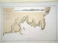
ref. 6279Paris: 1868. No binding. Very Good. 305 x 470 mm. in very good condition. A fine large scale plan of the harbour of 'Porto Praya' Praia on Santiago the capital of the Cape Verde Islands. It is situated on the south coast and shows wonderfully how the town has grown; the whole area to the south and west of the town is now developed. A prospect of the approach is shown above. The roads and individual buildings are shown as are numerous soundings in the Bay. The original survey in 1834 is the work of Lieutenant William Arlett of the British Royal Navy who is duly credited in the title. 1868 unknown