MORDEN, ROBERTBiblio.com
1782 resultados
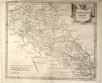
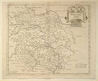
ref. 64216London.: Gibson. Early 18th Century. Black and white map from Camden's Britannia showing towns roads rivers and landforms 38 x 46.5 cm. . [Gibson.] unknown
ref. 64139London.: Gibson. Early 18th Century. Engraved map on watermarked paper central fold 38 x 46.5 cm decorative title cartouche towns roads rivers and landforms shown; from Gibson's edition of Camden's Britannia upper edge trimmed by the original binder causing minor loss to the border at the inner edge but in very good condition. . [Gibson.] unknown
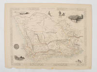
1851ref. 174666London.: Tallis John. 1851. Lithographed map 24.2 x 32 cm districts picked out in original hand colour inset vignette illustrations decorative border lower margin ragged but the attractive map in very good condition. Attractive decorative map from "Tallis's illustrated atlas and modern history of the world." one of the last great illustrated series of world maps. The fine vignettes are of Cape Town Graham Town and entrance to the Knysha Heads. . (Tallis, John). unknown
ref. 1849070962.Gpaperback. Good. Access codes and supplements are not guaranteed with used items. May be an ex-library book. paperback
ref. DADAX1461284082New unknown
ref. 1566958326.Gmap. Good. Access codes and supplements are not guaranteed with used items. May be an ex-library book. unknown
ref. 093065742X.Gpaperback. Good. Access codes and supplements are not guaranteed with used items. May be an ex-library book. paperback
ref. SONG1884582028Used: Good unknown
2025ref. DADAX1566958326National Geographic 2025-11-01. 2025. map. New. 4.25x3.00x9.25. Buy with confidence. Excellent Customer Service & Return policy. National Geographic unknown
ref. 052899932X.Gpaperback. Good. Access codes and supplements are not guaranteed with used items. May be an ex-library book. paperback
2001ref. H-467-294Editions du BRGM 2001. Good. Edition 2001. Ammareal gives back up to 15% of this item's net price to charity organizations. Editions du BRGM unknown
2001ref. H-467-730Editions du BRGM 2001. Paperback. Fine. Ammareal gives back up to 15% of this item's net price to charity organizations. Editions du BRGM paperback
ref. 30286HBDJ 1968 EARLY Edition VG/VG- AS-IS Original publisher's blue paper-covered boards pictorial dustjacket large 8vo: xij 108pp. fold-in map in Middle and in back footnotes bibliographical notes. Verynear fine copy.Octavo. 5.5 x 8.5 in. lived to be hundreds of years old and were capable of telepathy astral travel and teleportation.ATLANTIS they became greedy petty and "morally bankrupt" and the gods "became angry because the people had lost their way and turned to immoral pursuits" Orser says. As punishment he says the gods sent "one terrible night of fire and earthquakes" that caused Atlantis to sink into the sea. LONDON, Illinois: Theosophical Publishing House, hardcover
1993ref. 2082402113507248Mitsumura Maps Nire Publishing 1993. Soft Cover. Fine. Number of books: 30 Mitsumura Maps, Nire Publishing paperback
ref. ANAIS-1597755222National Geographic Maps. paperback. Good. 9.5X6.5X1.5. Buy with confidence. Excellent Customer Service & Return policy. National Geographic Maps paperback
2003ref. I-265-661IGN - Institut Géographique National 2003. Very Good. Former library book. Different cover. Edition 2003. Ammareal gives back up to 15% of this item's net price to charity organizations. IGN - Institut Géographique National unknown
ref. Z1-F-060-01618BRGM. Used - Good. Ships from UK in 48 hours or less usually same day. Your purchase helps support Sri Lankan Children's Charity 'The Rainbow Centre'. Ex-library so some stamps and wear but in good overall condition. 100% money back guarantee. We are a world class secondhand bookstore based in Hertfordshire United Kingdom and specialize in high quality textbooks across an enormous variety of subjects. We aim to provide a vast range of textbooks rare and collectible books at a great price. Our donations to The Rainbow Centre have helped provide an education and a safe haven to hundreds of children who live in appalling conditions. We provide a 100% money back guarantee and are dedicated to providing our customers with the highest standards of service in the bookselling industry. BRGM unknown
1976ref. Q-0878132252s.n. 1976-01-01. Hardcover. New. In shrink wrap. Looks like an interesting title! s.n.] hardcover
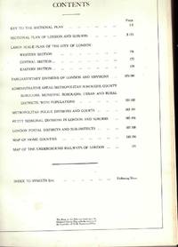
ref. 4551951589835357Geographia Ltd Fleet Street London. Hardcover. Good. THERE ARE NO TARIFFS OR CUSTOMS DUTIES ON BOOKS. Hardback. Used Very Good. Red boards with gilt title down the spine. Greater London Plans of London And Suburbs Parliamentary Administrative Postal Areas Underground.Railways Underground Stations and Bus or Tram Routes indicated on the maps.See photosThe maps are based upon the Ordnance Survey Maps with the sanction of the Controller of H.M. Stationery Office. Date not given but probably around 1930's. Copyright © Geographia Ltd Fleet Street London THERE ARE NO TARIFFS OR CUSTOMS DUTIES ON BOOKS. An audio offering from William.It's the beginning of the summer holidays and William and the Outlaws see an endless expanse of gloriously carefree days stretching ahead - but how to fill them. The six classic adventures contained in this unabridged reading are: William and the Holiday Centre; William's Treasure Trove; William and the Cottage; William Tackles the Job; William and Detective Journalism; and William and the Parsons' Guy. Read by Martin Jarvis. Copyright © BBC Audio Geographia Ltd Fleet Street London hardcover
ref. 455964Geographia Ltd Fleet Street London. Hardcover. Good. Hardback. Used Very Good. Red boards with gilt title down the spine. Greater London Plans of London And Suburbs Parliamentary Administrative Postal Areas Underground.Railways Underground Stations and Bus or Tram Routes indicated on the maps.See photosThe maps are based upon the Ordnance Survey Maps with the sanction of the Controller of H.M. Stationery Office. Date not given but probably around 1930's. Copyright A� Geographia Ltd Fleet Street London Geographia Ltd Fleet Street London hardcover
ref. DADAX0198834691New unknown
2000ref. 0904219China Press 2000-01-01. hardcover. Used - Good. Ship out in 2 business day And Fast shipping Free Tracking number will be provided after the shipment.China CARTOGRAPHIC PUBLISHING HOUSE. Bei Jing. 1989. Hardcover. Book Condition: New. First Edition. 380x270mm. Language: Chinese and English bilingual 1989/298 pages China is in a unique geodynamic position and offer a good opportunity for study of dynamics of continental lithosphere. In the past 20 years a wealth of new data from all branches of earth sciences and from every provinces has been accumulated. Thus the time appeared right for an attempt at a comprehensive treatment of the new da. Satisfaction guaranteedor money back. China Press hardcover
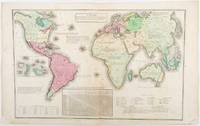
1835ref. 203763Philadelphia.: W. Marshall. Circa1835. Handcoloured engraved map 26.5 x 41.3 cms; 29.6 x 48.3 cms sheet central fold insets of "Oceanica" and "New Holland" central table some light staining in the image and margins in good condition. Eurocentrism laid bare. This 19th Century map includes a "State of Society" for each part of the world declared with a symbol to represent "Barbarous Half Civilized Civilized and Enlightened Societies" as well as noting religion and ethnicity. It includes a table of distances between chief towns or capitals and between these towns and Washington DC. Australia "New Holland" is styled principally as pagan barbarous unexplored and African a thin sliver of what is now New South Wales and Victoria is labelled civilized European and Protestant. Scarce. . (W. Marshall). unknown
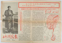
1967ref. 169746Beijing.: 地图戰報.Di tu zhan bao. September1967. Maps printed in red and black single sheet printed on both sides folded scale not given photographic image of Mao Zedong. Some light browning at edges with tears and losses on left edge still good. Text in Chinese. Sheet measures 26.5 x 38.4cm. Includes a map of Autumn Harvest Uprising and also shows the routes of the military advancing towards Jinggangshan between September and October 1927. On reverse left section a map shows the route along which Chairman Mao led the Fourth Army of the Chinese Red Army marching towards south of Anhui and Jiangxi Provinces in 1929. On reverse right section a map titled "The Long March of The Chinese Workers' and Peasants' Red Army October 1934-October 1935". Quotations of Chairman Mao about the Long March insert on corners of the map. Issue no. 6 of a series of maps with text issued by the Red Guards organisations in the form of Cultural Revolution tabloid-sized newspaper. This issue is designed to celebrate the 40th anniversary of the Autumn Harvest Uprising which was one of the earliest armed uprisings organised by the Chinese Communist Party. . 地图戰報.[Di tu zhan bao]. unknown
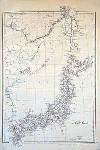
1852ref. 185246London.: Cassell Petter & Galpin. circa1852. Map with outline handcolour 42.5 x 30.1 cms; 49.2 x 34.3 cms sheet margins a little toned small corner crase but in very good condition. Very detailed map of the Japanese islands with Sakhalin above and the coast of Manchuria and Korea. . Cassell, Petter & Galpin. unknown