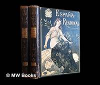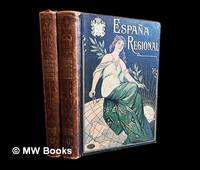
1913ref. 486511Barcelona : Alberto Martín 1913. Second Edition. Hardcover. Good copies both in contemporary quarter calf over gilt and colour-illustrated bevelled boards showing minor surface-wear. Corners slightly bumped. Spine leather rubbed particularly at the joints and endbands. Some preliminary leaves in both volumes show minor creases or tears. Text blocks otherwise remain strong and clean with only the expected sparse and faint foxing. A well-preserved set overall. Physical description; 2 volumes : illustrations ; 38 cm. Notes: Vols. 1-2 of 4 i.e. the complete text without maps or plans. Date conjectural. Contents: v. 1. Texto 1a. parte — v. 2. Texto 2a. parte. Subjects; Spain geography 20th century regional. Spain description and travel 1910s. Spanish topography regional geography. Barcelona : Alberto Martín hardcover
1910ref. 486513Barcelona : Alberto Martín 1910. First Edition. Hardcover. Good copies both in contemporary quarter calf over gilt and colour-illustrated bevelled boards somewhat scuffed. Corners slightly bumped. Spine leather rubbed particularly at the joints and endbands the latter crumbling slightly. Some preliminary leaves in both volumes show minor creases or tears. Text blocks otherwise remain strong and clean with only the expected sparse and faint foxing. A well-preserved set overall. Physical description; 2 volumes : illustrations ; 38 cm. Notes: Vols. 1-2 of 4 i.e. the complete text without maps or plans. Date conjectural. Contents: v. 1. Texto 1a. parte — v. 2. Texto 2a. parte. Subjects; Spain geography 20th century regional. Spain description and travel 1910s. Spanish topography regional geography. Barcelona : Alberto Martín hardcover
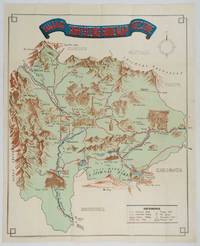
1930ref. 206841Kofu.: Onkodo Printing Co. circa1930s. Colour pictorial map 70.2 x 56 cms; 75.5 x 59.5 cms sheet light wear along the inner margin some soft creases from folding short split at center fold; in very good clean condition. An appealing and decorative map of Yamanashi Prefecture which while a process print has the attractive soft look of a lithograph adorned with vignettes of key attractions landmarks such as Mt. Fuji and industry such as silk and wine. The legend lists Railways 'Footing' Roads Hot Springs Hotels and National Parks. A scarce and attractive English language map for the tourist market. . Onkodo Printing Co., unknown
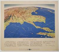
1944ref. 200808Remington Rand. 1944. Five printed colour maps each: 31.4 x 47 cms; 46.3 x 53.3 cms sheet central fold marginal edge wear chips and a few small edge tears tidemark affecting the ocean at the outer edge of Map VII but all the maps in very good condition. From a series of World War II battlefront maps "for the delight of arm-chair strategists" published by the Library Bureau of Remington Rand seven were published. Taken from a bird's eye view of the globe and with relief artistically rendered by artist Kenneth Thompson 1907-1996 and descriptive text by George Fielding Eliot 1894-1971. Eliot spent his youth in Australia attending Melbourne University serving with distinction in the Australian Infantry in WWI. Moving to the United States after a short stint in Canada serving with the RCMP her served as a reserve officer in the U.S. Army reserve in military intelligence from 1922 to 1933 and during WWII Eliot famously broadcast the first extended television coverage following the attack on Pearl Harbor. He continued to write books and articles about military strategy and world politics into the 1960s. In keeping with the "aviation-age" cartography of Richard Edes Harrison the unusual perspective of the maps--from above and often with a direction other than north at the top of the map--challenges the viewer to reconsider the geopolitical situation with the text of Eliot as a further prompt his captions below: Map III Italy & South France "Hannibal Caesar and Napoleon made their reputations here" Map IV The Western Front "Will the cockpit of 1918 see the decisive battles of 1944" Map V Southeastern Asia "The road to Mandalay -- and to China --along which bombs for Tokyo must travel" Map VI The Southwest Pacific "Island-hopping toward Japan -- in short and long hops" Map V11 The North Pacific "Here the enemy trusts in the protection of vast ocean distances" . Remington Rand. unknown
ref. GOR006270149Paperback. Acceptable. paperback
ref. GOR005344747Paperback. Very Good. paperback
ref. GOR004340453Paperback. Good. paperback
2007ref. 49413Washington D. C.: Dumbarton Oaks Research Library and Collection 2007. Good to near fine condition. Quarto. li 394 xv 290 plates 3 folding maps in envelope on inside back cover. Original textured blue cloth with gilt lettering on covers and spines in photo-illustrated dustjackets brown lettering on spine. Frontispiece maps. The Pontos and its Empire of Trebizond 1204-1461 embraced the distinctive Black Sea coastlands mountains and pastures of northeastern Anatolia. "The purpose of this Study is twofold. First it is an essay in placing the material remains of the medieval peoples of a distinct region of Anatolia the Pontos in their historical and geographical setting. Second it is a record - all too often of what can no longer be recorded. In the two decades since Anthony Bryer A.A.M.B. and David Winfield D.C.W. first met in the east porch of the Hagia Sophia Trebizond on 19 August 1959 the Pontos has suffered a greater physical transformation than in its entire previous history." Preface. Illustrated with some five hundred b/w photographs on 290 plates three folding maps two in two colors and in-text drawings maps plans and tables. Contains list of figures abbreviations and an extensive bibliography at front appendix with measurements and indices at rear. Dustjackets with light creasing at top and bottom edges light creasing hear and small closed tear at top left of volume two. Interiors in near fine condition. Dumbarton Oaks Research Library and Collection unknown
2012ref. 2412P-48999A-1308CNational Geographic Maps 2012-10-01. paperback. Very Good. 9x0x15. This Book is in Very Good condition. See our picture for exact item you will receive. All items ship within 24 hours. Packaging is 100% Recyclable. Most items purchased from Charitable organizations. A portion of each sale is also donated to a monthly charity check your package for this month's charity. Reuse-Recycle-Rebook! National Geographic Maps paperback
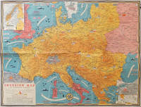
1944ref. 206781Toronto.: C.C. Petersen. 1944. Colour pictorial map 51 x 67 cm two small inset maps of Scandinavia and the Baltic and South Greece and the Dodecanese on the verso a black and white world map showing the Pacific Theatre marking keys events of the war and in European world history folding into the original pictorial pocket a little toned and marked 25.8 x 17.7 cm small fold split but in very good condition. A scarce map in the "Dated Events" series published by C.C. Petersen in Canada and distributed throughout North America commemorating D-Day. The colour map by Stanley Turner encompasses the area from England as far south as the French border with Spain and as far east as the USSR and Turkey. "With this invasion map you will be able to follow the progress of the Allied troops on their way to smash Germany.". The text at lower left goes on to elaborate on the features shown on the map from elevation "major battles are seldom fought on the tops of mountains" to pictographs of bombs falling. The black and white map on the verso shows the Far Eastern theatre of war centring on the Pacific Ocean with the Asian landmass including India and the USSR at upper left Australia at lower left and North America and the coast of South America at right of the map. Naval bases are shown and significant events in the war are noted in text boxes. A handsome production of a scarce map rarely seen with the original pictorial pocket. . C.C. Petersen. unknown
1948ref. 055564Division Of Mines Department Of Natural Resources State Of California 1948. 1st Edition 2nd Printing. Hardcover. Near Fine. Xvi 773 Pp; Errata On Last Page; Folding Map In Pocket At Rear. Brown Cloth. Stated Second Printing With Errata At Rear. Near Fine No Marks. With Folding Map In Pocket At Rear In Fine Condition. When They Pump The Oil And Gas Out The Land Sinks But The Producers Are Then Far Away. Division Of Mines, Department Of Natural Resources, State Of California hardcover
ref. 0749528834-11-1Automobile Association. Very Good. It's a well-cared-for item that has seen limited use. The item may show minor signs of wear. All the text is legible with all pages included. It may have slight markings and/or highlighting. Automobile Association unknown
1913ref. 63117New York: C.S. Hammond & Co. Schum Bros. Stationers and Printers 1913. 12mo. 3.5 x 7.5 double-sided colour lithograph map which folds out to 25.25 x 16.5 in. on 28 x 17.75 in. sheet very light dustsoiling slight shelfwear very slight age toning along the folds. Original printed gray-blue pocket portfolio folder blue lettering on recto & verso added affixed label of Schum Bros. over imprint minor age toning still a VG bright clean map. First edition thus of this very scarce Brass Era automobile travel map depicting Manhattan and portions of Long Island from Brooklyn across to Smithtown and Great River. Verso Map includes Long Island fro Great River up to Darlington across to Truman Beach and Bridgehampton with two inset maps: “Contination of North Shore” and “Continuation of South Shore” with “Good Roads” and “Fair Roads” differentiated as well as depiction of the Long Island Railway line and red dots tracing the electric interurban lines. As early as 1906 Hammond & Co. had produced a map for Good Roads enthusiasts and motorists but this updated issue documenting the improved roads was issued in 1913 and then regularly from 1914-1925. No copies in Worldcat. C.S. Hammond & Co., Schum Bros., Stationers and Printers, unknown
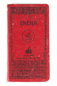
ref. 121332London Geoge Philip & Son Ltd. N.d. c. 1920 . Folding colour printed map laid on linen and housed within a red cloth case worn. Some small splits at the folds size when open: 67.5 cm x 54 cm. London, Geoge Philip & Son Ltd. N.d. c. 1920 hardcover
ref. 1931257450-8-1Streetwise Maps Inc. Fol Lam Ma. Very Good. It's a well-cared-for item that has seen limited use. The item may show minor signs of wear. All the text is legible with all pages included. It may have slight markings and/or highlighting. Streetwise Maps Inc. unknown
1859ref. H4454Dublin: Mark Allen 1859. Hardcover. Very Good. Published 1859 the map in 20 panels backed with linen measures 39.75 x 29.5 inches 100.5 x 75 cm hand colored in outline in very good condition small gray spot to blank area lower left in original cloth binding with printed label to front cover light wear and soil to binding. The accompanying pamphlet 31 pp. green wraps very good some of the stitching along spine coming loose. Both map and pamphlet signed Francis L. Casey RCV Cork. Uncommon. Mark Allen hardcover
1950ref. 1749Vichy France: Société des Cartes Folkloriques de France 1950. Wraps. Near fine. R. MARGOTTON. FRENCH LANGUAGE POSTCARDS FASHION / TRADITIONAL DRESS. R. MARGOTTON illustrator. 6 1/8" x 4 1/8" ; 84 cards numbered; half-bound tweed cloth folder with ties marbled paper over board color paper label to front folder; 3 black cloth folder ties; hand-colored wood-engraved cards verso is a divided back postcard with labeling and numbering within the series and four printed lines on which to write an address; light age-toning of edges; near fine. OCLC locates 3 copies all in the U.S. The art on the post cards is signed R. Margotton and it is possible this was Rene Margotton 1915-2009 although by the early 1950s he was a major French painter and one of the cubists from the early part of the 20th century. The laid-in form in the rear pocket is a listing of the cards by area. Société des Cartes Folkloriques de France unknown
1994ref. 2092902137201060Taipei Nantian Book Office 1994. Soft Cover. Fine. Number of books: 2 Taipei Nantian Book Office paperback
2001ref. SBBIH-YINW6BNWTB5FAutomobile Association 2001. map. Good. Our good condition books are generally good for reading but not for gifting or collecting. They could have imperfections such as creasing fanning inscriptions margin notes yellowing staining on edge or cover or pages bumps scuffs etc etc sometimes multiple of these. It's a wide category that encompasses anything that isn't almost-new down to anything that is slightly better than poor. We would NOT recommend gifting Good books - these should be considered reading copies. Our books are dispatched from a Yorkshire former cotton mill. We list via barcode/ISBN so please note that the images are stock images and may not be the exact copy you receive furthermore the details about edition and year might not be accurate as many publishers reuse the same ISBN for multiple editions and as we simply scan a barcode or enter an ISBN we do not check the validity of the edition data when listing. If you're looking for an exact edition please don't order at least not without checking with us first although we don't always have time to check. We aim to dispatch prompty the service used will depend on order value and book size. We can ship to most countries see our shipping policies. Payment is via Abe only. Automobile Association unknown
1873ref. 9509Paris 1873. French naval chart sheet 3273 sheet size 105.5 x 72 cm engraved by Nyon black and white centrefold one or two marginal nicks and tears blank verso. This detailed chart of Grenada was derived from British Admiralty surveys. Map unknown
1873ref. 9508Paris 1873. French naval chart sheet 3256 sheet size 72.5 x 105 cm engraved by Delamare black and white with coastal profiles in the lower part of the chart centrefold one or two marginal nicks and tears blank verso. This detailed chart of Isla Culebra now an island-municipality of Puerto Rico was derived from British Admiralty surveys. With no permmanent population for centuries the island was settled by the Spanish in the 1880s and ceded to the United States after the Spanish-American War. Map unknown
1584ref. 64215Antwerp.: Abraham Ortelius. circa1584. Two engraved maps on laid paper each 30.3 x 19.5 cm printed on the one sheet 48 x 60 cm original fold attractive hand colour with related French text on verso slight toning and spotting to the margins but the maps in very good condition preserved in a modern window mount. Attractive maps of the German coast published in Ortelius' great atlas "Theatrum Orbis.". The left-hand map showing the mouths of the Elbe complete with sea monster and Eider Rivers and the coast of Schleswig-Holstein; the right-hand map of the Baltic coast with the Pomeranian islands of Rugen and Usedom. . (Abraham Ortelius). unknown
ref. 1030X61IJR6Hardcover. Very Good. SIGNED by the topographer Col. Graham and apparently amended by him or someone with same contemporary hand. Please see our pics. Senate Document 121; 1852; Hardcover; Very Good; Original brown cloth with title "Report of Col. Graham Mexican Boundary in gilt on front. " 250 pages plus the 2 maps and the barometric report. Text is lightly foxed throughout but completely readable fascinating content. Folding maps & report very good faintly foxed small closed tears as pictured. Well-bound and subtly ex-library. hardcover
1935ref. 036820Los Angeles California: Title Guarantee And Trust / Title Insurance And Trust 1935 1936 1937 1938 1942 1946 1949 1951 1956 1957 1959 1961 1935. First Edition 1st Printing. Soft cover. Very Good/No Dust Jacket. 9 1/4" High. A Group Of 30 Different Booklets Including 19 Different First Printings 1935-1961 One With Second Issue Tipped In Slip 8Th Printing Of Old Spanish And Mexican Ranchos Of Orange County Six Are First Printings Of Later Revisions There Were Many Minor Revisions Usually Each Time They Were Re-Issued. Several Have Notations On Covers That They Were Gifts To Dr. George Hill Hastings From Arthur Mordan President Of Title Guaranty Who Employed Robinson. The Beverly Hills Book Has A Presentation Inscription From Mordan To Hastings The Island Of Santa Catalina Has A Long Notation By Hastings That It Was A Gift From Robinson Upon The Death Of Mordan A Dear Friend; Signed H. H. All Very Good To Near Fine Except Culver City Which Has Wear And Some Damp Spotting Centered On Spine And Extending Inwards Up To 1/4"; And The Forest And The People Is Only Good Worn And Some Small Light Water Spots. Title Guarantee And Trust / Title Insurance And Trust 1935 1936 1937 1938 1942 1946 1949 1951 1956 1957 1959 1961 paperback
ref. mon0003321896Edward Stanford. Good. . This is a large folding coloured linen backed map. Map is clean with minimal wear. No copyright date is given. Edward Stanford unknown