1804 resultados
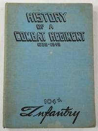
1945ref. 043919N.P.: 104th Infantry United States Army 1945. First edition undated late 1945 signed by Commanding Officer Ralph W. Palladino on the introductory page. History of this venerable US Army Regiment from its roots as a militia unit in the American Revolution up through the end of World War II the period on which this book focuses. Includes maps other black and white illustrations from photographs list those killed or missing in action battle statistics etc. Light blue cloth printed in black Route of Advance map on endpapers book about 7.5 inches tall 153 pages no dustjacket likely issued without. Some soil to covers good hinges sound text block age-browning to the war-era paper used for the pages no other names or markings. Signed by the Commanding Officer. First Edition. Hard Cover. Good. 16mo - over 5¾" - 6¾" tall. 104th Infantry, United States Army Hardcover
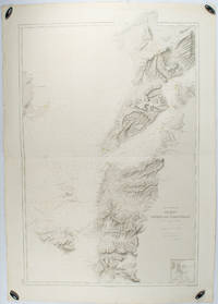
1883ref. 178272Paris.: Service hydrographique et océanographique de la marine. 1883 but1894. Engraved hydrographical chart on watermarked double sheet 99 x 63 cm soundings in metres lighthouses picked out in yellow and red inset map of the port and town of Tenedos central fold a few very slight edge tears to the generous margins light spotting and surface soiling but in very good condition. Fine and impressive large naval chart of this strategically important strait then still under the control of the Ottoman Empire. From a private collection; "Lord John Fitzroy Royal Yacht Squadron" in manuscript on the verso. . Service hydrographique et océanographique de la marine unknown
ref. DADAX1444112120New unknown
1903ref. 75062London: McCorquodale 1903. First edition of this atlas map folio 16 1/4 x 27 1/2 inches. 5 sheets of British Commission maps and index map; 13 sheets of United States Commission maps Alaska boundary atlas and index map. Total of 20 maps 19 folding and 5 in color Maps are 53 x 32 inches. All but the British index map folded and backed in linen. Quarter red morocco over red cloth. Gilt Royal Seal to front board and spine. Maps mounted on linen and sectioned as issued. Portfolio case with moderate rubbing chipping to leather. Does not include the 10 cards to accompany the U.S. Commission maps seems to be common that these smaller ones are missing. Old staining to cloth. Toning and edge wear to British Index map. Slight toning and offsetting to maps. Overall a very good copy; quite scarce. [McCorquodale] hardcover
1939ref. 144331939. Archive of six large original World War II-era maps used by a United States Army soldier in the European Theater of Operations during the Allied liberation of Europe. Lithographed maps various issuers 1938-1939 wartime use 1944-1945. Beyond their immediate tactical utility these maps occupy a pivotal geopolitical moment. The Czech sheets document territories liberated by American forces in May 1945 particularly around Plzeň which marked the effective western limit of U.S. advance before demarcation lines were fixed with Soviet forces. Within months these same regions fell firmly within the Soviet sphere of influence formalized through postwar agreements and culminating in the 1948 Communist coup in Czechoslovakia. Cartographically borders administrative divisions and place names shifted to reflect the new socialist state while subsequent Eastern Bloc map production emphasized different political geographies aligned with Moscow. Thus these pre-Communist and German-printed sheets capture a fleeting interstice: cities momentarily under American military administration before incorporation into the Soviet Eastern Bloc. The 1938 promotional map of Czechoslovakia preserves the nation's pre-Munich territorial identity prior to its partition under Nazi pressure while the 1939 Hamburg map reflects the industrial heartland of the Third Reich before Allied devastation and Germany's eventual division into East and West. In this sense the archive charts not only wartime movement but the rapid redrawing of Europe's political landscape-where American operational cartography was almost immediately superseded by Cold War boundary-making. Sizes range from 19" x 24" to 34" x 22". The archive comprises detailed city and regional maps of western Czechoslovakia-Město Teplá 19" x 24" Plzeň Sheet 4151 24" x 19" black and white with green overlay Horšovský Týn Sheet 4150 24" x 19" and Kralovice Sheet 4051-together with a large 1938 promotional map of Czechoslovakia 34" x 22" and a 1939 German-printed map of Hamburg 28" x 24". All are original period printings retained by the soldier following his service. Good overall with expected wartime folds creasing and moderate wrinkling from field use and storage; no significant losses observed. A rare and materially resonant survival of Allied operational maps that document both the liberation of Central Europe and the swift geopolitical transformation that consigned much of that terrain to the Soviet Eastern Bloc rendering these sheets artifacts of a brief and transitional military presence. unknown
ref. 72546E-210. Hardcover. 8vo. Published by Robert Clarke & Co Cincinnati OH. 1875 xiv 454 pp; v 478 pp; iv 22 fold-out maps. 3 volumes including 2 volumes of text plus the Atlas. Bound in red cloth boards with titles present to the spine and front board. Spines have been replaced and rebacked. Atlas is missing the spine. Boards have light shelf-wear present to the extremities. No ownership marks present. Text is clean and free of marks. Spine is missing from the atlas volume with the front board barely attached to the spine. The army originally fought under the name Army of the Ohio until Maj. Gen. William S. Rosecrans assumed command of it along with the Department of the Cumberland; he thus changed the name of the newly combined entity to the Army of the Cumberland. Under Major General George H. Thomas who took command in October of 1863 the Unit played a major role in Sherman's March to Atlanta. In all; the Army of the Cumberland played important roles in the battles of Stones River Chickamauga Chattanooga-Ringgold Peachtree Creek Kennesaw Mountain and Nashville. The Atlas volume depicts the army's movements during these battle and campaigns. ; 8vo 8" - 9" tall . hardcover
1941ref. 21072Window Rock AZ: United States Department of the Interior Office of Indian Affairs Navajo Service 1941. First Edition. Small quarto 26.25cm; mimeographed sheets printed recto and verso and side-stapled into illustrated wrappers; vi 180pp 20; illus. Former owner's name in ink to front wrapper with chipping thin splits and short tears to same; thin vertical paint streak to rear wrapper; text remains fresh and clean; Very Good. Guide book and gazeteer of the Navajo country and adjacent regions compiled by Richard Fowler Van Valkenburgh a former Bureau of Indian Affairs worker and long-time archeological assistant with the L.A. County Museum of History Art and Science. Contains a 4pp key to the Navajo alphabet palatalization and labialization an extensive list of Navajo place names providing detailed information regarding their origins history and significance. Illustrated throughout with maps drawn by Charles Keetsie Shirley. Scarce in commerce. United States Department of the Interior, Office of Indian Affairs, Navajo Service unknown
ref. GOR001576744Paperback. Very Good. paperback
1944ref. 144301944. Collection of German produced maps created during World War II documenting military geography industrial targets and occupied territories across Europe. Printed between approximately 1939 and 1945 the maps reflect the cartographic infrastructure used by the German military and administrative authorities during the conflict. They include operational target mapping of industrial facilities in Britain as well as broader geographic maps of Central and Western Europe produced during the period of German expansion and occupation. The materials illustrate the strategic importance of cartography in wartime planning intelligence gathering and territorial administration. Archive of ten German language maps printed circa 1939-1945. The group includes a German aerial bombing target map of the Chesterfield Tube Works in Great Britain dated December 1942 showing an aerial photographic image of the factory area overlaid with roads bridges and designated target points. The document bears the warning "Nur für den Dienstgebrauch" translated as "For Internal Use Only." The Chesterfield Tube Works produced industrial cylinders and compressors important to the Allied war effort and German bombing raids targeted the factory and nearby rail lines; one recorded bombing attempt reportedly missed the intended target and struck a golf course several miles away. The archive also includes a map titled Karte der ehemaligen Tschechoslowakei "Map of the Former Czechoslovakia" printed with red elevation markings and bearing the headline "Sonderausgabe!" "Special Edition!" produced during the period of German occupation following the annexation of the Sudetenland in 1938 and the subsequent occupation of the remainder of Czechoslovakia in 1939. Additional maps depict the city of Plzeň located at the edge of the Sudetenland and occupied by German forces during the war along with maps of Köln Cologne Umgebung von Wien surroundings of Vienna and broader geographic overview maps labeled Deutsches Reich Frankreich and Italien. One large overview sheet titled Blatt Südost includes a color printed regional map with scale 1:1000000. During World War II the production of detailed maps formed a central component of military planning aerial reconnaissance and territorial administration across Europe. German cartographic units compiled aerial imagery industrial intelligence and geographic data to support bombing operations and to administer occupied territories. Maps such as the Chesterfield industrial target sheet demonstrate how aerial photography and cartographic overlays were combined to identify transportation networks and industrial infrastructure vulnerable to bombing campaigns. Other maps in the archive reflect the shifting political geography of Europe under Nazi occupation including representations of territories incorporated into or controlled by the German Reich. The group contains ten maps of varying sizes including large wall maps exceeding 50 inches in width. Several maps show signs of use including wear and annotations; the Plzeň map lacks the original key section. Overall condition ranges from good to very good with occasional handling wear consistent with wartime cartographic materials. A substantial group of World War II German maps documenting both strategic planning and the geography of occupied Europe. unknown
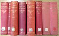
1935ref. 624644London: Macmillan and Co Ltd 1935. Eight volumes complete. Ex-library red cloth hardcovers with gilt lettering to the spines no dust jackets from Chris Church College Oxford in very good condition for their age. Maps and sketches by Major A.F. Becke. Book 1: The German march offensive and its preliminaries. Book 2: The German march offensive and its preliminaries: Appendices. Box 1: Maps. Book 3: March-April: Continuation of the German offensives. Box 2: Maps. Book 5: May-July: The German diversion offensives and the first allied counter-offensive. Volume IV: 8th August-26th September: The Franco-British Offensive. Volume V: 26th September-11 November: The advance to victory. Boards are somewhat sunned with labels on the lower spines. Spine ends are slightly bumped Page blocks and endpapers are lightly foxed with some foxing on occasional pages. Within customary array of labels and stamps. Bindings are sound and pages are otherwise clear. LW. Hardcover. Very Good/No Dust Jacket. Used. Macmillan and Co Ltd Hardcover
ref. SONG0444563571Used: Good unknown
ref. DADAX1570720452New unknown
1935ref. 1395167New York: Harcourt Brace and Company 1935. First Edition Fourth Printing. Hardcover. Octavo 255 pages. In Very Good minus condition and lacking issued dust jacket. Bound in dark blue cloth with silver gilt lettering on spine. First edition fourth printing as stated on copyright page. Foxing to boards with light fraying to cloth along edges. Top edge of textblock dyed dark blue though faded. Toning to interior pages and tanning to pastedowns. Inscribed by Anne Morrrow Lindbergh on second endpaper in Spanish. Shelved in Case 9. 1395167. Shelved Dupont Bookstore. Harcourt, Brace and Company hardcover
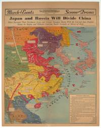
1940ref. 209821Los Angeles.: Los Angeles Examiner. 1940. Printed colour pictorial map on a single newspaper leaf 42.3 x 39.9 cms; 54.3 x 42.5 cms sheet archivally laid down on linen slight discolouration to lower centrefold and sheet slightly age-toned but in very good condition. A striking geopolitical map by Los Angeles Examiner artist Howard Burke covering China Japan Southern Russia and the northern part of French Indochina and Siam showing how the "Aggressors Divide China." Areas under Japanese occupation are shown in red and their naval blockade shown by an arc of naval vessels with vivid arrows indicating lines of supply. Text labels including sources of agricultural and raw materials provide a dynamic overview of the geopolitical situation and show the influence of American scientific illustrator and cartographer Richard Edes Harrison who argued for examining geographic issues from multiple perspectives and Los Angeles Times artist Charles Owens. . Los Angeles Examiner. unknown
1943ref. 144341943. Archive of nine large original World War II maps used by a United States Army soldier in the European Theater of Operations during the Allied liberation of Western Europe. Lithographed military maps variously issued by U.S. Army and War Office agencies 1943-1944. Large formats ranging from approximately 19" x 24" to 42" x 34". These maps document the cartographic infrastructure of Allied ground and air operations in the climactic campaigns of 1944-1945. The German sheets-many designated for "Army/Air" or restricted War and Navy Department use-reflect the intensive aerial reconnaissance bombing coordination and mechanized advance into the industrial and administrative heartland of the Third Reich. Cities such as Berlin Magdeburg Kassel and Düsseldorf were central to armaments production rail networks and military command making accurate and rapidly updated mapping indispensable. The Paris map corresponds to the Allied advance culminating in the Liberation of Paris in August 1944 marking the symbolic reclamation of a major European capital from Nazi control. Several sheets note reliance on prewar German cartography 1938 editions supplemented by wartime intelligence underscoring how Allied forces repurposed and revised enemy geographic data for invasion and occupation planning. Crucially these maps also capture a political geography that was almost immediately transformed by postwar settlement and Soviet expansion into Central and Eastern Europe. Within two years of their issue Germany was divided into occupation zones and by 1949 into separate states aligned with Western and Soviet blocs. Cities such as Berlin Halle Saale Magdeburg and Wernigerode fell within the Soviet zone and subsequently the German Democratic Republic fundamentally altering administrative boundaries transportation networks and the ideological framing of space. Cartographic production in these regions shifted accordingly with new editions reflecting socialist state structures and restricted internal mapping policies characteristic of the emerging Eastern Bloc. Thus these 1943-1944 sheets preserve a transitional moment: Nazi Germany still territorially intact on paper yet already subjected to Allied military penetration and poised on the brink of partition. As artifacts carried by an American soldier they embody both the tactical prosecution of total war and the immediate redrawing of Europe into Cold War spheres of influence. The archive includes operational maps of Magdeburg Sheet M.53 1:250000 "First Edition" 1943 with manuscript annotation Kassel Sheet L52 "Emergency Road Map" First Edition color based on 1938 mapping with wartime intelligence updates Düsseldorf Sheet K52 similar issue with fading highlighting and manuscript marks Hanover Sheet L53 1943 Berlin Sheet N53 "Army/Air" 1943 Halle Saale Sheet M52 marked "War and Navy Department Agencies only. Not for sale or distribution" 1943 Wernigerode Sheet 4130 First Edition War Office 1944 Jülich G.S.G.S. No. 4507 War Office 1944 35" x 30" and a large U.S.-issued map of Paris 42" x 34" 1944. All were retained by the soldier following his service. Very good overall with expected wartime folds and handling; several sheets with manuscript annotations highlighting fading or moderate water exposure notably Wernigerode stiffened from dampness; no major losses observed. A substantial and research-rich archive of original Allied operational maps materially linking frontline navigation aerial bombardment liberation campaigns and the swift geopolitical reconfiguration of Germany and Europe under the expanding Soviet Eastern Bloc. unknown
1867ref. 63963New York NY: Taintor Brothers Merrill & Co. 758 Broadway c. 1867 ca. 1870. One large folio colour lithograph map sized 19.5 x 25 in. expertly mounted on linen decorative border neatline very faint dustsoiling marks from when originally folded very slight age toning at the former creases still a VG bright copy. Early printing of this splendid map depicting the five boroughs before their consolidation 30 years later in 1898 and offering a superb snapshot of the streets ferry lines waterways and Harbor. New York rapidly changed during the end of the 19th Century with tremendous influx of immigrants into the City and this map captures a pivotal time. Joseph Taintor 1835-1881 established this mapmaking firm with his brother Charles Taintor in 1866 and after 1868 when they changed the name of the firm they added their Uncle and entered the field of school book pubishing including the Analytical Readers series. See: David Rumsey Historical Map Collection City of New York No. 0973.003. Taintor Brothers, Merrill & Co., 758 Broadway, unknown
ref. DADAX0847827437New unknown
1806ref. 009589London: Printed for Richard Phillips Sold By Souter No. 1 Pater-noster-row. 1806. Book. Very Good. Hardcover. First Edition. Large 4to. A very good "large paper" copy with uncut edges leaf size approximately 285mm x 225mm with a few additional items bound in. Pp. xiv 2 530 ii ii. 16 hand-tinted aquatints of which several folding map plus an additional contemporary hand-coloured map of Ireland as frontispiece. Contents: frontispiece quarto format map - engraved for the Poem of Erin. The folding plate of Dublin shown as the frontispiece in the "Directions for Placing the Plates" has been bound in opposite the first page of text title page dedication prefacecontents errata directions for placing the engravings main body of the text additional page on St. Patrick from "Guide to Knowledge" bound in at rear before the Publisher's adverts cutting from the Times 1842 entitled "Robert Emmet and the Gaoler of Kilmainham" pasted to rear paste-down. Original paper-covered boards with recent pebbled cloth spine to match original with the original paper title-label applied to the spine binding in very good condition. Contents very good the uncut edges are a little worn in places and a couple of a small near-contemporary oval stamps of the "Baptist College Bristol" to the front end paper no other marks. Paper in very good condition without any obvious staining minimal foxing almost completly confined to the tissue guards maps and plates all very good clean and crisp short repaired tear to the edge of page 318 not nearly affecting the text. A very good to fine copy. Printed for Richard Phillips, Sold By Souter, No. 1, Pater-noster-row. Hardcover
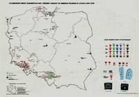
1979ref. 41929Warszawa Warsaw: Pan´stw. Wydawn. Naukowe 1979. 1st Edition. Original black printed portfolio 8vo. Portfolio of seven large folding maps on on 4 sheets of heavy paper 3 are double sided 1 is singled sided. Primarily black and white with some color. Text in Polish. Title translates to “Nazi camps in Poland 1939 - 1945. An Encyclopaedic Reference Book: Maps." Collection of 7 maps each 84 cm x 60 cm 33 x 24 inches produced by Jan Laskowski at the Main Commission for the Investigation of Nazi Crimes in Poland. The maps comprise Volume II of the work; Volume I is a heavily illustrated 676-page book of the same title which we offer separately. The Seven maps all present are: - Map 1 Single Sided: Hitlerowskie obozy na ziemiach polskich w latach 1939 - 1945. “Nazi camps in Poland in the years 1939 - 1945”. Showing: concentration and extermination camps sub-camps of concentration camps extermination centers POW camps more important sub-camps working divisions commandos and temporary POW camps penal labor camps major labor camps prisons transit camps & ghettos. - Map 2A: Getta na ziemiach polskich w okresie okupacji hitlerowskiej w latach 1939 - 1945 “Ghettos in Poland during the Nazi occupation in 1939 - 1945”. - Map 2B: Hitlerowskie obozy przejsciowe na ziemiach polskich w latach 1939 - 1945 “Nazi transit camps in Poland in 1939-1945”. - Map 3A: Hitlerowskie wiezienia i areszty na ziemiach polskich w latach 1939 - 1945 “Nazi prisons and arrests in Poland in 1939 - 1945”. - Map 3B: Hitlerowskie obozy pracy na ziemiach polskich w latach 1939 - 1945 “Nazi labor camps in Poland in the years 1939 - 1945”. - Map 4A: Hitlerowskie obozy jenieckie na ziemiach polskich w latach 1939 - 1945 “Nazi POW camps in Poland in 1939 - 1945”. - Map 4B: Hitlerowskie obozy koncentracyjne i osrodki zaglady na ziemiach polskich w latach 1939 - 1945 “Nazi concentration camps and extermination centers in Poland in 1939 - 1945”. Maps 2A & 2B have been described as a “Terrifying pair of maps showing the locations of German POW and internment camps in Poland during World War II highlighting the widespread locations of these establishments. In some parts of the map the information becomes so dense that three inset maps are shown. This map was designed by Jan Laskowski and printed in 1979 as part of a work on the Nazi extermination machine produced by PWN Warsaw a state-owned research-focused publishing house in Poland. The map on the front is particularly interesting for its depiction of symbols used to classify internees in German camps. The uppermost of these depictions shows the combinations that can be made for different types of prisoners of different levels of importance. The armbands that would have been worn by these prisoners is shown as well as the prison uniforms. Other details are also shown. The map lists hundreds of sites run by Nazi operators throughout the country. These include concentration camps death camps transitional camps and ghettos. The map is divided according to Poland's voivodeships with a key in the lower left. Names of cities too long to spell are also provided in the lower left. This map was produced during a point in Poland's history during which it was actively revisiting the period during the Second World War. Leading social scientists devoted their time to trying to gather all the living as well as the recorded history of the events of the Holocaust and related atrocities before this information vanished. Leading these efforts particularly during the 1960s and 1970s was the Glówna Komisja Scigania Zbrodni przeciwko Narodowi Polskiemu known as the Chief Commission for the Prosecution of Crimes against the Polish Nation. They were active in publishing maps both for domestic educational purposes and for international remembrance and diplomatic efforts regarding the Holocaust. Jan Laskowski was a leading cartographer who produced a number of maps in this field. These maps were produced as part of a series of maps that purported to combine to form an atlas of all of Hitler's crimes in Poland. Many of the large wall maps produced during this period could only show a fraction of the crimes or only the atrocities committed in one region. Thus a series of maps was needed to show all the points necessary which this present work contributes to. Polish Reinterpretations of the Holocaust: Studying the effects of German occupation in Poland is a delicate subject. While it is certain that Poland suffered at least as badly as any other European nation during the Second World War reinterpretations of the Holocaust in the country have also been used to satisfy nationalistic tendencies. It has become evident to Western observers in the last several years that there is a strong nationalist movement in Poland that seeks to place blame for the Holocaust solely on the shoulders of non-Polish actors a movement originally fostered under Soviet rule. This movement has gone so far as to limit freedom of speech criminalizing with a three-year sentence the suggestion that Poland or its citizens in any form participated in the murders committed by Nazis. As such the term ‘Polish concentration camps’ has been deemed unacceptable with the government-approved term being ‘concentration camps on Polish territory.’ All lines of evidence show that this map 2A & 2B was produced using the most accurate and impartial historical sources. The language on the map is simple naming only ‘Hitler's Atrocities’ and there is no evidence of a clear anti-German bias. However it is impossible to separate this map one of the most important productions of the remembrance movement during this period from the social situation in which it was produced. Maps like these can easily be converted into propaganda instruments and today's Polish leaders most of whom grew up during Soviet occupation will have formed their understanding of the Holocaust through maps like these. Soviet Censorship: While the content of the map appears to have been produced free from bias the map still had to go through Soviet censorship. Mentioning prisoner of war camps in which primarily Soviet troops were interned would have been a prerequisite condition upon which the publication of the map rested. Further the lack of mention of any Soviet killings or camps requires no explanation….The map unlike many later maps makes no differentiation between the populations who suffered at the various camps. This represents the Soviet agenda that all nations suffered fought and won equally which sought to limit divisions in this post-identity state” Ruderman 2022. SUBJECTS: World War 1939-1945 -- Prisoners and prisons German. -- Concentration camps -- Poland. Guerre mondiale 1939-1945 -- Prisonniers et prisons des Allemands. -- Camps d'internement -- Pologne. Obozy koncentracyjne -- Polska -- 1900-1945. OCLC: 830885973. Light shelf wear to portfolio as expected. All maps in pristine condition with normal folds as issued. Very Good Condition. Complete and dramatic BR5 holo2-147-19-'cc. Warszawa (Warsaw): Pan´stw. Wydawn. Naukowe unknown
1850ref. 95311J & F. Tallis London Edinburg & Dublin 1850-01-01. Leather. Very Good. 1850 Tallis 6 volumes bound into 2 vols 3/4 leather over marbleized boards. 7 hand colored maps 56 plates ownership ink to flyleafs and book dealership pencil. Tight bindings text unmarked. oversized and overweight. Please email for photos. J & F. Tallis, London, Edinburg & Dublin hardcover
1790ref. CC136G.G.J. and J. Robinson in Pater-noster Row.: Charles Dilly in the Poultry 1790. Hardcover. Very Good. 101-928pp. Worn original full calf binding with the front board detached but present. LACKING THE REAR BOARD. Illustrated with a correct set of maps by Mr Kitchen. Double page folding maps three with colour BY A YOUNG HAND!. Unlisted chart of the world showing the latest Captain Cook's discoveries bound in at p867. finis. LACKING THE BACK BOARD But a complete text block and plates.215x130mm. 21 plates and the Sphere plate present. A couple of plates hand coloured in outline. An additional CHART OF THE WORLD bound in at the rear. Most maps map two or three creased. A NICE COLLECTION Charles Dilly in the Poultry hardcover
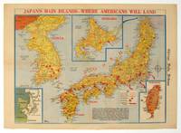
1945ref. 208877Chicago.: Chicago Daily Tribune. August1945. Printed colour pictorial map on a single newspaper leaf 37 x 52 cms; 43 x 59.5 cms sheet three inset maps archivally laid down on linen very good condition. Full page map published in the "Chicago Daily Tribune" after the bombing of Hiroshima and Nagasaki prior to occupation by US and Allied forces in September 1945. "This is a new map of the main islands of Japan where American occupational troops will land and establish their military rule." map text The legend notes "Places bombed by U.S. Air Forces with a red circle" and "Cities bombed by Atomic Bomb" with a red star. The main map shows the Japanese islands of Honshu Shikoku and Kyushu with the Korean peninsula. Inset maps show Hokkaido Formosa and a general map of the area. . Chicago Daily Tribune. unknown
ref. GOR009968733Paperback. Acceptable. paperback
ref. GOR006600469Paperback. Very Good. paperback
ref. GOR005648720Paperback. Good. paperback