2055 resultados
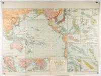
1930ref. 205997Sydney: H.E.C. Robinson. Circa1930s. Printed colour maps in all 65.5 x 99cm the main map roughly 50 x 65 cm on a single sheet 76 x 101.3 cms; a little carelessly folded decorative blue title cover a little dusty and a few fold splits and edgewear but in good condition. The exceptional feature of this map are the twenty six large scale inset maps of Pacific islands including: Malay States Singapore Hong Kong these at lower left Japan Philippine Islands Hawaiian Islands Fiji Solomon Islands Western and Eastern Samoa Tahiti Saipan New Caledonia and Dependencies and many others. The main map of the Pacific Ocean stretches from Southeast Asia including all of Australia and New Zealand the west coast of the Americas the Kamchatka Peninsula Manchukuo Manchuria and most of China. Korea and Taiwan are marked as Japanese Territory. Possessions of Britain France the Netherlands and the United States are highlighted. An incredibly rich source of information on the Pacific theatre during the years leading up to World War II. From the Sydney publisher H.E.C. Robinson the firm founded in 1895 by Herbert Robinson 1857-1933 a founder of the Royal Geographical Society of Australasia. . H.E.C. Robinson. unknown
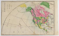
1877ref. 159812Kyoto.: 村上勘兵衛 文部省刊行. Murakami Kanbē; Monbushō kankō. Meiji 10 1877. Colour woodblock map of North and Central America. From the Journal of World Geography 萬國地誌略 published in 1877. Printed area measures 33.5 x 21cm a good copy with occasional soiling. . 村上勘兵衛, 文部省刊行. [Murakami Kanbē; Monbushō kanko& unknown
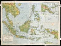
1940ref. 211106Sydney.: H.E.C. Robinson Pty. Ltd. circa1940. Full colour folding map 71 x 97 cms; 76.2 x 10² cms sheet blank on verso save for a neat inked stamp "East Indies" inset map of New Guinea and Papua heights shown by colour very good clean condition. Large scale World War II era map by Sydney publisher H. E. C. Robinson. Extremely detailed map it is coloured according to height above sea level and showing naval bases railways shipping routes air routes. Includes smaller inset map of "New Guinea & Papua" showing the eastern part of the island. . H.E.C. Robinson Pty. Ltd. unknown
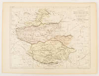
1856ref. 175109Paris.: Gustave Barba Editeur. 1856. Lithographed map with original hand colour central fold 24.2 x 31.5 cm marginal toning plate number in manuscript in very good condition. Finely engraved Dufour map of Central Asia prepared for his "Atlas Populaire" showing East Turkestan Petite Boukharie and Kalmykia Dzoungarie Mongolia and Tibet. . Gustave Barba Editeur. unknown
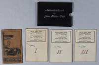
1935ref. 219096Semarang.: Hoofdkantoor. Circa1935. 3 folding colour lithographed maps on linen in a cloth covered slipcase lettered in white on the upper cover. Scale 1:500000. Each map has been numbered 1 to 3 by a prior owner on the reverse of the map with their signature. Sheets measure 55.5 x 83.4cm; 56 x 90cm and 56 x 82.3cm. The first map is a little stained on the reverse but the stains are not visible on the map itself. Very good copies in like slipcase. TOGETHER WITH Afstands Tabellen 1928 a separate 62pp booklet accompanies the folder of maps spine repaired with washi tissue. . Hoofdkantoor. hardcover
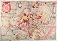
1892ref. 214181東京. Tokyo.: 山嵜暁三郎. Yamazaki Akizaburo. Meiji 25 1892. Colour woodblock map 50 x 71cm folds into card covers with plain cloth spine. 18 x 12cm. Occasional small holes at folds some colour offsetting in places a little marking and staining along upper margin upper left section of upper cover stained with a little subsequent staining to map. A bright and attractive map which looks better than this sounds. This 1892 map of Tokyo shows a growing metropolitan city which attracts many tourists from outside. Portraits of the Emperor and the Empress are featured prominently at the top. There are 11 inset illustrations of major buildings and sites surrounding the main map with a round chart which shows directions and distances to them. Another chart lists place names in wards and counties in Tokyo. The Royal Palace is featured in the center and the palace and major buildings are coloured in red. An inset map of Yokohama sits on the lower left. . 山嵜暁三郎. [Yamazaki Akizaburo]. hardcover
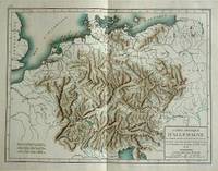
1800ref. 57070c1800. Copper engraving with handcolouring map shows Germany and parts of France Italie Hongrie Pologne and Prusse sic. Minor hole upper border few closed tears and some browning edges otherwise a clean and bright image. Map measures approximately 34 x 46cm. . unknown
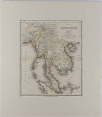
1866ref. 175919Hildburghausen: Bibliographischen Instituts. 1866. Engraved map with outline hand colour central fold 37 x 30 cm 47.4 x 36.2 cm sheet colour key to territorial control and administrative boundaries major cites towns roads rivers and mountains relief shown by hachures light toning in very good condition preserved in modern window mount. Detailed 19th Century regional map of the Malay Peninsula Vietnam Cambodia etc. extending from the Straits of Malaca and Singapore north to Hainan and the Gulf of Tonquin. Text in German prepared for Meyer's Hand Atlas noted in the marginal caption top-left . Bibliographischen Instituts unknown
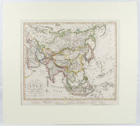
1855ref. 173439Gotha.: Perthes Justus. Circa1855. Engraved map 44.1 x 36.3 cm sheet size 35.8 x 29.7cm map size plate mark map with original hand colouring and hand coloured key noting Islamic "Mohammedanische" Buddhist "Buddhaistische" and European territories by country. Unusual map in an early issue. It was included as map 39 in Stieler's "Hand-Atlas uber alle Theile der Erde und uber das Weltgebaude by Frederic von Stulpnagel" revised by Hermann Berghaus in 1855. The issue is noted to the top right: Ausg. in 63BI. no XIV. Fine outline hand colouring denotes territories by religion and Chinese ports open to European trade and Japanese ports open to American trade. . Perthes, Justus. unknown
ref. 72355Hardcover. Very Good. Wittsburg Arkansas: Crowley's Ridge Steamboat Riverport 1848-1890 hardcover
ref. 0881309001New. paperback. New. Satisfaction Guaranteed or your money back. paperback
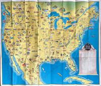
1936ref. 64019Chicago IL: The Pullman Company Poole Bros. Inc. Railroads of the United States Canada & Mexico c. 1936 1938. 4to. 24 pp unpaginated. which folds out into giant oblong atlas folio pictorial colour map 32 x 27 in. on verso orange & blue-tinted illustrations borders and self-printed over on recto in orange & blue w/ photo illustrations self-printed Art Deco cover art depicting streamliner steaming across America w/ Native American & Mexican American in foreground by Leslie Ragan slight age toning minor spotting dustsoiling couple very slight closed tears at fold creases still a VG bright copy. Second edition of this delightful and scarce promotional map issued by Pullman & the Poole Bros. for advocating Streamliner rail travel from British Columbia to Central Mexico Atlantic to Pacific along the Gulf of Mexico and Baja California. The cartographer and cartoonist has filled each area of the map with charming little pictorial vignettes highlighting historic sites National Parks recreational sports and other leisure activities. The Pullman Sleeping Car diagram depicts sections with drawing-room two compartments and double bedrooms with promotional photos. Ragan’s b. 1897 paintings and cover art graced New York Central and other railroads from 1925 through the 1950’s. This particular cover art was used the next year for the 1939 Golden Gate International Exposition World’s Fair brochures time tables and posters. Worldcat locates 1 copy Stanford. The Pullman Company, Poole Bros., Inc.], Railroads of the United States, Canada & Mexico, unknown
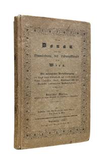
1844ref. 10175Regensburgh: Georg Joseph Manz 1844. First edition. 8vo xiv 205 1pp. Frontispiece with two engraved views and a large folding 6-section map at back. Original printed boards rubbed and soiled. Some foxing to the frontis and title scattered throughout and the map. Very good. Very attractive copy of this travel guide devoted to the stretch of the Danube from the Ludwig Canal to Vienna. This is a follow up to Müller's first work on the Danube issued in two volumes from 1839-1841 and covering the entire length of the river. Adalbert Müller 1802-1879 was a popular history and travel writer from Bavaria who wrote several works on the scenery and monuments in southern Germany during the steam travel age. Scarce. Georg Joseph Manz unknown
1889ref. 70991NY and Chicago: Rand McNally 1889. Engraved map 23 x 28 inches recto showing Lower Manhattan Brooklyn Jersey City and Hoboken lines for Manhattan Elevated Railway Suburban Rapid Transit Brooklyn Elevated R.R. and Kings Co. Elevated R.R. printed in dark red Bartholdi's Statue marked on Bedloes Island verso showing Upper Manhattan and printing a large more detailed inset of Lower Manhattan from Washington Square to the Battery 12 ½ x 13 inches and a boxed index to the street car lines 8 x 6 inches. Printed several times 1886-1889 this printing located in four copies on OCLC Newberry New York Public Boston Public Columbia. Folded into 16mo printed brown wrappers subtitle: Showing Street Car Lines Elevated Railroads Docks Ferries Steam Boat Lines etc.; some soiling several tiny corner fold breaks wrappers separated along the spine but still a good copy. Rand, McNally unknown
1941ref. 56936Washington D.C. & Chicago IL: Household Goods Carriers’ Bureau Rand McNally & Co. 1941; 1947. Two vols. 296 pp. including 22 large folding colour maps a few w/ minor toning to fore-edges some dustsoiling a few w/ minor tape repairs especially at a couple folds and near gutter margin. Quarter-green cloth over printed light green softcovers stapled as issued minor soiling some slight foxing & toning still VG copy; 9 3 pp. Stapled as issued minor toning light creasing at corners VG. First edition of this essential HHGCB mileage guide issued just weeks before Pearl Harbor and the entry of the United States into World War II. Originally established in 1936 after the passage of the Reed-Bulwinkle and Interstate Commerce Commission Acts the HHGCB organized to file the required mileage tariffs with the ICC and issued this guidebook. This mileage guide contained maps from the Rand McNally Co. together with charts to determine highway distances between principal points in the United States and allow transport charges to be computed. This guidebook offers an essential snapshot of not only the existing transportation network during World War II but also the vital routes of trucking goods across the country locally or into Canada and Mexico prior to the creation of the Interstate Highway System later authorized in 1956 by President Eisenhower. The supplement updated many of the mileage references following the War acknowledging the tremendous build-up of infrastructure during and in Post-War America. The HHGCB continued to operate in assorted consolidations and mergers until the 2007 decision eliminating all motor carrier rate bureaus. Worldcat locates 1 copy of No. 4 no copies located of Supplement No. 10 US Dept. of Transportation Library. Household Goods Carriers’ Bureau, Rand McNally & Co., paperback
ref. DADAX1912716046New unknown
ref. DADAX2067150529New unknown
ref. GOR008960106Paperback. Very Good. paperback
ref. GOR007803387Paperback. Good. paperback
ref. SONG2067126725Used: Good unknown
ref. SONG2067229796Used: Good unknown
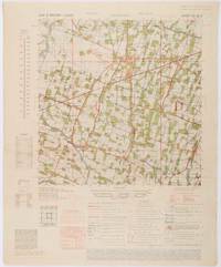
1945ref. 200411Washington D.C.: Army Map Service. First edition - revised AMS4. 1945. Army survey map printed in colour 36.7 x 36.7 cm; 58 x 48 cm sheet conversion graph glossary and administrative index to the inner margin; scale three column legend index to adjoining sheets and notes re grid references and mean declination to the foot; sheet toned a very few edge tears the map in very good condition. Wartime map produced by the US Army Map Service AMS who formed in 1942 and were at the forefront of military mapping campaigns during WWII and the post-war years. The very detailed map shows residency and administrative boundaries transportation ground and water features vegetation cultivation ruins religious sites "Graves; Chinese native" and "Cemetery; heathen Christian" walls hedges populated places built-up areas and buildings with those of iron stone wood and bamboo differentiated by colour; fishponds plantations and much more. . Army Map Service. unknown
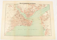
1925ref. 174961Constantinople.: The Anglo-American Book & Newsagency. 1925. Printed folding colour map 36 x 49.2 cm street grids for Stambul Pera Galata and Skutari railways and landing places marked small fold splits affecting the margins only now repaired with archival material two small holes at central folds pin-holes to the four corner some age-toning but in very good condition. A scarce map of the historic peninsula soon after the Republic of Turkey was founded and the capital moved to Ankara. Printed for the tourist market this map is a rare survival. . The Anglo-American Book & Newsagency. unknown
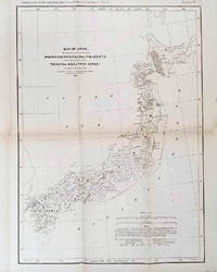
1878ref. 210211Philadelphia.: American Institute of Mining Engineers. Sherman & Co. printers. 1878. Large folding map of Japan showing "some of the more important Mining Districts Coal Fields etc." small fold split without loss tables 67pp. Covers a little scuffed and discoloured overall in very good condition. Scarce offprint separately paginated of a paper included in Volume V of the Transactions of the American Institute of Mining Engineers. The author Henry S. Munroe had been retained by the Japanese Government as Assistant Geologist and Mining Engineer with the Geological Survey of Yesso for the Hokkaidō Colonization Agency. His work laid the foundations for the future coal mining industry in Hokkaido. The report contains two lengthy tables relating to coal production and quality. . American Institute of Mining Engineers. Sherman & Co., printers. unknown
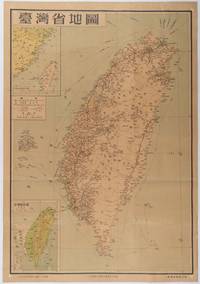
1954ref. 215869地圖出版社. Reprint. 1954. Colour folding map of Taiwan showing all major cities towns and villages railways highways roads rivers and sea routes. Topographical inset map at lower left Taiwan Straits with mainland coast inset map at top left. Each map has its own scale. Text in traditional Chinese characters. Washi repairs along some folds on reverse pin marks at corners evenly browned and a little faded. A nice map of Taiwan in fair condition. 77 x 53.8cm. . 地圖出版社. unknown