WWII MAPS W W IABAA

60 resultados
1944ref. 144301944. Collection of German produced maps created during World War II documenting military geography industrial targets and occupied territories across Europe. Printed between approximately 1939 and 1945 the maps reflect the cartographic infrastructure used by the German military and administrative authorities during the conflict. They include operational target mapping of industrial facilities in Britain as well as broader geographic maps of Central and Western Europe produced during the period of German expansion and occupation. The materials illustrate the strategic importance of cartography in wartime planning intelligence gathering and territorial administration. Archive of ten German language maps printed circa 1939-1945. The group includes a German aerial bombing target map of the Chesterfield Tube Works in Great Britain dated December 1942 showing an aerial photographic image of the factory area overlaid with roads bridges and designated target points. The document bears the warning "Nur für den Dienstgebrauch" translated as "For Internal Use Only." The Chesterfield Tube Works produced industrial cylinders and compressors important to the Allied war effort and German bombing raids targeted the factory and nearby rail lines; one recorded bombing attempt reportedly missed the intended target and struck a golf course several miles away. The archive also includes a map titled Karte der ehemaligen Tschechoslowakei "Map of the Former Czechoslovakia" printed with red elevation markings and bearing the headline "Sonderausgabe!" "Special Edition!" produced during the period of German occupation following the annexation of the Sudetenland in 1938 and the subsequent occupation of the remainder of Czechoslovakia in 1939. Additional maps depict the city of Plzeň located at the edge of the Sudetenland and occupied by German forces during the war along with maps of Köln Cologne Umgebung von Wien surroundings of Vienna and broader geographic overview maps labeled Deutsches Reich Frankreich and Italien. One large overview sheet titled Blatt Südost includes a color printed regional map with scale 1:1000000. During World War II the production of detailed maps formed a central component of military planning aerial reconnaissance and territorial administration across Europe. German cartographic units compiled aerial imagery industrial intelligence and geographic data to support bombing operations and to administer occupied territories. Maps such as the Chesterfield industrial target sheet demonstrate how aerial photography and cartographic overlays were combined to identify transportation networks and industrial infrastructure vulnerable to bombing campaigns. Other maps in the archive reflect the shifting political geography of Europe under Nazi occupation including representations of territories incorporated into or controlled by the German Reich. The group contains ten maps of varying sizes including large wall maps exceeding 50 inches in width. Several maps show signs of use including wear and annotations; the Plzeň map lacks the original key section. Overall condition ranges from good to very good with occasional handling wear consistent with wartime cartographic materials. A substantial group of World War II German maps documenting both strategic planning and the geography of occupied Europe. unknown books
1935ref. 1395167New York: Harcourt Brace and Company 1935. First Edition Fourth Printing. Hardcover. Octavo 255 pages. In Very Good minus condition and lacking issued dust jacket. Bound in dark blue cloth with silver gilt lettering on spine. First edition fourth printing as stated on copyright page. Foxing to boards with light fraying to cloth along edges. Top edge of textblock dyed dark blue though faded. Toning to interior pages and tanning to pastedowns. Inscribed by Anne Morrrow Lindbergh on second endpaper in Spanish. Shelved in Case 9. 1395167. Shelved Dupont Bookstore. Harcourt, Brace and Company hardcover books
1943ref. 144341943. Archive of nine large original World War II maps used by a United States Army soldier in the European Theater of Operations during the Allied liberation of Western Europe. Lithographed military maps variously issued by U.S. Army and War Office agencies 1943-1944. Large formats ranging from approximately 19" x 24" to 42" x 34". These maps document the cartographic infrastructure of Allied ground and air operations in the climactic campaigns of 1944-1945. The German sheets-many designated for "Army/Air" or restricted War and Navy Department use-reflect the intensive aerial reconnaissance bombing coordination and mechanized advance into the industrial and administrative heartland of the Third Reich. Cities such as Berlin Magdeburg Kassel and Düsseldorf were central to armaments production rail networks and military command making accurate and rapidly updated mapping indispensable. The Paris map corresponds to the Allied advance culminating in the Liberation of Paris in August 1944 marking the symbolic reclamation of a major European capital from Nazi control. Several sheets note reliance on prewar German cartography 1938 editions supplemented by wartime intelligence underscoring how Allied forces repurposed and revised enemy geographic data for invasion and occupation planning. Crucially these maps also capture a political geography that was almost immediately transformed by postwar settlement and Soviet expansion into Central and Eastern Europe. Within two years of their issue Germany was divided into occupation zones and by 1949 into separate states aligned with Western and Soviet blocs. Cities such as Berlin Halle Saale Magdeburg and Wernigerode fell within the Soviet zone and subsequently the German Democratic Republic fundamentally altering administrative boundaries transportation networks and the ideological framing of space. Cartographic production in these regions shifted accordingly with new editions reflecting socialist state structures and restricted internal mapping policies characteristic of the emerging Eastern Bloc. Thus these 1943-1944 sheets preserve a transitional moment: Nazi Germany still territorially intact on paper yet already subjected to Allied military penetration and poised on the brink of partition. As artifacts carried by an American soldier they embody both the tactical prosecution of total war and the immediate redrawing of Europe into Cold War spheres of influence. The archive includes operational maps of Magdeburg Sheet M.53 1:250000 "First Edition" 1943 with manuscript annotation Kassel Sheet L52 "Emergency Road Map" First Edition color based on 1938 mapping with wartime intelligence updates Düsseldorf Sheet K52 similar issue with fading highlighting and manuscript marks Hanover Sheet L53 1943 Berlin Sheet N53 "Army/Air" 1943 Halle Saale Sheet M52 marked "War and Navy Department Agencies only. Not for sale or distribution" 1943 Wernigerode Sheet 4130 First Edition War Office 1944 Jülich G.S.G.S. No. 4507 War Office 1944 35" x 30" and a large U.S.-issued map of Paris 42" x 34" 1944. All were retained by the soldier following his service. Very good overall with expected wartime folds and handling; several sheets with manuscript annotations highlighting fading or moderate water exposure notably Wernigerode stiffened from dampness; no major losses observed. A substantial and research-rich archive of original Allied operational maps materially linking frontline navigation aerial bombardment liberation campaigns and the swift geopolitical reconfiguration of Germany and Europe under the expanding Soviet Eastern Bloc. unknown books
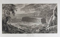
1833ref. 18856Milano: Fortunato Stella e Figli 1833. First Italian edition. Hardcover. f to vg. Oblong folio 12 6/8 x 18 1/2". 1 leaf Title 38 leaves Plates 1 leaf List of content. Original half morocco over burgundy paper covered boards. Gold lettering and tooling on spine. Rare first Italian edition of Paul-Louis-Bernard Drach's atlas volume of his "Sainte Bible de Vence" a series which was originally published in 27 volumes in Paris from 1827 to 1833. The striking 38 engraved plates featured in this atlas are composed of 13 maps by A. R. Fremin and 25 engravings signed by Falkeisen Angelini and Lanzani. The engraved plates have been laid down on beautiful hand-made paper and describe the following: 1. Map of the place of Eden Mesopotamy and Persian Gulf; 2. Noah's Arch construction; 3. Noah's Arch; 4. Map of the land divided among Noah's sons; 5. The Babel Tower; 6. Map of the Land of Canaan; 7. Map of Jews' Pilgrimage; 8. The Jerusalem Sahnedrin; 9. The Temple of Jerusalem plans and sections; 10. The Temple of Jerusalem square plan; 11. Map of ancient Jerusalem; 12. The Temple of Salomon; 13. The Temple's foundations; 14. The East Gate; 15. The Buildings of the Temple; 16. Musical Instruments of the Jews; 17. Hebrew Alphabet; 18. Jew's Vestments and worship's objects; 19. Two Menorah; 20. High Priest's vestments and Golden Menorah; 21. Moses' Tabernacle; 22. The Loaves of Proposition; 23. Plan and section of the Tabernacle; 24. The encampment of the Israelites; 25. Map of the Holy Land South; 26. Map of the Holy Land North; 27. Map of Syria; 28.Map of Israel under Salomon; 29. Plan of the House of the Forest of Lebanon; 30. The House of the Forest of Lebanon; 31. The Bronze Sea; 32. The Washings; 33. The Altars of the Holocausts; 34. Map of the Persian Empire; 35. Map of the Land of Canaan according to Ezechiel; 36. Map of Herod's Reign; 37. Zachary's Vision; 38. Map of the travels of Saint Peter and Saint Paul. The plates measure appr. 12 1/2 x 18 1/4" image size appr. : 9 1/2 x 14 6/8". Binding rubbed on covers and along edges. Head and tail of spine chipped. Previous owner's Ex-libris Calvin Bullock on inside of front cover. Minor and sporadic foxing along paper margin not affecting plates. Title and captions in Italian. Binding in overall fair interior in very good plates in near fine to fine condition. About the author: "David Paul Drach aka Paul-Louis-Bernard Drach after his conversion 1791-1865 was a Catholic convert from Judaism and librarian of the College of Propaganda in Rome. Drach received his early education from his father who was a rabbi. After spending some time in various Talmudic schools he became a teacher at Rappoltsweiler though only sixteen years of age. The love of the secular sciences brought him to Paris where he was welcomed by his coreligionists and became tutor in a wealthy Jewish family. His reputation as a teacher brought him Christian pupils; and this may have had some influence on his subsequent conversion; in fact he had always manifested some leaning toward Christianity. Drach had already begun the study of Greek and Latin so as to become acquainted with the Christian doctrines in their original sources. Struck by the accusation of some of the Fathers that the Jews had corrupted the Hebrew text he began a comparative study of the Hebrew and the Septuagint which study he continued in spite of the remonstrances of the president of the Central Consistory. Drach was received into the Catholic faith in 1823 together with his two daughters and his son Paul who afterward became a priest and a distinguished Biblical scholar. In 1827 Drach accepted the position of librarian of the Propaganda in Rome which position he held until the year of his death." From the Jewish Encyclopedia. Fortunato Stella e Figli hardcover books
1664ref. 2341508London: Excudebat J.F. James Flesher pro Jona Hart 1664. First Thus. Hard Cover. Near Fine/No Jacket. Rebound with new end sheets: brown leather spine marbled paper over boards red morocco spine label gilt titles and rules. Binding tight pages clean and unmarked. 1664 Hard Cover. viii 230 pp. Last text page misnumbered 216. Descartes's fundamental and originating work of the modern era in Western philosophy bound together with a work by one of the Utrecht Cartesians Lambert van Velthuysen. This is the first British printing of the Meditations though it does not include Descartes's 'Objections and Replies' as many editions do. Velthuysen was connected by marriage to Descartes's friend Henry Regnier and corresponded with scientists and philosophers such as von Leeuenhoek Spinoza and Leibniz. The work included here shows the influence of Thomas Hobbes - unsurprising given that Velthuysen is credited with translating Leviathan into Dutch. John Locke may have met Velthuysen while in Utrecht in 1684/85 and had eight titles by Velthuysen in his personal library including the Rheims edition of the present title. Bound into this volume are two plates not called for in either work which may be taken from the Hart printing of Principia Philosophia which was published the same year. Wolf 736 Wing D1133a. Excudebat J.F. [James Flesher] pro Jona Hart hardcover books
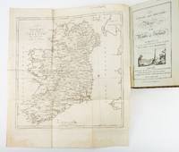
1783ref. ST19355London: Engraved by G. Terry and Sold by T. Longman London and W. Wilson Dublin 1783. Second Corrected Edition. 260 x 155 mm. 10 1/4 x 6". XXVII 289 pp. 4 leaves index. Contemporary half calf over marbled boards flat spine divided into panels by gilt rules red morocco label very neat repair to head of front joint and top of spine. Engraved title page with vignette and dedication leaf large folding map of Ireland and 289 engraved maps. Title page with early ink signature of Jos. Sabine. Moreland & Bannister p. 190; Tooley "Maps and Mapmakers" p. 94. Small signs of age and wear to the binding including slight crackling and nicks to the spine folding map with faint dampstain to tail margin two negligible ink spots to blank area on the map of the Irish Sea but A VERY APPEALING COPY quite clean and remarkably fresh internally and in an entirely solid period binding. This is the second corrected edition of the first comprehensive road atlas of Ireland offered here in especially attractive condition. In response to increasing demand for accurate maps of the country's road system the Irish House of Commons commissioned George Taylor and Andrew Skinner who together had previously produced the first road atlas of Scotland among other works to undertake a survey of the land. Taylor and Skinner completed their work in 1777 and published the first edition of their findings in 1778. This second edition includes updates to the year 1783 as well as an additional map no. 289. Renowned for their precision and detail Taylor and Skinner's maps clearly show roads crossroads and bridges as well as topographical features such as hills lakes and rivers including the direction of the water flow; landmarks such as castles churches and ruins; and the names of local landlords and their homes. The maps appear either as half-page strips or in full-page and the distances are given in both Irish and English miles 11 Irish miles being equal to 14 British miles. The robust list of subscribers which includes a number of earls viscounts lords bishops and British and Irish army men demonstrates the great need for and widespread success of this important work. Our former owner may well be the famed and controversial naturalist Joseph Sabine 1770-1837 who often signed his name as "Jos. Sabine" as seen here. He certainly had good reason to own maps of Ireland. He was from an Anglo-Irish family himself and was Honorary Secretary of the Horticultural Society a position which at the time carried great clout in the botanical community and one that presupposed knowledge of geography across the realm. DNB tells us that "Sabine played a leading part in the establishment of the society's garden first at Hammersmith and afterwards at Chiswick; in sending out David Douglas and others as collectors; in starting local societies in connection with the Horticultural Society; and in growing and distributing new and improved varieties of flowers fruits and vegetables throughout the country." While not a rare book this is the kind of volume that would have normally encountered frequent and inevitably damaging use so to find a copy as well preserved as this one is a lucky occurrence. Engraved by G. Terry and Sold by T. Longman, London and W. Wilson, Dublin unknown books
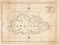
1860ref. 48522Antigua but actually Philadelphia: R.B. Eldridge & Co. ca.1860. Interesting Map of the Island of Antigua An unusual lithographic edition of Norie's 1827 revision of this handsome chart lithographed by Wagner & McGuigan in Philadelphia. A statement in the cartouche reads: "Presented by R.B. Eldridge Antigua to Captain Andrew Tyler." The captain's name is accomplished in manuscript. R.B. Eldridge is not listed in Tooley's DICTIONARY OF MAPMAKERS and appears to be unrelated to publisher of charts George Eldridge. It seems most likely that he was rather an Antigua merchant who commissioned a reprint of the chart for complimentary distribution to sea captains. A handsome piece. Lithographic sheet map 20½ x 26½ inches. Backed with contemporary blue paper. Light foxing and toning. A few small tears in margins. Very good. unknown books
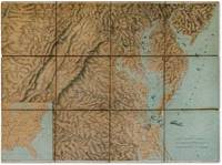
1861ref. 61812New York: W. Schaus; printed by Sarony Major & Knapp 1861. Second Edition. 59 x 76cm open. 19.5x19cm closed. Tinted lithographic map backed in brown silk in black slipcase with printed paper label. Bookseller's ticket of Rev. A. O. Brickman Baltimore. Two ownership inscriptions of "J. M. Deems Maj. 1st MD Cav" and inscribed "Deems" on the slipcase. Trimmed; splits along half of one horizontal fold; minor stains and discoloration to verso not affecting image which is bright and generally Very Good. Hand-made slipcase worn with portion cut out but with manuscript ownership label intact. Uncommon Civil War map used by a distinguished Union Army officer. James Monroe Deems 1818-1901 was a composer and music educator from Baltimore who secured a commission as a major in 1861. He was promoted to Lieutenant Colonel in spring 1863; led the First Maryland Cavalry during the Battle of Gettysburg; retired due to rheumatism in November 1863; and was brevetted Brigadier General in 1867. He likely acquired this map in Baltimore near the beginning of his military career and certainly before his promotion in 1863 given the use of "Maj." in his ownership inscriptions. The map itself is the second edition of this design by J. Schedler despite the title it is not a bird's-eye view. The more common first edition has two insets showing the Lower Mississippi Valley and the city of Richmond see Stephenson 17.3. This version has only one inset showing the eastern United States. Stephenson describes this edition as having a Washington DC bookseller's ticket; the present copy has a Baltimore bookseller's ticket instead. This copy was mounted for use in the field: it was trimmed down to the neatline the captions removed the image cut up into segments and mounted on linen. The printed label on the slipcase appears to be a portion of the original title. This may have been done by the bookseller Brickman possibly at Deems' request. Uncommon. OCLC records about 10 similarly titled maps but few listings distinguish between the first and second editions. STEPHENSON LC Civil War Maps 2nd ed 17.35. 61812. [W. Schaus; printed by Sarony, Major & Knapp] unknown books
1823ref. 42750London: T. Cadell and W. Davies 1823. First edition. Hardcover. g to vg. Large quarto 11 1/4 x 9". 2 xxviii xxiii 1 812pp; xix 13 715pp 1pp Errata 2pp Publisher's advertisement; 2 xv 12 20 822pp; 2 xx 14 735pp 1pp Errata; xii 14 763pp 1pp Errata; 2 iv 14 555 1pp. Modern half black morocco over dark grey cloth with gold lettering and ruling to spines. Raised bands. First volume with a striking tissue-guarded frontispiece portrait of the author engraved by Richard Golding after a painting by John Opie. Tissue-guarded engraved frontispiece in each volume. First edition of Edward Daniel Clarke's magnum opus "Travels in Various Countries of Europe Asia and Africa" the author's personal account of a fascinating journey throughout three continents. Following a tour of Scandinavia in 1799 Edward Daniel Clarke 1769-1822 travelled through Russia and the Crimea before proceeding to Constantinople Rhodes and afterwards Egypt and Palestine. Greece was the country next visited. While touring this country Clarke as a mineralogist and antiquary collected marbles coins and vases and purchased a large ancient statue at Eleusis. From Athens he proceeded by land to Constantinople and after a short stay in that city directed his course homewards through Rumelia Austria Germany and France. Each of the six volumes is lavishly illustrated throughout with numerous in-text vignettes and woodcuts as well as full-page copper plates many folded depicting views monuments natives in traditional costume ceremonies and processions antiquities etc. Includes several folded maps and charts. All the 185 copper plates and 157 vignettes and cuts are accounted for. Plates engraved by Joseph Skelton R. Pollard Laetitia and Elizabeth Byrne F. R. Hay J. Fittler and R. Cooper after illustrations by E. D. Clarke Angelica Clarke Guarenghi Martin Dreier W. Havell Camporesi J. B. Lusieri Morritt W. Harraden Grelot Fauvel G. Wilkins Henry Wrighte and Preaux. Most of the delightful vignettes were engraved by Elizabeth and Laetitia Byrne. The maps and plans were engraved by S. I. Neele and H. Mutlow. Some offsetting to text pages facing plates. Moderate to heavy foxing to plates throughout. Minor foxing to text pages. Sporadic clear water-staining along edges of plates in second volume Part 2 section 1. Ex-library copy with perforating library stamp to each title page and small reference stamp at inner gutter of the first text leaf of each volume not affecting lettering. Bindings in overall very good interior in good to very good condition. T. Cadell and W. Davies hardcover books
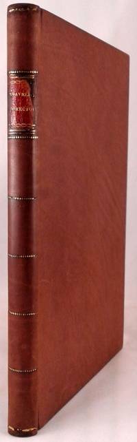
1804ref. 151171804. MOORE JOSHUA J. and THOMAS W. JONES. The Traveller's Directory: or a Pocket Companion Shewing the Course of the Main Road from Philadelphia to New York; and from Philadelphia to Washington: With Descriptions of the Places through which it Passes and the Intersections of the Cross Roads . By S. S. sic Moore and T. W. Jones. Philadelphia: Mathew Carey 1804. 8vo. 4 37 1 19 i.e. 17 p. 38 engraved strip maps on 22 plates. Modern full calf correctly done in perfect period style with original spine label slightly chipped at edges remounted and original endsheets relaid. Front free endsheet chipped at fore-edge name clipped from top blank margin of title page intermittant light browning of text and foxing of maps as is usual with this book. A very good copy of a book never found in fine condition. Second edition of the second American book of road maps following Christopher Colles' exceedingly rare Survey of the Roads of the United States 1789 and the first road map book to provide detailed maps of the road from Philadelphia north through New Jersey to New York and from Philadelphia south through Delaware Maryland and Virginia to Washington. Joshua John Moore and Thomas W. Jones were young surveyors in the employ of the Philadelphia publisher Mathew Carey. From several letters they wrote to Carey during the course of the survey Lea & Febiger papers PHi a clear picture emerges of the extremely difficult task they had undertaken. On June 29 1801 they wrote from New York: "We should have written to you before this had not fatigue of our daily Journies rendered repose indispensable after the finishing of our Notes and Traverses. After twelve days driving our way through an immense multitude of Questioners Observers laughters & Critics who generally thronged around us at every place to our great discomposure at first . we are at length arrived here. If astonishment would ensure success to a work we may entertain strong hopes indeed of ours; but it has nearly exhausted our health as every violent effort naturally must." Upon completion of the surveys the maps were drawn by the surveyors. They locate crossroads streams taverns churches and other public buildings and occasionally private houses. The text describes the various towns through which the roads pass. In this second edition published two years after the first edition of 1802 the descriptive text has been extensively corrected and expanded. The maps are identical to those in the earlier edition and are printed from the same plates. unknown books