Philip's MapsBiblio.com
1712 resultados
ref. 0540083356.Gpaperback. Good. Access codes and supplements are not guaranteed with used items. May be an ex-library book. paperback
ref. 0282155023.Gpaperback. Good. Access codes and supplements are not guaranteed with used items. May be an ex-library book. paperback
ref. 0008320381.Gmap. Good. Access codes and supplements are not guaranteed with used items. May be an ex-library book. unknown
1939ref. 74419Laboratoires Marinier 1939. map. Carte géographique en français. - Brochure de 24 pages. 15 x 23 cm. Légèrement défraîchie. ref. 74419 Laboratoires Marinier unknown
ref. 47113080-nnew. unknown
1986ref. SKU1018730GENERIC 1986-01-01. Paperback. Very Good. 9x6x0. Maps; b/w Drawings. 1986 Maryland Geological Survey. Pages are all clean tight and bright. Cover is clean and strong. GENERIC paperback
ref. 1845878418.Gmap. Good. Access codes and supplements are not guaranteed with used items. May be an ex-library book. unknown
ref. DADAX022671859XNew unknown
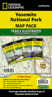
2023ref. ANAIS-1566957427Natl Geographic Society Maps 2023-01-01. 2023. map. Good. 9.5X6.5X1.5. Buy with confidence. Excellent Customer Service & Return policy. Natl Geographic Society Maps unknown
2023ref. SONG1597754013National Geographic 2023-01-01. 2023. map. Used: Good. 4.00x0.40x7.50. Buy with confidence. Excellent Customer Service & Return policy. National Geographic unknown
2011ref. 1-1931257558Streetwise Maps 2011. Map. New. map rev edition. 1 pages. 8.60x3.90x0.70 inches. Streetwise Maps unknown
2009ref. 2-1849070393Octopus Publishing Group 2009. Paperback. New. 384 pages. 13.98x11.14x0.75 inches. Octopus Publishing Group paperback
ref. 054009403X.Gpaperback. Good. Access codes and supplements are not guaranteed with used items. May be an ex-library book. paperback
ref. 0331288966.Gpaperback. Good. Access codes and supplements are not guaranteed with used items. May be an ex-library book. paperback
1900ref. FG 2016-26International Geological Congress 1900. no dates but guessing early to mid 1900's - 21 Maps: 1.Route Map Hyattstown to Frederick MD plate 3 2.Route Map Frederick MD to Charles Town W VA plate 4 3. Geologic Map and Sections Area NE of Harpers Ferry W VA plate 5 4. Route Map Hagerstown MD to Cacapon Mountain W VA plate 6 5. Section along Route Hancock to Cumberland MD plate 10 6. Route Map and Sections New Creek W VA to Virginia State Line plate11 7. Route Map and Section W VA state line to Winchester VA plate 12 8. Route Map Winchester to Luray VA and Section across Shenandoah Valley and Massanutten Mountain Plate 13 9. Route Map and Sections Mount Jackson to Staunton VA plate 14 10. Route Map and Sections Staunton to Healing Springs VA plate 15 11. Route Map and Sections Helaing Springs to Lexington VA plate 16 12.Route Map Natural Bridge to Roanoke VA and Section through Read Mountain Fenster plate 18 13. Route Map and Sections Elliston to Glenlyn VA plate 19 14. Route Map Glenlyn to Lebanon VA plate 20 15. Route Map and Section Lebanon to Bristol VA plate 21 16. Route Map Bristol to Pennington Gap VA plate 22 17.Map and Section of Cumberland Overthrust Block plate 23 18. Route Map Cumberland Gap to Morristown TN plate 24 19. Generalized Map and Section of the Cherokee Mountain Klippe TN plate 25 20. Route Map Bristol VA to Mountain City TN and Section from Delaney Mountain to Mountain City plate 26 21. Map of Fenster in Overthrust Block of Rome Formation 3 Miles 4.8 Kilometers East of Wytheville VA Plate 27. Maps. Good. International Geological Congress Paperback
ref. 1870423933.Ghardcover. Good. Access codes and supplements are not guaranteed with used items. May be an ex-library book. hardcover
2012ref. DADAX1597755095National Geographic Maps 2012-03-01. 2012. map. New. 3.25x3.25x37.00. Buy with confidence. Excellent Customer Service & Return policy. National Geographic Maps unknown
ref. 0540087777.Gpaperback. Good. Access codes and supplements are not guaranteed with used items. May be an ex-library book. paperback
ref. 000837001X.Gmap. Good. Access codes and supplements are not guaranteed with used items. May be an ex-library book. unknown
ref. 252090Ditchling Press 1980. Octavo red heavy card boards gilt lettering to spine gilt military motifs to front board illus eps frotnispiece xvii 370pp folding maps throughout VG light creasing & bruising to spine extrems & board corners light foxing to page edges & eps in d/w VG light creasing to edges moderate sun fading to spine light chafing & soiling to covers price clipped Ditchling Press 1980 hardcover
ref. 323822The Folio Society 1992. Imp 8vo illus cl bds gilt lettering & ornament to leather spine upper pg edge stained red illus map eps frontispiece xxi 632 pp. plates counted all present VG light soiling/rubbing to spine light rubbing to bords & extrems minor foxing to pg edges in slipcase with gilt ornament to front and back cover VG light chaffing to covers & spine light brusing to exrems & front cover The Folio Society 1992 hardcover
ref. 1597754064.Gmap. Good. Access codes and supplements are not guaranteed with used items. May be an ex-library book. unknown
2000ref. F-445-044IGN - Institut Géographique National 2000. Paperback. Very Good. Ammareal gives back up to 15% of this item's net price to charity organizations. IGN - Institut Géographique National paperback
2000ref. F-445-040IGN - Institut Géographique National 2000. Paperback. Good. Ammareal gives back up to 15% of this item's net price to charity organizations. IGN - Institut Géographique National paperback
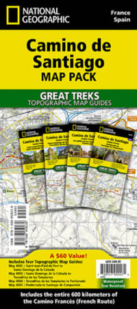
2024ref. __1566959233National Geographic Maps 2024. Paperback. New. 2024 fol m edition. 192 pages. 9.38x4.25x0.59 inches. National Geographic Maps paperback