CollectifLivre Rare Book

12.210 resultados
ref. 4881Extrait du registre des délibérations de la ville de Chalons- sur-Marne séance du 2 avril 1844.In 4 broché couverture imprimée ornée d’une vignette,32 pages,un tableau,1 carte;Châlons Imprimerie T.J Martin 1844.Très bon état Rare 220€ (photo)
ref. 4623en 5 volumes grand in 8 demi-toile rouge,titre,tomaison et filets dorés.Nombreuses vues de villes dans et hors-texte par CLERGET, nombreuses cartes en couleurs sur double page gravées par ERHARD.Jules ROUFF éditeur sans date. (1883,1884,1885…)Rousseurs éparses habituelles.Avec,sur le tome I,préfaces de la 1ère édition (1855)& de la nouvelle édition (1883),entièrement refondue:cartes entièrement refaites,tableaux statistiques dressés à nouveau à l’aide de documents officiels de 1876,1880,1881 &1883, texte soigneusement revu & augmenté d’un tiers et scrupuleusement mis au courant des derniers changements survenus soit dans la topographie des villes, soit dans l’administration”. 4064p:(8)-152 d’introduction suivies de livraisons de 32 pages,texte sur 2 colonnes ;1 livraison de 32 pages par département,sauf:Seine(192 pages),Seine-et-Oise(128 pages), Bouches-du-Rhône(64 pages),Côte-d’Or (64),Garonne(64 pages ),Gironde (64 pages),Nord (64 pages),Rhône(64 pages ),Seine-Inférieure(64 pages ).115 cartes sur double pagemontées,en couleurs :5 cartes générales de la France : physique;par anciennes provinces & départements; industrielle;réseaux des chemins de fer;militaire;87 cartes pour les 87 départements;11 plans de villes:Marseille, Dijon,Toulouse,Bordeaux,Lille, Lyon,Paris,Versailles,Saint-Germain,Saint-Cloud;8 cartes pour les colonies:Algérie, départements d’Alger,Constantine,Oran,Asie,Afrique, Amériques,Océanie ;4 cartes pour les territoires perdus d’Alsace-Lorraine.1 portrait-frontispice de l’auteur gravé sur bois, & pour chaque livraison de 32p, 1 gravure sur bois pleine page,soit 119, et3 à mi-page,soit 357;pour chaque département,4 pages(ou 5)de tableaux statistiques & 1 de bibliographie.Tome 5,après les 7 derniers départements métropolitains,128 pages consacrées à l’Algérie,128 pages aux colonies,128 pages à l’Alsace-Lorraine & 256 pages pour le “Dictionnaire complet des communes de la France de l’Algérie et des colonies françaises d’Asie,d’Afrique, d’Amérique et d’Océanie”,texte très serré sur 4 colonnes.
1959Carte entoilée au 1:1 000 000 dessinée sur le fond topographique de la carte de l'IGN, Ministère de l'Industrie, BRGM, Etablissements Veit, format 122 x 103 cm Bel exemplaire en parfait état Français
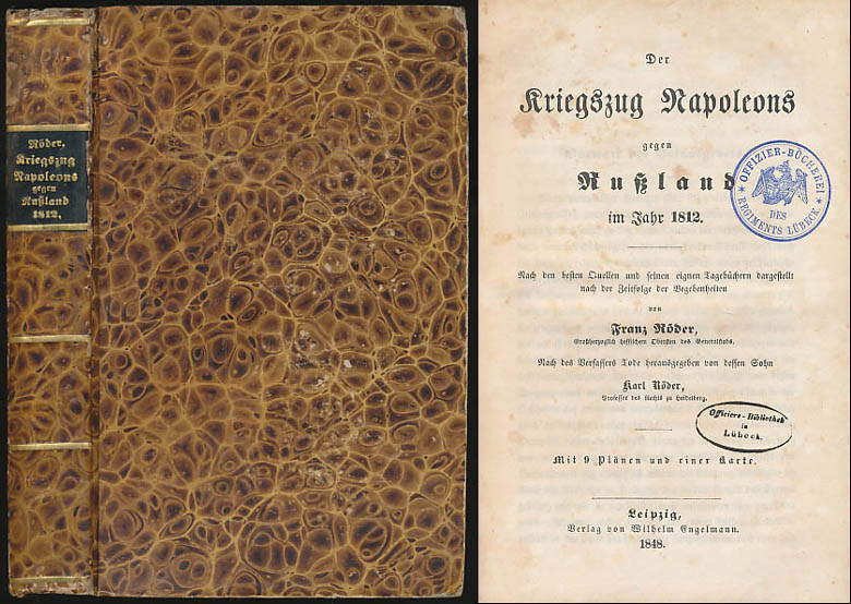
1848ref. 6469DBLeipzig, Verlag von Wilhelm Engelmann, 1848. 8°. 21 cm. XXX, 567 Seiten, X Blatt. Pappband der Zeit, gebunden. Mit goldgeprägtem Rückentitel.
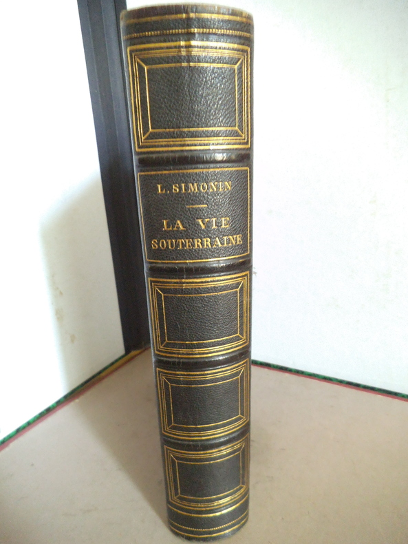
ref. 14505La vie souterraine ou les mines et les mineurs. Ouvrage illustré de 100 gravures sur bois hors texte et dans le texte 30 cartes tirées en couleurs et de 10 planches imprimées en chromolithographie dont le frontispice. In 8 demi chagrin vert titre, filets caissons dorés, plats percaline chagrinée verte, filets à froid en encadrement. 190x270mm, poids 2n2kg. Faux titre, frontispice, titre ; 604 pages ; tranches dorées, rousseurs éparses plus fortes en en début et fin de volume. Paris librairie hachette & Cie 1867. Bon exemplaire.
1764ref. 45755(Kiöbenhavn, 1764). 54x43 cm. Kobberstukket grundplan af København indenfor Voldene, visende bebyggelsen i 1764. Med spor efter foldning, men iøvrigt ren og frisk, trykt på svært skrivepapir
1767ref. 35415Hafniæ, Godiche, 1767. 45,5x55 cm. Kobberstukket kort over Viborg Stift med stor dekorativ kartouche. Nogle små marginalrifter repareret. En rift som går ind i billedfladen rep. på bagside, uden tab. Trykt på kraftigt skrivepapir. Kortet har været foldet.
1764(Kiöbenhavn, 1764). 54x43 cm. Kobberstukket grundplan af København indenfor Voldene, visende bebyggelsen i 1764. Med spor efter foldning, men iøvrigt ren og frisk, trykt på svært skrivepapir
1767Hafniæ, Godiche, 1767. 45,5x55 cm. Kobberstukket kort over Viborg Stift med stor dekorativ kartouche. Nogle små marginalrifter repareret. En rift som går ind i billedfladen rep. på bagside, uden tab. Trykt på kraftigt skrivepapir. Kortet har været foldet.
ref. 72355Hardcover. Very Good. Wittsburg Arkansas: Crowley's Ridge Steamboat Riverport 1848-1890 hardcover
ref. 0881309001New. paperback. New. Satisfaction Guaranteed or your money back. paperback
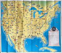
1936ref. 64019Chicago IL: The Pullman Company Poole Bros. Inc. Railroads of the United States Canada & Mexico c. 1936 1938. 4to. 24 pp unpaginated. which folds out into giant oblong atlas folio pictorial colour map 32 x 27 in. on verso orange & blue-tinted illustrations borders and self-printed over on recto in orange & blue w/ photo illustrations self-printed Art Deco cover art depicting streamliner steaming across America w/ Native American & Mexican American in foreground by Leslie Ragan slight age toning minor spotting dustsoiling couple very slight closed tears at fold creases still a VG bright copy. Second edition of this delightful and scarce promotional map issued by Pullman & the Poole Bros. for advocating Streamliner rail travel from British Columbia to Central Mexico Atlantic to Pacific along the Gulf of Mexico and Baja California. The cartographer and cartoonist has filled each area of the map with charming little pictorial vignettes highlighting historic sites National Parks recreational sports and other leisure activities. The Pullman Sleeping Car diagram depicts sections with drawing-room two compartments and double bedrooms with promotional photos. Ragan’s b. 1897 paintings and cover art graced New York Central and other railroads from 1925 through the 1950’s. This particular cover art was used the next year for the 1939 Golden Gate International Exposition World’s Fair brochures time tables and posters. Worldcat locates 1 copy Stanford. The Pullman Company, Poole Bros., Inc.], Railroads of the United States, Canada & Mexico, unknown
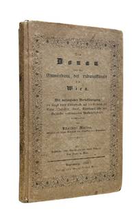
1844ref. 10175Regensburgh: Georg Joseph Manz 1844. First edition. 8vo xiv 205 1pp. Frontispiece with two engraved views and a large folding 6-section map at back. Original printed boards rubbed and soiled. Some foxing to the frontis and title scattered throughout and the map. Very good. Very attractive copy of this travel guide devoted to the stretch of the Danube from the Ludwig Canal to Vienna. This is a follow up to Müller's first work on the Danube issued in two volumes from 1839-1841 and covering the entire length of the river. Adalbert Müller 1802-1879 was a popular history and travel writer from Bavaria who wrote several works on the scenery and monuments in southern Germany during the steam travel age. Scarce. Georg Joseph Manz unknown
1889ref. 70991NY and Chicago: Rand McNally 1889. Engraved map 23 x 28 inches recto showing Lower Manhattan Brooklyn Jersey City and Hoboken lines for Manhattan Elevated Railway Suburban Rapid Transit Brooklyn Elevated R.R. and Kings Co. Elevated R.R. printed in dark red Bartholdi's Statue marked on Bedloes Island verso showing Upper Manhattan and printing a large more detailed inset of Lower Manhattan from Washington Square to the Battery 12 ½ x 13 inches and a boxed index to the street car lines 8 x 6 inches. Printed several times 1886-1889 this printing located in four copies on OCLC Newberry New York Public Boston Public Columbia. Folded into 16mo printed brown wrappers subtitle: Showing Street Car Lines Elevated Railroads Docks Ferries Steam Boat Lines etc.; some soiling several tiny corner fold breaks wrappers separated along the spine but still a good copy. Rand, McNally unknown
1889ref. 70991NY and Chicago: Rand McNally 1889. Engraved map 23 x 28 inches recto showing Lower Manhattan Brooklyn Jersey City and Hoboken lines for Manhattan Elevated Railway Suburban Rapid Transit Brooklyn Elevated R.R. and Kings Co. Elevated R.R. printed in dark red Bartholdi's Statue marked on Bedloes Island verso showing Upper Manhattan and printing a large more detailed inset of Lower Manhattan from Washington Square to the Battery 12 ½ x 13 inches and a boxed index to the street car lines 8 x 6 inches. Printed several times 1886-1889 this printing located in four copies on OCLC Newberry New York Public Boston Public Columbia. Folded into 16mo printed brown wrappers subtitle: Showing Street Car Lines Elevated Railroads Docks Ferries Steam Boat Lines etc.; some soiling several tiny corner fold breaks wrappers separated along the spine but still a good copy. Rand, McNally unknown books
1941ref. 56936Washington D.C. & Chicago IL: Household Goods Carriers’ Bureau Rand McNally & Co. 1941; 1947. Two vols. 296 pp. including 22 large folding colour maps a few w/ minor toning to fore-edges some dustsoiling a few w/ minor tape repairs especially at a couple folds and near gutter margin. Quarter-green cloth over printed light green softcovers stapled as issued minor soiling some slight foxing & toning still VG copy; 9 3 pp. Stapled as issued minor toning light creasing at corners VG. First edition of this essential HHGCB mileage guide issued just weeks before Pearl Harbor and the entry of the United States into World War II. Originally established in 1936 after the passage of the Reed-Bulwinkle and Interstate Commerce Commission Acts the HHGCB organized to file the required mileage tariffs with the ICC and issued this guidebook. This mileage guide contained maps from the Rand McNally Co. together with charts to determine highway distances between principal points in the United States and allow transport charges to be computed. This guidebook offers an essential snapshot of not only the existing transportation network during World War II but also the vital routes of trucking goods across the country locally or into Canada and Mexico prior to the creation of the Interstate Highway System later authorized in 1956 by President Eisenhower. The supplement updated many of the mileage references following the War acknowledging the tremendous build-up of infrastructure during and in Post-War America. The HHGCB continued to operate in assorted consolidations and mergers until the 2007 decision eliminating all motor carrier rate bureaus. Worldcat locates 1 copy of No. 4 no copies located of Supplement No. 10 US Dept. of Transportation Library. Household Goods Carriers’ Bureau, Rand McNally & Co., paperback
1867Very detailed (rivers, villages, wooded areas) lithographed map, scale 1:200,000, in six sheets of 68x92cm each. Some small repairs to blank verso (mostly to margins) not affecting printed area, some dust- or finger-marking, folded vertically one time; over all a good set. The map was intended to be coloured but this is a set in uncoloured state. Rare.
1708Pianta a proiezione verticale, orientata con il nord a sinistra. "Questa pianta assai schematica deriva come base di rappresentazione dalla pianta grande del Falda e non da quella del De Rossi come sostenuto in passato dall'Huelsen. Raffigura Roma attorno al 1700: manca infatti non solo la scalinata di Trinità dei Monti realizzata tra il 1721 e il 1725 come notato da Scaccia Scarafoni ma anche il porto di Ripetta realizzato nel 1704 e gli interventi dovuti a Innocenzo XII ma la poca definizione del disegno non consente di verificarlo con certezza. I lotti edificati non hanno campitura ma una fitta serie di 320 numeri e varie lettere che rimandano alla legenda disposta ai due lati della pianta. è invece rappresentato con maggiore cura il disegno dei giardini e delle ville" (cfr. Marigliani p. 255). Opera tratta dall'Atlas Historique, pubblicato ad Amsterdam tra il 1705 e il 1720. Incisione in rame, finemente colorata a mano, in perfette condizioni. Henri Abraham Chatelain (1684 - 1743) era un pastore ugonotto di origini parigine. È meglio conosciuto come cartografo olandese e più specificamente per il suo contributo cartografico nell’Atlas Historique in sette volumi, pubblicato ad Amsterdam tra il 1705 e il 1720. Innovativo per il suo tempo, l'Atlas Historique combinava incisioni e opere d'arte con studi di geografia, storia, etnologia, araldica e cosmografia. Alcuni studiosi suggeriscono che l'Atlas Historique non fu compilato esclusivamente da Henri Chatelain, come si crede comunemente, ma piuttosto fu un'impresa familiare che coinvolse Henri, suo padre Zacharie e suo fratello, sempre Zacharie. Bibliografia Huelsen (1915): n. 129b; Scaccia Scarafoni (1939): n. 219; Marigliani (2007): p. 255, n. 162. Vertical projection map of Rome, oriented with the north on the left. This very schematic plan derives as a basis of representation from the large map of Falda and not from that of De Rossi as claimed in the past by Huelsen. It depicts Rome around 1700: in fact, not only the Spanish Steps are missing, made between 1721 and 1725 as noted by Scaccia Scarafoni, but also the port of Ripetta made in 1704 and the interventions due to Innocenzo XII, but the poor definition of the drawing does not allow to verify with certainty. The built lots do not have a field but a dense series of 320 numbers and various letters that refer to the legend placed on the two sides of the plan. It is instead represented with greater care the design of gardens and villas (cf. Marigliani p. 255). Taken from "Atlas Historique" , this sheet includes a small map of the northern hemisphere including all of Europe and Asia and most of Africa, above the horn. Henri Abraham Chatelain (1684 - 1743) was a Huguenot pastor of Parisian origins. He is best known as a Dutch cartographer and more specifically for his cartographic contribution in the seminal seven volume Atlas Historique, published in Amsterdam between 1705 and 1720. Innovative for its time, the Atlas Historique combined fine engraving and artwork with scholarly studies of geography, history, ethnology, heraldry, and cosmography. Some scholarship suggests that the Atlas Historique was not exclusively compiled by Henri Chatelain, as is commonly believed, but rather was a family enterprise involving Henri, his father Zacharie and his brother, also Zacharie. Copper engraving, with fine later hand colour, in excellent condition. Literature Huelsen (1915): n. 129b; Scaccia Scarafoni (1939): n. 219; Marigliani (2007): p. 255, n. 162.
Madrid, 1849. Dos mapas de 81 x 108 cm., plegados a 17 x 11 cm., y coloreados, con planos particulares de Fondeadero de Tasacorte; Villa de San Sebastian de la Gomera y su puerto llamado también de Hita; Puerto de Naos; Caleta de Interian; Bahía y ciudad de Santa Cruz y San. Miguel de la Palma; Santa Cruz de Tenerife (situación); Santa Cruz de Tenerife (plano); Puerto de Garachico; Las Palmas; Gando; Puerto Naos (Lanzarote); Arrecife; Mapa de situación de las Islas; Puerto de la Cruz ó de Orotava. Encuadernación original en cartoné y media tela.
1595Pianta archeologica della città basata sul modello di Pirro Ligorio, pubblicata nel raro Parvum theatrum urbium sive urbium praecipuarum totius orbis brevis et methodica descriptio. Urbium praecipuarum totius orbis brevis et methodica descriptio [...]. di Adrian van Roomen, edita a Francoforte, Nicolaus Basse, 1595. Il Theatrum Urbium, stampato per la prima volta nel 1595 e quindi nel 1608, contiene 67 vedute silografiche di città. “Contains descriptions of Florida, New-France, New-Spain, Nova Galicia, Yucatan, Cuba, Brazil, Peru, etc." Also with views of Constantinople, Jerusalem, Genoa, London, Rostock, Rome, Vienna, Prague, Riga, Zurich, Genf, Bremen, Dresden, Geneva, Lubeck, Cologne, Leipzig, Mainz, Marburg, Munich, Nuremberg, Strasbourg, Trier, Ulm, Venice, Wittenberg and many others. (Sabin). Rara. Bibliografia Caldana, Roma Antica, Piante topografiche e vedute generali, p. 80, scheda I.11.Adams R 694. Bachmann 14. Muller 1376. Sabin 73000. Alden 595. Archaeological map of Rome based on the model of Pirro Ligorio (1561), published in the rare Parvum theatrum urbium sive urbium praecipuarum totius orbis brevis et methodica descriptio. Urbium praecipuarum totius orbis brevis et methodica descriptio [...]. by Adrian van Roomen, published in Frankfurt, Nicolaus Basse, 1595. The Theatrum Urbium, first printed in 1595 and again in 1608, contains 67 silographic views of cities. "Contains descriptions of Florida, New-France, New-Spain, Nova Galicia, Yucatan, Cuba, Brazil, Peru, etc." Also with views of Constantinople, Jerusalem, Genoa, London, Rostock, Rome, Vienna, Prague, Riga, Zurich, Genf, Bremen, Dresden, Geneva, Lubeck, Cologne, Leipzig, Mainz, Marburg, Munich, Nuremberg, Strasbourg, Trier, Ulm, Venice, Wittenberg and many others. (Sabin). Rare. Bibliography Caldana, Roma Antica, Piante topografiche e vedute generali, p. 80, scheda I.11.Adams R 694. Bachmann 14. Muller 1376. Sabin 73000. Alden 595.
ref. GOR008960106Paperback. Very Good. paperback
1869ref. 105243Chartres, Imprimerie de Garnier 1869 In-8 20 x 13 cm. Broché, couverture grise, titre en noir sur le dos et le premier plat, VIII-450 pp., notes en bas de page, bandeau, lettrines, culs-de-lampe,50 gravures hors-texte, table des matières, catalogue éditeur in fine, 16 pp. Couverture poussiéreuse, intérieur frais.
1889ref. 10845Avant-projets présentés par Schneider et Cie (du Creusot) et H. Hersent à l'Exposition Internationale de Paris en 1889 (94 x 32 cm), lithographiée en couleurs.
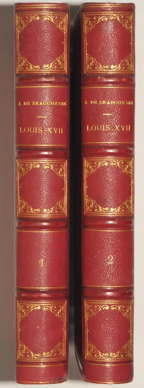
Paris, Henri Plon, 1867. 2 volumes grands in-8, 613 et 532 pp, plus table des matière dans chaque volume et placement des gravures et des autographes. Demi-chagrin rouge, dos à 4 nerfs, caissons ornés et filets dorés, tranches dorées. Belle reliure. Bel exemplaire sans rousseurs.
ref. 24447Paris, Henri Plon, 1867. 2 volumes grands in-8, 613 et 532 pp, plus table des matière dans chaque volume et placement des gravures et des autographes. Demi-chagrin rouge, dos à 4 nerfs, caissons ornés et filets dorés, tranches dorées. Belle reliure.