Collins MapsBiblio.com

2025ref. ANAIS-0008696063Collins 2025-04-29. Fifth. hardcover. Good. 9.5X6.5X1.5. Buy with confidence. Excellent Customer Service & Return policy. Collins hardcover
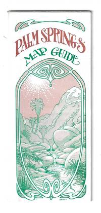
1976ref. 78705Orange and Palm Springs California: Ken and Ruth Du Maurier The Palm Springs Map Guide 1976. Tourist map to the desort resort city in Riverside County California. In addition to a large street map of Palm Springs there are smaller maps of the city bus route Cathedral City and the Coachella Valley respectively. Also provides a list with addresses of movie star and celebrity homes a brief history of the region a description of the picturesque canyon areas and descriptive lists of local shops restaurants hotels golf courses activities service stations etc. Features photographic illustrations and numerous advertisements. Printed in green and desert rose on a 30" x 25 1/2" sheet of white paper that folds to 3 3/4" x 8 1/2" 48 panels. A fresh and clean example. Scarce OCLC locates only one holding at the Library of Congress. Ken and Ruth Du Maurier, The Palm Springs Map Guide unknown
1952ref. 56432Portland OR: Published by Byington Printing Co. March 1952. 1 large folding map sized 21 x 23 printed in red & black inset map on verso of map as well as street and city guide index street traction system transportation information and zones. Map folds down into small printed portfolio w/ fold-over flap printed in red & black illust. of mill on front light toning still VG. First edition thus of this updated city map with postal zones and all of the motorcoach lines and electric trolley lines delineated. The map is of particular interest as showing Portland OR neighborhoods before the clearing and construction of Interstate-5 and the outlines of the destroyed city of Vanport. Destroyed in the 1948 flood Oregon’s second largest city had been originally constructed by Henry Kaiser outside of the Portland city limits in order to house a large influx of African-American workers largely barred by Oregon discriminatory laws. Byington 1862-1956 was a California printer who moved to Oregon following World War I would own and operate Byington Printing Co. until his death. No copies located in Worldcat. Published by Byington Printing Co., unknown
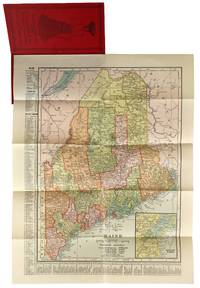
1904ref. 47779New York: C.S. Hammond & Co 1904. Very Good . New York: C.S. Hammond & Co. 1904. Fold-out map of Maine in red pictorial wrappers 33x26 cm. Wrappers gently creased and dust soiled with mild water damage and previous paperclip ghosting. Interior has calendars for 1905 and 1906 and another ad for R. M. Lewsen & Co which matches the exterior proclaiming they are the largest cloak store and leading millinery store in Maine. Map folded with only light toning. A Very Good or better example. C.S. Hammond & Co unknown
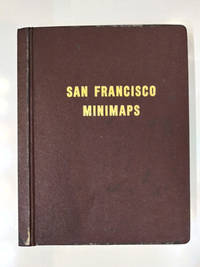
1969ref. 58769San Francisco: The Realty Index Co 1969. Hardcover. Very good. 631pp. Folio 36.5 cm Burgundy boards. With dividers and tabs. Moderate scuffing to the extremities; some discoloration to endpapers else internally clean. May require extra postage due to weight. An attractive and highly detailed volume of miniature Assessor's Blocks Maps reduced in size to make a legible yet at the same time compact and uncluttered book. With zoning information sectional maps major development areas and Assessor's Block Maps. The Realty Index Co hardcover
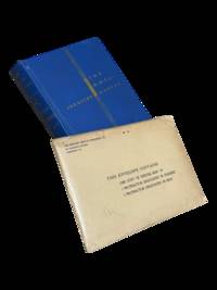
1939ref. 4298Harrisburg PA: The Military Service Publishing Company 1939. Hardcover. Very Good. Twenty first edition April 1939. 4to 216 pp. Publisher's blue cloth with gilt lettering and design. Very good with some soiling to boards and edges of page block. Clean internally with a few annotations in pencil throughout. Included is the supplementary envelope with Special Map "A" and four protractors only 2 are listed on the envelope. A few contemporary papers and supplementary materials for a course taken at the University of Wyoming are laid in as well. The Military Service Publishing Company hardcover
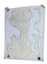
1937ref. 9266Washington D.C.: U.S. Coast and Geodetic Survey 1937. 4th edition. Large 2 color map 34.5 x 42.5" Date of 1948 stamped at the bottom along with stamps from Metsker's Maps in Tacoma. A couple small edge tears not extending into the image and light wrinkling around edges. A near fine example. Original WWII-era copy of this classic Seattle map showing shorelines depths tides etc. in full detail. This is #6449 of the U.S. Coast and Geodetic Survey the first edition appearing in 1922. U.S. Coast and Geodetic Survey unknown
1930ref. 56484Portland OR: Gilham’s Guide 1930. 8vo. 91 1 pp. Maps throughout. Tan printed softcovers minor darkening and thumbing to fore-edges 1 small corner creased still a VG copy. First edition of this scarce automobile travel map guide to Oregon for travelers and businessmen. Supplied with an extended index the strip maps all offer auto roads and stage roads for buses as well as showing railroad lines. In addition ferries post offices Western Union Express Offices and much more are shown. In addition there are mileage maps for Washington & Oregon included as well. Gilham 1882-1949 was a lifetime Portland OR resident who published gravel guides and histories on the Pacific Northwest but after losing his business during the Great Depression went to work for the Jones Lumber Co. Gilham’s Guide, paperback
1969ref. bing77np001Charles H. Belding 1969. with dustjacket hardcover. acceptable; used. Prompt shipment with tracking. we ship in CLEAN SECURE NEW boxes folio; 182 pages; acceptable hardcover with dustjacket; dustjacket stain scuff crease nicks to edges; spine starting; spine slanting; foxing to eges; some tanning; few faint stains; otherwise clean pages; prompt shipping with tracking Charles H. Belding hardcover
1887ref. 486270London : Dulau 1887. Second Edition Sixth Edition. Hardcover. Good copies both in the original gilt-blocked red cloth semi-flexible boards now lightly dust-dulled with spines sun-toned and dampstains to Part 1 front board. Contemporary ownership marks to front pastedowns and title pages. Text blocks remain strong and clean on the whole showing only the expected faint scattered foxing; folded matter remains crisp. A well-preserved set overall. Series; Thorough guide series 8-9. Physical description; complete in 2 volumes : maps plans ; 17 cm. Notes; Of this set Part 1 is 2nd ed 1887 Part 2 is 6th ed 1904. Maps and plans by John Bartholomew. Contents; Part 1: Chester Rhyl Llandudno Bangor Llanrwst Bettws-y-Coed Carnarvon Llanberis Beddgelert and Ffestiniog sections. Part 2: Llangollen Bala Dolgelley Barmouth Oswestry Shrewsbury Welshpool Llanidloes Machynlleth and Aberystwith sections. Subjects; Wales North guidebooks 19th century. Thorough guide series travel guides. London : Dulau hardcover
1933ref. 233821D. Van Nostrand Company Inc 1933. Book. Good. Hardcover. Dust jacket has fair amoutnt of edgewear. with small chips and tears and vertical crease to front and back. Boards have slightly darkened spiine with small white blotch there as well. Pages of text are clean lightly age toned and free of markings. Binding is tight and secure. Shipped within 24 hours from the beautiful Baltimore inner harbor area. First class service; accurate descriptions. Most items packed in boxes not envelopes. D. Van Nostrand Company, Inc Hardcover
1984ref. 2082702114602529Fixed 4800 Yen Nippon Geijutsu Publishing Co. Ltd. 1984. Soft Cover. Fine. Number of books: 1 Fixed 4800 Yen Nippon Geijutsu Publishing Co., Ltd. paperback
1950ref. 2080502106911445Not Available 1950. Soft Cover. Fine. The book is in fine condition. Not Available paperback
1973ref. 2080502106904303Not Available 1973. Soft Cover. Fine. The book is in fine condition. Not Available paperback
1967ref. 2090502113703439Not Available 1967. Soft Cover. Fine. The book is in fine condition. Not Available paperback
1975ref. 2090502113715761Not Available 1975. Soft Cover. Fine. The book is in fine condition. Not Available paperback
1978ref. 2090502113712102Not Available 1978. Soft Cover. Fine. The book is in fine condition. Not Available paperback
1978ref. 2090502113712103Not Available 1978. Soft Cover. Fine. The book is in fine condition. Not Available paperback
1968ref. 2080502106913718Not Available 1968. Soft Cover. Fine. The book is in fine condition. Not Available paperback
1979ref. 2090502113708698Not Available 1979. Soft Cover. Fine. The book is in fine condition. Not Available paperback
1980ref. 2090502113716153Not Available 1980. Soft Cover. Fine. The book is in fine condition. Not Available paperback
1964ref. 2083002116200859Engineering Maps KK Saichi Nonoyama 1964. Soft Cover. Fine. The book is in fine condition. Engineering Maps KK Saichi Nonoyama paperback
1962ref. 2080502106908338Not Available 1962. Soft Cover. Fine. The book is in fine condition. Not Available paperback
ref. 2080202103703542Penguin Books N.A. Soft Cover. Fine. Page size: 2 v. Size: 18 cm New book size Penguin Books paperback
2002ref. 2083002116200896Industrial Maps Supervised by Hiroyasu Funakubo and others 2002. Soft Cover. Fine. The book is in fine condition. Industrial Maps Supervised by Hiroyasu Funakubo and others paperback