Antiquariat.de
12.168 resultados
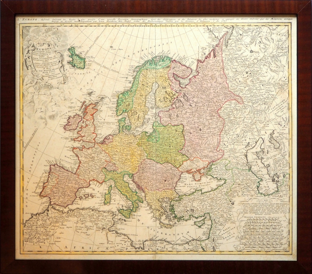
1743ref. 94351[Nürnberg], Homannianis Heredibus [Homanns Erben], 1743. Titelkartusche (die allegorischen Figuren in schwachem Druck), eine zweite Kartusche mit Meilenzeiger versch. Länder. Maßstab 1:11,200,000. 49 x 56 cm. Ohne Passepartout im versiegelten Mahagonirahmen. (56,5 x 63,5 cm.).
ref. CZC-11870complet de ses 27 cartes et plans, gravés par Ambroise Tardieu Histoire ancienne; monde connu des anciens, Égypte et Libye, partie de l'Afrique ou les Carthaginois ont étendus leurs dominations, carte pour l'expédition d'Annibal et son passage en Italie, carte pour l'intelligence de l'histoire des Assyriens, des Babyloniens et des Perses, Grèce, grande Grèce & Sicile, Plan de Syracuse, carte pour l'expédition de Syrus et la retraite des dix mille Grecs, Grèce et pays septentrionaux jusqu'au Danube, Expédition d'Alexandre, Orient, Asie mineure. Histoire Romaine; environ de Rome, Rome ancienne, Italie, Italie ou l'on a tracé les voies Romaines, vue du combat naval d'Ecnome, expédition d'Annibal, Sicile, plan de Syracuse, Espagne, Grèce, Gaule cisalpine, Numidie, Province Romaine dans la Gaule, Gaule au temps de la conquête de César. vol in8, demi cuir 18x10, bel état de l'ensemble, cartes dépliées, de dimentions variables soit 43x39cm, 40x33cm, etc.. Paris, chez Carez, Thomine & Portic, 1819 ref/155
ref. CZC-11870complet de ses 27 cartes et plans, gravés par Ambroise Tardieu Histoire ancienne; monde connu des anciens, Égypte et Libye, partie de l'Afrique ou les Carthaginois ont étendus leurs dominations, carte pour l'expédition d'Annibal et son passage en Italie, carte pour l'intelligence de l'histoire des Assyriens, des Babyloniens et des Perses, Grèce, grande Grèce & Sicile, Plan de Syracuse, carte pour l'expédition de Syrus et la retraite des dix mille Grecs, Grèce et pays septentrionaux jusqu'au Danube, Expédition d'Alexandre, Orient, Asie mineure. Histoire Romaine; environ de Rome, Rome ancienne, Italie, Italie ou l'on a tracé les voies Romaines, vue du combat naval d'Ecnome, expédition d'Annibal, Sicile, plan de Syracuse, Espagne, Grèce, Gaule cisalpine, Numidie, Province Romaine dans la Gaule, Gaule au temps de la conquête de César. vol in8, demi cuir 18x10, bel état de l'ensemble, cartes dépliées, de dimentions variables soit 43x39cm, 40x33cm, etc.. Paris, chez Carez, Thomine & Portic, 1819 ref/155
2007ref. 49413Washington D. C.: Dumbarton Oaks Research Library and Collection 2007. Good to near fine condition. Quarto. li 394 xv 290 plates 3 folding maps in envelope on inside back cover. Original textured blue cloth with gilt lettering on covers and spines in photo-illustrated dustjackets brown lettering on spine. Frontispiece maps. The Pontos and its Empire of Trebizond 1204-1461 embraced the distinctive Black Sea coastlands mountains and pastures of northeastern Anatolia. "The purpose of this Study is twofold. First it is an essay in placing the material remains of the medieval peoples of a distinct region of Anatolia the Pontos in their historical and geographical setting. Second it is a record - all too often of what can no longer be recorded. In the two decades since Anthony Bryer A.A.M.B. and David Winfield D.C.W. first met in the east porch of the Hagia Sophia Trebizond on 19 August 1959 the Pontos has suffered a greater physical transformation than in its entire previous history." Preface. Illustrated with some five hundred b/w photographs on 290 plates three folding maps two in two colors and in-text drawings maps plans and tables. Contains list of figures abbreviations and an extensive bibliography at front appendix with measurements and indices at rear. Dustjackets with light creasing at top and bottom edges light creasing hear and small closed tear at top left of volume two. Interiors in near fine condition. Dumbarton Oaks Research Library and Collection unknown
2007ref. 49413Washington D. C.: Dumbarton Oaks Research Library and Collection 2007. Good to near fine condition. Quarto. li 394 xv 290 plates 3 folding maps in envelope on inside back cover. Original textured blue cloth with gilt lettering on covers and spines in photo-illustrated dustjackets brown lettering on spine. Frontispiece maps. The Pontos and its Empire of Trebizond 1204-1461 embraced the distinctive Black Sea coastlands mountains and pastures of northeastern Anatolia. "The purpose of this Study is twofold. First it is an essay in placing the material remains of the medieval peoples of a distinct region of Anatolia the Pontos in their historical and geographical setting. Second it is a record - all too often of what can no longer be recorded. In the two decades since Anthony Bryer A.A.M.B. and David Winfield D.C.W. first met in the east porch of the Hagia Sophia Trebizond on 19 August 1959 the Pontos has suffered a greater physical transformation than in its entire previous history." Preface. Illustrated with some five hundred b/w photographs on 290 plates three folding maps two in two colors and in-text drawings maps plans and tables. Contains list of figures abbreviations and an extensive bibliography at front appendix with measurements and indices at rear. Dustjackets with light creasing at top and bottom edges light creasing hear and small closed tear at top left of volume two. Interiors in near fine condition. Dumbarton Oaks Research Library and Collection unknown books
1830ref. 49607(Paris, Crochard, 1830). No wrappers. In: ""Annales de Chimie, ou Recueil de Mémoires concernant la Chemie"" 2e Series, Tome 45, Cahier 3. Pp. 337-448 a. 1 engraved map (entire issue offered). Duperrey's paper: pp. 371-386. Text with scattered brownspots. Map with a small closed tear in lower left corner, otherwise fine.The map: ""Configuration de LÉquateur Magnétique.... faites dans la campagne de la Corvette de S.M. la Coquille, pendent les années 1822, 1823, 1824 et 1825. Par M.L.I. Duperrey Commandant de L'Expedition"" Left: Dressée par L.I. Duperrey, en 1829. Right corner: Gravée par Ambroise Tardieu. (29x80 cm. (the map-sheet))
1696ref. 52283(Nürnberg, 1696). (25,5 X 32 cm.). Kobberstukket planer over Køge by of dets fæstningsværker. Den ene del viser byen, den anden del byen omgivet af fæstningsværket som byen så ud 1659-60 under Svenskekrigen. Stikket foreligger her i fin håndkolorering med to barokkartoucher. Under glas i bred ""sølvramme"". Rammen med lidt kantstød.
1766ref. 43462(København), A.H. Godiche, 1766. 46,5 x 55,5 cm. Kobberstukket kort over Fyn og omgivende vande med Tåsinge og en del af Langeland. Stor fin rokokkokartouche. Nederste del af venstre margin lidt tæt beskåret, dog uden tab af billede. Ren og frisk, på svært skrivepapir.
1607ref. 25258(Amsterdam ca. 1607). 35,3x48 cm. Kobberstukket kort over Holsten. Ukoloreret. Velbevaret. På bagsiden latisnk tekst (pp.89-90) Daniae III Tabula, In qua Slesvicensis Ducatus, & Holsatia.
1813ref. 47340(Paris), Au Depot général dee la Marine, 1813. 85x59 cm. Kobberstukket kort i stort format over Kattegat og den nordlige del af Øresund med København i syd, den svenske vestkyst fra Tjørnø i nord til Barsebæk i syd. Jyllands østkyst fra Skagen i nord til Gylling Næs i syd med øerne Anholt, Læsø, Samsø, Endelave m.v. Lidt rifter i højre marginsom ikke når bileldfladen. Fint rent eksemplar.
1860ref. 46641Gotha, Julius Perthes, 1860. 4to. Contemp, hcalf. Gilt spine. A small stamp to titlepage. X,490 pp. and 19, partly folded, lithographed maps and plans. Internally clean. + Ergänzungshäfte.
1767ref. 43464(Kiøbenhavn, Godiche, 1767). 46,5 x 55,5 cm. Kobberstukket kort over Sjælland med stor fin rokokkokartouche. Lidt tæt beskåret, et par små revner ved venstre margin repareret.
1967ref. 4505414 grandes cartes dépliantes en couleurs (env. 89x90 cm) sous chemise éditeur à velcros avec brochure jointe, Editions Rossignol, Montmorillon, 1967. Rappel du titre complet : Cartes Historiques Jean Pitié. Classe de 3e [ Lot de 14 cartes historiques dépliantes avec la brochure explicative sous classeur commun ] La France 1715-1789 - L'Amérique du Nord au XVIIIe siècle - Les guerres de la Révolution 1792-1802 - La formation du Grand Empire - La chute de Napoléon - La France : 1815-1870 - Paris vers 1870 - Les Balkans et le Proche-Orient : 1815-1870 - L'indépendance de l'Amérique Latine - L'Empire d'Autriche - L'Unité italienne - L'Unité allemande - La guerre de 1870-1871 - Les Etats-Unis au XIXe siècle
1830(Paris, Crochard, 1830). No wrappers. In: ""Annales de Chimie, ou Recueil de Mémoires concernant la Chemie"" 2e Series, Tome 45, Cahier 3. Pp. 337-448 a. 1 engraved map (entire issue offered). Duperrey's paper: pp. 371-386. Text with scattered brownspots. Map with a small closed tear in lower left corner, otherwise fine.The map: ""Configuration de LÉquateur Magnétique.... faites dans la campagne de la Corvette de S.M. la Coquille, pendent les années 1822, 1823, 1824 et 1825. Par M.L.I. Duperrey Commandant de L'Expedition"" Left: Dressée par L.I. Duperrey, en 1829. Right corner: Gravée par Ambroise Tardieu. (29x80 cm. (the map-sheet))
1696(Nürnberg, 1696). (25,5 X 32 cm.). Kobberstukket planer over Køge by of dets fæstningsværker. Den ene del viser byen, den anden del byen omgivet af fæstningsværket som byen så ud 1659-60 under Svenskekrigen. Stikket foreligger her i fin håndkolorering med to barokkartoucher. Under glas i bred ""sølvramme"". Rammen med lidt kantstød.
1766(København), A.H. Godiche, 1766. 46,5 x 55,5 cm. Kobberstukket kort over Fyn og omgivende vande med Tåsinge og en del af Langeland. Stor fin rokokkokartouche. Nederste del af venstre margin lidt tæt beskåret, dog uden tab af billede. Ren og frisk, på svært skrivepapir.
1607(Amsterdam ca. 1607). 35,3x48 cm. Kobberstukket kort over Holsten. Ukoloreret. Velbevaret. På bagsiden latisnk tekst (pp.89-90) Daniae III Tabula, In qua Slesvicensis Ducatus, & Holsatia.
1813(Paris), Au Depot général dee la Marine, 1813. 85x59 cm. Kobberstukket kort i stort format over Kattegat og den nordlige del af Øresund med København i syd, den svenske vestkyst fra Tjørnø i nord til Barsebæk i syd. Jyllands østkyst fra Skagen i nord til Gylling Næs i syd med øerne Anholt, Læsø, Samsø, Endelave m.v. Lidt rifter i højre marginsom ikke når bileldfladen. Fint rent eksemplar.
1860Gotha, Julius Perthes, 1860. 4to. Contemp, hcalf. Gilt spine. A small stamp to titlepage. X,490 pp. and 19, partly folded, lithographed maps and plans. Internally clean. + Ergänzungshäfte.
1767(Kiøbenhavn, Godiche, 1767). 46,5 x 55,5 cm. Kobberstukket kort over Sjælland med stor fin rokokkokartouche. Lidt tæt beskåret, et par små revner ved venstre margin repareret.
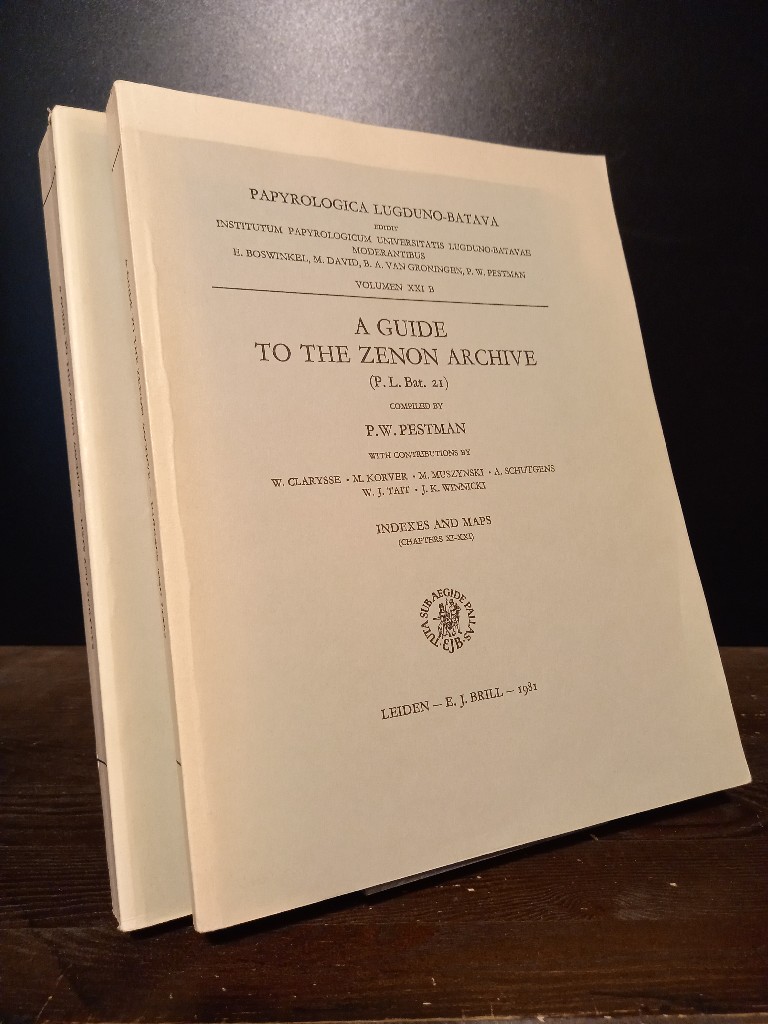
1981ref. 2140746Leiden: E. J. Brill 1981. XX, 466; 467-748 Seiten. With two maps. 4° (28 x 22 cm) Orig.-Broschuren. [Softcover / Paperback].
2012ref. 2412P-48999A-1308CNational Geographic Maps 2012-10-01. paperback. Very Good. 9x0x15. This Book is in Very Good condition. See our picture for exact item you will receive. All items ship within 24 hours. Packaging is 100% Recyclable. Most items purchased from Charitable organizations. A portion of each sale is also donated to a monthly charity check your package for this month's charity. Reuse-Recycle-Rebook! National Geographic Maps paperback
ref. 5674découverte des sources méridionales du Nil, circumnavigation du lac Victoria et du lac Tanganika, descente du fleuve Livingstone ou Congo jusqu’à l’atlantique.Durée de l’expédition 990 jours,distance parcourue 11571 km.Traduit de l’anglais avec l’autorisation de l’auteur.Deux tomes en deux volumes in 8 demi-chagrin rouge d’époque,titre,roulette,filets,dorés.Tome1:faux-titre,frontispice portait de STANLEY,titre,6 pages,IV,Une carte en couleurs Stanley 1874-1877.490 pages,nombreuses illustrations gravées sur bois dans et hors-texte.Six cartes en couleurs dont une très grande dépliante(78x87cm) en fin de volume.Tome 2:Faux-titre,frontispice,titre,544 pages,nombreuses illustrations dans et hors-texte. 3 cartes dont une très grande dépliante, en couleurs(70x87 cm),en fin de volume.Hachette & Cie 1879 édition originale de la traduction française. Quelques petites rousseurs en début et fin de volume,sinon très bon état.
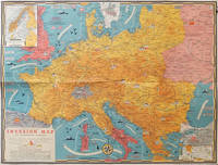
1944ref. 206781Toronto.: C.C. Petersen. 1944. Colour pictorial map 51 x 67 cm two small inset maps of Scandinavia and the Baltic and South Greece and the Dodecanese on the verso a black and white world map showing the Pacific Theatre marking keys events of the war and in European world history folding into the original pictorial pocket a little toned and marked 25.8 x 17.7 cm small fold split but in very good condition. A scarce map in the "Dated Events" series published by C.C. Petersen in Canada and distributed throughout North America commemorating D-Day. The colour map by Stanley Turner encompasses the area from England as far south as the French border with Spain and as far east as the USSR and Turkey. "With this invasion map you will be able to follow the progress of the Allied troops on their way to smash Germany.". The text at lower left goes on to elaborate on the features shown on the map from elevation "major battles are seldom fought on the tops of mountains" to pictographs of bombs falling. The black and white map on the verso shows the Far Eastern theatre of war centring on the Pacific Ocean with the Asian landmass including India and the USSR at upper left Australia at lower left and North America and the coast of South America at right of the map. Naval bases are shown and significant events in the war are noted in text boxes. A handsome production of a scarce map rarely seen with the original pictorial pocket. . C.C. Petersen. unknown
1860ref. 823CG(um 1860). Chromolithographie hinter Glas. Bildausschnitt: 24 x 33,5 cm.