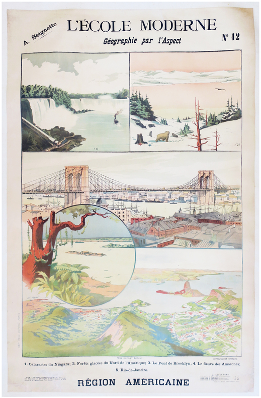
SEIGNETTE (Adrien) & LUNOIS (Alexandre).Livre Rare Book
12.067 resultados
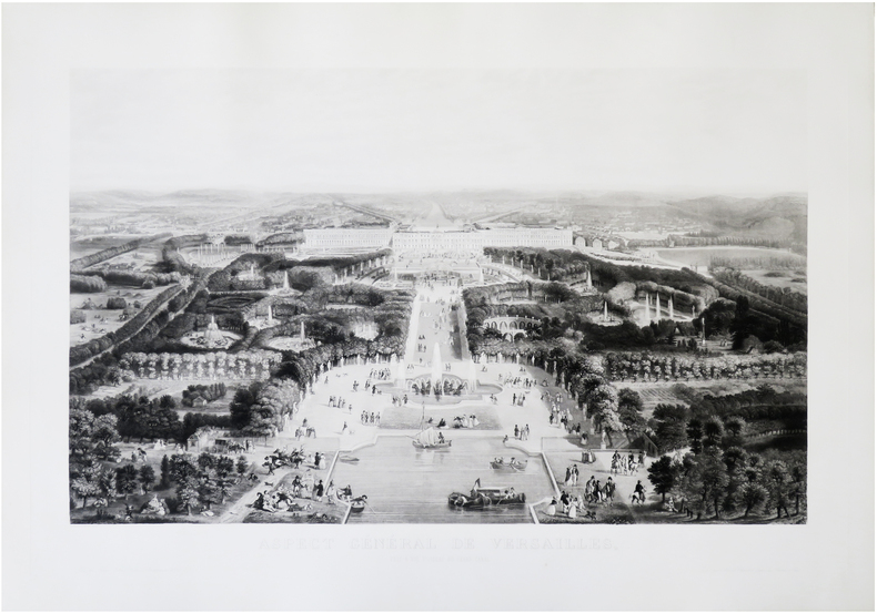
1900ref. LBW-7872Paris, Paul Dupont, [1900]. 1,22 x 0,85 m ; montée sur toile.
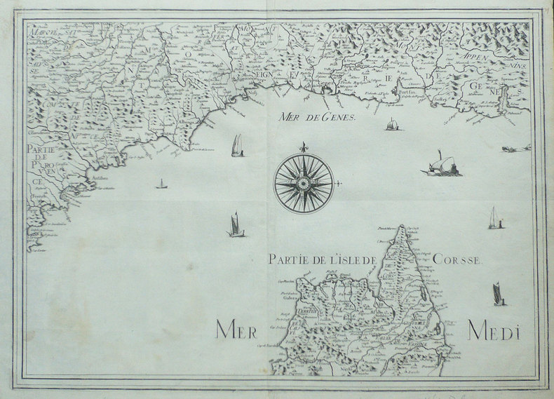
1730ref. LBW-8300Augsbourg, [circa 1730]. 573 x 491 mm.
Laminated folding map. Ca. 910 x 580 mm. Scale 1:1,500,000. Captions in English and Arabic. Road map of the Gulf region with 7 inset plans of Manama, Doha, Abu Dhabi, Kuwait, Dubai, Mutrah and Muscat. Apart from main and secondary roads and railways, the chart details larger and smaller towns, pipelines and oil fields. - Pierced near corners. Otherwise well preserved.
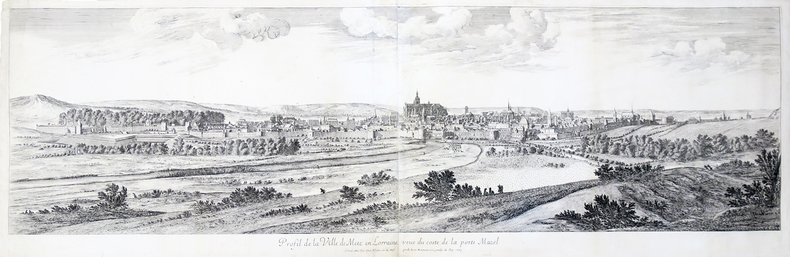
1667ref. LBW-4500Paris, Israel Silvestre, 1667. En deux feuilles jointes de 400 x 1286 mm.
ref. 17218Paris, Atelier de lithographie de N. Gratia, 1839 - 1842. In-plano (53,5 x 74 cm), un feuillet de légendes indiquant les Routes royales, Routes départementales et les Chemins de grandes communications, 34 cartes topographiques des cantons gravées sur pierre par Eugène Rembielinski, un tableau d'assemblage des feuilles et une deuxième carte de Caen "Statistique générale" de 1836 (nommée 7ème feuille de l'atlas, avec les détails statistiques), ces deux derniers sont gravés par Bouffard. Quelques cartes aux contours rehaussés de bleu. Exemplaire très frais, monté sur onglets. Demi-basane havane, dos lisse orné de filets dorés et fleurons à froid. Eraflures, coiffe inférieure usée. Reliure de l'époque.
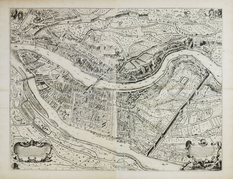
1696ref. LBW00291[1696]. En 2 feuilles pouvant être jointes et former un plan d'environ 660 x 860 mm.
1640ref. LBW-1382Paris circa 1640 367 x 516 mm.
1856ref. LBW-8701Paris, Fatout, [1856]. 570 x 817 mm.
ref. LBW00283circa 1760 498 x 1070 mm.
1824ref. LBW-7761824. 455 x 554 mm.
1827ref. LBW-41851827. En 18 sections montées sur toile et pliées, formant une carte de 620 x 930 mm.
ref. 899943Imprimerie De Didot Paris 1768 In-4 carré ( 250 X 195 mm. ) de: [5] ff. ( Titre, Titre gravé, Table des chapitres, Table des cartes et plans ), 152 pages, pleine basane fauve marbrée, dos à nerfs orné de caissons, fleurons et roulettes dorés, pièce de titre de maroquin vieux-rouge, chaînette dorée sur les coupes, tranches brique. Joli bandeau allégorique signé Jean CHOFFARD et 34 cartes gravées dont 16 doubles ( 2 dépliantes ) par Nicolas BELLIN. Parmi les 34 cartes qui illustrent louvrage, une carte générale du Nord de St Domingue et de ses cinq débouquements, une du Canal de Bahama représentant le sud du Golfe du Mexique. Rare édition originale de ce routier des Antilles par le premier hydrographe de la Marine royale française, Jacques-Nicolas BELLIN ( 1703-1772 ). ( J. Polak 591 Sabbin, 4552 ). Reliure un peu frottée, 2 coins émoussés, mouillure claire et petite galerie de vers marginale à quelques feuillets, bon exemplaire à grandes marges.
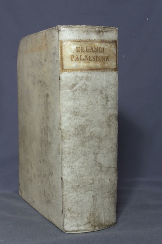
1716ref. 8475Norimbergae [Nuremberg], Petrum Conradum Monathum, 1716. Gros in-8 de [18]-787-[83]-[2bl.] pages, plein vélin ivoire du temps, dos lisse, titre doré au dos dans une cartouche de roulette dorée, tranches mouchetées. Hormis une pâle auréole d'humidité en marge supérieure de quelques feuillets, bel exemplaire.
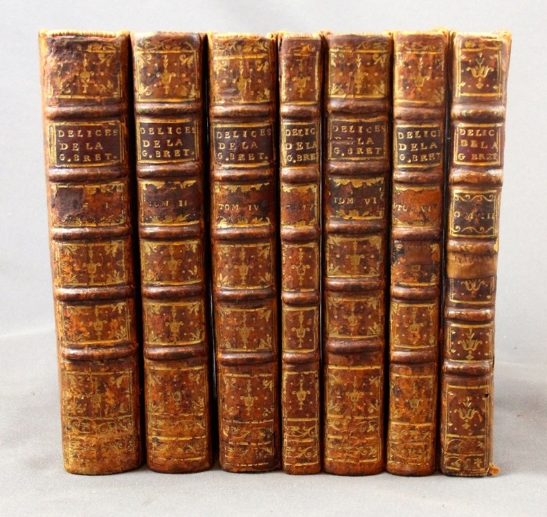
1727ref. 2311A Leide, Chez Pierre Vander, 1727. 7 vol. (sur 8) in-8 de 1506-[2] (Pagination continue : [17 ff.], [278] + [299] + [164] + [128] + [198] + [177] + [131] pp.), plein veau havane moucheté, dos à nerfs ornés de fleurons dorés, étiquettes de titre bordeaux, tranches rouges. Dos et coins frottés, coiffes sup. des vol. 1, 4, 5 et 8 manquantes, coiffes inf. du vol. 8 manquante, accroc à la coiffe sup. vol. 6 et à la coiffe inf. vol. 4, mors 1er plat légèrement fendu aux vol. 1, 2, 4 et 5 (env. 1 cm.), quelques rousseurs sur les cartes et pl.
1902ref. 4544Stuttgart, E. Schweizerbartsche Verlagsbuchhandlung, 1902-1903. 2 volumes in-4 de XII-509p. + X, 445-[6]-26 pages. Pleine toile écrue de l’éditeur.
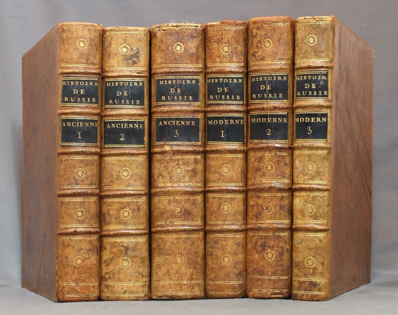
1783ref. 15434A Paris et à Versailles, Chez Froullé, Maradan et Chez Blaizot, 1783-1794. 6 volumes in-4 de [4]-VII-[1]-XX-510-[2]; [4]-XXIV-560-[2]; [4]-VI-[2]-748; [4]-536-VIII; [4]-619; VIII-424 pages. Pleine basane racinée du temps, dos à nerfs ornés de filets et petits fleurons dorés, roulette dorée sur les plats, tranches marbrées. Coins tapés et accrocs à quelques coiffes.
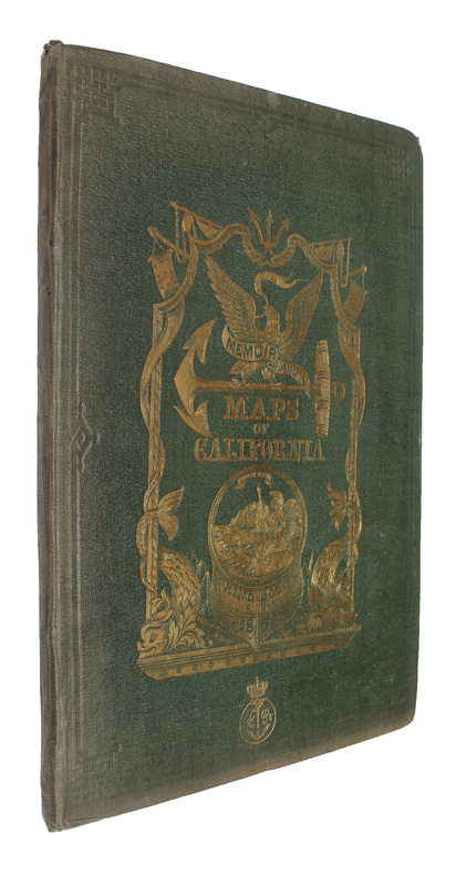
1851Washington, Jno. T. Towers, 1851. 4to. In publishers original full pictoral green cloth. Front and back board with embossed title and ornamentation, showing an eagle holding a banner and anchor beneath whom Columbia sits holding the shield of California with a bear asleep at her feet. Front board in gold. Lower front board with gilt stamp. Stamp to front free end-paper and title-page. Light wear to extremities and internally with light occassional miscolouring. 44. pp. + 11 lithographic plates including frontispiece and 6 folding maps.
1851ref. 53713Washington, Jno. T. Towers, 1851. 4to. In publishers original full pictoral green cloth. Front and back board with embossed title and ornamentation, showing an eagle holding a banner and anchor beneath whom Columbia sits holding the shield of California with a bear asleep at her feet. Front board in gold. Lower front board with gilt stamp. Stamp to front free end-paper and title-page. Light wear to extremities and internally with light occassional miscolouring. 44. pp. + 11 lithographic plates including frontispiece and 6 folding maps.
1708ref. 8917London: John Nicholson 1708. Full Leather. Very Good binding. Octavo. xxxviii 2 412; 2 382 2 ads 32 index pp. maps. First edition. Contemporary paneled-calf boards with modern reback. Title page to Volume 1 and four of the eight maps are lacking but are supplied in tasteful facsimile. The maps in facsimile are the North America New England Virginia and Maryland and Carolina. Bindings are solid and presently nicely; contents are clean and bright; but for the maps and title page this is an exceptional set. Of this work William Reese writes: "This basic 18th-century reference work on British America . . . offers an excellent comprehensive survey of Great Britain's American colonies at the point when those on the mainland of North America had grown past their initial phase and were expanding rapidly in population and productivity. . . . This important contemporary work would probably have been the first point of reference for any Englishman at the time" Reese Struggle for North America 1. Usually attributed to Oldmixon who penned the dedication but occasionally gets attributed to Moll according to Sabin. A significant work by the British historian. Howes O-61 "aa"; European Americana 1708/95; ESTC T45485; Sabin 57156. John Nicholson unknown
1812ref. PHO-1644Paris, A. Nepveu, 1812. Atlas in-folio oblong (420x280), pleine toile moderne, auteur et titre au dos, rousseurs, cachet de librairie, petite mouillure en début d’ouvrage, déchirures sur 2 planches en marge sans manque. Première édition, l'atlas comprend 45 planches et cartes, dessinées et gravées la plupart par l'auteur, certaines terminées par Coube, Hulk, Gossard ou Perdoux, (vue de la ville du Port Napoléon, vue du Cap de Bonne-Espérance, etc.). L'ouvrage traite de l'histoire de l'île Maurice, de sa population et de son administration, de géologie et de sciences naturelles.
1748Acquaforte e bulino, 1748, firmata sulla pietra con la scala in basso al centro "Piranesi e Nolli incisero". Celebre pianta di Roma, incisa da Giovanni Battista Nolli e Carlo Nolli, magnificamente arricchita da elementi decorativi incisi da Giovanni Battista Piranesi. La mappa descrive il centro di Roma su una grande quinta dispiegata dal putto in alto a destra. In alto a sinistra un putto sorregge lo stemma del cardinale Alessandro Albani, al quale l'opera è dedicata, come riportato nel cartiglio sottostante. Al lato sinistro, al di sotto del putto reggi stemma, si diparte una legenda con un elenco di centosettanta luoghi d'interesse, palazzi, monumenti e chiese, che prosegue sul bordo destro. In basso al centro, sui ruderi di un piedistallo, è riportato il titolo. Nella parte bassa della composizione si osservano un'immagine speculare della Basilica di San Pietro, la facciata della Basilica di Santa Croce in Gerusalemme di Pietro Passalacqua e Domenico Gregorini, la Fontana di Trevi di Nicola Salvi e la facciata della Basilica di Santa Maria Maggiore di Ferdinando Fuga. La pianta è conosciuta come "Pianta piccola" del Nolli; piccola per distinguerla dal celebre grande rilievo, impresso su 12 fogli (più 6 di indice), di cui questa pianta rappresenta la riduzione. È numerata 33-34 perché seguiva, nella pubblicazione completa, i 6 fogli di indice della pianta grande. Il titolo è riportato in basso, entro il piedistallo della colonna traiana. Accanto, entro un frammento architettonico su cui è riportata la "scala in palmi romani d'architettura", la sottoscrizione degli incisori C. Nolli e G.B. Piranesi. La dedica di G.B. Nolli al cardinale Alessandro Albani è datata "Roma il dì primo del 1748". L'indicazione di pubblicazione si trova nel lembo, ripiegato, del cartiglio sul lato destro. Acquaforte, impressa su carta vergata coeva, completa dei margini, leggera e diffusa brunitura, minime abrasioni, per il resto in buono stato di conservazione. Bibliografia Scaccia Scarafoni n. 227; Marigliani, 190; Frutaz CLXIX a-c; Wilton-Ely 1994, n. 1007. Etching and engraving, 1748, signed on stone with scale at bottom center "Piranesi e Nolli incisero". Famous map of Rome, engraved by Giovanni Battista Nolli and Carlo Nolli, beautifully enriched with decorative elements engraved by Giovanni Battista Piranesi. The map depicts the center of Rome on a large backdrop unfolded by the putto in the upper right. On the upper left a putto holds the coat of arms of Cardinal Alessandro Albani, to whom the work is dedicated, as shown in the cartouche below. On the left side, below the putto holding the coat of arms, departs a legend with a list of one hundred and seventy places of interest, palaces, monuments, and churches, which continues on the right border. At the bottom center, on the ruins of a pedestal, is the title. The lower part of the composition shows a mirror image of St. Peter's Basilica, the facade of the Basilica of Santa Croce in Gerusalemme by Pietro Passalacqua and Domenico Gregorini, the Trevi Fountain by Nicola Salvi, and the facade of the Basilica of Santa Maria Maggiore by Ferdinando Fuga. The map is known as Nolli's "Small Plan"; small to distinguish it from the famous large relief, imprinted on 12 sheets (plus 6 of index), of which this map represents the reduction. It is numbered 33-34 because it followed, in the complete publication, the 6 index sheets of the wall map. The title is given at the bottom, within the pedestal of the Trajan column. Next to it, within an architectural fragment on which is the "scala in palmi romani d'architettura", is the signature of engravers C. Nolli and G.B. Piranesi. G.B. Nolli's dedication to Cardinal Alessandro Albani is dated "Roma il dì primo del 1748." The indication of publication is in the flap, folded, of the cartouche on the right side. Etching, impressed on contemporary laid paper, complete with margins, light and diffuse browning, minimal abrasions, otherwise in good condition. Bibliografia Scaccia Scarafoni n. 227; Marigliani, 190; Frutaz CLXIX a-c; Wilton-Ely 1994, n. 1007.
1748Celebre pianta topografica di Roma, una rielaborazione, su invenzione di Giovanni Battista Nolli, della pianta xilografica di Leonardo Bufalini raffigurante la città nel 1551. La pianta era venduta insieme a quella grande e piccola del Nolli, di cui costituisce le tavv. 35 e 36. Fu incisa da Franco Monaco e Carlo Nolli, la cui sottoscrizione si legge in basso a sinistra. In alto a sinistra, entro un cartiglio, dedica del Nolli al cardinale Silvio Valenti Gonzaga. Nei due angoli inferiori, sono state inserite le vedutine del Pantheon a sinistra, e dell'Arco di Giano a destra. Orientamento con il nord in alto. Scalimetro in palmi romani. Ai lati, legenda di 307 voci. In basso a destra, le note tipografiche della pianta edita da Leonardo Bufalini nel 1551: "Edita per Mag[ist]r[u]mLeonardum Die XXVI. Men. Maij Anno Domini MDLI"; al centro, la notizia del privilegio e la data: "Romae cum privil. Sum. Pontificis, et Super. permissu anno 1748". Nolli non fece alcun tentativo di migliorare le incongruenze della mappa del Bufalini: gli angoli del Tridente di Piazza del Popolo sono ancora disuguali, e il Circo Massimo ha entrambe le estremità di forma, invece che una sola. Acquaforte e bulino, impressa su carta vergata coeva, con margini, in perfetto stato di conservazione. Bibliografia Frutaz, Le piante di Roma, CLXIX a-c. Famous topographical map of Rome, a reworking, on the invention of Giovanni Battista Nolli, of Leonardo Bufalini's xylographic plan depicting the city in 1551. The plan was sold together with Nolli's large and small plans, of which it constitutes Tables 35 and 36. It was engraved by Franco Monaco and Carlo Nolli, whose signature can be read at lower left. Nolli made no attempt to rectify inconsistencies of the Bufalini map when he prepared the reduced copy. The Popolo trivium still has its unequal angles, and the Circus Maximus is still semicircular at both ends instead of one. He did, however, give greater relief than the original to the densely populated part of the city by shading in the city blocks. This is the same graphical convention he used on his own map. He maintained Bufalini's emphasis on antiquity by copying them exactly as in the original. Indeed he acknowledges this aspect by including views of ancient buildings at the bottom, where the map appears to be scrolled up, so as to reveal the "Colonnacce," a broken aqueduct, and the Pantheon (with Baroque additions) in the lower left corner, and the three ruins of the Forum Boarium in the lower right hand corner: The round Temple of "Mater Matuta," the Arch of Janus (with Medieval additions) and the Temple of "Fortuna Virilis." The map was engraved, as signed, by Franco Monaco and Carlo Nolli. On the upper left, the cartouche with the dedication to the Cardinal Silvio Valenti Gonzaga. Etching with engraving, a fine impression on contemporary laid paper, with margins, perfect condition. Bibliografia Frutaz, Le piante di Roma, CLXIX a-c.
1561Acquaforte e bulino, circa 1561. Magnifica prova, impressa su carta vergata coeva, con margini, in perfetto stato di conservazione. Esemplare in meravigliosa coloritura coeva.La mappa di Ruscelli è molto interessante per la sua rappresentazione dei cinque continenti conosciuti, legati tra loro come una superficie continua. Questa mappa presenta una proiezione della superficie terrestre già piuttosto obsoleta ai tempi della sua pubblicazione. Già in precedenza, altri cartografi, partendo da Matrin Waldseemuller nel 1507, avevano messo in dubbio l’affermazione di Colombo secondo cui Asia e America formassero un unico continente. I viaggi di Magellano e di altri esploratori, che permisero di conoscere definitivamente la reale estensione dell’oceano Pacifico, diedero ulteriore sostegno a tali dubbi, sebbene lasciassero aperta la possibilità di una connessione America-Asia a settentrione. Intorno alla metà del XVI secolo, tuttavia, anche questa ultima ipotesi venne completamente screditata, per essere rimpiazzata dall’idea di un ipotetico “stretto di Anian”. Altra interessante caratteristica di questa mappa è l’intreccio di “linee dei sestanti” radianti da 16 punti focali. Il sestante era uno strumento indispensabile per misurare e tracciare, la rotta di navigazione. In questo caso, le linee tracciate sulla mappa sono esclusivamente ornamentali e illustrative, in quanto la carta è troppo piccola per poter essere funzionale. Carta tratta dalla "Geographia di Claudio Tolomeo", a cura del Ruscelli, pubblicata in Venezia in pù edizioni tra il 1561 ed il 1598. La carta è basata sulla "Geografia" di Giacomo Gastaldi, che probabilmente disegnò personalmente anche queste mappe, che vennero incise dai fratelli Sanuto. La peculiarità di queste mappe è che sono incise due per lastra e successivamente tagliate; questo il motivo per cui il segno del rame appare solo in tre lati della mappa. Il testo del Ruscelli e le sue carte sono considerate come il miglior atlante moderno fino alla prima versione del Thatrum di Ortelius, 1570. Solo la loro enorme diffusione ne impedisce una valutazione sostenuta nel mercato antiquario. L'opera infatti ebbe una prima stesura nel 1561, stampata da Vincenzo Valgrisi che ne curò anche la ristampa del 1562. Tre sono le edizioni firmate da Giordano Ziletti (due nel 1564 e una del 1574), mentre nel 1597 viene edita dai fratelli Calignani. Tutte queste edizioni contengono 64 tavole. Nel 1598 e 1599 vengono alla luce le due edizioni curate da Giuseppe Rosaccio e stampate dagli Eredi di Melchior Sessa. Queste ultime due edizioni comprendono 69 tavole; sono infatti aggiunte la carta del planisfero e dei continenti del Rosaccio.Gli esemplari delle carte del Ruscelli in coloritura coeva sono assolutamente rarissimi. - ORIGINAL COLOURING -Etching with engraving, about 1561. Magnificent proof, printed on contemporary laid paper, with margins, in perfect condition. Example in wonderful contemporary coloring.The map of Ruscelli is very interesting for its representation of the five known continents, linked together like a continuous surface. This map shows a projection of the Earth's surface rather obsolete already at the time of its publication. Previously, other cartographers, starting from Martin Waldseemuller in 1507, had questioned the assertion of Columbus that Asia and America form a single continent. The travels of Magellan and other explorers, which allowed him to finally know the true extent of the Pacific Ocean, gave further support to these concerns, although leave open the possibility of a free America-Asia to the north. Around the middle of the sixteenth century, however, this latter hypothesis was completely discredited, to be replaced by the idea of a hypothetical "Strait of Anian." Another interesting feature of this map is the plot of "lines of sextants" radiant 16 focal points. The sextant was an indispensable tool to measure and track, the navigation route. In this case, the lines drawn on the map are exclusively ornamental and illustrative, because the paper is too small to be functional. The map comes from Ptolemy's Geographia, edited by Ruscelli, published in Venice in multiple editions between 1561 and 1598. The map is based on the same work of Giacomo Gastaldi (1548), which probably also personally drew these maps, engraved by the brothers Livio and Giulio Sanuto. The peculiarity of these maps is that they are recorded two for plate and subsequently cut, consequently the sign of the copper appears only on three sides for each map. The text of Ruscelli and his maps are considered as the best modern atlas to the first version of the Theatrum Orbis Terrarum by Ortelius of 1570. Only their ubiquity prevents an assessment supported in the antique market.Girolamo Ruscelli (Viterbo 1504 - Venice 1566), scholar and polygraph native of Viterbo, was formed in Rome but soon moved in Veneto where he treated, for typography Valgrisi, numerous editions of Italian classics. Ruscelli was also the curator of the revised and expanded version of Ptolemy's Geographia, printed in Venice several times between 1561 and the end of the century. The maps are based on those by Giacomo Gastaldi for the Venetian edition of 1548, and engraved by the brothers Sanuto.Example of Ruscelli’s maps in contemporary coloring are absolutely rare. Shirley, The Mapping of the World, 111. Dimensioni 260x195.
1799La carta in esame appartiene a un progetto di atlante – in ambito antiquario noto come “Zattone” – mai portato a compimento, della così denominata Societè Calcographique, un’operazione commerciale messa su da due editori leader del mercato veneto del XVIII secolo, Antonio Zatta (1722-1804) e Giuseppe Antonio Remondini (1747-1811). La denominazione dell’impresa editoriale è nota attraverso una carta del mondo che, nella parte bassa del cartiglio, reca l’iscrizione a` Venise Chez la Societè Chalcographique 1799. (Sicilia 2014: 287). Il progetto sembra non sia stato portato a compimento poiché nessun atlante, con un proprio titolo, indice e frontespizio, contenente queste mappe, è noto in bibliografia. Probabilmente le carte venivano vendute singolarmente o a fascicoli come era comune per imprese editoriali di un certo costo. Le carte a tutt’oggi note sono realizzate mediante l’utilizzo di rami più antichi, appositamente modificati. Le matrici originali hanno molteplici origini: alcune appartengono a un altro sconosciuto Atlante d'Italia dedicato alli Augusti Viaggiatori il Conte, e la Contessa, Del Nort stampato con imprint Venezia MDCCLXXXII presso Vincenzo Formaleoni. Nessun esemplare completo di questa raccolta ci è noto, alcune di queste carte fanno parte di una raccolta fattizia conservata alla Biblioteca Nazionale Marciana di Venezia [284. c. 86], altre sono comparse di tanto in tanto nel mercato antiquario. Il frontespizio dell’atlante di Vincenzo Formaleoni (1752-1797) – che qui pubblichiamo e che ci ha consentito di formulare questa ipotesi – è recentemente apparso in una vendita all’asta Cambi di Genova. Altre mappe dello “Zattone” derivano da lastre di Paolo e Francesco Santini, riusate da Remondini per l’Atlas Universel nell’edizione degli anni 1782/84; altre da matrici impiegate da Antonio Zatta per il Nuovo Atlante pubblicato nel 1796. Le carte dei Santini sono abilmente arricchite, tramite la sovrapposizione di cartigli realizzati, nel classico stile di Zatta, su piccole lastre di rame le cui impronte calcografiche sono chiaramente visibili sulle mappe. I cartigli, realizzati dagli stretti collaboratori di Zatta Pasquali, Zuliani e Pitteri, spesso contengono brevi descrizioni storiche, e le mappe furono realizzate probabilmente per illustrare i notevoli cambiamenti geo-politici cui fu soggetta la penisola italiana durante il periodo napoleonico. Le 60 mappe di questa raccolta a tutt’oggi note, datate tra il 1795 e il 1805, sono principalmente dedicate a illustrare la penisola, ma anche altre regioni europee, i continenti e la già menzionata carta del mondo che riporta l’imprint editoriale della Societè Calcographique. Alcune di queste carte, raffiguranti la Repubblica Cisalpina, sono state descritte come parte di un Atlas très Nouveau del solo Remondini, edito a partire dal 1800: “In sostanza siamo di fronte a una semplice operazione commerciale che pensiamo sia stata operata dal Remondini, sebbene egli non si firmi come editore, poiché proprio nel 1799 egli stava acquisendo i rami dello Zatta” (Terre di Langobardia 2005:14). È molto più probabile che i due editori abbiano collaborato in questa avventura editoriale almeno fino alla morte di Antonio Zatta nel 1804, e che il progetto di un atlante completo non sia stato portato a termine anche per la morte, di pochi anni successiva, di Giuseppe Antonio Remondini. Acquaforte, finemente colorata a mano in epoca, in perfetto stato di conservazione. Bibliografia Il Piemonte nella Cartografia del Cinquecento e Seicento 1991, 75; Terre di Langobardia 2005:14; Le Grandi Alpi nella cartografia 2005: 147, 148; Sicilia 2014: 287. Zeno Davoli, Roberto Sanfelici, Terre di Langobardia - La "Lombardia" e il Ducato Estense nella cartografia a st... A large double-hemisphere map with ornate cartouches in each cusp. Published after Cook's first circumnaviation it has been updated with his discoveries: New Zealand is shown properly as two main islands and the east coast of Australia has been corrected, although still with Tasmania connected to the mainland. In the North Pacific the spurious North West Passage is shown. This very rare map belongs to a never finished project for the atlas of the so called Società Calcografia, a simple commercial trade realized by the two main Venetian publishers of the XVIII century, Antonio Zatta and Giuseppe Antonio Remondini. The term Società Calcografica has been deduced from the map of the world, which is part of the collection and bears in the lower cartouche the French writing “à Venise Chez la Societè Chalcographique 1799”. As already stated, the project was never finished for no atlas containing these maps has ever been listed in any bibliography. Very likely, then, the maps have been sold individually, or maybe as part of smaller, custom collections. The maps of the collection derive from Paolo and Francesco Santini’s plates, used by Remondini in his 1782/4 Atlas Universelle, and from the plates of Antonio Zatta’s Nuovo Atlante published in 1796. Santini’s maps have been beautifully enriched, using the system of small, masked plates which can be perceived through the platemarks on the paper, with great cartouches according to the classical style of Zatta and have been probably engraved by the members of his staff, Pasquali, Zuliani and Pitteri. The cartouches bear very often historical descriptions and maybe the maps have been realized to depict the great geographic changes of the peninsula during the Napoleonic period. The modern bibliography Terre di Langobardia describes some of the maps depicting the Repubblica Cisalpina, presenting them as part of Remondini’s “Atlas très Nouveau”, which was printed starting from 1800. In our opinion, the two publishers worked together to the realization of the project until Antonio Zatta died (1804), and the complete atlas was never finished because Giuseppe Antonio Remondini also died in 1811. I personally know 61 maps which were part of the project. Copper engraving, fine hand color, in excellent condition.
ref. 684269Librairie Hachette & Cie Paris 1906 2 volumes grands et forts in-4 ( 325 X 265 mm ) de XVI-504 et 640 pages, cartonnage éditeur illustré en couleurs, tête dorée. 3200 reproductions de cartes dont 956 en couleurs, 12 planches hors-texte coloriées à l'aquarelle, 25 phototypies, 116 enveloppes illustrées pour jeux de cartes & 340 vignettes & vues diverses. Edition originale et premier tirage. Minimes défauts aux mors et aux coiffes, ( comme toujours ), sinon très bel exemplaire, bien complet de ses serpentes, condition rare.