LUFT Hans (1495 – 1584)MareMagnum

12.595 resultados
1534Mappa intagliata in legno, contenuta in una pagina di testo di una Bibbia stampata a Wittenberg. Si tratta di una rara edizione di questa mappa un po' curiosa dell'Europa, dell'Africa e dell'Asia si trova nella letteratura apocalittica proveniente da Wittenberg nel 1530 o addirittura nel 1529. La mappa fu utilizzata per la prima volta dallo stampatore Hans Luft per illustrare due opere: una un commento sul profeta Daniele di Martin Lutero (1530) e un'altra che collega la visione di Daniele con gli assalti dei turchi ai confini dell'Europa cristiana dell'epoca. La mappa raffigura le quattro bestie del sogno di Daniele. La “mappa del mondo di Wittenberg”, più comunemente nota con il termine inglese di Daniel's Dream Map, è probabilmente la mappa del mondo più mistica di tutti i tempi. All'epoca della sua prima pubblicazione come il sessantunesimo mappamondo che andò in stampa, era, da un lato, una rappresentazione del Vecchio Mondo, basata sulla visione tolemaica del mondo, ma comprendente una serie di recenti scoperte spagnole e portoghesi, ma dall'altro, una visualizzazione del sogno apocalittico del profeta Daniele dei quattro regni. Ci sono quattordici diverse versioni della mappa del sogno di Daniele, tutte realizzate con la tecnica della xilografia. Secondo Ernst Gallner questa è la prima versione della mappa: “La prima menzione della mappa del sogno di Daniele viene fatta in un commento al profeta Daniele da parte di Justus Jonas e Philipp Melantone nel dicembre 1529 e subito dopo nel gennaio 1530 in una interpretazione del libro del profeta Daniele di Martin Lutero, entrambi pubblicati da Hans Lufft a Wittenberg. Da questo momento in poi, la mappa appare in una serie di Bibbie luterane, tedesche o di influenza tedesca e in libri teologici del XVI secolo fino alla metà del XVIII secolo, e in un libro sulla storia degli ebrei di Flavio Giuseppe. Queste varianti successive riproducono in parte l'originale, per cui alcuni degli artisti, contrariamente al desiderio di precisione geografica dell'epoca, alterano sempre più i contorni dei continenti, con aspetti visionari che hanno la precedenza sulla corretta rappresentazione cartografica. L'unica variante che si presenta in una Bibbia latina è una mappa schematica e astratta di Tobias Stimmer. Silografia, finemente colorata a mano, in ottimo stato di conservazione. Rara. Woodcut map with fine colouring, set in a text page of a Bible printed in Wittenberg. A rare edition of this somewhat curious map of Europe, Africa, and Asia is to be found in apocalyptic literature originally emanating from Wittenberg in 1530 or even 1529. The map was first used by the printer Hans Luft to illustrate two works: one a commentary on the prophet Daniel by Martin Luther (1530) and another linking the vision of Daniel with the assaults of the Turks on the perimeters of Christian Europe at the time. The wood cut map is showing the four beasts of Daniel's Dream Map. The Wittenberg World Map, more commonly known in English as Daniel’s Dream Map, is probably the most mystical world map of all time. At the time of its first publication as the sixty-first world map to go into print, it was, on the one hand, a depiction of the Old World, based on the Ptolemaic world view but including a number of recent Spanish and Portuguese discoveries, but on the other, a visualization of the prophet Daniel’s apocalyptic dream of the four kingdoms. There are fourteen different versions of Daniel’s Dream Map, with twenty printing blocks. All the versions are produced in woodcut technique. According to Ernst Gallner this is the first version of the map “The first mention of Daniel’s Dream Map is made in a commentary on the prophet Daniel by Justus Jonas and Philipp Melanchthon in December 1529 and immediately afterwards in January 1530 in an interpretation of the book of the prophet Daniel by Martin Luther, both published by Hans Lufft in Wittenberg. This version is referred to in the following as the original version. From this time on, the map appears in a number of Lutheran, German or German-influenced bibles and theological books of the 16th up to the mid.18th century, and in a book on the history of the Jews by Flavius Josephus. These later variants partially copy the original, whereby some of the artists, contrary to the wish of the time for geographical accuracy, increasingly alter the outlines of the continents, with visionary aspects taking precedence over correct cartographic depiction. The only variant to occur in a Latin bible is a schematic, abstract map by Tobias Stimmer” (cfr. The Wittenberg World Map). R. W. Shirley, "The Mapping of the world", 65A; Kaarten in Bijbels, W.C. Poortman and J. Augusteijn, 1995; Eine Wittenberger Weltkarte aus dem Jahr 1529, W. Bonacker und H. Volz, 1956.
1778ref. 21875London, printed for J. Robson, 1778. In-4 de [2]; X; 584 pages, plein veau brun, dos lisseorné de filets dorés, pièce de titre en maroquin rouge, supra-libros armorié en queue, filet doré encadrant les plats.
1580(Antwerpen ca. 1580). 32 x 41 cm. Kobberstukket Danmarkskort i original håndkolorereing. Med Skåne, Halland og Blekinge samt den nordlige del af Tyskland.Foldningen fint forstærket på bagsiden med japanpapir.
1693A Paris, (but Amsterdam, Pierre Mortier), 1693. 58x88 cm. Kobberstukket søkort over Øresund med den Skånsk/Hallandske kystline og den Sjællandske fra Møn i syd til Hesselø i nord. I pragtfuld fuld håndkolorering. Øverst i midten er indsat Amager og Saltholm i større målestok. Kortet ""ligger ned"", er orienteret øst/vest. Med kompasrose og vindretninger angivet.
1807Weimar, Geographischen Institute, (1807-13). Folio-oblong. Loose sheets in a box. Containg 128 engraved maps, each measuring ca. 30 x 45 cm. Mostly clean and fine, but some with annotations, some with browning and some with traces of use.
1852Paris, Dépôt-Général de la Marine, 1852. Folio. (34,5 x 27 cm.). 2 uniform contemp. hcalf. Gilt spines with gilt lettering. Light wear to edges. Stamp on title-pages. Volume 1: Engraved title-page. (2) pp. and 24 engraved maps of islands of which 18 are double-page, numbered 1317-1340. - Volume II: Engraved title-page. 83 engraved maps, mostly double-page, numbered 1341-1423 and 1-83. Clean and fine.
1580ref. 54214(Antwerpen ca. 1580). 32 x 41 cm. Kobberstukket Danmarkskort i original håndkolorereing. Med Skåne, Halland og Blekinge samt den nordlige del af Tyskland.Foldningen fint forstærket på bagsiden med japanpapir.
1693ref. 32305A Paris, (but Amsterdam, Pierre Mortier), 1693. 58x88 cm. Kobberstukket søkort over Øresund med den Skånsk/Hallandske kystline og den Sjællandske fra Møn i syd til Hesselø i nord. I pragtfuld fuld håndkolorering. Øverst i midten er indsat Amager og Saltholm i større målestok. Kortet ""ligger ned"", er orienteret øst/vest. Med kompasrose og vindretninger angivet.
ref. SONG3829770235Used: Good unknown
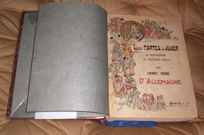
ref. 9812Hachette Et Cie Editeur - Paris - 1906 - Edition Originale - Deux gros volumes épais- Complet - Volume 1 :504 pages, volume 2 :640 pages .Exceptionnel ouvrage contenant 3200 reproductions de cartes à jouer ,956 en couleurs,12 planches hors texte acquaréllées main ,25 phototypies,116 enveloppes de cartes à jouer ,340 vignettes et vues diverses, tables des matières complètes en fin de chaque volume - Serpentes protégeant bien les gravures - Volumes in folio non rogné demi veau rouge ,dos à nerfs ,couvertures conservées ,intérieur très frais,pas de rousseur .
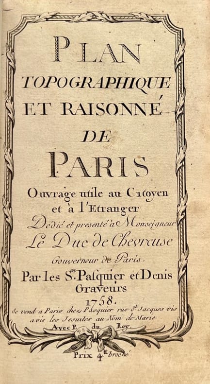
1758ref. 42372Se vend à Paris, chez Pasquier et Denis, 1758. Petit in-8 de 3 ff.n.ch., 149 pp., 1 f.n.ch., veau lisse brun, dos orné, pièce de titre en maroquin rouge (reliure de l'époque).
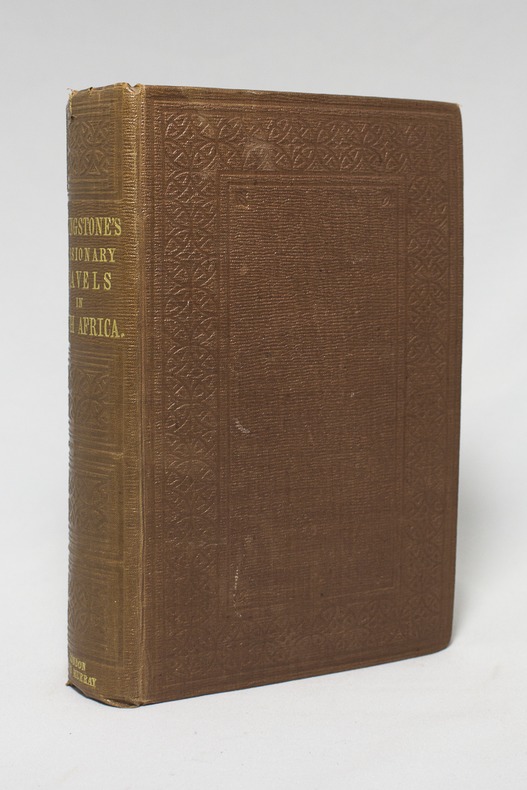
1857ref. 14921London, John Murray, 1857. Petit in-4 de IX-[1]-687-8 pages, pleine percaline brune décorée à froid. Etiquette de la librairie Desrogis, à Genève (de l'époque de la publication de l'ouvrage). Infime fente à la coiffe supérieure. Etiquette du relieur: Edmonds & Remnants.
ref. 127536aafHauterive, Editions Gilles Attinger, 1989, elefant-Folio: 59 x 75 cm (Kassette). Papiergrösse 56 x 71 cm. 127 lose faksimilierte, farbige Blätter in 59 bedruckten Papierhüllen, leinen-überzogene Kassette, Lederetikette vorne, Verschluss mit 2 Lederriemen und Druckknöpfen.
1942Very Good Turkish Paperback. A manuscript notebook. Roy. 8vo. (23 x 16 cm). In Turkish (Modern). 145, [10] p., schemes. Toprak hukuku, 1942-1943. These extremely rare and unpublished manuscript notes on 'land law' or 'real property law', were taken by a student between the years of 1942-44 during Mardin's lessons in Istanbul University. Very legible script. Fine manuscript with extra papers inside. Mardin was a Turkish jurist, academician and politician. He was one of the ends of the Ottoman Empire and the firsts of Turkish Republic lawyers. He worked as a lecturer at Istanbul University during his whole life, where he graduated, and became a professor of the Civil Law. He ws born in Shkodra. Extremely rare.
ref. 26975'Published by Survey Directorate G.H.Q. Paiforce 1944. All one page 20 x 33cms some stained but texts clear and complate. 1. Index map of Iraq and Iran for a 1:100000 scale survey series produced by the British military command PAIFORCE during World War II. All 20 x 32.5cm a couple sl. stained mainly good condition.1.Four Index maps of Iraq and Iran ¼ series I.D.R./X.D.R./G.S.G.S. 9002 3919 nos. 1-42.Index map of Iraq and Iran for a 1:100000 scale survey series produced by the British military command PAIFORCE during World War II. Index Map of 'Irq rn 1:100000 Series I.D.R. 9003'.3.Four Index Maps of places/areas of IRAN:a. Ahwaz 1:10000 series 1D MISC/563 to 573 stamped 11 June 1944b. Askaran and Sanandaj N.W. 1:25000 series …9005 stamped 25 June 1944c. Gach-I-Sar 1:50000 series stamped 11 June 1944d. Khurramshahr Abandan 1:12500 series4.Six Index Maps of places/areas of IRAQ all 1:25000 series ID 9005:a. Ba'qubab. Faidahc. Haffad. Hindiyae. Falluja f. MoselNo reference to other copies yet found. 'Published by Survey Directorate, G.H.Q. Paiforce [1944] unknown
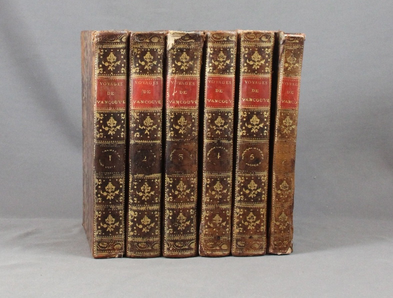
ref. 6293Paris, Didot jeune, an X. 6 volumes in-8 de [4]-VIII-341p., [4]-384p., [4]-381p., [4]-368p., [4]-438p., et un atlas de [4]p., 17 vues et 9 cartes, plein veau moucheté, dos lisses ornés de filets et fleurons dorés, pièces de titre rouge. Reliures un peu malmenées, coiffes frottées, mors un peu fendus, épidermures, auréoles pales à trois volumes, plus présentes dans l'atlas. Chaque première page est frappée d'un large tampon non identifié par votre serviteur.
1746ref. LBW-7930Paris, chez l'auteur, 1746. En deux feuilles pouvant être jointes pour former une carte de 825 x 860 mm.
1735ref. PHO-1902La Haye, Jean Neaulme, 1735. 2 Volumes en 1, grand in-4° (29x23 cm) relié plein veau époque, dos à nerfs avec pièce de titre, filets aux plats, tranches rouges, dos et coins restaurés, titre imprimé en rouge et noir. Imprimé et paginé sur 2 colonnes.
1785ref. 118031785 toilées, dans deux étuis en papier fort. Carte en 9 feuilles grand-aigle, 183 x 218 cms, 1 carte 64 x 73 cms et 1 petite 30 x 41, 1 carte de 42 x 43 cms. P. Dezauche, (ca. 1785),
1795ref. PHO-1770Paris, Déterville, De l’Imprimerie de H. L. Perronneau, s.d. [1795] & Jansen et Compagnie, L’An IVe de la République, une et indivisible. Ensemble 2 ouvrages en 4 volumes in-4, reliure moderne jaune pour les 2 voyages et plein veau pour la carte, ex-libris en page de garde, quelques rousseurs.
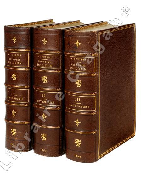
1895ref. 19909Lyon, Bernoux et Cumin, 1895-1899 ; 3 tomes fort in 8, maroquin bordeaux, dos à nerfs décoré et doré du fer au lion debout, titre et tomaison dorés, encadrement d’un triple filet doré, double filet doré sur les coupes, large dentelle intérieure, tête dorée, non rogné (L. Guétant) ; 614; 668 ; 666 pp., 26 planches hors-texte, certaines sur page double, [2] pp. d’Index de ces planches ; XXIV pp. Liste des souscripteurs.
1418ref. 159850Shūseidō 衆星堂. Reprint. Tenpō 14 1843. Large folding handcoloured map of the thirteen provinces from which Mt. Fuji can be viewed. 159 x 178cm. Folds into paper covered card covers measuring 40 x 24cm. Title label upper cover. A little browning along folds occasional spotting and soiling. A little worming causing approximately 1cm of loss in places. Two chops in lower section. A very striking and attractive map. This very large handsome map is a detailed map of the thirteen provinces from which one can see Mt. Fuji. Provinces shown are the eight provinces of the Kantō region Sagami 相模 Musashi 武蔵 Kazusa 上総 Shimofusa 下総 Awa 安房 Kōzuke 上野 Shimotsuke 下野 and Hitachi 常陸 and five other provinces Izu 伊豆 Suruga 駿河 Tōtōmi 遠江 Kai 甲斐 and Shinano 信濃. The map offers a large amount of detailed information such as province and county borders rivers high ways post towns checkpoints villages and scenic spots. The cartographer Akiyama Einen or Nagatoshi 秋山永年 came from Edo and the editor Funakoshi Seizō 船越清蔵 studio name: Shugu 守愚 1805-62 a Confucian scholar from Nagato Province now the western half of present-day Yamaguchi Prefecture. A dedication by Funahashi Akira 舟橋徴 is dated 1843. . Shūseidō 衆星堂 unknown
1934ref. 61915Chicago IL: Published by A.J. Nystryom & Co. Maps Globes Charts 1934. Seven large linen-backed colour lithograph maps sized from 43.5 x 72 in. to 51.5 x 60 in. all mounted on their original spring-loaded rollers wooden pull dowel & metal ring pull some creasing minor edgewear creasing soot soiling to the lower margin averaging about 6-7 in. due to exposure when rolled “Europe” and “United States” with faint tidemark & discoloration at left margin some minor creasing wear all preserved in the original A.J. Nystrom quarter-sawn oak wall bracket sized 58.5 x 15.25 x 3.25 in. all pull-down maps firmly secured in their steel brackets preserving 6 of the 7 original labels on the edge of the pull-down dowels still a VG- set of maps in their original configuration. First editions thus of this complete and exceptional example of the Atwood/A.J. Nystrom Regional-Political Series Map Case reflecting the many geographical and political changes between World War I and World War II. Such changes are reflected in the appearance of Manchoukuo the Japanese controlled rump state established in Manchuria in 1932 by the Japanese Empire and also depicting Korea still as Chosen. The Europe map depicts the East Prussia still controlled by the Weimar Republic and then after Hitler ascended to power; while Africa still retains much of the colonial powers as shown in the Belgian Congo Anglo-Egyptian Sudan French Equatorial Africa and even Beuchuanaland. The Australia and the Far East Map clearly defines the Japanese United States British & Australian mandates across the South Pacific. Atwood 1872-1949 was a noted geographer and educator who was a member of both the New Jersey and Wisconsin Geological Surveys served in the US Geological Survey served as professor of Physiography at Harvard and later from 1920-1946 when he produced these maps was President of Clark University and Head of its School of Geography. No similar complete sets located in Worldcat. Published by A.J. Nystryom & Co., Maps, Globes, Charts, unknown
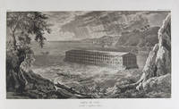
1833ref. 18856Milano: Fortunato Stella e Figli 1833. First Italian edition. Hardcover. f to vg. Oblong folio 12 6/8 x 18 1/2". 1 leaf Title 38 leaves Plates 1 leaf List of content. Original half morocco over burgundy paper covered boards. Gold lettering and tooling on spine. Rare first Italian edition of Paul-Louis-Bernard Drach's atlas volume of his "Sainte Bible de Vence" a series which was originally published in 27 volumes in Paris from 1827 to 1833. The striking 38 engraved plates featured in this atlas are composed of 13 maps by A. R. Fremin and 25 engravings signed by Falkeisen Angelini and Lanzani. The engraved plates have been laid down on beautiful hand-made paper and describe the following: 1. Map of the place of Eden Mesopotamy and Persian Gulf; 2. Noah's Arch construction; 3. Noah's Arch; 4. Map of the land divided among Noah's sons; 5. The Babel Tower; 6. Map of the Land of Canaan; 7. Map of Jews' Pilgrimage; 8. The Jerusalem Sahnedrin; 9. The Temple of Jerusalem plans and sections; 10. The Temple of Jerusalem square plan; 11. Map of ancient Jerusalem; 12. The Temple of Salomon; 13. The Temple's foundations; 14. The East Gate; 15. The Buildings of the Temple; 16. Musical Instruments of the Jews; 17. Hebrew Alphabet; 18. Jew's Vestments and worship's objects; 19. Two Menorah; 20. High Priest's vestments and Golden Menorah; 21. Moses' Tabernacle; 22. The Loaves of Proposition; 23. Plan and section of the Tabernacle; 24. The encampment of the Israelites; 25. Map of the Holy Land South; 26. Map of the Holy Land North; 27. Map of Syria; 28.Map of Israel under Salomon; 29. Plan of the House of the Forest of Lebanon; 30. The House of the Forest of Lebanon; 31. The Bronze Sea; 32. The Washings; 33. The Altars of the Holocausts; 34. Map of the Persian Empire; 35. Map of the Land of Canaan according to Ezechiel; 36. Map of Herod's Reign; 37. Zachary's Vision; 38. Map of the travels of Saint Peter and Saint Paul. The plates measure appr. 12 1/2 x 18 1/4" image size appr. : 9 1/2 x 14 6/8". Binding rubbed on covers and along edges. Head and tail of spine chipped. Previous owner's Ex-libris Calvin Bullock on inside of front cover. Minor and sporadic foxing along paper margin not affecting plates. Title and captions in Italian. Binding in overall fair interior in very good plates in near fine to fine condition. About the author: "David Paul Drach aka Paul-Louis-Bernard Drach after his conversion 1791-1865 was a Catholic convert from Judaism and librarian of the College of Propaganda in Rome. Drach received his early education from his father who was a rabbi. After spending some time in various Talmudic schools he became a teacher at Rappoltsweiler though only sixteen years of age. The love of the secular sciences brought him to Paris where he was welcomed by his coreligionists and became tutor in a wealthy Jewish family. His reputation as a teacher brought him Christian pupils; and this may have had some influence on his subsequent conversion; in fact he had always manifested some leaning toward Christianity. Drach had already begun the study of Greek and Latin so as to become acquainted with the Christian doctrines in their original sources. Struck by the accusation of some of the Fathers that the Jews had corrupted the Hebrew text he began a comparative study of the Hebrew and the Septuagint which study he continued in spite of the remonstrances of the president of the Central Consistory. Drach was received into the Catholic faith in 1823 together with his two daughters and his son Paul who afterward became a priest and a distinguished Biblical scholar. In 1827 Drach accepted the position of librarian of the Propaganda in Rome which position he held until the year of his death." From the Jewish Encyclopedia. Fortunato Stella e Figli hardcover
1833ref. 18856Milano: Fortunato Stella e Figli 1833. First Italian edition. Hardcover. f to vg. Oblong folio 12 6/8 x 18 1/2". 1 leaf Title 38 leaves Plates 1 leaf List of content. Original half morocco over burgundy paper covered boards. Gold lettering and tooling on spine. Rare first Italian edition of Paul-Louis-Bernard Drach's atlas volume of his "Sainte Bible de Vence" a series which was originally published in 27 volumes in Paris from 1827 to 1833. The striking 38 engraved plates featured in this atlas are composed of 13 maps by A. R. Fremin and 25 engravings signed by Falkeisen Angelini and Lanzani. The engraved plates have been laid down on beautiful hand-made paper and describe the following: 1. Map of the place of Eden Mesopotamy and Persian Gulf; 2. Noah's Arch construction; 3. Noah's Arch; 4. Map of the land divided among Noah's sons; 5. The Babel Tower; 6. Map of the Land of Canaan; 7. Map of Jews' Pilgrimage; 8. The Jerusalem Sahnedrin; 9. The Temple of Jerusalem plans and sections; 10. The Temple of Jerusalem square plan; 11. Map of ancient Jerusalem; 12. The Temple of Salomon; 13. The Temple's foundations; 14. The East Gate; 15. The Buildings of the Temple; 16. Musical Instruments of the Jews; 17. Hebrew Alphabet; 18. Jew's Vestments and worship's objects; 19. Two Menorah; 20. High Priest's vestments and Golden Menorah; 21. Moses' Tabernacle; 22. The Loaves of Proposition; 23. Plan and section of the Tabernacle; 24. The encampment of the Israelites; 25. Map of the Holy Land South; 26. Map of the Holy Land North; 27. Map of Syria; 28.Map of Israel under Salomon; 29. Plan of the House of the Forest of Lebanon; 30. The House of the Forest of Lebanon; 31. The Bronze Sea; 32. The Washings; 33. The Altars of the Holocausts; 34. Map of the Persian Empire; 35. Map of the Land of Canaan according to Ezechiel; 36. Map of Herod's Reign; 37. Zachary's Vision; 38. Map of the travels of Saint Peter and Saint Paul. The plates measure appr. 12 1/2 x 18 1/4" image size appr. : 9 1/2 x 14 6/8". Binding rubbed on covers and along edges. Head and tail of spine chipped. Previous owner's Ex-libris Calvin Bullock on inside of front cover. Minor and sporadic foxing along paper margin not affecting plates. Title and captions in Italian. Binding in overall fair interior in very good plates in near fine to fine condition. About the author: "David Paul Drach aka Paul-Louis-Bernard Drach after his conversion 1791-1865 was a Catholic convert from Judaism and librarian of the College of Propaganda in Rome. Drach received his early education from his father who was a rabbi. After spending some time in various Talmudic schools he became a teacher at Rappoltsweiler though only sixteen years of age. The love of the secular sciences brought him to Paris where he was welcomed by his coreligionists and became tutor in a wealthy Jewish family. His reputation as a teacher brought him Christian pupils; and this may have had some influence on his subsequent conversion; in fact he had always manifested some leaning toward Christianity. Drach had already begun the study of Greek and Latin so as to become acquainted with the Christian doctrines in their original sources. Struck by the accusation of some of the Fathers that the Jews had corrupted the Hebrew text he began a comparative study of the Hebrew and the Septuagint which study he continued in spite of the remonstrances of the president of the Central Consistory. Drach was received into the Catholic faith in 1823 together with his two daughters and his son Paul who afterward became a priest and a distinguished Biblical scholar. In 1827 Drach accepted the position of librarian of the Propaganda in Rome which position he held until the year of his death." From the Jewish Encyclopedia. Fortunato Stella e Figli hardcover books