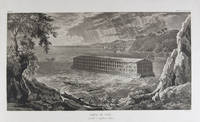
1833ref. 18856Milano: Fortunato Stella e Figli 1833. First Italian edition. Hardcover. f to vg. Oblong folio 12 6/8 x 18 1/2". 1 leaf Title 38 leaves Plates 1 leaf List of content. Original half morocco over burgundy paper covered boards. Gold lettering and tooling on spine. Rare first Italian edition of Paul-Louis-Bernard Drach's atlas volume of his "Sainte Bible de Vence" a series which was originally published in 27 volumes in Paris from 1827 to 1833. The striking 38 engraved plates featured in this atlas are composed of 13 maps by A. R. Fremin and 25 engravings signed by Falkeisen Angelini and Lanzani. The engraved plates have been laid down on beautiful hand-made paper and describe the following: 1. Map of the place of Eden Mesopotamy and Persian Gulf; 2. Noah's Arch construction; 3. Noah's Arch; 4. Map of the land divided among Noah's sons; 5. The Babel Tower; 6. Map of the Land of Canaan; 7. Map of Jews' Pilgrimage; 8. The Jerusalem Sahnedrin; 9. The Temple of Jerusalem plans and sections; 10. The Temple of Jerusalem square plan; 11. Map of ancient Jerusalem; 12. The Temple of Salomon; 13. The Temple's foundations; 14. The East Gate; 15. The Buildings of the Temple; 16. Musical Instruments of the Jews; 17. Hebrew Alphabet; 18. Jew's Vestments and worship's objects; 19. Two Menorah; 20. High Priest's vestments and Golden Menorah; 21. Moses' Tabernacle; 22. The Loaves of Proposition; 23. Plan and section of the Tabernacle; 24. The encampment of the Israelites; 25. Map of the Holy Land South; 26. Map of the Holy Land North; 27. Map of Syria; 28.Map of Israel under Salomon; 29. Plan of the House of the Forest of Lebanon; 30. The House of the Forest of Lebanon; 31. The Bronze Sea; 32. The Washings; 33. The Altars of the Holocausts; 34. Map of the Persian Empire; 35. Map of the Land of Canaan according to Ezechiel; 36. Map of Herod's Reign; 37. Zachary's Vision; 38. Map of the travels of Saint Peter and Saint Paul. The plates measure appr. 12 1/2 x 18 1/4" image size appr. : 9 1/2 x 14 6/8". Binding rubbed on covers and along edges. Head and tail of spine chipped. Previous owner's Ex-libris Calvin Bullock on inside of front cover. Minor and sporadic foxing along paper margin not affecting plates. Title and captions in Italian. Binding in overall fair interior in very good plates in near fine to fine condition. About the author: "David Paul Drach aka Paul-Louis-Bernard Drach after his conversion 1791-1865 was a Catholic convert from Judaism and librarian of the College of Propaganda in Rome. Drach received his early education from his father who was a rabbi. After spending some time in various Talmudic schools he became a teacher at Rappoltsweiler though only sixteen years of age. The love of the secular sciences brought him to Paris where he was welcomed by his coreligionists and became tutor in a wealthy Jewish family. His reputation as a teacher brought him Christian pupils; and this may have had some influence on his subsequent conversion; in fact he had always manifested some leaning toward Christianity. Drach had already begun the study of Greek and Latin so as to become acquainted with the Christian doctrines in their original sources. Struck by the accusation of some of the Fathers that the Jews had corrupted the Hebrew text he began a comparative study of the Hebrew and the Septuagint which study he continued in spite of the remonstrances of the president of the Central Consistory. Drach was received into the Catholic faith in 1823 together with his two daughters and his son Paul who afterward became a priest and a distinguished Biblical scholar. In 1827 Drach accepted the position of librarian of the Propaganda in Rome which position he held until the year of his death." From the Jewish Encyclopedia. Fortunato Stella e Figli hardcover books
1679ref. PHO-1772Paris, Dezallier, 1679, 2 volumes in-4 ,28ff.-686pp., 22ff-648pp , relié plein cuir époque, dos à nerfs orné avec pièce de titre et tomaison, tranches mouchetées rouge, réparations aux dos, pièces de titre et tomaison récentes au tome, illustré de 6 cartes dépliantes (7), ex-libris manuscrit en page de garde et au titre, traces de réparation aux cartes.
1797ref. 6471Paris, Le Clere, 1797. In-8 de [4]-XXIV-420-[4] p., plein veau marbré, dos lisse orné de filets et fleurons dorés, étiquette de titre rouge.
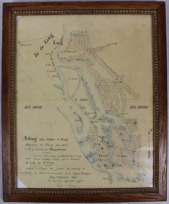
1893ref. 31781Kong, 30 septembre 1893 Carte dessinée en couleurs 42,5 X 35 dans son cadre argenté. Bel état. Rare croquis exploratoire de ce secteur des Quatre mille îles du Mékong dont le franchissement nécessitera la construction d’une ligne de chemin de fer. L’officier reporte l’itinéraire de sa colonne de Hach-Ki-Koaï à Kong [Khong] et les anciens ouvrages édifiés par les Siamois.
260 x 380 mm. Engraved map mounted on cloth. Matted. Early map of Russian Armenia, featuring the eight provinces annexed by Russia in 1828, with key in French and Russian. Following Qajar Iran's defeat in the Russo-Persian War (1826-28) and the 1828 Treaty of Turkmenchay, Eastern Armenia was, among other territories, ceded to Russia. It would remain part of the Russian Empire until its collapse in 1917. - Printed at the Mechitarists' press on the island of San Lazzaro, Venice, where the Armenian order had set up their colony in 1717. They began their editorial activities as early as the following year and set up a printing press, famed for its typographic capability in many languages and alphabets, in 1789. - Very rare; catalogues list a single specimen in the British Library. OCLC 556404373.
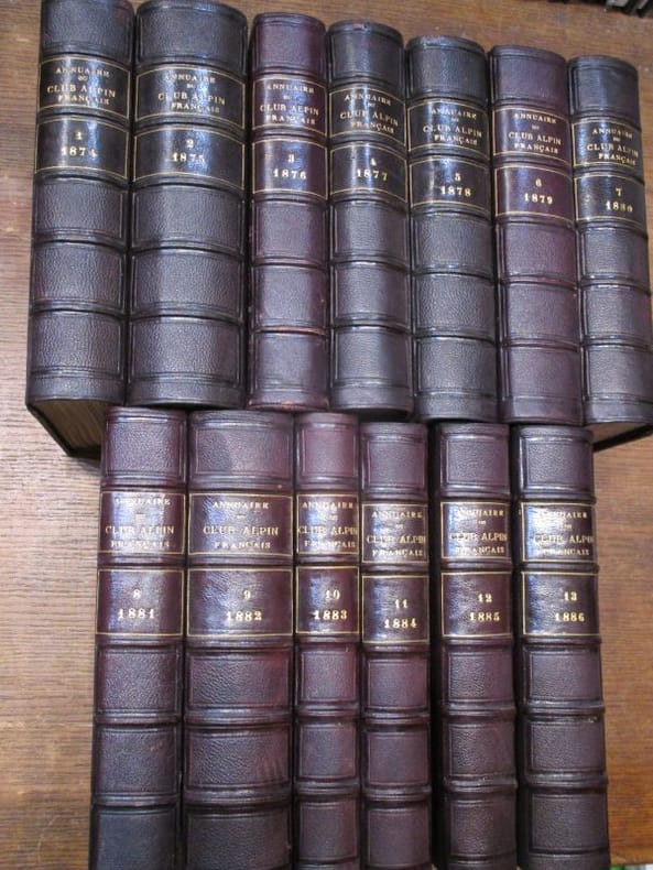
ref. 117927hachette 1875 - 1899 27 in-8 demi-chagrin Paris, Au siège social du Club Alpin Français, Librairie Hachette, 1875-1899, 27 volumes in-8 de 140x230 mm environ, environ 600 pages par volume, quelques gravures in-texte, nombreux hors-texte et planches dépliantes. Collationnés : quelques erreurs de placement des hors-textes mais il ne manque qu'une seule planche (Année 1874, manque une carte topographique du Mont Pelvoux), en revanche présence de figures, cartes et panoramas supplémentaires, non annoncés. Demi-chagrin aubergine, plats papier imitation chagrin assortis, dos à cinq nerfs portant titres et tomaisons dorées, gardes marbrées. Quelques marques sur le cuir, des frottements sur les dos et les plats, tranches piquées, un défaut d'impression p.68 de l'année 1899, un petit trou p.79 de la table, sinon intérieur propre, certains cahiers non coupés, bon état général, rare et bel ensemble. ATTENTION POUR EXPÉDITION : PLUS DE 35 kg.
1986ref. ABC_49503King of Prussia Pennsylvania USA: Franklin Maps 1986. Folded. Ca. 87.5 x 114 cm. Three maps printed in colour on one large sheet of paper: one large overview map of the Middle East also showing parts of the Soviet Union North Africa and Turkey on one side and the "title page" with two smaller maps - one of Iraq and one of the countries around the Persian Gulf - on the other side. Colourful declassified CIA map of the Middle East probably depicting the situation between January 1972 when the United Arab Emirates UAE was founded and 21 August 1974 when the Treaty of Jeddah was signed. On the present map the UAE still shares a direct border with Qatar which was no longer the case after the treaty as it had to cede territory to Saudi Arabia. The map was likely drawn and used by the CIA because of the tensions in the region but declassified a decade later. It is not dated but must have been published after 1986 as the publisher changed its name from Franklin Survey Company to Franklin Maps and moved its offices from Philadelphia to King of Prussia PA in 1986.With a contemporary ownership annotation "Betty Vomer Meurade ". The map is folded with small holes in some of the areas where two folds meet. Otherwise in good condition.l Cf. for the publisher: Tedyffrin Easstown Historical Society History Quarterly 42-3 Summer 2005 pp. 82-94 online via: https://www.tehistory.org/hqda/html/v42/v42n3p082.html. Franklin Maps, unknown
Colour-printed map, ca. 750 x 610mm. Scale: 1:1,000,000. Rare 5th GSGS edition of this map of Qatar, Bahrain, and Ras Tanura in Saudi Arabia, as part of the International Map of the World series. Depicts Saudi Arabia from As Saffaniyah in the North over Hofuf, to Hidiba in the South. Shows boundaries, highways and roads, railways, airports, rivers and water features, and other details. - Two small brown spots to the image and a nick to the top edge, some creasing near margins. OCLC 34907145.
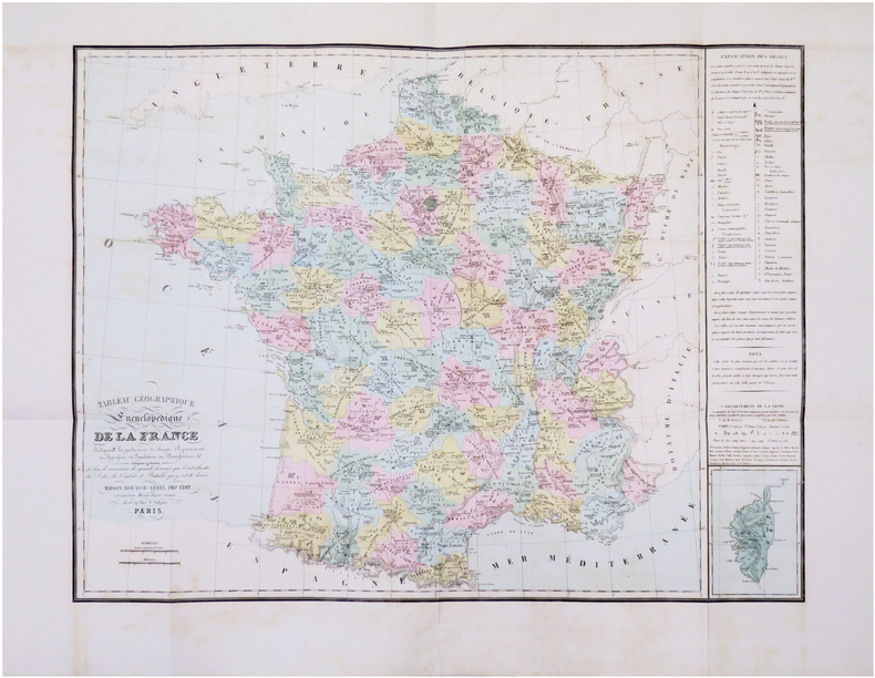
1863ref. LBW-8436Paris, Maison Bouasse Lebel & Anc.nne M.on Basset réunies, [1863]. Ensemble de deux planches, 490 x 605 mm et 470 x 590 mm.
1750ref. LBW-4159[circa 1750]. En 2 feuilles jointes de 0,39 x 1,12 m.
1600Pianta archeologica a proiezione verticale con alzato, priva di data ed indicazioni editoriali. Si tratta di una fedele replica della pianta archeologica pubblicata da Nicolas van Aelst ed incisa da Ambrogio Brambilla, probabilmente edita a Roma tra la fine del ’500 e l’inizio del secolo successivo. Caldana sottolinea che “l’anonimo incisore è bravo quasi quanto l’autore dell’originale, le differenze sono minime, salvo le misure che nella copia sono leggermente inferiori; imitata persino la calligrafia dei toponimi meno che per alcuni, scritti in lettere maiuscole”. Dal punto di vista editoriale, l’esistenza di un esemplare con l’imprint di Gian Giacomo de Rossi, descritto da Hülsen (1933) nella raccolta del castello di Wolfegg, certifica che il rame fosse in possesso della tipografia romana. Sempre Caldana sostiene, ma senza fondamento, che la pianta fu fatta incidere da Giuseppe de Rossi nel 1637, in occasione della ristampa della pianta di Roma moderna. Crediamo invece che il rame sia più antico e che, come per molte lastre del secolo precedente, solo successivamente venga acquisito dalla tipografia de Rossi. In alto, lungo il bordo superiore, è inciso il titolo: ANTIQUAE URBIS PERFECTA ET NOVA DELINEATIO. Lungo il margine inferiore si trova una legenda numerica di 90 rimandi a luoghi e monumenti notabili distribuita, su quindici colonne. Orientazione nei quattro lati al centro con il nome dei punti cardinali: SEPTENTRIO, MERIDIES, OCCIDENS, ORIENS il nord è a sinistra. Nella tavola sono presenti ulteriori indicazioni toponomastiche. Acquaforte e bulino, privo di indicazioni editoriali. Esemplare nel primo stato di due, avanti l'indirizzo di De Rossi. Magnifico esemplare di questa rara pianta archeologica di Roma. In perfetto stato di conservazione. Bibliografia Bifolco-Ronca, Cartografia e topografia italiana del XVI secolo, p. 2368, tav. 1217, I/II; Caldana (2013): n. I.28; Hülsen (1915): pp. 55-56, VIIIc, n. 41; Hülsen (1933): p. 106, VIIIc, n. 41a; Scaccia Scarafoni (1939): p. 28, n. 24. Archaeological map with vertical projection with elevation, without date and printing details. It is a faithful replica of the map published by Nicolas van Aelst and engraved by Ambrogio Brambilla, probably published in Rome between the end of the 16th century and the beginning of the following century. Caldana underlines that "the anonymous engraver is almost as good as the author of the original, the differences are minimal, except for the measurements that in the copy are slightly smaller; even the calligraphy of the place names is imitated, less so for some, written in capital letters". From the editorial point of view, the existence of a copy with the imprint of Gian Giacomo de Rossi, described by Hülsen (1933) in the collection of Wolfegg Castle, certifies that the copper was in the possession of the Roman printing house. Caldana also maintains, but without foundation, that the map was engraved by Giuseppe de Rossi in 1637, on the occasion of the reprinting of the modern Rome map. We believe instead that the copper is older and that, as for many plates of the previous century, it was only later acquired by de Rossi's printing house. At the top, along the upper edge, is engraved the title: ANTIQUAE URBIS PERFECTA ET NOVA DELINEATIO. Along the lower margin there is a numerical legend of 90 references to notable places and monuments distributed on fifteen columns. Orientation on the four sides in the centre with the name of the cardinal points: SEPTENTRIO, MERIDIES, OCCIDENS, ORIENS the north is on the left. In the map there are further toponymic indications. Etching and engraving; exemple in the first state of two, before the De Rossi's address. Magnificent example of this rare archaeological map of Rome. In perfect state of conservation. Literature Bifolco-Ronca, Cartografia e topografia italiana del XVI secolo, p. 2368, tav. 1217, I/II; Caldana (2013): n. I.28; Hülsen (1915): pp. 55-56, VIIIc, n. 41; Hülsen (1933): p. 106, VIIIc, n. 41a; Scaccia Scarafoni (1939): p. 28, n. 24.
1700ref. LBW-3460[début du XVIIIe siècle]. 370 x 475 mm.
1735ref. LBW-2732[Paris, 1735]. 421 x 529 mm.
1775ref. LBW-643[1775-1781]. 662 x 481 mm.
1618ref. LBW-7680[Paris, Nicolas Buon], 1616 [1618]. 310 x 405 mm.
1720Panorama di Roma preso dal Gianicolo, firmata "Aveline fecit et excudit", edita a Parigi presso Charpentier."La veduta panoramica di Roma è presa dal Gianicolo e raffigura sulla sinistra il complesso del Vaticano e Castel Sant'Angelo. AL centro il fitto tessuto urbano cittadino dal quale emergono torri e cupole non sempre riconoscibili. L'intera veduta è infatti condotta con grafia molto essenziale e immediata di non grande impatto visivo" (cfr. Barbara Jatta in "Roma Veduta" p. 193). La veduta viene attribuita dalla Jatta - soprattutto per motivi temporali legati all'editore Charpentier crediamo - ad Antoine Aveline "il giovane". La famiglia Aveline, appartenente alla borghesia parigina, lavorò per oltre due secoli nel campo artistico ed incisorio; visto il ripetersi dei nomi di battesimo e il fatto che apponevano la generica firma Aveline, si è spesso fatta confusione fra i sui vari componenti. Tuttavia l'imprint Aveline fecit et excudit lascia credere che l'edizione Charpentier sia il secondo stato (di tre) della lastra, che in seguito fu ristampata anche da Chereau. Quindi riteniamo più probabile - anche per lo stile grafico - attribuirla a Pierre Aveline e la data di stampa posta a circa il 1720 circa. Particolare curioso, la veduta non include il Colosseo. Nel margine inferiore, legenda di 47 numeri. Acquaforte, con ampli margini, consueta piega centrale, sporadiche e piccole ossidazioni nei margini bianchi nel complesso in ottimo stato di conservazione. Panorama of Rome taken from the Janiculum Hill, signed "Aveline fecit et excudit", published in Paris at Charpentier. The panoramic view of Rome is taken from the Janiculum Hill and depicts on the left the Vatican complex and Castel Sant'Angelo. At the center the dense urban fabric from which towers and domes emerge not always recognizable. The entire view is in fact conducted with very essential and immediate handwriting of not great visual impact (see Barbara Jatta in "Roma Veduta" p. 193). The view is attributed by Jatta to Antoine Aveline "the young". The Aveline family worked for over two centuries in the field of art and engraving; given the repetition of first names and the fact that they affixed the generic signature Aveline, there has often been confusion among the various members. However, the imprint Aveline fecit et excudit leads us to believe that the Charpentier edition is the second state (of three) of the plate, which was later reprinted also by Chereau. Therefore we think it more probable - also for the graphic style - to attribute it to Pierre Aveline and the date of printing placed at about 1720. Curious detail: the view does not include the Colosseum. In the lower margin, legend of 47 numbers. Etching, with wide margins, usual central fold, sporadic and small oxidations in the white margins, on the whole in very good condition. Arrigoni Bertarelli (1939): p. 20, n. 154; B. Jatta in "Roma Veduta", p. 193, n. 45; Marigiiani (2007), p. 262, n. 175.
1694ref. LBW-5226Paris, chez l'autheur, [circa 1694]. 447 x 541 mm.
1829ref. LBW-6825New York, H.I. Megarey, [1829]. 560 x 430 mm.
1650ref. LBW-1908circa 1650. 353 x 483 mm.
1876ref. LBW-78641876. En 24 sections montées sur toile et repliées, formant une carte de 0,88 x 1,16 m, montée dans une reliure éditeur de percaline rouge, avec titre en lettres dorées ""Souvenir des Pyrénées. Carte de la vallée d'Ossau, Eaux-Bonnes, Eaux-Chaudes, par J B Bonnecase géomètre"", et armoiries de la vallée d'Ossau sur le premier plat.
1867ref. LBW-8464Paris, Maison Bouasse-Lebel, Imp. Édit. et ancienne Maison Basset réunies, [1867]. 593 x 778 mm.
1950ref. LBW-8621Rabat, Éditions Africaines Perceval, [1950]. Lithographie en couleurs de 635 x 985 mm ; encadrée sous verre.
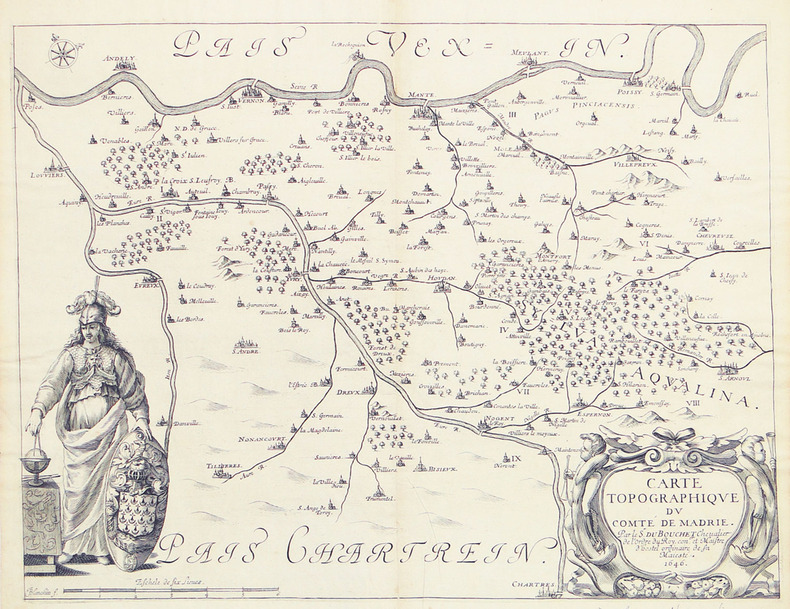
1646ref. LBW-27941646. 315 x 412 mm.
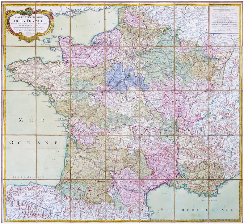
1779ref. LBW-6832Paris, Bourgoin, 1779. En 35 sections montées sur toile et pliées, formant une carte de 980x 990 mm ; étiquette au dos de l'éditeur Seguin père, artificier du roi et éditeur de la carte de Cassini ; sous étui de papier bleu avec dentelle dorée d'encadrement.
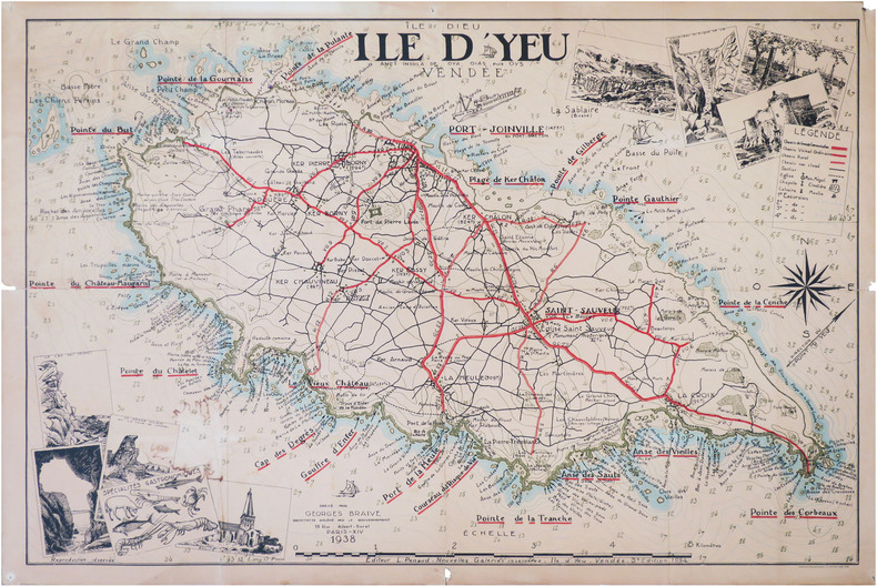
1938ref. LBW-8820Île d'Yeu, L. Penaud - Nouvelles Galeries Insulaires, 1938-1954. 0,71 x 1,05 m.