National Geographic MapsBiblio.com
12.365 resultados
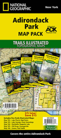
2023ref. DADAX1597752258National Geographic 2023-01-01. 2023. map. New. 4.25x0.50x9.25. Buy with confidence. Excellent Customer Service & Return policy. National Geographic unknown
2005ref. DADAX159775000XNATIONAL GEOGRAPHIC 2005-05-01. paperback. New. 11.25x1.00x14.50. Buy with confidence. Excellent Customer Service & Return policy. NATIONAL GEOGRAPHIC paperback
ref. SONG1581741316Brand: Thomas Brothers Maps 0000-00-00. spiral_bound. Used: Good. 9.25x0.75x11.00. Buy with confidence. Excellent Customer Service & Return policy. Brand: Thomas Brothers Maps unknown
1914ref. CJSBM18X1914. Hardcover. Fair. . These are a collection of First World War maps from the 1920s and 30s detailing battles and tactics.They are associated with similar volumes of text but would befit anyone who has an appetite for old war maps war history or those seeking original research.Some are unopened from their original paper clasps and are in almost pristine condition save a bit of fading and the odd library sticker mark.A very rare find.Ex private library stock so expect some library markings and sparse annotations in the text. Binder in good to very good condition with only a few signs of wear considering age. All maps present. Some yellowing of pages and some bleaching on spine. Foxing on some maps and boxes. Please note that the image above is a stock photo and may differ somewhat to that of the item delivered. 1918 variant includes both text AND maps.Many thanks for looking. hardcover
1914ref. CJSBM16K1914. Hardcover. Fair. . These are a collection of First World War maps from the 1920s and 30s detailing battles and tactics.They are associated with similar volumes of text but would befit anyone who has an appetite for old war maps war history or those seeking original research.Some are unopened from their original paper clasps and are in almost pristine condition save a bit of fading and the odd library sticker mark.A very rare find.Ex private library stock so expect some library markings and sparse annotations in the text. Binder in good to very good condition with only a few signs of wear considering age. All maps present. Some yellowing of pages and some bleaching on spine. Foxing on some maps and boxes. Please note that the image above is a stock photo and may differ somewhat to that of the item delivered. 1918 variant includes both text AND maps.Many thanks for looking. hardcover
1986ref. ABC_49503King of Prussia Pennsylvania USA: Franklin Maps 1986. Folded. Ca. 87.5 x 114 cm. Three maps printed in colour on one large sheet of paper: one large overview map of the Middle East also showing parts of the Soviet Union North Africa and Turkey on one side and the "title page" with two smaller maps - one of Iraq and one of the countries around the Persian Gulf - on the other side. Colourful declassified CIA map of the Middle East probably depicting the situation between January 1972 when the United Arab Emirates UAE was founded and 21 August 1974 when the Treaty of Jeddah was signed. On the present map the UAE still shares a direct border with Qatar which was no longer the case after the treaty as it had to cede territory to Saudi Arabia. The map was likely drawn and used by the CIA because of the tensions in the region but declassified a decade later. It is not dated but must have been published after 1986 as the publisher changed its name from Franklin Survey Company to Franklin Maps and moved its offices from Philadelphia to King of Prussia PA in 1986.With a contemporary ownership annotation "Betty Vomer Meurade ". The map is folded with small holes in some of the areas where two folds meet. Otherwise in good condition.l Cf. for the publisher: Tedyffrin Easstown Historical Society History Quarterly 42-3 Summer 2005 pp. 82-94 online via: https://www.tehistory.org/hqda/html/v42/v42n3p082.html. Franklin Maps, unknown
2007ref. USD_9781845876463Compass Maps Ltd 2007. 1ST. Hardcover. Used - Like New/Used - Like New. _ Compass Maps Ltd hardcover
ref. GOR015144698Paperback. Acceptable. paperback
1955ref. 20488AB1955. Madrid 1955 36 : 26 cm. X pages 1 leaf 378 pages 1 leaf 241 facsimiles of maps some folded and titles. Original half calftwo back lables. One of 500 numbered copies on special paper. the illustrations are made in Photogravure a high-quality engraving technique that uses light to transfer a photographic image onto a plate traditionally copper but now often photopolymer to create deep reliefs that reproduce soft tones and fine details when printed on paper. It is ideal for artistic reproductions and precision applications on various materials combining craftsmanship with digital technology. unknown
1959ref. 20489AB1959. Madrid 1959 36 : 26 cm. 129 pages 1 leaf with facsimiles of maps some folded and titles. Original half calftwo back lables. One of 500 numbered copies on special paper. The illustrations are made in Photogravure a high-quality engraving technique that uses light to transfer a photographic image onto a plate traditionally copper but now often photopolymer to create deep reliefs that reproduce soft tones and fine details when printed on paper. It is ideal for artistic reproductions and precision applications on various materials combining craftsmanship with digital technology. unknown
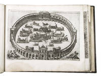
1550ref. ABC_49514Italy 1550. 17th-century gold-tooled brown calf sewn on 6 supports with the corresponding raised bands on the spine a red morocco title label on the spine with the title "Novissima urbis Romae descriptio" lettered in gold gold-tooled board edges. Large oblong folio ca. 59 x 42.3 cm. With 76 full-page engravings and 12 full-page etchings. Remarkable album with 77 beautiful examples of 16th-century Italian cartography all in very fine dark impressions. The collection includes plans of important Italian towns such as Rome Venice Genoa Naples Milan Florence Palermo Siena Bologna and Pisa as well as detailed views of individual buildings and monuments in Rome. They are engraved by several cartographers from the school of Antonio Lafreri 1512-1577 primarily Claudio Duchetti d. 1585 Matteo Florimi d. 1613 and Lafreri himself. Florimi's works are among the rarest of the Lafreri school map makers especially his Siena imprints of which several have here been included.In the middle of the 16th century Italy was the centre of map production and distribution in Europe. This industry primarily took place in Venice and Rome. The most notable of the publishers in Rome was Lafreri. His most important and most popular work is the Speculum Romanae magnificentiae a collection of plans an views of Rome's monuments; no two copies of the Speculum are the same. The present collection contains more than thirty plates from the Speculum. When Lafreri died his nephew Claudio Duchetti inherited the company. He continued to produce the Speculum plates but often made small adjustments and signed his own name at the bottom. Most of the Speculum plates in the present album are by Duchetti. After his death the copperplates were sold to other publishers such as Giovanni Orlandi before 1590-after 1640 who reissued them. The majority of the plates in the present album were printed by Orlandi in 1602.The album further contains 32 engraved city plans mostly of Italian towns although a few foreign cities are also included; one of the rarest is the view of Moscow which is also included here. The collection ends with a incomplete series of 11 etchings of landscapes and biblical scenes.A list of contents is available upon request.With the bookplate of Louis Routy de Charodon seigneur de Grésigny and Charodon 1710-1794 on the front pastedown and remnants of another bookplate above. The boards are somewhat scratched and stained the spine shows traces of use the edges of the boards have been professionally restored and the boards have been lengthened to fit the maps. The maps are slightly browned some are slightly foxed the first few maps have been mounted onto 17th-century leaves the longer maps are somewhat soiled on the fore edge three maps are restored at the fore edge and one at the bottom edge some maps have been cut slightly short. Otherwise in good condition.l Cf. Parshall P. "Antonio Lafreri's "Speculum Romanae magnificentiae"" in: Print Quarterly vol. 23 1 2006 pp. 3-28. hardcover
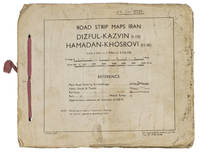
1944ref. ABC_4794483 Rep Group. I.E." 1944. Original beige printed paper wrappers side stichted by hand through 3 holes with a reddish pink cloth ribbon. Oblong 21 x 255 cm. With 1 index map and 16 numbered folding strip maps. Exceptionally rare collection of folded strip maps of roads in Western Iran which was very likely meant for military use during the Second World War. The abbreviated inscription on the front wrapper possibly stands for "24th brigade branch transportation office" though it is unknown which 24th brigade this would have been. The maps were originally printed on quarter inch sheets in 1942 and have been significantly enlarged for this edition to a scale of 1 inch to 2 miles. We have not been able to trace any other copies of either the first or second edition of this work anywhere.With an owner's inscription on the front wrapper. The maps and back wrapper have been reinforced with bookbinder's gauze. The wrappers are somewhat soiled creased and the edges are somewhat frayed. The maps have slightly browned and the index map has a small brown stain in the lower outer corner without affecting the image. Otherwise in good condition. 83 Rep Group. I.E.", hardcover
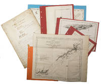
1755ref. ABC_474521755. Manuscript of 24 pages 6 printed maps on cardboard. This wonderful logbook details the journey of a French captain from Manila to the Maluku Islands in todays Indonesia. The journey took place during the months of March to May of 1755. The captain of the ship recounted with great detail the events of every day of the journey with detailed daily accounts of the weather winds manoeuvres of the ship its departures anchorages and precise coordinates at every point of the journey. The captain furthermore had a keen eye for the geographical and nautical details along the journey. He recounted the exact locations of for example sandbanks and bays where ships and their crews can take provisions and fresh water. The accounts are detailed and captivating: "After our boats were back on board we set sail . in the afternoon to moor under the old Portuguese fort on the Solor island Indonesia the winds for the tide were fresh at 1:34 a.m. . sand and gravel and then I went back to mooring. The pavilion of the fort . the village is under the said fort at 3 cables from us .". The captain goes on to describe the geographical features of the islands as well as other places en route with great detail. Curiously we find inscriptions in Spanish and the names of one don Phelipe Qui who describes himself as el piloto and one Padre Don Estevan de Melo. The latter might be identical with Don Estevan Roxas y Melo a native of Lima Peru and secretary to the Archbishop of Manila Rodriguez since 1736. Roxas y Melo was part of the 1751 reconstruction of the Cathedral of Manila working under the auspice of the Italian architect Juan de Uguccioni.The logbook comes with six printed maps partly illustrating the journey of the captain pasted on contemporary cardboard. They depict the Bay of Sulavesi with the city of Bantang Pitcairn the coast of New Guinea the coast of Queensland the Santa Cruz Islands in the present-day Solomon Islands and Alejandro Selkirk Island. The plates stem from the French translation of James Hawkesworths An Account of the Voyages Hawkesworth Relation des voyages entrepris par ordre de sa Majesté Britannique actuellement regnante; pour faire des découvertes dans l'hemisphère meridional Paris 1774.Some holes on the first sheet not affecting the text. Small water damage some slighlty affecting the text. Remnants of seals on last page. Otherwise in good condition. unknown
ref. SONG0008309388Nicholson 2019-05-01. New editionNew edition. spiral_bound. Used: Good. 5.75x0.40x8.25. Buy with confidence. Excellent Customer Service & Return policy. Nicholson unknown
ref. DADAX1925625036HEMA 2018-12-20. 6th edition. spiral_bound. New. 8.74x0.59x11.77. Buy with confidence. Excellent Customer Service & Return policy. HEMA unknown
ref. DADAX0008272700Collins 2018-10-01. New editionNew edition. spiral_bound. New. 8.25x0.60x11.75. Buy with confidence. Excellent Customer Service & Return policy. Collins unknown
1942ref. L7VCIV4N38L2UK Government: Survey Directorate HQ Tenth Army / Indian Field Survey Co. 1942. 42 chromolithographed topographic maps of parts of Iraq made from aerial photographs during World War II on a scale of 1:100000 and 1:253440 a quarter-inch to a mile. 68 x 50.5 cm & 60 x 47 cm. An impressive collection of Iraq maps compiled from the most current aerial photography and produced by the British Army for use in the Persian theatre of war during World War II. The cities and regions covered include Ain Sifni Aqra Tel Afar Salman Pak BaQuba Sumaika Penjwin Halabja Baghdad Kirkuk Dulaim Erbil and Mosul divisions.Previously folded. Generally well-preserved. Survey Directorate HQ Tenth Army / Indian Field Survey Co., unknown
ref. 0528995715.Gspiral_bound. Good. Access codes and supplements are not guaranteed with used items. May be an ex-library book. unknown
2023ref. SONG159775336XNational Geographic 2023-01-01. 2023. map. Used: Good. 4.25x0.30x9.25. Buy with confidence. Excellent Customer Service & Return policy. National Geographic unknown
2021ref. DADAX1597753998National Geographic 2021-03-20. 2021. map. New. 4.00x0.30x7.50. Buy with confidence. Excellent Customer Service & Return policy. National Geographic unknown
2023ref. DADAX1597752797Natl Geographic Society Maps 2023-01-01. 2023. map. New. 4.25x0.20x9.25. Buy with confidence. Excellent Customer Service & Return policy. Natl Geographic Society Maps unknown
ref. 156695150X.Gmap. Good. Access codes and supplements are not guaranteed with used items. May be an ex-library book. unknown
ref. 1553410882.Gmap. Good. Access codes and supplements are not guaranteed with used items. May be an ex-library book. unknown
1817ref. 11715AB1817. Vienna Geistinger 1817. 71 : 148 cm. Manyfolded contemporary coloured engraving. Contemporary mounted on linen. Interesting historical map giving an broad overview of the development of the history from ancient times until the 18th century. Friedrich Strass 1766-1846 was a teacher at the monastery of Berge near Magdeburg. His "Strom der Zeiten" got a great populariety and was admired also from the foreign countries. - As mostly browned. unknown
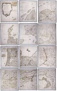
1790ref. 23331Paris: Jean A. Dezauche successor of Delisle & Buache 1790. Each map in contemporary box with green morocco spines with titles 'Hollande' and 'Zelande' lettered in gold and green paper sides with ornamental gilt borders along the edges. Together ca. 230 x 155 cm. Engraved and etched map hand-coloured in outlines the cities coloured red. Printed on 12 sheets each divided into 4 segments numbered 1-48. The 48 segments are mounted on contemporary linen and folded the edges reinforced with blue ribbon. With: 2 LE ROUGE George Louis. Topographie de la Zelande en 9 feuilles traduitte de l'Hollandois. Second title: Partie orientale de la Flandre Hollandoise Paris Jean A. Dezauche 1790. Large engraved and etched wall map hand-coloured in outlines the cities coloured in red printed on 9 numbered sheets each divided in 4 segments numbered 1-36 size each sheet 48 x 56.5 cm; the 36 segments are mounted on contemporary linen the edges reinforced with blue ribbon. Two large complementary wall maps of the seven Dutch provinces covering 1 the provinces Holland Utrecht Friesland Groningen Overijssel and Gelderland and a part of Brabant bound to the line Steenbergen - Roermond and 2 Zeeland. Both are rare especially the map of Zeeland. They were the first maps of the Netherlands on such a large scale mostly about 1:105000 but with some eastern regions squeezed in at about 1:140000. Fully assembled the map of Hollande would measure about 230 x 155 cm and the map of Zeeland about 143 x 175 cm.Originally published in 1748 Le Rouge's 21 plates for the two maps were revised for publication in a second state by Jean Crepy ca. 1770. The map in its present third state was revised and published by Jean A. Dezauche in 1790. On the back of each sheet is an engraved label with the sheet number and the name of the region covered added in manuscript.From the library of Marco-Antonio III 1730-1800 Prince Borghese: on each box is the engraved armorial bookplate of the library of this Borghese Prince. Marc-Antonio's son Camillo Filippo Ludovico 1775-1832 married Napoleon's sister in 1803.Boxes are slightly scuffed. A remarkable copy with a princely provenance.l De Vries 'Een Franse wandkaart van Nederland uit 1748' in: Caert-Thresoor 1 1982 pp. 24-29; cf. BMC Printed maps VIII cols. 967 & 969 1748 edition; not in Donkersloot-de Vrij; Oehme A French world atlas in: Imago mundi 25 1971 pp. 55-64 on Le Rouge. Jean A. Dezauche, successor of Delisle & Buache, unknown