12.228 resultados
1941ref. 48041Minneapolis MN: Global Map Co. ca. 1941. Oblong folio 22.5 x 11.25 in. Two rotating wheels each showing hemisphere projection maps which are attached to a thick brown base w/ printed labels on front cover original rivets still present printed paper label and instructions on verso some rubbing & edgewear minor foxing & scuffing still a G exemplar. First edition of this fascinating and scarce global map which allows the user to view steamship or airline distance routes as well as the principal railroads. The global map was designed so that opposite halves of the earth’s surface could be rotated and synchronized enabling continuous and accurate spherical relationships across any point on the rotating maps. The label on the back lists the area in square miles and population totals of the world. The map is dated to around 1941 because of the inclusion of Vichy France the government allowed by the Nazi occupiers after the fall of France in 1940. Global Map Co., unknown
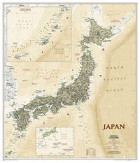
2012ref. SONG1597755206National Geographic Maps 2012-05-31. 2012. paperback. Used: Good. 10.50x0.25x14.75. Buy with confidence. Excellent Customer Service & Return policy. National Geographic Maps paperback

2000ref. mon0000515418Philip's 01/10/2012 00:00:01. spiral_bound. Very Good. 1.5988 in x 26.1801 in x 19.1854 in. Philip's unknown
2021ref. 106916Neuchâtel : Editions Livreo-Alphil 2021. reliure d'éditeur. WALTER François textes. - ZANOLI Marco cartes.Atlas historique de la Suisse. L'histoire suisse en cartes. 2e Edition. Neuchâtel Editions Livreo-Alphil2021 245x285mm 195 pages cartes en couleurs reliure d'éditeur. Format oblong. Très bel exemplaire. No hidden customs fees for orders shipped to the U.S.A with a value of up to 800 USD PDDP shipping we pay the VAT in advance Editions Livreo-Alphil unknown
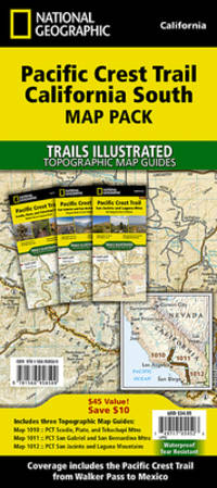
ref. 159775000X.Gpaperback. Good. Access codes and supplements are not guaranteed with used items. May be an ex-library book. paperback
ref. 1886705232.Gmap. Good. Access codes and supplements are not guaranteed with used items. May be an ex-library book. unknown
ref. 1886705291.Gmap. Good. Access codes and supplements are not guaranteed with used items. May be an ex-library book. unknown
ref. 1597754978.Gmap. Good. Access codes and supplements are not guaranteed with used items. May be an ex-library book. unknown
ref. 1566958504.Gmap. Good. Access codes and supplements are not guaranteed with used items. May be an ex-library book. unknown
ref. 62249Bielefeld Velhagen & Klasing 1928. . Gering berieben sonst gutes Exemplar Bielefeld, Velhagen & Klasing, 1928. unknown
ref. 58305Hamburg Deutsche Verlags-Gesellschaft D.V.G. 1912. . Außentitel "Pharus Atlas deutscher Städte". - Aachen Berlin Bremen Breslau Coblenz Cöln a. Rh. Darmstadt Dresden Duisburg Düsseldorf Frankfurt a.M. Hamburg Hannover Kiel Leipzig Lübeck Magdeburg München Stettin Stuttgart sowie Brüssel London Paris Wien. Mit illustrierten Bäder- und Kurort-Anzeigen und Führer von Heidelberg Hildesheim Osnabrück und Rendsburg von diesen Städten keine Pläne vorgesehen sowie internationalem Hotel-Register und einem Mitgliederverzeichnis des Internationalen Möbel-Transport-Verbandes. Mit einem Sonderanhang "Schweiz". Besonders interessant durch die zahlreichen schön gestalteten Anzeigen der Zeit viele davon ganzseitig. - Berieben wenig bestoßen innen nur vereinzelt etwas fleckig wenige Blätter eingerissen 1 Blatt m. großem Einriß. Hamburg, Deutsche Verlags-Gesellschaft D.V.G. 1912]. unknown
ref. 52158Berlin Gebr. Mann 1994. . Von den Karten primitiver Völker bis ins 18. Jhdt. Mit Erläuterungen zu den Abbildungen von Heinrich Winter Anmerkungen Verzeichnis der abgebildeten Karten Verzeichnis der Kartographen u. ihrer Werke Literaturverzeichnis u. Sachregister mit ca. 1500 Stichworten. - Gutes sauberes Exempöar Berlin, Gebr. Mann, (1994). unknown
ref. 30692Hamburg 1927. . Möller/Tecke I 443. - Der Hrsg. war Inhaber der Hamburg-Stade-Altländer Linie. - Rücken wenig verblaßt. Gutes Exemplar. Hamburg, 1927. unknown
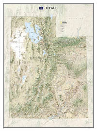
ref. A9781597752466Sheet map rolled. New. unknown
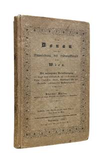
1844ref. 10175Regensburgh: Georg Joseph Manz 1844. First edition. 8vo xiv 205 1pp. Frontispiece with two engraved views and a large folding 6-section map at back. Original printed boards rubbed and soiled. Some foxing to the frontis and title scattered throughout and the map. Very good. Very attractive copy of this travel guide devoted to the stretch of the Danube from the Ludwig Canal to Vienna. This is a follow up to Müller's first work on the Danube issued in two volumes from 1839-1841 and covering the entire length of the river. Adalbert Müller 1802-1879 was a popular history and travel writer from Bavaria who wrote several works on the scenery and monuments in southern Germany during the steam travel age. Scarce. Georg Joseph Manz unknown
1928ref. 70989Chicago IL: Illinois Commerce Commission 1928. First edition. Mammoth lithograph map 52 ½ x 34 inches showing the railroad lines throughout the state and cities and towns they pas through with an inset detailed map of Chicago and vicinity 15 ¼ x 8 ½ inches and boxed panels for identification of the various railroads and "Passenger Terminals in Chicago" verso prints an index to counties and towns. Relatively uncommon OCLC locating 12 copies 6 in Illinois 4 in Wisconsin. Folded into 12mo printed light brown wrappers; several closed marginal tears into map one two-inch horizontal fold break else very good. Illinois Commerce Commission unknown
1889ref. 70991NY and Chicago: Rand McNally 1889. Engraved map 23 x 28 inches recto showing Lower Manhattan Brooklyn Jersey City and Hoboken lines for Manhattan Elevated Railway Suburban Rapid Transit Brooklyn Elevated R.R. and Kings Co. Elevated R.R. printed in dark red Bartholdi's Statue marked on Bedloes Island verso showing Upper Manhattan and printing a large more detailed inset of Lower Manhattan from Washington Square to the Battery 12 ½ x 13 inches and a boxed index to the street car lines 8 x 6 inches. Printed several times 1886-1889 this printing located in four copies on OCLC Newberry New York Public Boston Public Columbia. Folded into 16mo printed brown wrappers subtitle: Showing Street Car Lines Elevated Railroads Docks Ferries Steam Boat Lines etc.; some soiling several tiny corner fold breaks wrappers separated along the spine but still a good copy. Rand, McNally unknown
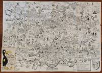
1954ref. BK0099Darmstadt Gemany: Stars and Stripes 1954. Folding pictorial map approximately 2 3¼ x 33 inches unfolded in original illustrated wrappers. OCLC 59284292. Near fine with some wear to wrappers. A wonderfully busy cartoon map of Frankfurt made for American servicemen stationed in Germany during the early Cold War. Byrel "Lefty" Burgess a career U.S. Army engineer and cartoonist fills the city with G.I.s military police beer halls historic buildings street jokes and visual gags while giving particular attention to the extensive American military presence in and around Frankfurt. American sites include barracks the 97th General Hospital WAC quarters Frankfurt High School the PX and residential areas occupied by servicemen and their families. The map ranges from Höchst and Bad Vilbel to Harheim and Offenbach mixing useful street information with caricatures and annotations. Burgess labels historic sites including the Saalhof Karmeliter Kloster Dominikaner Kloster and Drei Königs Kirche while military life and Frankfurt's drinking culture provide much of the humor. Along the upper edge references to places back home-including Texas Chicago Los Angeles Pike's Peak and the Rocky Mountains-reinforce the map's intended audience of Americans temporarily living overseas. Burgess served in the Army Corps of Engineers; he later produced a similarly humorous map of Seoul in 1957. OCLC 59284292. . Stars and Stripes unknown
2008ref. SBBIH-7MPYQLS6RK3CPhilip's 2008. hardcover. Acceptable. Please see the condition note after this for details if this is missing please consider Acceptable to mean poor quality that could include major staining water damage writing missing dustjacket etc etc. Our books are dispatched from a Yorkshire former cotton mill. We list via barcode/ISBN so please note that the images are stock images and may not be the exact copy you receive furthermore the details about edition and year might not be accurate as many publishers reuse the same ISBN for multiple editions and as we simply scan a barcode or enter an ISBN we do not check the validity of the edition data when listing. If you're looking for an exact edition please don't order at least not without checking with us first although we don't always have time to check. We aim to dispatch prompty the service used will depend on order value and book size. We can ship to most countries see our shipping policies. Payment is via Abe only. Philip's hardcover
2008ref. SBBIH-XL4NKQUGZS7WPhilip's 2008. hardcover. Good. Our good condition books are generally good for reading but not for gifting or collecting. They could have imperfections such as creasing fanning inscriptions margin notes yellowing staining on edge or cover or pages bumps scuffs etc etc sometimes multiple of these. It's a wide category that encompasses anything that isn't almost-new down to anything that is slightly better than poor. We would NOT recommend gifting Good books - these should be considered reading copies. Our books are dispatched from a Yorkshire former cotton mill. We list via barcode/ISBN so please note that the images are stock images and may not be the exact copy you receive furthermore the details about edition and year might not be accurate as many publishers reuse the same ISBN for multiple editions and as we simply scan a barcode or enter an ISBN we do not check the validity of the edition data when listing. If you're looking for an exact edition please don't order at least not without checking with us first although we don't always have time to check. We aim to dispatch prompty the service used will depend on order value and book size. We can ship to most countries see our shipping policies. Payment is via Abe only. Philip's hardcover
ref. mon0000499419Collins 07/02/2019 00:00:01. map. Very Good. 0.7994 in x 13.9894 in x 9.0931 in. Collins unknown
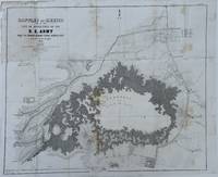
1848ref. 70172Washington 1848. Caption titles of the maps listed below in chronological order according to the date of the action described in the map; almost all bear the lithographer's slug. Several have tears in marginal folds and a few show some foxing one uniformly browned. All are serviceable examples almost all very good. 1 Sketch of the Actions Fought at San Pascal in Upper California between the Americans and Mexicans Dec. 6th & 7th 1846 caption title. 11 x 7 ¾ inches neatline. 2 Sketch of the Passage of the Rio San Gabriel Upper California by the Americas Discomfiting the Opposing Mex. Forces Jan 8th 1847 caption title. From a sketch by Lt. Emory. P. S. Duval Lith. Phil. 6 3/8 x 8 ¼ inches neatline. 3 Sketch of the Battle of Los Angeles Upper California Fought between the Americans and Mexicans Jany 9th 1847 caption title. From a sketch of Emory. 5 ¾ x 8 ¼ inches neatline. 4 Sketch Accompanying Col. Price's Despatch of 15th Feb. 1847 caption title. 8 1/8 x 5 ¾ inches neatline. 5 Linnard Capt. T. B. Plan of the Battle of Buena-Vista Fought February 22nd and 23rd 1847 caption title. Surveyed by Capt. Linnard & Lts. Pope & Franklin. Lith of P. S. Duval Phil. Notes in several margins. 16 ¼ x 20 inches neatline. 6 Sketch of the Battle of Sacramento Feb. 28th 1847 caption title. Printed note of the battle in lower margin. 12 ½ x 9 ½ inches neatline. 7 Coppee Lt. H. Survey of the Mexican Lines of Defence at Cerro Gordo and the Lines of Attack of the American Army under Major General Scott. On the 17th and 18th of April 1847 caption title. Surveyed by Major Turnbull and Capt. McClellan Top. Engineers. Lith of P. S. Duval Phil. 12 ¼ x 18 ¾ inches neatline. 8 Sketch Accompanying Col. Price's Despatch of 18 April 1847 caption title. P. S. Duval Lith Phil. 9 ½ x 11 ½ inches neatline. 9 Map of the California coast supplied title. June 19th 1847. Table in lower margin recording distances between towns and number of men available in each. Lith of P. S. Duval Phil. 14 ½ x 11 ¾ inches neatline. 10 Hardcastle Lt. Edmund. Battles of Mexico Line of Operations of the U. S. Army under the Command of Major General Winfield Scott on the 19th and 20th of August 1847 caption title. Surveyed by Major Turnbull Capt. McClellan and Lt. Hardcastle. Lith of P. S. Duval Phil. 23 ½ x 28 ½ inches neatline. 11 Hardcastle Lt. Edmund. Map of Genl. Worth's Operations on the 20th of Augt. 1847 caption title. Surveyed by Capt. Mason of Engineers and Lt. Hardcastle of Top. Engrs. 18 ½ x 30 ¾ inches neatline. 12 Hardcastle Lt. Edmund. Battle of Molino Del Re: Sketch of the Operations of the 1st Division United States Army under the Command of General Worth on the 8th Sept 1847 caption title. P.S. Duval Lith Phil. 19 3/8 x 12 ¼ inches neatline. 13 Hardcastle Lt. Edmund. Battles of Mexico Line of Operations of the U. S. Army under the Command of Major General Winfield Scott on the 8th 12th and 13th of September 1847 caption title. Surveyed by Major Turnbull Capt. McClellan and Lt. Hardcastle. Lith of P. S. Duval Phil. 28 x 21 ½ inches neatline . 14 Pemberton Bvt. Capt. J. C. Sketch of the Route of General Worth's Column from Chapultepec to the Alameda in the Attack upon the City of Mexico 13th & 14th September 1847 caption title. 14 ¼ x 10 ¼ inches neatline. Notes in lower margin. 15 Hardcastle Lt. Edmund. Map of the Valley of Mexico caption title. Lith of P. S. Duval. 12 x 16 ¾ inches neatline. Fold separations from edges. 16 Plan Accompanying Gen. Quitman's Report caption title. Duval's Lith Press. 13 x 17 ¾ inches neatline. Notes on the battle in lower margin. Some hand coloring. Two splits through margin at folds uniformly browned. 17 Sketch Accompanying Col. Price Despatch caption title. 9 ½ x 11 ½ inches neatline For the lot of 17 maps unknown
2024ref. x-0008696063Harpercollins Publishers 2024. Hardcover. New. 5th revised edition edition. 296 pages. 10.51x1.34x14.41 inches. Harpercollins Publishers hardcover
ref. 191451548X.Gmap. Good. Access codes and supplements are not guaranteed with used items. May be an ex-library book. unknown
ref. 0008445214.Gpaperback. Good. Access codes and supplements are not guaranteed with used items. May be an ex-library book. paperback