Compass Maps,Biblio.com
12.228 resultados
2007ref. USD_9781845876463Compass Maps Ltd 2007. 1ST. Hardcover. Used - Like New/Used - Like New. _ Compass Maps Ltd hardcover
ref. GOR015144698Paperback. Acceptable. paperback
1867ref. 63963New York NY: Taintor Brothers Merrill & Co. 758 Broadway c. 1867 ca. 1870. One large folio colour lithograph map sized 19.5 x 25 in. expertly mounted on linen decorative border neatline very faint dustsoiling marks from when originally folded very slight age toning at the former creases still a VG bright copy. Early printing of this splendid map depicting the five boroughs before their consolidation 30 years later in 1898 and offering a superb snapshot of the streets ferry lines waterways and Harbor. New York rapidly changed during the end of the 19th Century with tremendous influx of immigrants into the City and this map captures a pivotal time. Joseph Taintor 1835-1881 established this mapmaking firm with his brother Charles Taintor in 1866 and after 1868 when they changed the name of the firm they added their Uncle and entered the field of school book pubishing including the Analytical Readers series. See: David Rumsey Historical Map Collection City of New York No. 0973.003. Taintor Brothers, Merrill & Co., 758 Broadway, unknown
1936ref. 64218Chicago IL: The Pullman Company Poole Bros. Inc. Railroads of the United States Canada & Mexico 1936. 4to. 24 pp unpaginated. which folds out into giant oblong atlas folio pictorial colour map 32 x 27 in. on verso illustration borders and self-printed over on recto in orange & black w/ photo illustrations slight age toning slight shelfwear couple very slight closed tears still VG bright copy. First edition of this delightful promotional map issued by Pullman & the Poole Bros. for advocating rail travel from British Columbia to Central Mexico Atlantic to Pacific along the Gulf of Mexico and Baja California. The cartographer and cartoonist has filled each area of the map with charming little pictorial vignettes highlighting historic sites National Parks recreational sports and other leisure activities. The Pullman Sleeping Car diagram depicts sections with drawing-room two compartments and double bedrooms with promotional photos. Worldcat locates 4 copies Boston Pub Osher Map Lib. U of MO St. Louis SMU. The Pullman Company, Poole Bros., Inc.], Railroads of the United States, Canada & Mexico, unknown
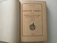
1955ref. 20488AB1955. Madrid 1955 36 : 26 cm. X pages 1 leaf 378 pages 1 leaf 241 facsimiles of maps some folded and titles. Original half calftwo back lables. One of 500 numbered copies on special paper. the illustrations are made in Photogravure a high-quality engraving technique that uses light to transfer a photographic image onto a plate traditionally copper but now often photopolymer to create deep reliefs that reproduce soft tones and fine details when printed on paper. It is ideal for artistic reproductions and precision applications on various materials combining craftsmanship with digital technology. unknown
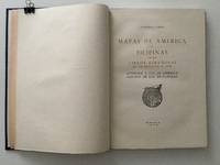
1959ref. 20489AB1959. Madrid 1959 36 : 26 cm. 129 pages 1 leaf with facsimiles of maps some folded and titles. Original half calftwo back lables. One of 500 numbered copies on special paper. The illustrations are made in Photogravure a high-quality engraving technique that uses light to transfer a photographic image onto a plate traditionally copper but now often photopolymer to create deep reliefs that reproduce soft tones and fine details when printed on paper. It is ideal for artistic reproductions and precision applications on various materials combining craftsmanship with digital technology. unknown
1944ref. 63900Washington D.C. & New York NY: Navy distribution by Educational Services Section; Prepared and distributed by Army Information Branch Army Service Forces 1944. Oblong double atlas folio. 47 x 34.5 in. One large double-sided colour lithograph map and panoramic cutaway view minor dustsoiling light age toning very minor creasing at folds still a NF copy. First edition of this splendid educational panorama with cutaway view of a World War II Balao-class submarine conning tower lines have been altered to prevent enemy identification when surfacing which improved upon the Gato class with higher yield-strength steel pressure hull skins and increased depth to 400 feet. The four inset maps on verso track the campaigns in the Philippine Islands with maps for Manila Bay and Cebu Leyte & Samar separately as well as maps tracking the Western Front progress in 1944 just 4 months after D-Day. Navy distribution by Educational Services Section; Prepared and distributed by Army Information Branch, Army Service Forces, unknown
1914ref. 63899Columbus OH: The Columbus Lithograph Co. Commissioners of Public Printing of Ohio 1914. One linen-backed dissected folding map. 8vo. 4 x 8.25 in. which folds out into 32 panel 28.5 x 32.5 in. colour lithograph map w/ illustration of steam locomotive and electric railway in lower right corner rail lines demarcated in colours very minor age toning at folds slight creasing edgewear still a NF copy preserved in the original black cloth portfolio case w/ “Ohio Railway Map” stamped in gilt on front cover. First edition thus of this Progressive Era Ohio railroad map demarcating the steam railroads such as the Baltimore & Ohio RR Cincinnati Georgetown & Portsmouth RR Detroit Toledo & Ironton Ry Erie Railroad New York Central Pennsylvania RR in colours with index below. Also included are identifying routes of the electric railways operating at the time along with telegraph companies express companies and even the Pullman Car Company. The Columbus Lithograph Co., Commissioners of Public Printing of Ohio, hardcover
1913ref. 63117New York: C.S. Hammond & Co. Schum Bros. Stationers and Printers 1913. 12mo. 3.5 x 7.5 double-sided colour lithograph map which folds out to 25.25 x 16.5 in. on 28 x 17.75 in. sheet very light dustsoiling slight shelfwear very slight age toning along the folds. Original printed gray-blue pocket portfolio folder blue lettering on recto & verso added affixed label of Schum Bros. over imprint minor age toning still a VG bright clean map. First edition thus of this very scarce Brass Era automobile travel map depicting Manhattan and portions of Long Island from Brooklyn across to Smithtown and Great River. Verso Map includes Long Island fro Great River up to Darlington across to Truman Beach and Bridgehampton with two inset maps: “Contination of North Shore” and “Continuation of South Shore” with “Good Roads” and “Fair Roads” differentiated as well as depiction of the Long Island Railway line and red dots tracing the electric interurban lines. As early as 1906 Hammond & Co. had produced a map for Good Roads enthusiasts and motorists but this updated issue documenting the improved roads was issued in 1913 and then regularly from 1914-1925. No copies in Worldcat. C.S. Hammond & Co., Schum Bros., Stationers and Printers, unknown
1844ref. 63111London: J.&C. Walker 9 Castle Street Published by Longman & Co. ca. 1844. 16mo. 3.5 x 5 in. folding out to 13.25 x 16.5 in. dissected 15-panel hand-coloured steel-engraved map linen-backed w/ 3 leaf folding population and mileage distance chart from Dublin by County mounted on front pastedown. Dark gray-green publisher’s cloth portfolio pocket binding decorative borders in blind gilt lettering stamped on front cover a NF copy. First edition thus of this very scarce dissected pocket map of Ireland published against the backdrop of the full impact of the Great Potato Famine which from 1841-1851 resulted in the diaspora and death of nearly 30% of the Irish population and as reflected in the mileage table mounted with the map the population in 1845 had already dropped from 8.2 million in 1841 to 7.7 million by 1844 and it would plummet further to below 6.5 million by 1851. The bulk of these emigrated to the United States Canada and the United Kingdom resulting in the fact that Ireland’s current population still resides below the high of 1841 and nearly 38 million Irish-Americans claim descent from the successive waves of migration much of which channeled through New York’s Lower East Side and the Bowery in the 19th-Century. John Walker 1787-1873 was a British mapmaker engraver lithographer hydrographer draughtsman and publisher publishing nautical charts and geographical maps with his brothers Charles and Alexander in their firm J.&C. Walker located at 9 Castle Street Holborn from 1841-1847 and moving to 37 Castle St. in 1848 where they remained to 1875. Much of their work was published under the auspices of the Society for the Diffusion of Useful Knowledge or S.D.U.K. Worldcat locates 1 copy Yale. J.&C. Walker, 9 Castle Street, Published by Longman & Co., hardcover
1910ref. 63113London & Norwich UK: Coleman & Co. Ltd. John Bartholomew & Co. Fletcher & Son Ltd. Litho ca. 1910. Sixteen parts. 64 pp unpaginated. double-page colour-lithograph maps throughout sized 9.5 x 7.2 when unfolded. Self-printed colour lithograph softcovers decorated title cover on front of each installment Wincarnis tonic advertisement in full colour on back cover edgewear thumbing minor chipping to a few fore-edges & corners still a G set. First edition thus of this uncommon and complete set of promotional maps for automobile travelers and bicyclists in Edwardian England whose drivers and riders were often fueled by the “delicious tonic and restorative recommended by over 8000 medical men.” The 16 maps featuring sections from London to Cornwall South Wales to Manchester and Lincolnshire to Yorkshire offered an accurate and compact set of travel maps documenting main roads secondary roads “other roads typically nearly impassable local lanes & livestock paths railways and rivers. Wincarnis was first introduced as a medicinal treatment in the Victorian era was a liqueur derived from a mix of secret herbs & spices meat extract malt extract infused with cloves nutmeg and citrus and although not openly marketed as alcoholic featured a significant 17-18% alcohol content. Therapeutic use was widely encouraged and severe motoring and bicycle accidents often included drivers and riders under the influence. Following the 1914 Parliamentary “Commission on Patent Medicines” investigation numerous changes and rules were changed regarding marketing and sales of such products as well as curtailing of hyping the “Restorative” properties. Worldcat locates 2 sets 1 undated - Hartley Library; 1 set misdated -- Wellcome; See: Drinking for Health: Proprietary Tonic Wines Chapter 10 Drinking in Victorian and Edwardian Britain: Beyond the Spectre of the Drunkard National Library of Medicine 2018. Coleman & Co., Ltd., John Bartholomew & Co., Fletcher & Son, Ltd. Litho, paperback
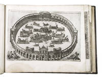
1550ref. ABC_49514Italy 1550. 17th-century gold-tooled brown calf sewn on 6 supports with the corresponding raised bands on the spine a red morocco title label on the spine with the title "Novissima urbis Romae descriptio" lettered in gold gold-tooled board edges. Large oblong folio ca. 59 x 42.3 cm. With 76 full-page engravings and 12 full-page etchings. Remarkable album with 77 beautiful examples of 16th-century Italian cartography all in very fine dark impressions. The collection includes plans of important Italian towns such as Rome Venice Genoa Naples Milan Florence Palermo Siena Bologna and Pisa as well as detailed views of individual buildings and monuments in Rome. They are engraved by several cartographers from the school of Antonio Lafreri 1512-1577 primarily Claudio Duchetti d. 1585 Matteo Florimi d. 1613 and Lafreri himself. Florimi's works are among the rarest of the Lafreri school map makers especially his Siena imprints of which several have here been included.In the middle of the 16th century Italy was the centre of map production and distribution in Europe. This industry primarily took place in Venice and Rome. The most notable of the publishers in Rome was Lafreri. His most important and most popular work is the Speculum Romanae magnificentiae a collection of plans an views of Rome's monuments; no two copies of the Speculum are the same. The present collection contains more than thirty plates from the Speculum. When Lafreri died his nephew Claudio Duchetti inherited the company. He continued to produce the Speculum plates but often made small adjustments and signed his own name at the bottom. Most of the Speculum plates in the present album are by Duchetti. After his death the copperplates were sold to other publishers such as Giovanni Orlandi before 1590-after 1640 who reissued them. The majority of the plates in the present album were printed by Orlandi in 1602.The album further contains 32 engraved city plans mostly of Italian towns although a few foreign cities are also included; one of the rarest is the view of Moscow which is also included here. The collection ends with a incomplete series of 11 etchings of landscapes and biblical scenes.A list of contents is available upon request.With the bookplate of Louis Routy de Charodon seigneur de Grésigny and Charodon 1710-1794 on the front pastedown and remnants of another bookplate above. The boards are somewhat scratched and stained the spine shows traces of use the edges of the boards have been professionally restored and the boards have been lengthened to fit the maps. The maps are slightly browned some are slightly foxed the first few maps have been mounted onto 17th-century leaves the longer maps are somewhat soiled on the fore edge three maps are restored at the fore edge and one at the bottom edge some maps have been cut slightly short. Otherwise in good condition.l Cf. Parshall P. "Antonio Lafreri's "Speculum Romanae magnificentiae"" in: Print Quarterly vol. 23 1 2006 pp. 3-28. hardcover
ref. 9781849075701Good. Exact ISBN match. Immediate shipping. No funny business. unknown
1928ref. 62600Ottawa ONT: Natural Resources Intelligence Service 1928-1929. Four large folding colour maps. atlas folio w/ largest sized 45 x 35 in. w/ each sheet including an index map indicating there are 4 in total with outlines fold creases as issued minor age toning to fore-edges a few minor closed tears at fold creases still a VG set of maps. Early printing of this four sheet map depicting the automobile roads connecting Canada and the United States during the 1920’s as the Good Roads Movement rapidly expanded through the Northern Country following World War I. These maps depict the burgeoning highway and national road system which had been fostered by urban centers attempting to convince rural municipalities to replace their seasonal dirt roads with those of gravel or crushed stone and facilitate much greater movement of agricultural and manufacturing products across the continent and with the U.S. The Atlantic map stretches from the maritime provinces down to Washington D.C. and over to Niagara Falls and Buffalo NY; The Middle West map documents the main automobile roads and highways from Port Albert to Port Arthur and South from Denver to St. Louis indicating provincial federal and state roads and highways; The Great Lakes section tracks the extensive network of roads and highways surrounding the Great Lakes including those in Iowa Kentucky Wisconsin New York and the Canadian provinces of Quebec and Ontario; while the Pacific Map records the highways from San Francisco to Denver and up through Alberta and over to British Columbia. Uncommon with all four maps present. See: J.I. Little Confronting Rural Localism: The Good Roads Movement in Quebec’s Eastern Townships 1897-1920 Social History/Histoire sociale Vol. 57 No. 117 May 2024. Natural Resources Intelligence Service, unknown
1949ref. 62765London & Paris: British European Airways 1949. 4to. 20 pp unpagianted. colour-illustrated maps and red & black text throughout. Self-printed colour-illustrated maps w/ ad for BP Aviation Service and Anglo-Iranian Oil Co. Ltd. on back cover Dunlop tire ad verso of front center crease fold as issued w/ original BEA sleeve from the library of Archibald Angus MacDonald 1892-1977 stepson of famed southern California oil man William F. Byrne as well as oil company and drilling equipment owner and manager of MacDonald & Burns Oil Producers. First edition of this surprisingly scarce BEA route map book issued following World War II and prior to the establishment of the Western US UK and French Zones into the Federal Republic of German and the Soviet Zone into the German Democratic Republic East Germany. In 1946 BEA was established to feed short commuter flights across Europe and until 1950 used a fleet of Douglas DC-3 aircraft based out of Croydon and Northold Airports moving to Heathrow in 1950. No copies in Worldcat. British European Airways, unknown
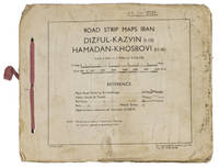
1944ref. ABC_4794483 Rep Group. I.E." 1944. Original beige printed paper wrappers side stichted by hand through 3 holes with a reddish pink cloth ribbon. Oblong 21 x 255 cm. With 1 index map and 16 numbered folding strip maps. Exceptionally rare collection of folded strip maps of roads in Western Iran which was very likely meant for military use during the Second World War. The abbreviated inscription on the front wrapper possibly stands for "24th brigade branch transportation office" though it is unknown which 24th brigade this would have been. The maps were originally printed on quarter inch sheets in 1942 and have been significantly enlarged for this edition to a scale of 1 inch to 2 miles. We have not been able to trace any other copies of either the first or second edition of this work anywhere.With an owner's inscription on the front wrapper. The maps and back wrapper have been reinforced with bookbinder's gauze. The wrappers are somewhat soiled creased and the edges are somewhat frayed. The maps have slightly browned and the index map has a small brown stain in the lower outer corner without affecting the image. Otherwise in good condition. 83 Rep Group. I.E.", hardcover
1934ref. 61915Chicago IL: Published by A.J. Nystryom & Co. Maps Globes Charts 1934. Seven large linen-backed colour lithograph maps sized from 43.5 x 72 in. to 51.5 x 60 in. all mounted on their original spring-loaded rollers wooden pull dowel & metal ring pull some creasing minor edgewear creasing soot soiling to the lower margin averaging about 6-7 in. due to exposure when rolled “Europe” and “United States” with faint tidemark & discoloration at left margin some minor creasing wear all preserved in the original A.J. Nystrom quarter-sawn oak wall bracket sized 58.5 x 15.25 x 3.25 in. all pull-down maps firmly secured in their steel brackets preserving 6 of the 7 original labels on the edge of the pull-down dowels still a VG- set of maps in their original configuration. First editions thus of this complete and exceptional example of the Atwood/A.J. Nystrom Regional-Political Series Map Case reflecting the many geographical and political changes between World War I and World War II. Such changes are reflected in the appearance of Manchoukuo the Japanese controlled rump state established in Manchuria in 1932 by the Japanese Empire and also depicting Korea still as Chosen. The Europe map depicts the East Prussia still controlled by the Weimar Republic and then after Hitler ascended to power; while Africa still retains much of the colonial powers as shown in the Belgian Congo Anglo-Egyptian Sudan French Equatorial Africa and even Beuchuanaland. The Australia and the Far East Map clearly defines the Japanese United States British & Australian mandates across the South Pacific. Atwood 1872-1949 was a noted geographer and educator who was a member of both the New Jersey and Wisconsin Geological Surveys served in the US Geological Survey served as professor of Physiography at Harvard and later from 1920-1946 when he produced these maps was President of Clark University and Head of its School of Geography. No similar complete sets located in Worldcat. Published by A.J. Nystryom & Co., Maps, Globes, Charts, unknown
1939ref. 60959San Francisco CA: San Francisco Bay Exposition 1939. 8vo. 116 pp. With oblong folio. 19.25 x 16 in. colour pictorial map frontisp. detailed sections of island and exhibits in blue on verso fold creases numerous photo illustrations text maps diagrams stepped thumb tabs at outer fore-edge. Blue-cloth backed softcovers featuring the striking Art Deco cover art by Simon “Si” Vanderlaan 1904-1986 famed pin-up artist and illustrator who worked for Walt Disney studios during World War II minor scuffing very minor age toning shelfwear still VG bright copy from the library of Prof. Marvin Nathan. Revised 1939 edition of this excellent guide to the first year in 1939 of the Golden Gate International Exposition including “Cartograph” revealing all of the Art Deco architectural wonders and surrounding areas of Treasure Island. The pictorial maps were issued separately as well as with the “Official Guide Books.” Ruth Taylor White’s 1902-1985 delightful pictographic maps or cartographs included depictions of the Territory of Hawaii in which she had driven or traveled to every corner of the Islands and the Grand Canyon for her for her brother’s book “Grand Canyon Country.” Later Little Brown requested an entire atlas which was published as the very scarce Our U.S.A. “A gay geography.” Her cartographs influenced the style of American cartographic illustration for decades afterwards. See: Griffin Mapping Wonderlands: Illustrated Cartography pp. 192-193; Field MapCarte 29/364: Our U.S.A. A Gay Geography 2014. San Francisco Bay Exposition, paperback
1959ref. 61207New York: Platt & Munk Co. Inc. 1959. Oblong folio. 15 x 11 in. Approx. 75 pieces puzzle pictorial map illustration of 48 state products. Colour-illustrated box w/ label affixed on front cover announcing “Now includes Alaska the 49th State! but puzzle w/o additional image of Alaska red white & blue ribbing fore-edges minor scuffing 1 corner w/ tear & old scotch tape repair w/ former ownership marking of “Kathy” on lid still a VG copy and publisher’s ad for “Let’s Fly Away with Mother Goose” laid-in. Later printing of this surprisingly scarce pictorial map puzzle originally issued by Platt & Munk in 1932 featuring the artwork depicting Sequoia trees & fruits in California mining & sheep in Utah cattle & sheep in Montana hogs corn & wheat in Nebraska and citrus cotton oil & cattle in Texas. White 1884-1948 was an artist who trained & lived in Brooklyn NY and spent much of his later career through World War II as an instructor in fashion design and art renderings at the 5th Avenue Fashion Art Design School which preceded FIT and also featured other instructors such as Louis A. Eisele. Platt & Munk Co., Inc., unknown
1938ref. 60338Marshfield OR: Oregon Coast Highway Association 1938. 4to. 16 pp unpaginated. numerous text illustrations double-page centerfold map by T.J. Greene small closed tear minor creasing self-printed photo-illustrated colour-softcovers center crease and printed in double-columns for folding slight soiling front cover still VG- copy w/ small rubber stamp of Breakers Motor Apts. Crescent City California on front cover. First edition thus of this automobile and bus travel tour guide to the newly completed US Highway 101 which finally had completed paved highway and bridges including the iconic Yaquina Bay bridge designed by Conde B. McCullough. Throughout the 1930’s with substantial support from the WPA and PWA projects as well as the U.S. Bureau of Public Works the highway became a scenic continuous drive. Oregon Coast Highway Association, paperback
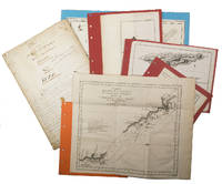
1755ref. ABC_474521755. Manuscript of 24 pages 6 printed maps on cardboard. This wonderful logbook details the journey of a French captain from Manila to the Maluku Islands in todays Indonesia. The journey took place during the months of March to May of 1755. The captain of the ship recounted with great detail the events of every day of the journey with detailed daily accounts of the weather winds manoeuvres of the ship its departures anchorages and precise coordinates at every point of the journey. The captain furthermore had a keen eye for the geographical and nautical details along the journey. He recounted the exact locations of for example sandbanks and bays where ships and their crews can take provisions and fresh water. The accounts are detailed and captivating: "After our boats were back on board we set sail . in the afternoon to moor under the old Portuguese fort on the Solor island Indonesia the winds for the tide were fresh at 1:34 a.m. . sand and gravel and then I went back to mooring. The pavilion of the fort . the village is under the said fort at 3 cables from us .". The captain goes on to describe the geographical features of the islands as well as other places en route with great detail. Curiously we find inscriptions in Spanish and the names of one don Phelipe Qui who describes himself as el piloto and one Padre Don Estevan de Melo. The latter might be identical with Don Estevan Roxas y Melo a native of Lima Peru and secretary to the Archbishop of Manila Rodriguez since 1736. Roxas y Melo was part of the 1751 reconstruction of the Cathedral of Manila working under the auspice of the Italian architect Juan de Uguccioni.The logbook comes with six printed maps partly illustrating the journey of the captain pasted on contemporary cardboard. They depict the Bay of Sulavesi with the city of Bantang Pitcairn the coast of New Guinea the coast of Queensland the Santa Cruz Islands in the present-day Solomon Islands and Alejandro Selkirk Island. The plates stem from the French translation of James Hawkesworths An Account of the Voyages Hawkesworth Relation des voyages entrepris par ordre de sa Majesté Britannique actuellement regnante; pour faire des découvertes dans l'hemisphère meridional Paris 1774.Some holes on the first sheet not affecting the text. Small water damage some slighlty affecting the text. Remnants of seals on last page. Otherwise in good condition. unknown
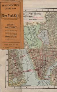
1913ref. 41637New York: Wehman Brothers Publishers 1913. Very good. An impressive color map of the island of Manhattan and the Bronx. Scale is 1" equals 1/2 mile and includes railroads subways elevated railroads surface railroads and proposed railroads. An uncommon early 20th Century New York City street map. Folding color map. Measuring approximately 18" x 36" when unfolded. In original printed card wrapper. Verso a thorough printed street index. Mild handling wear toning. A few tiny holes near fold corners. Overall well preserved; very good. Wehman Brothers Publishers unknown
1896ref. 59118Chicago: J. Blegen 1896. 12mo. 69 1 pp. With 1 large folding double-sided map “The World” on recto “United States” on verso with illustrated ads for steamship lines and Milwaukie road on recto above World map edgewear rubbing at crease folds some creasing at fore-edges couple very minor closed tears at folds. Quarter-brown cloth over beige boards decorative blue border blue lettering minor soiling edgewear still VG copy. First edition of this very scarce travel guide and pocket map issued by Blegen 1842-1927 a Norwegian-American steamship travel agent from the 1890’s into the 20th Century. His concise guidebook offered railway fares from Chicago Ocean steamship rates from New York Montreal New Orleans and San Francisco along with postage rates death mortality statistics for major American cities Brownsville TX sported 45 per 1000 while Salt Lake was 8 per 1000 coin equivalents and even a guide to sanatoriums and health spas in Europe. No physical printed copies located in Worldcat only digital or print-on-demand copies. J. Blegen, hardcover
ref. SONG0008309388Nicholson 2019-05-01. New editionNew edition. spiral_bound. Used: Good. 5.75x0.40x8.25. Buy with confidence. Excellent Customer Service & Return policy. Nicholson unknown
ref. DADAX1925625036HEMA 2018-12-20. 6th edition. spiral_bound. New. 8.74x0.59x11.77. Buy with confidence. Excellent Customer Service & Return policy. HEMA unknown