12.210 resultados
ref. DADAX1925625036HEMA 2018-12-20. 6th edition. spiral_bound. New. 8.74x0.59x11.77. Buy with confidence. Excellent Customer Service & Return policy. HEMA unknown
ref. DADAX0008272700Collins 2018-10-01. New editionNew edition. spiral_bound. New. 8.25x0.60x11.75. Buy with confidence. Excellent Customer Service & Return policy. Collins unknown
1942ref. L7VCIV4N38L2UK Government: Survey Directorate HQ Tenth Army / Indian Field Survey Co. 1942. 42 chromolithographed topographic maps of parts of Iraq made from aerial photographs during World War II on a scale of 1:100000 and 1:253440 a quarter-inch to a mile. 68 x 50.5 cm & 60 x 47 cm. An impressive collection of Iraq maps compiled from the most current aerial photography and produced by the British Army for use in the Persian theatre of war during World War II. The cities and regions covered include Ain Sifni Aqra Tel Afar Salman Pak BaQuba Sumaika Penjwin Halabja Baghdad Kirkuk Dulaim Erbil and Mosul divisions.Previously folded. Generally well-preserved. Survey Directorate HQ Tenth Army / Indian Field Survey Co., unknown
ref. 0528995715.Gspiral_bound. Good. Access codes and supplements are not guaranteed with used items. May be an ex-library book. unknown
2023ref. SONG159775336XNational Geographic 2023-01-01. 2023. map. Used: Good. 4.25x0.30x9.25. Buy with confidence. Excellent Customer Service & Return policy. National Geographic unknown
2021ref. DADAX1597753998National Geographic 2021-03-20. 2021. map. New. 4.00x0.30x7.50. Buy with confidence. Excellent Customer Service & Return policy. National Geographic unknown
2023ref. DADAX1597752797Natl Geographic Society Maps 2023-01-01. 2023. map. New. 4.25x0.20x9.25. Buy with confidence. Excellent Customer Service & Return policy. Natl Geographic Society Maps unknown
ref. 156695150X.Gmap. Good. Access codes and supplements are not guaranteed with used items. May be an ex-library book. unknown
ref. 1553410882.Gmap. Good. Access codes and supplements are not guaranteed with used items. May be an ex-library book. unknown
1817ref. 11715AB1817. Vienna Geistinger 1817. 71 : 148 cm. Manyfolded contemporary coloured engraving. Contemporary mounted on linen. Interesting historical map giving an broad overview of the development of the history from ancient times until the 18th century. Friedrich Strass 1766-1846 was a teacher at the monastery of Berge near Magdeburg. His "Strom der Zeiten" got a great populariety and was admired also from the foreign countries. - As mostly browned. unknown
1941ref. 56936Washington D.C. & Chicago IL: Household Goods Carriers’ Bureau Rand McNally & Co. 1941; 1947. Two vols. 296 pp. including 22 large folding colour maps a few w/ minor toning to fore-edges some dustsoiling a few w/ minor tape repairs especially at a couple folds and near gutter margin. Quarter-green cloth over printed light green softcovers stapled as issued minor soiling some slight foxing & toning still VG copy; 9 3 pp. Stapled as issued minor toning light creasing at corners VG. First edition of this essential HHGCB mileage guide issued just weeks before Pearl Harbor and the entry of the United States into World War II. Originally established in 1936 after the passage of the Reed-Bulwinkle and Interstate Commerce Commission Acts the HHGCB organized to file the required mileage tariffs with the ICC and issued this guidebook. This mileage guide contained maps from the Rand McNally Co. together with charts to determine highway distances between principal points in the United States and allow transport charges to be computed. This guidebook offers an essential snapshot of not only the existing transportation network during World War II but also the vital routes of trucking goods across the country locally or into Canada and Mexico prior to the creation of the Interstate Highway System later authorized in 1956 by President Eisenhower. The supplement updated many of the mileage references following the War acknowledging the tremendous build-up of infrastructure during and in Post-War America. The HHGCB continued to operate in assorted consolidations and mergers until the 2007 decision eliminating all motor carrier rate bureaus. Worldcat locates 1 copy of No. 4 no copies located of Supplement No. 10 US Dept. of Transportation Library. Household Goods Carriers’ Bureau, Rand McNally & Co., paperback
1938ref. 56963Fresno CA: City Planning Commission 1938. Oblong folio. 13.5 x 9.25 in. 17 blueprint maps variously numbered. w/ first map as the Key Map for the remainders. Stapled at gutter margin w/ protective green-tinted back softcover folded to provide reinforcement at spine from the library of George Reed Volker 1925-2018 former World War II pilot and urban planner in California New York and Washington State. First editions of these exceedingly scarce land use district zoning maps drawn up in 1938 after the passage of the 1937 Housing Act which unfortunately upended much of the spending not only by the WPA but also required any federal money to spent in “blighted” areas. These detailed maps show major streets demarcate singe family housing multi-family housing manufacturing and commercial bases for the community. Eventually the Public Housing which was built in Fresno during World War II began in West Fresno or “Chinatown first with the Sequoia Courts and later the Sierra Plaza followed by others. No copies located in Worldcat; See: Bibliography of Research Projects Reports W.P.A. Technical Series Research and Records Projects Bibliography No. 1 Feb. 2 1940 p. 53 Zoning Ordinance. City Planning Commission, paperback
1952ref. 56432Portland OR: Published by Byington Printing Co. March 1952. 1 large folding map sized 21 x 23 printed in red & black inset map on verso of map as well as street and city guide index street traction system transportation information and zones. Map folds down into small printed portfolio w/ fold-over flap printed in red & black illust. of mill on front light toning still VG. First edition thus of this updated city map with postal zones and all of the motorcoach lines and electric trolley lines delineated. The map is of particular interest as showing Portland OR neighborhoods before the clearing and construction of Interstate-5 and the outlines of the destroyed city of Vanport. Destroyed in the 1948 flood Oregon’s second largest city had been originally constructed by Henry Kaiser outside of the Portland city limits in order to house a large influx of African-American workers largely barred by Oregon discriminatory laws. Byington 1862-1956 was a California printer who moved to Oregon following World War I would own and operate Byington Printing Co. until his death. No copies located in Worldcat. Published by Byington Printing Co., unknown
1930ref. 56484Portland OR: Gilham’s Guide 1930. 8vo. 91 1 pp. Maps throughout. Tan printed softcovers minor darkening and thumbing to fore-edges 1 small corner creased still a VG copy. First edition of this scarce automobile travel map guide to Oregon for travelers and businessmen. Supplied with an extended index the strip maps all offer auto roads and stage roads for buses as well as showing railroad lines. In addition ferries post offices Western Union Express Offices and much more are shown. In addition there are mileage maps for Washington & Oregon included as well. Gilham 1882-1949 was a lifetime Portland OR resident who published gravel guides and histories on the Pacific Northwest but after losing his business during the Great Depression went to work for the Jones Lumber Co. Gilham’s Guide, paperback
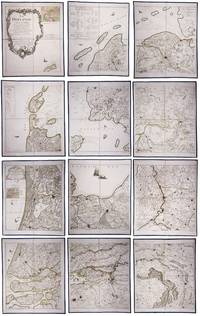
1790ref. 23331Paris: Jean A. Dezauche successor of Delisle & Buache 1790. Each map in contemporary box with green morocco spines with titles 'Hollande' and 'Zelande' lettered in gold and green paper sides with ornamental gilt borders along the edges. Together ca. 230 x 155 cm. Engraved and etched map hand-coloured in outlines the cities coloured red. Printed on 12 sheets each divided into 4 segments numbered 1-48. The 48 segments are mounted on contemporary linen and folded the edges reinforced with blue ribbon. With: 2 LE ROUGE George Louis. Topographie de la Zelande en 9 feuilles traduitte de l'Hollandois. Second title: Partie orientale de la Flandre Hollandoise Paris Jean A. Dezauche 1790. Large engraved and etched wall map hand-coloured in outlines the cities coloured in red printed on 9 numbered sheets each divided in 4 segments numbered 1-36 size each sheet 48 x 56.5 cm; the 36 segments are mounted on contemporary linen the edges reinforced with blue ribbon. Two large complementary wall maps of the seven Dutch provinces covering 1 the provinces Holland Utrecht Friesland Groningen Overijssel and Gelderland and a part of Brabant bound to the line Steenbergen - Roermond and 2 Zeeland. Both are rare especially the map of Zeeland. They were the first maps of the Netherlands on such a large scale mostly about 1:105000 but with some eastern regions squeezed in at about 1:140000. Fully assembled the map of Hollande would measure about 230 x 155 cm and the map of Zeeland about 143 x 175 cm.Originally published in 1748 Le Rouge's 21 plates for the two maps were revised for publication in a second state by Jean Crepy ca. 1770. The map in its present third state was revised and published by Jean A. Dezauche in 1790. On the back of each sheet is an engraved label with the sheet number and the name of the region covered added in manuscript.From the library of Marco-Antonio III 1730-1800 Prince Borghese: on each box is the engraved armorial bookplate of the library of this Borghese Prince. Marc-Antonio's son Camillo Filippo Ludovico 1775-1832 married Napoleon's sister in 1803.Boxes are slightly scuffed. A remarkable copy with a princely provenance.l De Vries 'Een Franse wandkaart van Nederland uit 1748' in: Caert-Thresoor 1 1982 pp. 24-29; cf. BMC Printed maps VIII cols. 967 & 969 1748 edition; not in Donkersloot-de Vrij; Oehme A French world atlas in: Imago mundi 25 1971 pp. 55-64 on Le Rouge. Jean A. Dezauche, successor of Delisle & Buache, unknown
2001ref. DADAX159775224XNational Geographic 2020-01-01. 2020. map. New. 4.25x0.20x9.25. Buy with confidence. Excellent Customer Service & Return policy. National Geographic unknown
ref. A9781597751360Sheet map rolled. New. unknown
2023ref. DADAX1597754013National Geographic 2023-01-01. 2023. map. New. 4.00x0.40x7.50. Buy with confidence. Excellent Customer Service & Return policy. National Geographic unknown
ref. GOR008669745Paperback. Very Good. paperback
1909ref. 52792Boston: The Bullard Co. Inc. 1909. Large folding accordion-style folded map printed in red & black sized 41 x 38 in. which when entirely folded into covers measures 5.5 x 11.25 in. Original burgundy-coloured boards small lozenge map of New York & Pennsylvania on front cover some edgewear rubbing minor tidemark to upper fore-edge of 1 corner still VG- copy. Second edition revised of this scarce and well documented map showing good roads for automobile travel railroads canals new Erie Barge Canal Steamship lines ferries lighthouses electric railway lines and more. First published in 1908 and then again in 1910 MacNair drew from US government surveys State surveys and other original commercial sources. Worldcat locates 2 copies. The Bullard Co., Inc., hardcover
1920ref. 52936Syracuse NY: Empire New England Company Inc. ca. 1920. Double Elephant folio. 51 x 59 in. Large colour-printed map dissected and mounted on linen backing brass grommets at upper fore-edge for hanging title stamped on verso minor edgewear at creases very minor lifting at seams minor dustsoiling to outer linen when folded still a VG exemplar. First edition thus of this scarce education map of post-World War I South American geography. The map details the principal railways water routes major cities steamship routes and geographical and political details. The Empire New England Company was active in upstate New York from about 1915 until the end of the 1920s selling educational supplies maps textbooks and more. The New World School Maps could be purchased individually or in cases which held between 6-10 individual maps for school uses according to company literature of the period. Worldcat locates 1 copy Buffalo & Erie County Public Library smaller size - 1931 ed. Empire New England Company, Inc., unknown
1888ref. J4KDIGIVEPWUFrance 1888. Brown and black ink watercolour chalk and gold paint on paper mounted on several laminated sheets of paper 69.5 x 52.5 cm. Charming trompe-l'oeil of maps of European countries on a decorated background somewhat reminiscent of a church ceiling. It contains a French inscription "to my beloved parents" which together with some inconsistencies in the use of perspective suggest a young French artist. The maps show some interesting departures from reality: in the Netherlands parts of the province of Gelderland are shifted 50 kilometres to the north replacing Zwolle with Arnhem and Sweden lacks Stockholm but includes Copenhagen in place of Malmö. However the most humorous is in the map of Germany which lacks its western neighbours - the Netherlands Belgium Luxemburg and France - giving it an extensive North Sea coast. The gothic lettering is inconsistent in style with the artist apparently improvising an alphabet for each inscription in the process forgetting Denmark.Somewhat soiled and browned at the edges with several white spots due to overpainting; the sheets are coming loose from one another. unknown
ref. GOR007629080Paperback. Very Good. paperback
1784ref. 25892London: Harrison & Co 1784. 1 vols. 10 x 7 3/4 inches. Extracted from a volume. Some light marginal discoloration folds else in very good condition. 1 vols. 10 x 7 3/4 inches. The first "A General Stereographic Map on the Plane of the Meridian" and the other showing a "Stereographic Projection on the Plane of the Horizon" and "Orthographic Projection on the pLane of the Meridian" Maps of the Hemispheres. Harrison & Co unknown
ref. GOR006600469Paperback. Very Good. paperback