National Geographic MapsBiblio.com
12.245 resultados
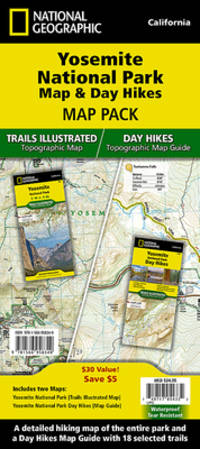
2010ref. DADAX1566958369National Geographic 2022-01-01. 2022. map. New. 4.20x0.50x9.50. Buy with confidence. Excellent Customer Service & Return policy. National Geographic unknown
2021ref. DADAX1734315040Benchmark Maps 2021-06-15. 12th Edition 2021. paperback. New. 10.70x0.80x15.30. Buy with confidence. Excellent Customer Service & Return policy. Benchmark Maps paperback
ref. A9780792250012Sheet map. New. unknown
ref. A9781597753487Sheet map rolled. New. unknown
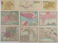
1870ref. 221021Japan. Circa1870s - 1890s. Collection of nine handcoloured copper engraving maps: 大日本全圖. Greater Japan map. 11.5 x 31cm 京都全圖. Kyōto map. 11.5 x 16cm 大阪全圖. Ōsaka map.11.8 x 16cm 大阪市街之圖. Ōsaka city map. 18 x 21.3cm 箱館市街之圖. Hakodate city map. 18 x 21.5cm 長﨑市街之圖. Nagasaki city map. 18 x 22cm 兵庫神戸両港市街之圖. Hyōgo Kōbe city map. 18.1 x 21.6cm 新潟市街之圖. Niigata city map. 18 x 21.8cm 京都市街之圖. Kyōto city map. 17.3 x 21.5cm Occasional light browning on margins of a few maps but all maps in very good condition. This very attractive collection of nine hand-coloured copper engraved maps was most likely published during the early Meiji period between the 1870s and early 1880s. The first three maps depicting Japan Kyoto and Osaka probably date from the early 1870s. On the Osaka map the site of Osaka Castle is still identified simply as a castle while the map of Japan uses Edo-period regional names such as Tosa rather than Kochi Prefecture. The remaining six maps appear to be slightly later probably dating from the early 1880s. On one of these Osaka Castle is identified as military headquarters reflecting the military use of the site during the Meiji period. The map of Kobe also includes an inset railway timetable for services between Kyoto and Kobe. The railway linking the two cities opened in 1877 providing a further indication of the map’s date. The maps are delicately drawn and contain minute details including town names and the locations of numerous public and commercial facilities. Maps of the treaty ports of Hakodate Niigata Nagasaki and Kobe are particularly uncommon. The Hakodate map features attractive illustrations of a Western-style sailing ship and steamship while the Kobe map shows the foreign concession and a cemetery for foreign residents. . unknown
ref. 1566959888.Gmap. Good. Access codes and supplements are not guaranteed with used items. May be an ex-library book. unknown
ref. 0007485905.Gmap. Good. Access codes and supplements are not guaranteed with used items. May be an ex-library book. unknown
ref. 1845879864.Gmap. Good. Access codes and supplements are not guaranteed with used items. May be an ex-library book. unknown
2012ref. DADAX1597755249Natl Geographic Society Maps 2012-10-01. 2012. paperback. New. 10.60x0.90x15.10. Buy with confidence. Excellent Customer Service & Return policy. Natl Geographic Society Maps paperback
ref. 1931257345.Gmap. Good. Access codes and supplements are not guaranteed with used items. May be an ex-library book. unknown
ref. 1886705569.Gmap. Good. Access codes and supplements are not guaranteed with used items. May be an ex-library book. unknown
ref. 1886705348.Gmap. Good. Access codes and supplements are not guaranteed with used items. May be an ex-library book. unknown
ref. 1583559191.Gbundle. Good. Access codes and supplements are not guaranteed with used items. May be an ex-library book. unknown
ref. 1597754013.Gmap. Good. Access codes and supplements are not guaranteed with used items. May be an ex-library book. unknown
2016ref. 018239Sarasota Fl: Streetwise Maps 2016. Soft Cover/Fold-out. New/None as Issued. Michael E. Brown Cartography. NEW. Highly regarded laminated 10-page laminiated acordion style folding pocket-size map to the borough of Manhattan and New York City proper. Map folds out to an impressive 8-1/2" to 19-1/4" in length. Highlights to cultural site points of interests major government offices hospitals and churches. Both functional and appealing makes travelling an informed pleasure. Marvellous guide. Streetwise Maps paperback
ref. GOR007463676Paperback. Very Good. paperback
ref. GOR006722255Paperback. Very Good. paperback
ref. GOR005344747Paperback. Very Good. paperback
ref. 1566959411.Gmap. Good. Access codes and supplements are not guaranteed with used items. May be an ex-library book. unknown
ref. 1910218006.Gmap. Good. Access codes and supplements are not guaranteed with used items. May be an ex-library book. unknown
ref. A9780792283119Sheet map. New. unknown
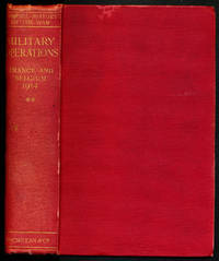
1929ref. 000015669London: Macmillan and Co. Limited 1929. 1929 reprint. hardcover. Very Good. Octavo red cloth covers xxvii 9 548 4 pages of ads for the series. Maps on endpapers and maps in the text. Corrections tipped in on several pages some red ink cross-outs text still readable. A few spots on covers and minor color bleeding into top margin of front map--does not affect image. Does not include separate map case. Part of the series: History of the Great War Based on Official Documents by Direction of the Historical Section of the Committee of Imperial Defense. 040414A Macmillan and Co., Limited hardcover
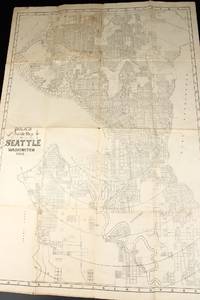
1908ref. 13531Seattle: Polk's 1908. Folded map. Very Good-. Folded paper map measuring 22.5 x 31 inches. Rubbed edges; a few spots; water damage to rear. Now housed within a clear removable archival protector with acid-free backing. If ordered online map will ship in box well packed in folded state. Polk's unknown
ref. 44312518-nnew. unknown
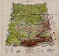
1942ref. 5332Washington D.C.: Army Map Service U.S. Army 1942. Second Edition. Loose sheet. Very Good. Full color map measures 29 x 29 inches. With a list of authorities i.e. other maps consulted in the creation of this map. Glossary. Index to boundaries. Folds as issued and with light soiling. A bright copy. First published 1931 by the War Office this edition is labeled "For Use by War and Navy Department Agencies Only. Not for Sale or Distribution." A vital map published the year 1942 the Japanese invaded Burma and closed off the Allies main supply route the Burma Road. Having already controlled littoral China supplying inland Chinese forces and the Chinese population became increasingly fraught. The region covered extends westward to USSR southward to Northern India and eastward to Mongolia. From the collection of Asian books and maps formed by Albert Ravenholt. On verso Ravenholt has written "Central Asia as far as E. of Tihwa. Army Map Service U.S. Army unknown