Thomas Brothers MapsBiblio.com

12.267 resultados
1999ref. mon0000091938Thomas Brothers Maps 6/1/1999 12:00:00 AM. paperback. Good. 1.2598 in x 11.4960 in x 9.2520 in. Paperback. Spiral binding. Cover shows some wear. Binding is tight. Pages are clean no markings notes or stains. Ships from Friends bookstore to benefit Beaverton Oregon library. Thomas Brothers Maps paperback
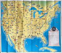
1936ref. 64019Chicago IL: The Pullman Company Poole Bros. Inc. Railroads of the United States Canada & Mexico c. 1936 1938. 4to. 24 pp unpaginated. which folds out into giant oblong atlas folio pictorial colour map 32 x 27 in. on verso orange & blue-tinted illustrations borders and self-printed over on recto in orange & blue w/ photo illustrations self-printed Art Deco cover art depicting streamliner steaming across America w/ Native American & Mexican American in foreground by Leslie Ragan slight age toning minor spotting dustsoiling couple very slight closed tears at fold creases still a VG bright copy. Second edition of this delightful and scarce promotional map issued by Pullman & the Poole Bros. for advocating Streamliner rail travel from British Columbia to Central Mexico Atlantic to Pacific along the Gulf of Mexico and Baja California. The cartographer and cartoonist has filled each area of the map with charming little pictorial vignettes highlighting historic sites National Parks recreational sports and other leisure activities. The Pullman Sleeping Car diagram depicts sections with drawing-room two compartments and double bedrooms with promotional photos. Ragan’s b. 1897 paintings and cover art graced New York Central and other railroads from 1925 through the 1950’s. This particular cover art was used the next year for the 1939 Golden Gate International Exposition World’s Fair brochures time tables and posters. Worldcat locates 1 copy Stanford. The Pullman Company, Poole Bros., Inc.], Railroads of the United States, Canada & Mexico, unknown
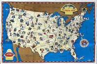
1941ref. 64221Chicago IL: Greyhound Corp. 1941. Oblong atlas folio colour-illustrated pictorial map sized 30 x 20 in. fold creases as issued w/ site index specifically listed on the verso couple text illustrations of Greyhound bus minor age toning couple slight closed tears very minor shelfwear still VG copy. A charming pictorial map focused on natural and some manmade roadside attractions across the United States with Wagner’s pictorial caricatures ranging from the charming to politically incorrect especially for Native American depictions. Attractions range from Craters of the Moon in Idaho to Grasshopper Glacier near Cooke MT Old Faithful in Yellowstone National Park to the Great Salt Lake in Utah. Other depictions include the statue of Tom Sawyer and Huckleberry Finn in Hannibal MO Fort McHenry where Francis Scott Key penned the National Anthem and more. Greyhound Corp., unknown
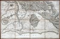
1618ref. 60225Rome: Venance Monaldini Librarie Place d’Espagne No. 79 1816-1821. Four works. 1st -- Large dissected copper-engraved map dissected & mounted on linen 35.5 x 22.75 in. slight foxing edgewear closed tears at corner folds a couple folds w/ archival repair tape on verso over linen; 2nd & 3rd - 8vo. 63 1; 15 1 pp. With large folding copper-engraved frontisp. highlighting section of the pantogram. Original marbled wrappers very slight chipping head & foot of spine; 4th -- large 3-sheet “Pantogram” or panoramic view of Rome 63 x 8.75 in. all preserved together in open-backed slipcase wrapped in patterned blue paper printed cover label manuscript pricing information & title in ink some scuffing & edgewear still an overall VG set. Second edition of the large dissected map of Rome and surrounding countryside fourth edition of the two-in-one handbook illustrating the coast along the Tyrrhenian Sea from Lake Bracchiano to Mount Circe and inland to the Central Apennines foothills. Sickler’s 1773-1836 Panoramic elevated view of Rome with text key above identifying churches monuments and historical locations in 19th-Century Rome together with the map and handbooks here were key references for those taking the Grand Tour following the Napoleonic Wars which had devastated much of the Continent. Pietro Ruga 1772-1850 was a noted Italian engraver printmaker furniture designer and architectural draftsman best remembered for his maps and pocket panoramic views of Rome. Venance Monaldini Librarie, Place d’Espagne, No. 79, unknown
ref. 0008258007.Gspiral_bound. Good. Access codes and supplements are not guaranteed with used items. May be an ex-library book. unknown
ref. A9780792293217Sheet map rolled. New. unknown
ref. A9780792283195Sheet map. New. unknown
ref. A9780792281139Sheet map rolled. New. unknown
ref. GOR003246899Paperback. Very Good. paperback
2026ref. __1566959896Benchmark Maps 2026. Paperback. New. 277 pages. 11.11x0.61x14.91 inches. Benchmark Maps paperback
ref. 0881304654.Ghardcover. Good. Access codes and supplements are not guaranteed with used items. May be an ex-library book. hardcover
ref. ria9781849077002_inpHardback. New. New Book; Fast Shipping from UK; Not signed; Not First Edition; Capturing the latest world statistics this lavish edition of Philip's RGS Atlas of the World interprets global changes. Filled with clear up-to-date data and captivating cartography and images it gives a powerful view of Planet Earth hardcover
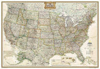
1963ref. 1125558442Chicago: Denoyer-Geppert Social Science Maps 1963. Book. Very Good. No Binding. 1 map : color ; 69 x 105 cm folded to 42 x 28 cm. showing transport routes America wide.main lines and secondary routes divided in sections and laid on canvas eyelets for hanging very good conditionScale ca. 1:4500000 Denoyer-Geppert social science maps A19. Denoyer-Geppert Social Science Maps unknown
ref. 3865740278.Gmap. Good. Access codes and supplements are not guaranteed with used items. May be an ex-library book. unknown
ref. 0881305243.Gloose_leaf. Good. Access codes and supplements are not guaranteed with used items. May be an ex-library book. unknown
ref. 0881302422.Gpaperback. Good. Access codes and supplements are not guaranteed with used items. May be an ex-library book. paperback
ref. 0008445079.Gspiral_bound. Good. Access codes and supplements are not guaranteed with used items. May be an ex-library book. unknown
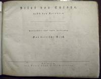
ref. 51860Leipzig Georg Joachim Göschen 1830. . Verlags-Bibliographie Göschen 1785-1838 Nr. 1027. Vgl. Studien zur Verlagsgeschichte u. zur Verlegertypologie der Goethezeit S. 190. - Einband stark beschabt Textteil gebräunt/stockfl.; erste Karte gebräunt sonst nur gelegentlich stockfleckig im weißen Kartenrand. - Allgemeine Übersicht. Topographie der vorzüglichsten Orte von A-Z. Grenzkolorierte Karten von Königreiche ENGLAND SCHOTTLAND u. IRLAND; Gibraltar Malta Helgoland Ionien; die Kolonien: Britisch-Ostindien Kap-Kolonie Westindien afrikanische Westküste Goldküste Guinea Mauritius St. Helena Nordamerika Hopparo Britisch-Guyana Australien. - Der königlich sächsische Kammerrat W. E. A. v. Schlieben 1781-1839 Statistiker u. Oberlandfeldmesser war Mitbegründer des Statischen Vereins in Sachsen 1831-1850 u. Leiter des Zentralkomitees des Vereins. Leipzig, Georg Joachim Göschen, 1830. unknown
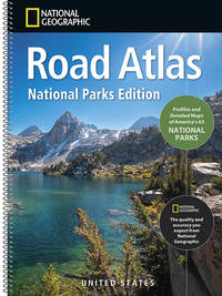
ref. ria9781566959896_inpPaperback / softback. New. New Book; Fast Shipping from UK; Not signed; Not First Edition; Discover America's wildest places with the Road Atlas: National Parks Edition your guide to all 63 national parks. Each park features a dedicated spread with a detailed map clear directions ranger recommendations top things to do a paperback
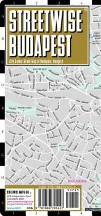
ref. K03R-00203Streetwise Maps. Used - Like New. Like New condition. Revised 2008 edition. A near perfect copy that may have very minor cosmetic defects. Streetwise Maps unknown
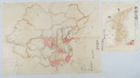
1902ref. 220266Japan. No date. Circa1902. Two very attractive colour folded manuscript maps one showing China and the other Korea. Map of China: Watercolour map 48 x 63.5cm. Closed tear now professionally repaired. Map of Korea: Finely detailed watercolour map a few tiny holes very neatly repaired on the verso with archival washi. 33 x 24.5cm Two delicate hand-painted maps one of China and one of Korea produced by a Japanese student cartographer named Koike Tokushige 小池徳重. The undated map of China appears to have been produced in the first five years of the twentieth century: a time when Japan had recently colonized Taiwan and when Japanese economic and political interest in the region was rapidly expanding. The inscription on the map suggests that it was a third year college project. But the high level of detail suggests that the artist had considerable experience of map making. The map of China shows the main provinces rivers major transport routes the Great Wall and the location of key cities although the names of the cities are not included. It also shows outlines of the Korean Peninsula Taiwan and the Japanese island of Kyushu but not the rest of Japan. The map of Korea is more detailed. It provides an accurate outline of the Korean Peninsula with careful hatching indicating changes in elevation. Rivers and major road routes are shown on the map and the locations of major towns are marked though only Busan and Incheon are named. Dotted lines show coastal sea routes and routes between Kyushu and Busan and between Incheon and China. The map shows the Gyeongin railway line between Seoul and Incheon which was completed in 1899 and route of the Gyeongbu railway line between Busan and Seoul whose construction started from both ends in 1901. But the map depicts only small sections of this line close to Seoul and Busan as being completed with the rest more lightly outlined to show the projected route implying that the map was drawn around 1901-1902 and certainly before the Gyongbu line was opened in 1904. Inserted text gives the land area and population of Korea. Rather strangely though the figure given for the Korean population is vastly underestimated. Ikeda gives this as 5.7 million when in fact at that time is was around 18 million. . unknown
ref. ria9780702074936_inpPaperback / softback. New. New Book; Fast Shipping from UK; Not signed; Not First Edition; N/A paperback
ref. 1887749829.Gspiral_bound. Good. Access codes and supplements are not guaranteed with used items. May be an ex-library book. unknown
ref. 1734315040.Gpaperback. Good. Access codes and supplements are not guaranteed with used items. May be an ex-library book. paperback
ref. 3906593363.Gmap. Good. Access codes and supplements are not guaranteed with used items. May be an ex-library book. unknown