Day BrothersBiblio.com
12.595 resultados
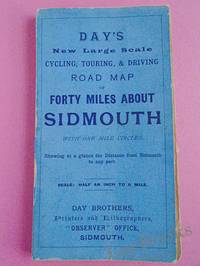
1900ref. 033970Sidmouth: Day Brothers 1900. Map. Very Good. Unframed. New Edition. Undated but circa 1900 Engraved map main roads coloured orange 445 x 575 mm folding down to 150 x 85 mm with printed blue covers published by Day Brothers "Printers Stationers & Booksellers Observer Office Sidmouth". Generally in very good condition with light general wear and some rubbing to edges of covers. An attractive map. Scarce. Day Brothers unknown
2011ref. DADAX1597752657National Geographic 2011-01-01. 2011. map. New. 3.50x28.00x6.00. Buy with confidence. Excellent Customer Service & Return policy. National Geographic unknown
2023ref. DADAX1597755974National Geographic 2023-01-01. 2023. map. New. 4.25x0.50x9.25. Buy with confidence. Excellent Customer Service & Return policy. National Geographic unknown
ref. DADAX1597754064National Geographic 2019-01-01. 2019. map. New. 4.00x0.40x7.50. Buy with confidence. Excellent Customer Service & Return policy. National Geographic unknown
2023ref. DADAX1597756059National Geographic 2023-01-01. 2023. map. New. 4.72x1.02x9.06. Buy with confidence. Excellent Customer Service & Return policy. National Geographic unknown
2023ref. SONG1597754013National Geographic 2023-01-01. 2023. map. Used: Good. 4.00x0.40x7.50. Buy with confidence. Excellent Customer Service & Return policy. National Geographic unknown
1840ref. 018232London: Printed and Published By J. Barfield 1840. Book. Very Good. Hardcover. Fourth Edition. Folio 30 x 46cm. "Revised Collated and Considerably Enlarged by John Satchell Esq." Seventy-four double-page engraved genealogical tables and geographical maps all with original hand colouring contemporary . half black morocco gilt with green cloth boards. Binding good with some general wear and rubbing leather chipped with loss to the base of the spine joints rubbed but still strong corners worn. All edges gilt./ Contents clean and tight contemporary ink stain effecting the fore-edges of the first few pages but not affecting text or maps most noticeable to the front end papers with also have a pencil inscription dated 30 November 1935. All maps and charts in very good condition. Notwitstanding wear to the binding a very good copy. Printed and Published By J. Barfield Hardcover
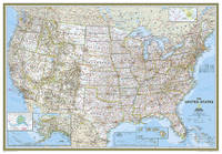
ref. DADAX079225001XNatl Geographic Society Maps 2016-05-26. 2016. map. New. 0.00x69.25x46.25. Buy with confidence. Excellent Customer Service & Return policy. Natl Geographic Society Maps unknown
1788ref. 024356London: Printed for J. Walker 1788. Book. Very Good. Hardcover. First Edition. 12mo. A very good four volume set in contemporary full tree calf binding with double lettering pieces in red and green. Complete pp. iii-vii 1 222; 2 206; 2 238 & 2 198. No half-titles which may or may not be wanting but the pagination for the prelims to vol. I might suggest that one is required Very good bindings with a little rubbing a couple of volumes slightly chipped to the head/tail of the spines corners lightly bruised. Contents clean and tight manuscript Greek initials to title pages dated 1788 otherwise unmarked no foxing paper crisp. A very good set. A Rare Eighteenth Century Novel. We have managed to located just one other copy at auction in the last thirty years and that at Sotheby's sale of July 21 1993 where it made £1000 on the hammer though seemingly not such a nice copy. Referenced by: ESTC T068744. Printed for J. Walker Hardcover
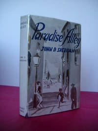
1945ref. 023064Dublin: The Talbot Press 1945. Book. Fine. Hardback. First Edition. 8vo. 273 pages. Original dust jacket bright without browning; a little rubbing and general wear lightly scuffed to head/tail of the spine and corners small chip to centre of front spine fold and several marginal tears repaired to the reverse with archival materials now protected in a clear removable archival sleeve. Hard-back binding very good. Contents clean and tight no inscriptions no foxing. A fine first edition copy in a very good jacket. Scarce first edition. The Talbot Press Hardcover
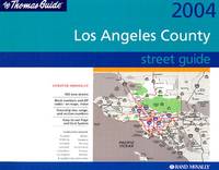
ref. DADAX0528866915Brand: Thomas Brothers Maps 0000-00-00. paperback. New. 8.75x1.00x10.50. Buy with confidence. Excellent Customer Service & Return policy. Brand: Thomas Brothers Maps paperback
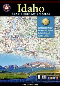
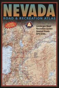
ref. DADAX0929591925Benchmark 2014-11-03. 2015. paperback. New. 10.75x0.50x10.00. Buy with confidence. Excellent Customer Service & Return policy. Benchmark paperback
ref. DADAX0929591062Benchmark 2015-05-26. 2015. paperback. New. 11.25x0.25x15.75. Buy with confidence. Excellent Customer Service & Return policy. Benchmark paperback
1838ref. 021038London: T. McLean D.& P. Colnaghi and John F. Lewis 1838. 1838. Book. Illus. by John F. Lewis. Near Fine. Hardcover. First Edition. Folio approx. 55 x 36.5cm. Complete with all Lithographic plates as called for; tinted frontispiece tinted title-vignette further 27 tinted views on 25 leaves all by Lewis after Coke Smyth. A very clean bright copy. Finely bound in modern brown morocco to style with gilt lettering to the spine and gilt bands to the top and bottom of the spine. Contents clean and tight new light brown endpapers in keeping with the new binding two blank leaves to the front and rear all pages have been professionally cleaned and restored by a paper conservator minimal and unobtrusive water staining remains to some pages and plates mostly confined to the margins and blank areas most plates unaffected new archival paper guards to all plates no inscriptions. A fine complete copy beautifully rebound. References -. Abbey Travel II 394; Atabey 722; Blackmer 1015; Contominas 413; RIBA 1886. T. McLean, D.& P. Colnaghi and John F. Lewis [1838]. Hardcover
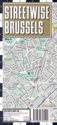
2007ref. SONG1886705526StreetWise 2007-12-27. map. Used: Good. 4.50x0.25x8.25. Buy with confidence. Excellent Customer Service & Return policy. StreetWise unknown
ref. SONG052899932XBrand: Thomas Brothers Maps 0000-00-00. paperback. Used: Good. 1.00x8.25x11.75. Buy with confidence. Excellent Customer Service & Return policy. Brand: Thomas Brothers Maps paperback
ref. SONG092959181XBrand: Benchmark Maps 0000-00-00. paperback. Used: Good. 11.00x0.25x15.75. Buy with confidence. Excellent Customer Service & Return policy. Brand: Benchmark Maps paperback
1766ref. 016077London: Printed for S. Crowder 1766. Book. Very Good. Hardcover. The Second Edition. Folio 21 x 32cm. The second edition with additions and improvements; pp. iv 45 iii publisher's adverts; engraved frontispiece map of the world five further engraved plates of maps and one engraved plate of globes ten engraved figures and diagrams within the text. Contemporary half textured calf binding with marbled paper boards expertly restored with a new spine in matching style re-corned. contents clean and tight a few small marks/reading wear; frontispiece plate with a couple of short edge-tears expertly and inconspicuously repaired a few corners re-tipped. A very good well-presented copy. Scarce. Printed for S. Crowder Hardcover
1915ref. 015456Antwerpen: Willem Seghers Litho-Grav. 1915. Map. Good. Unframed. First Edition. 120x86cm. A substantial map 120 x 86cm colour printed in two halves and joined on the back. A few edge tears and a few splits to the central folds a couple of splits repaired to the verso with paper tape several light creases. A good copy. Seemingly scarce. Willem Seghers, Litho-Grav. unknown
1830ref. 009582Paris - 21 Quai Voltaire: Rosselin 1830. Map. Fine. Map. A fine map hand-coloured in outline folding into original marbled paper boards with title label to the front board. Boards rubbed conrners worn. The map measures 74 x 55cm and is in very good condition with the paper bright. A very good to fine copy of this rare map. Rosselin hardcover
1806ref. 009589London: Printed for Richard Phillips Sold By Souter No. 1 Pater-noster-row. 1806. Book. Very Good. Hardcover. First Edition. Large 4to. A very good "large paper" copy with uncut edges leaf size approximately 285mm x 225mm with a few additional items bound in. Pp. xiv 2 530 ii ii. 16 hand-tinted aquatints of which several folding map plus an additional contemporary hand-coloured map of Ireland as frontispiece. Contents: frontispiece quarto format map - engraved for the Poem of Erin. The folding plate of Dublin shown as the frontispiece in the "Directions for Placing the Plates" has been bound in opposite the first page of text title page dedication prefacecontents errata directions for placing the engravings main body of the text additional page on St. Patrick from "Guide to Knowledge" bound in at rear before the Publisher's adverts cutting from the Times 1842 entitled "Robert Emmet and the Gaoler of Kilmainham" pasted to rear paste-down. Original paper-covered boards with recent pebbled cloth spine to match original with the original paper title-label applied to the spine binding in very good condition. Contents very good the uncut edges are a little worn in places and a couple of a small near-contemporary oval stamps of the "Baptist College Bristol" to the front end paper no other marks. Paper in very good condition without any obvious staining minimal foxing almost completly confined to the tissue guards maps and plates all very good clean and crisp short repaired tear to the edge of page 318 not nearly affecting the text. A very good to fine copy. Printed for Richard Phillips, Sold By Souter, No. 1, Pater-noster-row. Hardcover
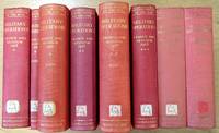
1935ref. 624644London: Macmillan and Co Ltd 1935. Eight volumes complete. Ex-library red cloth hardcovers with gilt lettering to the spines no dust jackets from Chris Church College Oxford in very good condition for their age. Maps and sketches by Major A.F. Becke. Book 1: The German march offensive and its preliminaries. Book 2: The German march offensive and its preliminaries: Appendices. Box 1: Maps. Book 3: March-April: Continuation of the German offensives. Box 2: Maps. Book 5: May-July: The German diversion offensives and the first allied counter-offensive. Volume IV: 8th August-26th September: The Franco-British Offensive. Volume V: 26th September-11 November: The advance to victory. Boards are somewhat sunned with labels on the lower spines. Spine ends are slightly bumped Page blocks and endpapers are lightly foxed with some foxing on occasional pages. Within customary array of labels and stamps. Bindings are sound and pages are otherwise clear. LW. Hardcover. Very Good/No Dust Jacket. Used. Macmillan and Co Ltd Hardcover
ref. SONG1851376283Hweryho 2019-10-18. 1st edition 2019. hardcover. Used: Good. 8.27x0.98x9.84. Buy with confidence. Excellent Customer Service & Return policy. Hweryho hardcover
2021ref. SONG1566959047National Geographic 2021-08-21. 2021. map. Used: Good. 4.33x0.39x9.76. Buy with confidence. Excellent Customer Service & Return policy. National Geographic unknown
2021ref. DADAX0792229878National Geographic 2021-06-01. 2021. map. New. 69.25x48.00x2.36. Buy with confidence. Excellent Customer Service & Return policy. National Geographic unknown