Collins MapsBiblio.com

12.535 resultados
ref. 0007485905.Gmap. Good. Access codes and supplements are not guaranteed with used items. May be an ex-library book. unknown
ref. 1845879864.Gmap. Good. Access codes and supplements are not guaranteed with used items. May be an ex-library book. unknown
2012ref. DADAX1597755249Natl Geographic Society Maps 2012-10-01. 2012. paperback. New. 10.60x0.90x15.10. Buy with confidence. Excellent Customer Service & Return policy. Natl Geographic Society Maps paperback
ref. 1931257345.Gmap. Good. Access codes and supplements are not guaranteed with used items. May be an ex-library book. unknown
ref. 1886705569.Gmap. Good. Access codes and supplements are not guaranteed with used items. May be an ex-library book. unknown
ref. 1886705348.Gmap. Good. Access codes and supplements are not guaranteed with used items. May be an ex-library book. unknown
ref. 1583559191.Gbundle. Good. Access codes and supplements are not guaranteed with used items. May be an ex-library book. unknown
ref. 1597754013.Gmap. Good. Access codes and supplements are not guaranteed with used items. May be an ex-library book. unknown
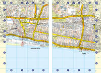
2016ref. 018239Sarasota Fl: Streetwise Maps 2016. Soft Cover/Fold-out. New/None as Issued. Michael E. Brown Cartography. NEW. Highly regarded laminated 10-page laminiated acordion style folding pocket-size map to the borough of Manhattan and New York City proper. Map folds out to an impressive 8-1/2" to 19-1/4" in length. Highlights to cultural site points of interests major government offices hospitals and churches. Both functional and appealing makes travelling an informed pleasure. Marvellous guide. Streetwise Maps paperback
ref. GOR006722255Paperback. Very Good. paperback
ref. GOR005344747Paperback. Very Good. paperback
ref. 1566959411.Gmap. Good. Access codes and supplements are not guaranteed with used items. May be an ex-library book. unknown
ref. 1910218006.Gmap. Good. Access codes and supplements are not guaranteed with used items. May be an ex-library book. unknown
ref. A9780792283119Sheet map. New. unknown
1929ref. 000015669London: Macmillan and Co. Limited 1929. 1929 reprint. hardcover. Very Good. Octavo red cloth covers xxvii 9 548 4 pages of ads for the series. Maps on endpapers and maps in the text. Corrections tipped in on several pages some red ink cross-outs text still readable. A few spots on covers and minor color bleeding into top margin of front map--does not affect image. Does not include separate map case. Part of the series: History of the Great War Based on Official Documents by Direction of the Historical Section of the Committee of Imperial Defense. 040414A Macmillan and Co., Limited hardcover
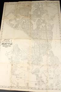
1908ref. 13531Seattle: Polk's 1908. Folded map. Very Good-. Folded paper map measuring 22.5 x 31 inches. Rubbed edges; a few spots; water damage to rear. Now housed within a clear removable archival protector with acid-free backing. If ordered online map will ship in box well packed in folded state. Polk's unknown
ref. 44312518-nnew. unknown
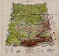
1942ref. 5332Washington D.C.: Army Map Service U.S. Army 1942. Second Edition. Loose sheet. Very Good. Full color map measures 29 x 29 inches. With a list of authorities i.e. other maps consulted in the creation of this map. Glossary. Index to boundaries. Folds as issued and with light soiling. A bright copy. First published 1931 by the War Office this edition is labeled "For Use by War and Navy Department Agencies Only. Not for Sale or Distribution." A vital map published the year 1942 the Japanese invaded Burma and closed off the Allies main supply route the Burma Road. Having already controlled littoral China supplying inland Chinese forces and the Chinese population became increasingly fraught. The region covered extends westward to USSR southward to Northern India and eastward to Mongolia. From the collection of Asian books and maps formed by Albert Ravenholt. On verso Ravenholt has written "Central Asia as far as E. of Tihwa. Army Map Service U.S. Army unknown
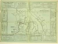
1925ref. 5871Ashcroft British Columbia: Ashcroft Journal - Board of Trade Ashcroft B.C. 1925. Loose Sheet. Very Good. Map measuring 20 inches x 15 inches printed with black ink on light green paper. Map shows a section of British Columbia from Vancouver north to Quesnell east to Fernie. Map surrounded by ads for Ashcroft businesses. On verso a descriptive narrative offers Ashcroft's history known locally as "Spud City" its regional resources hunting and fishing opportunities and the physical aspects of the landscape. Two rubber stamps one per side for the City Publicity Bureau in Vancouver. Very slight edge-wear to the left margin; a slight stain on the non-map side; old folds now mellowed. A handsome copy of a scarce map suitable for framing. Regarding the publication date: The map refers to Ashcroft as an unincorporated city was formed in 1952 the Main Cariboo Road is described as "a first class dirt and gravel road" and Dr. William Henry Sutherland British Columbia Minister of Public Works is quoted as stating that the scenery in the Marble Canyon Lillooet Lakes and the region of the Fraser River between Lillooet and Lytton "could not be duplicated on the whole of North American Continent and I doubt if it could be surpassed in Europe." Sutherland served in that capacity from 1922-1928 As such we'll posit 1925 as the publication date. Now enclosed in a removable clear archival sleeve. Ashcroft Journal - Board of Trade, Ashcroft, B.C. unknown
ref. 0007455232.Ghardcover. Good. Access codes and supplements are not guaranteed with used items. May be an ex-library book. hardcover
ref. 0008447861.Gpaperback. Good. Access codes and supplements are not guaranteed with used items. May be an ex-library book. paperback
ref. 0008445230.Gpaperback. Good. Access codes and supplements are not guaranteed with used items. May be an ex-library book. paperback
1999ref. mon0000091938Thomas Brothers Maps 6/1/1999 12:00:00 AM. paperback. Good. 1.2598 in x 11.4960 in x 9.2520 in. Paperback. Spiral binding. Cover shows some wear. Binding is tight. Pages are clean no markings notes or stains. Ships from Friends bookstore to benefit Beaverton Oregon library. Thomas Brothers Maps paperback
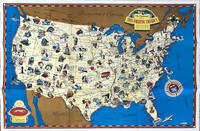
1936ref. 64019Chicago IL: The Pullman Company Poole Bros. Inc. Railroads of the United States Canada & Mexico c. 1936 1938. 4to. 24 pp unpaginated. which folds out into giant oblong atlas folio pictorial colour map 32 x 27 in. on verso orange & blue-tinted illustrations borders and self-printed over on recto in orange & blue w/ photo illustrations self-printed Art Deco cover art depicting streamliner steaming across America w/ Native American & Mexican American in foreground by Leslie Ragan slight age toning minor spotting dustsoiling couple very slight closed tears at fold creases still a VG bright copy. Second edition of this delightful and scarce promotional map issued by Pullman & the Poole Bros. for advocating Streamliner rail travel from British Columbia to Central Mexico Atlantic to Pacific along the Gulf of Mexico and Baja California. The cartographer and cartoonist has filled each area of the map with charming little pictorial vignettes highlighting historic sites National Parks recreational sports and other leisure activities. The Pullman Sleeping Car diagram depicts sections with drawing-room two compartments and double bedrooms with promotional photos. Ragan’s b. 1897 paintings and cover art graced New York Central and other railroads from 1925 through the 1950’s. This particular cover art was used the next year for the 1939 Golden Gate International Exposition World’s Fair brochures time tables and posters. Worldcat locates 1 copy Stanford. The Pullman Company, Poole Bros., Inc.], Railroads of the United States, Canada & Mexico, unknown
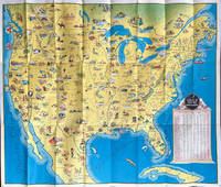
1941ref. 64221Chicago IL: Greyhound Corp. 1941. Oblong atlas folio colour-illustrated pictorial map sized 30 x 20 in. fold creases as issued w/ site index specifically listed on the verso couple text illustrations of Greyhound bus minor age toning couple slight closed tears very minor shelfwear still VG copy. A charming pictorial map focused on natural and some manmade roadside attractions across the United States with Wagner’s pictorial caricatures ranging from the charming to politically incorrect especially for Native American depictions. Attractions range from Craters of the Moon in Idaho to Grasshopper Glacier near Cooke MT Old Faithful in Yellowstone National Park to the Great Salt Lake in Utah. Other depictions include the statue of Tom Sawyer and Huckleberry Finn in Hannibal MO Fort McHenry where Francis Scott Key penned the National Anthem and more. Greyhound Corp., unknown