Collins MapsBiblio.com

12.365 resultados
ref. 0007538987.Gspiral_bound. Good. Access codes and supplements are not guaranteed with used items. May be an ex-library book. unknown
ref. 1845878698.Gmap. Good. Access codes and supplements are not guaranteed with used items. May be an ex-library book. unknown
ref. 0881309206.Gpaperback. Good. Access codes and supplements are not guaranteed with used items. May be an ex-library book. paperback
ref. 79037Paris Ch. Delagrave 1881. Two maps printed in black blue and red 25.7 x 25.6 cm; and 16.5 x 17.4 cm on a single folded sheet 46.7 x 30.3 cm. Original printed wrappers. = Two seldom-seen if not downright rare maps showing the Polar region and Africa indicating where the latest explorations were made thus showing the borderline between areas known and those still unknown in the year 1880. Contained in the Bulletin of the Société de Géographie Paris together with descriptive text. Also included is an account of the disastrous Flatters expedition. Paul Flatters 1832-1881 "was a French soldier who spent a long period as a military administrator in Algeria. He is known as leader of the Flatters expedition an ill-fated attempt to explore the route of a proposed Trans-Saharan railway from Algeria to the Sudan. Almost all members of the expedition were massacred by hostile Tuaregs. The survivors resorted to eating grass and to cannibalism on the long retreat through the desert. After a brief outburst of public indignation the fiasco was forgotten." French Wikipedia. The Polar map is in blue the African map in grey. Short tear at map adhesion point; slight fraying to the uncut wrapper's edges; otherwise very good clean and unmarked. unknown
ref. 0540086622.Gpaperback. Good. Access codes and supplements are not guaranteed with used items. May be an ex-library book. paperback
ref. 0540088730.Gpaperback. Good. Access codes and supplements are not guaranteed with used items. May be an ex-library book. paperback
ref. 0309130573.Gpaperback. Good. Access codes and supplements are not guaranteed with used items. May be an ex-library book. paperback
ref. 0008328072.Gmap. Good. Access codes and supplements are not guaranteed with used items. May be an ex-library book. unknown
ref. 0008319456.Gpaperback. Good. Access codes and supplements are not guaranteed with used items. May be an ex-library book. paperback
ref. A9780792280897Sheet map rolled. New. unknown
2009ref. mon0000575172Philip's 07/09/2009 00:00:01. hardcover. Acceptable. 1.7986 in x 35.1733 in x 27.9787 in. NOT an ex-library book. Clean copy in good condition. Cover stained and worn at corners. Philip's hardcover
ref. 0540092312.Ghardcover. Good. Access codes and supplements are not guaranteed with used items. May be an ex-library book. hardcover
ref. 1849070032.Gpaperback. Good. Access codes and supplements are not guaranteed with used items. May be an ex-library book. paperback
ref. 1597750891.Gmap. Good. Access codes and supplements are not guaranteed with used items. May be an ex-library book. unknown
ref. 0008374422.Gmap. Good. Access codes and supplements are not guaranteed with used items. May be an ex-library book. unknown
1987ref. 1417754Columbia: University of South Carolina Press 1987. First Edition. Hardcover. Octavo x xii xviii 332 pages. In Very Good condition with a Very Good dust jacket. Dust jacket protected with a mylar covering. Spine pictorial light blue and white with light blue and black lettering. Exterior has very slight wear including mild sunning. Boards have very slight wear. Text has very light wear including mild age toning to the edges. Illustrated. First edition. Shelved in Column L. 1417754. FP New Rockville Stock. University of South Carolina Press hardcover
1987ref. 1417756Columbia: University of South Carolina Press 1987. First Edition. Hardcover. Octavo x xii xviii 332 pages. In Very Good condition with a Very Good dust jacket. Dust jacket protected with a mylar covering. Spine pictorial light blue and white with light blue and black lettering. Exterior has slight wear including light soiling. Boards have slight wear including mild cocking to the spine. Text has very slight wear including mild age toning to the edges. Illustrated. First edition. Shelved in Column L. 1417756. FP New Rockville Stock. University of South Carolina Press hardcover
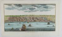
1750ref. 177186circa1750. Hand-coloured engraving 19.5 x 35.6 cm 25.5 x 41.6 cm sheet original folds two old paper repairs not affecting the image a trifle toned but in very good condition Attractive bird's-eye view town plan of Makassar in Sulawesi prepared for Abbé Prevost's monumental 'Histoire Générale des Voyages.' . unknown
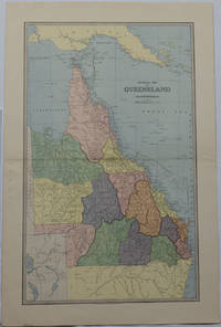
1886ref. 175917Sydney & Melbourne.: The Picturesque Atlas Publishing Company Limited Sydney & Melbourne. 1886-1888. Large printed colour map 60.9 x 37 cm 69.9 x 45.3 cm sheet central fold slight browning at the fold and to the generous margins in very good condition. Detailed map prepared for Andrew Garran's monumental "Picturesque Atlas of Australasia" 1886-1888 with the counties attractively coloured. New Guinea is shown to the North and borders with Northern Territory South Australia and New South Wales. The extent of the Great Barrier Reef is delineated along with the ocean "Border of Colony". Proposed and current railways are shown with an extensive place index printed on the verso of the map. . The Picturesque Atlas Publishing Company, Limited, Sydney & Melbourne. unknown
ref. 0930657101.Gpaperback. Good. Access codes and supplements are not guaranteed with used items. May be an ex-library book. paperback
ref. 159775028X.Gmap. Good. Access codes and supplements are not guaranteed with used items. May be an ex-library book. unknown
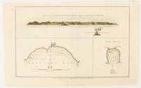
1784ref. 174896London.: Alexander Hogg at the King's Arms. circa1784. Engraved map in triptych on laid paper 20.1 x 32.7 cm three insets: cross section of the north side of Queen Charlotte's Islands Solomon Islands with detail of a volcano "6 leagues North"; Swallow's Bay Harbour; and Byron's Harbour early hand colour trimmed to the plate mark at the top edge neat sealed tear affecting the publisher's caption slight edge wear and paper toning but a most attractive map in very good condition. Attractive engraving of the Queen Charlotte's Islands Solomon Islands. The Islands were named for the consort of King George III by Philip Carteret the British naval officer and explorer who participated in two of the Royal Navy's circumnavigation expeditions in 1764–66 and 1766–69. His ship the Swallow gave her name to the Bay and Carteret's commanding officer on the first of his voyages John Byron to the Harbour depicted in this most attractive early chart. . Alexander Hogg at the King's Arms. unknown
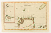
1784ref. 174895London.: Alexander Hogg at the King's Arms. circa1784. Engraved map on laid paper 21.4 x 33.7 cm inset of Gower's Simson's and Carteret's Island early outline hand colour trimmed to the plate mark at the top edge three small edge tears affecting the upper margin only slight paper toning but a most attractive map in very good condition. Fine impression of the Queen Charlotte's Islands Solomon Islands. It features the Swallow's track the ship's route taken by Captain Philip Carteret in 1767 the British naval officer and explorer who participated in two of the Royal Navy's circumnavigation expeditions in 1764–66 and 1766–69. . Alexander Hogg at the King's Arms. unknown
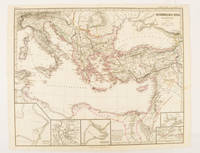
ref. 174950Gotha.: Justus Perthes. Map with original colour and outline hand-colour 32.2 x 40 cm text in German five inset maps central fold slight marginal toning and spotting on the verso but in very good condition. A most handsome and highly detailed map detailing the Eastern provinces of the Byzantine/Roman Empire in the time of the Roman Emperor Justinian 527-565. The inset maps depict Carthage Rome Constantinople Naples and a Western continuation of the main map originally issued for the "Hand-Atlas für die Geschichte des Mittelatters und die Neueren Zeit" . Justus Perthes. unknown
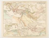
1877ref. 174917Gotha: Justus Perthes. 1877. Map with original colour and outline hand-colour 32.7 x 40.7 cm four inset maps text in German central fold slight marginal edge wear and spotting to the verso but in very good condition. A handsome map detailing the lands of Islam at the time of the Bujids 945-1055. The inset maps depict a western extension to the main map southern Arabia the lands of the Ghaznavid sultanate in Central Asia and lands of the Eastern Roman/Byzantine Empire issued for the "Hand-Atlas für die Geschichte des Mittelatters und die Neueren Zeit". . Justus Perthes unknown