SPRUNER, KARL AND MENKE,THEODORBiblio.com
12.365 resultados
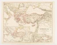
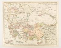
1877ref. 174915Gotha: Justus Perthes. 1877. Map with original colour and outline hand-colour 32.2 x 40 cm two inset maps text in German central fold in very good condition. A most handsome map detailing countries on the Aegean and Black Seas 1311 to 1390. The inset maps depict the kingdom of Stephan Duschan Serbia and the land of the Crimean Goths issued for the "Hand-Atlas für die Geschichte des Mittelatters und die Neueren Zeit". . Justus Perthes unknown
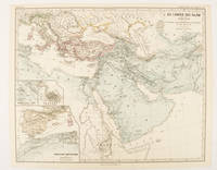
1877ref. 174913Gotha: Justus Perthes. 1877. Map with original colour and outline hand-colour 32.2 x 40 cm three inset maps text in German central fold slight marginal toning in very good condition. A most handsome map detailing the lands of Islam under the Abbasids up to the capture of Baghdâd by the Bûjids from 750 to 945 AD. The inset maps depict Northern Iraq Baghdad and a western continuation of the main map issued for the "Hand-Atlas für die Geschichte des Mittelatters und die Neueren Zeit". . Justus Perthes unknown
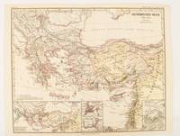
1874ref. 174914Gotha: Justus Perthes. 1874. Map with original colour and outline hand-colour 32.2 x 40 cm three inset maps text in German central fold slight marginal toning in very good condition. A most handsome map detailing the Eastern Roman Empire from the immigration of Hungarians in Ponnonia around 895 to the subjugation of the Bulgarian Empire by Emperor Basilius in 1019. The inset maps depict Divisions of the Empire Palestine and the Themata around Propontis present day Sea of Marmara issued for the "Hand-Atlas für die Geschichte des Mittelatters und die Neueren Zeit". . Justus Perthes unknown
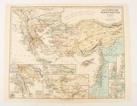
1876ref. 174911Gotha: Justus Perthes. 1876. Map with original colour and outline hand-colour 32.2 x 40 cm text in German four inset maps central fold slight marginal toning and spotting on the verso but in very good condition. A most handsome and highly detailed map detailing the Eastern provinces of the Byzantine/Roman Empire before the Fourth Crusade. The inset maps depict Constantinople Divisions of the Empire and Antioch issued for the "Hand-Atlas für die Geschichte des Mittelatters und die Neueren Zeit" . Justus Perthes unknown
1876ref. 174910Gotha: Justus Perthes. 1876. Map with original colour and outline hand-colour 32.2 x 40 cm seven inset maps text in German central fold slight marginal toning in very good condition. A most handsome and highly detailed map detailing provinces of the Latin Empire in the wake of the Crusades. The inset maps depict Achaia in Greece Divisions of the Empire and a city plan of Constantinople issued for the "Hand-Atlas für die Geschichte des Mittelatters und die Neueren Zeit" . Justus Perthes unknown
ref. 093065708X.Gpaperback. Good. Access codes and supplements are not guaranteed with used items. May be an ex-library book. paperback
ref. 1566958342.Gmap. Good. Access codes and supplements are not guaranteed with used items. May be an ex-library book. unknown
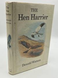
1977ref. FF0775T & A. D. Poyser 1977-01-01. 1st Edition. Hardcover. Very Good/Good. 9x6x1. THE Author has made a study of the Hen Harrier over many years and his field notes and sketch book of this exceptional bird of prey go back to the 1940's. The book opens with the world distribution of the harrier family then there is a fuller treatment of the Hen Harrier in Europe and North America the Marsh Hawk its history and present status. Further chapters detail hunting methods and prey selection the breeding cycle migration and distribution. The Jacket has a clear protective cover on it. T & A. D. Poyser hardcover
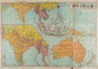
1572ref. 159290東京 Tokyo.: 金鈴社 Kinrei-sha. 昭和十八 October 101943. Two maps printed in colour on a single side of a folded sheet. The map titled "Complete Map of India and Australia" shows the region covering Australia southern India western mainland south-east Asia Indonesia the Philippines and New Guinea. The other map titled "India and Burma" shows the region covering India Afghanistan the western section of China Burma and Thailand on the lower left side. New Zealand is in an inset map in the lower right corner. As the note on the cover says "Including the detailed descriptions of the Solomons New Guinea and southern islands" this map shows the theatres of the Pacific War and the surrounding areas. The map indicates agricultural and mineral resources as well as cities roads railways sea routes national borders etc. Cover and publication details printed on two panels on the reverse. Some marking and browning. . 金鈴社 [Kinrei-sha]. unknown
1970ref. 54789circa1970. Collection of 20 black and white photographic plates with their accompanying negatives of maps showing patterns of land use and land forms throughout Pakistan. These photographs are of two sets of maps prepared by the Canadian government covering the whole of Pakistan. A very useful set. From the collection of Professor Basil Johnson Emeritius Professor of Geography at the Australian National University Canberra. From the collection of geographer Professor Basil Johnson who was the author of a number of works on South Asia including "India Resources and Development" and "Geographical Dictionary of India". . unknown
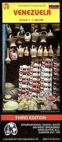
ref. 0921463596.Gmap. Good. Access codes and supplements are not guaranteed with used items. May be an ex-library book. unknown
ref. 1877302651.Gspiral_bound. Good. Access codes and supplements are not guaranteed with used items. May be an ex-library book. unknown
ref. 0008272700.Gspiral_bound. Good. Access codes and supplements are not guaranteed with used items. May be an ex-library book. unknown
ref. 0008102287.Gspiral_bound. Good. Access codes and supplements are not guaranteed with used items. May be an ex-library book. unknown
ref. 0540085790.Gpaperback. Good. Access codes and supplements are not guaranteed with used items. May be an ex-library book. paperback
ref. 1581743505.Gspiral_bound. Good. Access codes and supplements are not guaranteed with used items. May be an ex-library book. unknown
ref. 1597756059.Gmap. Good. Access codes and supplements are not guaranteed with used items. May be an ex-library book. unknown
ref. 000854705X.Ghardcover. Good. Access codes and supplements are not guaranteed with used items. May be an ex-library book. hardcover
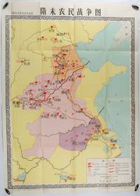
1980ref. 176714北京. Beijing.: 地图出版社.Di tu chu ban she. 1st Edition 1st Printing. 1980. Large Chinese education map folded with original envelope scale 1:1500000 legend left lower corner showing the military advance routes and battle grounds led by several leaders of the agrarian rebels including 王薄 Wang Bo 窦建德 Dou Jiande 杜伏威 Du Fuwei and 翟让 Zhai Rang. Very good copy. Text in Chinese. Sheet measures 106.8 x 76.52cm. . 地图出版社.[Di tu chu ban she]. unknown
ref. 0930657136.Gpaperback. Good. Access codes and supplements are not guaranteed with used items. May be an ex-library book. paperback
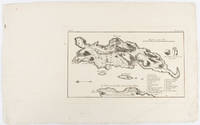
1703ref. 176390Amsterdam. circa1703. Engraved map on watermarked laid paper 16.5 x 26.5 cm plate-mark 26 x 42 cm sheet key in German inset detail of grave sites on the island of "Rhenee" Rineia and Apollonian relics lower corner creased and with a sealed tear to the verso no loss in very good condition. Fine engraving with large margins of the Greek island of Delos of great significance to classical antiquity and the mythological birthplace of the Greek deities Artemis and Apollo. . unknown
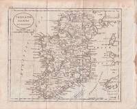
1796ref. 176602circa1796. Engraved map 18.3 x 22 cm 21.7 x 27 cm sheet original folds age toning and some offsetting inner edge darkened and discoloured but the map in good condition. Finely engraved map showing Ireland divided into counties lower coast of Scotland and Wales and the Isles of Man and Anglesea; also noting Nymph Bank 'discovered in 1735 by Capt. Doyle.' . unknown
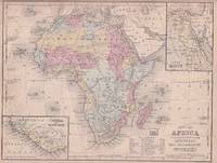
1869ref. 176603Philadelphia.: E. H. Butler. circa1869. Lithographed map with original hand-colour 21.2 x 27.6 cm two inset maps of Liberia and Sierra Leone; and Egypt showing the Suez Canal text and engravings for an unrelated entry on the verso; margins dusty top edge worn with small edge tears one affecting the border and marginal chip but in good condition. Detailed map of Africa before the escalation of colonial acquisition in the 1880s. . (E. H. Butler). unknown
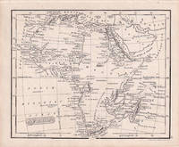
1830ref. 176607London.: Robert Jennings. 1830. Engraved map 11.5 x 14.3 cm showing route of European explorers faint added outline colour in an early hand and manuscript note to the verso in the same ink edges age-toned but in very good condition. Detailed pre-colonial map of Africa "Regions Unexplored" marked and "no fresh water to be found" on the west coast. An early manuscript inscription on the verso refers to Lander's ."wanderings of Clapperton" the Scottish naval officer and explorer. Richard Lander had returned with Hugh Clapperton's journal following his death and the account was published in the same year as Fenner's "Pocket Atlas of Modern & Ancient Geography" for which this map was prepared. . (Robert Jennings) unknown
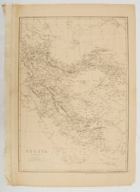
1863ref. 177017London.: Cassell Petter and Galpin. circa1863. Engraved map 43.1 x 30.3 cm 50.7 x 34.5 cm sheet central fold small edge tears one neatly repaired lower corner chipped slight age toning but in very good condition. Impressive large map of Persia Iran by noted map maker Edward Weller in original uncoloured state re-issued by the publisher for inclusion as map 26 in Cassell's Atlas. . Cassell, Petter and Galpin. unknown